
|
Follows the northwest rim of Big Sand Flat to the benchmark called "Sand."
|
|
Other articles:
• Field Notes:
22 Jun 2010;
Coll. No. 605, 22 Jun 2010.;
Coll. No. 606, 22 Jun 2010.;
Coll. No. 607, 22 Jun 2010.;
Coll. No. 608, 22 Jun 2010.;
Coll. No. 609, 22 Jun 2010.;
Coll. No. 610, 22 Jun 2010.;
Coll. No. 611, 22 Jun 2010.;
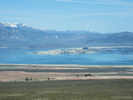 Mono Lake from "Sand" Mono Lake from "Sand"
 View southwest from the "Sand" marker. View southwest from the "Sand" marker.
|
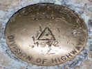
Marker at "Sand" |
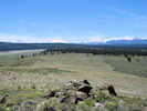
View southeast toward Sagehen Peak. |
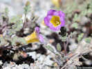
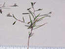
Phacelia bicolor, Collection No. 594 |
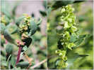
Male and female flowers of Grayia spinosa as collected at “Sand.” |
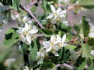
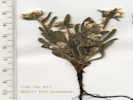
Utah Service Berry as found on the knob named “Sand.” |
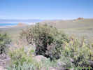
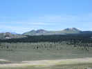
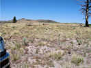
Habitat of Utah Service Berry near the knob named “Sand.” |
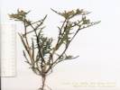
Gaytophytum diffusum var.parviflorum, Collection No. |
Coll No. 611, Plagiobothrys kingii var. harknessii |
Coll. No. 958, Mentzelia albicaulis |
Outcrop with benchmark named "Sand."
|
|
Other articles:
• Forest Road 1S19C:
at 01S19A;
• Forest Road 1S19C (1S215):
at 1S19A;
|
Junction: Forest Road 1S19C Goes down a little draw to 1S19B (1S181) in Big Sand Flat. Some maps show this road as 1S215.
|
|
Other articles:
• Field Notes:
20070625220;
 Collection locality northwest of Big Sand Flat Collection locality northwest of Big Sand Flat
|
|
|
Other articles:
• Forest Road 1S19D:
at 01S19A;
|
Junction: Forest Road 01S19D(x-1S182?) Kind of a cross road.
|
|
Other articles:
• Forest Road 1S19:
at FR 01S19A;
|
Junction: Forest Road 1S19
|
|
If you have a question or a comment you may write to me at:
tomas@schweich.com
I sometimes post interesting questions in my FAQ, but I never disclose your full name or address.
|
[Home Page] [Site Map]
Date and time this article was prepared:
5/12/2025 2:43:23 PM
|
 Eastern Mojave Vegetation