Eastern Mojave Vegetation
Tom Schweich
|
Eastern Mojave Vegetation
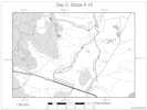
| Forest Road 3S07, Mono County, California |
|
Tom Schweich |

|
South from the Huntley Kaolinite Quarry. | ||||||||
|
Other articles:
|
Junction: Antelope Springs Road
|
|
Literature Cited:
Other articles:
Locations: Blue Chert Mine.
| Blue Chert Mine
This small hill appears to be the top of a fossil hot springs system. Numerous other small knolls occur throughout this area. Each hill represents the locus of a hot spring or fumarole. As hot water rises in the vent conduit and cools, it deposits microcrystalline silica along the walls of the fissure. This often seals the vent system, which remains dormant for decades until seismic activity reopens the fissures. When that happens, the trapped geothermal waters rise rapidly to the surface and flash to steam. The explosiveness of the erupting geyser often overcomes the tensile strength of the rock, shattering it and creating a breccia pipe. The rapid temperature drop deposits a silica sinter blanket around the vent opening.
|
End of road near north side of Hot Creek.
|
If you have a question or a comment you may write to me at:
tomas@schweich.com
I sometimes post interesting questions in my FAQ, but I never disclose your full name or address.
|
|
Date and time this article was prepared: 4/21/2025 8:15:16 PM |