Eastern Mojave Vegetation
Tom Schweich
|
Eastern Mojave Vegetation
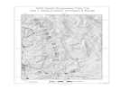
| Tinemaha Road, Inyo County, California |
|
Tom Schweich |

|
Parallels US Highway 395 between Fort Independence and Fish Springs | |
|
Other articles:
|
Junction: Fish Springs Road | |
|
Other articles:
|
Junction: Griffith Road | |
|
Literature Cited:
Other articles:
Locations: Poverty Hills. |
| |
| Junction: Fuller Road | ||
| Junction: Black Rock Springs Road | ||
|
Locations: Sawmill Creek. |
Cross Sawmill Creek. To the west is Sawmill Creek, Sawmill Meadow, Sawmill Lake, Sawmill Point, and Sawmill Pass. There are collections of Frasera puberulenta from Sawmill Creek, Sawmill Meadow, and Sawmill Pass. | |
|
Other articles:
|
Junction: US Highway 395 | |
| If you have a question or a comment you may write to me at: tomas@schweich.com I sometimes post interesting questions in my FAQ, but I never disclose your full name or address. |
Date and time this article was prepared: 5/12/2025 2:43:36 PM |