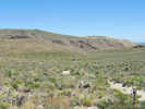
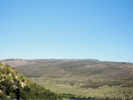
 Eastern Mojave Vegetation
Tom Schweich
 Eastern Mojave Vegetation
| Cowtrack Mountain Road, Mono County, California |
|
Tom Schweich |

|
The is not really a Cowtrack Mountain Road. This is more of a route, than a single road. There is a Forest Service Road 1N06 that leaves California Highway 120 along this route. However, it is not clear how much of this route is comprised by Forest Service roads. |
|
Locations:
Mono Lake.
|
End of Road, top of Cowtrack Mountain. |
|
Junction: Road north to Cowtrack Spring. At the bottom of the hill the road north goes to Cowtrack Spring. | |
|
Other articles:
Locations:
Cowtrack Mountain.
|
|
| Cross small divide into Cowtrack Spring drainage. | |
|
Other articles:
Locations:
Cowtrack Mountain.
|
This flat area near the top of Cowtrack Mountain is several miles long by more than a mile wide. |
|
Junction: Road northwest. This road goes northwest, then turns west to a rim overlooking Indian Spring. | |
| Cross small divide. To the north, drainage is into Mono Lake basin. To the south, through Granite Basin into Adobe Valley. | |
| Junction at Water Tank. Cowtrack Mountain Road turns northwest and climbs out of Granite Basin. | |
 A portion of Cowtrack Mountain Road A portion of Cowtrack Mountain Road
|
|
|
Other articles:
|
Calochortus beside the road. |
| Top of mountain | |
|
Locations:
Glass Mountain.
|
View of Glass Mountain to the south. |
|
Locations:
Cowtrack Mountain.
|
View to the southwest, back towards California Highway 120. |
| Switchback | |
| Junction: Forest Road 01S172, McPherson Grade | |
|
Other articles:
|
Junction: California Highway 120 |
 View of Cowtrack Mountain Road from CA Hwy 120 View of Cowtrack Mountain Road from CA Hwy 120
|
View of the southern portion of Cowtrack Mountain Road from California Highway 120. |
| If you have a question or a comment you may write to me at: tomas@schweich.com I sometimes post interesting questions in my FAQ, but I never disclose your full name or address. |
Date and time this article was prepared: 5/12/2025 2:43:52 PM |