 Eastern Mojave Vegetation
Tom Schweich
 Eastern Mojave Vegetation
| Racetrack Valley Road, Inyon County, California |
|
Tom Schweich |

|
This article describes Racetrack Valley Road from its junction with North Highway near Scotty's Castle to The Racetrack (a dry lake) in Death Valley National Park. | |
|
Other articles:
|
Junction: North Highway, north to Scotty's Castle, and south into Death Valley. | |
|
Other articles:
|
Junction: Death Valley Road, take Death Valley Road north to the Last Chance Range, then west to the Eureka Valley, and the Inyo Mountains. | |
|
Other articles:
|
View north from parking lot at Ubehebe Crater. This is the northern part of Death Valley. | |
|
Literature Cited:
Other articles:
Locations: Ubehebe Crater. |
Ubehebe CraterSoft sediment deformation is always interesting and can yield impressive shapes when exposed in cuts or cliffs. Generally it is thought that soft sediment deformation occurs when the sediments are in a wet and cohesive state. However, Valentine, et al. (2021) show that there is no evidence of wet deposition in soft sediment structures at Ubehebe Crater. Instead they show that a massive bed can creep downhill in a dry state carrying and crumpling the overlying beds. This is probably quite a bit different than the crumpled beds of mud along Cemetery Road at Mono Lake.
| |
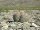
 Ferocactus polycephalus along Racetrack Valley Road. Ferocactus polycephalus along Racetrack Valley Road.
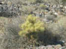
 Opuntia along Racetrack Valley Road. Opuntia along Racetrack Valley Road.
|
||
|
Literature Cited:
Other articles:
Locations: Dry Mountain. |
Dry Mountain to the west of the road. Frasera albomarginata has been observed, but not collected on Dry Mountain. | |
|
Locations: Tin Mountain. |
Tim Mountain to the east of the road. | |
|
Locations:
Teakettle Junction.
|
Teakettle Junction | |
|
|
Ubehebe Lead Mine | |
|
Locations:
Racetrack.
|
||
|
|
The Racetrack | |
|
Locations:
Racetrack.
|
| |
| If you have a question or a comment you may write to me at: tomas@schweich.com I sometimes post interesting questions in my FAQ, but I never disclose your full name or address. |
Date and time this article was prepared: 5/12/2025 2:44:24 PM |