Eastern Mojave Vegetation
Tom Schweich
|
Eastern Mojave Vegetation
| Mines Geology Trail, Golden, Jefferson County, Colorado |
|
Tom Schweich |

|
Short street on the western-most section of the Mines campus. | |||
|
Other articles:
|
Stop 1. The Geology Museum | |||
|
Other articles:
|
| |||
|
Other articles:
|
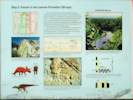
Stop 2. Laramie Formation (68 Ma). Dinosaur Tracks, Log and Plant Imprints
| |||
|
Other articles:
|
| |||
|
|
Stop 3. Laramie Formation; Fire Clay and Sandstone; Environments of Deposition | |||
|
|
Stop 4. Clay Pits Fault. | |||
|
|
Stop 5. Overview of Clear Creek Valley; Rock Exhibit. | |||
|
|
Stop 6. Pierre and Fox Hills Formations (69 Ma). | |||
|
Other articles:
Locations: White Ash Mine. |
Stop 7. Laramie Formation (68 Ma); White Ash Mine.
| |||
|
|
Stop 8. Arapahoe Formation (67 Ma); Structural Geology. | |||
| If you have a question or a comment you may write to me at: tomas@schweich.com I sometimes post interesting questions in my FAQ, but I never disclose your full name or address. |
Date and time this article was prepared: 10/2/2026 12:39:59 PM |