 Eastern Mojave Vegetation
Tom Schweich
 Eastern Mojave Vegetation
| Colorado State Highway 131 |
|
Tom Schweich |

|
State Highway 131 is a north–south state highway that connects U.S. Highway 40 4 miles (6.4 km) east of Steamboat Springs to the north with Interstate 70 at Wolcott to the south. It is 68.7 mi (110.6 km) in length, and travels through the towns of State Bridge, Bond, McCoy, Toponas, Yampa, and Oak Creek. | ||
|
Other articles:
|
Junction: US Highway 40 | ||
|
|
Oak Creek | ||
|
|
Phippsburg | ||
|
North edge of Yampa Junction:
| |||
|
|
Yampa | ||
|
Other articles:
|
Junction: Moffat Avenue, County Road 7, Forest Road 900 along the Bear River, as far as Stillwater Reservoir. | ||
|
Other articles:
Locations: Trapper. |
Trapper | ||
|
Other articles:
Locations:
Toponas.
|
Toponas
| ||
|
Other articles:
|
Junction: Colorado State Highway 134, east over Gore Pass through the middle of the Gore Range. | ||
|
Other articles:
|
Junction: County Route 5, west through Egeria Park. | ||
|
|
McCoy | ||
| Yarmony Creek, highway leaves river. | |||
Two Bridges Boat Ramp | |||
|
|
Bond | ||
|
|
State BridgeJunction: County Road 1, in the direction of Rancho Del Rio. | ||
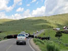
 Herding cows to summer pasture. Herding cows to summer pasture.
|
|||
| Junction: US Highway 6, west. | |||
| Junction: US Highway 6, east. | |||
|
Other articles:
|
Junction: US Interstate 70 at Exit 157 | ||
| If you have a question or a comment you may write to me at: tomas@schweich.com I sometimes post interesting questions in my FAQ, but I never disclose your full name or address. |
Date and time this article was prepared: 4/21/2025 8:20:20 PM |