Gazetteer
Query:
G.N.I.S.
See also:
Devils Gate.
Joshua Flats.
Little Cow Horn Valley.

|
|
|
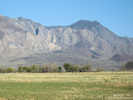
Major mountain range in eastern California, 250-350 km northwest of Lobo Point, more often associated with Great Basin vegetation than Mojave vegetation. Forms the eastern side of the Owens Valley.
Articles that refer to this location:
- The Vegetation of Lobo Point and North Wild Horse Mesa, Mojave National Preserve, San Bernardino County, California.:
60800;
Literature Referring To This Location:
-
Bradley, W. G., and J. E. Deacon. 1967.
The biotic communities of southern Nevada.
Nevada State Museum Anthropological Paper.
13(4).
-
Ernst, W. G., C. M. Van de Ven, and R. J. P. Lyon. 2003.
Relationships among vegetation, climatic zonation, soil, and bedrock in the central White-Inyo Range, eastern California: A ground-based and remote-sensing study.
GSA Bulletin.
115(12):1583-1597.
{TAS-pdf}
-
Merriam, Charles W., and Wayne E. Hall. 1977.
Pennsylvanian and Permian Rocks of the Southern Inyo Mountains, California.
Contributions to General Geology.
Geological Survey Bulletin.
1061-A.
Washington, DC: United States Government Printing Office, 1957.
{TAS-pdf}
-
Ross, Donald C. 1967.
Generalized Geologic Map of the Inyo Mountains Region, California.
Miscellaneous Geologic Investigations Map I-506.
Washington, DC: U. S. Geological Society, 1967.
{TAS}
-
Young, James A, and Charlie D. Clements. 2002.
Purshia: the wild and bitter roses.
Reno, Nevada: University of Nevada Press, 2002.
{TAS}
|
|
No collections made at this location.
|
|
If you have a question or a comment you may write to me at:
tomas@schweich.com
I sometimes post interesting questions in my FAQ, but I never disclose your full name or address.
|
A, B, C,
D, E, F,
G, H, I,
J, K, L,
M,
N, O,
P, Q, R,
S, T, U,
V, W, X,
Y, Z
[Home Page] [Site Map]
Date and time this article was prepared:3:01:34 PM, 5/12/2025.
|
 Eastern Mojave Vegetation
 Eastern Mojave Vegetation