Eastern Mojave Vegetation
|
Eastern Mojave Vegetation
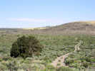
| Adobe Hills, Mono County, California. |
|
Gazetteer Query: G.N.I.S. See also: Adobe Hills Spillway.
|
||
|
The Adobe Hills volcanic area is comprised of a sheetlike mass of overlapping olivine basalt flows that cover an irregularly shaped, generally east-west-trending area of approximately 800 square kilometers. This area, which extends eastward for approximately 60 kilometers from the eastern shore of Mono Lake, is roughly bisected by the California-Nevada border. The irregular sheet of basalt flows locally attains thicknesses of nearly 200 meters in its central part, where multiple flows overlap, but thins to individual flows, with thicknesses of less than 10 meters, along its northern and southern margins.Its highly irregular shape and subregional extent suggest an origin by numerous eruptions from a number of widely spaced centers. … (From: From: Wood and Kienle, 1990, Volcanoes of North America: United States and Canada: Cambridge University Press, 354p., p.256-262, Contribution by John C. Dohrenwend)
Literature Referring To This Location:
| ||
| No collections made at this location. | ||
| If you have a question or a comment you may write to me at: tomas@schweich.com I sometimes post interesting questions in my FAQ, but I never disclose your full name or address. |
A, B, C,
D, E, F,
G, H, I,
J, K, L,
M, Date and time this article was prepared:8:31:25 PM, 4/21/2025. | |