Gazetteer
Query:
G.N.I.S.

|
|
Former military fort on the Mojave Road.
|
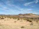
Camp Cady (1860-1871)
Camp Cady was located in the Mojave Road, which connected Los
Angeles to Albuquerque. Non-indian travel on this and the nearby
Sale Lake Road was beset by Paiutes, Mohaves, and Chemehuevis
defending their homeland. To protect both roads, Camp Cady was
established by U. S. Dragoons in 1860. The main building was a
stout mud redoubt. Improved camp structures were built 1/2 mile
west in 1868. After peace was achieved, the military withdrew in
1871. This protection provided by Camp Cady enabled travelers,
merchandise, and mail using both roads to boost California's
economy and growth.
California Registered Historical Landmark No. 963-1
Plaque placed by the State Department of Parks and Recreation in
cooperation with Billy Holcomb Chapter of E. Clampus Vitis, State
Department of Fish and Game, Mojave River Valley Museum, and
Daggett Historical Society, Inc., May 1, 1994.
|
Elevation: 1690ft.
Articles that refer to this location:
Literature Referring To This Location:
-
Casebier, Dennis G. 1972.
Carleton's Pah-Ute Campaign.
Tales of the Mojave Road, Number One.
Norco, California: Dennis G. Casebier, June 1972.
{TAS}
-
Casebier, Dennis G. 1972a.
The Battle at Camp Cady.
Tales of the Mojave Road, Number Two.
Norco, California: Dennis G. Casebier, September 1972.
{TAS}
-
Lovich, Jeff, and Kathie Meyer. 2002.
The western pond turtle (Clemmys marmorata) in the Mojave River, California, USA: highly adapted survivor or tenuous relict?.
Journal of the Zoological Society of London.
256: 537-545.
{TAS-pdf}
|
|
No collections made at this location.
|
|
If you have a question or a comment you may write to me at:
tomas@schweich.com
I sometimes post interesting questions in my FAQ, but I never disclose your full name or address.
|
A, B, C,
D, E, F,
G, H, I,
J, K, L,
M,
N, O,
P, Q, R,
S, T, U,
V, W, X,
Y, Z
[Home Page] [Site Map]
Date and time this article was prepared:8:31:32 PM, 4/21/2025.
|
 Eastern Mojave Vegetation
 Eastern Mojave Vegetation