 Eastern Mojave Vegetation
 Eastern Mojave Vegetation
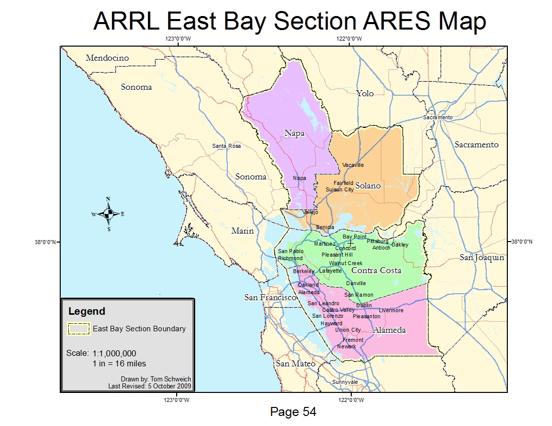
| ARRL East Bay Section ARES Map |
|
|

If you have a question or a comment about this photograph you may write to me at: tomas@schweich.com I sometimes post interesting questions in my FAQ, but I never disclose your full name or address. |

This map was requested by my local ARES coordinator to show the extent of the American Radio Relay League (ARRL) East Bay section of Amateur Radio Emergency Services (ARES). The data source is a combination of county divisions from Cal-Atlas (http://www.atlas.ca.gov/) and the ArcGIS Data & Maps 9.3 DVD. The map actually delivered can be seen at: http://www.schweich.com/images/CountySketch2.pdf
Location records that use this photograph:
Article records that use this photograph:
Other photos about Geography - California or Unclassified.
|
|
Date and time this page was prepared: 5/12/2025 3:02:29 PM |