 Eastern Mojave Vegetation
 Eastern Mojave Vegetation
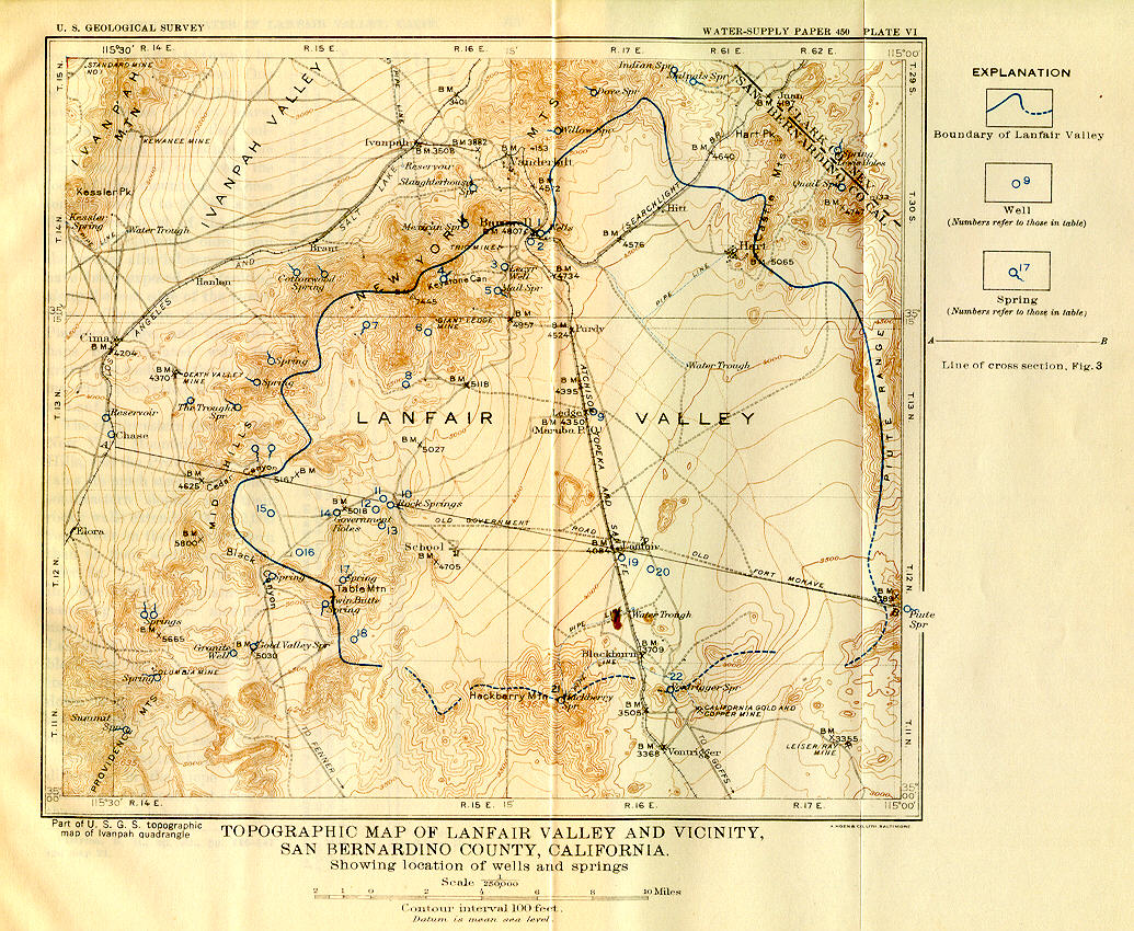
| David Thompson's (1920) map of Lanfair Valley. |
|
|

If you have a question or a comment about this photograph you may write to me at: tomas@schweich.com I sometimes post interesting questions in my FAQ, but I never disclose your full name or address. |

This is Plate VI from Thompson, David G., 1920. I was particularly interested in this map because it shows the location of Ledge. This map shows it also to be known as Maruba P. O. It was at Ledge that miners directed Annie Alexander and Louise Kellogg to the south side of the New York Mountains in 1940 because the road to Keystone Canyon was washed out.
Location records that use this photograph:
Article records that use this photograph:
Other photos about Geography - Eastern Mojave or Lanfair Valley.
|
|
Date and time this page was prepared: 3/23/2025 6:12:44 PM |