Eastern Mojave Vegetation
Tom Schweich
|
Eastern Mojave Vegetation
| Beaver Dam Road, Lincoln County, Nevada |
|
Tom Schweich |

|
From US Highway 93 to Beaver Dam State Park on Beaver Dam Wash. |
|
Other articles:
|
Junction: US Highway 93, Caliente to the south, Panaca and Pioche to the north. |
|
Other articles:
|
On the west edge of Miller Bench, just as the road climbs up out of Meadow Valley Wash, I found the first Frasera albomarginata. |
|
Other articles:
|
|
|
Locations: Miller Bench. |
Miller Bench between Meadow Valley Wash and Empy Mountain of the Cedar Range. |
|
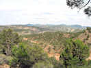
Locations: Empy Mountain. |
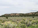
Empy Mountain to the north. |
|
Other articles:
|
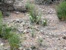
Frasera albomarginata has been observed near here. |
|
Locations: Empy Wash. |
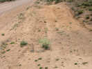
Cross Empy Wash. |
 Crossroads Crossroads
|
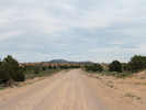
Looking southwest into Crossroads. |
|
Locations: Crossroads. |
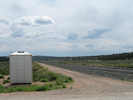
CrossroadsJunction: road from Oak Well Canyon, and road to Barclay. |
| Junction: Oak Well Canyon Road | |
|
Other articles:
Locations:
Acoma.
|
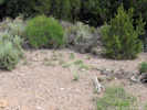
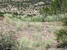
AcomaFrasera albomarginata was collected near here. |
 Bluffs about 1/2 mile east of Acoma Bluffs about 1/2 mile east of Acoma
|
Bluffs west of Acoma. |
|
Other articles:
|
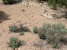
Frasera albomarginata habitat near Acoma. |
|
Other articles:
|
Junction: Rural road northeast to Utah border, and Crestline |
|
Literature Cited:
Locations:
Beaver Dam Flat.
|
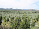
The area of Beaver Dam Flat was chained, plowed and seeded in 1956. A total of 1,590 acres of Beaver Dam Flat on the Haypress Allotment and neighboring Barclay Allotment were mechanically treated (plowed and chained) and seeded with crested wheatgrass and yellow sweet clover (Melilotus spp.). Fifty years of succession has resulted in the seeding reverting to a Wyoming sagebrush dominated site. The crested wheatgrass on the Haypress Allotment is all but gone and Wyoming sagebrush (Artemisia tridentata var. wyomingensis) dominates the site with a small component of perennial grasses, forbs and other shrubs to accompany it. |
|
Other articles:
Locations:
Beaver Dam State Park.
|
Beaver Dam State ParkIndians first explored this area, camping and hunting along the streams of Headwaters Creek and Pine Creek. The two streams come together to form Beaver Dam Wash which is directly above the reservoir. Spaniards may also have crossed the region between 1540 and 1775 while establishing trade routes in the Southwest. In 1849, a group of emigrants left the Old Spanish Trail to the south, and journeyed west to seek gold in California. |
|
Other articles:
|
|
|
Other articles:
|
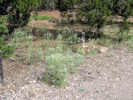
Frasera albomarginata in Campground "B." |
|
Other articles:
|
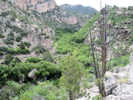
View from Oak Knoll |
|
Other articles:
|
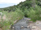
Beaver Dam Creek at the Waterfall Trailhead. |
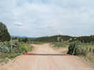
| End of Road near Nevada/Utah state line. | |
| If you have a question or a comment you may write to me at: tomas@schweich.com I sometimes post interesting questions in my FAQ, but I never disclose your full name or address. |
Date and time this article was prepared: 4/21/2025 8:28:16 PM |