Eastern Mojave Vegetation
Tom Schweich
|
Eastern Mojave Vegetation
| Utah Highway 9 |
|
Tom Schweich |

|
(No Preface) | ||||||||||||||||||||||||||||||||
|
Other articles:
|
Mt. Carmel Jct.Junction: U. S. Highway 89.
| ||||||||||||||||||||||||||||||||
|
Zion National Park below
|
Literature Cited:
Loope, et al., 2013, recorded a Jurassic earthquake as evidenced by multiple generations of sand blows in the Navajo sandstone. Their sites A (37.2098,-112.9149) and B (37.2050,-112.9343) are just south of the highway.
|
|
| Zion - Mount Carmel Tunnel
|
Literature Cited:
Other articles:
Locations: Zion National Park.
| Zion National ParkGeology of Zion National Park in Biek, et al., 2003.
|
Zion National Park above
|
|
| Springdale
|
Locations: Rockville.
| Rockville
|
Other articles:
Locations: Wire Mesa.
Junction: Bridge Road, south across the Virgin River, to Grafton Road, which gives access to Wire Mesa where Frasera albomarginata has been collected.
|
|
Literature Cited:
Grafton across the Virgin River.
|
|
Other articles:
Locations:
Coalpits Wash.
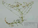
| Coalpits WashThere are numerous collections of Frasera albomarginata from Coalpits Wash. The southern border of Zion National Park is right at the fence line just north of the road.
|
| Virgin
|
Other articles:
Junction: Kolob Road. On a trip we took this road to Lava Point, Kolob Reservoir then over the top of the Mesa to Cedar City.
|
|
Other articles:
Locations: La Verkin.
| La VerkinJunction: Utah Highway 17, north to US Interstate 15, and then to points further north.
|
Locations: Virgin River.
Virgin River.
|
|
Other articles:
Locations: Hurricane.
| HurricaneJunction: Utah Highway 59, southwest to the Arizona border near Colorado City, Arizona. Also to AZ Highway 389, to Fredonia, Arizona, and Kanab, Utah.
|
Other articles:
Junction: U. S. Interstate 15. |
If you have a question or a comment you may write to me at:
tomas@schweich.com
I sometimes post interesting questions in my FAQ, but I never disclose your full name or address.
|
|
Date and time this article was prepared: 4/21/2025 8:30:57 PM |