Eastern Mojave Vegetation
Tom Schweich
|
Eastern Mojave Vegetation
| California Highway 198 |
|
Tom Schweich |

|
(No Preface) | ||||
|
Other articles:
|
Junction: U. S. Highway 101 | ||||
|
Other articles:
|
Junction: Lockwood San Lucas Road | ||||
|
|
San Lucas | ||||
|
Other articles:
|
Junction: California Highway 25 | ||||
|
Other articles:
|
Junction: Peach Tree Road | ||||
|
Other articles:
Locations:
Peachtree Valley.
|
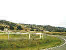
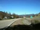
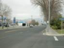
Looking west on California Highway 198 from the intersection of that highway and Peach Tree Road. | ||||
|
Other articles:
Locations:
Peachtree Valley.
|
|||||
|
Other articles:
|
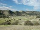
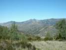
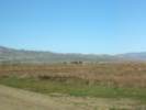
View across Peathtree Valley on the descent from Mustang Ridge. | ||||
|
Other articles:
|
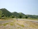
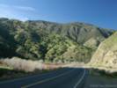
California Highway 198 crosses Mustang Ridge between Priest Valley and Peachtree Valley. | ||||
|
Locations: Priest Valley. |
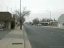
Priest Valley | ||||
|
Other articles:
|
|||||
|
Other articles:
|
|||||
|
Monterey County above
Fresno County below | |||||
|
Other articles:
|
Junction: Coalinga Mineral Springs Road | ||||
|
Other articles:
|
Parkfield JunctionJunction: Parkfield Grade | ||||
|
Other articles:
Locations:
Warthan Canyon.
|
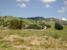
Warthan Canyon. The R. C. Baker Museum in Coalinga had many photographs of road construction in this canyon. | ||||
|
Other articles:
|
Junction: California Highway 33, south to US Hwy 101 at Ventura. | ||||
|
Other articles:
|
|||||
|
Other articles:
|
|||||
|
Other articles:
|
|||||
|
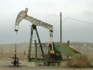
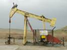
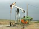
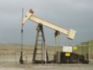
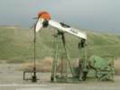
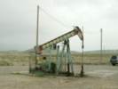
Locations: Coalinga. |
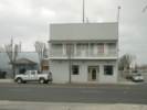
Coalinga | ||||
|
Other articles:
|
Junction: Van Ness Street, leads to Los Gatos Road. | ||||
|
Other articles:
|
View northwest from Coalinga. | ||||
|
Other articles:
|
| ||||
|
Other articles:
|
Junction: U. S. Interstate 5 | ||||
|
Locations: Kings River. |
Kings River, flowing south to the Tulare Lakebed. | ||||
|
|
Hanford | ||||
|
Other articles:
|
Junction: California Highway 99 | ||||
|
|
Visalia | ||||
| Junction: California Highway 65 | |||||
|
|
Three Rivers | ||||
| Junction: Mineral King Road | |||||
| Sequoia National Park Entrance | |||||
| Visitor Center | |||||
| Sherman Grove | |||||
|
Other articles:
|
Junction: California Highway 180 | ||||
| If you have a question or a comment you may write to me at: tas4@schweich.com I sometimes post interesting questions in my FAQ, but I never disclose your full name or address. |
Date and time this article was prepared: 5/10/2024 10:58:01 AM |