|
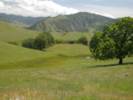
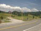
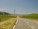
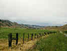
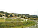
California Highway 25 roughly follows the San Andreas Fault from US Highway 101 north of Hollister, south to California Highway 198, near King City.
|
|
Other articles:
• U. S. Highway 101:
at CA Hwy 25;
|
Junction: U. S. Highway 101- North to San Jose and San Francisco, or
- South through the Salinas Valley to San Luis Obispo and, eventually, Los Angeles.
|
|
Other articles:
• Field Notes:
17-Apr-05;
|
Junction: Monterey Road
|
|
Other articles:
• California Highway 156:
at California Highway 25;
|
Junction: California Highway 156, southwest to San Juan Bautista.
|
|
Images:
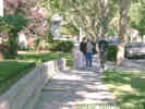
Offset sidewalk in Hollister.
|
Hollister
|
|
|
San Benito
|
|
Other articles:
• Panoche Road:
Paicines;
• Field Notes:
20040418010;
17-Apr-05 at Paicines;
Locations:
Paicines.
|
Paicines
Junction: Panoche Road- Southeast to Panoche, and eventually to US Interstate 15.
|
|
Other articles:
• Field Notes:
20040418020;
|
|
|
Other articles:
• Field Notes:
17-Apr-05;
|
South of Paicines the canyon narrows, and near Willow Creek and the Melendy Ranch, we saw this small ranch house perched on hummocky terrain.
|
|
Other articles:
• Field Notes:
17-Apr-05;
|
|
|
|
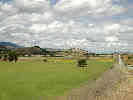
There is a short section of Highway 25 that leaves the trace of the San Andreas Fault, and climbs up onto a plateau-like valley. The San Benito River is to the east, and followed by Willow Creek Road.
|
|
Other articles:
• Field Notes:
17-Apr-05;
|
|
|
Other articles:
• California Highway 146:
at CA Hwy 25;
• Field Notes:
17-Apr-05;
Locations:
Pinnacles National Monument.
|
Junction: California Highway 146, west to Pinnacles National Monument.
|
|
Other articles:
• Field Notes:
17-Apr-05;
|
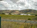
There is a place where southbound California Highway 25 crosses a ridge, rejoining the San Andreas fault zone, that several shutter ridges and a sag pond can be seen.
|
|
Other articles:
• San Benito Lateral:
at CA Hwy 25;
|
Junction: San Benito Lateral- East to the former town of San Benito, and to Old Hernandez Road.
|
|
Other articles:
• Coalinga Road:
at CA Highway 25;
|
Junction: Coalinga Road- Southeast past Hernandez Reservoir and Clear Creek Road, to Los Gatos Road.
|
|
Other articles:
• CR G-13:
at Bitterwater;
Locations:
Bitterwater.
|
Bitterwater
Junction: Monterey G-13
|
|
Literature Cited:
- Gudde, Erwin G., 1969 (3rd Ed.).
Other articles:
• Field Notes:
17-Apr-05 Bitterwater Lk;
Locations:
Bitterwater Lake.
La Laguna Vieja Rancho.
|
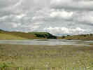
Just south of Bitterwater, in Bitterwater Valley, is Bitterwater Lake. I'm guessing someone thought the water was bitter. Gudde (1969) notes at least fifty locations, lakes, and streams in California with a reference to bitterness of the water. "Amargosa" also refers to bitterness of the water, although modern Spanish uses "amargo" or "amargado" for the adjective "bitter." The location of Bitterwater Lake is also occupied by La Laguna Vieja Rancho.
|
|
Other articles:
• Lewis Creek Road:
at CA Hwy 25;
|
Junction: Lewis Creek Road- Southeast along Lewis Creek, dead end.
|
|
Other articles:
• Lonoak Road:
at CA Hwy 25;
|
Junction: Lonoak Road
|
|
Other articles:
• Field Notes:
17-Apr-05;
Locations:
Peachtree Valley.
|
|
|
Other articles:
• Field Notes:
20040418070;
Locations:
Peachtree Valley.
|
|
|
Other articles:
• CA Hwy 198:
at CA Hwy 25;
• Field Notes:
20040418080;
|
Junction: California Highway 198- West to US Highway 101 at San Lucas, or
- East to Coalinga, US Interstate 5, Visalia, and Sequoia National Park.
|
|
If you have a question or a comment you may write to me at:
tomas@schweich.com
I sometimes post interesting questions in my FAQ, but I never disclose your full name or address.
|
[Home Page] [Site Map]
Date and time this article was prepared:
10/2/2026 12:35:12 PM
|
 Eastern Mojave Vegetation