Eastern Mojave Vegetation
Tom Schweich
|
Eastern Mojave Vegetation
| Box Canyon Road, Riverside County, California |
|
Tom Schweich |

|
East and west through Box Canyon. Formerly part of California Highway 195. | ||
|
Other articles:
|
Junction: US Interstate 10 | ||
| Enter Box Canyon below. | |||
|
Other articles:
|
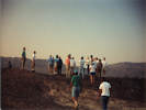
Shavers Well. To the east is a small dry lake in a closed basin on a trace of the Hidden Springs Fault. | ||
| Hidden Spring Trail. | |||
|
Other articles:
Locations:
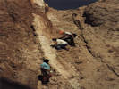
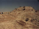
Mecca Hills.
|
Mecca Hills
| ||
| Jeep trail north. | |||
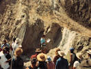
| Mouth of Canyon. | |||
| Painted Canyon Road. | |||
| Cross Coachella Canal. | |||
| Arthur Road / Coachella Canal Road | |||
|
Other articles:
|
Junction: 66th Avenue, straight ahead into Mecca, Garfield Street, north and south. | ||
| If you have a question or a comment you may write to me at: tomas@schweich.com I sometimes post interesting questions in my FAQ, but I never disclose your full name or address. |
Date and time this article was prepared: 5/12/2025 2:44:25 PM |