Eastern Mojave Vegetation
Tom Schweich
|
Eastern Mojave Vegetation
| Colorado and New Mexico Highway 17 |
|
Tom Schweich |

|
North and south generally in the San Luis Valley | |||||||||||||||||||||||||||||||||
|
Other articles:
|
Junction: US Highway 285 | |||||||||||||||||||||||||||||||||
|
Locations: Major Creek. |
Junction: County Road GG, east to Mineral Hot Springs and, by way of CR 65, Major Creek.
Literature Cited:
Locations:
Major Creek.
To the east is Major Creek, one location of Hurtado & Gallen (2025) to measure deglaciation rebound of the Sangre de Cristo Mountains.
Junction: County Road AA, a possible route to access Major Creek.
Other articles:
Junction: Lane 9 North
Other articles:
Other articles:
Other articles:
Other articles:
Other articles:
Locations:
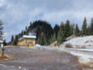
Cumbres.
Locations:
Chama.
Other articles:
Date and time this article was prepared:
4/21/2025 8:20:24 PM
|