 Eastern Mojave Vegetation
 Eastern Mojave Vegetation
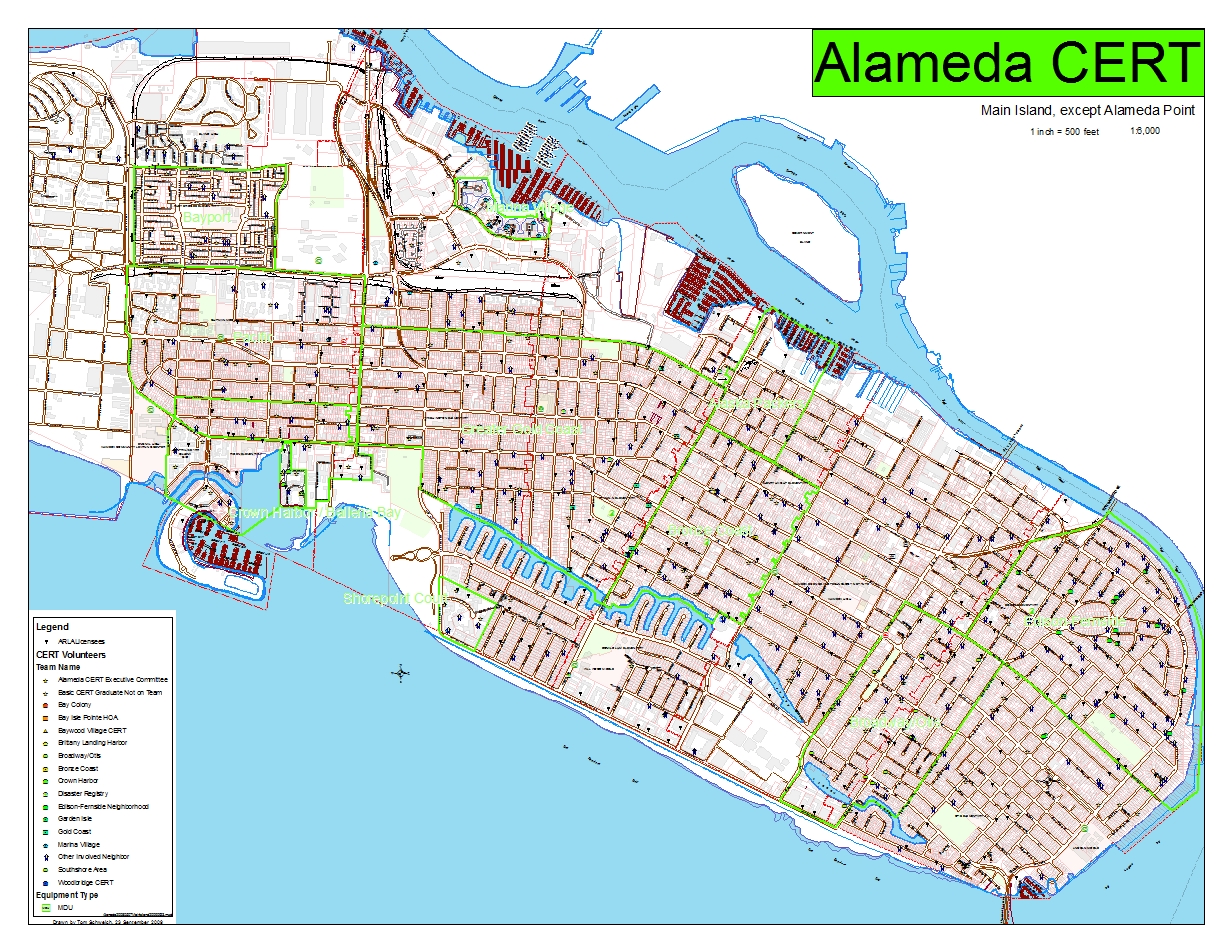
| Map of the Main Island |
|
|

If you have a question or a comment about this photograph you may write to me at: tomas@schweich.com I sometimes post interesting questions in my FAQ, but I never disclose your full name or address. |

This map was requested by a member of the Executive Committee to show to new CERT trainees and determine whether they lived in a neighborhood with a team, or where the nearest team is located. The map also showed how much of the main island can be gotten onto a single ANSI E-size sheet, using a scale of 1:6000.
Location records that use this photograph:
Article records that use this photograph:
Other photos about Alameda or Maps.
|
|
Date and time this page was prepared: 5/12/2025 3:02:10 PM |