
Eastern Mojave Vegetation
By Tom Schweich
|
Eastern Mojave Vegetation | Images -- Alameda |
|
By Tom Schweich |
|

Unclassified Geography - Idaho Geography - Park County, CO Geography - Summit County, CO Geography - Arizona Geography - British Columbia Geography - California Geography - California's Colorado Desert Alaska Geography - Mono Lake Basin, California Geography - Mono County, California Geography - San Luis Obispo County, California Geography - Marin County, California Geography - Santa Clara County Alameda Garden Geography - Central Mojave Geography - New Mexico Geography - Eastern Mojave Geography - Northern Mojave Geography - Colorado Geography - Alamosa County, CO Geography - Boulder County, CO Geography - Clear Creek County, CO Geography - Chaffee County, CO Geography - Douglas County, CO Geography - Gilpin County, CO Geography - Golden, Colorado Geography - Weld County, CO Geography - Hinsdale County, CO Geography - Jefferson County, CO Geography - North Table Mountain, Jefferson Cty, CO Geography - Lake County, CO Geography - Larimer County, CO Geography - Nevada Geography - Oregon Geography - South Dakota Geography - Utah Geography - Virginia Geography - Washington Geography - Wyoming Spain - Andalucia Spain - Castilla y Leon Spain - Castilla-La Mancha Spain - Extremadura Spain - Galicia Spain - Madrid Portugal Geology Economic Geology Climatology Botany Salvia dorrii Frasera albomarginata Species Species - Polygonaceae Species - Brassicaceae Species - Brassicaceae, Physaria vitulifera Species - Rosaceae Species - Fabaceae Species - Onagraceae Species - Polemoniaceae Species - Boraginaceae Species - Plantaginaceae Species - Asteraceae Species - Poaceae Zoology Ecology Archeology Customer Satisfaction General Arizona California Kansas Missouri Nebraska New York Christmas 2002 Family Photos Family Documents Family Photos 2003 Art of Lydia Schweich Portraits Railroad Geography - Germany |
Images are organized by the topics listed at left. Click on a topic name to see images with that topic. Would you like to use these photographs in your school term paper or report? License is hereby granted for non-commercial use of the images contained herein provided that the images are reproduced with the copyright notice intact. This means that we give you our permission to use the photographs and information you find here in your school term papers and reports. You may resize the photograph to fit your needs, but you may not remove the copyright. Your term paper should note that the photographs are reproduced with permission and it should have a reference to this web site, such as: "Photograph �1999 Tom Schweich. Used by permission, http://www.schweich.com" If you have a comment or a question about a photograph you may write to me at tomas@schweich.com I will answer you as soon as I can. I sometimes post interesting questions in my FAQ, but I will not disclose your full name or address.
| 
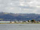
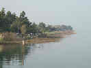
Eastshore near Central |
Article records that use this photograph:
images/DSCN0710sm.jpg
| 
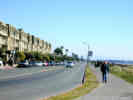
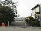
Entrance to Public Waterfront Promenade on Washington Street. | Photograph taken January 24, 2004
Article records that use this photograph:
images/IMGP0107sm.jpg
| 
Lone rower on San Leandro Bay |
Article records that use this photograph:
images/DSCN0708sm.jpg
| 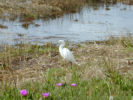
Egret in Elsie Roemer Bird Sanctuary. |
Location records that use this photograph:
Article records that use this photograph:
images/DSCN0717sm.jpg
| 
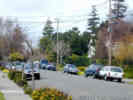
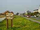
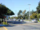
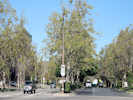
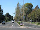
Park at Central |
Article records that use this photograph:
images/DSCN0678sm.jpg
| 
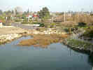
EBRPD Lagoon | Photographed 15 May 2012.
Article records that use this photograph:
images/IMG30139sm.jpg
| 
Small marsh at end of Washington Street. | Photograph taken January 24, 2004. While this photo looks pretty ugly, I was able to find Limonium californicum, Suaeda, and Triglochin, not to mention Spartina.
Article records that use this photograph:
images/IMGP0105sm.jpg
| 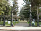
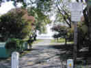
Lincoln Park at the High Street entrance. | Photograph taken January 25, 2004.
Article records that use this photograph:
images/IMGP0110sm.jpg
| 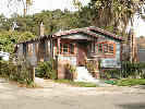
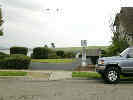
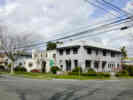
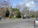
California bungalow on Central Avenue. | Photograph taken January 25, 2004.
Article records that use this photograph:
images/IMGP0113sm.jpg
| 
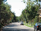
Northwood at Cambridge |
images/DSCN0724sm.jpg
| 
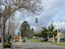
Central, at Court |
Article records that use this photograph:
images/DSCN0721sm.jpg
| 
Santa Clara at Court |
Article records that use this photograph:
images/DSCN0722sm.jpg
| 
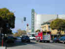
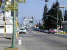
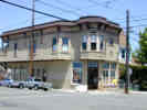
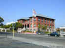
Broadway at Central. | Alameda Hotel, now mostly a residential hotel.
Article records that use this photograph:
images/DSCN0675sm.jpg
| 
Gibbons Drive at Southwood and Northwood. | Gibbons straight ahead. Southwood to the left; Northwood to the right. Photograph taken October 20, 2002.
Article records that use this photograph:
images/DSCN0509sm.jpg
| 
Lincoln at Court |
Article records that use this photograph:
images/DSCN0723sm.jpg
| 
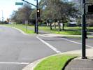
Shoreline access on Bayview Drive. | Photograph taken January 18, 2004.
Article records that use this photograph:
images/IMGP0091sm.jpg
| 
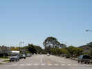
Shoreline at Westline |
Article records that use this photograph:
images/DSCN0681sm.jpg
| 
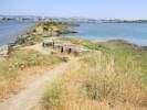
Marshes fringing Bay Farm Island at high tide. | Photograph taken January 18, 2004. Taken at high time, this photo shows the marshes on the north side of Bay Farm Island.
Article records that use this photograph:
images/IMGP0089sm.jpg
| 
Towata Park as seen from the Bay Farm Island Bridge. | Photograph taken January 18, 2004. There is a small inlet in this park, shown here at high tide, that has potential to be a small marsh.
Article records that use this photograph:
images/IMGP0087sm.jpg
| 
Shoreline Drive at Elsie Roemer Marsh. | Photograph taken January 18, 2004. Lookup northwest up Shoreline Drive from near Broadway.
Article records that use this photograph:
images/IMGP0082sm.jpg
| 
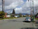
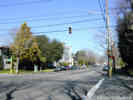
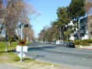
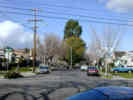
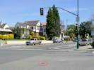
Central Avenue at Park Street | Looking north. Photograph taken October 20, 2002.
Article records that use this photograph:
images/DSCN0512sm.jpg
| 
Grand at Central |
Article records that use this photograph:
images/DSCN0680sm.jpg
| 
Aeolian Yacht Club |
Article records that use this photograph:
images/DSCN0714sm.jpg
| 
Shoreline access on Bayview Drive. | Photograph taken January 18, 2004.
Article records that use this photograph:
images/IMGP0092sm.jpg
| 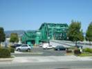
The Park Street Bridge. | Photograph taken September 4, 2005, from the Alameda side of the estuary.
Article records that use this photograph:
images/IMGP1688sm.jpg
| 
The Fruitvale Bridge in the Up position. | Photograph taken September 4, 2005, from the Alameda side of the estuary, when the sand barge was going by.
Article records that use this photograph:
images/IMGP1685sm.jpg
| 
The Fruitvale Bridge. | Photograph taken September 4, 2005, from the Oakland side of the estuary, south of the bridge.
Article records that use this photograph:
images/IMGP1680sm.jpg
| 
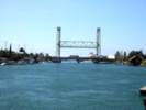
The High Street Bridge. | Photograph taken September 4, 2005, from the Oakland side of the estuary, north of the bridge.
Article records that use this photograph:
images/IMGP1679sm.jpg
| 
Park at Shoreline. |
Article records that use this photograph:
images/DSCN0684sm.jpg
| 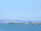
View of San Francisco from Bay Farm Island Bridge, Alameda | Photograph taken September 29, 2002.
Article records that use this photograph:
images/DSCN0469sm.jpg
| 
Westline at Shoreline |
Article records that use this photograph:
images/DSCN0683sm.jpg
| 
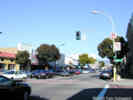
Central at Broadway |
Article records that use this photograph:
images/DSCN0676sm.jpg
| 
Broadway at Shoreline. |
Article records that use this photograph:
images/DSCN0686sm.jpg
| 
Fernside at Fairview | Magnolia in bloom, February morning after a rain storm.
Article records that use this photograph:
images/DSCN0704sm.jpg
| 
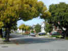
Thompson at Fairview | This street becomes "Christmas Tree Lane" in that season.
Article records that use this photograph:
images/DSCN0705sm.jpg
| 
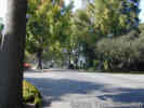
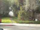
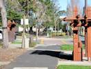
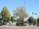
Vest pocket park at the end of Central Avenue |
Article records that use this photograph:
images/DSCN0709sm.jpg
| 
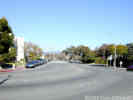
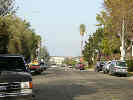
Gibbons Drive at Santa Clara. | Looking East. Photograph taken October 20, 2002.
Article records that use this photograph:
images/DSCN0511sm.jpg
| 
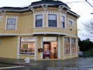
Ole's Waffle Shop | Good place for breakfast, lunch, and now dinner. Crowded on weekends.
Article records that use this photograph:
images/OlesWaffleShopCard.jpg
| 
High Street Bridge. | The High Street bridge looking from Alameda into Oakland. The cross street is Fernside Blvd., and Gibbons Drive also enters from the left. Photograph taken October 20, 2002.
Article records that use this photograph:
images/DSCN0510sm.jpg
| 
General view of Bayview Drive, looking northwest. | Photograph taken January 18, 2004.
Article records that use this photograph:
images/IMGP0090sm.jpg
| 
Otis at High. | Krusi Park in the background.
Article records that use this photograph:
images/DSCN0687sm.jpg
| 
Central at Park |
Article records that use this photograph:
images/DSCN0677sm.jpg
| 
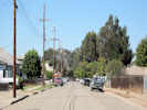
Encinal, looking across Fernside. |
Article records that use this photograph:
images/DSCN0711sm.jpg
| 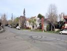
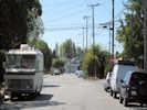
Intersection with evidence of "side shows." | Photograph taken 26 March 2012. The "side show" or "donut spinning" occurred the previous evening.
Article records that use this photograph:
images/IMG30078sm.jpg
| 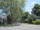
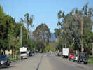
Monte Vista Avenue from Bayo Vista Avenue to Fernside Boulevard. | Photograph taken 17 May 2012. Monte Vista Walk is at the end of the block.
Article records that use this photograph:
images/IMG30151sm.jpg
| Alameda Point
| 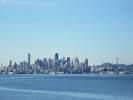
View of San Francisco | Photographed 13 January 2013.
Article records that use this photograph:
images/IMG30973sm.jpg
| 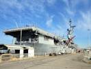
View of the USS Hornet from the back end. | I think that would be called the "stern." Photographed 13 January 2013
Article records that use this photograph:
images/IMG30976sm.jpg
| Art in Alameda
| 
Frank Bette Center with new paint job. | The Frank Bette Ceter is at http://www.frankbettecenter.org/
Article records that use this photograph: images/DSCN0226sm.jpg
| 
Frank Bette Center for the Arts | The Frank Bette Ceter is at http://www.frankbettecenter.org/
Article records that use this photograph: images/DSCN0968sm.jpg
| 
Artist's Open Studio on Clinton Avenue | There were three artists exhibiting here.
Article records that use this photograph:
images/DSCN0967sm.jpg
| Bay Farm Island, Bicycle Path
| 
Bicycle path across Robert E. Davey Drive. | Photographed 10 December 2012. The point of this photograph is to show how bicycles on the bicycle path are directed into th crosswalk.
Article records that use this photograph:
images/IMG30828sm.jpg
| 
Bicycle path across Maitland Drive. | Photographed 10 December 2012. The point of this photograph is to show how bicycles are required to use the crosswalk to access the signed bicycle path across Maitland Drive.
Article records that use this photograph:
images/IMG30830sm.jpg
| Christmas, 2000
| 
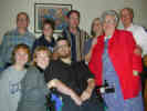
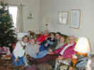
Group picture | Front row: Heidi, Heather and Jacob. Back row: Charlene, Allison, Jake, Cheryl, Peggy, and Bob.
images/Dscn0137.jpg
| 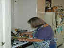
Cheryl making the gravy. |
images/Dscn0125.jpg
| 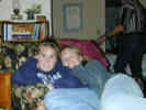
Allison and Heather in the Artichoke chair |
images/Dscn0135.jpg
| 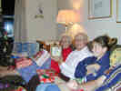
Bob shows off his clock. | From left: Peggy, Bob, and Allison.
images/Dscn0139.jpg
| 
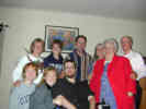
Group picture | From left: Front row: Heidi, Heather and Jacob, Back row: Tom, Allison, Jake, Cheryl, Peggy, and Bob.
images/Dscn0136.jpg
| 
Cheryl checks the turkey. | December 24, 2000
images/DSCN0123.jpg
| 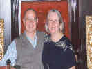
Mom and Dad at the PICU Christmas Party. | From left: Dad, Mom.
images/PICU_Party_2000.jpg
| 
Sitting on the couch. | From left to right: Peggy, Charlene, Bob, Allison, and Jake.
images/Dscn0134.jpg
| 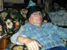
Tom shows off his new hat and bronze cricket. |
images/Dscn0141.jpg
| 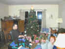
Waiting to open presents | From left: Jacob, Heather, and Heidi.
images/Dscn0131.jpg
| 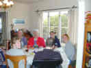
Waiting for the photographer to stop so they can eat. | Clockwise from foreground: Jacob, Heather, Cheryl, Peggy, Allison, and Heidi.
images/Dscn0130.jpg
| 
Still getting ready to eat. | Clockwise from foreground: Jacob, Heather, Jake, Charlene, Bob, Cheryl, and Peggy.
images/Dscn0128.jpg
| 
Getting ready to eat. | Clockwise from left: Cheryl, Peggy, Jacob, Heather, and Jake.
images/Dscn0127.jpg
| 
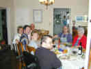
Group picture before dinner. | From left to right, Charlene (Cheryl's sister), Heather (Charlene's oldest daughter), Peggy (Cheryl's mother), Allison (Charlene's youngest daughter), Jake (Charlene's husband, Cheryl and Tom's brother-in-law), and Bob (Cheryl's father).
images/Dscn0124.jpg
| 
Tom getting ready to carve the turkey. |
images/Dscn0126.jpg
| City Buildings
| 
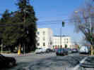
City Hall | Photograph taken October 20, 2002.
Location records that use this photograph:
Article records that use this photograph:
images/DSCN0513sm.jpg
| Community of Harbor Bay Island
| 
Fitchburg Avenue, looking southwest. | Photograph taken 1 Oct 2009. This view is from Beach Road. The first cross street is Maitland Drive, the second is Magnolia Drive, then the Cul de Sac.
Article records that use this photograph:
images/IMG02211sm.jpg
| 
Island Drive, as seen from Catalina Avenue | Photograph taken 1 Oct 2009.
Article records that use this photograph:
images/IMG02213sm.jpg
| 
Harrington Park, in Harbor Bay | Photograph taken 1 Oct 2009.
Article records that use this photograph:
images/IMG02212sm.jpg
| 
Catalina Avenue, near Island Drive, looking southeast. | Photograph taken 1 Oct 2009.
Article records that use this photograph:
images/IMG02214sm.jpg
| 
Catalina Avenue, near Island Drive, looking northwest | Photograph taken 1 Oct 2009.
Article records that use this photograph:
images/IMG02215sm.jpg
| 
Island Drive, north of Mecartney Road | Photograph taken 1 Oct 2009.
Article records that use this photograph:
images/IMG02216sm.jpg
| 
Island Drive, south of Mecartney Road | Photograph taken 1 Oct 2009.
Article records that use this photograph:
images/IMG02218sm.jpg
| 
Beach Road, looking northwest. | Photograph taken 1 Oct 2009. This view shows the length of Beach Road from near its intersection with Fitchburg Avenue. Beach Road ends at Flower Lane in the distance, and the golf course is on the right.
Article records that use this photograph:
images/IMG02210sm.jpg
| 
Mecartney Road, east of Island Drive | Photograph taken 1 Oct 2009.
Article records that use this photograph:
images/IMG02219sm.jpg
| 
Mecartney Road, west of Island Drive | Photograph taken 1 Oct 2009.
Article records that use this photograph:
images/IMG02217sm.jpg
| Control Points
| 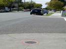
Control Point HT0034 "Clara Mo" | Photographed 16 April 2012.
Article records that use this photograph:
images/Droid2_570sm.jpg
| 
Control Point HT0035 "High Clara" | Photographed 16 April 2012.
Article records that use this photograph:
images/Droid2_970sm.jpg
| 
Control Point HT2480 "High Fair 1947" | Photographed 16 April 2012.
Article records that use this photograph:
images/Droid2_126.jpg
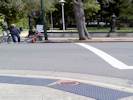
| 
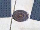
Control Point "FERN HIGH 1947" | Photographed 16 April 2012. Since this control point is in the middle of an intersection, I don't use it in my GPS accuracy project.
Article records that use this photograph:
images/Droid2_553sm.jpg
| | |||||||