
Eastern Mojave Vegetation
By Tom Schweich
|
Eastern Mojave Vegetation | Images -- Geography - California's Colorado Desert |
|
By Tom Schweich |
|

Unclassified Geography - Idaho Geography - Park County, CO Geography - Summit County, CO Geography - Arizona Geography - British Columbia Geography - California Geography - California's Colorado Desert Alaska Geography - Mono Lake Basin, California Geography - Mono County, California Geography - San Luis Obispo County, California Geography - Marin County, California Geography - Santa Clara County Alameda Garden Geography - Central Mojave Geography - New Mexico Geography - Eastern Mojave Geography - Northern Mojave Geography - Colorado Geography - Alamosa County, CO Geography - Boulder County, CO Geography - Clear Creek County, CO Geography - Chaffee County, CO Geography - Douglas County, CO Geography - Gilpin County, CO Geography - Golden, Colorado Geography - Weld County, CO Geography - Hinsdale County, CO Geography - Jefferson County, CO Geography - North Table Mountain, Jefferson Cty, CO Geography - Lake County, CO Geography - Larimer County, CO Geography - Nevada Geography - Oregon Geography - South Dakota Geography - Utah Geography - Virginia Geography - Washington Geography - Wyoming Spain - Andalucia Spain - Castilla y Leon Spain - Castilla-La Mancha Spain - Extremadura Spain - Galicia Spain - Madrid Portugal Geology Economic Geology Climatology Botany Salvia dorrii Frasera albomarginata Species Species - Polygonaceae Species - Brassicaceae Species - Brassicaceae, Physaria vitulifera Species - Rosaceae Species - Fabaceae Species - Onagraceae Species - Polemoniaceae Species - Boraginaceae Species - Plantaginaceae Species - Asteraceae Species - Poaceae Zoology Ecology Archeology Customer Satisfaction General Arizona California Kansas Missouri Nebraska New York Christmas 2002 Family Photos Family Documents Family Photos 2003 Art of Lydia Schweich Portraits Railroad Geography - Germany |
Images are organized by the topics listed at left. Click on a topic name to see images with that topic. Would you like to use these photographs in your school term paper or report? License is hereby granted for non-commercial use of the images contained herein provided that the images are reproduced with the copyright notice intact. This means that we give you our permission to use the photographs and information you find here in your school term papers and reports. You may resize the photograph to fit your needs, but you may not remove the copyright. Your term paper should note that the photographs are reproduced with permission and it should have a reference to this web site, such as: "Photograph �1999 Tom Schweich. Used by permission, http://www.schweich.com" If you have a comment or a question about a photograph you may write to me at tomas@schweich.com I will answer you as soon as I can. I sometimes post interesting questions in my FAQ, but I will not disclose your full name or address.
| Anza Borrego State Park
| 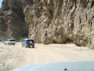
Axis of drag fold | Photograph taken April 21, 2008.
Article records that use this photograph:
images/IMG10568sm.jpg
| 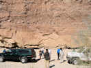
Field Trip Stop 3-2. Elephant Trees Conglomerate. | Photograph taken April 21, 2008.
Location records that use this photograph:
Article records that use this photograph: images/IMG10564sm.jpg
| 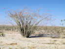
Ocotillo on Borrego Springs Road | Photograph taken April 21, 2008.
Article records that use this photograph:
images/IMG10584sm.jpg
| 
Field Trip Stop 3-8. Arroyo Diablo Formation. | Photograph taken April 21, 2008.
Article records that use this photograph:
images/IMG10577sm.jpg
| 
Field Trip Stop 3-7. Yuha Formation. | Photograph taken April 21, 2008.
Location records that use this photograph:
Article records that use this photograph: images/IMG10575sm.jpg
| 
Field Trip Stop 3-6. Colorado River delta rythmites | Photograph taken April 21, 2008.
Location records that use this photograph:
Article records that use this photograph: images/IMG10573sm.jpg
| 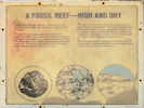
Fossil Reef Interpretive Sign | Photograph taken April 21, 2008.
Location records that use this photograph:
Article records that use this photograph: images/IMG10572sm.jpg
| 
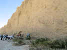
Field Trip Stop 3-4. First Evidence of Ancestral Colorado River | Photograph taken April 21, 2008.
Article records that use this photograph: images/IMG10569sm.jpg
| 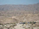
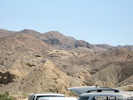
Vallecito Mountains above Fish Creek | Photograph taken April 21, 2008.
Article records that use this photograph:
images/IMG10578sm.jpg
| 
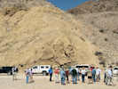
Field Trip Stop 3-3. Base of the Latrania Formation | Photograph taken April 21, 2008.
Location records that use this photograph:
Article records that use this photograph: images/IMG10567sm.jpg
| 
Field Trip Stop 3-3. Srutzstrom | Photograph taken April 21, 2008.
Location records that use this photograph:
Article records that use this photograph: images/IMG10565sm.jpg
| 
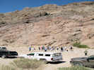
Fish Creek Campground | Photograph taken April 21, 2008.
Location records that use this photograph:
Article records that use this photograph:
images/IMG10561sm.jpg
| 
Field Trip Stop 3-1. Fish Creek Gypsum | Photograph taken April 21, 2008.
Article records that use this photograph: images/IMG10562sm.jpg
| 
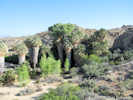
Wind Caves in sandstone above Fish Creek | Photograph taken April 21, 2008.
Article records that use this photograph:
images/IMG10570sm.jpg
| California Highway 111
| 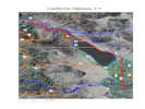
Map of California Highway 111 |
Article records that use this photograph:
images/CAHwy111.jpg
| California Highway 78
| 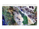
Map of California Highway 78 |
Article records that use this photograph:
images/CAHwy78.jpg
| Imperial County
| 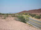
CA Hwy 78 north of Ben Hulse Monument | Photograph taken April 20, 2008.
Article records that use this photograph:
images/IMG10542sm.jpg
| 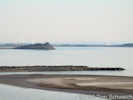
Rock Hill and Obsidian Butte from Red Island | Photograph taken April 20, 2008.
Location records that use this photograph:
Article records that use this photograph: images/IMG10552sm.jpg
| 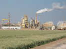
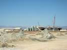
Elmer Power Plant of the California Energy Company | Photograph taken April 20, 2008.
Article records that use this photograph:
images/IMG10550sm.jpg
| 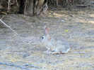
Cottontail rabbit at Sonny Bono Salton Sea National Wildlife Refuge | Photograph taken April 20, 2008.
Location records that use this photograph:
Article records that use this photograph:
images/IMG10549sm.jpg
| 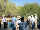
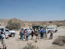
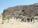
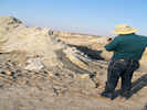
Geology talk at Sonny Bono Salton Sea National Wildlife Refuge | Photograph taken April 20, 2008.
Location records that use this photograph:
Article records that use this photograph:
images/IMG10548sm.jpg
| 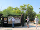
Entrance to Sonny Bono National Wildlife Refuge | Photograph taken April 20, 2008.
Location records that use this photograph:
Article records that use this photograph:
images/IMG10546sm.jpg
| 
CA Hwy 78 south of Ben Hulse Monument | Photograph taken April 20, 2008.
Article records that use this photograph:
images/IMG10543sm.jpg
| 
Monument on Ben Hulse Highway | Photograph taken April 20, 2008.
Location records that use this photograph:
Article records that use this photograph:
images/IMG10541sm.jpg
| 
Bouse Formation outcrop near the Ben Hulse Monument | Photograph taken April 20, 2008. Near the Ben Hulse Monument is an outcrop of the Lawlor Tuff in Bouse Formation sediments. This outcrop demonstrates than the high stand of water here reached 330 m (1080 ft) when the Lawlor Tuff was deposited at 4.83 Ma.
Article records that use this photograph:
images/IMG10544sm.jpg
| Joshua Tree National Park
| 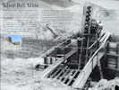
Silver Bell Mine | Photograph taken April 22, 2008.
Location records that use this photograph:
Article records that use this photograph:
images/IMG10608sm.jpg
| 
Cottonwood Spring | Photograph taken April 22, 2008.
Location records that use this photograph:
Article records that use this photograph:
images/IMG10591sm.jpg
| 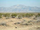
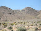
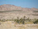
Pinto Mountain, the highest peak in the Pinto Mountains, as seen across the Pinto Basin | Photograph taken April 22, 2008.
Location records that use this photograph:
Article records that use this photograph:
images/IMG10593sm.jpg
| 
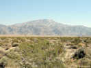
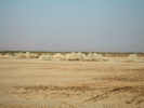
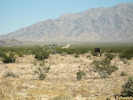
Turkey Flats | Photograph taken April 22, 2008.
Location records that use this photograph:
Article records that use this photograph:
images/IMG10596sm.jpg
| 
Turkey Flats | Photograph taken April 22, 2008.
Location records that use this photograph:
Article records that use this photograph:
images/IMG10597sm.jpg
| 
Silver Bell Mine | Photograph taken April 22, 2008.
Location records that use this photograph:
Article records that use this photograph:
images/IMG10609sm.jpg
| 
Cottonwood Spring | Photograph taken April 22, 2008.
Location records that use this photograph:
Article records that use this photograph:
images/IMG10589sm.jpg
| 
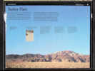
Interpretive Sign About Pinto Basin | Photograph taken April 22, 2008.
Location records that use this photograph:
Article records that use this photograph:
images/IMG10592sm.jpg
| Palo Verde Mesa
| 
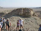
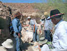
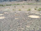
Mule Mountain Archaeological Area | Photograph taken April 20, 2008.
Location records that use this photograph:
Article records that use this photograph:
images/IMG10531sm.jpg
| 
Mule Mountain Archaeological Area | Photograph taken April 20, 2008.
Location records that use this photograph:
Article records that use this photograph:
images/IMG10533sm.jpg
| 
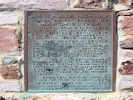
Plaque at Mule Mountain Archaeological Area | Photograph taken April 20, 2008.
Location records that use this photograph:
Article records that use this photograph:
images/IMG10532sm.jpg
| Salton Sea Mud Volcanoes
| 
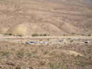
Mud Volcanoes | Photograph taken April 20, 2008.
Article records that use this photograph:
images/IMG10560sm.jpg
| 
Mud Volcanoes | Photograph taken April 20, 2008.
Article records that use this photograph:
images/IMG10554sm.jpg
| 
Mud Volcanoes | Photograph taken April 20, 2008.
Article records that use this photograph:
images/IMG10558sm.jpg
| 
A geothermal plant goes up behind the mud volcanoes. | Photograph taken 29 April 2011.
Article records that use this photograph:
images/IMG11721sm.jpg
| Sheephole Mountains
| 
Pediment in Sheephole Pass | Photograph taken April 22, 2008.
Location records that use this photograph:
Article records that use this photograph:
images/IMG10611sm.jpg
| 
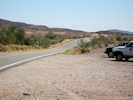
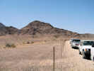
Amboy Road toward Sheephole Pass | Photograph taken April 22, 2008.
Location records that use this photograph:
Article records that use this photograph:
images/IMG10610sm.jpg
|
| Date and time this article was prepared: 4/21/2025 8:32:53 PM | |||||||||||||||||||||||||||