 Eastern Mojave Vegetation
Tom Schweich
 Eastern Mojave Vegetation
| California Highway 111 |
|
Tom Schweich |

|
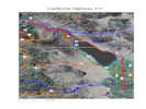
From US I-10 north of Palm Springs, through Palm Springs, then around the east side of the Salton Sea, through Brawley, and to the Mexican Border at Calexico |
 Map of California Highway 111 Map of California Highway 111
|
|
|
Other articles:
|
Junction: US Interstate 10 |
| Indian Canyon Drive | |
| Gene Autry Trail | |
| Ramon Road | |
| Palm Canyon Drive | |
| Junction: California Highway 74 | |
| Junction: California Highway 86 | |
| Junction: California Highway 86 | |
|
|
Thermal |
| Junction: 4th Street, for Mecca. | |
|
Other articles:
|
Junction: California Highway 195, also known as 66th Street. |
|
|
Salton |
|
|
Bombay Beach |
|
Other articles:
|
Junction: Davis Road, south along the shore of the Salton Sea to the geothermal field. |
|
|
Niland |
|
Other articles:
|
Junction: Schrimpf Road, west to Davis Road and the mud volcanoes. |
|
Other articles:
|
Junction: Sinclair Road, west to the Sonny Bono Salton Sea National Wildlife Refuge. |
|
|
Calipatria |
| Cross Alamo River | |
| County Route S26 | |
|
Brawley below | |
|
Other articles:
|
BrawleyJunction: California Highway 78, west through Anza Borrego State Park. |
|
Other articles:
|
Junction: California Highway 78, east, then north to Blythe, California. |
|
Brawley above. | |
| Evan Hewes Highway | |
| Junction: US Interstate 8 | |
|
Other articles:
|
Junction: California Highway 85 |
|
Calexico below | |
|
|
CalexicoJunction: California Highway 98 |
|
California, United States above Baja California Norte below | |
| If you have a question or a comment you may write to me at: tomas@schweich.com I sometimes post interesting questions in my FAQ, but I never disclose your full name or address. |
Date and time this article was prepared: 5/12/2025 2:42:17 PM |