
Eastern Mojave Vegetation
By Tom Schweich
|
Eastern Mojave Vegetation | Images -- Geography - Northern Mojave |
|
By Tom Schweich |
|

Unclassified Geography - Idaho Geography - Park County, CO Geography - Summit County, CO Geography - Arizona Geography - British Columbia Geography - California Geography - California's Colorado Desert Alaska Geography - Mono Lake Basin, California Geography - Mono County, California Geography - San Luis Obispo County, California Geography - Marin County, California Geography - Santa Clara County Alameda Garden Geography - Central Mojave Geography - New Mexico Geography - Eastern Mojave Geography - Northern Mojave Geography - Colorado Geography - Alamosa County, CO Geography - Boulder County, CO Geography - Clear Creek County, CO Geography - Chaffee County, CO Geography - Douglas County, CO Geography - Gilpin County, CO Geography - Golden, Colorado Geography - Weld County, CO Geography - Hinsdale County, CO Geography - Jefferson County, CO Geography - North Table Mountain, Jefferson Cty, CO Geography - Lake County, CO Geography - Larimer County, CO Geography - Nevada Geography - Oregon Geography - South Dakota Geography - Utah Geography - Virginia Geography - Washington Geography - Wyoming Spain - Andalucia Spain - Castilla y Leon Spain - Castilla-La Mancha Spain - Extremadura Spain - Galicia Spain - Madrid Portugal Geology Economic Geology Climatology Botany Salvia dorrii Frasera albomarginata Species Species - Polygonaceae Species - Brassicaceae Species - Brassicaceae, Physaria vitulifera Species - Rosaceae Species - Fabaceae Species - Onagraceae Species - Polemoniaceae Species - Boraginaceae Species - Plantaginaceae Species - Asteraceae Species - Poaceae Zoology Ecology Archeology Customer Satisfaction General Arizona California Kansas Missouri Nebraska New York Christmas 2002 Family Photos Family Documents Family Photos 2003 Art of Lydia Schweich Portraits Railroad Geography - Germany |
Images are organized by the topics listed at left. Click on a topic name to see images with that topic. Would you like to use these photographs in your school term paper or report? License is hereby granted for non-commercial use of the images contained herein provided that the images are reproduced with the copyright notice intact. This means that we give you our permission to use the photographs and information you find here in your school term papers and reports. You may resize the photograph to fit your needs, but you may not remove the copyright. Your term paper should note that the photographs are reproduced with permission and it should have a reference to this web site, such as: "Photograph �1999 Tom Schweich. Used by permission, http://www.schweich.com" If you have a comment or a question about a photograph you may write to me at tomas@schweich.com I will answer you as soon as I can. I sometimes post interesting questions in my FAQ, but I will not disclose your full name or address.
| 
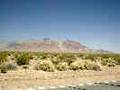
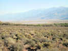
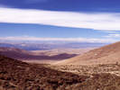
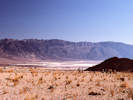
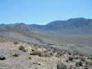
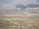
Chicago Valley, looking south. | Photograph taken May 24, 2004.
Location records that use this photograph:
Article records that use this photograph:
images/IMGP0497sm.jpg
| 
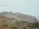
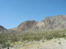
Southeastern tip of the Funeral Mountains. | Photograph taken May 24, 2004.
Location records that use this photograph:
Article records that use this photograph:
images/IMGP0504sm.jpg
| 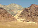
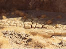
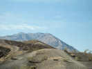
Is this a landslide? | Photograph taken May 24, 2004. Every time I drive by this canyon at the very southeastern tip of the Funeral Mountains, I wonder whether it might be a landslide. Of course, I'll have to confess that I've not been sufficiently curious that I went to any effort to go look at it.
Article records that use this photograph:
images/IMGP0503sm.jpg
| 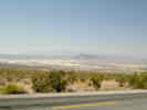
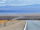
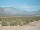
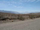
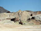
Tecopa Lake beds between Tecopa and Shoshone. | Photograph taken May 24, 2004.
Article records that use this photograph:
images/IMGP0501sm.jpg
| 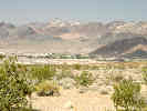
View of Shoshone from the east. | Photograph taken May 24, 2004.
Location records that use this photograph:
Article records that use this photograph:
images/IMGP0502sm.jpg
| 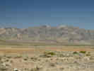
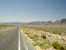
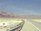
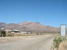
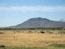
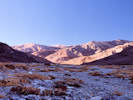
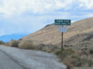
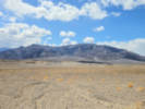
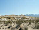
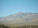
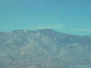
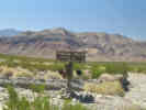
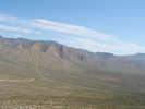
Resting Spring Range | Photograph taken May 24, 2004. This photograph is looking west from some small hills just west of Pahrump, Nevada. The little green sign in the center of the photo is the California state line.
Location records that use this photograph:
Article records that use this photograph:
images/IMGP0496sm.jpg
| 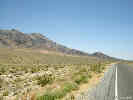
Chicago Valley and the Resting Spring Range, looking north. | Photograph taken May 24, 2004.
Location records that use this photograph:
Article records that use this photograph:
images/IMGP0498sm.jpg
| 
Generalized tectonic setting of the Precambrian-Cambrian margin of North America. | Many have drawn this diagram. This one is patterned after Corsetti and Hagadorn (2003).
Article records that use this photograph:
images/cambrian_facies.gif
| Aguereberry Point
| 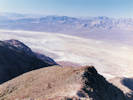
View northeast from Aguereberry Point. | Probably photographed May 1999.
Location records that use this photograph:
Article records that use this photograph:
images/199905_View_Aguereberry_Ptsm.jpg
| 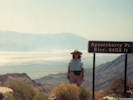
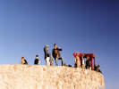
Cheryl at Aguereberry Point. | Photographed May 1993. Scanned 17 March 2018.
Location records that use this photograph:
Article records that use this photograph:
images/9354-10-332.jpg
| Amargosa River
| 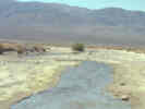
The Amargosa River where it crosses California Highway 127. |
Location records that use this photograph:
Article records that use this photograph:
images/0072_3301_0700_52.jpg
| 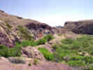
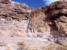
Hanging Gardens at the Amargosa Gorge. | View looking south of the "hanging Gardens" that have formed when waterfalls flowed from the contact at the base of a conglomerate. These ancient cascades with mineral-rich "hard water" have left travertine onyx drapes that contain impronts of fossil vegetation. The roadbed of theTonopah and Tidewater is seen in the middleground. Photograph taken from the purplish outcrop of Zabriskie Quartzite.
Location records that use this photograph:
Article records that use this photograph:
images/0022_3291_2725_02.jpg
| 
Looking north toward the Ibex Hills and Ibex Pass from the Amargosa River. |
Location records that use this photograph:
Article records that use this photograph:
images/0072_3301_0700_53.jpg
| Big Pine
| 
Blackbrush near Big Pine | Photograph taken April 27, 2009.
Article records that use this photograph:
images/IMG01638sm.jpg
| 
Blackbrush near Big Pine | Photograph taken April 27, 2009.
Location records that use this photograph:
Article records that use this photograph:
images/IMG01637sm.jpg
| 
Blackbrush near Big Pine | Photograph taken April 27, 2009. Klondike Lake is in the middleground, and the White Mountains in the distance.
Location records that use this photograph:
Article records that use this photograph:
images/IMG01635sm.jpg
| 
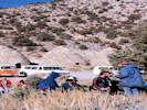
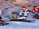
Waiting for our leaders at Big Pine. | Photographed September 1991, scanned from a print 7 February 2018.
Location records that use this photograph:
Article records that use this photograph:
images/919-1-300.jpg
| Big Pine Fault
| 
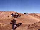
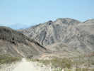
Field discussion of Big Pine Fault and Poverty Hills | Photograph taken April 25, 2009.
Location records that use this photograph:
Article records that use this photograph:
images/IMG01594sm.jpg
| 
Fault near Crater Mountain | Photograph taken April 25, 2009. This fault appears to run from the northeast corner of the Poverty Hills into the Big Pine Fault on the south side of Crater Mountain. It is one piece of evidence often cited for the Poverty Hills being a pressure ridge.
Location records that use this photograph:
Article records that use this photograph:
images/IMG01591sm.jpg
| Billie Mine
| 
Billie Mine across Furnace Creek Wash. | Photographed 2 April 2025.
Location records that use this photograph:
Article records that use this photograph:
images/20250402_105423sm.jpg
| Cave Spring (Fort Irwin)
| 
Cave Spring. | Between 1883 and 1887, Cave Spring was a water and rest stop for wagons loaded with borax from Death Valley (Vredenburgh, 1994). It also operated as an automobile rest stop on the main road to Death Valley from Barstow until the 1920s.
Location records that use this photograph:
Article records that use this photograph:
images/caftirwincavespr.jpg
| Chalfant Quarry
| 
Chalfant Quarry in Bishop Ash | Photograph taken April 26, 2009.
Location records that use this photograph:
Article records that use this photograph:
images/IMG01611sm.jpg
| China Ranch
| 
China Ranch Date Farm. | Great place to stop for a Date Shake.
Location records that use this photograph:
Article records that use this photograph:
images/0022_3291_2725_05.jpg
| Coso Junction
| 
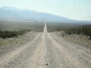
Coso Junction | Photograph taken April 25, 2009.
Location records that use this photograph:
Article records that use this photograph:
images/IMG01580sm.jpg
| Cottonwood Charcoal Kilns
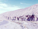
| 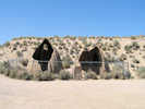
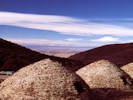
Remains of adobe charcoal kilns. | Photograph taken April 25, 2009.
Location records that use this photograph:
Article records that use this photograph:
images/IMG01583sm.jpg
| 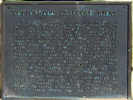
Plaque at Cottonwood Charcoal Kilns | Photograph taken April 25, 2009.
Location records that use this photograph:
Article records that use this photograph:
images/IMG01582sm.jpg
| Cottonwood Creek
| 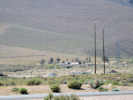
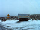
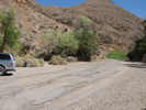
Water treatment plant near Cottonwood Creek. | Photograph taken April 25, 2009.
Article records that use this photograph:
images/IMG01581sm.jpg
| Crater Mountain
| 
Crater Mountain, as seen from Klondike Lake | Photograph taken April 27, 2009.
Location records that use this photograph:
Article records that use this photograph:
images/IMG01641sm.jpg
| Dante's View
| 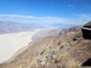
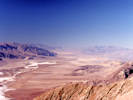
Floor of Death Valley from Dante's View (2025). | Photographed 2 April 2025.
Location records that use this photograph:
Article records that use this photograph:
images/20250402_101810sm.jpg
| 
Panamint Mountains across Death Valley (2025). | Photographed 2 April 2025.
Location records that use this photograph:
Article records that use this photograph:
images/20250402_101828sm.jpg
| Death Valley
| 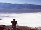
Death Valley salt pan from Dante's View. | Photographed in November 1980, scanned from a slide in 2023.
Location records that use this photograph:
Article records that use this photograph:
images/1980-11-img359sm.jpg
| 
Looking down Wildrose Canyon from near the charcoal kilns. | Photographed in November 1980, scanned from a slide in 2023.
Location records that use this photograph:
Article records that use this photograph:
images/1980-11-img365sm.jpg
| 
Trail Canyon in the late afternoon. | Photographed in November 1980, scanned from a slide in 2023.
Location records that use this photograph:
Article records that use this photograph:
images/1980-11-img361sm.jpg
| 
Charcoal kilns and Wildrose Canyon. | Photographed in November 1980, scanned from a slide in 2023.
Location records that use this photograph:
Article records that use this photograph:
images/1980-11-img367sm.jpg
| 
Ron Felzer (right) leads field trip stop at Wildrose Charcoal Kilns. | Photographed November 1980. Scanned 30 November 2020.
Location records that use this photograph:
Article records that use this photograph:
images/198011_img109_X3200sm.jpg
| 
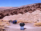
George Hilton consults the map in Trail Canyon. | Photographed November 1980. Scanned 30 November 2020.
Location records that use this photograph:
Article records that use this photograph:
images/198011_img108_X3200sm.jpg
| 
Salt formation at Badwater. | Photographed in November 1980, scanned from a slide in 2023.
Location records that use this photograph:
Article records that use this photograph:
images/1980-11-img362sm.jpg
| 
View from Trail Canyon fan into Death Valley. | Photographed in November 1980, scanned from a slide in 2023.
Location records that use this photograph:
Article records that use this photograph:
images/1980-11-img360sm.jpg
| 
Towne Pass, elevation 4956 feet. | Photographed 2 April 2025.
Location records that use this photograph:
Article records that use this photograph:
images/20250402_131646sm.jpg
| 
The view from Zabriskie Point. | Photographed November 1980. Scanned 30 November 2020.
Location records that use this photograph:
Article records that use this photograph:
images/198011_img106_X3200sm.jpg
| 
Townes Pass in the snow. | Photographed November 1980. Scanned 30 November 2020.
Location records that use this photograph:
Article records that use this photograph:
images/84B-1-25_img110_X3200sm.jpg
| 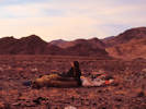
Waking up on the Trail Canyon fan. | Photographed in November 1980, scanned from a slide in 2023.
Location records that use this photograph:
Article records that use this photograph:
images/1980-11-sm.jpg
| 
View northwest from Dante's View. | Photographed in November 1980, scanned from a slide in 2023.
Location records that use this photograph:
Article records that use this photograph:
images/1980-11-img363sm.jpg
| 
View south towards Furnace Creek from the Sea Level sign. | Photographed 2 April 2025. This is about 14 miles north of Furnace Creek,
Location records that use this photograph:
Article records that use this photograph:
images/20250402_122022sm.jpg
| 
Exhumed mud cracks in Trail Canyon. | Photographed November 1980.
Location records that use this photograph:
Article records that use this photograph:
images/1980-12-2-32-600dpism.jpg
| 
Cheryl at the charcoal kilns. | Photographed in November 1980, scanned from a slide in 2023.
Location records that use this photograph:
Article records that use this photograph:
images/1980-11-img366sm.jpg
| 
Last part of the road to Dante's View. | Photographed 2 April 2025.
Location records that use this photograph:
Article records that use this photograph:
images/20250402_101635sm.jpg
| 
On the ridge at Dante's View. | Photographed in November 1980, scanned from a slide in 2023.
Location records that use this photograph:
Article records that use this photograph:
images/1980-11-img358sm.jpg
| 
Sea Level. | Photographed 2 April 2025. This is about 14 miles north of Furnace Creek,
Location records that use this photograph:
Article records that use this photograph:
images/20250402_121934sm.jpg
| 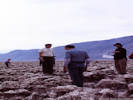
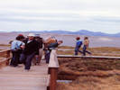
George Hilton and several students at Devils Golf Course. | Photographed November 1980. Scanned 30 November 2020.
Location records that use this photograph:
Article records that use this photograph:
images/198011_img107_X3200sm.jpg
| 
Tucki Mountain from the Sea Level sign. | Photographed 2 April 2025. This is about 14 miles north of Furnace Creek,
Location records that use this photograph:
Article records that use this photograph:
images/20250402_121948sm.jpg
| 
Emigrant Canyon. | Photographed in November 1980, scanned from a slide in 2023.
Location records that use this photograph:
Article records that use this photograph:
images/1980-11-img370sm.jpg
| 
Faulting in Emigrant Canyon. | Photographed in November 1980, scanned from a slide in 2023.
Location records that use this photograph:
Article records that use this photograph:
images/1980-11-img371sm.jpg
| 
Cheryl at Salt Creek. | Photographed in November 1980, scanned from a slide in 2023.
Location records that use this photograph:
Article records that use this photograph:
images/1980-11-img373sm.jpg
| 
Wildrose Charcoal Kilns. | Photographed in November 1980, scanned from a slide in 2023.
Location records that use this photograph:
Article records that use this photograph:
images/1980-11-img368sm.jpg
| 
Landscape beside the road at Towne Pass. | Photographed 2 April 2025.
Location records that use this photograph:
Article records that use this photograph:
images/20250402_131714sm.jpg
| 
Death Valley as seen from the Last Chance Range. | Photograph taken October 7, 2000. Ubehebe Crater is in the center of the photograph.
Location records that use this photograph:
Article records that use this photograph:
images/0091_3182_0174_30.jpg
| 
Looking up (East) into Nemo Canyon | Photograph taken 2-May-07. The mountain at right is Wildrose Peak.
Location records that use this photograph:
Article records that use this photograph:
images/IMG_1456sm.jpg
| 
General view south into Death Valley. | Photograph taken April 23, 2008.
Article records that use this photograph:
images/IMG10641sm.jpg
| 
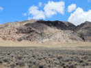
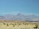
The Nelson Range east of Cerro Gordo. | Photograph taken July 16, 2005.
Location records that use this photograph:
Article records that use this photograph:
images/IMGP1576sm.jpg
| 
General view of Sand Spring | Photograph taken April 23, 2008.
Location records that use this photograph:
Article records that use this photograph:
images/IMG10640sm.jpg
| 
Dry Mountain from Ubehebe Crater | Photograph taken April 23, 2008.
Location records that use this photograph:
Article records that use this photograph:
images/IMG10629sm.jpg
| 
Tin Mountain from Ubehebe Crater | Photograph taken April 23, 2008.
Location records that use this photograph:
Article records that use this photograph:
images/IMG10630sm.jpg
| 
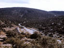
Foothills of the Grapevine Mountains along Death Valley Road | Photograph taken April 23, 2008.
Article records that use this photograph:
images/IMG10632sm.jpg
| 
View into the most northern end of Death Valley | Photograph taken April 23, 2008. Last Chance Mountain is on the left skyline. Death Valley Road near Crankshaft Crossing can be seen in the center of the photo.
Article records that use this photograph:
images/IMG10634sm.jpg
| 
General view of Little Sand Spring | Photograph taken April 23, 2008.
Location records that use this photograph:
Article records that use this photograph:
images/IMG10637sm.jpg
| 
Northern part of Death Valley from Ubehebe Crater | Photograph taken April 23, 2008.
Article records that use this photograph:
images/IMG10628sm.jpg
| 
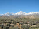
Telescope Peak as seen from Dante's View | Photograph taken 2-May-07.
Location records that use this photograph:
Article records that use this photograph:
images/IMGP2522sm.jpg
| 
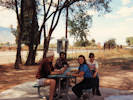
Wildrose Spring | Photograph taken 2-May-07. There are picnic tables under the trees.
Location records that use this photograph:
Article records that use this photograph:
images/IMG_1459sm.jpg
| 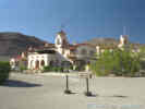
Scotty's Castle in northern Death Valley. |
Location records that use this photograph:
Article records that use this photograph:
images/2907-81.jpg
| 
Wildrose Graben | Photograph taken 2-May-07.
Location records that use this photograph:
Article records that use this photograph:
images/IMG_1461sm.jpg
| 
The sign and teakettle at Teakettle Junction. |
Location records that use this photograph:
Article records that use this photograph:
images/2907-72.jpg
| 
Wildrose Spring | Photograph taken 2-May-07. There are picnic tables under the trees.
Location records that use this photograph:
Article records that use this photograph:
images/IMG_1458sm.jpg
| 
Looking down (West) Nemo Canyon | Photograph taken 2-May-07. The Argus Range is seen in the distance.
Location records that use this photograph:
Article records that use this photograph:
images/IMG_1457sm.jpg
| 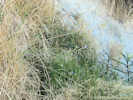
Vegetation in Little Sand Spring | Photograph taken April 23, 2008. I assumed that the Sisyrinchium was S. halophilum. Of course, if I had looked at the Jepson Manual later, I learned it could have also been S. funereum.
Location records that use this photograph:
Article records that use this photograph:
images/IMG10639sm.jpg
| 
Corkscrew Peak from the valley floor. | Photograph taken 2-May-07.
Location records that use this photograph:
Article records that use this photograph:
images/IMGP2526sm.jpg
| 
Mesquite Spring Campground | Photograph taken April 23, 2008.
Article records that use this photograph:
images/IMG10625sm.jpg
| 
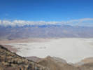
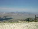
Death Valley salt pan and alluvial fan from Dante's View. | Photograph taken 2-May-07.
Location records that use this photograph:
Article records that use this photograph:
images/IMGP2523sm.jpg
| 
General view of Crater | Photograph taken April 23, 2008.
Location records that use this photograph:
Article records that use this photograph:
images/IMG10648sm.jpg
| 
Death Valley Road traverses the Last Chance Range | Photograph taken April 23, 2008.
Article records that use this photograph:
images/IMG10647sm.jpg
| 
Northern end of Death Valley. | Photograph taken April 23, 2008. Crankshaft Crossing is at the road junction in the left middleground.
Article records that use this photograph:
images/IMG10646sm.jpg
| 
Death Valley Road climbs the Last Chance Range | Photograph taken April 23, 2008.
Article records that use this photograph:
images/IMG10643sm.jpg
| | |||||||||||||||||||