Eastern Mojave Vegetation
Tom Schweich
|
Eastern Mojave Vegetation
| Field Notes (Continued) |
|
Tom Schweich |

Topics in this Article: 1800s 1900s 1910s 1920s 1930s 1940s 1950s 1960s 1970s 1980s 1990 1991 1992 1993 1995 1996 1997 1998 1999 2000 2001 2002 2003 2004 2005 2006 2007 2008 2008 Tour de Swertia albomarginata Mono Lake, August 2008 2009 2010 2011 2012 2013 2014 2015 2016 2017 2018 2019 2020 2021 2022 2023 2024 2025 Contents Literature Cited |
When I first read the field notes of Annie Alexander and Louise Kellogg, I was fascinated by the descriptions they wrote about the places they went and the plants and animals they found there. By publishing my field notes on the Internet I hope to follow a little bit in their tradition. | ||||||||
|
|
Spring 1991 | ||||||||
|
|
1991 | ||||||||
|
Other articles:
Locations:
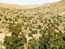
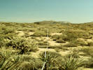
Rainbow Basin.
|
Barstow Syncline | ||||||||
|
Other articles:
Locations:
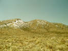
Lobo Point.
|
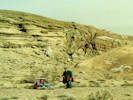
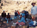
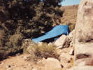
Desert Studies Field Trip
| ||||||||
|
Other articles:
Locations:
Lobo Point.
Wild Horse Canyon.
|
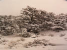
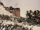
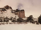
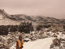
Snow partially melted at the end of the week.
| ||||||||
| April 8, 1991: Letter from Lydia Schweich. | |||||||||
|
Other articles:
Locations:
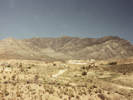
Mountain Pass.
Piute Valley.
|
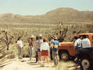
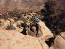
Mojave Desert Quaternary Research Center symposium and field trip.
| ||||||||
|
|
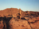
Vision Quest | ||||||||
|
Other articles:
Locations:
Big Pine.
Nelson Range.
|
| ||||||||
|
|
Thanksgiving 1991 | ||||||||
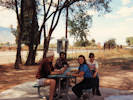
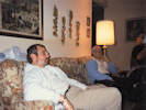
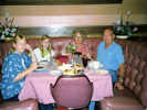 At a restaurant in Solvang At a restaurant in Solvang
|
Martha, Melisa, Lydia, and Ivan Bell at a restaurant (Moellenkiorn?) in Solvang. | ||||||||
|
[Previous Page]
[Next Page]
Go to page: [1800s] [1900s] [1910s] [1920s] [1930s] [1940s] [1950s] [1960s] [1970s] [1980s] [1990] [1991] [1992] [1993] [1994] [1995] [1996] [1997] [1998] [1999] [2000] [2001] [2002] [2003] [2004] [2005] [2006] [2007] [2008] [2009] [2010] [2011] [2012] [2013] [2014] [2015] [2016] [2017] [2018] [2019] [2020] [2021] [2022] [2023] [2024] [2025] [A] | |||||||||
| If you have a question or a comment you may write to me at: tomas@schweich.com I sometimes post interesting questions in my FAQ, but I never disclose your full name or address. |
Date and time this article was prepared: 5/12/2025 2:50:36 PM |
||||||||