Eastern Mojave Vegetation
Tom Schweich
|
Eastern Mojave Vegetation
| Field Notes (Continued) |
|
Tom Schweich |

Topics in this Article: 1800s 1900s 1910s 1920s 1930s 1940s 1950s 1960s 1970s 1980s 1990 1991 1992 1993 1995 1996 1997 1998 1999 2000 2001 2002 2003 2004 2005 2006 2007 2008 2008 Tour de Swertia albomarginata Mono Lake, August 2008 2009 2010 2011 2012 2013 2014 2015 2016 2017 2018 2019 2020 2021 2022 2023 2024 2025 Contents Literature Cited |
When I first read the field notes of Annie Alexander and Louise Kellogg, I was fascinated by the descriptions they wrote about the places they went and the plants and animals they found there. By publishing my field notes on the Internet I hope to follow a little bit in their tradition. | |||||||||||||||||||||||||||||||||||||||||||||||||||||||||||||||||||||||||||||||||||||||||||||||||||||||||||||||||||||||||||||||||||||||||||||||||||||||
|
|
2002 | |||||||||||||||||||||||||||||||||||||||||||||||||||||||||||||||||||||||||||||||||||||||||||||||||||||||||||||||||||||||||||||||||||||||||||||||||||||||
|
Other articles:
Locations:
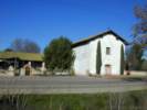
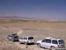
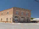
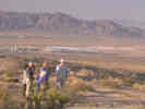
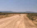
San Miguel.
|
Stopped in San Miguel on the way home. | |||||||||||||||||||||||||||||||||||||||||||||||||||||||||||||||||||||||||||||||||||||||||||||||||||||||||||||||||||||||||||||||||||||||||||||||||||||||
|
|
Thursday, April 18, 2002 | |||||||||||||||||||||||||||||||||||||||||||||||||||||||||||||||||||||||||||||||||||||||||||||||||||||||||||||||||||||||||||||||||||||||||||||||||||||||
|
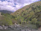
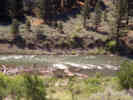
Locations:
Kern River.
|
Left home at 8:00 AM Thursday morning and, pushed by a tailwind, arrived in Bakersfield at Noon. After shopping, drive toward Highway 178. The day was overcast, but warm in Bakersfield, turning cooler as I progressed up the canyon. | |||||||||||||||||||||||||||||||||||||||||||||||||||||||||||||||||||||||||||||||||||||||||||||||||||||||||||||||||||||||||||||||||||||||||||||||||||||||
|
Locations:
Kern River.
|
In the lower canyon, I saw Dichelostemma, some lupines, and a Cryptantha. One location had many Fremontia in bloom. The Kern River was running, but without much vigor. At China Gardens there was a Collinsia with pairs of flowers rather than whorls. | |||||||||||||||||||||||||||||||||||||||||||||||||||||||||||||||||||||||||||||||||||||||||||||||||||||||||||||||||||||||||||||||||||||||||||||||||||||||
|
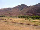
Other articles:
Locations:
Isabella Lake.
|
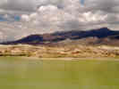
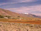
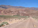
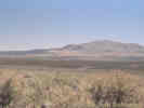
Isabella Lake looks to be down about 30 feet from its maximum. Stopped at the Wildlife Viewing Area, where the stream flow was at most languid, and no wildlife was seen. | |||||||||||||||||||||||||||||||||||||||||||||||||||||||||||||||||||||||||||||||||||||||||||||||||||||||||||||||||||||||||||||||||||||||||||||||||||||||
 Fremontia (Fremontodendron californicum) in South Fork Valley. Fremontia (Fremontodendron californicum) in South Fork Valley.
|
Saw a few more Fremontia in bloom near Onyx. | |||||||||||||||||||||||||||||||||||||||||||||||||||||||||||||||||||||||||||||||||||||||||||||||||||||||||||||||||||||||||||||||||||||||||||||||||||||||
|
Other articles:
|
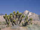
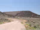
At one place on the north side of the highway, Digger Pines and Joshua Trees were growing together. There were irrigation ditches along side both sides of the highway and I could not safely stop. However, a little further down the road there was a place to pull off. | |||||||||||||||||||||||||||||||||||||||||||||||||||||||||||||||||||||||||||||||||||||||||||||||||||||||||||||||||||||||||||||||||||||||||||||||||||||||
|
Other articles:
Locations:
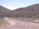
Walker Pass.
|
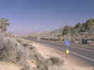
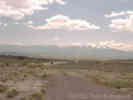
Very windy at Walker Pass, and very dry also. | |||||||||||||||||||||||||||||||||||||||||||||||||||||||||||||||||||||||||||||||||||||||||||||||||||||||||||||||||||||||||||||||||||||||||||||||||||||||
|
|
Friday, April 19, 2002 | |||||||||||||||||||||||||||||||||||||||||||||||||||||||||||||||||||||||||||||||||||||||||||||||||||||||||||||||||||||||||||||||||||||||||||||||||||||||
| On Friday morning, we left Ridgecrest a few minutes after 6:00 AM, and rolled into Zzyzx a little after 8:30 AM. The morning dawned red with clouds. A cloud bank could be seen over the Sierras. The day cleared slowly with a cool north wind into the evening. | ||||||||||||||||||||||||||||||||||||||||||||||||||||||||||||||||||||||||||||||||||||||||||||||||||||||||||||||||||||||||||||||||||||||||||||||||||||||||
| Lauren Wright gave an overview of global tectonic events, noting Death Valleys and Amargosa Valleys position in each. The Rodinia supercontinent and the invalidation of the Amargosa aulacogen were two new concepts to me. | ||||||||||||||||||||||||||||||||||||||||||||||||||||||||||||||||||||||||||||||||||||||||||||||||||||||||||||||||||||||||||||||||||||||||||||||||||||||||
| Brian Brown talked about the early history of China Ranch. The legend of a Chinese man named Ah Foo, who farmed at China Ranch, seems to have some basis in fact. | ||||||||||||||||||||||||||||||||||||||||||||||||||||||||||||||||||||||||||||||||||||||||||||||||||||||||||||||||||||||||||||||||||||||||||||||||||||||||
| Jeff Lovitch talked about historic records of Gila Monsters in the eastern Mojave. He reviewed some records from the Providence Mountains. Rangers at Mitchell Caverns report occasional sightings along the trail to the caverns. Jeff favors occurrence of the Gila Monster in riparian areas where biphasic precipitation occurs. | ||||||||||||||||||||||||||||||||||||||||||||||||||||||||||||||||||||||||||||||||||||||||||||||||||||||||||||||||||||||||||||||||||||||||||||||||||||||||
| Warren and Schneider reported on their renewed archeological investigations at the outlet of Lake Mojave, now known as Silver Lake. They have found a horizon with artifacts whose minimum age is constrained by a cross-cutting Anodonta siphon. | ||||||||||||||||||||||||||||||||||||||||||||||||||||||||||||||||||||||||||||||||||||||||||||||||||||||||||||||||||||||||||||||||||||||||||||||||||||||||
| Friday night was clear and cool, but got a little warmer as the north wind stopped after dark, and was replaced by a warmer westerly flow. | ||||||||||||||||||||||||||||||||||||||||||||||||||||||||||||||||||||||||||||||||||||||||||||||||||||||||||||||||||||||||||||||||||||||||||||||||||||||||
|
|
Saturday, April 20, 2002 | |||||||||||||||||||||||||||||||||||||||||||||||||||||||||||||||||||||||||||||||||||||||||||||||||||||||||||||||||||||||||||||||||||||||||||||||||||||||
| This morning is beautiful: clear and cool, with a warm sun. Maybe it will warm up to 75-80 degrees today. | ||||||||||||||||||||||||||||||||||||||||||||||||||||||||||||||||||||||||||||||||||||||||||||||||||||||||||||||||||||||||||||||||||||||||||||||||||||||||
| I asked Emmett Harder if he knew any of the Dorr family, but he did not. | ||||||||||||||||||||||||||||||||||||||||||||||||||||||||||||||||||||||||||||||||||||||||||||||||||||||||||||||||||||||||||||||||||||||||||||||||||||||||
Bob told us about the upcoming field trip. After reviewing marker beds in Pleistocene Lake Manix that are time and topography, we will review marker beds in Miocene sediments of the Barstow formation. The specific marker beds we will review are:
| ||||||||||||||||||||||||||||||||||||||||||||||||||||||||||||||||||||||||||||||||||||||||||||||||||||||||||||||||||||||||||||||||||||||||||||||||||||||||
| David Miller reviewed his work in the Dove Spring Formation, which he studied while developing a protocol for monitoring off-highway vehicle use. The fluvial environment indicates a relatively wet environment, as discussed in Quade, et al., 1996 and Benson, et al., 2002 who concluded that Las Vegas and the Great Basin was cooler and wetter until 8-9 kybp. This was related to the younger Dryas cold event. | ||||||||||||||||||||||||||||||||||||||||||||||||||||||||||||||||||||||||||||||||||||||||||||||||||||||||||||||||||||||||||||||||||||||||||||||||||||||||
| At Field Trip Stop 1-1, we are looking at mid-Pleistocene Lake Manix. Here tufa was deposited by blue-green algae on alluvial fan deposits in clear water (Photo 4). | ||||||||||||||||||||||||||||||||||||||||||||||||||||||||||||||||||||||||||||||||||||||||||||||||||||||||||||||||||||||||||||||||||||||||||||||||||||||||
|
Other articles:
Locations:
Harvard Hill.
|
| |||||||||||||||||||||||||||||||||||||||||||||||||||||||||||||||||||||||||||||||||||||||||||||||||||||||||||||||||||||||||||||||||||||||||||||||||||||||
|
Locations:
Harvard Hill.
|
Photo 7 shows I-15 from Harvard Hill. Collected stromatolites with plant fossils. | |||||||||||||||||||||||||||||||||||||||||||||||||||||||||||||||||||||||||||||||||||||||||||||||||||||||||||||||||||||||||||||||||||||||||||||||||||||||
| While we waited for low-slung car consolidation, Fred Budinger told us about the Calico Early Man Site and some recent work. | ||||||||||||||||||||||||||||||||||||||||||||||||||||||||||||||||||||||||||||||||||||||||||||||||||||||||||||||||||||||||||||||||||||||||||||||||||||||||
 Field trip discussion of the Miocene Barstow Basin. Field trip discussion of the Miocene Barstow Basin.
|
Field Trip Stop 1-3. Parked cars in wash, walked up the hill to the silicified algal limestone. These were hard dark reddish-brown rocks over a softer brown-tan clastic rock. According to Bob Reynolds, the algal mats preserved here are the deep water facies of the MSL. The stromatolites interfinger with the andesite zone, and silicified very rapidly. The silica came from nearby volcanic rocks and, therefore, the silicified algal mats cannot be termed biogenic. | |||||||||||||||||||||||||||||||||||||||||||||||||||||||||||||||||||||||||||||||||||||||||||||||||||||||||||||||||||||||||||||||||||||||||||||||||||||||
| Field Trip Stop 1-4 was at the drill pad on the north side of the east end of Daggett Ridge. Top of ridge has stromatolites. Resistent steeply dipping arkosic sandstone. Pink tuff is younger than the Strontium Borate Layer (SBH) and may be mappable to the Peach Springs Tuff(?) at the Pink Lady Mine. | ||||||||||||||||||||||||||||||||||||||||||||||||||||||||||||||||||||||||||||||||||||||||||||||||||||||||||||||||||||||||||||||||||||||||||||||||||||||||
 View of Mojave Valley from Dagget Ridge View of Mojave Valley from Dagget Ridge
|
Field Trip Stop 1-5, does the pink tuff correlate to the pink ash at Outlet Center Drive? | |||||||||||||||||||||||||||||||||||||||||||||||||||||||||||||||||||||||||||||||||||||||||||||||||||||||||||||||||||||||||||||||||||||||||||||||||||||||
|
|
Sunday, April 21, 2002 | |||||||||||||||||||||||||||||||||||||||||||||||||||||||||||||||||||||||||||||||||||||||||||||||||||||||||||||||||||||||||||||||||||||||||||||||||||||||
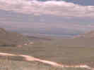
| Field Trip Stop 2-2, Rogers Road at California Highway 14, and most northwestern edge of Mojave geologic province. | ||||||||||||||||||||||||||||||||||||||||||||||||||||||||||||||||||||||||||||||||||||||||||||||||||||||||||||||||||||||||||||||||||||||||||||||||||||||||
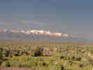
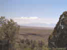
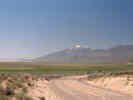
| Alan Schoenherr gave an overview of biological aspects of the Mojave. Creosote bush is a marker for hot desert. Joshua tree is a marker for the biological Mojave Desert. Top of grade between Coso Junction and Olancha has a few Joshua trees, and is typically taken as the northern boundary of the Mojave Desert. Winter rain: Mojave desert; Winter snow: Great basin; i.e., a climatological boundary of the Mojave desert that roughly corresponds with the biological boundary. | ||||||||||||||||||||||||||||||||||||||||||||||||||||||||||||||||||||||||||||||||||||||||||||||||||||||||||||||||||||||||||||||||||||||||||||||||||||||||
| Frank Monastero from China Lake: focus on evolution of Indian Wells Valley and the Coso geothermal field. Eagle Crags is a large rhyolitic center in the central Mojave. Correlated Cudahy Camp formation with rocks in eagle crags. Dates 15-17 ma (K-Ar), unique chemistry in basalts, implies 64 km offset, Garlock may be an intercontinental transform. Dove Spring Formation correlates to other rocks south of Garlock Fault in El Paso Mountains, 30-34 km offset between 15.7 ma and 10 ma. Remaining offset would precede Dove Springs time hills are south of Garlock Fault and east of Randsburg. Ricardo Group includes the Dove Springs Formation (8-13 ma) and the Cudahy Camp Formation (15-20 ma) with a substantial hiatus between them. | ||||||||||||||||||||||||||||||||||||||||||||||||||||||||||||||||||||||||||||||||||||||||||||||||||||||||||||||||||||||||||||||||||||||||||||||||||||||||
| Field Trip Stop 2-5. Several drill holes and seismic reflection lines, published a hypothesis of a hot spot, turned out to be a thick sequence of sediments. Seismic reflection data show the Sierra Nevada Frontal Fault to be a low angle normal fault with some right lateral component. Indian Wells Valley is interpreted as a half-graben (Leeder and Gauthorp) with axial drainage. | ||||||||||||||||||||||||||||||||||||||||||||||||||||||||||||||||||||||||||||||||||||||||||||||||||||||||||||||||||||||||||||||||||||||||||||||||||||||||
| The White Hills deposits occur under the basalt flows, and White Hill, seen across the valley occurs in a window in the basalt flows. Duffield and Bacon (1980) write a paper about damning of the Owens River and diversion of its channel by the basalt flows. | ||||||||||||||||||||||||||||||||||||||||||||||||||||||||||||||||||||||||||||||||||||||||||||||||||||||||||||||||||||||||||||||||||||||||||||||||||||||||
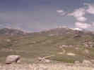
| Creosote Bush rings on mountain side. | ||||||||||||||||||||||||||||||||||||||||||||||||||||||||||||||||||||||||||||||||||||||||||||||||||||||||||||||||||||||||||||||||||||||||||||||||||||||||
| Joshua trees. | ||||||||||||||||||||||||||||||||||||||||||||||||||||||||||||||||||||||||||||||||||||||||||||||||||||||||||||||||||||||||||||||||||||||||||||||||||||||||
|
|
Monday April 22, 2002 | |||||||||||||||||||||||||||||||||||||||||||||||||||||||||||||||||||||||||||||||||||||||||||||||||||||||||||||||||||||||||||||||||||||||||||||||||||||||
|
Locations: Sheep Tank. |
Don Lofgren and Malcolm McKenna, Phd UC, Chester Stock, coal mine near Colorado Camp, lot of red banded sediments, 10000 11000 feet in basin, tilted since to the north, began as lacustrine and became marine. Dibblee called it Goler Formation. Too thick to be a single formation. Rounded conglomerate pebbles coming from direction now known as east, as entire deposits have been rotated counterclockwise. Partial paleomagnetic study shows Paleocene age. Very few fossils, some petrified wood, one leaf locality across valley. Fossils found include palms, magnolias, avocados; near-coastal, river flowing west. Erosion period followed by 18 ma lapilli tuff, 17 ma andesite, 15 ma lava and feeder dike system, all formerly mapped as Pleistocene. Antiform in valley suggests compression, but no other evidence thereof. The Rand / Orocopia / Pelona Schist suggest viscous flow. Garlock Fault early movement probably vertical. Goler Formation is the only terrestrial Paleocene deposit in California. Kinnick Fm = Cudahy Camp Fm. Marine in Goler Fm are clams, snails that are early Eocene (Penutian?). Fauna: sub-tropical, some South American: tuberculates (who lasted until late Eocene), 2-3 kinds of primitive South American ungulates, primates (pleisiatapus?): 4 kinds; marsupials; 2 turtles; fish; lizards (Randy Knightsen); invertebrates and root casts. Only window about this period in California. Black Mountain basalt is not the same as basalt near Red Rock Canyon. Basement of Goler Formation is seen to the south, in Permian ________ (fusilinids). | |||||||||||||||||||||||||||||||||||||||||||||||||||||||||||||||||||||||||||||||||||||||||||||||||||||||||||||||||||||||||||||||||||||||||||||||||||||||
| Stop 3-2. Goler Formation, Laudate site near Sheep Tank, just west of El Paso Mountains Wilderness. | ||||||||||||||||||||||||||||||||||||||||||||||||||||||||||||||||||||||||||||||||||||||||||||||||||||||||||||||||||||||||||||||||||||||||||||||||||||||||
|
|
Tuesday, April 23, 2002 | |||||||||||||||||||||||||||||||||||||||||||||||||||||||||||||||||||||||||||||||||||||||||||||||||||||||||||||||||||||||||||||||||||||||||||||||||||||||
| A few high clouds this morning. Calm last night, and calm again at Mid Hills Campground this morning. After breakfast I drove down Wild Horse Canyon. There were three deer along the road. I noticed a few Purshia that were starting to bloom, but these were the only flowers I saw anywhere. As I came over the divide between Macedonia and Wild Horse Canyon, a very large bird flew in front of my car. It was dark brown, definitely not black, and flew with its feet hanging down. I suspect that it was an eagle. | ||||||||||||||||||||||||||||||||||||||||||||||||||||||||||||||||||||||||||||||||||||||||||||||||||||||||||||||||||||||||||||||||||||||||||||||||||||||||
| I stopped at the Salvia dorrii plot and collected data. The plants had no new stem growth, and I suspect that any leaves were left over from the last growth season. Stem die-back was fairly common. I resorted to testing the leaves to see if they fell off, or were still pliable. If the leaves were pliable, I assessed plant status as 3, meaning vegetative growth. But if the leaves were not pliable and fell off, I assessed plant status as 2, meaning dormant. Many of the plants look like little trees that have been coppiced. They have a caudex that flairs out into woody stems that look cut off. | ||||||||||||||||||||||||||||||||||||||||||||||||||||||||||||||||||||||||||||||||||||||||||||||||||||||||||||||||||||||||||||||||||||||||||||||||||||||||
| I partially exhumed one small Salvia dorrii to see how deep the woody caudex went. This plant was about 15 cm high and had about seven stems. The single caudex was 4-5 mm in diameter and extended from about 5 mm above ground to about 10 mm below the surface. Then roots spread out at about a 45° angle. I tried to be careful not to cut roots, replaced the dirt and watered the plant. It will be interesting to see how the plant survives the experience. Close examination of more mature Salvia dorrii with caudex diameters of 1-2 cm showed that stem splitting has already occurred. | ||||||||||||||||||||||||||||||||||||||||||||||||||||||||||||||||||||||||||||||||||||||||||||||||||||||||||||||||||||||||||||||||||||||||||||||||||||||||
| From the plot, I drove into Lobo Point. Checking on the plants there, the Menodora scoparia had no stems as it was eaten down to within a couple of inches of the ground. The Symphoricarpos longiflorus had no leaves. There were no flowers on any of the plants. | ||||||||||||||||||||||||||||||||||||||||||||||||||||||||||||||||||||||||||||||||||||||||||||||||||||||||||||||||||||||||||||||||||||||||||||||||||||||||
|
Other articles:
|
Drove over to Wild Horse Mesa. Hiked up to my experimental plots. No plants had any leaves. I believe this may be the first time I have observed this. Some of last years seed capsules still had seeds in them. | |||||||||||||||||||||||||||||||||||||||||||||||||||||||||||||||||||||||||||||||||||||||||||||||||||||||||||||||||||||||||||||||||||||||||||||||||||||||
| Since the Frasera albomarginata were dormant, I thought perhaps of the possibility of transplanting them to the Bay Area for study. I selected dormant plants that had no green leaves showing. I dug the plants to a depth of 9-12 inches. I wrapped the roots in tissue (the only packing material at hand), dampened them with water, and placed the wrapped plants in a plastic bag. | ||||||||||||||||||||||||||||||||||||||||||||||||||||||||||||||||||||||||||||||||||||||||||||||||||||||||||||||||||||||||||||||||||||||||||||||||||||||||
| From my plots I climbed up to the saddle north of the mesa, and then turned north onto the spur of welded tuff north of Wild Horse Mesa. I was looking for Agave desertii that I had seen there once before. I found them at the narrow upper end of the spur. There was one stalk from last year, and three rosettes about 3 feet away. No others were found. | ||||||||||||||||||||||||||||||||||||||||||||||||||||||||||||||||||||||||||||||||||||||||||||||||||||||||||||||||||||||||||||||||||||||||||||||||||||||||
| I dropped off the spur and walked the ridge to Winklers Cabin. Checked the log book, and then added my entry. The previous entry was from April 18th, five days previous. | ||||||||||||||||||||||||||||||||||||||||||||||||||||||||||||||||||||||||||||||||||||||||||||||||||||||||||||||||||||||||||||||||||||||||||||||||||||||||
| Toured down Wild Horse Canyon Road, stopped at Hole-in-the-Wall to check voice mail, and then up Black Canyon Road. Noticed that there is a sign offering 40 acre parcels from the Gold Valley Ranch. Tried to find the Mid Hills RAWS weather station out in Lanfair Valley, but I dont think its there, and the advertised latitude and longitude is incorrect. | ||||||||||||||||||||||||||||||||||||||||||||||||||||||||||||||||||||||||||||||||||||||||||||||||||||||||||||||||||||||||||||||||||||||||||||||||||||||||
|
|
Wednesday, April 24, 2002. | |||||||||||||||||||||||||||||||||||||||||||||||||||||||||||||||||||||||||||||||||||||||||||||||||||||||||||||||||||||||||||||||||||||||||||||||||||||||
| Saw the deer at the windmill, as I was leaving Mid Hills Campground. Drove down Macedonia Canyon, then through Kelso to Interstate 40, and home. | ||||||||||||||||||||||||||||||||||||||||||||||||||||||||||||||||||||||||||||||||||||||||||||||||||||||||||||||||||||||||||||||||||||||||||||||||||||||||
|
|
Thursday, April 25, 2002 | |||||||||||||||||||||||||||||||||||||||||||||||||||||||||||||||||||||||||||||||||||||||||||||||||||||||||||||||||||||||||||||||||||||||||||||||||||||||
| Today I planted the Frasera albomarginata. I was very shocked to find that the rosettes had grown while placed in the wet tissue. Each plant had green leaves, the largest being ¼ inch long. | ||||||||||||||||||||||||||||||||||||||||||||||||||||||||||||||||||||||||||||||||||||||||||||||||||||||||||||||||||||||||||||||||||||||||||||||||||||||||
|
|
Sunday, June 2, Alameda to Elko | |||||||||||||||||||||||||||||||||||||||||||||||||||||||||||||||||||||||||||||||||||||||||||||||||||||||||||||||||||||||||||||||||||||||||||||||||||||||
|
Other articles:
Locations:
Donner Pass.
|
I left the house at 7:00 AM, stopped at Starbucks for a cup of coffee, and hit the highway, joining the leftover drunks and the early birds. Was over Donner Pass by 10:30 AM, and stopped here for the view of Donner Lake. Too hazy for a photo, but looking up toward Donner Pass was clear. Turns out that Interstate 80 does not cross the Sierra summit at Donner Pass, but at a smaller pass called Euer Saddle. Overhead, there were a pair of pelicans circling to gain altitude for their flight to the west. | |||||||||||||||||||||||||||||||||||||||||||||||||||||||||||||||||||||||||||||||||||||||||||||||||||||||||||||||||||||||||||||||||||||||||||||||||||||||
|
Other articles:
Locations:
Truckee River.
|
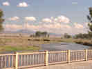
While driving down the east side along the Truckee River, I was looking for a place to pull over for a nice photo. This, of course, can be a bit hair-raising with Lincoln Navigators on your bumper at 80 miles per hour. Anyway I did find this spot that came complete with a fisherman. | |||||||||||||||||||||||||||||||||||||||||||||||||||||||||||||||||||||||||||||||||||||||||||||||||||||||||||||||||||||||||||||||||||||||||||||||||||||||
| Stopped in Reno to get gas. Also, I had again forgotten to bring a hat, so I went to K-Mart, two exits up US Hwy 395 from I-80. Hats are in the Men's department in the east end of the store, not in the Sporting Goods section in the west end. | ||||||||||||||||||||||||||||||||||||||||||||||||||||||||||||||||||||||||||||||||||||||||||||||||||||||||||||||||||||||||||||||||||||||||||||||||||||||||
|
Other articles:
Locations:
Truckee River.
|
From Reno to Wadsworth, I-80 continues to follow the course of the Truckee River. The landscape is a bit different here, as just a few feet from the river is desert, just as though the water wasn't there. | |||||||||||||||||||||||||||||||||||||||||||||||||||||||||||||||||||||||||||||||||||||||||||||||||||||||||||||||||||||||||||||||||||||||||||||||||||||||
|
Other articles:
Locations: Lovelock. |
I stopped in Lovelock, Nevada for lunch. There is a nice tree-shaded park behind the city hall (or county offices, I don't remember which), restrooms, and a Safeway market nearby. | |||||||||||||||||||||||||||||||||||||||||||||||||||||||||||||||||||||||||||||||||||||||||||||||||||||||||||||||||||||||||||||||||||||||||||||||||||||||
|
Other articles:
Locations:
Rye Patch Reservoir.
|
Rye Patch Reservoir is quite close to the highway between Lovelock and Winnemucca. There are a few restrooms and a few trees for shaded places to picnic. There are also some campsites. Otherwise, the water is quite green and not too attractive. | |||||||||||||||||||||||||||||||||||||||||||||||||||||||||||||||||||||||||||||||||||||||||||||||||||||||||||||||||||||||||||||||||||||||||||||||||||||||
|
Locations: Winnemucca. |
I stopped in Winnemucca only to fill up with gas. | |||||||||||||||||||||||||||||||||||||||||||||||||||||||||||||||||||||||||||||||||||||||||||||||||||||||||||||||||||||||||||||||||||||||||||||||||||||||
 Looking south toward Beowawe from US I-80. Looking south toward Beowawe from US I-80.
|
In an older marketing brochure published by Southern Pacific, I once saw a photo of the Beowawe Geyser erupting. Of course, I had not planned to stop on this trip, and thought maybe I could exit the freeway and find the geysers by following the wisps of steam. | |||||||||||||||||||||||||||||||||||||||||||||||||||||||||||||||||||||||||||||||||||||||||||||||||||||||||||||||||||||||||||||||||||||||||||||||||||||||
|
Locations:
Beowawe.
|
The town of Beowawe consists of a bar, a meeting hall, a branch library, and a few houses. No sign of the geysers. After I returned from the trip, I learned that the geysers no longer function, victums of geothermal exploration. I also learned that they are a few miles west of the town. | |||||||||||||||||||||||||||||||||||||||||||||||||||||||||||||||||||||||||||||||||||||||||||||||||||||||||||||||||||||||||||||||||||||||||||||||||||||||
 View east from summit on dirt road. View east from summit on dirt road.
|
Maps show a "major street" heading southeast from Exit 271 of US I-80 to Nevada Highway 278. I took this exit and headed down a dirt road into a canyon. Then I came to a fork in the road. The lower fork continued down the canyon and a small sign said, "Lead Mine Road." I took the upper, unnamed road that looked like it would turn to the east. | |||||||||||||||||||||||||||||||||||||||||||||||||||||||||||||||||||||||||||||||||||||||||||||||||||||||||||||||||||||||||||||||||||||||||||||||||||||||
 Looking down into Palisade, NV. Looking down into Palisade, NV.
|
The dirt road climbed up over a low pass and descended into the valley I would later learn was Pine Valley. | |||||||||||||||||||||||||||||||||||||||||||||||||||||||||||||||||||||||||||||||||||||||||||||||||||||||||||||||||||||||||||||||||||||||||||||||||||||||
 Calochortus growing alongside the road. Calochortus growing alongside the road.
|
About half way dowm from the summit to Pine Valley, I saw this single Calochortus. The flower seemed to be quite deep relative to its width. | |||||||||||||||||||||||||||||||||||||||||||||||||||||||||||||||||||||||||||||||||||||||||||||||||||||||||||||||||||||||||||||||||||||||||||||||||||||||
|
Locations:
Palisade.
|
The dirt road came into Palisade. I could see the name on the map, but I had no idea that this was once an important railroad junction. Of what was once a good-sized town, now only a single large building remains, with the usual junk laying about. I found the Cemetery, also good-sized, by accident. Tried several locations for photographs, none good, before taking this one. | |||||||||||||||||||||||||||||||||||||||||||||||||||||||||||||||||||||||||||||||||||||||||||||||||||||||||||||||||||||||||||||||||||||||||||||||||||||||
|
Locations: Carlin. |
From Palisade, I drove north on NV Highway 278, looking for possible routes into the canyon of the Humboldt River to the west. Ultimately, I ended up in Carlin, driving through town before getting back on US I-80, heading east for Elko. | |||||||||||||||||||||||||||||||||||||||||||||||||||||||||||||||||||||||||||||||||||||||||||||||||||||||||||||||||||||||||||||||||||||||||||||||||||||||
|
Locations: Elko. |
ElkoI arrived in Elko at about 5:00 PM, taking the Business I-80 exit and driving past the airport before realizing I was on Idaho Street, the main street of town. My hotel, the Holiday Inn Express was at the east end of town, still on Idaho Street. | |||||||||||||||||||||||||||||||||||||||||||||||||||||||||||||||||||||||||||||||||||||||||||||||||||||||||||||||||||||||||||||||||||||||||||||||||||||||
|
|
Monday, June 3, Elko, Lamoille Canyon | |||||||||||||||||||||||||||||||||||||||||||||||||||||||||||||||||||||||||||||||||||||||||||||||||||||||||||||||||||||||||||||||||||||||||||||||||||||||
|
Well, when I checked in to the Holiday Inn, I asked about a good place to eat. They sent me to "the best place in town." The meal was pretty good, but after several hours I was pretty uncomfortable, at three hours I was praying for relief, and at four hours blowing chunks. Needless to say I was feeling a little punk the next morning. For breakfast I had 8 dry Cherios and a sip of water, followed by a nap to rest up from the exertion. | ||||||||||||||||||||||||||||||||||||||||||||||||||||||||||||||||||||||||||||||||||||||||||||||||||||||||||||||||||||||||||||||||||||||||||||||||||||||||
|
Literature Cited:
|
Somewhat bummed, I fortified myself with 8 more dry Cherios and another sip of water, and struggled out to the Northeastern Nevada Museum. This is a pretty good museum, with fine displays about Nevada ranching and mining history. Also, Jack Wanamaker, a famous taxidermist, donated his personal collection and funds to house his collection in a new wing of the museum. I also purchased the Ruby Mountain Flora (Anderson, et al., 1988) and The Ruby Mountains, A Visitor's Guide (Hyslop, 1999) at the museum. | |||||||||||||||||||||||||||||||||||||||||||||||||||||||||||||||||||||||||||||||||||||||||||||||||||||||||||||||||||||||||||||||||||||||||||||||||||||||
|
Literature Cited:
Other articles:
Locations: Ruby Mountains. |
| |||||||||||||||||||||||||||||||||||||||||||||||||||||||||||||||||||||||||||||||||||||||||||||||||||||||||||||||||||||||||||||||||||||||||||||||||||||||
|
Other articles:
Locations:
Elko.
|
Driving southeast on Nevada Highway 227, an excellent view of the Ruby Mountains and of Elko can be had from Elko Summit. | |||||||||||||||||||||||||||||||||||||||||||||||||||||||||||||||||||||||||||||||||||||||||||||||||||||||||||||||||||||||||||||||||||||||||||||||||||||||
|
Locations: Lamoille. |
I drove through Lamoille just to see what was there. The town was much smaller that I had expected. I found the Post Office and Presbyterian Church, but otherwise the sights of town must be hidden back in the trees. | |||||||||||||||||||||||||||||||||||||||||||||||||||||||||||||||||||||||||||||||||||||||||||||||||||||||||||||||||||||||||||||||||||||||||||||||||||||||
|
Locations: Lamoille Canyon. |
So I headed up Lamoille Canyon. Somewhere, I cant find it now, I read that the most recent glacial moraine is highly visible, as one drives toward the canyon. At the edge of the moraine a fine pasture turns to hummocky sagebrush-covered terrain. This is about a mile below the mouth of the canyon and easy to find. | |||||||||||||||||||||||||||||||||||||||||||||||||||||||||||||||||||||||||||||||||||||||||||||||||||||||||||||||||||||||||||||||||||||||||||||||||||||||
|
Locations:
Lamoille Canyon.
|
About mid-way up Lamoille Canyon, the canyon narrows and affords excellent views both up and down the canyon. Still benefitting from my previous night's adventures, I took these pictures and immediately got back into the car to sit down. | |||||||||||||||||||||||||||||||||||||||||||||||||||||||||||||||||||||||||||||||||||||||||||||||||||||||||||||||||||||||||||||||||||||||||||||||||||||||
|
Locations: Lamoille Canyon. |
I continued driving up to Road's End, verified that the road indeed ended, and turned around, heading back down the canyon. | |||||||||||||||||||||||||||||||||||||||||||||||||||||||||||||||||||||||||||||||||||||||||||||||||||||||||||||||||||||||||||||||||||||||||||||||||||||||
|
Locations:
Lamoille Canyon.
|
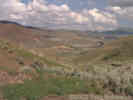
In the upper third of the canyon, vegetation was just beginning to come out, where I stopped to take this photograph. The Beaver ponds were in 4-5 levels, though I saw no signs of beavers. While I was here, the Forest Service crew arrived to re-install the interpretive signs that had been removed for the winter. This is one sign that I was visiting very early in the season. | |||||||||||||||||||||||||||||||||||||||||||||||||||||||||||||||||||||||||||||||||||||||||||||||||||||||||||||||||||||||||||||||||||||||||||||||||||||||
| I had intended to eat a few bites of lunch at the Terraces picnic ground, but it was closed, probably because it was still early in the season. Looking at the terrain, I would assume the the "terraces" name was applied because of terraces of thin soil and vegetation upon bare rock in this area. | ||||||||||||||||||||||||||||||||||||||||||||||||||||||||||||||||||||||||||||||||||||||||||||||||||||||||||||||||||||||||||||||||||||||||||||||||||||||||
| Instead I ate lunch in Thomas Canyon Campground. This is pretty nice, but more oriented to RVs and trailers than to tents, as most of the campsites had a layer of gravel everywhere. For lunch, I had about two dozen Cherios in three bites of yoghurt. | ||||||||||||||||||||||||||||||||||||||||||||||||||||||||||||||||||||||||||||||||||||||||||||||||||||||||||||||||||||||||||||||||||||||||||||||||||||||||
| Ready for a nap, I headed back to town, took a nap, ate about 3 bites of dinner, and retired early. | ||||||||||||||||||||||||||||||||||||||||||||||||||||||||||||||||||||||||||||||||||||||||||||||||||||||||||||||||||||||||||||||||||||||||||||||||||||||||
|
|
Tuesday, June 4, Elko, Ruby Lake National Wildlife Refuge | |||||||||||||||||||||||||||||||||||||||||||||||||||||||||||||||||||||||||||||||||||||||||||||||||||||||||||||||||||||||||||||||||||||||||||||||||||||||
|
Other articles:
Locations:
Halleck.
|
After a hearty breakfast of Cherios (with a little milk), I headed east on I-80 to Exit 321 at Halleck. There is nothing at Halleck, and this photo "View of Ruby Mountains from US I-80" was taken from the center of it. | |||||||||||||||||||||||||||||||||||||||||||||||||||||||||||||||||||||||||||||||||||||||||||||||||||||||||||||||||||||||||||||||||||||||||||||||||||||||
|
Locations: Cedar Canyon. |
On its way to Ruby Valley, NV Hwy 229 follows Secret Creek through Secret Canyon into Secret Valley before passing over Secret Pass. This is one of those unusual canyons that penetrates well into a drainage on the other side of a ridge. Cedar Canyon in the eastern Mojave in a similar canyon. It extends from the west side of the ridge, penetrates the ridge line, extending well into the east side, and capturing east side drainage, while the actual divide is a very subtle geomorphic feature. | |||||||||||||||||||||||||||||||||||||||||||||||||||||||||||||||||||||||||||||||||||||||||||||||||||||||||||||||||||||||||||||||||||||||||||||||||||||||
 Canyon on east side of Ruby Mountains Canyon on east side of Ruby Mountains
|
I think this may be Colonel Moore Canyon because I seem to remember stopping and backing up to this spot just before I passed Ruby Valley School. | |||||||||||||||||||||||||||||||||||||||||||||||||||||||||||||||||||||||||||||||||||||||||||||||||||||||||||||||||||||||||||||||||||||||||||||||||||||||
|
Locations:
Ruby Valley.
|
After passing through the community of Ruby Valley, I took this photo looking back to the northeast. The peaks in the distance are the East Humboldt Range, which appears to be a northeastern extension of the Ruby Mountains. | |||||||||||||||||||||||||||||||||||||||||||||||||||||||||||||||||||||||||||||||||||||||||||||||||||||||||||||||||||||||||||||||||||||||||||||||||||||||
|
Other articles:
|
I drove out into Ruby Lake National Wildlife Refuge on two of the dikes. I would recommend driving straight to the Refuge headquarters and picking up a brochure with map. | |||||||||||||||||||||||||||||||||||||||||||||||||||||||||||||||||||||||||||||||||||||||||||||||||||||||||||||||||||||||||||||||||||||||||||||||||||||||
|
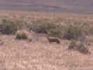
Other articles:
|
When I drove out on the Brown Dike to the eastern side of the Refuge I saw this coyote who, while keeping an eye on me, did not seem to be particularly concerned. | |||||||||||||||||||||||||||||||||||||||||||||||||||||||||||||||||||||||||||||||||||||||||||||||||||||||||||||||||||||||||||||||||||||||||||||||||||||||
|
Other articles:
|
View of the Gallagher State fish hatchery from the access road to Brown dike. The next clump of trees up the road is the location of Refuge headquarters. | |||||||||||||||||||||||||||||||||||||||||||||||||||||||||||||||||||||||||||||||||||||||||||||||||||||||||||||||||||||||||||||||||||||||||||||||||||||||
| I stopped at the South Ruby Campground for a bite of lunch. It's an OK campground in the lower edges of the Pinyon-Juniper woodland. Many of the sites have been spread with gravel, so I did not see a lot of tent sites. | ||||||||||||||||||||||||||||||||||||||||||||||||||||||||||||||||||||||||||||||||||||||||||||||||||||||||||||||||||||||||||||||||||||||||||||||||||||||||
|
Other articles:
Locations:
Harrison Pass.
|
However the red sign up the road states that the road is closed for reconstruction. I drove up the road anyway to see how far I could get. The was open as far as Harrison Pass, where it was closed. I drove a short distance south of Harrison Pass along a 4WD road. The vegetation here has an "alpine" appearance being very low-growing. However, the species were more typical of moderate elevations in desert mountains: sagebrush, Castilleja, buckwheats, Ericameria, etc. Since I could not get over the Ruby Mountains at Harrison Pass, I resolved to continue south and cross at Overland Pass. | |||||||||||||||||||||||||||||||||||||||||||||||||||||||||||||||||||||||||||||||||||||||||||||||||||||||||||||||||||||||||||||||||||||||||||||||||||||||
|
Other articles:
|
This is open cattle range, and these cattle seemed to know where they were headed, south right along the edge of the road. | |||||||||||||||||||||||||||||||||||||||||||||||||||||||||||||||||||||||||||||||||||||||||||||||||||||||||||||||||||||||||||||||||||||||||||||||||||||||
|
Other articles:
|
Overland Pass was the route of the Pony Express for the short period of its existence. | |||||||||||||||||||||||||||||||||||||||||||||||||||||||||||||||||||||||||||||||||||||||||||||||||||||||||||||||||||||||||||||||||||||||||||||||||||||||
 Wild horses in Overland Pass Wild horses in Overland Pass
|
At Overland Pass, I saw three wild horses. | |||||||||||||||||||||||||||||||||||||||||||||||||||||||||||||||||||||||||||||||||||||||||||||||||||||||||||||||||||||||||||||||||||||||||||||||||||||||
| Having come through Overland Pass, I turned north on what the map said was the Elko Hamilton Stage Road, but the sign said it was the Bald Mountain Mine Road. | ||||||||||||||||||||||||||||||||||||||||||||||||||||||||||||||||||||||||||||||||||||||||||||||||||||||||||||||||||||||||||||||||||||||||||||||||||||||||
|
Other articles:
|
This photo is looking east to the Smith Creek drainage of the Ruby Mountains | |||||||||||||||||||||||||||||||||||||||||||||||||||||||||||||||||||||||||||||||||||||||||||||||||||||||||||||||||||||||||||||||||||||||||||||||||||||||
| I stopped at Zunino-Jiggs Reservoir (county park) to pee. It looks like one could also camp here. | ||||||||||||||||||||||||||||||||||||||||||||||||||||||||||||||||||||||||||||||||||||||||||||||||||||||||||||||||||||||||||||||||||||||||||||||||||||||||
|
Other articles:
|
I turned off the highway following the sign to Twin Bridges. The bridges are over Huntington Creek. This dirt road rejoins Nevada Highway 228 near Jiggs. There was one broad canyon with many of these Larkspurs (Delphinium) growing in them. | |||||||||||||||||||||||||||||||||||||||||||||||||||||||||||||||||||||||||||||||||||||||||||||||||||||||||||||||||||||||||||||||||||||||||||||||||||||||
| At this point I was getting ready for my afternoon nap, so I headed back to the motel in Elko. | ||||||||||||||||||||||||||||||||||||||||||||||||||||||||||||||||||||||||||||||||||||||||||||||||||||||||||||||||||||||||||||||||||||||||||||||||||||||||
|
|
Wednesday, June 5, Elko to Alameda | |||||||||||||||||||||||||||||||||||||||||||||||||||||||||||||||||||||||||||||||||||||||||||||||||||||||||||||||||||||||||||||||||||||||||||||||||||||||
| Wednesday, June 5th, was clear and warm. Nearly all clouds had left the sky. I headed south over Elko Summit, nearly to Spring Creek, where I turned south again on Nevada Highway 28. | ||||||||||||||||||||||||||||||||||||||||||||||||||||||||||||||||||||||||||||||||||||||||||||||||||||||||||||||||||||||||||||||||||||||||||||||||||||||||
|
Other articles:
Locations:
Huntington Creek.
|
Past the Zunino-Jiggs Reservoir I noticed a lot of cow poop on the road. Stopped just north of Jiggs specifically to take this photograph, of a view I noticed yesterday. The dirt road in the foreground follows Huntington Creek to Twin Bridges. This is the other end of the road where I saw the Larkspurs yesterday. After taking the photograph and driving down to the ranch, I saw the ranchers herding a few cows back into their fields. I assumed that a few of their cows had escaped from pastures in the night. | |||||||||||||||||||||||||||||||||||||||||||||||||||||||||||||||||||||||||||||||||||||||||||||||||||||||||||||||||||||||||||||||||||||||||||||||||||||||
|
Other articles:
Locations:
Jiggs.
|
As I came around the bend into Jiggs, it became readily apparent why the road was littered with cow poop. The cowboys were using the road to move cows from pasture to pasture. I waited here a few minutes while they finished herding the cows into a field at right, then continued on my way. My car, of course, had a nice aromatic layer of cow poop in the wheel wells and on the rocker panels. | |||||||||||||||||||||||||||||||||||||||||||||||||||||||||||||||||||||||||||||||||||||||||||||||||||||||||||||||||||||||||||||||||||||||||||||||||||||||
|
Other articles:
|
From Jiggs, I drove 20-30 miles along the edge of Huntington Valley. At about the 15 mile point the road crossed from the east to the west side of the valley. Huntington Creek was a small, but lively creek at this point. There were even a few ducks in the creek. Just south of this crossing the road climbed up on the bajada, and split into the road heading east to Railroad Pass and the road heading south. | |||||||||||||||||||||||||||||||||||||||||||||||||||||||||||||||||||||||||||||||||||||||||||||||||||||||||||||||||||||||||||||||||||||||||||||||||||||||
|
Other articles:
Locations:
Huntington Creek.
|
| |||||||||||||||||||||||||||||||||||||||||||||||||||||||||||||||||||||||||||||||||||||||||||||||||||||||||||||||||||||||||||||||||||||||||||||||||||||||
|
Other articles:
|
295 |
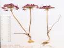
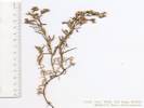
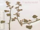
Allium bisceptrum S. Watson. Twincrest Onion
At this spring mound was the small Allium I have been seeing frequently. This collection is from dry ground on the edge of the spring vegetation. This one didn't key out cleanly. Collection No. 295, 14 August 2012, characters observed while keying: Geophyte, not rhizomatous, very few increase bulbs, those present smaller than parent bulbs (last two characters conflict in FNANM key), bulb coat reticulation indistinct with elongation perhaps in the vertical direction, Leaves, generally 3, to 16 cm. long, sheathing the scape 1/3 to 1/2 (This character leads to A. paniculatum which is not known from Nevada), to 7 mm. wide, flat, withering from tip during anthesis (leads to A. campanulatum), Scape to 15 cm., 1-2 mm. dia., fistulose (i.e., hollow; however, this character leads to giant onions, such as leeks), Pedicels floriferous (i.e., not replaced by bulbils), Tepals lanceolate, outer and inner tepal margins entire, tips acuminate, papery in fruit, Stamens included, Filaments unappendaged, Ovary prominently crested. | ||||||||||||||||||||||||||||||||||||||||||||||||||||||||||||||||||||||||||||||||||||||||||||||||||||||||||||||||||||||||||||||||||||||||||||||||||||||
 This bull was really unhappy about my presence. This bull was really unhappy about my presence.
|
When I pulled up to the spring, there were a few cows at the other end, about 100 yards away. One of them seemed to have been a bull, who started bellowing, pawing the earth and heading my way. Honking my car horn, shouting and waving my arms seemed to slow him down a bit, but he never stopped expressing his displeasure at my presence. The photograph is a composite of two photographs I took of him. I tried to cut out a photo of the bull when he wasn't surrounded by the dust made by pawing the earth, and paste it over the photo of him in the dust. It's a bit obvious that something has been done to the photo. I think the biggest problem is the complexity of the mask I had to make to copy his image. | |||||||||||||||||||||||||||||||||||||||||||||||||||||||||||||||||||||||||||||||||||||||||||||||||||||||||||||||||||||||||||||||||||||||||||||||||||||||
| The next three collections were made in sagebrush, above and south of the spring. This is on the east side of the Diamond Mountains, east of the northern Diamond Peak. There are two Diamond Peaks in the Diamond Mountains. At this location there is a ridge that comes down to the road. There is also an Astragalus, and a phlox, but most of the vegetation is sagebrush. | ||||||||||||||||||||||||||||||||||||||||||||||||||||||||||||||||||||||||||||||||||||||||||||||||||||||||||||||||||||||||||||||||||||||||||||||||||||||||
|
Other articles:
|
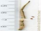
296 |
Allium acuminatum Hook. Taper Tip Onion.
Huntington Valley, White Pine County, Nevada. On the east side of the Diamond Mountains, east of Diamond Peak, where a ridge comes down to the road and a spring, 44.6 miles north of US Hwy 50 via NV S. R. 892 and White Pine Cty Rd 1, and 66 miles south of Elko via NV S. R. 228 and White Pine Cty Rd 1 39.9911°N, 115.7625°W. WGS 1984. Elev. 1895 m. In sagebrush. Collection No. 296, 15 August 2012, characters observed while keying: Geophyte to 20 cm., bulbs not clustered on rhizomes, increase bulbs absent, outer bulb coat chartaceous (not fibrous), reticulation obvious, polygonal, Leaves 3, narrow (< 5 mm.), rolled or channelled, withering at anthesis, jointed ? (broken leaves all broken at a similar-looking thickening in lower leaf), sheathing < 1/3 of length, Scape to 2 mm. dia., fistulose (i.e., hollow, although description says solid), Inflorescence > leaves, Pedicel floriferous, Flowers > 20, 6-8 mm., Tepals erect, Outer tepal margins entire, recurved at tip, Inner tepal margins finely dentate, Stamens included, Ovary not prominently crested. | ||||||||||||||||||||||||||||||||||||||||||||||||||||||||||||||||||||||||||||||||||||||||||||||||||||||||||||||||||||||||||||||||||||||||||||||||||||||
|
Other articles:
|
297 |
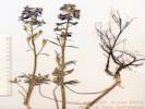
Delphinium andersonii A. Gray. Anderson's Larkspur, blue, same as those seen near Twin Bridges.
Big Springs, White Pine County, Nevada. On the east side of the Diamond Mountains, east of Diamond Peak, where a ridge comes down to the road and a spring. 39.9911°N, 115.7625°W. WGS 1984. Elev. 1895 m. In sagebrush. Coll. No. 297, 5 June 2002, characters observed while keying(?): Stem 50-60 cm, generally 1 stem; Leaf blade base truncate; Petiole proximal hairs 0; Petiole slightly sigmoid; Sepals blue; Petals lower plades > 1/5 length of lateral sepals, hairy adaxially; Seed without inflated collar. Of the twelve species of Delphinium occurring in Nevada, according to SEINet, six occur in California, and six do not. I don't have a key that works in Nevada, and the Delphinium key is not available for FNA so, under the hoof-beat theory, I'm going to go with D. andersonii for now. | ||||||||||||||||||||||||||||||||||||||||||||||||||||||||||||||||||||||||||||||||||||||||||||||||||||||||||||||||||||||||||||||||||||||||||||||||||||||
|
Other articles:
|
298 |
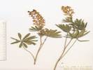
Lupinus arbustus Douglas. Long Spur Lupine.
Big Springs, White Pine County, Nevada. 44.6 miles north of US Highway 50 by way of Nevada State Route 892 and White Pine County Road 1, on the east side of the Diamond Mountains, east of Diamond Peak, where a ridge comes down to the road and a spring. 39.9911°N, 115.7625°W. WGS 1984. Elev. 1895 m. In sagebrush. Coll. No. 298, keyed 1 Dec 2012, characters observed: Perennial of Great Basin, to 45 cm.; Leaf palmate; Leaflets 12-14, 35 mm. x 7 mm. wide, strigose; Calyx 6 mm., hairy, spur 1 mm. +, lower lip folded down; Bract 4-5 mm.; Corolla yellow; Banner 9 mm., back hairy, else glabrous; Wings 10 mm., dense patch of hair near tip; Keel ciliate in distal half. | ||||||||||||||||||||||||||||||||||||||||||||||||||||||||||||||||||||||||||||||||||||||||||||||||||||||||||||||||||||||||||||||||||||||||||||||||||||||
 Antelope crosses the road. Antelope crosses the road.
|
The divide between Huntington Valley and Newark Valley is quite subtle, having mostly the appearance of a broad highland. This lone Antelope crossed the road in front of me, not appearing to be in any kind of hurry. | |||||||||||||||||||||||||||||||||||||||||||||||||||||||||||||||||||||||||||||||||||||||||||||||||||||||||||||||||||||||||||||||||||||||||||||||||||||||
 Placer US Incorporated Bald Mountain Project Placer US Incorporated Bald Mountain Project
|
The Bald Mountain Mine must be huge when seen close up. | |||||||||||||||||||||||||||||||||||||||||||||||||||||||||||||||||||||||||||||||||||||||||||||||||||||||||||||||||||||||||||||||||||||||||||||||||||||||
| At the very north end of Newark Valley, a small dirt road heads up into Big Canyon. The next three collections were made in a disturbed area at the mouth of the canyon. | ||||||||||||||||||||||||||||||||||||||||||||||||||||||||||||||||||||||||||||||||||||||||||||||||||||||||||||||||||||||||||||||||||||||||||||||||||||||||
|
Other articles:
Locations: Big Canyon. |
299 | Lepidium? Basal leaves finely divided, cauline leaves perfoliate. | ||||||||||||||||||||||||||||||||||||||||||||||||||||||||||||||||||||||||||||||||||||||||||||||||||||||||||||||||||||||||||||||||||||||||||||||||||||||
 Coll. No. 300, Sphaeralcea munroana Coll. No. 300, Sphaeralcea munroana
|
300 |
Sphaeralcea munroana (Douglas ex Lindl.) Spach ex A. Gray. Monro's Globe Mallow.
Big Canyon, White Pine County, Nevada. Mouth of Big Canyon, east side of central Diamond Mountains. 39.8802°N, 115.7488°W. WGS 1984. Elev. 1961 m. Coll. No. 300, keyed 9 Dec 2012, characters observed: Perennial to 45 cm., moderate density of stellate hairs (less than s. ambigua); Herbage green; Leaf 30 mm x 25 mm, broadly lanceolate, lobed, irregularly toothed; Inflorescence panicle (not raceme); Involucel of 3 bractlets; Pedicel 1 mm, lengthening to 5 mm at anthesis; Calyx 4-5 mm, uniformly stellate; Petals to 10 mm (smaller than S. ambigua); Seed immature. Keyed from Welsh, et al., 1993. | ||||||||||||||||||||||||||||||||||||||||||||||||||||||||||||||||||||||||||||||||||||||||||||||||||||||||||||||||||||||||||||||||||||||||||||||||||||||
 Coll. No. 301, Chorispora tenella Coll. No. 301, Chorispora tenella
 Coll. No. 301, Chorispora tenella Coll. No. 301, Chorispora tenella
|
301 |
Chorispora tenella (Pall.) DC. Crossflower.
Big Canyon, White Pine County, Nevada. Mouth of Big Canyon, east side of central Diamond Mountains. 39.8802°N, 115.7488°W. WGS 1984. Elev. 1961 m. Coll. No. 301, keyed 5 Nov 2012, characters observed while keying: Annual, hairs 0, sparsely stalked-gland-dotted; Leaves basal, withered at flowering, cauline simple, not basally lobed or clasping; Flowers radial; Corolla purple; Stamens 6; Ovary linear when young; Fruit linear, bilateral, to 4 cm, seed in proximal 2.5 cm., tip pointed; Seeds in two rows, brown, 1 mm. | ||||||||||||||||||||||||||||||||||||||||||||||||||||||||||||||||||||||||||||||||||||||||||||||||||||||||||||||||||||||||||||||||||||||||||||||||||||||
 Newark Valley and the Diamond Mountains. Newark Valley and the Diamond Mountains.
 Spring and Buck Mountain across Newark Valley Spring and Buck Mountain across Newark Valley
|
From Big Canyon, I pretty much drove straight south through Newark Valley to US Highway 50, turning east to Eureka. | |||||||||||||||||||||||||||||||||||||||||||||||||||||||||||||||||||||||||||||||||||||||||||||||||||||||||||||||||||||||||||||||||||||||||||||||||||||||
|
Literature Cited:
Locations:
Eureka.
|
| |||||||||||||||||||||||||||||||||||||||||||||||||||||||||||||||||||||||||||||||||||||||||||||||||||||||||||||||||||||||||||||||||||||||||||||||||||||||
 Looking east on U. S. Highway 50. Looking east on U. S. Highway 50.
|
After leaving Eureka and passing west through Devil's Gate, I stopped at this small summit north of the Twin Spring Hills to take an illustrative photo of America's Loneliest Highway. However, I have to say that after driving south from Elko to Eureka, US Highway 50 doesn't seem so lonely. This photo looks across Antelope Valley to the Mountain Boy Range. Diamond Peak in the Diamond Mountains in the background. | |||||||||||||||||||||||||||||||||||||||||||||||||||||||||||||||||||||||||||||||||||||||||||||||||||||||||||||||||||||||||||||||||||||||||||||||||||||||
|
Locations:
Hickison Petroglyph Recreation Area.
|
| |||||||||||||||||||||||||||||||||||||||||||||||||||||||||||||||||||||||||||||||||||||||||||||||||||||||||||||||||||||||||||||||||||||||||||||||||||||||
| After passing through Austin, I turned southwest on Nevada Highway 772. This is an excellent highway, and seems like it might have been an earlier route of US Highway 50. | ||||||||||||||||||||||||||||||||||||||||||||||||||||||||||||||||||||||||||||||||||||||||||||||||||||||||||||||||||||||||||||||||||||||||||||||||||||||||
|
Locations:
Reese River Valley.
|
I stopped at a rise in the road to take this photo of the Reese River Valley. Now this highway is lonely. Austin is approximately at the intersection of the highway and the Toiyabe Range in the distance. | |||||||||||||||||||||||||||||||||||||||||||||||||||||||||||||||||||||||||||||||||||||||||||||||||||||||||||||||||||||||||||||||||||||||||||||||||||||||
 View east across Smith Creek Valley. View east across Smith Creek Valley.
|
The next valley is Smith Creek Valley. The highway had come around the left (north) side of Iron Mountain through (yet another) Railroad Pass. | |||||||||||||||||||||||||||||||||||||||||||||||||||||||||||||||||||||||||||||||||||||||||||||||||||||||||||||||||||||||||||||||||||||||||||||||||||||||
|
Locations:
Eastgate.
|
After coming though the Desatoya Mountains through Eastgate, I stopped to take this photo looking back. The afternoon light (about 4:00 pm) really lights up the mountains. | |||||||||||||||||||||||||||||||||||||||||||||||||||||||||||||||||||||||||||||||||||||||||||||||||||||||||||||||||||||||||||||||||||||||||||||||||||||||
|
Other articles:
Locations:
Sand Mountain.
|
I stopped briefly to take this photo of Sand Mountain. | |||||||||||||||||||||||||||||||||||||||||||||||||||||||||||||||||||||||||||||||||||||||||||||||||||||||||||||||||||||||||||||||||||||||||||||||||||||||
| I pulled into Fallon about 5 o'clock. The wind was blowing, the dust was rising, and I'm thinking, "I'll just drive home from here." It took about 4 1/2 hours as I got home about 9:30 PM. | ||||||||||||||||||||||||||||||||||||||||||||||||||||||||||||||||||||||||||||||||||||||||||||||||||||||||||||||||||||||||||||||||||||||||||||||||||||||||
|
Other articles:
|
302 |
Layia platyglossa (Fischer & C. Meyer) A. Gray. Coastal Tidytips.
Shell Creek, San Luis Obispo County, California. Along Shell Creek Road, about 1.7 miles north of California Highway 58. 35.4814°N, 120.3287°W. WGS 1984. Elev. 407 m. Grazed grassland with few oaks. Paul A. Schweich #302. 25-Jun-2002 Coll. No. 302, 25 June 2002, characters observed while keying: Annual, tap-rooted, to 15 cm.; Leaves alternate; Inflorescence, some flowers with strap-shaped corollas, head radiate, composed of 2 kinds of flowers, disc flowers ≥20; Phyllaries in 1 series, each subtending a ray flower, folded base 3 mm. + tip 4 mm. = 7 mm.; Receptacle paleate, 1(2) rings of paleae subtending outer disk flowers; Pappus of bristles, 3 mm., not as broad at base as L. glandulosa, scabrous (barely plumose?); Fruit, ray, mature, compressed front to back (though not as compressed as L. glandulosa). These were sent to me by my father who collected them where we previously scattered my mother's ashes. -- TAS | ||||||||||||||||||||||||||||||||||||||||||||||||||||||||||||||||||||||||||||||||||||||||||||||||||||||||||||||||||||||||||||||||||||||||||||||||||||||
|
Literature Cited:
Other articles:
Locations: Harrison Pass. Huntington Creek. |
Looked up Egan's (1977, 302) description of Fremont's passage through Ruby Mountain territory. Fremont split his party into two groups at Whitton or Mound Spring, and " the two parties left Whitton or Mound Springs early in the morning on November 5, 1845. Captain Fremont and his men took a course to the south of Franklin Lake. From there they headed into Ruby Valley southeast of present Elko, Nevada, and they appear to have crossed the Ruby Mountains by Harrison Pass. By November 8 the fast-moving party reached either present Twin or Huntington Creek, a tributary of the Humboldt River." | |||||||||||||||||||||||||||||||||||||||||||||||||||||||||||||||||||||||||||||||||||||||||||||||||||||||||||||||||||||||||||||||||||||||||||||||||||||||
|
Literature Cited:
Locations: Big Smoky Valley. Eureka. |
"The days moved on as the small party crossed the rough ground of Ruby Pass and descended into Diamond Valley, where they stopped overnight on November 11 at Connor Spring Keeping a southwestern course, the men passed to the south of today's Eureka, Nevada, drifted around the northern slopes of the Monitor Range and then crossed the Toquima Range into Big Smoky Valley (Egan, 1977, 303)." | |||||||||||||||||||||||||||||||||||||||||||||||||||||||||||||||||||||||||||||||||||||||||||||||||||||||||||||||||||||||||||||||||||||||||||||||||||||||
|
Literature Cited:
|
Ned Kern of the Walker party kept his own journal. "Early on the morning of November 7, the snow was falling only lightly, and Walker gave the order to move out. They headed across sagebrush flats, struck the foothills, and began to move upward into the Ruby Mountains. The climb was steep and rrocky, and long before they reached Secret Pass, the men were very nearly blinded by a wind-driven blizzard. Down from the pass and the high country, they came to a good valley where there were groves of aspen and cottonwoods. Here they made camp on a small stream that Walker called Walnut creek because once one of his trappers had brought a twig from such a tree he had found at the head of the creek (Egan, 1977, 304)." | |||||||||||||||||||||||||||||||||||||||||||||||||||||||||||||||||||||||||||||||||||||||||||||||||||||||||||||||||||||||||||||||||||||||||||||||||||||||
|
Literature Cited:
|
"Two days beyond this camp the men arrived at some hot springs near present Elko, Nevada. Here, where Walnut Creek joined the Humboldt River, they met a party of Shoshoni Indians who told them about three different emigrant parties that had passed by during the fall. From this point on, the journey was one of following the Humboldt River (Egan, 1977, 304)." | |||||||||||||||||||||||||||||||||||||||||||||||||||||||||||||||||||||||||||||||||||||||||||||||||||||||||||||||||||||||||||||||||||||||||||||||||||||||
|
|
Saturday August 17, 2002 | |||||||||||||||||||||||||||||||||||||||||||||||||||||||||||||||||||||||||||||||||||||||||||||||||||||||||||||||||||||||||||||||||||||||||||||||||||||||
 Point Edith Salt Marsh Point Edith Salt Marsh
|
Laura Hansen of the Contra Costa Mosquito & Vector Control District (Jeez I hope I have this right) led a CNPS field trip to the Point Edith complex near Martinez. We had get special permission to enter through the Tesoro Petroleum Refinery, and parked at the end of the road. Topographic maps show this place to be called Hastings, on Hastings Slough. Laura told us there was formerly a marina here. | |||||||||||||||||||||||||||||||||||||||||||||||||||||||||||||||||||||||||||||||||||||||||||||||||||||||||||||||||||||||||||||||||||||||||||||||||||||||
| We were given a very nice plant list of Species List and Common Names for Peyton Slough, Peyton Levee, and Point Edith Complex. Unfortunately, I dont know who wrote it. I did not take very good notes; and now I am disappointed that I don't have good notes. Im going to reproduce the plant list here. If you recognize the list, or know the author please let me know. | ||||||||||||||||||||||||||||||||||||||||||||||||||||||||||||||||||||||||||||||||||||||||||||||||||||||||||||||||||||||||||||||||||||||||||||||||||||||||
| Plants that I found particularly interesting were: | ||||||||||||||||||||||||||||||||||||||||||||||||||||||||||||||||||||||||||||||||||||||||||||||||||||||||||||||||||||||||||||||||||||||||||||||||||||||||
| Atriplex triangularis Willd. Spearscale. Primarily because I think of Atriplex as a desert plant. | ||||||||||||||||||||||||||||||||||||||||||||||||||||||||||||||||||||||||||||||||||||||||||||||||||||||||||||||||||||||||||||||||||||||||||||||||||||||||
 Cordylanthus mollis at Port Edith salt marsh. Cordylanthus mollis at Port Edith salt marsh.
 Cordylanthus mollis at Port Edith salt marsh. Cordylanthus mollis at Port Edith salt marsh.
|
Cordylanthus mollis A. Gray ssp. mollis. Soft Birds-Beak. To see Lauras plots in this plant was the primary purpose of this field trip. I was also interested to see this plant, because of also seeing Cordylanthus parviflorus in the eastern Mojave. | |||||||||||||||||||||||||||||||||||||||||||||||||||||||||||||||||||||||||||||||||||||||||||||||||||||||||||||||||||||||||||||||||||||||||||||||||||||||
| Cuscuta salina Engelm. Dodder. The dodder was in bloom, something new to me. | ||||||||||||||||||||||||||||||||||||||||||||||||||||||||||||||||||||||||||||||||||||||||||||||||||||||||||||||||||||||||||||||||||||||||||||||||||||||||
|
Limonium californicum (Boiss.) A. A. Heller. Western Marsh Rosemary. A new species to me, its pretty in the fall, with a lavender haze of flowers. Since this trip, I have also seen this species in the salt marshes at Alameda. I once had a rather difficult conversation with my mother because she thought I should recognize "the plumbago they plant along the freeways." Well, now, having seen this species, and then seeing something very similar planted horticulturally, I can now say that I recognize the plumbago planted along the freeways. | ||||||||||||||||||||||||||||||||||||||||||||||||||||||||||||||||||||||||||||||||||||||||||||||||||||||||||||||||||||||||||||||||||||||||||||||||||||||||
| Scirpus cernuusVahl. Low Bulrush. Also known as Fiber-Optic Grass and sold commonly in nurseries. It looks like it will stay quite small, so I thought I would take a chance and put it in the bog. | ||||||||||||||||||||||||||||||||||||||||||||||||||||||||||||||||||||||||||||||||||||||||||||||||||||||||||||||||||||||||||||||||||||||||||||||||||||||||
Species List and Common Names for Peyton Slough, Peyton Levee, Pt Edith Complex
| ||||||||||||||||||||||||||||||||||||||||||||||||||||||||||||||||||||||||||||||||||||||||||||||||||||||||||||||||||||||||||||||||||||||||||||||||||||||||
|
|
Friday August 30, 2002 | |||||||||||||||||||||||||||||||||||||||||||||||||||||||||||||||||||||||||||||||||||||||||||||||||||||||||||||||||||||||||||||||||||||||||||||||||||||||
| I left Alameda about 9:15 AM. Made the Bakersfield grocery, gas and lunch stop and pressed on over Tehachapi Pass. The traffic seemed really slow. Too many holiday drivers out on this day before the Labor Day holiday. It must have been about Six or so when I pulled into the Mid Hills campground. The thermometer said 94°F. I left the rain fly off of the tent in hopes that the tent would stay a little bit cooler in the night. | ||||||||||||||||||||||||||||||||||||||||||||||||||||||||||||||||||||||||||||||||||||||||||||||||||||||||||||||||||||||||||||||||||||||||||||||||||||||||
|
|
Saturday August 31, 2002 | |||||||||||||||||||||||||||||||||||||||||||||||||||||||||||||||||||||||||||||||||||||||||||||||||||||||||||||||||||||||||||||||||||||||||||||||||||||||
| This morning got an early start and went down to check the Salvia dorrii plot near Lobo Point. Very dry, no plants put out leaves. All I could do is walk through the plot and shake my head. | ||||||||||||||||||||||||||||||||||||||||||||||||||||||||||||||||||||||||||||||||||||||||||||||||||||||||||||||||||||||||||||||||||||||||||||||||||||||||
| Drove into Lobo Point and took a little break. Then drove over to Wild Horse Mesa, and I walked up to the Frasera albomarginata plot. None of my plants had leaves. And I saw no Frasera albomarginata anywhere with leaves. | ||||||||||||||||||||||||||||||||||||||||||||||||||||||||||||||||||||||||||||||||||||||||||||||||||||||||||||||||||||||||||||||||||||||||||||||||||||||||
| Walked up to my plot at Pinto Mountain. I suppose just to make sure I wouldnt find what I did not expect to find. | ||||||||||||||||||||||||||||||||||||||||||||||||||||||||||||||||||||||||||||||||||||||||||||||||||||||||||||||||||||||||||||||||||||||||||||||||||||||||
| Took a long leisurely lunch, and read a book for a while. Then I walked up onto the hill east of the campground looking for the RAWS weather station. | ||||||||||||||||||||||||||||||||||||||||||||||||||||||||||||||||||||||||||||||||||||||||||||||||||||||||||||||||||||||||||||||||||||||||||||||||||||||||
|
|
Sunday September 1, 2002 | |||||||||||||||||||||||||||||||||||||||||||||||||||||||||||||||||||||||||||||||||||||||||||||||||||||||||||||||||||||||||||||||||||||||||||||||||||||||
| Got up early, packed up and headed out. Drove down Macedonia Canyon, through Kelso, and then to Baker. After gassing up we drove through Barstow and then north on 395 to Inyokern. I had thought to drive through Nine Mile Canyon and Kennedy Meadows to Johnsondale. | ||||||||||||||||||||||||||||||||||||||||||||||||||||||||||||||||||||||||||||||||||||||||||||||||||||||||||||||||||||||||||||||||||||||||||||||||||||||||
| I asked a couple of Highway Patrolmen about the road. One of them knew the road and told us that a recent fire would leave the road smoky and covered with ashes. I decided instead to use Walker Pass. | ||||||||||||||||||||||||||||||||||||||||||||||||||||||||||||||||||||||||||||||||||||||||||||||||||||||||||||||||||||||||||||||||||||||||||||||||||||||||
| Stopped for lunch at the Weldon School. At bit warm, but the shade of the trees and the breeze was nice. | ||||||||||||||||||||||||||||||||||||||||||||||||||||||||||||||||||||||||||||||||||||||||||||||||||||||||||||||||||||||||||||||||||||||||||||||||||||||||
| From Isabella, I took CA Hwy 155 north to Wofford Heights, and then west over Greenhorn Pass to Glennville. From Wofford Heights to Greenhorn Pass is very steep, uphill for me. The descent to Glennville is more gentle, but still a winding mountainside road. | ||||||||||||||||||||||||||||||||||||||||||||||||||||||||||||||||||||||||||||||||||||||||||||||||||||||||||||||||||||||||||||||||||||||||||||||||||||||||
| From Glennville the road winds around visiting such lovely spots as Balance Rock, Sugarloaf, and California Hot Springs, until I stopped for the day in Porterville. | ||||||||||||||||||||||||||||||||||||||||||||||||||||||||||||||||||||||||||||||||||||||||||||||||||||||||||||||||||||||||||||||||||||||||||||||||||||||||
|
|
Monday, September 2, 2002 | |||||||||||||||||||||||||||||||||||||||||||||||||||||||||||||||||||||||||||||||||||||||||||||||||||||||||||||||||||||||||||||||||||||||||||||||||||||||
|
Locations: Mineral King. |
This morning I left Porterville fairly early and, stopping for ice and supplies in Lindsey, I appeared at the entrance of Sequoia National Park. Having paid the entrance fee, and checking out the information center I drove into Mineral King. I cant recommend this for a day trip. The road is 21 miles of very slow mountainside driving. Once at Mineral King, I found the area quite beautiful. I hiked a little bit. On one little terrace by the river, I found many Gentiana calycosa in bloom, then had lunch by the river, and began the long slow drive out. | |||||||||||||||||||||||||||||||||||||||||||||||||||||||||||||||||||||||||||||||||||||||||||||||||||||||||||||||||||||||||||||||||||||||||||||||||||||||
| The Generals Highway climbs over 3000 feet from the Kaweah River to the Giant Forest Village, in a series of impressive switchbacks, and around sharp ridges. | ||||||||||||||||||||||||||||||||||||||||||||||||||||||||||||||||||||||||||||||||||||||||||||||||||||||||||||||||||||||||||||||||||||||||||||||||||||||||
| Took a walk in the Generals Meadow, had a snack and then headed for the hotel, Wuksachi Lodge. | ||||||||||||||||||||||||||||||||||||||||||||||||||||||||||||||||||||||||||||||||||||||||||||||||||||||||||||||||||||||||||||||||||||||||||||||||||||||||
|
|
Tuesday September 3, 2002 | |||||||||||||||||||||||||||||||||||||||||||||||||||||||||||||||||||||||||||||||||||||||||||||||||||||||||||||||||||||||||||||||||||||||||||||||||||||||
 Moro Rock Moro Rock
 View west from Moro Rock. View west from Moro Rock.
|
This morning, after a leisurely breakfast I drove to Moro Rock and climbed that. Very impressive view, and certainly capable of invoking ones fear of heights. | |||||||||||||||||||||||||||||||||||||||||||||||||||||||||||||||||||||||||||||||||||||||||||||||||||||||||||||||||||||||||||||||||||||||||||||||||||||||
| Thereafter, I drove to Crescent Meadow, and walked that loop, including Tharps Log and Huckleberry Meadow. | ||||||||||||||||||||||||||||||||||||||||||||||||||||||||||||||||||||||||||||||||||||||||||||||||||||||||||||||||||||||||||||||||||||||||||||||||||||||||
|
|
Wednesday, September 4, 2002 | |||||||||||||||||||||||||||||||||||||||||||||||||||||||||||||||||||||||||||||||||||||||||||||||||||||||||||||||||||||||||||||||||||||||||||||||||||||||
| This morning, I checked out of the hotel and drove into Kings Canyon. This is another long winding road into a deep canyon. However, the road is much better than the Mineral King Road. | ||||||||||||||||||||||||||||||||||||||||||||||||||||||||||||||||||||||||||||||||||||||||||||||||||||||||||||||||||||||||||||||||||||||||||||||||||||||||
| In Kings Canyon, it was clearly end of the season. No crowds, and even few cars. The canyon is deep somewhat like Yosemite Valley. Most of Kings Canyon National Park is wilderness, and only this one road cherry stems into the park. | ||||||||||||||||||||||||||||||||||||||||||||||||||||||||||||||||||||||||||||||||||||||||||||||||||||||||||||||||||||||||||||||||||||||||||||||||||||||||
| I left Grant Grove Village, about 5:00 PM, stopped for dinner at Andersens in Santa Nella and arrived at home about 9:30 PM. | ||||||||||||||||||||||||||||||||||||||||||||||||||||||||||||||||||||||||||||||||||||||||||||||||||||||||||||||||||||||||||||||||||||||||||||||||||||||||
| Purpus 6285 and 7089. Clokey collections: 5558, 5559, and 7243 from Charleston Park, Spring Mountains, 7799 from Griffiths Mine, Spring Mountains, and 8613 from Pine Canyon, Spring Mountains. Alexander and Kellogg 759 and 1714. | ||||||||||||||||||||||||||||||||||||||||||||||||||||||||||||||||||||||||||||||||||||||||||||||||||||||||||||||||||||||||||||||||||||||||||||||||||||||||
|
|
Sunday, September 22, 2002 | |||||||||||||||||||||||||||||||||||||||||||||||||||||||||||||||||||||||||||||||||||||||||||||||||||||||||||||||||||||||||||||||||||||||||||||||||||||||
| This Sunday afternoon I went into the marshes of Alameda, looking primarily for Limonium californicum. I had seen this species at the Point Edith Complex recently, and was looking for it | ||||||||||||||||||||||||||||||||||||||||||||||||||||||||||||||||||||||||||||||||||||||||||||||||||||||||||||||||||||||||||||||||||||||||||||||||||||||||
| 304 | Frankenia salina | |||||||||||||||||||||||||||||||||||||||||||||||||||||||||||||||||||||||||||||||||||||||||||||||||||||||||||||||||||||||||||||||||||||||||||||||||||||||
 Coll. No. 305, Cuscuta pacifica var. pacifica Coll. No. 305, Cuscuta pacifica var. pacifica
|
305 | Cuscuta sp. Dodder, on Pickleweed. | ||||||||||||||||||||||||||||||||||||||||||||||||||||||||||||||||||||||||||||||||||||||||||||||||||||||||||||||||||||||||||||||||||||||||||||||||||||||
|
Other articles:
|
306 |
Undet., maybe also Frankenia, but the stems look really different.
Spergularia marina (L.) Besser. Salt Sandspurry. Elsie Roemer Bird Sanctuary, City of Alameda, Alameda County, California. Western shoreline between High Street and Broadway. Coll. No. 306, 22 Sep 2002, characters observed while keying: Perennial (short-lived) subshrub, saline environments, green and photosynthetic; Leaves, opposite, simple, fused at base, linear, entire, petiole 0; Stipules, 3 mm., scarious; Inflorescence, 1-3 in involucre, glandular hairy; Flowers, open, radial, bisexual, parts in 5s, both sepals and petals; Sepals, 5, free; Petals, 5, free at base, claw 0; Ovary superior; Pistil 1; Stigma 2; Stamens, #±5, alternate; Fruit, capsule; Seed, 0.6 mm., light brown. | ||||||||||||||||||||||||||||||||||||||||||||||||||||||||||||||||||||||||||||||||||||||||||||||||||||||||||||||||||||||||||||||||||||||||||||||||||||||
| 307 | Limonium californicum. | |||||||||||||||||||||||||||||||||||||||||||||||||||||||||||||||||||||||||||||||||||||||||||||||||||||||||||||||||||||||||||||||||||||||||||||||||||||||
|
|
Friday September 27th, 2002 | |||||||||||||||||||||||||||||||||||||||||||||||||||||||||||||||||||||||||||||||||||||||||||||||||||||||||||||||||||||||||||||||||||||||||||||||||||||||
| Today I went into the Herbarium for a few hours to work on my plants. | ||||||||||||||||||||||||||||||||||||||||||||||||||||||||||||||||||||||||||||||||||||||||||||||||||||||||||||||||||||||||||||||||||||||||||||||||||||||||
| 241 | I first worked on Collection 241, which is the little Phacelia I collected on top of Castles of Clay at Shoshone. See photos 1440-70 and 1440-71. These plants were growing in lines that we decided corresponded to cracks in the underlying clays. It is clearly an annual with leaves simple to weakly lobed, which puts it into Group 3. The corolla is deciduous (1) and there appears to be more that 5 seeds in the one open fruit I could see through the microscope (7) . The leaf blades are generally as wide as they are long (25). At this point I lost the key, although the stamens are quite short, < 10 mm. | |||||||||||||||||||||||||||||||||||||||||||||||||||||||||||||||||||||||||||||||||||||||||||||||||||||||||||||||||||||||||||||||||||||||||||||||||||||||
| Its not P. mustelina because there are fewer large leaves. | ||||||||||||||||||||||||||||||||||||||||||||||||||||||||||||||||||||||||||||||||||||||||||||||||||||||||||||||||||||||||||||||||||||||||||||||||||||||||
Its not P. pulchella ssp. gooddingii because the fruit is large and round, and the stem and leaf is much more glandular-puberulent.
|
|
|
I had settled on P. pachyphylla because the fruit is spheric.
|
|
|
Now at home Im not so sure that its not P. calthifolia so next time I go into the Herbarium, Ill have to check that species.
|
|
261
|
Then I looked at a milkweed, Collection 261, that I collected on the north side of Potosi Mountain. The leaves are persistent (1) and the leaves are always one per node (3).
|
|
|
Definitely not A. linaria because its leaves are almost needle-like.
|
|
|
At first I ruled out A. asperula because the description says, hairy. However, the Jepson and UC vouchers of A. asperula are all glabrous, like the specimen I collected. But they still didnt look exactly like my collection.
|
|
|
Checking the UC North America collections, there are no folders for A. asperula. However, I did find two folders of A. capricornu ssp. occidentalis. These specimens, especially those from the Spring Mountains look a lot more like mine. The Jepson manual indicates this subspecies is a synonym for A. asperula. And BONAP shows A. capricornu ssp occidentalis is a synonym for A. asperula ssp capricornu. Some of the more interesting collections were:
|
|
|
| Friday, October 4, 2002
|
241
|
Q. Is Collection #241 Phacelia pachyphylla? Or, P. calthifolia? | A.P. calthifolia because the flowers are larger and the fruit is less densely packed on the stem.
|
|
I started looking for Alexander and Kellogg Collection No. 301, Salvia columbariae, UC 625576. Found: |
|
|
Norman C. Wilson collected S. columbariae 10 mi. from Kingman in May 1893 and at Peach Springs 28-Apr-1893.
|
|
|
Alexander and Kellogg #301, Spiraea douglasii, collected at Rush Creek, Siskiyou County, July 29, 1911, Alt. 6400 ft., UC 195237
|
|
|
Alexander and Kellogg #302, Arabis pulchra, 14-Apr-1939, voucher UC 625647. Also collection 1028, Walker Pass Road, 12-Apr-1940, UC696108.
|
|
|
From Jepsons Types and Original Citations, Vol. 1, -g. 181, N. C. Wilson traveled from Berkeley to Arizona (or Arizona to Berkeley) by rail over the Tehachapi Range. With characteristic vagueness, Greene says of Ribes wilsonianum mts. of Kern Cty. This must have been Tehachapi. I think Wilson botanized only along the railroad in California. See top of next page. From Page 179, N. C. Wilson, set at Kew.
|
|
|
Also Dick Beidleman gave me this, Norman C. Wilson (Jepson Notes), a young friend of E. L. Greene, of about college age, who was traveling in the west for his health, and collecting plants for Prof. Greene. I think he was paid for them. This was in 1893. See an attempt at his itinerary F. B. vol. 28, p. 118. Jepson Types and Original Citations, Volume II.
| Received the following from David Hollombe, March 3rd, 2013: Norman Chipman Wilson, born at Washington IA in Sept. 1869, son of a Presbyterian minister. Shown in the 1870 census at Salinas, CA and in 1880 at Waitsburgh, WA. Later the family was at The Dalles, OR where in 1886 Norman headed the formation of a chapter of the Agassiz Association and advertised in the Association's columns in the St Nicholas illustrated magazine for exchange of botanical specimens. It appears that in 1892 he was president of the YMCA chapter at the Belmont School in Belmont, CA. By 1894 he had settled at Phoenix, AZ. On 24 March 1897 he married Leona Wooldridge, who died in April 1899. In August of 1900 Norman survived being lost for two weeks after becoming separated from his friends while camping and hunting about fifty miles south of Flagstaff. He later lived in Washington, mostly at Walla Walla, but also at Seattle. He married again about 1916 and became a Christian Science practitioner. He died on Oct. 29, 1948, thirteen days after driving off a 100 foot embankment from Scenic Loop Road in Walla Walla.
|
|
Jan 30, Needles, Larrea tridentata |
|
|
Regarding Alexander and Kelloggs #303 of Guillenia lasiophylla at Yucca Grove, I went through all collections of Jepson, California, and North America G. lasiophylla. I found Coll. No. 1256 on 28-Apr-1940 and No. 1893 on 4-Mar-1941, but not No. 303.
|
|
 Simone, Matt, Paul, and Tom at Atascadero Simone, Matt, Paul, and Tom at Atascadero
|
| Visit to Atascadero
|
|
| Sunday, December 29, 2992
|
 A packed-to-the-gills street car rumbles by on its way to Fishermans Wharf. A packed-to-the-gills street car rumbles by on its way to Fishermans Wharf.
|
Today I went into San Francisco to visit the Spanish sailing ship, the Juan Sebastian de Elcano. It is docked at Pier 35. I took BART to the Embarcadero station and walked over to the street car tracks near the Ferry Building. Waited for a while for a streetcar. One went by without stopping as it was completely full of passengers. I therefore resolved to walk from the Ferry Building Pier 1 to Pier 35. This took about 20 minutes. The following text is from the brochure we were given aboard the ship:
|
|
Locations:
Cadiz.
|
"You are on board the Spanish Navy Sailing Training Ship Juan Sebastian de Elcano, one of our most representative ships and also one of the biggest and most antique sailing ships still sailing.
| "She was built in "Echevarrieta y Larrinaga" shipyard in Cadiz, and was launched on March the 5th, 1927. She cost 49.220 . She has been thus, 75 years at sea with more than one and a half million nautical miles sailed through all the Seas, calling at the most important ports of the globe. "As a training ship, the Elcano, (so we call her, for short), has a main objective, which is the training at sea of the Navy Officers-to-be, the Midshipmen. With this aim, every year she usually makes a six months Training Trip, normally out of Spain, and approximately three quarters of it are spent at sea where Midshipmen take their lessons and participate in the ship's works. Of the 73 trips the ship has made, nine of them have been around the globe (the present is the tenth). During all these years, the ship has suffered all kind of rough seas and winds and has always proved to be such a seaworthy ship. "Elcano is also a floating embassy. Her presence in foreign ports helps the Spanish Foreign Policy and besides showing a beautiful image of our motherland, she also let those Spanish people living abroad to take one step I this "piece of Spain that sails." "The ship is called after an excellent and notable sailor, Juan Sebastian de Elcano, who made one of the biggest exploits of the Spanish maritime history. He was born in Guetaria (Guipúzcoa) in 1476. He enlisted as an expert sailor in a five ship expedition ordered by the Emperor Charles the First, which departed from Sanlucar de Barrameda in 1519, under the command of Magellan, in order to find a new route to the islands of spices. After sailing round America through the south, discovering the Philippines and experiencing great hardship (death of Magellan, shipwrecks, hunger, ...), the expedition, of which only were left the vessel Victoria under the command of Elcano, arrived in Spain, three years after the departure, once having circumnavigated the globe for the first time in history. Charles the First, granted Elcano the use of a Coat of Arms with a globe on top with the motto "Primus Circumdedisti me" which means "You were the first to circumnavigate me." The Coat of Arms also has a field with the spices they went to look for: stick cinnamon, nutmeg and clove. "The "Juan Sebastian de Elcano" is a four-masted Top Sail Schooner. The deck is all made of wood and she is divided into four sections which are: aftercastle, quarterdeck, beamdeck and forecastle. "In the aftercastle we can see the rudder servomotor cabin, the manual wheel, the Captain's smoking room, the fourth mast, called "Mesana", several machinery room skylights and the rowing boats. The four masts are called after several previous sailing ships of the Spanish Navy. The name for "Mesana" is "Nautilus." "In the quarterdeck is placed the "Mayor Popel," also called "Asturias." In this deck take place many different acts of the day by day life such as divisions, deck cinema, Music Band concerts, Sunday Mass, and so on. "The midshipmen bedroom has 84 beds although nowadays courses consist of about 40 midshipmen (30 line corps and 10 marine corps). The midshipmen wardroom is the place where they have their meals, lessons and leisure time. The chapel is as little as beautiful as you can tell when taking a look at the altar piece. "In the beamdeck there are two masts the Mayor Proel" and "Trinquete," also called "Almansa" and "Blanca." In this part of the ship are located the radio room, meterology room, kitchen, bakery, sickbay and operating theatre, bridge, course rooms (two, the Captain's one and another for midshipmen). In the forecastle you can see the anchors winch, two little salvo guns and the bow mast called "Baupres," with Minerva the goddess below as the figurehead."
|
 The Juan Sebastian de Elcano in San Francisco. The Juan Sebastian de Elcano in San Francisco.
|
After touring the ship, I had dinner at Nonna Roses. This was pretty good. Not seeing any street cars running along the Embarcadero, I decided to walk back to the Ferry Building. Its a good thing I did because only one streetcar came by, and it was packed.
|
|
|
[Previous Page]
[Next Page]
| Go to page: [1800s] [1900s] [1910s] [1920s] [1930s] [1940s] [1950s] [1960s] [1970s] [1980s] [1990] [1991] [1992] [1993] [1994] [1995] [1996] [1997] [1998] [1999] [2000] [2001] [2002] [2003] [2004] [2005] [2006] [2007] [2008] [2009] [2010] [2011] [2012] [2013] [2014] [2015] [2016] [2017] [2018] [2019] [2020] [2021] [2022] [2023] [2024] [2025] [A]
If you have a question or a comment you may write to me at:
tomas@schweich.com
I sometimes post interesting questions in my FAQ, but I never disclose your full name or address.
|
|
Date and time this article was prepared: 5/12/2025 2:51:18 PM | ||||||||||||||||||||||||||||||||||||||||||||||||||||||||||||||||||||||||||||||||||||