When I first read the field notes of Annie Alexander and Louise Kellogg, I was fascinated by the descriptions they wrote about the places they went and the plants and animals they found there. By publishing my field notes on the Internet I hope to follow a little bit in their tradition.
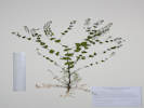
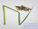
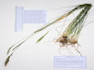
Note on Smooth Brome
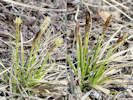
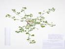
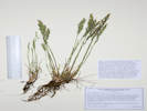
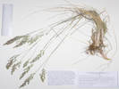
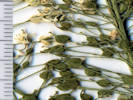
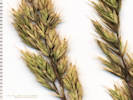
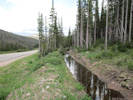
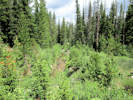
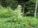
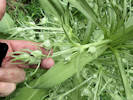
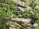
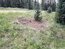
One of the most common non-native species found at nearly every site was smooth brome
(Bromopsis (Bromus) inermis).
Smooth brome is not on the noxious weed list, yet it appears
to be one of the largest threats to ecosystems, besides development,
in Jefferson County, particularly in wetlands.
Smooth brome is very difficult to treat without causing problems
to the surrounding environment.
Unfortunately, the spread of smooth brome is being
encouraged by weed treatment activities especially in wetlands.
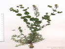
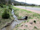
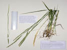
Canada thistle is very common in wetlands, and is a B-List noxious weed.
It is often treated with herbicides that impact dicots.
Smooth brome is a monocot.
A recent report by Rondeau (2011) found in a six year monitoring effort
for Canada thistle (Cirsium arvense, also Breea arvensis) that
although the treatments were successful in removing the Canada thistle
it was replaced by smooth brome in wetlands where smooth brome was already
in the area.
In addition, they found the local native plants including woody species
were being impacted as well over the six year study.
Overall the result was a less desirable outcome than the situation being
remedied from an ecological perspective.
This is unfortunate because Canada thistle is a B-Listed plant;
people are being required to treat it.
If smooth brome is in the vicinity (which is often the case)
a state listed noxious weed is being replaced by something that is even
more difficult to control and arguably more damaging to the ecosystem.
In the State of Colorado, smooth brome is available for use in
seed mixes used by ranchers, homeowners and highway departments
which is why it is not listed as an invasive species. This plant is
considered to be an invasive species in at least ten other states
(MN, OH, IN, IL, KY, TN, NB, WI, ND and MS),
by Ivasives.org and The Nature Conservancy.
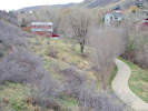
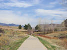
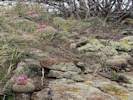
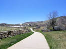
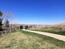
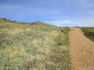
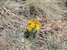
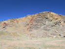
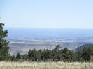
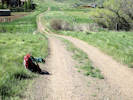
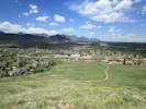
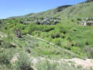
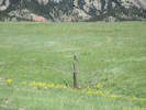
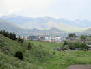
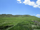
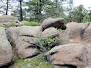
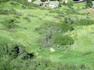
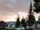
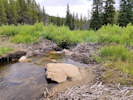
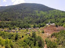
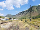
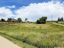
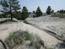
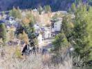
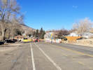
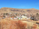
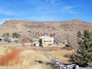
Locations: Schweich Hill.
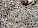
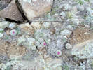
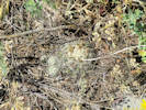
Missouri Foxtail Cactus sits low in the soil.
Sunday, March 11th
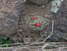
Missouri Foxtail Cactus beside the trail.
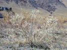
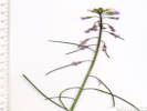
Bractless Blazing Star (Mentzelia nuda) with last year's fruit.
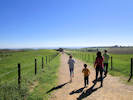
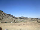
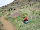
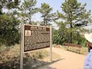
Walked up to the North Washington Open Space to look for the Escobaria missouriensis and other things that might be in bloom.
Wednesday, March 14th
Other articles: • Social Trail:
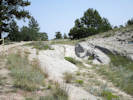
near NTM trl; Escobaria missouriensis in a crack between three rocks.
One plant of Escobaria missouriensis found on the toe of a landslide, lowest southwest slopes of North Table Mountain.
Other articles: • Golden Checklist Flora:
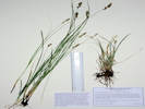
Carex inops heliophila; • Social Trail:
at corner; Carex inops var. heliophila along the trail.
A little Carex just starting to bloom, probably C. inops var. heliophila.
Friday, March 23rd
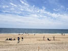
Denver to Newark to Atlantic Ocean.
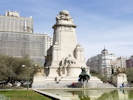
Saturday, March 24th
Atlantic Ocean to Madrid to Bormujos.
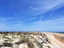
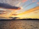
Sunday, March 25th
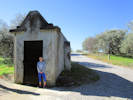
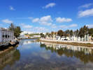
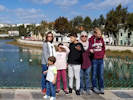
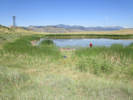
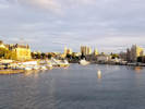
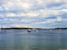
Salida, Sanlucar la Mayor.
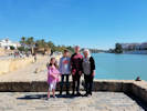
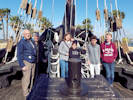
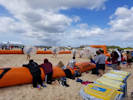
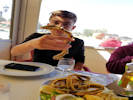
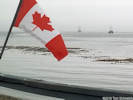
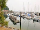
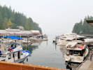
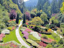
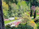
Sofia, Ian, Colin, and Cheryl by the Rio Guagalquivir
Knitted decorations along the river.
Monday, March 26th
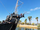
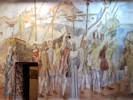
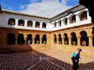
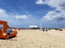
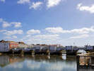
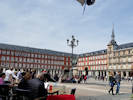
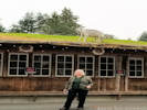
Sevilla, paso of San Gonzalo over Triana Bridge.
The float of the Virgin in the streets of Triana. The thing to see here is the float will “jump” when it is picked up by the costaleros.
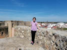
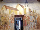
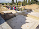
Tuesday, March 27th
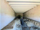
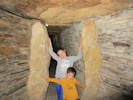
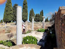
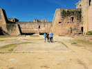
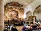
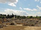
Dolmens and Italica.
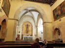
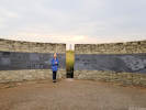
Locations: Dolmen de Matarrubilla.
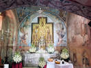
Altar or offering table in the Dolmen de Matarrubilla.
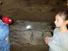
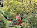
Sofia at the entrance to the Dolmen de Matarrubilla.
Dolmen de Matarrubilla
The Matarrubilla Dolmen was discovered in 1917, also as a result of some agricultural tasks. It is just one kilometer in a straight line from La Pastora,
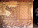
As a funerary corridor and circular chamber structure with a total length of 32 meters, Matarrubilla approaches La Pastora in grandeur. It differs fundamentally because in the chamber is a great block of black marble, carved and with a recess of several centimeters on the upperpart, that probably fulfilled functions of table of offerings or altar. Undoubtedly it is a ritual element that already had great importance in the design and planning of the monument, since its placement, occupying much of the space of the chamber, must have occurred before the erection of the roof in a false dome.
The funeral deposit found in Matarrubilla was quite scarce. In the plundered chamber were scrambled and fragmented remains of pottery and some human bones. In the corridor, some materials were in situ, including stone tools, a large number of fragments of gold lamellae, some ivory objects (including an elephant tusk in the rough, unworked) and several thousands of necklace beads. Only one complete skeleton was found, halfway down the corridor and in a cramped position. The relatively low number of burials and grave goods and the presence of the altar or offering table that so clearly dominates the space available in the vaulted chamber of the monument suggests that, indeed, a monument such as Matarrubilla may have played the role of a temple or ceremonial enclosure besides (or perhaps more than) a sepulcher
(
https://www.rutasconhistoria.es/loc/dolmen-de-matarrubilla
).
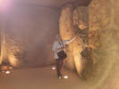
Locations: Dolmen de Pastora.
Path to the Dolmen de Pastora
Entrance to the Dolmen de Pastora.
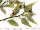
Field identification: Juniperus sp., probably a horticultural species.
Juniperus virginiana L. Eastern Redcedar.
North Washington Open Space, Jefferson County, Colorado. On a cut bank near the north boundary fence of the North Washington Open Space, 1.8 km northwest of the GNIS location of Golden. 39.7689°N, 105.2334°W. WGS 1984 Single plant about 2 m. tall. Probable garden escapee.
Tall narrow shrub, to 2 m.;
Leaves in 2s,
scale-like, margin entire, tip acute, overlapping > ¼ length of next leaf,
length of gland < distance to apex;
Seed, #1, 4 mm. × 3 mm.
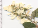
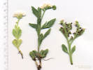
Field identification: Lamium amplexicaule. Turkish Mint.
Lamium amplexicaule L. Henbit.
North Washington Open Space, Jefferson County, Colorado. Small (4 acre) fallow city-owned parcel in northern Golden, near the intersection of Colorado Highway 93 and Washington Avenue, 1.75 km. northwest of the GNIS location of Golden. 39.7688°N, 105.2317°W. WGS 1984 Elev. 1797 m.. Small group of plants in the area that has previously mowed by neighbors, northeast corner of parcel.
Field identification:Carex inops var. heliophila. Sun Sedge.
Carex inops L.H. Bailey ssp. heliophila (Mack.) Crins. Sun Sedge.
North Table Mountain, Jefferson County, Colorado. Southwest corner of North Table Mountain, exposed sites on lower slopes, near City of Golden North Table Mountain trail, 1.23 km. north of the GNIS location of Golden. 39.7665°N, 105.2192°W. WGS 1984 Elev. 1818 m..
Thursday, April 12th
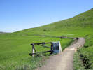
Kinney Gulch Trail, from Eagle Ridge up to Tripp Ranch.
Kinney Run, Jefferson County, Colorado. Between Kinney Run Trail and the creek, just north of Tripp Ranch, 3.36 km. south of the GNIS location of Golden. 39.7259°N, 105.2137°W. WGS 1984 Elev. 1889 m.
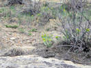
Habitat of Coll. No. 1779, Euphorbia myrsinites in Kinney Run.
Euphorbia myrsinites L. Myrtle Spurge.
Kinney Run, Jefferson County, Colorado. West-facing slope, just beginning to bloom, collection from southern edge of an infestation that extends 175 m. north along the rock outcrop. 3.31 km. south of the GNIS location of Golden. 39.7264°N, 105.2133°W. WGS 1984 Elev. 1851 m.
Kinney Run, Jefferson County, Colorado. 40 m. east of, and above the Kinney Run Trail, in the sandstone of a hogback, at the base of Cercocarpus montanus, which itself was rooted in a fracture of the bedrock, 3.22 km. south of the GNIS location of Golden. 39.7272°N, 105.2134°W. WGS 1984 Elev. 1845 m.
Cerastium arvense L. ssp. strictum Gaudin. Field Chickweed.
Kinney Run, Jefferson County, Colorado. 40 m. east of and above the Kinney Run Trail, in the sandstone of a hogback, at the base of Cercocarpus montanus, which itself was rooted in a fracture of the bedrock, 3.22 km. south of the GNIS location of Golden. 39.7272°N, 105.2134°W. WGS 1984 Elev. 1845 m.
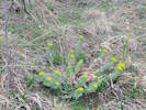
Taraxacum officinale F. H. Wigg. Common Dandelion.
Kinney Run, Jefferson County, Colorado. Thirty meters east of and above the Kinney Run Trail, in thin soil near bare rock outcrops of a small hogback, 3.16 km. south of the GNIS location of Golden. 39.7276°N, 105.2136°W. WGS 1984 Elev. 1839 m.
Kinney Run, Jefferson County, Colorado. Thirty-eight meters east of and above the Kinney Run Trail, west side of the hogback in a small cove or old excavation that collects water, 3.12 km. south of the GNIS location of Golden. 39.728°N, 105.2137°W. WGS 1984 Elev. 1835 m.
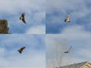
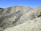
Locations: Kinney Run.
Light-phase Red-Tailed Hawk seen in Kinney Run.
Also seen: Lomatium orientale, Alyssum simplex, Erodium cicutarium, Claytonia rosea, Zigadenus paniculatus. Three raptors seen today. This is the first of three.
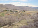
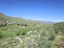
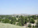
General view north on Kinney Run.
Monday, April 16th
North Table Mountain. Cottonwood Canyon to North Table Loop, the basalt quarry, and back.
Field identification: Carex inops var. heliophila. In rocks with some openings and bare ground, Berberis repens.
Carex inops L.H. Bailey ssp. heliophila (Mack.) Crins. Sun Sedge.
North Table Mountain Park, Jefferson County, Colorado. Upper part of Cottonwood Canyon, a relatively large canyon draining North Table Mountain to the southeast, on top of small rise along an old social trail that predates Open Space trail construction, 3.07 km. northeast of the GNIS location of Golden. 39.7799°N, 105.2043°W. WGS 1984 Elev. 1896 m. With Berberis repens. Early anthesis at this slightly higher elevation, pistillate spikelets just beginning to develop.
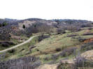
Locations: North Table Mountain Park.
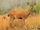
Concentration of Pediocactus simpsonii Deer at the break in mountain slope.
Tops of rocky ledges above Cottonwood Canyon: a lot of Pediocactus simpsonii and a good number of Carex inops var. simpsonii. Small (10-12) herd of deer in the upper reaches of Cottonwood Canyon, away from the trail.
Concentration of Pediocactus simpsonii
Locations: North Table Mountain Park.
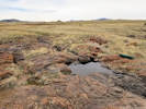
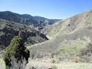
Flowing water entering Cottonwood Canyon
Flowing water entering Cottonwood Canyon
Stream draining the small reservoir, and feeding Cottonwood Canyon.
A second group of deer on top of North Table Mountain.
Wednesday, April 18th.
Heritage Dells and Magic Mountain Archeological Site.
Muscari botryoides (L.) Mill. Common Grape Hyacinth.
Heritage Square, Jefferson County, Colorado. Heritage Dells area, 35 m. east of the Kinney Run Trail, in thin soil on top of a very low hogback, 4.3 km. south of the GNIS location of Golden 39.7177°N, 105.2111°W. WGS 1984 Elev. 1872 m. Well naturalized in a small thriving colony. Most leaves have been at least partially eaten.
Field identification: Cerastium arvense ssp. strictum
Cerastium arvense L. ssp. strictum Gaudin. Field Chickweed.
Heritage Square, Jefferson County, Colorado. Heritage Dells area, 41 m. east of the Kinney Run Trail, in thin soil on top of a very low hogback, 4.3 km. south of the GNIS location of Golden 39.7177°N, 105.211°W. WGS 1984 Elev. 1887 m.
Carex inops L.H. Bailey ssp. heliophila (Mack.) Crins. Sun Sedge.
Heritage Square, Jefferson County, Colorado. Heritage Dells area, 47 m. east of the Kinney Run Trail, in thin soil on top of a very low hogback, 4.34 km. south of the GNIS location of Golden 39.7172°N, 105.211°W. WGS 1984 Elev. 1898 m.
Heritage Square, Jefferson County, Colorado. Heritage Dells area, 47 m. east of the Kinney Run Trail, in thin soil on top of a very low hogback, 4.34 km. south of the GNIS location of Golden 39.7172°N, 105.211°W. WGS 1984 Elev. 1898 m. Dark blue-purple larkspur. Only four plants, therefore only one flower and one leaf collected.
Other articles: • Kinney Run Trail:
at Burgess; at top of hill; Looking south on the Kinney Run Trail.
Looking north on the Kinney Run Trail.
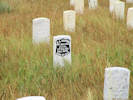
Matthews/Winters Park, Jefferson County, Colorado. Beside the Village Walk Trail, near the Mount Vernon Cemetery, 7.25 km. south of the GNIS location of Golden 39.6909°N, 105.2085°W. WGS 1984 Elev. 1948 m. Duplicates Judy King collection 4 May 2009, KHD47888. Also collected in Kinney Run, Golden, my Coll. Nos. 1783 and 1827.
Field identification: Collinsia parviflora “Blue-Eyed Mary”
Collinsia parviflora Lindl. Maiden Blue-eyed Mary.
Colorado School of Mines Survey Field, Jefferson County, Colorado. North-facing slope of small gulch, 1.97 km. south southwest of the GNIS location of Golden. 39.7383°N, 105.2267°W. WGS 1984 Elev. 1846 m.
Other articles: • Golden Checklist Flora:
Erodium cicutarium; Coll. No. 1790, Erodium cicutarium
Erodium cicutarium (L.) L'Her. ex Aiton. Redstem Stork's Bill.
Colorado School of Mines Survey Field, Jefferson County, Colorado. South side of an alluvial hill near the center of the Survey Field, 2.22 km, south of the GNIS location of Golden. 39.7357°N, 105.2245°W. WGS 1984 Elev. 1843 m.
Colorado School of Mines Survey Field, Jefferson County, Colorado. Distributed broadly across upper surface of small alluvial hill, near the center of the Survey Field, 2.22 km, south of the GNIS location of Golden. 39.7359°N, 105.2245°W. WGS 1984 Elev. 1851 m.
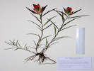
Anemone patens L. var. multifida Pritzel. Eastern Pasqueflower.
Ranson/Edwards Homestead Open Space Park, Jefferson County, Colorado. Highest Great Plains at base of the Rocky Mountain Front Range, just above Rocky Flats, 1.7 mi. west on Colorado Highway 73 from Colorado Highway 93, then 2.0 mi. generally north on Plainview Road. 39.898°N, 105.2704°W. WGS 1984 Elev. 1943 m.
Clear Creek Canyon Park, Jefferson County, Colorado. Southeast-facing hillslope just inside the mouth of Clear Creek Canyon, foothills of Rocky Mountain Front Range, 2.3 km west of the GNIS location of Golden. 39.7528°N, 105.2476°W. WGS 1984 Elev. 1816 m.
Other articles: • Golden Checklist Flora:
Euphorbia esula; Habitat of Coll. No. 1795, Euphorbia esula
Clear Creek Canyon Park, Jefferson County, Colorado. Colonizing a former quarry road, southeast-facing side of the canyon, just inside the mouth of Clear Creek Canyon, foothills of Rocky Mountain Front Range, 2.16 km west of the GNIS location of Golden. 39.7532°N, 105.2461°W. WGS 1984 Elev. 1794 m.
Other articles: • Golden Checklist Flora:
Physaria vitulifera; Habitat of Coll. No. 1796, Physaria vitulifera
Clear Creek Canyon Park, Jefferson County, Colorado. Growing on the bank of a former quarry road, southeast-facing side of the canyon, just inside the mouth of Clear Creek Canyon, foothills of Rocky Mountain Front Range, 2.16 km west of the GNIS location of Golden. 39.7535°N, 105.2459°W. WGS 1984 Elev. 1801 m.
Locations: Indian Gulch.
Obs. No. 1599, Oenothera coronopifolia
Erysimum capitatum among Linaria dalmatica.
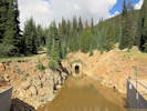
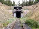
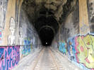
Indian Gulch
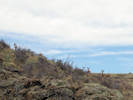
Tunnel No. 1 from ridge above Indian Gulch.
Leucocrinum montanum sometimes called "sand lily" in some actual sandy habitat.
Also seen on the slope: Lithospermum incisum, Erysimum capitatum, Corydalis aureus, Viola nuttallii, and an Oenothera that I think was O. coronopifolia. I described the Oenothera as Leaves cauline, deeply pinnately lobed, sepals reflexed, bi-fised, hairy, tip non-descript, stamens 8, indusium present, stigma 4-lobed.
Field identification: Carex inops ssp. heliophila.
Carex inops L.H. Bailey ssp. heliophila (Mack.) Crins. Sun Sedge.
North Washington Open Space, Jefferson County, Colorado. Scattered across the top and southwest slope of the hill with somewhat intact mixed-grass prairie, 1.76 km. northwest of the GNIS location of Golden. 39.7685°N, 105.2331°W. WGS 1984 Elev. 1817 m. Three collections of the Sun Sedge bearing the suffixes .0, .1, and .2 were made this day relatively near to each other.
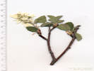
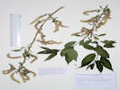
Field identification: Celtis reticulata, in bloom.
Celtis reticulata Torr. Net-Leaved Hackberry.
North Washington Open Space, Jefferson County, Colorado. Small (4 acre) fallow city-owned parcel in northern Golden, near the intersection of Colorado Highway 93 and Washington Avenue, 1.75 km. northwest of the GNIS location of Golden. 39.7684°N, 105.2326°W. WGS 1984 Elev. 1794 m. Two trees, three short branches taken from each. Just off the top of the hill to the south.
North Table Mountain, from Easley Road, Lithic Trail, North Table Loop, Mesa Top Trail, Cottonwood Canyon Trail, North Table Loop, to Lithic Trail and Easley Road.
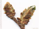
Other articles: • Lithic Trail:
at lower switchback; Coll. No, 1799, Celtis reticulata Coll. No, 1799, Celtis reticulata
North Table Mountain Park, Jefferson County, Colorado. Lower east slopes of North Table Mountain, along the upper portion of the Lithic Trail and nearby portions of the North Table Loop, 3.77 km. northeast of the GNIS location of Golden 39.7812°N, 105.1926°W. WGS 1984 Elev. 5826 ft. Several small trees scattered on the hillslope.
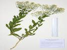
Amelanchier alnifolia (Nutt.) Nutt. ex M. Roem. Saskatoon Serviceberry.
North Table Mountain Park, Jefferson County, Colorado. A few small shrubs on slopes of northeast aspect, lower east slopes of North Table Mountain, 3.83 km. northeast of the GNIS location of Golden. 39.7833°N, 105.1946°W. WGS 1984 Elev. 1796 m.
Coll. No. 1800-1801, 7 May 2018, characters oberved:
Shrub, to 1 m.;
Stems,
branches unarmed;
Leaves,
simple,
petiole, 8 mm.,
blade, 22-32 mm. × 19-32 mm. wide,
veins, pinnate,
surface,
sparsely hairy above,
sparsely to moderately hairy below,
margin, serrate;
Flowers,
borne singly,
pedicels, 10 mm.,
petals 9 mm. × 4.5 mm. wide,
color cream;
Ovary,
inferior,
tip hairy;
Styles, #(4)5;
Other articles: • North Table Loop:
at Coll. No. 1801; Coll. No. 1801, Amelanchier alnifolia Coll. No. 1801, Amelanchier alnifolia
Amelanchier alnifolia (Nutt.) Nutt. ex M. Roem. Saskatoon Serviceberry.
North Table Mountain Park, Jefferson County, Colorado. Slopes of northeast aspect, lower east slopes of North Table Mountain, 4.00 km. northeast of the GNIS location of Golden. 39.7854°N, 105.1948°W. WGS 1984 Elev. 1841 m. Beside North Table Loop, numerous small shrubs.
Coll. No. 1800-1801, 7 May 2018, characters oberved:
Shrub, to 1 m.;
Stems,
branches unarmed;
Leaves,
simple,
petiole, 8 mm.,
blade, 22-32 mm. × 19-32 mm. wide,
veins, pinnate,
surface,
sparsely hairy above,
sparsely to moderately hairy below,
margin, serrate;
Flowers,
borne singly,
pedicels, 10 mm.,
petals 9 mm. × 4.5 mm. wide,
color cream;
Ovary,
inferior,
tip hairy;
Styles, #(4)5;
Other articles: • North Table Loop:
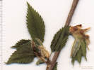
along trail; Coll. No. 1802, Corylus cornutaUlmus americana Coll. No. 1802, Corylus cornutaUlmus americana
Field identification: Corylus cornuta, leaves just beginning, no reproductive parts.
Corylus cornuta Marshall. Beaked Hazelnut.
North Table Mountain Park, Jefferson County, Colorado. Lower northeast slopes of North Table Mountain, adjacent to North Table Loop, which has the appearance of once having been a road at this location, 4.55 km. northeast of the GNIS location of Golden. 39.7922°N, 105.1974°W. WGS 1984 Elev. 1830 m. Tree, just beginning to leaf out, no reproductive structures. Determination tentative.
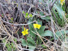
North Table Mountain Park, Jefferson County, Colorado. Eastern slope of North Table Mountain, just below the rim of the mesa, beside the Mesa Top Trail which is a former road, 3.83 km. northeast of the GNIS location of Golden 39.7848°N, 105.1974°W. WGS 1984 Elev. 1830 m. Small yellow flowers on Mesa Top Trail.
Coll. No. 1803, 7 May 2018, characters observed:
Annual herb, prostrate, to 1 cm. × 50 cm. wide;
Leaves,
compound,
stipules, leaf-like, 6.5 mm.,
petioles, 11 mm.,
leaflets, #3, obovate, 5 mm. × 5-6 mm. wide,
margin denticulate,
middle leaflet extended beyond lateral leaflet on a petiolule;
Inflorescence,
compact axillary raceme,
8 mm. × 3.5 mm. wide;
Sepals,
1 mm.;
Flowers,
2 mm.,
color yellow;
Fruit,
unknown -- should be curved.
Other articles: • Mesa Top Trail:
at bridge; Location of Coll. No. 1804, Juncus sp.
Plants of Jefferson County Open Space Jefferson County, Colorado
Poaceae
Poa fendleriana (Steud.) Vasey.
Muttongrass.
North Table Mountain Park, Jefferson County, Colorado.
Top of North Table Mountain, east side, between the Cottonwood Canyon Trail near the north end and northernmost tower of the adjacent power line, 3.45 km. northeast of the GNIS location of Golden.
39.7835°N, 105.2035°W.
WGS 1984
Elev. 1959 m.
Perennial, clumped, non-rhizomatous grass, in wet shallow soil on basalt caprock of the mesa.
Collected by permit: Jefferson County Open Space, 2018, issued: Mar 1, 2018, to: Tom Schweich.
Tom Schweich
1805.
8-May-2018
Coll. No. 1805, 8 May 2018, characters observed:
Perennial grass,
to 22 cm.,
clumped;
Roots,
fibrous;
Stem,
herbaceous;
Leaves,
sheath,
40-80 mm.,
open;
ligule,
membranous,
1.5 mm.,
auricles, absent;
blade,
40 mm,
revolute,
margins, scabrous;
Inflorescence,
1 per culm,
>leaves,
contracted panicle,
80 mm. × 14 mm. wide,
4± branches;
Rachis,
not extended,
sparsely scabrous;
Spikelets,
many,
7 mm. × 1.3 mm. wide,
similar,
borne singly,
stalked,
pedicels 1-2 mm.,
2-many flowered;
Compression,
lateral;
Disarticulation,
above the glumes;
Glumes,
lower,
2.6 mm.,
veins, #3,
upper,
2.7 mm.,
<lowest floret,
veins, #3,
keeled,
membranous,
awns, #0;
Florets,
4 per spikelet,
all staminate, no pistillate or bisexual florets found;
Lemma,
4.5 mm.,
>glumes,
ovate,
membranous,
hairy proximally to short hairy distally, none cobwebby,
color, green-purple,
veins, #5, obscure,
tip, obtuse;
Palea,
3.7 mm.,
<lemma,
membranous,
veins,
green,
ciliate,
margin,
glabrous,
tip,
entire;
Anthers,
1.7 mm.
Other articles: • Cottonwood Canyon Trail:
head of landslide; Location of Coll. No. 1806, Carex praegracilis Coll. No. 1806, Carex praegracilis
Field identification: Carex sp., settled on C. praegracilis, but I'm not so sure about this one.
Plants of Jefferson County Open Space Jefferson County, Colorado
Cyperaceae
Carex praegracilis W. Boott.
Clustered Field-Sedge.
North Table Mountain Park, Jefferson County, Colorado.
Beside the Cottonwood Canyon Trail, about 2/3 of the way up Cottonwood Canyon on the southeast flank of North Table Mountain, 3.13 km. northeast of the GNIS location of Golden.
39.7792°N, 105.2012°W.
WGS 1984
Elev. 1889 m.
Small patch in head of landslide, growing around a large boulder.
Collected by permit: Jefferson County Open Space, 2018, issued: Mar 1, 2018, to: Tom Schweich.
Tom Schweich
1806.
7-May-2018
`
Coll. No. 1806, 8 May 2018. characters observed:
Perennial sedge,
Habit:
rhizomatous;
Culms:
to 45 mm.,
scabrous below head;
Leaves:
2.2 mm. wide,
green,
sheaths,
white-hyaline,
smooth;
Inflorescence:
27 mm. × 8 mm. wide,
#8-10 spikes,
loosely clustered;
Spikes:
identical appearing,
terminal androgynous,
lateral androgynous,
proximal pistillate,
8 mm. × 5 mm. wide;
Bracts:
proximal,
24 mm.,
<inflorescence,
setaceous (bristle-like);
Pistillate scales:
4 mm. × 2 mm. wide,
green mid-vein, brown laterally, hyaline margin,
one scale margin just barely folded over edge of perigynum;
Perigynia:
#15-16 per spike,
3.8 mm. × 1.6 mm. wide,
wingless,
obscurely veined,
glabrous,
beak,
0.8 mm.,
flattish,
±sloping to tip,
serrulate,
achene to beak tip 1.6 mm.;
Achene:
2.1 mm. × 1.3 mm. wide,
pretty flat,
obovate;
Stigma:
#2.
North Table Mountain Park, Jefferson County, Colorado. Lowest eastern slopes of North Table Mountain, beside the Lithic Trail about mid-way between the Fairmont Ditch and North Table Loop, 3.80 km. northeast of the GNIS location of Golden, 39.7818°N, 105.1927°W. WGS 1984 Elev. 1777 m. "Reddish stems," actually reddish proximal sheaths, attracted me from trailside.
Coll. No. 1807, 7 May 2018, characters observed:
Perennial grass,
50-60 cm.,
clumped,
not rhizomatous;
Roots, fibrous;
Stems, herbaceous;
Internodes, hollow, glabrous;
Leaves, blade and sheath differentiated;
Sheath,
120 mm.,
open at least ½,
minutely scabrous,
reddish color proximally;
Ligule,
membraneous,
2 mm.,
auricles absent;
Blade,
25 mm.,
scabrous,
margin scabrous;
Inflorescence,
1 per culm,
> leaves,
panicle,
110 mm. × 20 mm. wide,
spikelets many;
Rachis,
sparsely scabrous on all sides,
not extended beyond upper spikelet;
Spikelets,
many,
similar,
borne singly, one per node,
stalked,
6 mm.;
Compression,
lateral;
Disarticulation,
above the glumes;
Glumes,
lower 3.7 mm.,
upper 4.3 mm.,
veins 3(5);
Florets,
5-6 per spikelet,
pistillate;
Axis,
hairy,
extended beyond upper floret;
Lemma,
5 mm., > glumes,
membraneous,
keeled,
keel and margin are villous proximally,
hairs to 0.7 mm.,
veins definitely ≥3, maybe 5,
parallel,
tip entire, obtuse;
Palea, 2.5 mm., <lemma,
proximally villous,
keels ciliate,
margin glabrous;
Stamens,
none found;
Ovary,
glabrous,
yellow-brown;
Stigma,
feathery;
Other articles: • North Table Loop:
at bolts; Two of many bolts just below the North Table Loop.
There is an area that has a double row of bolts just below the trail.
Other articles: • North Table Loop:
at s. switchback; Base of lava flow along North Table Loop.
Base of lava flow along North Table Loop.
At the switchback, it looks like the bottom of a lava flow is exposed.
Plants of Jefferson County Open Space Jefferson County, Colorado
Brassicaceae
Lepidium perfoliatum L.
Clasping Pepperweed.
North Table Mountain Park, Jefferson County, Colorado.
In the median and beside the Mesa Spur Trail, near the crossing of Ramstetter Creek, 130 m. south of W. 58th Avenue, surrounded on both sides by horse corrals and facilities, 5.07 km. north of the GNIS location of Golden.
39.8006°N, 105.2124°W.
WGS 1984
Elev. 1788 m.
Collected by permit: Jefferson County Open Space, 2018, issued: Mar 1, 2018, to: Tom Schweich.
Tom Schweich
1808.
11-May-2018
Location of Collections 1809 to 1812.1
Location of Collections 1809 to 1812.1
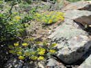
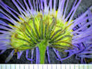
Senecio and Taraxacum for sure, but can you see the Boechera?
Plants of Jefferson County Open Space Jefferson County, Colorado
Anthericeae
Leucocrinum montanum Nutt. ex A. Gray.
Star Lily.
North Table Mountain Park, Jefferson County, Colorado.
Lowest north slopes of North Table Mountain, on a small flat that appears to be a landslide run-out, 4.8 km. north of the GNIS location of Golden
39.7979°N, 105.2088°W.
WGS 1984
Elev. 1820 m.
Collected by permit: Jefferson County Open Space, 2018, issued: Mar 1, 2018, to: Tom Schweich.
Plants of Jefferson County Open Space Jefferson County, Colorado
Fabaceae
Astragalus agrestis Douglas ex G. Don.
Purple Milkvetch.
North Table Mountain Park, Jefferson County, Colorado.
Lowest north slopes of North Table Mountain, on a small flat that appears to be a landslide run-out, 4.8 km. north northeast of the GNIS location of Golden.
39.7978°N, 105.2088°W.
WGS 1984
Elev. 1818 m.
Found among short grasses and forbs in all areas of North Table Mountain.
Collected by permit: Jefferson County Open Space, 2018, issued: Mar 1, 2018, to: Tom Schweich.
Tom Schweich
1810.
10-May-2018
Button-like caudex of Coll. No. 1811, Senecio integerrimus
Plants of Jefferson County Open Space Jefferson County, Colorado
Asteraceae
Senecio integerrimus Nutt.
Columbia Ragwort.
North Table Mountain Park, Jefferson County, Colorado.
Lowest north slopes of North Table Mountain, on a small flat that appears to be a landslide run-out, 4.8 km. north northeast of the GNIS location of Golden.
39.7977°N, 105.2087°W.
WGS 1984
Elev. 1818 m.
Numerous plants among short grasses and forbs.
Collected by permit: Jefferson County Open Space, 2018, issued: Mar 1, 2018, to: Tom Schweich.
Tom Schweich
1811.
10-May-2018
Coll. No. 1811, 10 May 2018, characters observed:
Perennial, herb, to 40 cm., sap clear,
caudex button-like;
Stem,
multicellular arachnose throughout;
Leaves,
basal and cauline,
alternate,
basal,
petiole, 70 mm.,
blade, 75 mm. × 12 mm. wide,
sparsely arachnose,
margin wavy and revolute in places,
reduced above,
cauline,
sessile,
blade 85 mm. × 10 mm. wide,
reduced above,
margin wavy and revolute in part;
Inflorescence,
corymbiform,
heads #8-10 per stem,
somewhat convex,
>leaves;
Pedicels,
5-20 mm.,
subtended by a bract to 6 mm.,
lanceolate;
Involucre,
7 mm. × 10 mm wide,
bowl-shaped,
±glabrous;
Phyllaries,
±equal,
in 1 series,
7 mm. × 1.8 mm. wide,
green,
eglandular,
margins ±flat,
not clasping ray ovaries,
tips acuminate with terminal tuft of hairs;
Receptacle, epaleate;
Ray flowers,
#8-10,
tube 4 mm. + blade 5 mm. × 2.5 mm. wide,
yellow,
fertile;
Disk flowers,
many,
tube 4.5 mm. + lobes 1 mm.,
yellow;
Pappus,
many,
well-developed,
bristles,
±equal;
Cypsela,
1.3 mm.,
brown.
Other articles: • Golden Checklist Flora:
Boechera fendleri; Inflorescence of Coll. No. 1812, Boechera fendleri Coll. No. 1812, Boechera fendleri
North Table Mountain Park, Jefferson County, Colorado.
Lowest north slopes of North Table Mountain, on a small flat that appears to be a landslide run-out, 4.8 km. north northeast of the GNIS location of Golden.
39.7978°N, 105.2088°W.
WGS 1984
Elev. 1816 m.
Many plants scattered over a small area.
Collected by permit: Jefferson County Open Space, 2018, issued: Mar 1, 2018, to: Tom Schweich.
Keys easily to B. fendleri in Weber & Wittmann (2012) and Harrington (2nd ed., 1964). Gets lost in Ackerfield (2015, p. 226) at couplet 9, and in FNANM Group 4 at couplet 25, both over the question of whether there are simple trichomes in addition to rayed trichomes on basal leaves and proximal stem. There are only a very few simple trichomes and those are on leaf margins.
Plants of Jefferson County Open Space Jefferson County, Colorado
Violaceae
Viola nuttallii Pursh.
Nuttall's Violet.
North Table Mountain Park, Jefferson County, Colorado.
Lowest north slopes of North Table Mountain, on a small flat that appears to be a landslide run-out, 4.8 km. north northeast of the GNIS location of Golden.
39.7978°N, 105.2088°W.
WGS 1984
Elev. 1818 m.
Larger plants than typically seen around Golden.
Collected by permit: Jefferson County Open Space, 2018, issued: Mar 1, 2018, to: Tom Schweich.
Tom Schweich
1812.1
10-May-2018
Other articles: • North Table Loop:
near trl jct; Habitat of Coll. No. 1813, Delphinium nuttallianum.
Plants of Jefferson County Open Space Jefferson County, Colorado
Ranunculaceae
Delphinium nuttallianum Pritz.
Twolobe Larkspur.
North Table Mountain Park, Jefferson County, Colorado.
Lower north slopes of North Table Mountain, in a swale beside the North Table Loop, 4.56 km. north northeast of the GNIS location of Golden.
39.7957°N, 105.21°W.
WGS 1984
Elev. 1828 m.
Stems from a small cluster of thickened, fleshy, tuber-like roots.
Moist friable soil.
Collected by permit: Jefferson County Open Space, 2018, issued: Mar 1, 2018, to: Tom Schweich.
Tom Schweich
1813.
10-May-2018
Other articles: • North Table Loop:
above trl jct; Coll. No. 1814, Phlox, tentatively determined as P. multiflora.
Plants of Jefferson County Open Space Jefferson County, Colorado
Polemoniaceae
Phlox multiflora A. Nelson.
Mountain Phlox.
North Table Mountain Park, Jefferson County, Colorado.
Lower north slopes of North Table Mountain, on a small ridge overlooking the North Table Loop, 4.51 km. north northeast of the GNIS location of Golden
39.7954°N, 105.2106°W.
WGS 1984
Elev. 1841 m.
Collected by permit: Jefferson County Open Space, 2018, issued: Mar 1, 2018, to: Tom Schweich.
Field identification: Koeleria macrantha, determination tentative.
Oh geez I can't get this thing into anything but Poa fendleriana but it is full of bisexual florets. Compare it to my Coll. No. 1807.
Plants of Jefferson County Open Space Jefferson County, Colorado
Poaceae
Poa fendleriana (Steud.) Vasey.
Muttongrass.
North Table Mountain Park, Jefferson County, Colorado.
Lower north slopes of North Table Mountain, on the nose of a small ridge in the corner of the North Table Loop, 4.49 km. north northeast of the GNIS location of Golden
39.7952°N, 105.2107°W.
WGS 1984
Elev. 1849 m.
Collected with Phlox multiflora and Carex inops var. heliophila.
Collected by permit: Jefferson County Open Space, 2018, issued: Mar 1, 2018, to: Tom Schweich.
Tom Schweich
1815.
10-May-2018
Coll. No. 1815, 10 May 2018, characters observed:
Perennial grass,
to 50 cm.,
clumped, not rhizomatous;
Stem,
herbaceous;
Leaves,
mostly basal,
blade and sheath differentiated;
(Cauline) Sheath,
55 mm.,
open at least ½,
minutely scabrous;
Ligule,
membraneous,
1 mm.;
Auricles,
0;
(Cauline) Blade,
15-25 mm.,
rolled,
margins minutely scabrous;
Inflorescence,
1 per culm,
contracted panicle,
85 mm. × 15 mm. wide,
spikelets many;
Rachis,
not extended beyond the upper spikelet;
Spikelets,
many,
similar,
borne singly,
stalked,
narrowly rounded at base,
2-many flowered,
6.5 mm. × 3 mm. wide;
Compression,
lateral;
Disarticulation,
unknown;
Glumes,
lower 3 mm.,
upper 3.5 mm.,
keeled,
membraneous,
awns 0;
Florets,
5 per spikelet,
bisexual;
Rachilla,
glabrous,
extended beyond upper floret;
Lemma,
3 mm.,
ovate,
membraneous,
keeled,
sparsely villous on proximal keel and margin,
veins, ≥3(5),
tip entire, obtuse,
awns, 0;
Palea,
2.9 mm.,
<lemma,
membraneous,
keel ciliate;
Anthers,
1.5-1.7 mm.;
Ovary,
glabrous;
Stigma,
feathery.
Becomes lost in keys requiring that all florets be pistillate, e.g., Shaw (2008) and Ackerfield (2015). Keys easily to Poa fendleriana in keys that do not mention that florets are unisexual or that plant is dioecious, e.g., Hitchcock (2ed, Chase, 1950), Harrington (2ed, 1964), Welsh, et al. (1993), Baldwin (2012), and Weber & Wittman (2012).
Other articles: • North Table Loop:
above trl jct; North slope, junction of North Table Loop and Mesa Spur Trail in foreground.
Coll. No. 1816, Carex inops var. heliophila
Field identification: Carex inops var. heliophila.
Inflorescence of Coll. No. 1816, Carex inops var. heliophila
Plants of Jefferson County Open Space Jefferson County, Colorado
Cyperaceae
Carex inops L.H. Bailey ssp. heliophila (Mack.) Crins.
Sun Sedge.
North Table Mountain Park, Jefferson County, Colorado.
Lower north slopes of North Table Mountain, on the nose of a small ridge in the corner of the North Table Loop, 4.49 km. north northeast of the GNIS location of Golden
39.7952°N, 105.2107°W.
WGS 1984
Elev. 1851 m.
Collected with Phlox multiflora and Poa fendleriana
Collected by permit: Jefferson County Open Space, 2018, issued: Mar 1, 2018, to: Tom Schweich.
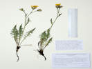
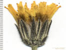
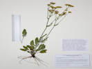
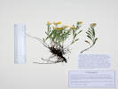
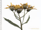
Field identification: Packera, Keyed out while fresh in the office to P. plattensis.
Native and Naturalized Flora of the Golden Area, Jefferson County, Colorado
Asteraceae
Packera plattensis (Nuttall) W. A. Weber & Á. Löve.
Prairie Groundsel.
North Washington Open Space, Jefferson County, Colorado.
Near social trail just west of the top of hill. Small (4 acre) fallow city-owned parcel in northern Golden, near the intersection of Colorado Highway 93 and Washington Avenue, 1.75 km. northwest of the GNIS location of Golden.
39.7686°N, 105.2331°W.
WGS 1984
Elev. 5950 ft.
Collected by permit: City of Golden, 2018, issued: Feb 23, 2018, to: Tom Schweich.
Tom Schweich
1817.
12-May-2018
Coll. No. 1817, 12 May 2018, characters observed:
Perennial herb,
14 cm.,
from taprooted caudix,
sap not milky;
Stem,
light green,
tomentose,
densely so in axils;
Leaves,
mostly basal and few cauline,
alternate,
petiole 8 mm.,
blade 10 mm. × 5 mm. wide,
oblanceolate,
surface,
upper thinly tomentose,
lower moderately tomentose, especially the mid-vein,
margin, crenulate;
Inflorescence,
head enclosed by involucre,
showy;
Heads,
#10,
pedicels, 12 mm.;
Involucre,
7 mm. × 5-6 mm. wide,
thinly tomentose;
Phyllaries,
equal,
in 1 series,
5 mm. × 0.7 mm. wide,
green,
flat;
Receptacle,
epaleate;
Flowers,
of 2 kinds;
Ray flowers,
#10,
tube 3 mm. + blade 7 mm.,
yellow,
fertile;
Disc flowers,
many,
tube 4 mm. + lobes 0.5 mm.,
yellow;
Pappus,
many,
well-developed,
bristles,
4 mm.,
±equal,
Style,
2-branched;
Fruit,
1 mm.,
green,
beak-less,
glabrous.
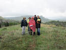
Sunday, May 13th
Other articles: • Social Trail (N. Wash. OS):
west of top;
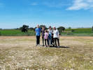
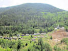
Locations: Schweich Hill.
Field Trip group, May 13, 2018.
Field trip to North Washington Open Space, 13 May 2018.
Native and Naturalized Flora of the Golden Area, Jefferson County, Colorado
Brassicaceae
Barbarea vulgaris R. Br.
Garden Yellowrocket.
Kinney Run, Jefferson County, Colorado.
In a tributary to the locally named “Kinney Run,” recognized by the BGN as Deadman Gulch, 2.8 km. south of the GNIS location of Golden.
39.7308°N, 105.2159°W.
WGS 1984
Elev. 1789 m.
Growing in flowing water.
Collected by permit: City of Golden, 2018, issued: Feb 23, 2018, to: Tom Schweich.
Tom Schweich
1818.
16-May-2018
Coll. No. 1818, 16 May 2018, characters observed:
Probably a biennial or perennial, to 40 cm.,
terrestrial but growing in flowing water,
glabrous throughout;
Leaves,
lower cauline,
150 mm. × 45 mm. wide,
pinnafitid,
lyrate,
lobes, #9,
terminal lobe 47 mm. × 40 mm. wide,
auriculate,
auricles, glabrous,
leaves reduced upward,
upper cauline,
sessile,
35 mm. × 18 mm. wide,
lobes, 3;
Inflorescence,
not bracted;
Flowers,
radial;
Sepals,
2.5 mm. × 1.8 mm. wide,
ovate,
rows, #1,
color, yellow;
Petals,
6 mm.,
obovate,
claw not conspicuously differentiated from blade,
margin, entire,
color, yellow;
Stamens, #6;
Filaments,
4 mm.,
plain;
Anthers, 1 mm.;
Fruit,
pedicels, 5 mm., glabrous,
mature,
19.5 mm. × 0.5 mm. wide,
spreading,
glabrous.
Native and Naturalized Flora of the Golden Area, Jefferson County, Colorado
Rosaceae
Prunus americana Marshall.
American Plum.
Kinney Run, Jefferson County, Colorado.
Small alluvial terrance between the streambeds of Kinney Run and Deadman Gulch, 2.8 km. south of the GNIS location of Golden
39.7307°N, 105.2159°W.
WGS 1984
Elev. 1804 m.
Few shrubs in deep grasses; Ribes aureum and R. cereum also collected here.
Collected by permit: City of Golden, 2018, issued: Feb 23, 2018, to: Tom Schweich.
Tom Schweich
1819.
16-May-2018
Coll. No. 1819, 16 May 2018, characters observed:
Spreading woody shrub, to 2 m.,
blooming before leafing out;
Stem,
unarmed,
glabrous,
peeling to brown;
Leaves,
(immature, at time of flowering),
simple,
15 mm. × 5.5 mm. wide,
elliptic-rhomboid,
bases ±equal,
pinnately veined,
margin serrate,
teeth eglandular,
few hairs on petioles and leaf base margin;
Flowers
in small groups of 2-3,
Pedicels,
9-18 mm.;
Hypanthium,
2 mm.;
Sepals,
2.8 mm.,
reflexed,
few cobwebby hairs adaxially;
Petals,
free,
5.5 mm. × 2.5 mm. wide,
white;
Stamens,
many (30?);
Style,
#1,
10 mm.
Other articles: • Kinney Run Trail:
at Deadman Gl; • Glossary:
dentate; Coarsely dentate leaves of Coll. No. 1820, Thlaspi arvense
Native and Naturalized Flora of the Golden Area, Jefferson County, Colorado
Brassicaceae
Thlaspi arvense L.
Field Penny Cress.
Kinney Run, Jefferson County, Colorado.
Small alluvial terrance between the streambeds of Kinney Run and Deadman Gulch, 2.8 km. south of the GNIS location of Golden
39.7309°N, 105.2158°W.
WGS 1984
Elev. 1803 m.
Among deep grasses, forbs, and a few shrubs.
Collected by permit: City of Golden, 2018, issued: Feb 23, 2018, to: Tom Schweich.
Tom Schweich
1820.
16-May-2018
Coll. No. 1820, 16 May 2018, characters observed:
Annual terrestrial herb, to 50 cm.;
Hairs,
0;
Roots,
tap-rooted;
Leaves,
cauline,
30 mm. × 9 mm. wide,
sessile,
basally lobed,
sparsely dentate;
Inflorescence,
raceme;
Flowers,
radial;
Sepals,
1 row,
2 mm. × 1 mm. wide,
ovate;
Petals,
3.5 mm. × 1 mm. wide,
spoon-shaped,
margin entire,
color white;
Stamens,
2 mm.;
Anthers,
0.5 mm.;
Fruit,
pedicels,
15 mm.,
glabrous,
silicle,
10 mm. × 8 mm. wide,
spreading;
Seeds,
many.
Other articles: • Golden Checklist Flora:
Draba nemorosa; • Kinney Run Trail:
at Deadman Gl; Inflorescence of Coll. No. 1821, Draba nemorosa Coll. No. 1821, Draba nemorosa
Field identification: At first I thought this might be Camelina microcarpa, but now I'm not so sure. It needs a good keying out.
Overview of Coll. No. 1821, Draba nemorosa
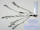
Native and Naturalized Flora of the Golden Area, Jefferson County, Colorado
Brassicaceae
Draba nemorosa L.
Woodland Whitlow Grass.
Kinney Run, Jefferson County, Colorado.
Small alluvial terrance between the streambeds of Kinney Run and Deadman Gulch, 2.8 km. south of the GNIS location of Golden
39.7308°N, 105.2159°W.
WGS 1984
Elev. 1809 m.
Among deep grasses, forbs, and a few shrubs.
Collected by permit: City of Golden, 2018, issued: Feb 23, 2018, to: Tom Schweich.
Tom Schweich
1821.
16-May-2018
Coll. No. 1821, 16 May 2018, characters observed:
Annual terrestrial herb, 11 to 25 cm.,
hairs vary: none, simple, forked, but not dolabriform;
Stem,
proximal, hairs simple and forked,
distal, glabrous;
Leaves,
basal and cauline,
Basal,
simple,
12 mm. × 4.5 mm. wide,
hairs forked;
Cauline,
#5-6,
sessile,
11 mm. × 4 mm. wide,
sparsely dentate,
hairs, simple and forked;
Inflorescene,
raceme;
Sepals,
rows, #1,
1.3 mm. × 0.7 mm. wide,
ovate,
color, green turning yellow,
abaxial hairs wavy;
Petals,
2 mm. × 0.7 mm. wide,
spoon-shaped,
margin entire,
color, yellow;
Stamens,
#4 or 6,
1.3 mm.;
Anthers,
0.3 mm.;
Style,
very short;
Fruit,
pedicels,
20 mm.,
puberulent,
body,
7 mm. × 2 mm. wide,
ascending,
short straight appressed hairs.
Native and Naturalized Flora of the Golden Area, Jefferson County, Colorado
Grossulariaceae
Ribes aureum Pursh.
Golden Currant.
Kinney Run, Jefferson County, Colorado.
Small alluvial terrance between the streambeds of Kinney Run and Deadman Gulch, 2.8 km. south of the GNIS location of Golden
39.7307°N, 105.2159°W.
WGS 1984
Elev. 1807 m.
Among deep grasses, forbs, and a few shrubs.
Collected by permit: City of Golden, 2018, issued: Feb 23, 2018, to: Tom Schweich.
Native and Naturalized Flora of the Golden Area, Jefferson County, Colorado
Grossulariaceae
Ribes cereum Douglas.
Wax Currant.
Kinney Run, Jefferson County, Colorado.
Small alluvial terrace between the streambeds of Kinney Run and Deadman Gulch, 2.8 km. south of the GNIS location of Golden
39.7307°N, 105.2158°W.
WGS 1984
Elev. 1803 m.
One shrub in this area.
Among deep grasses, forbs, and a few shrubs.
Collected by permit: City of Golden, 2018, issued: Feb 23, 2018, to: Tom Schweich.
Field identification: Zigadenus paniculatus gramineus
Native and Naturalized Flora of the Golden Area, Jefferson County, Colorado
Melanthiaceae
Zigadenus paniculatus (Nutt.) S. Watson var. gramineus (Rydb.) Ackerfield.
Grassy Death Camas.
Kinney Run, Jefferson County, Colorado.
Northwest slope of a small hill between Kinney Run and Deadman Gulch, 2.84 km. south of the GNIS location of Golden.
39.7303°N, 105.2159°W.
WGS 1984
Elev. 1814 m.
Collected by permit: City of Golden, 2018, issued: Feb 23, 2018, to: Tom Schweich.
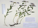
Native and Naturalized Flora of the Golden Area, Jefferson County, Colorado
Lamiaceae
Scutellaria brittonii Porter.
Britton's Skullcap.
Kinney Run, Jefferson County, Colorado.
East-facing alluvial slope of a small hill between Kinney Run and Deadman Gulch, 2.86 km. south of the GNIS location of Golden.
39.7301°N, 105.2158°W.
WGS 1984
Elev. 1812 m.
Small, dense colony.
Collected by permit: City of Golden, 2018, issued: Feb 23, 2018, to: Tom Schweich.
Kinney Run, Jefferson County, Colorado.
Small hill between Kinney Run and Deadman Gulch near their junction, 2.86 km. south of the GNIS location of Golden.
39.7301°N, 105.2158°W.
WGS 1984
Elev. 1813 m.
Three plants on a steep east-facing alluvial slope.
Collected by permit: City of Golden, 2018, issued: Feb 23, 2018, to: Tom Schweich.
Tom Schweich
1826.
16-May-2018
Coll. No. 1826, 16 May 2018, characters observed:
Perennial herb, to 10 cm.,
acaulescent;
Leaves,
compound,
petiole, 50 mm.,
blade,
90 mm. × 37 mm. wide,
leaflets,
#13,
17 mm. × 10 mm. wide,
terminal leaflet not a tendril,
petiole, rachis, and leaflets with appressed stiff straight hairs;
Inflorescence,
not an umbel;
Calyx,
tube 6 mm. + lobes 4 mm.,
hairs similar;
Flower,
zygomorphic,
banner 22 mm.,
wings 18 mm., clawed,
keel, 22 mm., tip obtuse;
Fruit,
35 mm. × 10 mm. wide,
falcate,
appressed stiff basifixed straight hairs.
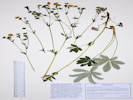
Native and Naturalized Flora of the Golden Area, Jefferson County, Colorado
Boraginaceae
Lithospermum arvense L.
Corn Gromwell.
Kinney Run, Jefferson County, Colorado.
Southeast slope of a small hill between Kinney Run and Deadman Gulch, near the junction of those two small streams, 2.89 km. south of the GNIS location of Golden.
39.7299°N, 105.2159°W.
WGS 1984
Elev. 1811 m.
The small plants are my collection no. 1783, made 12 April 2018, from the same population.
Collected by permit: City of Golden, 2018, issued: Feb 23, 2018, to: Tom Schweich.
Tom Schweich
1827.
16-May-2018
Coll. No. 1827, 16 May 2018, characters observed:
Annual, to 30 cm.,
hairs appressed with pustular bases;
Stem,
some branched distally;
Leaves,
basal and cauline,
basal,
petiole 5 mm. + blade 13 mm. × 3.5 mm. wide,
slightly obovate,
margin entire,
hairs as above,
withering,
cauline,
alternate,
sessile,
19 mm. × 3.7 mm. wide,
margin entire,
hairs as above;
Calyx,
lobes, 5.2 mm. × 0.7 mm. wide,
enlarged in fruit to 7 mm.,
hairs as above;
Corolla,
tube 4 mm. + throat 1 mm. + lobes 1.5 mm.,
blue to white,
abaxial spreading hairy;
Stamens, attached in tube;
Style,
1.2 mm.,
Nutlets,
#(1-2) 3 (4),
2.8 mm. × 2 mm. wide,
green - tan,
tuberculed.
Other articles: • Golden Checklist Flora:
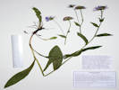
Cynoglossum officinale; Habitat of Coll. No. 1827.1, Cynoglossum officinale.
Native and Naturalized Flora of the Golden Area, Jefferson County, Colorado
Boraginaceae
Cynoglossum officinale L.
Gypsyflower.
Kinney Run, Jefferson County, Colorado.
Southeast slope of a small hill between Kinney Run and Deadman Gulch, near the junction of those two small streams, 2.89 km. south of the GNIS location of Golden.
39.73°N, 105.2159°W.
WGS 1984
Elev. 1811 m.
Small colony, along with Lithospermum arvense and Euphorbia peplus.
Colorado Noxious Weed List B.
Collected by permit: City of Golden, 2018, issued: Feb 23, 2018, to: Tom Schweich.
Field identification: Physaria vitulifera. Coll. Nos. 1828.1 and 1828.2 subsumed here.
View of knob where some Physaria vitulifera grow.
Native and Naturalized Flora of the Golden Area, Jefferson County, Colorado
Brassicaceae
Physaria vitulifera Rydb.
Roundtip Twinpod.
Kinney Run, Jefferson County, Colorado.
Outcrops of sandstone about 2/3 of the way up the west limb of the hogback, east side of Kinney Run, 3.07 km. south of the GNIS location of Golden.
39.7284°N, 105.214°W.
WGS 1984
Elev. 1827 m.
Most basal leaves are entire, only a few are once very shallowly dentate.
Growing in fractures of sandstone outcrops.
Collected by permit: City of Golden, 2018, issued: Feb 23, 2018, to: Tom Schweich.
Tom Schweich
1828.
16-May-2018
Coll. No. 1828, 16 May 2018, characters observed:
Perennial terrestrial herb, to 15 cm.,
stellate hairy throughout;
Roots,
tap;
Stem,
scapose,
hairs as above;
Leaves,
basal and cauline,
basal,
simple,
petiole 15-35 mm.
+ blade 22-24 mm. × 10-14 mm. wide,
few basal leaves with a single pair of teeth,
remainder entire,
tip barely acuminate,
cauline,
nearly sessile,
22 mm. × 4.5 mm. wide,
margin entire;
Inflorescence,
raceme,
60-90 mm. × 35 mm, wide;
Sepals,
#4,
rows 1,
7 mm. × 1.5 mm. wide
elliptic,
green,
hairy as above;
Petals,
10 mm. × 2 mm. wide,
obovate,
margin entire,
yellow;
Stamens,
#6 (4 long, 2 short),
6-8 mm.;
Filaments,
4.5-6 mm.,
pair of short filaments slightly winged proximal ½;
Anthers,
1.5 mm.,
saggitate (?);
Ovary,
2 mm. × 1.8 mm. wide;
Style,
6.4 mm.,
not elongating in fruit;
Fruit,
pedicels,
18-20 mm,
longest sigmoid,
hairs as above,
mature fruit,
3 mm. × 4 mm. wide,
didymous,
apical sinus well-developed,
basal sinus much less so,
hairy as above.
Will key to P. bellii in Ackerfield (2015) at couplet 17 per the shape of the basal leaves, which are entire to very shallowly once dentate. However, FNANM sends this in the direction of P. vitulifera at couplet 12 based on the relative development of the basal and apical sinuses of the fruit.
Locations: Kinney Run.
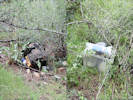
Yard waste disposal on the ridge above Kinney Run.
On the ridge east of Kinney Run. I was coming down the ridge towards the lime kiln and saw this coyote across the trail. I think I might have flushed it out of a hiding place just south of the lime kiln.
Native and Naturalized Flora of the Golden Area, Jefferson County, Colorado
Asteraceae
Erigeron flagellaris A. Gray.
Trailing Fleabane.
Kinney Run, Jefferson County, Colorado.
On the west limb of a small hogback, about 2/3 of the way up from Kinney Run to the crest of the hogback, 3.1 km. south of the GNIS location of Golden.
39.7282°N, 105.2139°W.
WGS 1984
Elev. 1830 m.
Thin vegetation on sandstone.
Collected by permit: City of Golden, 2018, issued: Feb 23, 2018, to: Tom Schweich.
This was an attempt to pass by the old homestead and continue northeast to the northeast corner of the park. I returned to Plainview Road mainly by way of the old ranch road.
Native and Naturalized Flora of the Golden Area, Jefferson County, Colorado
Plantaginaceae
Penstemon virens Pennell ex Rydb.
Front Range Beardtongue.
Kinney Run, Jefferson County, Colorado.
Top of small hogback between Kinney Run and Eagle Ridge Drive, 3.01 km. south of the GNIS location of Golden.
39.729°N, 105.2142°W.
WGS 1984
Elev. 1830 m.
Sparsely vegetated sandstone among Cercocarpus montanus.
Common Front Range Penstemon.
Collected by permit: City of Golden, 2018, issued: Feb 23, 2018, to: Tom Schweich.
Tom Schweich
1830.
16-May-2018
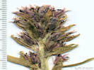
Inflorescence of Coll. No. 1831, Senecio integerrimus
Plants of Jefferson County Open Space Jefferson County, Colorado
Asteraceae
Senecio integerrimus Nutt.
Columbia Ragwort.
Ranson/Edwards Homestead Open Space Park, Jefferson County, Colorado.
1.7 miles west on CO Highway 72 from CO Highway 93, then 1.4 miles generally north on Plainview Road, then about 300 m. northwest to the general vicinity of the old homestead, about 15.8 km. north of the GNIS location of Golden.
39.8943°N, 105.2602°W.
WGS 1984
Elev. 1938 m.
Moderate north slope, deep grass with Astragalus agrestis.
Collected by permit: Jefferson County Open Space, 2018, issued: Mar 1, 2018, to: Tom Schweich.
Ranson/Edwards Homestead Open Space Park, Jefferson County, Colorado.
1.7 miles west on CO Highway 72 from CO Highway 93, then 1.4 miles generally north on Plainview Road, then about 350 m. northwest to the general vicinity of the old homestead, about 15.9 km. north of the GNIS location of Golden.
39.8949°N, 105.2603°W.
WGS 1984
Elev. 1928 m.
Stigmas 3, achenes with longitudinal ridges.
Small patch less than 1 m. sq., north side of the pond between the well and the homestead.
Determination tentative.
Collected by permit: Jefferson County Open Space, 2018, issued: Mar 1, 2018, to: Tom Schweich.
Plants of Jefferson County Open Space Jefferson County, Colorado
Rosaceae
Prunus virginiana L.
Chokecherry.
Ranson/Edwards Homestead Open Space Park, Jefferson County, Colorado.
1.7 miles west on CO Highway 72 from CO Highway 93, then 1.4 miles generally north on Plainview Road, then about 530 m. northwest past the old homestead, about 15.9 km. north of the GNIS location of Golden.
39.896°N, 105.2587°W.
WGS 1984
Elev. 1923 m.
Small area of low (<1m) shrubs in grasses; Ribes aureum nearby in a small pile of rocks.
Collected by permit: Jefferson County Open Space, 2018, issued: Mar 1, 2018, to: Tom Schweich.
Plants of Jefferson County Open Space Jefferson County, Colorado
Grossulariaceae
Ribes aureum Pursh.
Golden Currant.
Ranson/Edwards Homestead Open Space Park, Jefferson County, Colorado.
1.7 miles west on CO Highway 72 from CO Highway 93, then 1.4 miles generally north on Plainview Road, then about 530 m. northwest past the old homestead, about 15.9 km. north of the GNIS location of Golden.
39.8959°N, 105.2586°W.
WGS 1984
Elev. 1920 m.
One shrub in pile of rocks in an otherwise open grassy field. The pile of rocks may be artificial given the proximity of the original homestead.
Collected by permit: Jefferson County Open Space, 2018, issued: Mar 1, 2018, to: Tom Schweich.
Ranson/Edwards Homestead Open Space Park, Jefferson County, Colorado.
1.7 miles west on CO Highway 72 from CO Highway 93, then 1.4 miles generally north on Plainview Road, then about 570 m. northeast past the old homestead, about 15.9 km. north of the GNIS location of Golden.
39.8964°N, 105.2586°W.
WGS 1984
Elev. 1925 m.
Along a low ridge that is a little drier and rockier than surrounding grass land; moss growing on bare soil.
Collected by permit: Jefferson County Open Space, 2018, issued: Mar 1, 2018, to: Tom Schweich.
Tom Schweich
1835.
17-May-2018
Coll. No. 1835, 17 May 2018, characters observed:
Perennial or at least biennial, terrestrial herb,
hairs dolabriform throughout;
Root,
tap;
Stem,
erect,
leafy,
hairs as above;
Leaves,
basal and cauline,
basal,
simple,
petiole,
indistinct,
±10 mm.,
blade 50 mm. × 2.5 mm. wide,
narrowly oblanceolate,
1-3 shallowly pinnate dentate,
cauline,
nearly sessile,
42 mm. × 2.5 mm. wide,
±linear,
marginm
entire;
Inflorescence,
raceme
130 mm. × 45 mm. wide,
not bracted;
Flowers,
radial;
Sepals,
#4,
rows, 1,
7 mm. × 1-1.5 mm. wide,
narrow and wide pairs opposite;
Petals,
claw, 10 mm. +
blade 6 mm. × 4 mm. wide,
spoon-shaped,
margin, entire,
color, orange;
Stamens,
#6,
11 & 15 mm.,
tetradynamous (2 short, 4 long);
Anthers,
4.5 mm.;
Ovary,
4 mm.;
Style,
9 mm.;
Stigma,
capitate;
Pedicels,
5-6 mm.,
ascending;
Fruit,
17 mm. × 1 mm. wide,
ascending,
hairy as above.
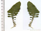
Field identification: Brassicaceae, but likely Arabis pycnocarpa.
Plants of Jefferson County Open Space Jefferson County, Colorado
Brassicaceae
Arabis pycnocarpa M. Hopkins.
Cream Flower Rockcress.
Ranson/Edwards Homestead Open Space Park, Jefferson County, Colorado.
1.7 miles west on CO Highway 72 from CO Highway 93, then 1.4 miles generally north on Plainview Road, then about 570 m. northeast past the old homestead, about 15.9 km. north of the GNIS location of Golden.
39.8964°N, 105.2586°W.
WGS 1984
Elev. 1924 m.
Perennial, simple hairs, fls. white, fr. silique, basal lvs. present at anthesis.
Along a low ridge that is a little drier and rockier than surrounding grass land; moss growing on bare soil.
This is apparently the only name that remains in Arabis in Colorado.
Collected by permit: Jefferson County Open Space, 2018, issued: Mar 1, 2018, to: Tom Schweich.
Tom Schweich
1836.
17-May-2018
Coll. No. 1836, 17 May 2018, characters observed:
Perennial terrestrial herb,
to 25 cm. tall,
hairs simple proximally;
Roots,
tap;
Stem,
erect,
leafy;
Leaves,
basal and cauline,
basal,
simple,
petiole 12 mm.
+ blade 10 mm. × 8 mm. wide,
margin entire, ciliate,
tip obtuse;
cauline,
sessile,
basally lobed,
22 mm × 6 mm. wide,
lanceolate,
margin 1-3 dentate;
Flowers,
radial;
Sepals,
#4,
rows, 1,
2 mm. × 1 mm. wide,
ovate,
green,
glabrous;
Petals,
3.7 mm. × 0.9 mm. wide,
obovate,
margin,
entire,
color,
white;
Stamens,
#6,
3.5 & 3.8 mm.;
Anthers,
0.7 mm.,
ovate;
Ovary,
3 mm.;
Stigma,
capitate;
Fruit,
pedicels,
6 mm.,
fruit,
40 mm. × 1 mm. wide,
appressed,
glabrous.
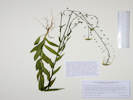
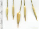
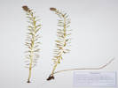
Fruit of Coll. No. 1837, Lomatium orientale Inflorescence of Coll. No. 1837, Lomatium orientale Coll. No. 1837, Lomatium orientale
Ranson/Edwards Homestead Open Space Park, Jefferson County, Colorado.
1.7 miles west on CO Highway 72 from CO Highway 93, then 1.4 miles generally north on Plainview Road, then about 567 m. northeast past the old homestead, about 15.9 km. north of the GNIS location of Golden.
39.8963°N, 105.2585°W.
WGS 1984
Elev. 1923 m.
Along a low ridge that is a little drier and rockier than surrounding grass land; moss growing on bare soil.
Collected by permit: Jefferson County Open Space, 2018, issued: Mar 1, 2018, to: Tom Schweich.
Tom Schweich
1837.
17-May-2018
Coll. No. 1837, 17 May 2018, characters observed:
Perennial, to 20 cm.,
woody taproot;
Leaves,
compound,
pinnate,
75 mm. × 26 mm. wide,
ultimate divisions,
≤3 mm.,
≤1 mm. wide,
villous,
tips,
obtuse,
(with a very small white “spine”);
Inflorescence,
compound umbel;
Involucel Bracts, glabrous;
Flowers,
white;
Anthers,
red;
Ovary,
glabrous,
stylopodium, absent;
Fruit,
5 mm. × 3.5 mm. wide,
ovate,
glabrous,
dorsally compressed,
lateral ribs winged.
Ranson/Edwards Homestead Open Space Park, Jefferson County, Colorado.
1.7 miles west on CO Highway 72 from CO Highway 93, then 1.4 miles generally north on Plainview Road, then about 567 m. northeast past the old homestead, about 15.9 km. north of the GNIS location of Golden.
39.8964°N, 105.2586°W.
WGS 1984
Elev. 1922 m.
Along a low ridge that is a little drier and rockier than surrounding grass land; moss growing on bare soil.
Collected by permit: Jefferson County Open Space, 2018, issued: Mar 1, 2018, to: Tom Schweich.
Tom Schweich
1838.
17-May-2018
Other articles: • Golden Checklist Flora:
Boechera fendleri; Habitat of Coll. No. 1839, Boechera fendleri
Ranson/Edwards Homestead Open Space Park, Jefferson County, Colorado.
1.7 miles west on CO Highway 72 from CO Highway 93, then 1.4 miles generally north on Plainview Road, then about 700 m. northeast past the old homestead, about 15.9 km. north of the GNIS location of Golden.
39.897°N, 105.2572°W.
WGS 1984
Elev. 1918 m.
Along a low ridge that is a little drier and rockier than surrounding grass land; moss growing on bare soil.
Collected by permit: Jefferson County Open Space, 2018, issued: Mar 1, 2018, to: Tom Schweich.
Plants of Jefferson County Open Space Jefferson County, Colorado
Gentianaceae
Frasera speciosa Griseb.
Elkweed.
Ranson/Edwards Homestead Open Space Park, Jefferson County, Colorado.
1.7 miles west on CO Highway 72 from CO Highway 93, then 1.4 miles generally north on Plainview Road, then about 950 m. northeast past the old homestead to the northeast corner of the open space; about 16.3 km. north of the GNIS location of Golden.
39.8992°N, 105.256°W.
WGS 1984
Elev. 1905 m.
The larger leaves are basal, while the smaller leaves are cauline.
Limited plant parts collected, only one plant in bloom in this foothill prairie location.
Collected by permit: Jefferson County Open Space, 2018, issued: Mar 1, 2018, to: Tom Schweich.
Plants of Jefferson County Open Space Jefferson County, Colorado
Polygonaceae
Rumex acetosella L.
Sorrel.
Ranson/Edwards Homestead Open Space Park, Jefferson County, Colorado.
1.7 miles west on CO Highway 72 from CO Highway 93, then 1.4 miles generally north on Plainview Road, then about 800 m. northeast past the old homestead to the northeast corner of the open space; about 16 km. north of the GNIS location of Golden.
39.897°N, 105.2555°W.
WGS 1984
Elev. 1911 m.
Beside an old ranch road near the eastern boundary fence.
Collected by permit: Jefferson County Open Space, 2018, issued: Mar 1, 2018, to: Tom Schweich.
Tom Schweich
1841.
17-May-2018
Coll. No. 1841, 17 May 2018, characters observed:
Perennial herb from woody rootstock, to 30 cm.,
dioecious (all plants in this collection staminate);
Leaves,
basal and cauline similar,
ocrea, 7-10 mm.,
petiole 20 mm. +
blade 12-24 mm. × 6 mm. wide,
base hastate, lobes pointing outward,
tip acuminate;
Pedicels,
1-3 mm.;
Flowers,
bulbar-like base,
described as stipe-like,
but does not look stipe-like such as
that seen in Eriogonum umbellatum;
Pedicels,
1-3 mm.;
Tepals,
#6,
1.7 mm.,
reddish.
Plants of Jefferson County Open Space Jefferson County, Colorado
Juncaceae
Juncus interior Wiegand.
Inland Rush.
Ranson/Edwards Homestead Open Space Park, Jefferson County, Colorado.
1.7 miles west on CO Highway 72 from CO Highway 93, then 1.4 miles generally north on Plainview Road, then about 800 m. northeast past the old homestead to the northeast corner of the open space; about 16 km. north of the GNIS location of Golden.
39.897°N, 105.2555°W.
WGS 1984
Elev. 1910 m.
Beside an old ranch road near the eastern boundary fence.
Collected by permit: Jefferson County Open Space, 2018, issued: Mar 1, 2018, to: Tom Schweich.
Plants of Jefferson County Open Space Jefferson County, Colorado
Grossulariaceae
Ribes cereum Douglas.
Wax Currant.
Ranson/Edwards Homestead Open Space Park, Jefferson County, Colorado.
1.7 miles west on CO Highway 72 from CO Highway 93, then 1.4 miles generally north on Plainview Road, then about 660 m. east northeast; about 15.7 km. north of the GNIS location of Golden.
39.8948°N, 105.2555°W.
WGS 1984
Elev. 1910 m.
Along the eastern boundary fence.
Collected by permit: Jefferson County Open Space, 2018, issued: Mar 1, 2018, to: Tom Schweich.
Field identification: Descurainia incisa, but a field trip attendee thought Sisymbrium.
Descurainia keys in Ackerfield's (2015) Key 1 (Plants with branched, forked, stellate, or dolabriform hairs), whereas Sisymbrium keys in Key 3 (Plants glabrous or with simple hairs; leaves with a sagittate or auriculate base).
Native and Naturalized Flora of the Golden Area, Jefferson County, Colorado
Brassicaceae
Sisymbrium altissimum L.
Tall Tumblemustard.
North Washington Open Space, Jefferson County, Colorado.
Small (4 acre) fallow city-owned parcel in northern Golden, near the intersection of Colorado Highway 93 and Washington Avenue, 1.73 km. north northeast of the GNIS location of Golden.
39.7689°N, 105.2316°W.
WGS 1984
Elev. 1791 m.
In the formerly mowed area, along the northeast side.
Collected by permit: City of Golden, 2018, issued: Feb 23, 2018, to: Tom Schweich.
Tom Schweich
1845.
18-May-2018
Coll. No. 1845, 18 May 2018, characters observed:
Annual terrestrial herb,
to 50 mm.;
Roots,
tap;
Stem,
erect,
branched above,
leafy,
few simple hairs;
Leaves,
basal and cauline,
basal
compound,
(petiole short if at all present),
120 mm. × 28 mm. wide,
oblong,
pinnately divided,
few simple hairs on petioles, mid-ribs, and margins;
cauline,
nearly sessile,
lanceolate,
very finely pinnately divided;
Flowers,
radial;
Sepals,
#4,
rows, 1,
3.5-4.5 mm. × 0.8 mm. wide,
small hood-shaped appendage at tip;
Petals,
7 mm. × 1.5 mm. wide,
margin, entire,
color, yellow;
Stamens,
tetradynamous,
3.6, 5.2 mm.;
Filaments,
plain;
Anthers,
2 mm.;
Stigma,
(weakly) 2-lobed;
Fruit,
17 mm. × 0.5 mm. wide,
ascending,
glabrous.
Native and Naturalized Flora of the Golden Area, Jefferson County, Colorado
Brassicaceae
Thlaspi arvense L.
Field Penny Cress.
North Washington Open Space, Jefferson County, Colorado.
Small (4 acre) fallow city-owned parcel in northern Golden, near the intersection of Colorado Highway 93 and Washington Avenue, 1.73 km. north northeast of the GNIS location of Golden.
39.7689°N, 105.2324°W.
WGS 1984
Elev. 1814 m.
Along the north fence.
Collected by permit: City of Golden, 2018, issued: Feb 23, 2018, to: Tom Schweich.
Native and Naturalized Flora of the Golden Area, Jefferson County, Colorado
Asteraceae
Senecio integerrimus Nutt.
Columbia Ragwort.
North Washington Open Space, Jefferson County, Colorado.
Small (4 acre) fallow city-owned parcel in northern Golden, near the intersection of Colorado Highway 93 and Washington Avenue, 1.73 km. north northeast of the GNIS location of Golden.
39.7687°N, 105.2325°W.
WGS 1984
Elev. 1813 m.
Just a few plants on the eastern slope, in dense smooth brome.
Collected by permit: City of Golden, 2018, issued: Feb 23, 2018, to: Tom Schweich.
Native and Naturalized Flora of the Golden Area, Jefferson County, Colorado
Fabaceae
Astragalus agrestis Douglas ex G. Don.
Purple Milkvetch.
North Washington Open Space, Jefferson County, Colorado.
Small (4 acre) fallow city-owned parcel in northern Golden, near the intersection of Colorado Highway 93 and Washington Avenue, 1.73 km. north northeast of the GNIS location of Golden.
39.7687°N, 105.2325°W.
WGS 1984
Elev. 1815 m.
Just a few plants on the eastern slope, in dense smooth brome.
Collected by permit: City of Golden, 2018, issued: Feb 23, 2018, to: Tom Schweich.
Native and Naturalized Flora of the Golden Area, Jefferson County, Colorado
Fabaceae
Astragalus agrestis Douglas ex G. Don.
Purple Milkvetch.
North Washington Open Space, Jefferson County, Colorado.
Small (4 acre) fallow city-owned parcel in northern Golden, near the intersection of Colorado Highway 93 and Washington Avenue, 1.73 km. north northeast of the GNIS location of Golden.
39.7686°N, 105.2325°W.
WGS 1984
Elev. 1814 m.
Upper eastern slope, above the thickest infestation of smooth brome, near social trail.
Collected by permit: City of Golden, 2018, issued: Feb 23, 2018, to: Tom Schweich.
Field identification: grass, fine light-green ring forming perennial bunch grass.
Native and Naturalized Flora of the Golden Area, Jefferson County, Colorado
Poaceae
Festuca saximontana Rydb.
Rocky Mountain Fescue.
North Washington Open Space, Jefferson County, Colorado.
Small (4 acre) fallow city-owned parcel in northern Golden, near the intersection of Colorado Highway 93 and Washington Avenue, 1.74 km. north northeast of the GNIS location of Golden.
39.7685°N, 105.2325°W.
WGS 1984
Elev. 1817 m.
Fine light-green perennial bunch grass beside trail, just east of crest of hill.
Not really native to Golden; probably a grass used in revegetation project.
Collected by permit: City of Golden, 2018, issued: Feb 23, 2018, to: Tom Schweich.
North Washington Open Space, Jefferson County, Colorado.
Top of hill, beside social trail. Small (4 acre) fallow city-owned parcel in northern Golden, near the intersection of Colorado Highway 93 and Washington Avenue, 1.75 km. northwest of the GNIS location of Golden.
39.7686°N, 105.2328°W.
WGS 1984
Elev. 1821 m.
Only one plant found in this parcel, so far.
Collected by permit: City of Golden, 2018, issued: Feb 23, 2018, to: Tom Schweich.
Tom Schweich
1851.
18-May-2018
Coll. No. 1851, 18 May 2018, characters observed:
Perennial herb, to 15 cm.,
Leaves,
compound,
stipules free,
petiole, 15 mm.,
blade,
85 mm. × 22 mm. wide,
leaflets,
#23,
11 mm. × 3.5 mm. wide,
terminal leaflet, not a tendril,
hairs, simple, appressed, straight,
Calyx,
tube 8 mm. + lobes 3 mm.,
hairs, simple, some light and some dark,
Flower,
zygomorphic,
white to blue,
banner, 24 mm., glabrous,
wings,
claw, 10 mm.,
blade, 10 mm.,
keel,
20 mm.,
tip, obtuse;
Style,
persistent,
8 mm.;
Fruit,
17 mm. × 7.3 mm. wide,
oblong,
glabrous.
Coll. No. 1852, Vulpia octoflora Coll. No. 1852, A little annual Vulpia octoflora
Field identification: grass. Very small, annual, not Buffalo grass.
Native and Naturalized Flora of the Golden Area, Jefferson County, Colorado
Poaceae
Vulpia octoflora (Walt.) Rydb.
Six Weeks Fescue.
North Washington Open Space, Jefferson County, Colorado.
Top of hill, beside social trail. Small (4 acre) fallow city-owned parcel in northern Golden, near the intersection of Colorado Highway 93 and Washington Avenue, 1.75 km. northwest of the GNIS location of Golden.
39.7685°N, 105.2328°W.
WGS 1984
Elev. 1819 m.
Very small grass.
Collected by permit: City of Golden, 2018, issued: Feb 23, 2018, to: Tom Schweich.
Tom Schweich
1852.
18-May-2018
Coll. No. 1852, 18 May 2018, characters observed:
Annual,
5-6 cm.,
tufted;
Roots,
fibrous;
Sheath,
6 mm.,
open,
minutely hairy;
Ligule,
membraneous,
very short;
Blade,
4.5 mm. × 0.3 mm. wide,
rolled,
glabrous;
Inflorescence,
1 per culm,
>leaves,
raceme,
16 mm. × 5 mm. wide;
Spikelets,
#6,
6-7 mm.,
similar,
1 / node,
many flowered;
Compression,
lateral;
Disarticulation,
between florets;
Glumes,
lower,
2 mm.,
vein, #1,
upper,
3 mm.,
veins, #3,
keeled,
awns, #0;
Florets,
#5-6 per spikelets;
Axis,
short hairy abaxially;
Lemma,
3.2 mm,
>glumes,
lanceolate,
green,
rolled,
hairs, 0.2 mm., white/straw color,
veins, #3, glabrous,
tip entire,
awns, #1, 1.8 mm., straight,
attached to end;
Palea,
2.7 mm.,
<lemma,
membraneous,
margin ciliate;
keeled.
Field identification: grass. Revegetation bunch grass.
Native and Naturalized Flora of the Golden Area, Jefferson County, Colorado
Poaceae
Festuca saximontana Rydb.
Rocky Mountain Fescue.
North Washington Open Space, Jefferson County, Colorado.
Top of hill, beside social trail. Small (4 acre) fallow city-owned parcel in northern Golden, near the intersection of Colorado Highway 93 and Washington Avenue, 1.75 km. northwest of the GNIS location of Golden.
39.7688°N, 105.2337°W.
WGS 1984
Elev. 1817 m.
Revegetation bunch grass.
Collected by permit: City of Golden, 2018, issued: Feb 23, 2018, to: Tom Schweich.
Tom Schweich
1853.
18-May-2018
Coll. No. 1853, 18 May 2018, characters observed:
Perennial grass, to 60 cm., tufted;
Leaves,
mostly basal,
cauline leaves on flowering culms;
Sheath,
75 mm.,
open,
minutely scabrous;
Blade,
70 mm. × 1 mm. wide,
rolled,
minutely scabrous;
Inflorescence,
1 per culm,
>leaves,
panicle,
115 mm. × 8 mm. wide,
2-3 branches, 2.5 mm.;
Rachis,
finely scabrous;
Spikelets,
many,
similar,
9 mm. × 2 mm. wide,
1 per node;
Compression,
unremarkable;
Disarticulation,
unknown;
Glumes,
lower,
3 mm.,
veins, #1,
upper,
4 mm.,
veins, #3,
awns, #0,
margins, entire;
Florets,
4(5) per spikelet;
Axis,
few short hairs;
Lemma,
4.5 mm.,
>glumes,
lanceolate,
membraneous,
veins, #5,
parallel,
margin, chartaceous,
tip, entire, acute,
awns, #1, 2.5 mm., straight,
attached,
end (remove palea before making this determination),
Palea,
4 mm.,
<lemma,
membraneous,
glabrous,
tip, 2-forked;
Anthers,
1.5 mm.
Placed in F. saximontana per the short anthers.
This is one of several collections from
North Washington Open Space
that will key out as either
F. idahoensis or F. saximontana,
neither of which are really native to Golden.
This was likely planted as part of a revegetation project.
In fact, one voucher of this collection will contain
remnants of the plastic netting commonly used in such projects.
Field identification: Poa sp., probably P. pratensis
Native and Naturalized Flora of the Golden Area, Jefferson County, Colorado
Poaceae
Poa pratensis L.
Kentucky Bluegrass.
North Washington Open Space, Jefferson County, Colorado.
Top of hill, beside social trail. Small (4 acre) fallow city-owned parcel in northern Golden, near the intersection of Colorado Highway 93 and Washington Avenue, 1.75 km. northwest of the GNIS location of Golden.
39.7687°N, 105.233°W.
WGS 1984
Elev. 1817 m.
Collected by permit: City of Golden, 2018, issued: Feb 23, 2018, to: Tom Schweich.
Tom Schweich
1854.
18-May-2018
Coll. No. 1854, 18 May 2018, characters observed:
Perennial, to 60 cm.,
1 of 3 plants collected has a rhizome;
Roots,
fibrous;
Stem,
herbaceous;
Internodes,
hollow;
Sheath,
90 mm.,
open;
Ligule,
membraneous;
Blade,
45 mm. × 2.5 mm. wide,
flat,
scabrous;
Inflorescence,
1 per culm,
>leaves,
panicle,
85 mm. × 10 mm. wide,
4 branches per node;
Spikelets,
many,
similar,
1 per node,
4 mm. × 1.2 mm. wide;
Compression,
lateral;
Glumes,
lower,
2 mm.,
veins, #1,
upper,
2.7 mm.,
veins, #3,
awns, #0;
Florets,
2 per spikelet;
Callus,
hairs,
½ length of lemma,
cobwebby;
Lemma,
2.5 mm.,
>glumes,
ovate,
membraneous,
keeled,
hairy,
veins, #3,
tip, entire,
awns, #0;
Palea,
2 mm.,
green on veins,
glabrous;
Anthers,
1.2 mm.
Field identification: Koeleria macrantha, determination tentative. — Yikes!!
Native and Naturalized Flora of the Golden Area, Jefferson County, Colorado
Poaceae
Poa secunda J. Presl ssp. secunda.
Sandberg Bluegrass..
North Washington Open Space, Jefferson County, Colorado.
Top of hill, near social trail. Small (4 acre) fallow city-owned parcel in northern Golden, near the intersection of Colorado Highway 93 and Washington Avenue, 1.75 km. northwest of the GNIS location of Golden.
39.7686°N, 105.233°W.
WGS 1984
Elev. 1816 m.
Collected by permit: City of Golden, 2018, issued: Feb 23, 2018, to: Tom Schweich.
Tom Schweich
1855.
18-May-2018
Coll. No. 1855, 18 May 2018, characters observed:
Perennial, to 50 cm.,
not rhizomatous;
Internodes,
hollow,
glabrous;
Sheath,
60 mm.,
open;
Ligule,
membranous,
4 mm.,
auricles, 0.2-0.3 mm.;
Blade,
20-37 mm. × 2 mm. to 1 mm. wide,
flat,
tip folded and fused (prow-shaped),
mid-rib and margins sparsely scabrous;
Inflorescence,
1 per culm,
>leaves,
panicle,
80 mm. × 11 mm. wide,
1-5 branches, 3-7 mm.,
spikelets,
many;
Rachis,
sparsely scabrous,
nodes yellowish;
Spikelets,
many,
similar,
1 per node,
5-6.2 mm. × 1.5-2 mm. wide,
2-many flowered;
Compression,
unremarkable;
Glumes,
lower,
2.5 mm.,
veins, #3,
upper,
3.2 mm.,
veins, #3,
awns, #0;
Florets,
3 per spikelet,
fertile;
Axis,
sparsely hairy;
Lemma,
3.5 mm.,
±=glumes,
lanceolate,
membranous,
rounded proximal ½ to weakly keeled above,
wavy hairy (to 0.5 mm.) proximally, not cobwebby,
color, green,
veins, #5, ±parallel,
tip, entire, obtuse,
awns, #0;
Palea,
3.2 mm.,
±lemma,
membranous,
glabrous,
greenish at base and margins,
Anthers,
1.3 mm.
North Washington Open Space, Jefferson County, Colorado.
Top of hill, near social trail. Small (4 acre) fallow city-owned parcel in northern Golden, near the intersection of Colorado Highway 93 and Washington Avenue, 1.75 km. northwest of the GNIS location of Golden.
39.7686°N, 105.233°W.
WGS 1984
Elev. 1816 m.
Collected by permit: City of Golden, 2018, issued: Feb 23, 2018, to: Tom Schweich.
Tom Schweich
1856.
18-May-2018
Locations: Tin Cup Ridge.
Escobaria missouriensis at Tin Cup Ridge.
The new boxes on the Bachman Ranch stand out.
Plants of Jefferson County Open Space Jefferson County, Colorado
Fabaceae
Vicia americana Willd. var. minor Hook.
American Vetch.
Tin Cup Ridge, Jefferson County, Colorado.
Lowest east slopes of Tin Cup Ridge, the northward extension of Dinosaur Ridge into Golden, 4.73 km. south southeast of the GNIS location of Golden.
39.7148°N, 105.2047°W.
WGS 1984
Elev. 1858 m.
Tendrils variously forked and not, racemes 3-4 flowered.
Collected by permit: Jefferson County Open Space, 2018, issued: Mar 1, 2018, to: Tom Schweich.
Tom Schweich
1857.
23-May-2018
Coll. No. 1857, 23 May 2018, characters observed:
Perennial herb,
to 30 cm.,
sprawling;
Stem,
not winged,
hairs, simple, basifixed;
Leaves,
compound,
stipules, free,
7 mm. × 3.5 mm. wide,
leaflets,
#10,
22 mm. × 3.7 mm. wide,
oblong,
terminal leaflet, a tendril, variously forked or not,
hairs, simple, basifixed;
Inflorescence,
raceme,
3-4 flowers,
pedicels 22-28 mm.;
Calyx,
tube 4-5 mm. + lobes 2 mm.,
longer abaxially,
simple basifixed hairs;
Flower,
zygomorphic,
banner,
18 mm.,
reflexed at middle,
back glabrous,
blade, 17 mm.,
keel,
13 mm.,
tip obtuse;
Stigma,
round,
ring of hairs below stigma.
Button-like caudex of Coll. No. 1858, Senecio integerrimus
Plants of Jefferson County Open Space Jefferson County, Colorado
Asteraceae
Senecio integerrimus Nutt.
Columbia Ragwort.
Tin Cup Ridge, Jefferson County, Colorado.
Lower east slopes of Tin Cup Ridge, the northward extension of Dinosaur Ridge into Golden, 4.77 km. south southeast of the GNIS location of Golden. Open grassland.
39.7144°N, 105.2048°W.
WGS 1984
Elev. 1889 m.
Collected by permit: Jefferson County Open Space, 2018, issued: Mar 1, 2018, to: Tom Schweich.
Plants of Jefferson County Open Space Jefferson County, Colorado
Caryophyllaceae
Cerastium arvense L. ssp. strictum Gaudin.
Field Chickweed.
Tin Cup Ridge, Jefferson County, Colorado.
Lower east slopes of Tin Cup Ridge, the northward extension of Dinosaur Ridge into Golden, 4.80 km. south southeast of the GNIS location of Golden.
39.7142°N, 105.2046°W.
WGS 1984
Elev. 1892 m.
Among grasses on the edge of the brush.
Collected by permit: Jefferson County Open Space, 2018, issued: Mar 1, 2018, to: Tom Schweich.
Plants of Jefferson County Open Space Jefferson County, Colorado
Poaceae
Bromus tectorum L.
Cheat Grass.
Tin Cup Ridge, Jefferson County, Colorado.
Lower east slopes of Tin Cup Ridge, the northward extension of Dinosaur Ridge into Golden, 4.80 km. south southeast of the GNIS location of Golden.
39.7141°N, 105.2045°W.
WGS 1984
Elev. 1891 m.
Grasses in an opening in the brush.
Collected by permit: Jefferson County Open Space, 2018, issued: Mar 1, 2018, to: Tom Schweich.
Plants of Jefferson County Open Space Jefferson County, Colorado
Anacardiaceae
Rhus trilobata Nutt. var. trilobata.
Skunkbush Sumac.
Tin Cup Ridge, Jefferson County, Colorado.
Lower east slopes of Tin Cup Ridge, the northward extension of Dinosaur Ridge into Golden, 4.80 km. south southeast of the GNIS location of Golden.
39.7141°N, 105.2045°W.
WGS 1984
Elev. 1892 m.
Collected by permit: Jefferson County Open Space, 2018, issued: Mar 1, 2018, to: Tom Schweich.
Plants of Jefferson County Open Space Jefferson County, Colorado
Boraginaceae
Lithospermum incisum Lehm.
Narrowleaf Stoneseed.
Tin Cup Ridge, Jefferson County, Colorado.
Lower east slopes of Tin Cup Ridge, the northward extension of Dinosaur Ridge into Golden, 4.83 km. south southeast of the GNIS location of Golden.
39.714°N, 105.2046°W.
WGS 1984
Elev. 1894 m.
Collected by permit: Jefferson County Open Space, 2018, issued: Mar 1, 2018, to: Tom Schweich.
Plants of Jefferson County Open Space Jefferson County, Colorado
Asteraceae
Tragopogon dubius Scop.
Yellow Salsify.
Tin Cup Ridge, Jefferson County, Colorado.
Lower east slopes of Tin Cup Ridge, the northward extension of Dinosaur Ridge into Golden, 4.83 km. south southeast of the GNIS location of Golden.
39.714°N, 105.2046°W.
WGS 1984
Elev. 1897 m.
In grasses amid shrubs.
Collected by permit: Jefferson County Open Space, 2018, issued: Mar 1, 2018, to: Tom Schweich.
Plants of Jefferson County Open Space Jefferson County, Colorado
Asparagaceae
Asparagus officinalis L.
Asparagus.
Tin Cup Ridge, Jefferson County, Colorado.
Lower east slopes of Tin Cup Ridge, the northward extension of Dinosaur Ridge into Golden, 4.83 km. south southeast of the GNIS location of Golden.
39.714°N, 105.2047°W.
WGS 1984
Elev. 1899 m.
In mixed shrubs and grasses.
Collected by permit: Jefferson County Open Space, 2018, issued: Mar 1, 2018, to: Tom Schweich.
Plants of Jefferson County Open Space Jefferson County, Colorado
Orobanchaceae
Castilleja integra A. Gray.
Wholeleaf Indian Paintbrush.
Tin Cup Ridge, Jefferson County, Colorado.
Lower east slopes of Tin Cup Ridge, the northward extension of Dinosaur Ridge into Golden, 4.83 km. south southeast of the GNIS location of Golden.
39.714°N, 105.2047°W.
WGS 1984
Elev. 1899 m.
In mixed grasses and shrubs.
Collected by permit: Jefferson County Open Space, 2018, issued: Mar 1, 2018, to: Tom Schweich.
Plants of Jefferson County Open Space Jefferson County, Colorado
Onagraceae
Oenothera suffrutescens (Ser.) W. L. Wagner & Hoch.
Linda Tarde.
Tin Cup Ridge, Jefferson County, Colorado.
Lower east slopes of Tin Cup Ridge, the northward extension of Dinosaur Ridge into Golden, 4.83 km. south southeast of the GNIS location of Golden.
39.7141°N, 105.2047°W.
WGS 1984
Elev. 1893 m.
North side of small watercourse, among shrubs and some open grassland.
Collected by permit: Jefferson County Open Space, 2018, issued: Mar 1, 2018, to: Tom Schweich.
Plants of Jefferson County Open Space Jefferson County, Colorado
Grossulariaceae
Ribes cereum Douglas.
Wax Currant.
Tin Cup Ridge, Jefferson County, Colorado.
Middle east slopes of Tin Cup Ridge, the northward extension of Dinosaur Ridge into Golden, 4.83 km. south southeast of the GNIS location of Golden.
39.714°N, 105.2048°W.
WGS 1984
Elev. 1893 m.
In shrubs above the grassland.
Collected by permit: Jefferson County Open Space, 2018, issued: Mar 1, 2018, to: Tom Schweich.
Plants of Jefferson County Open Space Jefferson County, Colorado
Rosaceae
Prunus virginiana L.
Chokecherry.
Tin Cup Ridge, Jefferson County, Colorado.
Middle east slopes of Tin Cup Ridge, the northward extension of Dinosaur Ridge into Golden, 4.83 km. south southeast of the GNIS location of Golden.
39.714°N, 105.2048°W.
WGS 1984
Elev. 1893 m.
Base of steepest slopes.
Collected by permit: Jefferson County Open Space, 2018, issued: Mar 1, 2018, to: Tom Schweich.
Plants of Jefferson County Open Space Jefferson County, Colorado
Boraginaceae
Lappula occidentalis (S. Watson) Greene var. cupulata (A. Gray) Higgins.
(Syn: Lappula redowskii (Hornem.) Greene var. cupulata (A. Gray) M. E. Jones)
fide Ackerfield (2015).
Crowned Stickseed.
Tin Cup Ridge, Jefferson County, Colorado.
Middle east slopes of Tin Cup Ridge, the northward extension of Dinosaur Ridge into Golden, 4.65 km. south southeast of the GNIS location of Golden.
39.7153°N, 105.2061°W.
WGS 1984
Elev. 1898 m.
On the bank of a ditch cut on contour of the slope.
Collected by permit: Jefferson County Open Space, 2018, issued: Mar 1, 2018, to: Tom Schweich.
Plants of Jefferson County Open Space Jefferson County, Colorado
Boraginaceae
Cynoglossum officinale L.
Gypsyflower.
Tin Cup Ridge, Jefferson County, Colorado.
Near the top of Tin Cup Ridge, the northward extension of Dinosaur Ridge into Golden,4.57 km. south southeast of the GNIS location of Golden.
39.7159°N, 105.2065°W.
WGS 1984
Elev. 1904 m.
Among trees and shrubs.
Colorado Noxious Weed List B.
Collected by permit: Jefferson County Open Space, 2018, issued: Mar 1, 2018, to: Tom Schweich.
Plants of Jefferson County Open Space Jefferson County, Colorado
Asteraceae
Arnica fulgens Pursh.
Foothill Arnica.
Tin Cup Ridge, Jefferson County, Colorado.
Near the top of Tin Cup Ridge, the northward extension of Dinosaur Ridge into Golden,4.57 km. south southeast of the GNIS location of Golden.
39.716°N, 105.2065°W.
WGS 1984
Elev. 1903 m.
Amid trees and shrubs, east exposure.
Collected by permit: Jefferson County Open Space, 2018, issued: Mar 1, 2018, to: Tom Schweich.
Plants of Jefferson County Open Space Jefferson County, Colorado
Brassicaceae
Arabis pycnocarpa M. Hopkins.
Cream Flower Rockcress.
Tin Cup Ridge, Jefferson County, Colorado.
Near the top of Tin Cup Ridge, the northward extension of Dinosaur Ridge into Golden,4.57 km. south southeast of the GNIS location of Golden.
39.7159°N, 105.2066°W.
WGS 1984
Elev. 1904 m.
In open areas among brush and trees.
Collected by permit: Jefferson County Open Space, 2018, issued: Mar 1, 2018, to: Tom Schweich.
Tom Schweich
1872.
23-May-2018
Coll. No. 1872, 23 May 2018, characters observed:
Annual or short-lived Perennial,
terrestrial herb,
to 60 cm. tall;
Stem,
erect,
leafy,
proximal hairs simple,
distal glabrous;
Leaves,
basal and cauline,
basal,
simple,
petiole, 10 mm., indistinct,
blade 45 mm. × 10 mm. wide,
oblanceolate,
pinnately toothed,
hairs, forked, not dolabriform,
cauline,
sessile,
basally lobed,
lanceolate,
proximal leaves have a mix of simple and forked hairs,
mid- to distal-leaves are glabrous,
margin, entire;
Inflorescence,
raceme,
65 mm. × 15 mm. wide,
not bracted, not secund;
Flowers,
radial;
Pedicels,
3 mm.;
Sepals,
#4,
rows 1,
4.2 mm. × 1.2 mm. wide,
lanceolate,
chartaceous,
glabrous;
Petals,
5 mm. × 1 mm. wide,
somewhat spoon-shaped,
margin entire,
color, white to cream;
Stamens,
#6,
5.2 mm.;
Filaments,
plain;
Anthers,
1 mm.,
exserted;
Ovary,
5 mm. × 0.7 mm. wide;
Stigma,
capitate,
0.6 mm. wide,
±= width of ovary base (Welsh, 1993);
Fruit,
pedicels,
6 mm.,
ascending, nearly appressed,
glabrous;
mature,
12-16 mm. × 0.8 mm. wide,
ascending, nearly appressed,
not inflated,
glabrous.
Tin Cup Ridge, Jefferson County, Colorado.
Near the top of Tin Cup Ridge, the northward extension of Dinosaur Ridge into Golden,4.50 km. south southeast of the GNIS location of Golden.
39.7165°N, 105.2067°W.
WGS 1984
Elev. 1895 m.
Five plants, several old flower stalks.
In a collapsed mined out vein.
Collected by permit: Jefferson County Open Space, 2018, issued: Mar 1, 2018, to: Tom Schweich.
Tom Schweich
1873.
23-May-2018
Other articles: • Tin Cup Ridge (social trail):
on trail; Camping supplies stashed on Tin Cup Ridge.
Cache of camping supplies on Tin Cup Ridge.
Other articles: • Golden Checklist Flora:
Lepidium draba; Coll. No. 1874, Lepidium draba Fruit of Coll. No. 1874, Lepidium draba
Plants of Jefferson County Open Space Jefferson County, Colorado
Brassicaceae
Lepidium draba L.
White Top.
Tin Cup Ridge, Jefferson County, Colorado.
Lowest slopes of Tin Cup Ridge, the northward extension of Dinosaur Ridge into Golden, 4.5 km. south southeast of the GNIS location of Golden.
39.7149°N, 105.2046°W.
WGS 1984
Elev. 1884 m.
At the edge of the parking lot.
Colorado Noxious Weed List B
Collected by permit: Jefferson County Open Space, 2018, issued: Mar 1, 2018, to: Tom Schweich.
Field identification: Fabaceae; best guess back in the office: Vicia villosa.
Plants of Jefferson County Open Space Jefferson County, Colorado
Fabaceae
Vicia villosa Roth.
Hairy Vetch.
North Table Mountain Park, Jefferson County, Colorado.
Smooth brome-infested grasslands on the lower northwest slope of North Table Mountain, just off North Table Loop in the direction of Ramstetter Reservoir, 3.67 km. north of the GNIS location of Golden.
39.7883°N, 105.2263°W.
WGS 1984
Elev. 1805 m.
Lax, twining on smooth brome.
Collected by permit: Jefferson County Open Space, 2018, issued: Mar 1, 2018, to: Tom Schweich.
Tom Schweich
1875.
24-May-2018
Coll. No. 1875, 24 May 2018, characters observed:
Perennial, herb,
sprawling through the smooth brome,
to 50 cm.;
Leaves,
compound,
stipules,
13 mm. × 3 mm. wide,
2-lobed,
petiole, 0,
blade,
75 mm. × 28 mm. wide,
leaflets,
#13-15,
20 mm. × 4 mm. wide,
linear-elliptic,
terminal leaflet a tendril, forked, #3-4,
hairs, straight;
Inflorescence,
raceme,
secund,
flowers,
#±20;
Calyx,
tube 3 mm. + lobes 4 mm., narrow,
hairs simple;
Flower,
zygomorphic,
white to dark blue,
banner,
16 mm.,
reflexed ¾,
wings,
14 mm.,
clawed,
dark blue,
keel,
11 mm.,
tip obtuse;
Style,
ring of hairs below stigma,
0.6 mm.;
Fruit,
(immature)
5 mm. × 0.8 mm wide,
lanceolate,
glabrous.
Other articles: • Golden Checklist Flora:
Camelina microcarpa; Coll. No. 1876, Camelina microcarpa
Plants of Jefferson County Open Space Jefferson County, Colorado
Brassicaceae
Camelina microcarpa Andrz. ex DC.
Little-Podded False Flax.
North Table Mountain Park, Jefferson County, Colorado.
Smooth brome-infested grasslands on the lower northwest slope of North Table Mountain, just off North Table Loop in the direction of Ramstetter Reservoir, 3.7 km. north of the GNIS location of Golden.
39.7885°N, 105.2268°W.
WGS 1984
Elev. 1825 m.
Collected by permit: Jefferson County Open Space, 2018, issued: Mar 1, 2018, to: Tom Schweich.
Tom Schweich
1876.
24-May-2018
Coll. No. 1876, characters observed:
Annual, terrestrial, herb, to 80 cm. tall;
Stem,
erect,
mostly single,
some branched mid-stem;
Leaves,
basal,
absent or withered,
cauline,
#20-25,
sessile,
basally lobed,
62 mm. × 10 mm. wide,
reduced above,
lanceolate,
hairs simple and forked;
Inflorescence,
to 200 mm. × 35 mm. wide,
not bracted,
not one-sided;
Flowers,
radial;
Pedicels,
8 mm.;
Sepals,
#4,
2.4 mm. × 0.8 mm. wide,
ovate,
color, green,
tip purplish,
abaxially hairy;
Petals,
4.0 mm. × 0.7 mm. wide,
oblong-spatulate,
margin, entire,
color, yellow;
Stamens,
#6,
3 mm.;
Filaments,
plain or maybe very narrowly winged;
Anthers,
0.7 mm.,
ovate;
Ovary,
1.8 mm. × 0.9 mm. wide;
Style,
0.8 mm.;
Stigma,
capitate,
0.4 mm. wide;
Fruit,
pedicels, 15 mm.,
3× than fruit,
spreading,
mature fruit,
5 mm. × 3.2 mm. wide,
somewhat flattened,
parallel to replum,
coriaceous,
short-winged,
valve mid-vein apparent but not prominent;
Seeds,
many,
1.0 mm. × 0.7 mm. wide,
angled,
papillate.
Plants of Jefferson County Open Space Jefferson County, Colorado
Primulaceae
Androsace occidentalis Pursh.
Western Rockjasmine.
North Table Mountain Park, Jefferson County, Colorado.
Smooth brome-infested grasslands on the lower northwest slope of North Table Mountain, just off North Table Loop in the direction of Ramstetter Reservoir, 3.7 km. north of the GNIS location of Golden.
39.7885°N, 105.2268°W.
WGS 1984
Elev. 1825 m.
Lowest northwest slope of North Table Mountain; small colony in Bromus inermis, Camelina microcarpa, Alyssum simplex, Linaria dalmatica, and Tragopogon dubius; only native here.
Accidently discovered when pulling Coll. No. 1876, Camelina microcarpa out of the ground.
Collected by permit: Jefferson County Open Space, 2018, issued: Mar 1, 2018, to: Tom Schweich.
Field identification: Astragalus, probably A. flexuousus.
Plants of Jefferson County Open Space Jefferson County, Colorado
Fabaceae
Astragalus flexuosus G. Don.
Flexible Milkvetch.
North Table Mountain Park, Jefferson County, Colorado.
Smooth brome-infested grasslands on the lower northwest slope of North Table Mountain, north from North Table Loop in the direction of Ramstetter Reservoir, 3.76 km. north of the GNIS location of Golden.
39.7891°N, 105.2269°W.
WGS 1984
Elev. 1820 m.
One crown with stems emerging from an area 15 cm. diameter, small magenta flowers.
Collected by permit: Jefferson County Open Space, 2018, issued: Mar 1, 2018, to: Tom Schweich.
Tom Schweich
1878.
24-May-2018
Coll. No. 1878, 24 May 2018, characters observed:
Perennial herb,
sprawling,
to 30 cm.,
appressed basifixed straight white hairs throughout,
plus black hairs in the inflorescence;
Leaves,
compound,
stipules, 4 mm., triangular, entire,
free (except possibly slightly connate on side opposite to petiole),
petioles, 6 mm.,
blade,
45 mm. × 14 mm. wide,
leaflets,
#19,
7 mm. × 2.3 mm. wide,
terminal leaflet present,
Inflorescence,
raceme;
Calyx,
tube 3 mm. + lobes 0.7 mm.;
Flower,
zygomorphic,
banner,
9 mm.,
reflexed middle,
back glabrous,
wings,
8 mm.,
keel,
6 mm.,
tip obtuse,
Fruit,
legume,
7.5 mm. × 1.2 mm. wide,
linear-lanceolate.
Field identification: Erigeron, probably E. tracyi.
Quite tall, and some buds are nodding.
Plants of Jefferson County Open Space Jefferson County, Colorado
Asteraceae
Erigeron divergens Torr. & A. Gray.
Spreading Fleabane.
North Table Mountain Park, Jefferson County, Colorado.
Smooth brome-infested grasslands on the lower northwest slope of North Table Mountain, north from North Table Loop in the direction of Ramstetter Reservoir, 3.76 km. north of the GNIS location of Golden.
39.79°N, 105.227°W.
WGS 1984
Elev. 1816 m.
Collected by permit: Jefferson County Open Space, 2018, issued: Mar 1, 2018, to: Tom Schweich.
Tom Schweich
1879.
23-May-2018
Locations: Ramstetter Creek.
Ramstetter Reservoir.
Ramstetter Reservoir seen from the dam.
North Table Mountain from the dam of Ramstetter Reservoir.
Ramstetter Reservoir
Pistillate catkin of Coll. No. 1880, Salix exigua Staminate catkin of Coll. No. 1880, Salix exigua
Ramstetter Reservoir, Jefferson County, Colorado.
Southeast shore of Ramstetter Reservoir, northwest corner of North Table Mountain Park, 4.03 km. north of the GNIS location of Golden.
39.7914°N, 105.2282°W.
WGS 1984
Elev. 1809 m.
Nearly all plants staminate.
Collected by permit: Jefferson County Open Space, 2018, issued: Mar 1, 2018, to: Tom Schweich.
Tom Schweich
1880.
24-May-2018
Coll. No. 1880, 24 May 2018, characters observed:
Perennial erect shrub, to 2 m.;
Leaves,
alternate,
21 mm. ×. 1.8 mm. wide,
11.7 ×long as wide,
abaxial villous,
adaxial mostly glabrous,
margins entire, slightly revolute;
Staminate catkins, 30 mm. × 6 mm. wide;
Pistillate catkins, 42 mm. × 4 mm. wide,
floral bract, 1.8 mm.,
capsule, 2.6 mm., glabrous.
Plants of Jefferson County Open Space Jefferson County, Colorado
Cyperaceae
Carex praegracilis W. Boott.
Clustered Field-Sedge.
Ramstetter Reservoir, Jefferson County, Colorado.
Southeast shore of Ramstetter Reservoir, northwest corner of North Table Mountain Park, 4.03 km. north of the GNIS location of Golden.
39.7911°N, 105.2289°W.
WGS 1984
Elev. 1810 m.
Collected by permit: Jefferson County Open Space, 2018, issued: Mar 1, 2018, to: Tom Schweich.
Tom Schweich
1881.
24-May-2018
Coll. No. 1881, 24 May 2018, characters observed:
Perennial,
to 40 cm.,
from rhizomes;
Rhizomes and culm bases ±black;
Culm,
ridges scabrous;
Leaves,
mostly basal or near basal,
sheath, front hyaline without veins,
ligule, 2 mm.,
blade, flat;
Spikes,
> 6 per culm,
differentiated,
androgynous;
Bract,
9 mm.,
margin chartaceous proximal ⅔;
Scales,
±clasping perigynia;
Perigynia,
2.5-2.7 mm.,
beak 1.7 mm.
This was the first collection I keyed out using Wingate, J. L., 2017. Sedges of Colorado. I like the key therein, as the detailed descriptions.
Plants of Jefferson County Open Space Jefferson County, Colorado
Plantaginaceae
Plantago patagonica Jacq.
Woolly Plantain.
North Table Mountain Park, Jefferson County, Colorado.
Lowest west slopes of North Table Mountain, between CO Highway 93 and North Table Loop, 3.53 km. north of the GNIS location of Golden.
39.7867°N, 105.2292°W.
WGS 1984
Elev. 1822 m.
Small, dry gravelly bar between two small watercourses.
Collected by permit: Jefferson County Open Space, 2018, issued: Mar 1, 2018, to: Tom Schweich.
Tom Schweich
1882.
24-May-2018
Other articles: • Golden Checklist Flora:
Sphaeralcea coccinea; Sphaeralcea coccinea (Nutt.) Rydb. On the lowest slopes of North Table Mountain.
Native and Naturalized Flora of the Golden Area, Jefferson County, Colorado
Brassicaceae
Camelina microcarpa Andrz. ex DC.
Little-Podded False Flax.
Colorado School of Mines Survey Field, Jefferson County, Colorado.
Southern part of Survey field, about half-way down northwest-facing bank of an unnamed watercourse, 2.49 km. south of the GNIS location of Golden.
39.7331°N, 105.2201°W.
WGS 1984
Elev. 1801 m.
Collected by permit: Colorado School of Mines, 2018, issued: Apr 1, 2018, to: Tom Schweich.
Native and Naturalized Flora of the Golden Area, Jefferson County, Colorado
Fabaceae
Vicia americana Willd.
American Vetch.
Colorado School of Mines Survey Field, Jefferson County, Colorado.
Southern part of Survey field, bottom of northwest-facing bank of an unnamed watercourse, 2.47 km. south of the GNIS location of Golden.
39.7333°N, 105.2203°W.
WGS 1984
Elev. 1811 m.
Variety minor if infraspecific names are to be applied.
Collected by permit: Colorado School of Mines, 2018, issued: Apr 1, 2018, to: Tom Schweich.
Native and Naturalized Flora of the Golden Area, Jefferson County, Colorado
Asteraceae
Tragopogon dubius Scop.
Yellow Salsify.
Colorado School of Mines Survey Field, Jefferson County, Colorado.
Southern part of Survey field, base of northwest-facing bank of an unnamed watercourse, 2.47 km. south of the GNIS location of Golden.
39.7333°N, 105.2202°W.
WGS 1984
Elev. 1818 m.
Collected by permit: Colorado School of Mines, 2018, issued: Apr 1, 2018, to: Tom Schweich.
Tom Schweich
1885.
28-May-2018
Other articles: • Glossary:
ament; catkin; Salix amygdaloides (Coll. No. 1886) with Cottonwood in southern Survey Fields.
Coll. No. 1886, Salix amygdaloides
Native and Naturalized Flora of the Golden Area, Jefferson County, Colorado
Salicaceae
Salix amygdaloides Andersson.
Peachleaf Willow.
Colorado School of Mines Survey Field, Jefferson County, Colorado.
Along an unnamed stream in the south end of the Survey Field, 2.47 km. south of the GNIS location of Golden.
39.7333°N, 105.2204°W.
WGS 1984
Elev. 1823 m.
In streambed with cottonwood.
Collected by permit: Colorado School of Mines, 2018, issued: Apr 1, 2018, to: Tom Schweich.
Tom Schweich
1886.
28-May-2018
Coll. No. 1886, 28 May 2018, characters observed:
Perennial tree,
Twigs,
young, dark brown;
Leaves,
alternate,
petiole,
10-12 mm.,
tuft of hairs adaxially,
glands absent at base of leaf,
blade,
80 mm. × 26 mm. wide,
3.08 × long as wide,
young leaves have slightly tangled white hairs both sides,
mature leaves, green adaxially,
glaucus abaxially,
margin,
serrate,
tip,
acuminate;
Staminate catkins (aments),
peduncle,
12 mm.,
spike,
47 mm. × 9 mm. wide,
stamens,
#4-5,
4.5 mm.;
Pistillate catkins,
absent.
Native and Naturalized Flora of the Golden Area, Jefferson County, Colorado
Brassicaceae
Turritis glabra L.
Tower Rockcress.
Colorado School of Mines Survey Field, Jefferson County, Colorado.
Southeast-facing slope, along an unnamed stream in the south end of the Survey Field, 2.44 km. south of the GNIS location of Golden.
39.7336°N, 105.2207°W.
WGS 1984
Elev. 1824 m.
Late, some have finished blooming, flowers pinkish rather than white.
Collected by permit: Colorado School of Mines, 2018, issued: Apr 1, 2018, to: Tom Schweich.
Tom Schweich
1887.
28-May-2018
Coll. No. 1887, 28 May 2018, characters observed:
Short-lived (?) perennial,
terrestrial, herb,
45 cm. to 90 cm. tall;
Roots,
tap.
Stem,
erect,
#1,
(1 of 4 specimens has 2 stems),
leafy,
proximal, simple and forked hairs,
distal, glabrous;
Leaves,
basal and cauline,
basal
simple,
petiole, 6 mm.,
blade, 60 mm. × 15 mm. wide,
oblanceolate,
hairs, simple and forked,
margin, dentate,
tip, obtuse;
cauline,
#20,
sessile,
lobed, 2.5 mm.,
40 mm. × 10 mm. wide,
lanceolate,
reduced above,
margin, entire,
becoming glabrous distally;
Inflorescence,
raceme, 70 mm. × 11 mm. wide,
not bracted,
not one-sided;
Pedicels (at anthesis),
3-4 mm.,
glabrous;
Sepals,
#4,
2.5 mm. × 1.1 mm. wide,
ovate,
green,
margin chartaceous;
Petals,
4.5 mm. × 0.7 mm. wide,
spatulate,
margin entire,
color, pinkish, fading lavender;
Fruit,
(24-) 80-85 mm. × 0.9 mm. wide,
ascending-appressed,
glabrous,
flattened,
parallel to replum,
style, base 0.4-0.5 mm. wide,
stigma, 0.8-0.9 mm. wide;
Ovules,
biseriate,
many,
0.7 mm. × 0.3 mm. wide,
tan, translucent, wing not apparent.
Native and Naturalized Flora of the Golden Area, Jefferson County, Colorado
Caryophyllaceae
Silene antirrhina L.
Sleepy Catchfly.
Colorado School of Mines Survey Field, Jefferson County, Colorado.
Southeast-facing slope, along an unnamed stream in the south end of the Survey Field, 2.44 km. south of the GNIS location of Golden.
39.7336°N, 105.2208°W.
WGS 1984
Elev. 1823 m.
Collected by permit: Colorado School of Mines, 2018, issued: Apr 1, 2018, to: Tom Schweich.
Tom Schweich
1888.
28-May-2018
Coll. No. 1888, 28 May 2018, characters observed:
Annual, to 60 cm.;
Stem,
proximal finely pubescent, distal glabrous,
distal internodes frequently glutinous
(a.k.a., “sticky band below upper leaves”);
Leaves,
basal,
withered,
cauline,
opposite,
connate proximally,
45 mm. × 8 mm. wide,
oblanceolate,
reduced above,
margin ciliate;
Inflorescence,
cymose;
Calyx,
8 mm. × 3.7 mm. fused;
Petals,
white to pink,
barely exserted from calyx,
withered and withdrawn after drying;
Styles,
#3.
Native and Naturalized Flora of the Golden Area, Jefferson County, Colorado
Poaceae
Poa pratensis L.
Kentucky Bluegrass.
Colorado School of Mines Survey Field, Jefferson County, Colorado.
Highest Great Plains at the base of the Rocky Mountain Front Range, small southeast-facing terrace, above an unnamed stream in the south end of the Survey Field, 2.42 km. south of the GNIS location of Golden.
39.7337°N, 105.2209°W.
WGS 1984
Elev. 1824 m.
Collected by permit: Colorado School of Mines, 2018, issued: Apr 1, 2018, to: Tom Schweich.
Tom Schweich
1889.
28-May-2018
Coll. No. 1889, 28 May 2018, characters observed:
Perennial grass,
to 60 cm.,
rhizomatous;
Roots,
fibrous;
Stem,
herbaceous;
Internodes,
hollow,
glabrous;
Leaves,
blade and sheath undifferentiated;
Sheath,
86 mm.,
open;
Ligule,
membranous,
1.5 mm.;
Blade,
26 mm.,
rolled,
scabrous;
Inflorescence,
1 per culm,
>leaves,
panicle,
70 mm. × 33 wide,
pyramidal,
up to 4 branches per node;
Rachis,
not extended,
glabrous;
Pedicels,
1.5 mm.,
sparsely scabrous;
Spikelets,
many,
similar,
1 per node,
2-many flowered,
4.8 mm.;
Compression,
lateral;
Disarticulation,
above the glumes;
Glumes,
lower,
2.3 mm.
vein, #1
upper,
2.6 mm.,
veins, #3,
awns, 0;
Florets,
#3 per spikelet,
fertile;
Axis,
glabrous,
extended beyond upper floret;
Lemma,
3 mm.,
>glumes,
ovate,
membranous,
keeled,
tangled hairs proximal ½
veins,
likely 5 as the 2 outer veins that are visible are quite near margins,
chartaceous,
tip, acute,
awns, 0;
Palea,
3 mm.,
±lemma,
membranous,
chartaceous,
veins, #2, green, scabrous;
Anthers,
1.6 mm.;
Stigmas,
feathery;
Crypsela,
brown.
I think I have been using chartaceous when I should have been using scarious or membranous for the thin, translucent margins of glumes and lemmas.
Literature Cited: - Barkworth, Mary, 1978. Florets of Coll. No. 1890, Hesperostipa comata
Native and Naturalized Flora of the Golden Area, Jefferson County, Colorado
Poaceae
Hesperostipa comata (Trin. & Rupr.) Barkworth.
Needle and Thread.
Colorado School of Mines Survey Field, Jefferson County, Colorado.
Highest Great Plains at the base of the Rocky Mountain Front Range, small southeast-facing terrace, above an unnamed stream in the south end of the Survey Field, 2.42 km. south of the GNIS location of Golden.
39.7338°N, 105.2211°W.
WGS 1984
Elev. 1823 m.
Probably subspecies or variety comata if any of the various infraspecific names are to be recognized.
Collected by permit: Colorado School of Mines, 2018, issued: Apr 1, 2018, to: Tom Schweich.
Tom Schweich
1890.
28-May-2018
Coll. No. 1890, 28 May 2018, characters observed:
Perennial,
50 cm.,
clumped,
nonrhizomatous;
Roots,
fibrous;
Stem,
herbaceous;
Leaves,
blade and sheath differentiated;
Sheath,
100-120 mm.,
open ≥½,
glabrous;
Ligule,
membranous,
length 3.7 mm.,
lacerate into 2 equal parts,
auricles 0;
Blade,
60 mm.,
involute,
glabrous;
Inflorescence,
1 per culm,
>leaves,
panicle,
200 mm. × 30 mm. wide;
Rachis,
not extended,
somewhat scabrous throughout;
Spikelets,
many,
similar,
borne singly;
Compression,
unremarkable;
Disarticulation,
above the glumes;
Glumes,
lower,
23 mm.,
veins #3,
upper,
23 mm.,
veins #5,
awl-shaped,
rounded,
membranous,
±equal,
tip,
very narrow, not awned;
Florets,
1 per spikelet;
Callus,
5 mm.,
sharp,
straight hairs to 1.5 mm.,
color tan;
Lemma,
9.5 mm.,
rolled,
indurate,
straight hairy 0.5 mm.,
color tan,
veins #3(?),
awns,
#1,
160 mm.,
bent,
twisted,
hairs,
short straight proximally,
scabrous distally;
Palea,
9 mm.,
±lemma,
few white hairs on mid-vein;
Stamens,
#3;
Anthers,
6.5 mm.
Native and Naturalized Flora of the Golden Area, Jefferson County, Colorado
Asteraceae
Erigeron tracyi Greene.
Running Fleabane.
Colorado School of Mines Survey Field, Jefferson County, Colorado.
Highest Great Plains at the base of the Rocky Mountain Front Range, small southeast-facing terrace, above an unnamed stream in the south end of the Survey Field, 2.42 km. south of the GNIS location of Golden.
39.7339°N, 105.2212°W.
WGS 1984
Elev. 1825 m.
Collected by permit: Colorado School of Mines, 2018, issued: Apr 1, 2018, to: Tom Schweich.
Native and Naturalized Flora of the Golden Area, Jefferson County, Colorado
Rubiaceae
Galium aparine L.
Sticky Willy, Cleavers.
Colorado School of Mines Survey Field, Jefferson County, Colorado.
Highest Great Plains at the base of the Rocky Mountain Front Range, southeast-facing slope, above an unnamed stream in the south end of the Survey Field, 2.40 km. south of the GNIS location of Golden.
39.734°N, 105.2219°W.
WGS 1984
Elev. 1829 m.
Fruit, 2 hairy berries, in a thicket of Rhus trilobata.
Collected by permit: Colorado School of Mines, 2018, issued: Apr 1, 2018, to: Tom Schweich.
Colorado School of Mines Survey Field, Jefferson County, Colorado.
Highest Great Plains at the base of the Rocky Mountain Front Range, southeast-facing slope, above an unnamed stream in the south end of the Survey Field, 2.36 km. south of the GNIS location of Golden.
39.7343°N, 105.2227°W.
WGS 1984
Elev. 1838 m.
On the edge of a small swale.
Collected by permit: Colorado School of Mines, 2018, issued: Apr 1, 2018, to: Tom Schweich.
Tom Schweich
1893.
28-May-2018
Other articles: • Golden Checklist Flora:
Crepis occidentalis; Coll. No. 1894, Crepis occidentalis Flower head of Coll. No. 1894, Crepis occidentalis
Field identification: Chicorieae, later tentatively determined as Crepis occidentalis.
Native and Naturalized Flora of the Golden Area, Jefferson County, Colorado
Asteraceae
Crepis occidentalis Nutt.
Largeflower Hawksbeard.
Colorado School of Mines Survey Field, Jefferson County, Colorado.
Highest Great Plains at the base of the Rocky Mountain Front Range, southeast-facing slope, above an unnamed stream in the south end of the Survey Field, 2.36 km. south of the GNIS location of Golden.
39.7343°N, 105.2228°W.
WGS 1984
Elev. 1837 m.
Chicorieae, phyllaries grayish, glandular.
Subspecies costata if infraspecific names are to be applied.
Collected by permit: Colorado School of Mines, 2018, issued: Apr 1, 2018, to: Tom Schweich.
Tom Schweich
1894.
28-May-2018
Coll. No. 1894, 28 May 2018, characters observed:
Perennial,
herb,
to 25 cm.,
taprooted;
Stem,
green,
tomentose,
glandular,
no bristles;
Leaves,
basal and cauline,
alternate,
petiole 20 mm. + blade 56 mm. × 17 mm. wide,
reduced distally,
pinnately lobed nearly to mid-rib,
segments deltoid,
tomentose, glandular;
Inflorescence,
heads #3 per stem,
showy,
>leaves;
Peduncles,
23 mm.;
Involucre,
12 mm. × 12 mm. wide,
cyindric,
tomentose;
Phyllaries,
2 graduated series,
3.5 mm. &tmes; 2 mm. wide,
deltoid,
12.5 mm. × 3 mm. wide,
lanceolate,
±flat,
tomentose,
gland-tipped black bristles evenly distributed;
Receptacle,
epaleate;
Ray flowers (ligules),
many,
tube 6 mm. + blade 12.5 mm. × 2.4 mm. wide,
yellow;
Pappus,
9 mm.
well-developed,
bristles,
±equal,
smooth;
Fruit,
2 mm. × 1.3 mm. wide,
brown,
glabrous.
Colorado School of Mines Survey Field, Jefferson County, Colorado.
Highest Great Plains at the base of the Rocky Mountain Front Range, southeast-facing slope, above an unnamed stream in the south end of the Survey Field, 2.36 km. south of the GNIS location of Golden.
39.7343°N, 105.2228°W.
WGS 1984
Elev. 1837 m.
In fruit.
Collected by permit: Colorado School of Mines, 2018, issued: Apr 1, 2018, to: Tom Schweich.
Native and Naturalized Flora of the Golden Area, Jefferson County, Colorado
Plantaginaceae
Linaria dalmatica (L.) Mill.
Dalmatian ToadFlax.
Colorado School of Mines Survey Field, Jefferson County, Colorado.
Highest Great Plains at the base of the Rocky Mountain Front Range, southeast-facing slope, above an unnamed stream in the south end of the Survey Field, 2.36 km. south of the GNIS location of Golden.
39.7342°N, 105.2228°W.
WGS 1984
Elev. 1842 m.
Full of aphids and bugs!
Colorado Noxious Weed List B.
Collected by permit: Colorado School of Mines, 2018, issued: Apr 1, 2018, to: Tom Schweich.
Tom Schweich
1896.
28-May-2018
Habitat of four collections in the Survey Field.
Coll. No. 1897, Senecio integerrimus in Colorado School of Mines Survey Field.
Native and Naturalized Flora of the Golden Area, Jefferson County, Colorado
Asteraceae
Senecio integerrimus Nutt.
Columbia Ragwort.
Colorado School of Mines Survey Field, Jefferson County, Colorado.
Base of the Rocky Mountain Front Range, northeast-facing slope, above an unnamed stream in the south end of the Survey Field, 2.51 km. south of the GNIS location of Golden.
39.733°N, 105.2213°W.
WGS 1984
Elev. 1830 m.
Growing in deep grasses and forbs at the base of tall shrubs.
Collected by permit: Colorado School of Mines, 2018, issued: Apr 1, 2018, to: Tom Schweich.
Native and Naturalized Flora of the Golden Area, Jefferson County, Colorado
Boraginaceae
Hydrophyllum fendleri (A. Gray) A. Heller.
Colorado School of Mines Survey Field, Jefferson County, Colorado.
Base of the Rocky Mountain Front Range, northeast-facing slope, above an unnamed stream in the south end of the Survey Field, 2.51 km. south of the GNIS location of Golden.
39.733°N, 105.2212°W.
WGS 1984
Elev. 1830 m.
Growing in deep grasses and forbs at the base of tall shrubs.
Collected by permit: Colorado School of Mines, 2018, issued: Apr 1, 2018, to: Tom Schweich.
Native and Naturalized Flora of the Golden Area, Jefferson County, Colorado
Plantaginaceae
Collinsia parviflora Lindl.
Maiden Blue-eyed Mary.
.
Colorado School of Mines Survey Field, Jefferson County, Colorado.
Base of the Rocky Mountain Front Range, northeast-facing slope, above an unnamed stream in the south end of the Survey Field, 2.51 km. south of the GNIS location of Golden.
39.733°N, 105.2212°W.
WGS 1984
Elev. 1830 m.
Growing in deep grasses and forbs at the base of tall shrubs.
Collected by permit: Colorado School of Mines, 2018, issued: Apr 1, 2018, to: Tom Schweich.
Tom Schweich
1899.
28-May-2018
Coll. No. 1899, 28 May 2018, characters observed:
Annual herb, to 23 cm.,
±minutely pubescent throughout, eglandular;
Stem,
round;
Leaves,
opposite below,
but occurring in 3s above,
14 mm. × 3.5 mm. wide,
oblanceolate,
very short petiole if at all,
generally glabrous except minute pubescence on entire margins;
Inflorescence,
indeterminant,
axillary
(or nearly entire plant inflorescence as seen in Veronica spp.);
Pedicels,
4 mm. in flower, to 21 mm. in fruit,
finely pubescent;
Calyx,
lobes, #5,
tube 2 mm. + lobes 2.5-3.0 mm.,
keeled or mid-vein prominent,
body purplish when young, fading tan,
tips, green;
Corolla, none found;
Stamens, none found;
(Possible that stamens are inserted on a corolla
that is very early deciduous.)
Ovary,
1.6 mm. × 1.4 mm. wide,
globose,
entire,
very dark brown to black;
Style,
#1, 2.5-2.7 mm.;
Stigma,
simple;
Fruit,
capsule,
5 mm. × 2 mm. wide,
entire, i.e., no notch,
obovate;
Seeds,
#3, maybe 4,
2 mm. × 1.5 mm. wide,
flattened,
dark brown.
Thank you to Richard Old and Dean Wm. Taylor who helped me identify this by way of the Plant Identification group on Facebook.
Native and Naturalized Flora of the Golden Area, Jefferson County, Colorado
Plantaginaceae
Veronica arvensis L.
Corn Speedwell.
Colorado School of Mines Survey Field, Jefferson County, Colorado.
Base of the Rocky Mountain Front Range, northeast-facing slope, above an unnamed stream in the south end of the Survey Field, 2.51 km. south of the GNIS location of Golden.
39.733°N, 105.2213°W.
WGS 1984
Elev. 1830 m.
Blue flowers, margin of fruit glandular hairy.
Growing in deep grasses and forbs at the base of tall shrubs.
Collected by permit: Colorado School of Mines, 2018, issued: Apr 1, 2018, to: Tom Schweich.
Tom Schweich
1900.
28-May-2018
Locations: Little Scraggy Peak.
Jamesia americana “Five-Petal Cliffbush” on the flanks of Little Scraggy Peak.
Little Scraggy Peak, Jefferson County, Colorado.
Northeast slopes of Little Scraggy Peak, 46.5 km. south of the GNIS location of Golden.
39.3402°N, 105.2655°W.
WGS 1984
Elev. 2403 m.
Moderate slope in Ponderosa pine forest.
Collected by permit: Pike-San Isabel National Forest, 2018, issued: May 2, 2018, to: Tom Schweich.
Tom Schweich
1901.
31-May-2018
Coll. No. 1901, 31 May 2018, characters observed:
Perennial herb, from woody caudex, 10 cm.;
Leaves,
basal,
petiole, 18-22 mm.,
5 mm. × 6 mm. wide,
ternately divided,
glandular,
straight multicellular hairy;
Inflorescence,
1 head per stem;
Peduncles,
40 mm.,
glandular,
short straight spreading hairs;
Involucre,
5 mm. × 10 mm. wide;
Phyllaries,
2+ series,
6 mm. × 1.3 mm. wide,
outer phyllaries glandular hairy,
green mid-rib and distally,
chartaceous then scarious toward margin,
tip, acute, purplish;
Receptacle,
epaleate;
Flowers,
of 2 kinds;
Ray flowers,
#25,
tube 1.8 mm. + blade 5.3 mm. × 1 mm. wide,
white,
fertile;
Disk flowers,
many,
tube 3.5 mm. + lobes 0.3 mm.,
expanding gradually,
yellow,
open;
Pappus,
well-developed,
bristles,
3.5-3.8 mm.,
±equal,
capillary;
Cypsela,
2.2 mm. × 0.6 mm. wide,
angled,
brown,
hairy.
Packera plattensis (Nuttall) W. A. Weber & Á. Löve.
Prairie Groundsel.
Little Scraggy Peak, Jefferson County, Colorado.
Buffalo Creek Recreation Area, northeast slopes of Little Scraggy Peak, 46.5 km. south of the GNIS location of Golden.
39.3392°N, 105.2656°W.
WGS 1984
Elev. 2414 m.
Collected by permit: Pike-San Isabel National Forest, 2018, issued: May 2, 2018, to: Tom Schweich.
Aliciella pinnatifida (Nutt. ex A.Gray) J.M.Porter.
Sticky Gilia.
Little Scraggy Peak, Jefferson County, Colorado.
Buffalo Creek Recreation Area, northeast slopes of Little Scraggy Peak, 46.5 km. south of the GNIS location of Golden.
39.3386°N, 105.2655°W.
WGS 1984
Elev. 2436 m.
Collected by permit: Pike-San Isabel National Forest, 2018, issued: May 2, 2018, to: Tom Schweich.
Little Scraggy Peak, Jefferson County, Colorado.
Buffalo Creek Recreation Area, northeast slopes of Little Scraggy Peak, 46.5 km. south of the GNIS location of Golden.
39.3386°N, 105.2656°W.
WGS 1984
Elev. 2440 m.
Collected by permit: Pike-San Isabel National Forest, 2018, issued: May 2, 2018, to: Tom Schweich.
Tom Schweich
1905.
31-May-2018
Coll. No. 1905, 31 May 2018, characters observed:
Perennial grass,
to 45 cm.,
not rhizomatous,
clumped;
Roots,
fibrous;
Stem,
herbaceous,
compressed;
Internodes,
hollow,
glabrous;
Leaves,
most leaves basal,
blade and sheath differentiated;
Sheath (cauline),
80 mm.,
open;
Ligule,
membranous,
1 mm.,
auricles, 0;
Blade,
10 mm.,
involute,
mid-rib and margins minutely scabrous,
tip, prow-shaped;
Inflorescence,
1 per culm,
>leaves,
panicle,
65 mm. × 10 mm. wide,
2 branches per node,
spikelets, many;
Rachis,
not extended,
finely scabrous;
Pedicels,
1-2.8 mm.;
Spikelets,
many,
similar,
borne singly,
6 mm. × 2.2 mm. wide;
Compression,
lateral;
Disarticulation,
above the glumes;
Glumes,
lower,
3 mm.,
veins, #1,
upper,
4 mm.,
veins, #5,
weakly keeled,
membranous, quite thin,
awns, #0,
margins, entire;
Florets,
4 per spikelet,
pistillate;
Axis,
sparsely scabrous,
extended above upper floret;
Lemma,
4 mm.,
>glumes,
membranous,
keeled, proximal,
color, green proximal to scarious distally,
mid-vein and lateral veins are hairy proximally,
margin, scarious,
tip, entire, obtuse,
awns, 0;
Palea,
2.5 mm.,
<lemma,
keel ciliate,
margin glabrous,
veins, green;
Crypsela,
green,
1.5 mm.
Little Scraggy Peak, Jefferson County, Colorado.
Buffalo Creek Recreation Area, northeast slopes of Little Scraggy Peak, 46.5 km. south of the GNIS location of Golden.
39.3384°N, 105.2662°W.
WGS 1984
Elev. 2434 m.
Collected by permit: Pike-San Isabel National Forest, 2018, issued: May 2, 2018, to: Tom Schweich.
Tom Schweich
1906.
31-May-2018
Coll. No. 1906, 31 May 2018, characters observed:
Perennial herb,
with spreading-ascending branches to 20 cm.;
Stem,
glabrous;
Leaves,
basal and cauline,
basal,
petiole 55 mm. + blade 50 mm. × 12.5 mm. wide,
lanceolate,
distinct lateral veins,
papillate adaxially,
margin,
entire,
appressed ciliate;
cauline,
sessile,
40 mm. × 4 mm. wide,
without distinct lateral veins,
papillate adaxially,
margin,
entire,
appressed ciliate;
Inflorescence,
panicle;
Calyx,
tube 1.5 mm. + lobes 2-3 mm.;
Corolla,
tube 4 mm. + throat 4.5 mm.,
limb 5 mm.,
deciduous,
blue,
small tufts of hairs at base of throat;
Stamens,
#5,
inserted,
attached at throat;
Filaments,
2 mm.;
Anthers,
2.3 mm.,
yellow;
Ovary,
0.7 mm. × 1.3 mm. wide,
partially fused to calyx;
Style,
7.0-7.5 mm.,
single,
±≥anthers;
Stigma,
simple;
Fruit,
#4 nutlets,
1.7 mm. × 1.5 mm. wide.
Details of the umbel of Coll. No. 1907, Androsace septentrionalis
Androsace occidentalis Pursh.
Western Rockjasmine.
Little Scraggy Peak, Jefferson County, Colorado.
Buffalo Creek Recreation Area, northeast slopes of Little Scraggy Peak, 1 km. southwest of the intersection of County Roads 126 and 550, 46.5 km. south of the GNIS location of Golden.
39.3384°N, 105.2661°W.
WGS 1984
Elev. 2436 m.
Collected by permit: Pike-San Isabel National Forest, 2018, issued: May 2, 2018, to: Tom Schweich.
Little Scraggy Peak, Jefferson County, Colorado.
Buffalo Creek Recreation Area, northeast slopes of Little Scraggy Peak, 1.05 km. southwest of the intersection of County Roads 126 and 550, 46.5 km. south of the GNIS location of Golden.
39.3384°N, 105.2661°W.
WGS 1984
Elev. 2435 m.
Same as Coll. No. 1905.
Collected by permit: Pike-San Isabel National Forest, 2018, issued: May 2, 2018, to: Tom Schweich.
Little Scraggy Peak, Jefferson County, Colorado.
Buffalo Creek Recreation Area, northeast slopes of Little Scraggy Peak, 1.05 km. southwest of the intersection of County Roads 126 and 550, 46.5 km. south of the GNIS location of Golden.
39.3384°N, 105.2662°W.
WGS 1984
Elev. 2428 m.
Collected by permit: Pike-San Isabel National Forest, 2018, issued: May 2, 2018, to: Tom Schweich.
Tom Schweich
1909.
31-May-2018
Coll. No. 1909, 31 May 2018, characters observed:
Perennial herb, to 10 cm.,
stoloniferous;
Stem,
tomentose;
Leaves,
basal and cauline,
basal,
petiole,
gradually expanding into blade,
blade,
16 mm. × 6.7 mm. wide,
oblanceolate,
entire,
glandular,
tomentose,
tips, pointed,
cauline,
10 mm. × 2 mm. wide,
linear;
Inflorescence,
heads enclosed by an involucre,
#3 per stem,
not showy;
Involucre,
7 mm. × 4.5 mm. wide,
cylindric;
Phyllaries,
5+ series,
4 mm. × 2 mm. wide to
8 mm. × 1 mm. wide,
green proximally to white (pinkish) distally,
tomentose,
margins, flat, scarious,
tips, rounded;
Receptacle,
epaleate;
Flowers,
of 1 kind;
Disk flowers,
many,
6.5 mm.,
white;
Pappus,
many,
well-developed,
bristles,
8 mm.,
±equal;
Cypsela,
0.8 mm. × 0.3 mm. wide,
brown,
glabrous.
Penstemon virens Pennell ex Rydb.
Front Range Beardtongue.
Little Scraggy Peak, Jefferson County, Colorado.
Buffalo Creek Recreation Area, northeast slopes of Little Scraggy Peak, 1.2 km. southwest of the intersection of County Roads 126 and 550, 46.7 km. south of the GNIS location of Golden.
39.3366°N, 105.2665°W.
WGS 1984
Elev. 2454 m.
Collected by permit: Pike-San Isabel National Forest, 2018, issued: May 2, 2018, to: Tom Schweich.
Tom Schweich
1910.
31-May-2018
Coll. No. 1910, 31 May 2018, characters observed:
Perennial herb, to 20 cm.;
Stem,
proximally glabrous to finely pubescent to glandular in the inflorescence;
Leaves,
basal and cauline,
basal,
petiole, 20 mm.,
blade, 30 mm. × 8.5 mm. wide,
lanceolate,
puberulent,
entire,
tip, acute,
cauline,
opposite,
20 mm. × 4 mm. wide,
sessile,
lanceolate,
margin, finely irregularly serrate;
Inflorescence,
cymose (?),
35-100 mm. × 30 mm. wide,
glandular;
Calyx,
tubes 2 mm. + lobes 2 mm.,
margins, green;
Corolla,
tube 10 mm. + lobes 3 mm.,
2 lobes up, 3 lobes down;
white to blue;
Stamens,
#4,
10 mm.;
Staminode,
distally hairy on top,
yellow-orange;
Anthers,
1.2 mm.,
purple,
minutely pappilate;
Ovary,
2 mm. × 1.5 mm. wide,
ovate,
dark purplish-brown;
Style,
9 mm.;
Stigma,
simple;
Fruit,
capsule.
Little Scraggy Peak, Jefferson County, Colorado.
Buffalo Creek Recreation Area, northeast slopes of Little Scraggy Peak, 1.2 km. southwest of the intersection of County Roads 126 and 550, 46.7 km. south of the GNIS location of Golden.
39.3366°N, 105.2665°W.
WGS 1984
Elev. 2454 m.
Collected by permit: Pike-San Isabel National Forest, 2018, issued: May 2, 2018, to: Tom Schweich.
Tom Schweich
1910.1
31-May-2018
Coll. No. 1910.1, 31 May 2018, characters observed:
Perennial sedge,
caespitose,
to 17 cm.;
Inflorescence,
<leaves,
differentiated spikes,
basal spikes present;
Spikes,
terminal spike,
staminate,
10 mm. × 1.3 mm. wide;
lateral spikes,
pistillate,
#2,
3-4 flowered;
Pistillate scales,
ovate,
±=perigynia;
Perigynia,
suborbicular,
4 mm.,
pubescent,
beak, 1.5 mm.
Little Scraggy Peak, Jefferson County, Colorado.
Buffalo Creek Recreation Area, northeast slopes of Little Scraggy Peak, 0.83 km. west southwest of the intersection of County Roads 126 and 550, 46.2 km. south of the GNIS location of Golden.
39.3413°N, 105.2652°W.
WGS 1984
Elev. 2421 m.
At base of rocks.
Collected by permit: Pike-San Isabel National Forest, 2018, issued: May 2, 2018, to: Tom Schweich.
Tom Schweich
1911.
31-May-2018
Coll. No. 1911, 31 May 2018, characters observed:
Perennial herb,
rhizomatous,
to 20 mm.;
Stem,
erect,
green,
multicellular viscid hairs;
Leaves,
basal and cauline,
basal,
58 mm. × 16 mm. wide,
compound,
leaflets,
#11,
cauline,
#3-4 per stem,
alternate,
compound,
pinnate,
stipules,
5 mm. × 2 mm. wide,
lanceolate,
entire to once shallowly toothed;
petiole,
18 mm.,
multicellular viscid hairs,
prior years remaining on plant
(as sometimes described for P. rupincola),
blade,
51 mm. × 22 mm. wide,
leaflets,
#13,
petiolulate (not decurrent),
12 mm. × 9 mm. wide,
viscid hairy,
terminal leaflet (8)10 mm. side,
margin,
flat,
serrate,
teeth,
4-6 per side, on distal ¾,
tip dark reddish;
Inflorescence,
clusters of 5+ flowers;
Pedicels,
3 mm.,
hairy below;
Calyx,
lobes,
#5,
7-7.5 mm. × 2.7-3.0 mm. wide,
fused ±½,
viscid hairy,
epicalyx bractlets,
3-3.5 mm. × 0.8 mm. wide,
±½ sepals;
Flowers,
limb,
15 mm.;
Petals,
#5,
7-8 mm. × 5-9 mm. wide,
obovate,
yellow;
Receptacle,
hairy;
Stamens,
>25;
Anthers,
1.4 mm. × 1 mm. wide;
Ovary,
many,
superior,
glabrous;
Styles,
1.3 mm.,
attached laterally below top of ovary,
thickest at base,
tapered from middle,
not warty;
Stigma,
#1;
Achenes,
glabrous.
Field identification: Scutellaria, I assume S. brittonii.
Plants of Colorado
Lamiaceae
Scutellaria brittonii Porter.
Britton's Skullcap.
Little Scraggy Peak, Jefferson County, Colorado.
Buffalo Creek Recreation Area, northeast slopes of Little Scraggy Peak, 0.8 km. west southwest of the intersection of County Roads 126 and 550, 46.2 km. south of the GNIS location of Golden.
39.3413°N, 105.2648°W.
WGS 1984
Elev. 2425 m.
Collected by permit: Pike-San Isabel National Forest, 2018, issued: May 2, 2018, to: Tom Schweich.
Tom Schweich
1912.
31-May-2018
Coll. No. 1913, Carexoccidentalis Coll. No. 1913, Carex occidentalis Inflorescence of Coll. No. 1913, Carex occidentalis.
Carex occidentalis L. H. Bailey.
Western Sedge.
Det. by J. L. Wingate, 3/26/2019.
Little Scraggy Peak, Jefferson County, Colorado.
Buffalo Creek Recreation Area, northeast slopes of Little Scraggy Peak, 0.8 km. west southwest of the intersection of County Roads 126 and 550, 46.2 km. south of the GNIS location of Golden.
39.3411°N, 105.2647°W.
WGS 1984
Elev. 2419 m.
Growing in hollows in a pile of boulders.
Collected by permit: Pike-San Isabel National Forest, 2018, issued: May 2, 2018, to: Tom Schweich.
Tom Schweich
1913.
31-May-2018
Coll. No. 1913, 31 May 2018, characters observed:
Perennial sedge,
Habit,
densely loosely caespitose, short creeping rhizomes;
Culms,
to 60 cm.,
lightly scabrous below head;
Leaves,
2.2 mm. wide,
green,
Sheaths,
white-hyaline,
ventrally smooth;
Inflorescence,
22-26 mm. × 8-9 mm. wide,
8-9 spikes,
closely clustered;
Spikes,
identical (appearing),
brown (but not reddish),
7-9 mm. × 5-6 mm. wide,
gynecandrous(?) androgynous (but I can see stigmas at the tops of the spikes.
There are no anthers. However, there are filaments.
In the upper spikes, the flowers are mixed staminate
and pistillate with neither appearing to be particularly
superior to the other.)
Proximal bract,
short (7.5 mm.) and setaceous (bristle-like);
Pistillate scales,
3.5 mm.,
<perigynia,
green center, brown laterally, hyaline margin;
Perigynia,
#10 per spike,
3 mm. × 1.4 mm. wide,
some weakly winged,
papillate,
beak flattish, ± sloping to tip, serrulate,
achene to beak tip, 1.3 mm.;
Achene,
1.7 mm. × 1.4 mm. wide,
biconvex;
Stigma,
#2.
Plants of Jefferson County Open Space Jefferson County, Colorado
Asteraceae
Packera plattensis (Nuttall) W. A. Weber & Á. Löve.
Prairie Groundsel.
Ranson/Edwards Homestead Open Space Park, Jefferson County, Colorado.
1.7 mi. west on CO Highway 72 Coal Creek Canyon Roaf from CO Highway 93, 1 mi. generally north on Plainview Road, then 60 m. east into field.
39.8872°N, 105.2607°W.
WGS 1984
Elev. 1882 m.
Drier southeast-facing slope.
Collected by permit: Jefferson County Open Space, 2018, issued: Mar 1, 2018, to: Tom Schweich.
Tom Schweich
1914.
3-Jun-2018
Coll. No. 1914, 3 June 2018, characters observed:
Perennial,
herb,
to 40 cm.,
caudex, 12 mm.,
elongated rather than button-like;
Stem,
tomentose, thinning above but never glabrous;
Leaves,
basal and cauline,
(largest) basal leaf,
petiole 30 mm.,
blade 57 mm. × 19-20 mm. wide,
some pinnatisect, with 2 pair of lobes,
most basal leaves orbicular or oblong,
margin crenate, sometimes doubly,
petiole and mid-vein tomentose, highly variable,
eglandular,
cauline leaves reduced above into the inflorescence;
Inflorescence,
heads,
±30 per stem;
Involucre,
5 mm. × 7.5 mm. wide,
spheric;
Phyllaries,
in 1 series,
5.5 mm. × 1 mm. wide,
green and chartaceous,
thinly tomentose,
margins, flat, scarious,
tips, acuminate, green, with tufts of hair;
Receptacle,
epaleate;
Flowers,
2 kinds;
Ray flowers,
#13,
tube 3 mm. + blade 6.5 mm. × 2.5 mm. wide,
tips deeply cleft, to 1.5 mm.,
yellow,
fertile;
Disk flowers,
many,
tube 3.5 mm. + lobes 0.5 mm.,
yellow;
Pappus,
many,
well-developed,
bristles,
4-5 mm.,
±equal;
Fruit (cypsela),
2 mm. × 0.5 mm. wide,
beak-less,
brown,
ribbed,
pubescent on ribs.
Plants of Jefferson County Open Space Jefferson County, Colorado
Plantaginaceae
Veronica peregrina L. ssp. xalapensis (Kunth) Pennell.
Neckweed.
Ranson/Edwards Homestead Open Space Park, Jefferson County, Colorado.
1.7 mi. west on CO Highway 72 Coal Creek Canyon Roaf from CO Highway 93, 1 mi. generally north on Plainview Road, then 350 m. east to a terrace overlooking Coal Creek.
39.8871°N, 105.2572°W.
WGS 1984
Elev. 1919 m.
Annual, white flowers, in sheet flow water from a small stream that has been diverted.
Collected by permit: Jefferson County Open Space, 2018, issued: Mar 1, 2018, to: Tom Schweich.
Plants of Jefferson County Open Space Jefferson County, Colorado
Poaceae
Alopecurus carolinianus Walter.
Carolina Foxtail.
Ranson/Edwards Homestead Open Space Park, Jefferson County, Colorado.
1.7 mi. west on CO Highway 72 Coal Creek Canyon Roaf from CO Highway 93, 1 mi. generally north on Plainview Road, then 404 m. a little north of east to a terrace overlooking Coal Creek.
39.8876°N, 105.2566°W.
WGS 1984
Elev. 1921 m.
Annual, in sheet flow water from a small stream that has been diverted.
Collected by permit: Jefferson County Open Space, 2018, issued: Mar 1, 2018, to: Tom Schweich.
Tom Schweich
1917.
3-Jun-2018
Coll. No. 1917, 3 June 2018, characters observed:
Annual,
clumped,
to 25 cm.;
Roots,
fibrous;
Stem,
herbaceous;
Internodes,
hollow,
glabrous;
Sheath,
30 mm.,
open;
Ligule,
membranous,
3.8 mm.,
auricles, 0;
Blade,
37 mm., × 2.5 mm. wide,
flat,
glabrous,
margins, glabrous;
Inflorescence,
1 per culm,
tightly contracted panicle, appearing to be a spike,
35 mm. × 6 mm. wide;
Rachis,
not extended,
glabrous;
Spikelets,
many,
similar,
borne singly,
1-flowered,
2.6 mm.;
Disarticulation,
below the glumes;
Glumes,
lower,
2.8 mm.,
veins (3),
upper,
2.8 mm.,
veins (3),
lateral veins pillose,
keeled,
keels ciliate,
awns 0;
Florets,
1 per spikelet;
Lemma,
2.6 mm.,
±=glumes,
ovate,
glabrous,
margins connate ½,
tip obtuse,
awns, #1, 4 mm., bent,
attached middle;
Palea, absent;
Anthers, 0.5 mm.
Plants of Jefferson County Open Space Jefferson County, Colorado
Cyperaceae
Carex.
Sedge.
Ranson/Edwards Homestead Open Space Park, Jefferson County, Colorado.
1.7 mi. west on CO Highway 72 Coal Creek Canyon Roaf from CO Highway 93, 1 mi. generally north on Plainview Road, then 400 m. a little north of east to a terrace overlooking Coal Creek.
39.8876°N, 105.2566°W.
WGS 1984
Elev. 1921 m.
Perennial, in sheet flow water from a small stream that has been diverted.
Collected by permit: Jefferson County Open Space, 2018, issued: Mar 1, 2018, to: Tom Schweich.
Tom Schweich
1917.1
3-Jun-2018
Coll. No. 1917.1, 3 June 2018, characters observed:
Perennial,
to 15 cm.,
weakly rhizomatous;
Culm,
ridges smooth below the inflorescence;
Leaves,
sheath, front smooth,
widest blade, 1 mm.;
Spikes,
#4 + a terminal spike,
4 mm. × 3.5 mm. wide,
androgynous
(within the upper spikes, the staminate flowers
are above the pistillate flowers);
Anthers,
1.6 mm.;
Pistillate scales,
2.7 mm. × 1.8 mm. wide;
Perigynia,
2.7 mm. × 1.0 mm. wide,
wingless,
smooth,
very sparse pubescence on upper margin;
Stigmas, #2.
Could be Carex brevior, duriuscula, or jonesii.
Plants of Jefferson County Open Space Jefferson County, Colorado
Scrophulariaceae
Limosella aquatica L.
Water Mudwort.
Ranson/Edwards Homestead Open Space Park, Jefferson County, Colorado.
1.7 mi. west on CO Highway 72 Coal Creek Canyon Roaf from CO Highway 93, 1 mi. generally north on Plainview Road, then 410 m. a little north of east to a terrace overlooking Coal Creek.
39.8879°N, 105.2566°W.
WGS 1984
Elev. 1922 m.
Petals #5, light pink or lavender.
Annual, in sheet flow water from a small stream that has been diverted.
Collected by permit: Jefferson County Open Space, 2018, issued: Mar 1, 2018, to: Tom Schweich.
Plants of Jefferson County Open Space Jefferson County, Colorado
Brassicaceae
Lepidium campestre (L.) W. T. Aiton.
Field Pepperweed.
Ranson/Edwards Homestead Open Space Park, Jefferson County, Colorado.
1.7 mi. west on CO Highway 72 Coal Creek Canyon Roaf from CO Highway 93, 1 mi. generally north on Plainview Road, then 410 m. a little north of east to a terrace overlooking Coal Creek.
39.8879°N, 105.2566°W.
WGS 1984
Elev. 1922 m.
Annual, in sheet flow water from a small stream that has been diverted.
Collected by permit: Jefferson County Open Space, 2018, issued: Mar 1, 2018, to: Tom Schweich.
Tom Schweich
1918.1
3-Jun-2018
Coll. No. 1918.1, 3 June 2018, characters observed:
Annual,
herb,
in wet habitat,
15 cm. to 25 cm. tall,
Hairs, simple,
on stems and leaves;
Roots,
tap;
Stem,
erect,
leafy;
Leaves,
basal,
absent or withered,
cauline,
sessile,
12 mm. × 3.5 mm. wide,
linear,
auricle, 2 mm.,
margin,
dentate,
anthocyanic;
Inflorescence,
raceme
35 mm. × 17 mm. wide,
not bracted,
not one-sided;
Flowers,
radial;
Sepals,
#4,
rows, #1,
1.2 mm. × 0.6 mm. wide,
ovate,
color, cream with purple tip,
margin, white;
Petals,
1.5 mm.,
spoon-shaped,
margin, entire,
color, white;
Fruit,
spreading,
pedicels,
4 mm.,
body,
4 mm. × 3 mm. wide,
ovate,
winged distally apically;
Plants of Jefferson County Open Space Jefferson County, Colorado
Crassulaceae
Sedum lanceolatum Torr.
Spearleaf Stonecrop.
Ranson/Edwards Homestead Open Space Park, Jefferson County, Colorado.
1.7 mi. west on CO Highway 72 Coal Creek Canyon Roaf from CO Highway 93, 1 mi. generally north on Plainview Road, then 290 m. a little south of east to a terrace overlooking Coal Creek.
39.8856°N, 105.2584°W.
WGS 1984
Elev. 1931 M.
North-facing dry alluvial slope.
Collected by permit: Jefferson County Open Space, 2018, issued: Mar 1, 2018, to: Tom Schweich.
Plants of Jefferson County Open Space Jefferson County, Colorado
Onagraceae
Oenothera suffrutescens (Ser.) W. L. Wagner & Hoch.
Linda Tarde.
Ranson/Edwards Homestead Open Space Park, Jefferson County, Colorado.
High plains above Rocky Flats, 1.7 mi. west on CO Highway 72, Coal Creek Canyon Road, from CO Highway 93, 0.8 mi. generally north on Plainview Road, then 250 m. a little south of east on a gasline access road to a terrace overlooking Coal Creek.
39.8841°N, 105.2594°W.
WGS 1984
Elev. 1936 m.
Collected by permit: Jefferson County Open Space, 2018, issued: Mar 1, 2018, to: Tom Schweich.
Plants of Jefferson County Open Space Jefferson County, Colorado
Poaceae
Aegilops cylindrica Host.
Jointed Goat Grass.
Ranson/Edwards Homestead Open Space Park, Jefferson County, Colorado.
High plains above Rocky Flats, 1.7 mi. west on CO Highway 72, Coal Creek Canyon Road, from CO Highway 93, 0.8 mi. generally north on Plainview Road, then 250 m. a little south of east on a gasline access road to a terrace overlooking Coal Creek.
39.8841°N, 105.2595°W.
WGS 1984
Elev. 1936 m.
Colorado Noxious Weed List B.
Collected by permit: Jefferson County Open Space, 2018, issued: Mar 1, 2018, to: Tom Schweich.
Plants of Jefferson County Open Space Jefferson County, Colorado
Caryophyllaceae
Silene csereii Baumg.
Balkan Catchfly.
Ranson/Edwards Homestead Open Space Park, Jefferson County, Colorado.
High plains above Rocky Flats, 1.7 mi. west on CO Highway 72, Coal Creek Canyon Road, from CO Highway 93, 0.8 mi. generally north on Plainview Road, then 250 m. a little south of east on a gasline access road to a terrace overlooking Coal Creek.
39.884°N, 105.2596°W.
WGS 1984
Elev. 1941 m.
Collected by permit: Jefferson County Open Space, 2018, issued: Mar 1, 2018, to: Tom Schweich.
Tom Schweich
1922.
3-Jun-2018
Coll. No. 1922, 3 June 2018, characters observed:
Perennial herb,
erect,
to 50 cm.;
Stem,
simple,
branched only in the inflorescence,
without dark or sticky band;
Inflorescence,
glabrous;
Calyx,
tube 9 mm. × 8 mm. across + lobes 2 mm.,
indented at base around peduncle,
glabrous,
veins obscure,
reticulations faint;
Corolla,
white to cream;
Stamens,
#10,
exserted 10 mm.;
Filaments,
white to purple-tinged distally;
Seeds,
unknown.
Field identification: Veronica, probably V anagalis-aquatica.
Plants of Jefferson County Open Space Jefferson County, Colorado
Plantaginaceae
Veronica anagallis-aquatica L.
Water Speedwell.
Ranson/Edwards Homestead Open Space Park, Jefferson County, Colorado.
High plains above Rocky Flats, 1.7 mi. west on CO Highway 72, Coal Creek Canyon Road, from CO Highway 93, 0.9 mi. generally north on Plainview Road, then 125 m. generally east along a small ephemeral stream draining to Coal Creek.
39.8859°N, 105.2603°W.
WGS 1984
Elev. 6252 ft.
Growing in stream.
Coordinates estimated with GoogleEarth.
Collected by permit: Jefferson County Open Space, 2018, issued: Mar 1, 2018, to: Tom Schweich.
Field identification: Carex, probably C. nebrascensis.
Plants of Jefferson County Open Space Jefferson County, Colorado
Cyperaceae
Carex nebrascensis Dewey.
Nebraska Sedge.
Ranson/Edwards Homestead Open Space Park, Jefferson County, Colorado.
High plains above Rocky Flats, 1.7 mi. west on CO Highway 72, Coal Creek Canyon Road, from CO Highway 93, 0.9 mi. generally north on Plainview Road, then 125 m. generally east along a small ephemeral stream draining to Coal Creek.
39.8859°N, 105.2603°W.
WGS 1984
Elev. 6352 m.
Collected by permit: Jefferson County Open Space, 2018, issued: Mar 1, 2018, to: Tom Schweich.
Tom Schweich
1924.
3-Jun-2018
Coll. No. 1924, 3 June 2018, characters observed:
Perennial sedge;
Habit,
rhizomatous;
Culms,
to 50 cm.,
lightly scabrous below the head;
Leaves,
4.3 mm. wide,
green,
sheaths,
white-hyaline,
ventrally smooth;
Inflorescence,
120 mm. × 15 mm. wide,
#5 spikes per culm,
separated;
Proximal bract,
leaf-like,
130 mm.,
nearly equaling the inflorescence;
Spikes,
differentiated,
terminal spike staminate,
lateral spikes androgynous to proximal spikes pistillate;
Pistillate spike,
40 mm. × 7-7.5 mm. wide;
Pistillate scales,
5 mm., including awn 1.2 mm.,
>perigynia,
brown,
mid-vein green;
Perigynia,
many per spike,
3 mm. × 1.5 mm. wide,
beak 0.3-0.4 mm.,
wingless,
glabrous,
faces veined;
Achene,
1.4 mm. × 0.9 mm. wide,
biconvex;
Stigma,
#2.
Other articles: • Golden Checklist Flora:
Physocarpus monogynus; • North Table Loop:
above social trail; Habitat of Physocarpus monogynus on North Table Mountain.
Packera plattensis fendleri in the quarry on top of North Table Mountain
North Table Mountain Park, Jefferson County, Colorado.
Top of North Table Mountain, in the main basalt quarry near the west edge of the mesa, 2.2 km. north of the GNIS location of Golden.
39.7752°N, 105.2229°W.
WGS 1984
Elev. 1945 m.
Base of northwest-facing wall of quarry, with Hydrophyllum fendleri, Penstemon virens, Prunus virginiana, Brickellia california, and Physaria vitulifera.
Collected by permit: Jefferson County Open Space, 2018, issued: Mar 1, 2018, to: Tom Schweich.
Plants of Jefferson County Open Space Jefferson County, Colorado
Polemoniaceae
Aliciella pinnatifida (Nutt. ex A.Gray) J.M.Porter.
Sticky Gilia.
North Table Mountain Park, Jefferson County, Colorado.
Top of North Table Mountain, in the main basalt quarry near the west edge of the mesa, 2.1 km. north of the GNIS location of Golden.
39.7745°N, 105.2229°W.
WGS 1984
Elev. 1973 m.
Floor of basalt quarry, with Heterotheca villosa, and Paronychia jamesii.
Collected by permit: Jefferson County Open Space, 2018, issued: Mar 1, 2018, to: Tom Schweich.
North Table Mountain Park, Jefferson County, Colorado.
Top of North Table Mountain, near the southwest edge of the mesa, 1.99 km. north of the GNIS location of Golden.
39.7735°N, 105.2216°W.
WGS 1984
Elev. 1977 m.
Gentle east-facing slope, east of quarry.
Collected by permit: Jefferson County Open Space, 2018, issued: Mar 1, 2018, to: Tom Schweich.
Plants of Jefferson County Open Space Jefferson County, Colorado
Cyperaceae
Carex praegracilis W. Boott.
Clustered Field-Sedge.
North Table Mountain Park, Jefferson County, Colorado.
Top of North Table Mountain, southwest quadrant, 2.02 km. north of the GNIS location of Golden.
39.7737°N, 105.2196°W.
WGS 1984
Elev. 1960 m.
In the bottom of a watercourse draining to an unnamed canyon on the south side of the mesa.
Collected by permit: Jefferson County Open Space, 2018, issued: Mar 1, 2018, to: Tom Schweich.
Tom Schweich
1928.
8-Jun-2018
Coll. No. 1928, 8 June 2018, characters observed:
Perennial sedge,
to 60 cm.,
rhizomes blackish-brown;
Culms,
lightly scabrous;
Leaves,
3 mm. wide,
revolute,
sheaths,
inner band not elongated;
Inflorescence,
25-30 mm. × 5-9 mm. wide,
closely clustered;
Spikes,
6-7 mm. × 2-4 mm.,
identical appearing,
nearly all staminate with a few pistillate flowers in some spikes;
Bracts,
proximal,
6.5 mm.,
leaf-like;
Pistillate scales,
5.5 mm.,
>perigynia;
Perigynia,
1(2) in some spikes,
3.5 mm. × 1.2 mm. wide,
adaxial vein-less,
abaxial veined,
minutely papillate,
beak,
1.5 mm.,
serrulate;
achene to beak tip 1.3 mm.;
Achene,
1.7 mm, × 1.1 mm. wide,
(nearly) filling the body of the perigynia,
biconvex;
Stigma,
#2;
Anthers,
1.3 mm.,
apex bristly.
Plants of Jefferson County Open Space Jefferson County, Colorado
Poaceae
Hesperostipa comata (Trin. & Rupr.) Barkworth.
Needle and Thread.
North Table Mountain Park, Jefferson County, Colorado.
Top of North Table Mountain, southwest quadrant, 2.09 km. north of the GNIS location of Golden.
39.7742°N, 105.2182°W.
WGS 1984
Elev. 1965 m.
Southeast exposure, drier areas.
Collected by permit: Jefferson County Open Space, 2018, issued: Mar 1, 2018, to: Tom Schweich.
Plants of Jefferson County Open Space Jefferson County, Colorado
Poaceae
Hordeum pusillum Nutt.
Little Barley.
North Table Mountain Park, Jefferson County, Colorado.
Top of North Table Mountain, southwest quadrant, 2.22 km. north of the GNIS location of Golden.
39.7751°N, 105.2157°W.
WGS 1984
Elev. 1959 m.
Along a watercourse that drains an ephemeral pond south to Clear Creek.
Collected by permit: Jefferson County Open Space, 2018, issued: Mar 1, 2018, to: Tom Schweich.
Tom Schweich
1930.1
8-Jun-2018
Other articles: • Golden Checklist Flora:
Water Foxtail; Coll. No. 1930.2, Alopecurus geniculatus
Plants of Jefferson County Open Space Jefferson County, Colorado
Poaceae
Alopecurus geniculatus L.
Water Foxtail.
North Table Mountain Park, Jefferson County, Colorado.
Top of North Table Mountain, southwest quadrant, 2.22 km. north of the GNIS location of Golden.
39.7751°N, 105.2157°W.
WGS 1984
Along a watercourse that drains an ephemeral pond south to Clear Creek.
Collected by permit: Jefferson County Open Space, 2018, issued: Mar 1, 2018, to: Tom Schweich.
Tom Schweich
1930.2
8-Jun-2018
Coll. No. 1930.2, 8 Jun 2018, characters observed:
Perennial grass,
clumped,
45-50 cm.;
Roots,
fibrous;
Leaves,
sheath and blade differentiated;
Sheath,
40-55 mm.,
open,
loose or inflated;
Ligule,
membranous,
2.5-7.0 mm.,
auricles, 0;
Blade,
65-75 mm. × 2.2 mm. wide,
flat,
glabrous;
Inflorescence,
1 per culm,
>leaves,
panicle tightly contracted,
50 mm. × 6 mm. wide,
branched ≥ 2×,
spikelets, many;
Rachis,
not extended,
glabrous;
Spikelets,
many,
similar,
borne singly,
1-flowered,
3 mm. × 1.3 mm. wide,
look like little horseshoe crabs;
Compression,
lateral;
Disarticulation,
below the glumes;
Glumes,
lower, 2.8 mm.,
upper, 2.7 mm.,
keeled,
membranous,
awns,
0,
hairy on keel and lateral vein;
Florets,
1 per spikelet,
bisexual;
Lemma,
2.7 mm.,
membranous,
glabrous,
awns,
#1,
5 mm.,
gently curved not sharply bent,
attached proximal ⅓;
Palea,
absent;
By dimensions of glumes, lemmas, and lemma awns,
this would be A. geniculatus, but very few awns
geniculate.
Plants of Jefferson County Open Space Jefferson County, Colorado
Poaceae
Hordeum jubatum L.
Foxtail Barley.
North Table Mountain Park, Jefferson County, Colorado.
Top of North Table Mountain, south-central area, in an ephemeral pond that has been enhanced by a small rock dam, 2.35 km. north northeast of the GNIS location of Golden.
39.7759°N, 105.2134°W.
WGS 1984
Elev. 1964 m.
Collected by permit: Jefferson County Open Space, 2018, issued: Mar 1, 2018, to: Tom Schweich.
Tom Schweich
1931.
8-Jun-2018
Inflorescence of Coll. No. 1932, Hordeum sp., probably H. jubatum.
Field identification: Grass, with dark gray florets.
Plants of Jefferson County Open Space Jefferson County, Colorado
Poaceae
Hordeum sp., probably Hordeum jubatum L. Wild Barley.
North Table Mountain Park, Jefferson County, Colorado.
Top of North Table Mountain, south-central area, in an ephemeral pond that has been enhanced by a small rock dam, 2.35 km. north northeast of the GNIS location of Golden.
39.7759°N, 105.2134°W.
WGS 1984
Elev. 1965 m.
Florets black and deformed by fungus.
Collected by permit: Jefferson County Open Space, 2018, issued: Mar 1, 2018, to: Tom Schweich.
Plants of Jefferson County Open Space Jefferson County, Colorado
Plantaginaceae
Gratiola neglecta Torr.
Clammy Hedge Hyssop.
North Table Mountain Park, Jefferson County, Colorado.
Top of North Table Mountain, south-central area, in a natural ephemeral pond that has been enhanced by a small rock dam, 2.35 km. north northeast of the GNIS location of Golden.
39.7775°N, 105.218°W.
WGS 1984
Elev. 1975 m.
Drying mud.
Collected by permit: Jefferson County Open Space, 2018, issued: Mar 1, 2018, to: Tom Schweich.
Plantae perennis, herbaceae. Caules non rite foliosi.
Caudex sine rhizoma repens vel suberectus.
Folia simplicia et integra ad lyrato-pinnatifida, folia radicalia petiolata, caulinaria amilia vel minora.
Plantae glabratae alteruter ab initium vel plus minusve permanentes tomentosae;
pubescentia nunquam e pilis longis articulatisque.
Numerus basicus chromosomatum x = 23.
Typus generis: Packera aurea (L.) Löve & Löve.
Herbaceous perennials.
Stems not uniformly leafy to the inflorescences,
arising from a horizontal to suberect caudex or rhizome.
Leaves simple and entire to lyrate-pinnafitid, those at the base petiolate,
gradually reduced upwards, or uniform throughout.
Plants either quite glabrous from the beginning or more or less permanently tomentose; pubescence never of long jointed hairs.
Basic chromosome number x = 23.
This mainly North and South American genus with a few representatives in Asia comprises the groups Aurei, Lobati and Tomentosi of the collective genus Senecio as described by Rydberg (1900) and Greenman (1916),
which stand apart from the other divisions of the collective aggregate by having prolonged rhizomes,
and if pubescence is present it is a tomentum of more or less arachnoid and never of long and jointed hairs, but persistent as flocculent tufts.
Its morphological and geographical distinctions are enhanced by its basic chromosome number,
which differs markedly from that of Senecio L. s. str. (x=10)
and Tephroseris (Rchb.) Rchb. (x = 8)
so that its distinction as a genus is biologically well substantiated.
It is our pleasure to name the new genus in honour of John G. Packer, an oldtime friend who has contributed much to the clarification of the status of the
arctic-alpine North American members of the taxon.
Ranson/Edwards Homestead Open Space Park, Jefferson County, Colorado.
High plains above Rocky Flats, 1.7 mi. west on CO Highway 72 “Coal Creek Canyon Road” from CO Highway 93, 1.3 mi. generally north on Plainview Road, then 40 m. east to an old ranch road, 15.4 km. north northwest of the GNIS location of Golden.
39.8906°N, 105.2614°W.
WGS 1984
Elev. 1938 m.
Collected by permit: Jefferson County Open Space, 2018, issued: Mar 1, 2018, to: Tom Schweich.
Plants of Jefferson County Open Space Jefferson County, Colorado
Poaceae
Hesperostipa comata (Trin. & Rupr.) Barkworth.
Needle and Thread.
Ranson/Edwards Homestead Open Space Park, Jefferson County, Colorado.
High plains above Rocky Flats, 1.7 mi. west on CO Highway 72 Coal Creek Canyon Road from CO Highway 93, 1.4 mi. generally north on Plainview Road, then 210 m. east northeast to an old ranch road, 15.55 km. north northwest of the GNIS location of Golden.
39.8923°N, 105.2597°W.
WGS 1984
Elev. 1938 m.
Collected by permit: Jefferson County Open Space, 2018, issued: Mar 1, 2018, to: Tom Schweich.
Tom Schweich
1935.
14-Jun-2018
Glumes, 31-33 mm., Callus, 5.5- 6 mm., hair tan - lt. brown; Lemma, 12-13 mm., hair white; Awn, twisted 60 mm., bent, straight 65 mm. = 125 mm.
Plants of Jefferson County Open Space Jefferson County, Colorado
Poaceae
Hesperostipa comata (Trin. & Rupr.) Barkworth.
Needle and Thread.
Ranson/Edwards Homestead Open Space Park, Jefferson County, Colorado.
High plains above Rocky Flats, 1.7 mi. west on CO Highway 72 Coal Creek Canyon Road from CO Highway 93, 1.3 mi. generally north on Plainview Road, then 170 m. east northeast to an old ranch road, 15.50 km. north northwest of the GNIS location of Golden.
39.8918°N, 105.2601°W.
WGS
Elev. 1938 m.
Collected by permit: Jefferson County Open Space, 2018, issued: Mar 1, 2018, to: Tom Schweich.
Plants of Jefferson County Open Space Jefferson County, Colorado
Crassulaceae
Crassula aquatica (L.) Schoenl.
Water Pygmy Weed.
Ranson/Edwards Homestead Open Space Park, Jefferson County, Colorado.
High plains above Rocky Flats, 1.7 mi. west on CO Highway 72 Coal Creek Canyon Road from CO Highway 93, 1.1 mi. generally north on Plainview Road, then 410 m. east northeast, 15.50 km. north northwest of the GNIS location of Golden.
39.888°N, 105.2566°W.
WGS 1984
Elev. 1921 m.
On a terrace overlooking Coal Creek, in still water that has been diverted to this terrace from a nearby ephemeral stream.
Collected by permit: Jefferson County Open Space, 2018, issued: Mar 1, 2018, to: Tom Schweich.
Plants of Jefferson County Open Space Jefferson County, Colorado
Brassicaceae
Rorippa palustris (L.) Besser.
Bog Yellow-Cress.
Ranson/Edwards Homestead Open Space Park, Jefferson County, Colorado.
High plains above Rocky Flats, 1.7 mi. west on CO Highway 72 Coal Creek Canyon Road from CO Highway 93, 1.1 mi. generally north on Plainview Road, then 305 m. east southeast, 14.90 km. north northwest of the GNIS location of Golden.
39.8867°N, 105.2581°W.
WGS 1984
Elev. 1925 m.
Glabrous, small yellow flowers, growing in diverted water.
Collected by permit: Jefferson County Open Space, 2018, issued: Mar 1, 2018, to: Tom Schweich.
Tom Schweich
1938.
14-Jun-2018
Coll. No. 1938, 14 June 2018, characters observed:
Annual (or short-lived perennial),
herb,
wet habitats,
45 cm. to 50 cm.;
Hairs,
mostly glabrous,
except few simple hairs on proximal stem,
and margins of auricles;
Roots,
tap,
and fibrous,
rooting from proximal nodes;
Stem,
leafy;
Leaves,
cauline,
petiole, unclear,
blade,
50 mm. × 12 mm. wide,
lyrate-pinnatifid,
tips,
acute,
spinulose,
auriculate,
auricles,
1.5-2 mm.,
margin sparsely ciliate;
Inflorescence,
axillary racemes,
35 mm. × 7 mm. wide;
Flowers,
radial;
Sepals,
#4,
1 row,
0.7 mm.,
tip, acuminate,
color,
yellow,
glabrous;
Petals,
0.6 mm. × 0.3 mm. wide,
spoon-shaped,
margin, entire,
color, yellow;
Stamens,
#6;
Filaments,
color,
lavender;
Fruit,
mature,
3 mm. × 1.4 mm. wide,
ovate-oblong,
spreading,
not inflated,
glabrous.
In Weber & Wittmann (2012), keys directly to R. sphaerocarpa in Brassicaceae Key A at couplet 17, then gets lost at couplet 5 in their key to Rorippa, over the question of whether the plant is erect or decumbent. In Ackerfield (2015), keys fairly easily to R. palustris, the only question being whether the stem is hirsute. In Harrington (2nd ed., 1964), keys easily to R. islandica, for which Harrington gives R. palustris as a synonym.
Plants of Jefferson County Open Space Jefferson County, Colorado
Cyperaceae
Carex brevior (Dewey) Mack.
Shortbeak Sedge.
Ranson/Edwards Homestead Open Space Park, Jefferson County, Colorado.
High plains above Rocky Flats, 1.7 mi. west on CO Highway 72 Coal Creek Canyon Road from CO Highway 93, 1.1 mi. generally north on Plainview Road, then 295 m. east southeast, 14.90 km. north northwest of the GNIS location of Golden.
39.8867°N, 105.2582°W.
WGS 1984
Elev. 1927 m.
Growing in the flowing water of a small diverted ephemeral stream.
Collected by permit: Jefferson County Open Space, 2018, issued: Mar 1, 2018, to: Tom Schweich.
Tom Schweich
1939.
14-Jun-2018
Coll. No. 1939, 14 June 2018, characters observed:
Perennial sedge;
Habit:
rhizomatous;
Culms:
to 60 cm.,
base,
brown;
Leaves:
2.0-2.5 mm. wide,
green,
margins,
slightly scarious,
sheaths,
ventrally,
tan + brown-dotted,
smooth;
Inflorescence:
17 mm. × 13 mm. wide,
#4 spikes,
loosely clustered;
Spikes:
identical appearing,
sessile,
8 mm. × 6 mm. wide,
gynecandrous;
Bracts:
6.5 mm.,
short,
proximal,
8 mm.,
setaceous;
Pistillate scales:
4 mm. × 2 mm. wide,
<perigynia,
green mid-vein, brown laterally;
Perigynia:
many per spike,
4.3 mm. × 3 mm. wide,
winged,
veined both sides,
glabrous;
Beak:
1.5 mm.,
±sloping to tip,
serrulate;
Achene:
1.7 mm. × 1.4 mm. wide,
biconvex,
oblong;
Stigma:
#2.
Plants of Jefferson County Open Space Jefferson County, Colorado
Fabaceae
Amorpha fruticosa L.
False Indigo.
Ranson/Edwards Homestead Open Space Park, Jefferson County, Colorado.
High plains above Rocky Flats, 1.7 mi. west on CO Highway 72 Coal Creek Canyon Road from CO Highway 93, 1.0 mi. generally north on Plainview Road, then 260 m. east, 14.90 km. north northwest of the GNIS location of Golden.
39.8865°N, 105.2584°W.
WGS 1984
Elev. 1929 m.
Shrubs growing on bank of small ephemeral stream that was flowing at the time of this collection.
Collected by permit: Jefferson County Open Space, 2018, issued: Mar 1, 2018, to: Tom Schweich.
Tom Schweich
1940.
14-Jun-2018
Coll. No. 1940, 14 June 2018, characters observed:
Perennial shrub,
to 1.5 m.,
erect;
Stem,
pubescent,
hairs,
simple,
basifixed;
Leaves,
compound,
stipules,
free,
3 mm.,
petiole,
15 mm.,
leaflets,
#15,
25-32 mm. × 9-15 mm. wide,
mid-rib extended as a short mucro,
pubescent,
appressed short straight hairs;
Inflorescence,
raceme,
60 mm. × 18 mm. wide,
many flowers,
pedicels,
1.5 mm.;
Calyx,
tube 2.5 mm. + lobes 0.7 mm.,
increasingly pubescent distally;
Flower,
zygomorphic,
banner,
4.0-4.5 mm.,
not reflexed,
back,
glabrous,
wings,
absent,
keel,
absent;
Fruit,
unknown (immature).
Ranson/Edwards Homestead Open Space Park, Jefferson County, Colorado.
High plains above Rocky Flats, 1.7 mi. west on CO Highway 72 Coal Creek Canyon Road from CO Highway 93, 1.1 mi. generally north on Plainview Road, then 25 m. east, 15.06 km. north northwest of the GNIS location of Golden.
39.8876°N, 105.2611°W.
WGS 1984
Elev. 1946 m.
Somewhat ambiguous as to H. comata or H. spartea.
Collected by permit: Jefferson County Open Space, 2018, issued: Mar 1, 2018, to: Tom Schweich.
Tom Schweich
1941.
14-Jun-2018
Coll. No. 1941, 14 June 2018, characters observed:
Leaf,
lower sheath margin ciliate,
ligule,
truncate to rounded lacerate;
Callus,
6 mm.,
hairs,
light brown,
2 mm.;
Glumes,
lower, 32-34 mm.,
upper, 35-36 mm.;
Lemma,
13 mm.,
pubescent at base, thining, then only at margins at top;
Awns,
twisted, 56 mm. +
bent +
±straight, 80 mm.
= 136 mm.
Exertion of inflorescence, length of glumes, ciliate sheath margins,
pattern and color (i.e., darker than tan) of hair on floret lean toward H. spartea.
Length of lemma, color of hair (i.e., not chesnut brown), and straight distal awn
lean toward H. comata.
Barkworth (1978), lemma pubescence pattern, lower sheath margin ciliate lean toward H. spartea, ligule and distal awn ambiguous.
Harrington (2nd ed., 1964) suggests H. c. intermedia.
Wingate (1994) lemma color suggests H. c., but glume length suggests H. s..
Shaw (2012) H. s. per size of glumes.
W&W (2012) H. c. per size of lemma.
Ackerfield (2015) lemma length suggests H. c., whereas color of
lemma hair suggests H. s.
Ranson/Edwards Homestead Open Space Park, Jefferson County, Colorado.
High plains above Rocky Flats, 1.7 mi. west on CO Highway 72 Coal Creek Canyon Road from CO Highway 93, 1.6 mi. generally north on Plainview Road, then 10 m. northeast, 15.75 km. north northwest of the GNIS location of Golden.
39.8932°N, 105.2659°W.
WGS 1984
Elev. 1963 m.
Collected by permit: Jefferson County Open Space, 2018, issued: Mar 1, 2018, to: Tom Schweich.
Tom Schweich
1942.
14-Jun-2018
Locations: Schweich Hill.
Orobanche fasciculata seen in Schweich Hill.
Escobaria vivipara in the Schweich Hill.
Friday, June 15th
North Washington Open Space, mostly as a pre-walk for my field trip on Sunday.
North Washington Open Space, Jefferson County, Colorado.
Small (4 acre) fallow city-owned parcel in northern Golden, near the intersection of Colorado Highway 93 and Washington Avenue, 1.75 km. northwest of the GNIS location of Golden.
39.7685°N, 105.2328°W.
WGS 1984
Elev. 1822 m.
Southeast side of hill, immediately adjacent to social trail.
Collected by permit: City of Golden, 2018, issued: Feb 23, 2018, to: Tom Schweich.
Native and Naturalized Flora of the Golden Area, Jefferson County, Colorado
Poaceae
Hesperostipa comata (Trin. & Rupr.) Barkworth.
Needle and Thread.
North Washington Open Space, Jefferson County, Colorado.
Small (4 acre) fallow city-owned parcel in northern Golden, near the intersection of Colorado Highway 93 and Washington Avenue, 1.75 km. northwest of the GNIS location of Golden.
39.7685°N, 105.2329°W.
WGS 1984
Elev. 1816 m.
Lower sheath margin glabrous, callus hairs dark, lemma 10 mm. and hairs evenly distributed.
Collected by permit: City of Golden, 2018, issued: Feb 23, 2018, to: Tom Schweich.
Native and Naturalized Flora of the Golden Area, Jefferson County, Colorado
Poaceae
Hesperostipa comata (Trin. & Rupr.) Barkworth.
Needle and Thread.
North Washington Open Space, Jefferson County, Colorado.
Small (4 acre) fallow city-owned parcel in northern Golden, near the intersection of Colorado Highway 93 and Washington Avenue, 1.75 km. northwest of the GNIS location of Golden.
39.7686°N, 105.233°W.
WGS 1984
Elev. 1818 m.
Lower sheath margin glabrous, callus hairs light and dark, lemma 8-9 mm. and hairs evenly distributed.
Collected by permit: City of Golden, 2018, issued: Feb 23, 2018, to: Tom Schweich.
Native and Naturalized Flora of the Golden Area, Jefferson County, Colorado
Poaceae
Aegilops cylindrica Host.
Jointed Goat Grass.
North Washington Open Space, Jefferson County, Colorado.
Small (4 acre) fallow city-owned parcel in northern Golden, near the intersection of Colorado Highway 93 and Washington Avenue, 1.75 km. northwest of the GNIS location of Golden.
39.7685°N, 105.2329°W.
WGS 1984
Elev. 1822 m.
Colorado Noxious Weed List B.
Collected by permit: City of Golden, 2018, issued: Feb 23, 2018, to: Tom Schweich.
Field identification: that damned revegetation grass, office identification: Festuca idahoense.
Inflorescence of Coll. No. 1947, Festuca idahoensis
Spikelets of Coll. No. 1947, Festuca idahoensis
Native and Naturalized Flora of the Golden Area, Jefferson County, Colorado
Poaceae
Festuca idahoensis Elmer.
Idaho Fescue.
North Washington Open Space, Jefferson County, Colorado.
Small (4 acre) fallow city-owned parcel in northern Golden, near the intersection of Colorado Highway 93 and Washington Avenue, 1.75 km. northwest of the GNIS location of Golden.
39.7688°N, 105.2337°W.
WGS 1984
Elev. 1817 m.
Lemma 4-4.5 mm., awn 1-2.5 mm., anther 2.2-2.5 mm.
Grass found in areas that have been revegetated; compare to other collections fom the same revegetation project that have been determined F. saximontana.
Collected by permit: City of Golden, 2018, issued: Feb 23, 2018, to: Tom Schweich.
Tom Schweich
1947.
15-Jun-2018
Coll. No. 1947, 15 June 2018, characters observed:
Perennial grass,
clumped,
not rhizomatous;
Leaves,
Sheath,
130 mm.,
open,
glabrous;
Ligule,
membranous,
0.5 mm.,
auricles,
minimal;
Blade,
proximal,
200 mm.,
distal,
50-60 mm.,
revolute,
scabrous inside;
Inflorescence,
1 per culm,
>leaves,
somewhat dispersed contracted panicle,
100 mm. × 9 mm. wide,
spikelets,
many;
Rachis,
not extended,
scabrous;
Spikelets,
many,
similar,
1 per node,
pedicels,
1 mm.,
2-many flowered,
8-9 mm. × 3 mm. wide;
Compression,
unremarkable;
Disarticulation,
above the glumes,
florets falling as a unit;
Glumes,
lower,
3.2 mm.,
veins, #1,
upper,
4.0 mm.,
<lowest floret,
veins, #3,
±parallel,
awns, #0;
Florets,
5 per spikelet;
Lemma,
4.0-4.5 mm.,
>glumes,
ovate,
membranous,
rolled,
glabrous,
distally pubescent,
tan
veins, #5,
tip,
entire,
awns,
#1,
0.7-2.7 mm.,
straight,
attached end;
Palea,
4.5 mm.,
≥lemma,
membranous,
margin and keels scabrous,
tip, bifid;
Anthers,
few found,
2.2-2.5 mm.;
Grain,
2.2 mm.,
green.
One of several fescues found in this parcel, none of which are native to Golden. These appear to be robust cultivars that were used in a revegetation project. Compare to other collections from the same revegetation project that have been determined F. saximontana, such as my Coll. Nos. 1667, 1850, and 1853.
Field identification: Cactus, office identification: Opuntia macrorhiza.
Native and Naturalized Flora of the Golden Area, Jefferson County, Colorado
Cactaceae
Opuntia macrorhiza Engelm.
Western Pricklypear.
North Washington Open Space, Jefferson County, Colorado.
Small (4 acre) fallow city-owned parcel in northern Golden, near the intersection of Colorado Highway 93 and Washington Avenue, 1.75 km. northwest of the GNIS location of Golden.
39.7685°N, 105.2337°W.
WGS 1984
Elev. 1807 m.
West-central portion of parcel, likely in the revegetated area, but unlikely to be a revegetated species.
Collected by permit: City of Golden, 2018, issued: Feb 23, 2018, to: Tom Schweich.
Tom Schweich
1948.
15-Jun-2018
Coll. No. 1948, 15 June 2018, characters observed:
Perennial cactus,
not distinctly mat-forming;
Stem,
segments,
90 mm. × 60 mm. wide,
flattened,
bluish-green,
areoles,
#5-6 per diagonal row,
spaced 8-14 mm.,
proximal, glochids only,
distal, glochids and spines,
spines, #2,
#1, 28 mm., erect, brown to tan at tip,
#1, 12 mm., recumbent, nearly white;
Flowers,
petals,
36 mm. × 22 mm. wide,
wedge-shaped,
color yellow;
Stamens,
many,
18 mm.,
yellow;
Style,
20-24 mm.,
stout;
Stigma,
lobes, #6-8,
3 mm.;
Fruit,
38 mm. × 17 mm. wide,
narrow at base,
fleshy,
green,
areoles, mix of glochids and short spines.
Native and Naturalized Flora of the Golden Area, Jefferson County, Colorado
Fabaceae
Astragalus flexuosus G. Don.
Flexible Milkvetch.
North Washington Open Space, Jefferson County, Colorado.
Small (4 acre) fallow city-owned parcel in northern Golden, near the intersection of Colorado Highway 93 and Washington Avenue, 1.75 km. northwest of the GNIS location of Golden.
Fruit.
Top of hill, center of parcel.
Collected by permit: City of Golden, 2018, issued: Feb 23, 2018, to: Tom Schweich.
Tom Schweich
1949.
17-Jun-2018
Monday, June 18th
Golden to Walden, CO.
Other articles: • Colorado State Highway 14:
at BNSF Xing; • US Highway 287:
at BNSF Xing; BNSF 5264 and NS 9580 lead a string of hoppers through downtown Fort Collins.
BNSF 7648 and BNSF 5540 bring up the rear on a string of hopper cars.
Stopped in Fort Collins for a BNSF train of hopper cars.
Locations: Great Stupa Cemetery.
View of the Great Stupa from the visitor parking lot.
Shambala Mountain Center
The Great Stupa at the Shambala Mountain Center
View from the Great Stupa.
Other articles: • Colorado State Highway 14:
at Laramie-Poudre tunnel; • Colorado Trans-Basin Water Transfer:
Laramie-Poudre Tunnel; Water from Laramie-Poudre Tunnel cascades down Tunnel Creek to the Cache La Poudre River.
Stop at Tunnel Creek to view the diverted water coming down from the Laramie-Poudre Tunnel.
Locations: Cameron Pass.
Interpretive panel at Cameron Pass.
Stop at Cameron Pass for obligatory photo, and viewing of the Michigan and Cameron Ditches.
Interpretive panel for Forest Conservation.
Informational sign for Cache la Poudre - North Park Scenic and Historic Byway.
View a little east of south to Lulu Mountain on the right and Thunder Mountain on the left.
Michigan Ditch approaches Colorado Highway 14.
The water from Michigan Ditch exits through a gaging station.
Cameron Pass, Larimer and Jackson Counties, Elevation 10, 276 feet.
South water-gathering ditch of Cameron Pass Ditch
Water-gathering ditches join and cross under the highway in a culvert.
Cameron Pass Ditch transport ditch
Auto Tourism
Highway 14
The first Highway over Cameron Pass,
completed in 1882 but the Cache la Poudre and North Park Toll Road Company,
ran more than one hundred miles from Fort Collins to the silver camp of Teller.
Travelers paid three dollars per wagon,
with additional fees for herd and pack animals,
for the privilege of laboring up a demanding, boulder-strewn route.
Some stretches were so hard to navigate
(especially steep Pingree Hill)
they left teamsters cursing in frustration.
Opened to free public travel in 1902,
the road received much-needed improvements in the 1910s,
with a smoother surface and an easier grade carved out by convict laborers.
When the road reopened in 1915,
two hundred automobiles drive to a celebratory picnic at milepost 109
(about forty miles east of here),
motoring with ease over the once formidable route
— and heralding a new generation of auto tourism.
The Autobungaloofer, seen here in 1921,
epitomized America's craze for auto tourism.
Serene mountain towns cleared trees and shrubs to make room for homes on wheels.
For those who didn't think to bring the house with them,
motels were built,
while Mom and Pop made room for convenience stores,
gift shops,
and bait shops.
As early as 1896 John C. Zimmerman,
with help from his wife and four children,
built their second hotel,
the Keystone.
Most of the construction on the three-story,
forty-room building,
including brickmaking,
was done by hand.
Convicts from the state penitentiary in Cañon City
completed much of the work in the Cache la Poudre and North Park Toll Road.
In 1917 the Rocky Mountain News credited convicts working in the Poudre Canyon
with having completed the most difficult work out of some 145 miles
constructed within the state of Colorado.
By the 1870s,
boom towns Lulu and Teller City,
just west of bustling Fort Collins,
were established and silver excitement was in the air.
The Cache la Poudre and North Park Toll Road
was built to provide smooth passage for trade.
Auto Tourism
By 1927 automobiles could drive the Cameron Pass roas all the
way from Fort Collins to Walden
— about a hundred miles.
Toursim soon became a major industry in the Cache la Poudre corridor,
with campgrounds and motor courts lining the valley.
Ironically,
this influx of people compromised the very attractions
— solitude and beauty —
that drew visitors in the first place.
The paradox climaxed in the early 1970s,
when developers proposed a ski area atop Cameron Pass
to lure the Winter Olympics to Colorado.
Local residents joined environmentalists from
across the state to defeat the idea,
but one element of the plan survived
— an asphalt surface for unpaved Highway 14.
That brought still more traffic,
helping the economy
but applying more pressure on the wilderness.
The same trade-off confronts communities throughout Colorado,
representing one of the biggest challenges
of the late twentieth and early twenty-first centuries.
Forest Conservation
Pingree Park
During the construction of the transcontinental railroad in the late 1860s,
the timber fell almost continuously in Pingree Park.
Named for the legendary tie-hack George Pingree
(who supposedly could cut a hundred ties a day),
the tree-covered valley about seventeen miles east of here supplied the
Union Pacific with much of its building material.
Overcutting decimated the forests,
and the site lay abandoned from the 1870s until 1912,
when the Agricultural College of Colorado
(later Colorado State University)
acquired the land.
The college, ironically,
transformed this overused resource into a model of wise environmental management.
Pingree Park became an outdoor classroom,
anchoring one of the nation's leading natural resource programs.
Colorado State produced so many U.S. Forest Service
and National Park employees that it was named
“the Ranger Factory”
— a training ground for latter-day George Pingrees
who build forests up rather than chopping them down.
The legendary George Pingree in 1859
— two years before enlisting in the U. S. Army at Central City.
After the Sand Creek Massacre in 1864,
Pingree served a ten-day sentence at Fort Lyon
for scalping thirteen Indians.
He resented his sentence and never regretted his part in the massacre.
In October 1986, Congress passed the
National Wild and Scenic Rivers Act to protect the few unpolluted,
undeveloped rivers in the United States.
Since then, over 10,000 river miles have been protected,
including seventy-five miles of the Cache la Poudre
— the only Colorado river pristine enough to allow designation.
Right:
Grand Ditch construction camp, Hitchen's Gulch, 1942.
Begun in the early 1900s, the Grand Ditch was among the first transmountain diversion structures built in the state.
There are eight such structures carrying water from other river basins
to the Poudre River to supplement it during warm summer months.
Tie-hacks were paid to cents per tie,
and could usually cut thirty to forty a day.
Legend has it that George Pingree,
standing over six feet tall and weighing 225 pounds,
could cut one hundred a day.
Irrigation
Farmers have been tapping the Cache la Poudre for
irrigation since the early 1870s
— and Colorado's government has been regulating
the river almost as long.
Because water is so scarce in Colorado,
state legislators created a network of water districts in 1876
to ensure fair distribution among the various claimants.
Since then, the system
— based on the doctrine of prior appropriation,
which gives top priority to the oldest claims —
has governed water use throughout Colorado.
By the mid-twentieth century,
however, the nature of water regulation changed,
with irrigation needs balanced against environmental,
aesthetic, and recreational concerns.
In October 1986,
the federal government set aside seventy-five miles
of the Cache la Poudre as a Wild and Scenic River,
the only Colorado river so designated.
Other articles: • Colorado State Highway 14:
at scenic view; View from Colorado Highway 14.
Scenic view from Colorado Highway 14.
Tuesday, June 19th
Other articles: • Colorado State Highway 14:
in Walden;
Locations: Walden.
Downtown Walden in the morning.
Early breakfast for moose-viewing.
Other articles: • Colorado State Highway 14:
at overlook;
Locations: Laramie River.
Frasera speciosa along Laramie River Road.
Near Tunnel Campground, saw these striking specimens of Frasera speciosa. The flowers are borne at a higher level above the ground than the specimens usually seen in the Front Range, and the flowers are on long pedicels.
Locations: Willow Creek.
Location of Coll. Nos. 1950-1956
Wednesday, June 20th
Willow Creek on the north side of the Rabbit Ears Range.
Location of Coll. Nos. 1950-1956
This area extensively collected by J. E. Tear, Jr. (1993-1995, 135 collections, deposited at CS) and B. E. Nelson (2000, 145 collections, deposited at RM).
Penstemon rydbergii A. Nelson
fide Ackerfield (2015).
Rydberg's Penstemon.
Willow Creek, Jackson County, Colorado.
North slope of Rabbit Ears Range, along Willow Creek and Forest Road 106, 7.4 km. north of Haystack Mountain, 6.7 km. south of Rand.
40.3945°N, 106.1882°W.
WGS 1984
Elev. 2750 m.
Open lodge-pole pine forest with shrubs and forbs.
Var. rydbergii if infraspecific names are to be applied.
This area extensively collected by J. E. Tear, Jr. (1993-1995, 135 collections, deposited at CS) and B. E. Nelson (2000, 145 collections, deposited at RM).
Tom Schweich
1950.
20-Jun-2018
Coll. No. 1950, 20 June 2018, characters observed:
Perennial herb,
to 30 cm.,
caulescent;
Stem,
unbranched,
leafy,
increasingly pubescent above,
(in lines running downward from intervals between leaf-pairs, Harrington, 1964);
Leaves,
basal and cauline,
green (not thick, fleshy, or glaucus);
basal,
some withered at anthesis,
petiole, 20 mm. + blade 50 mm. × 9-10 mm. wide,
margin, entire,
glabrous,
cauline,
opposite,
sessile,
75 mm. × 12 mm. wide,
reduced above,
oblanceolate,
slightly falcate,
margin, entire;
Inflorescence,
2 dense symmetrical verticillasters,
48 mm. × 30 mm. wide,
eglandular;
Bracts,
9-11 mm., scarious margins, tip acuminate;
Pedicels,
1-3.5 mm,
obscured;
Flowers,
ascending to spreading;
Calyx,
tube 1 mm. + lobes 3.5 mm.,
green,
margins scarious;
Corolla,
tube 7-8 mm. + lobes 1.5-2.0 mm.,
blue,
palate, yellow bearded;
Filaments,
10 mm.,
curved at end;
Anthers,
just reaching to end of corolla,
spreading wide, 1.5 mm.,
glabrous on side opposite dehiscence;
Staminode,
not widened at tip,
scant golden hairs;
Ovary,
1.8 mm. × 1.2 mm. wide;
Style,
10 mm.;
Stigma,
weakly lobed.
Willow Creek, Jackson County, Colorado.
North slope of Rabbit Ears Range, along Willow Creek and Forest Road 106, 7.4 km. north of Haystack Mountain, 6.7 km. south of Rand.
40.3944°N, 106.1882°W.
WGS 1984
Elev. 2750 m.
This area extensively collected by J. E. Tear, Jr. (1993-1995, 135 collections, deposited at CS) and B. E. Nelson (2000, 145 collections, deposited at RM).
Willow Creek, Jackson County, Colorado.
North slope of Rabbit Ears Range, along Willow Creek and Forest Road 106, 7.4 km. north of Haystack Mountain, 6.7 km. south of Rand.
40.3942°N, 106.188°W.
WGS 1984
Elev. 2750 m.
This area extensively collected by J. E. Tear, Jr. (1993-1995, 135 collections, deposited at CS) and B. E. Nelson (2000, 145 collections, deposited at RM).
Tom Schweich
1952.
20-Jun-2018
Coll. No. 1952, 20 June 2018, characters observed:
Perennial herb,
40 cm. to 55 cm.,
glabrous except basal leaves;
Stem,
single, erect,
leafy,
glabrous;
Leaves,
basal and cauline,
basal,
simple,
petiole, 10 mm.,
transition unclear,
blade,
23 mm. × 3 mm. wide,
oblanceolate,
hairs,
dolabriform,
cauline,
sessile,
basally lobed,
0.8-1.5 mm.,
23 mm. × 3.5 mm. wide,
lanceolate,
margin entire;
Inflorescence,
raceme,
25 mm. × 12.5 mm. wide,
elongating in fruit;
Flowers,
radial;
Sepals,
#4,
1 row,
5 mm. × 1 mm. wide,
elliptic,
color green,
glabrous;
Petals,
9 mm. × 1.8 mm. wide,
spoon-shaped,
margin entire,
color lavender (when dry);
Fruit,
mature,
60 mm. × 1 mm. wide,
appressed to rachis,
glabrous.
Arabis drummondii is the correct name for this species in that genus; the epithet stricta has priority in Boechera. This very distinctive species is easily recognized by having basal leaves with branched trichomes, all sessile and 2-rayed (malpighiaceous). It is also the most promiscuous, having formed apomictic hybrids with at least 15 other species of Boechera. (Al-Shebaz, FNANM)
Ipomopsis aggregata (Pursh) V. E. Grant ssp. attenuata (A. Gray) V. E. Grant & A. D. Grant.
Shorttube Skyrocket.
Willow Creek, Jackson County, Colorado.
North slope of Rabbit Ears Range, along Willow Creek and Forest Road 106, 7.4 km. north of Haystack Mountain, 6.7 km. south of Rand.
40.3942°N, 106.1879°W.
WGS 1984
Elev. 2750 m.
Common, especially along roadsides.
This area extensively collected by J. E. Tear, Jr. (1993-1995, 135 collections, deposited at CS) and B. E. Nelson (2000, 145 collections, deposited at RM).
Tom Schweich
1953.
20-Jun-2018
Coll. No. 1953, 20 June 2018, characters observed:
Calyx,
tube 2.5-3.0 mm. + lobes 3.5-4.0 mm.;
Corolla,
filiform,
tube 20 mm. × 1 mm. wide flaring gradually to 3 mm.
+ lobes 7.5-8.0 mm.;
Anthers,
close to orfice.
Two subspecies of Ipomopsis aggregata (Pursh) V.E. Grant have been collected
within ½ km. radius of this collection. J. E. Tear, Jr. #258, 1993-06-16, CS81546, was determined I. a. subsp. weberi V.E. Grant & Wilkin by Ackerfield.
Ackerfield (2015) now treats subsp. weberi as a synonym of
I. a. subsp. attenuata (A. Gray) V.E. Grant & A.D. Grant.
B. E. Nelson #49939, 2000-6-27, RM760254, was determined I. a. subsp.
aggregata.
This specimen will key ambiguously to either subsp. attenuata or
subsp. aggregata in Ackerfield (2015) depending upon how much weight
one places on the shape of the corolla tube vs. the position of the anthers.
However, this specimen keys unambiguously to subsp. attenuata in
Grant & Wilkin (1986) based upon the shape and dimensions of the corolla tube
and the position of the anthers.
Lupinus argenteus Pursh var. rubricaulis (Greene) S.L. Welsh.
Silvery Lupine.
Willow Creek, Jackson County, Colorado.
North slope of Rabbit Ears Range, along Willow Creek and Forest Road 106, 7.4 km. north of Haystack Mountain, 6.7 km. south of Rand.
40.3942°N, 106.1879°W.
WGS 1984
Elev. 2750 m.
This area extensively collected by J. E. Tear, Jr. (1993-1995, 135 collections, deposited at CS) and B. E. Nelson (2000, 145 collections, deposited at RM).
Tom Schweich
1954.
20-Jun-2018
Coll. No. 1954, 20 June 2018, characters observed:
Perennial herb,
to 70 cm.,
caulescent,
erect;
Stem,
not winged,
hairs basifixed;
Leaves,
compound,
palmate,
stipules,
free,
4 mm.,
petiole,
25-60 mm.,
blade,
largest,
60 mm. × 100 mm. wide,
leaflets,
#7,
largest,
57 mm. × 17 mm. wide,
margin,
entire,
petiole and abaxial surface short straight appressed hairs,
adaxial glabrous;
Inflorescence,
raceme,
30+ flowers,
bract,
4 mm.,
pedicels,
0-4.5 mm. as flowers mature,
Calyx,
asymmetric,
4.5 mm.,
hairs simple;
Flower,
zygomorphic,
banner,
8 mm.,
reflexed distal ⅔ (±3 mm. from tip),
giving shallowly gaping appearance,
back has a few hairs,
wings,
claw,
2.5 mm.,
+ blade 8 mm. = 10.5 mm.,
keel,
9.6 mm.,
glabrous throughout,
white to dark blue,
tip erect;
Ovary,
4 mm. × 0.7 mm. wide,
glabrous.
Coll. No. 1955, Valeriana occidentalis Inflorescence of Coll. No. 1955, Valeriana occidentalis
Field identification: Valerian?, office guess: Valeriana occidentalis
Plants of Colorado
Caprifoliaceae
Valeriana occidentalis A. Heller.
Western Valerian.
Willow Creek, Jackson County, Colorado.
North slope of Rabbit Ears Range, along Willow Creek and Forest Road 106, 7.4 km. north of Haystack Mountain, 6.7 km. south of Rand.
40.3945°N, 106.1882°W.
WGS 1984
Elev. 2750 m.
In shrubs and forbs beside intermittent stream.
This area extensively collected by J. E. Tear, Jr. (1993-1995, 135 collections, deposited at CS) and B. E. Nelson (2000, 145 collections, deposited at RM).
Tom Schweich
1955.
20-Jun-2018
Coll. No. 1955, 20 June 2018, characters observed:
Perennial herb,
to 50 cm.;
Stem,
1 or 2 from caudex with fibrous roots;
Leaves,
basal,
withered,
cauline,
opposite,
petiole,
25 mm.,
blade,
60 mm. × 20 mm. wide,
pinnatifid,
terminal leaflet,
32 mm. × 20 mm. wide,
glabrous except at the axils;
Inflorescence,
corymb,
35 mm. wide;
Calyx,
segments,
5-7 mm.;
Corolla,
tube 1.4-2.4 mm. + lobes 1.0-1.3 mm. × 2.3-3.0 mm. wide,
white drying yellow,
glabrous;
Stamens,
well exserted.
Willow Creek, Jackson County, Colorado.
North slope of Rabbit Ears Range, along Willow Creek and Forest Road 106, 7.4 km. north of Haystack Mountain, 6.7 km. south of Rand.
40.3945°N, 106.1882°W.
WGS 1984
Elev. 2750 m.
In shrubs and forbs beside intermittent stream.
This area extensively collected by J. E. Tear, Jr. (1993-1995, 135 collections, deposited at CS) and B. E. Nelson (2000, 145 collections, deposited at RM).
Tom Schweich
1956.
20-Jun-2018
Coll. No. 1956, 20 June 2018,characters observed:
Perennial herb,
to 40 cm.;
Stems,
erect,
not rooting at nodes;
Leaves,
basal,
compound,
palmate,
leaflets, #5 or 7 (never ternate),
toothed ±entire length,
#7-11 teeth,
adaxial green, few long hairs,
abaxial gray, densely tomentose;
cauline,
few (2-3);
Inflorescence,
#14 flowers,
inconspicuous tiny red-tipped glands on sepals and epicalyx bractlets;
Sepals,
fused 1.5 mm. + free 5 mm. × 1.8 mm. wide,
green,
hirsute,
glandular;
Epicalyx bractlets,
4.5 mm. × 1.1 mm. wide,
green, with reddish-brown tips;
Petals,
8 mm. × 8 mm. wide,
deltate,
yellow;
Styles,
2 mm.,
filiform,
terminal.
Field identification: Hesperostipa, maybe H. spartea.
Plants of Jefferson County Open Space Jefferson County, Colorado
Poaceae
Hesperostipa comata (Trin. & Rupr.) Barkworth.
Needle and Thread.
North Table Mountain Park, Jefferson County, Colorado.
Top of North Table Mountain, along the Tilting Mesa Trail, 2.54 km. north northeast of the GNIS location of Golden.
39.778°N, 105.2149°W.
WGS 1984
Elev. 1970 m.
Gentle eastern slope.
Collected by permit: Jefferson County Open Space, 2018, issued: Mar 1, 2018, to: Tom Schweich.
Tom Schweich
1957.
21-Jun-2018
Coll. No. 1957, 21 June 2018, characters observed:
Sheath,
lower,
margins glabrous;
Inflorescence,
not fully exserted;
Glumes,
lower, 26 mm.,
upper, 27 mm.;
Callus,
3.7 mm.,
hairs,
dark brown,
Lemma,
9.5-10.2 mm.,
brown,
hairs,
lighter,
hairy throughout, thinning distally only slightly;
Awn,
114 mm.,
twisted, 25 mm., bent, bent again, then wavy.
North Table Mountain Park, Jefferson County, Colorado.
Top of North Table Mountain, along the Tilting Mesa Trail, 2.64 km. north northeast of the GNIS location of Golden.
39.7787°N, 105.2141°W.
WGS 1984
Elev. 1965 m.
Drying mud, bottom of a small reservoir.
Collected by permit: Jefferson County Open Space, 2018, issued: Mar 1, 2018, to: Tom Schweich.
Tom Schweich
1958.
21-Jun-2018
Other articles: • Golden Checklist Flora:
Heliotropium curassavicum; • Tilting Mesa Trail:
at pond; Coll. No. 1959, Heliotropium curassavicum Location of Coll. No. 1959, Heliotropium curassavicum
Location of Coll. No. 1959, Heliotropium curassavicum
Coll. No. 1959, Heliotropium curassavicum
Plants of Jefferson County Open Space Jefferson County, Colorado
Juncaceae
Juncus bufonius L.
Toad Rush.
North Table Mountain Park, Jefferson County, Colorado.
Top of North Table Mountain, along the Tilting Mesa Trail, 3.36 km. north northeast of the GNIS location of Golden.
39.7851°N, 105.2125°W.
WGS 1984
Elev. 1968 m.
Southeast corner of a natural pond, in an opening between cattails.
Collected by permit: Jefferson County Open Space, 2018, issued: Mar 1, 2018, to: Tom Schweich.
Tom Schweich
1959.1
21-Jun-2018
Other articles: • Golden Checklist Flora:
Puccinellia distans; • Tilting Mesa Trail:
at pond; Coll. No. 1959.2, Puccinellia distans
Plants of Jefferson County Open Space Jefferson County, Colorado
Poaceae
Puccinellia distans (L.) Parl.
European Alkali Grass.
North Table Mountain Park, Jefferson County, Colorado.
Top of North Table Mountain, along the Tilting Mesa Trail, 3.36 km. north northeast of the GNIS location of Golden.
39.7851°N, 105.2124°W.
WGS 1984
Elev. 1968 m.
Southeast corner of a natural pond, in an opening between cattails.
Collected by permit: Jefferson County Open Space, 2018, issued: Mar 1, 2018, to: Tom Schweich.
Tom Schweich
1959.2
21-Jun-2018
Coll. No. 1959.2, 21 June 2018, characters observed:
Perennial grass,
to 45 cm.,
clumped;
Leaves,
Sheath,
62 mm.,
open;
Ligule,
membranous,
1.7 mm.,
auricles, absent;
Blade,
41 mm.,
revolute,
scabrous on mid-vein and margin,
tip, prow-shaped;
Inflorescence,
1 per culm,
>leaves,
open panicle,
120 mm. × 90 mm. wide,
pyramidal,
some branches reflexed;
Rachis,
not extended,
scabrous;
Spikelets,
many,
2.5 mm. × 0.9 mm. wide,
similar,
borne singly,
pedicels, 1.0-3.5 mm.,
3-4 flowered;
Compression,
unremarkable;
Disarticulation,
above the glumes, between the florets,
florets falling separately;
Glumes,
lower,
0.9 mm.,
veins, #1,
upper,
1.5 mm.,
<lowest floret,
veins, 1 or more, obscure,
awns, #0;
Lemma,
1.9 mm.,
>glumes,
ovate,
membranous,
rolled,
glabrous,
purple to tan,
veins,
≥5, obscure,
tip, rounded, lacerate or erose,
Palea,
1.9 mm.,
±=lemma,
keels minutely scabrous,
tip, entire,
color purple to straw;
Anthers,
0.7 mm.;
Crypsela,
1.2 mm. × 0.6 mm. wide,
brown.
Other articles: • Tilting Mesa Trail:
at pond; Coll. No. 1959.3, Potentilla rivalis
Plants of Jefferson County Open Space Jefferson County, Colorado
Rosaceae
Potentilla rivalis Nutt.
Brook Cinquefoil.
North Table Mountain Park, Jefferson County, Colorado.
Top of North Table Mountain, along the Tilting Mesa Trail, 3.36 km. north northeast of the GNIS location of Golden.
39.7851°N, 105.2124°W.
WGS 1984
Elev. 1968 m.
Southeast corner of a natural pond, in an opening between cattails.
Collected by permit: Jefferson County Open Space, 2018, issued: Mar 1, 2018, to: Tom Schweich.
Tom Schweich
1959.3
21-Jun-2018
Coll. No. 1959.3, 21 June 2018, characters observed:
Perennial herb,
short-lived(?),
25 cm. to 45 cm.,
erect,
not stoloniferous,
hairs, 1 mm.,
eglandular,
soft,
not pustule-based;
Leaves,
basal and stem,
equally thinly hirsute above and below,
Basal,
stipules, 10 mm., simple, free,
petiole, 20 mm.,
blade,
compound,
ternate,
11 mm. × 12.5 mm. wide,
Cauline,
many per stem,
stipules,
8 mm. × 2 mm. wide,
lanceolate,
entire,
petiole, 6 mm.,
blade,
14 mm. × 14 mm. wide,
leaflets,
#3,
10 mm. × 5 mm. wide,
lobed ≤½-mid-rib,
teeth, red-tipped;
Inflorescence,
eglandular;
Calyx,
3 mm. wide,
flattened at base,
lobes,
3 mm. × 2 mm. wide,
green,
epicalyx bractlets,
3 mm. × 1.2 mm. wide,
Flowers,
limb, 5 mm. wide,
Petals,
#5,
2 mm. × 1.2 mm. wide,
obovate,
yellow;
Stamens, #12;
Anthers,
0.3 mm. × 0.3 mm. wide,
Ovary,
many,
glabrous;
Styles,
0.8 mm.,
attached laterally below top of ovary,
thickest at base;
Stigma,
#1;
Achenes,
0.7 mm. × 0.5 mm. wide,
tan,
glabrous,
smooth;
without prominently septate gland-tipped trichomes (hairs),
and with tiny smooth pale achenes, FNANM would put
this in P. rivalis.
Other articles: • Mesa Top Trail:
near pond; Coll. No. 1960, Ranunculus sceleratus
Field identification: Ranunculus, maybe R. sceleratus
Plants of Jefferson County Open Space Jefferson County, Colorado
Ranunculaceae
Ranunculus sceleratus L.
Cursed Buttercup.
North Table Mountain Park, Jefferson County, Colorado.
Top of North Table Mountain, along the now-closed portion of the Mesa Top Trail, 3.39 km. north northeast of the GNIS location of Golden.
39.7856°N, 105.214°W.
WGS 1984
Elev. 1974 m.
Northwest corner of a natural pond, amid grasses and forbs.
Collected by permit: Jefferson County Open Space, 2018, issued: Mar 1, 2018, to: Tom Schweich.
Tom Schweich
1960.
21-Jun-2018
Coll. No. 1960, 21 June 2018, characters observed:
Perennial,
terrestrial herb of wet places,
to 20 mm.;
Leaves,
basal,
petiole 45 mm. + blade 20 mm. × 32 mm. wide,
deeply lobed into 3 segments,
lobes rounded,
mostly withered,
cauline,
alternate,
petiole 20 mm. + blade 20 mm. × 24 mm. wide,
twice ternately lobed,
lobes rounded,
few long thin hairs;
Flowers,
actinomorphic;
Sepals,
2.2 mm. × 1.2 mm. wide,
thin, ovate,
thin white hairs;
Petals,
2 mm. × 1.3 mm. wide,
yellow,
elliptic,
not spurred;
Achenes,
1.3 mm. × 1.0 mm. wide,
green-tan, subglobose, small beak, glabrous.
Information sign on the portal of the Pennsylvania Mine.
Portal of the Pennsylvania Mine.
Pennsylvania Mine.
Portal Rehabilitation Project.
The Pennsylvania Mine drains heavy metal laden water into Peru Creek,
a tributary of the Snake River, and results in one of the most significant
single loading sources contributing to water quality degradation.
The mine is developed on six different “levels,”
designated A through F, with A being the highest in elevation
and F at the bottom.
The first goal of the project is to establish safe access to the underground
workings on both Level F and Level C of the Pennsylvania Mine.
Following conplretion of the project,
underground investigations will be conducted
to provide a more comprehensive understanding of mine hydrology
and eventual remedy selection.
Project managed and developed by:
Colorado Division of Reclamation Mining & Safety.
Native and Naturalized Flora of the Golden Area, Jefferson County, Colorado
Solanaceae
Solanum dulcamara L.
Climbing Nightshade.
Kinney Run, Jefferson County, Colorado.
Streambed of Deadman Gulch at Illinois Avenue, between US Highway 6 and the Fossil Trace Golf Club, 2.03 km. south southeast of the GNIS location of Golden.
39.7379°N, 105.2151°W.
WGS 1984
Elev. 1770 m.
Flowers bluish-purple with a pair of yellow spots at the base of the corolla lobes.
Growing in culvert at Illinois Avenue
Collected by permit: City of Golden, 2018, issued: Feb 23, 2018, to: Tom Schweich.
Tom Schweich
1961.
6-Jul-2018
Other articles: • Illinois Street:
at Deadman Gl; Coll. No. 1962, Schoenoplectus tabernaemontani
Kinney Run, Jefferson County, Colorado.
In Deadman Gulch, also euphemistically called Kinney Run, along Illinois Street between US Highway 6 and the Fossil Trace Golf Club, 2.15 km. south southeast of the GNIS location of Golden.
39.7368°N, 105.2151°W.
WGS 1984
Elev. 1772 m.
Collected by permit: City of Golden, 2018, issued: Feb 23, 2018, to: Tom Schweich.
Field identification: Nyctaginaceae, later in the office: Mirabilis nyctaginea
Native and Naturalized Flora of the Golden Area, Jefferson County, Colorado
Nyctaginaceae
Mirabilis nyctaginea (Michx.) MacMill.
Heartleaf Four O'Clock.
Kinney Run, Jefferson County, Colorado.
Beside Deadman Gulch, also euphemistically called Kinney Run, along Illinois Street between US Highway 6 and the Fossil Trace Golf Club, 2.16 km. south southeast of the GNIS location of Golden.
39.7366°N, 105.2152°W.
WGS 1984
Elev. 1782 m.
Collected by permit: City of Golden, 2018, issued: Feb 23, 2018, to: Tom Schweich.
Native and Naturalized Flora of the Golden Area, Jefferson County, Colorado
Scrophulariaceae
Scrophularia lanceolata Pursh.
Lanceleaf Figwort.
Kinney Run, Jefferson County, Colorado.
On the bank of Kinney Run, above its junction with Deadman Gulch, and near the Cambria Lime Kiln (historic site), 2.95 km. south southeast of the GNIS location of Golden.
39.7294°N, 105.2151°W.
WGS 1984
Elev. 1812 m.
Collected by permit: City of Golden, 2018, issued: Feb 23, 2018, to: Tom Schweich.
Native and Naturalized Flora of the Golden Area, Jefferson County, Colorado
Cyperaceae
Scirpus pallidus (Britt.) Fern.
Cloaked Bulrush.
Kinney Run, Jefferson County, Colorado.
On a bank of Kinney Run, between the Cambria Lime Kiln and Tripp Ranch, 3.06 km. south southeast of the GNIS location of Golden.
39.7284°N, 105.2149°W.
WGS 1984
Elev. 1817 m.
Collected by permit: City of Golden, 2018, issued: Feb 23, 2018, to: Tom Schweich.
Kinney Run, Jefferson County, Colorado.
West slope of the hogback on the east side of Kinney Run, between the Cambria Lime Kiln and Tripp Ranch, 3.19 km. south southeast of the GNIS location of Golden.
39.7274°N, 105.2135°W.
WGS 1984
Elev. 1833 m.
Collected by permit: City of Golden, 2018, issued: Feb 23, 2018, to: Tom Schweich.
Kinney Run, Jefferson County, Colorado.
West slope of the hogback on the east side of Kinney Run, between the Cambria Lime Kiln and Tripp Ranch, 3.20 km. south southeast of the GNIS location of Golden.
39.7273°N, 105.2136°W.
WGS 1984
Elev. 1833 m.
Var. minor if infraspecific names are to be applied.
Collected by permit: City of Golden, 2018, issued: Feb 23, 2018, to: Tom Schweich.
Field identification: Thistle, later in-office guess: Carduus nutans.
Native and Naturalized Flora of the Golden Area, Jefferson County, Colorado
Asteraceae
Carduus nutans L.
Nodding Plumeless Thistle.
Kinney Run, Jefferson County, Colorado.
West slope of the hogback on the east side of Kinney Run, between the Cambria Lime Kiln and Tripp Ranch, 3.22 km. south southeast of the GNIS location of Golden.
39.7272°N, 105.2136°W.
WGS 1984
Elev. 1833 m.
Collected by permit: City of Golden, 2018, issued: Feb 23, 2018, to: Tom Schweich.
Native and Naturalized Flora of the Golden Area, Jefferson County, Colorado
Asteraceae
Solidago missouriensis Nutt.
Missouri Goldenrod.
Kinney Run, Jefferson County, Colorado.
West slope of the hogback on the east side of Kinney Run, between the Cambria Lime Kiln and Tripp Ranch, 3.12 km. south southeast of the GNIS location of Golden.
39.728°N, 105.2137°W.
WGS 1984
Elev. 1832 m.
Collected by permit: City of Golden, 2018, issued: Feb 23, 2018, to: Tom Schweich.
Tom Schweich
1969.
6-Jul-2018
Other articles: • Kinney Run Trail:
near Eagle Ridge Drive; Coll. No. 1970, Clematis ligustifolia
Field identification: Lonicera, maybe L. morrowii Yikes! What a brain-fart!
Native and Naturalized Flora of the Golden Area, Jefferson County, Colorado
Ranunculaceae
Clematis ligusticifolia Nutt.
Western White Clematis.
Kinney Run, Jefferson County, Colorado.
Beside Deadman Gulch, locally euphemistically called Kinney Run, between Eagle Ridge Drive and US Highway 6, 2.62 km. south southeast of the GNIS location of Golden.
39.7323°N, 105.216°W.
WGS 1984
Elev. 1797 m.
Collected by permit: City of Golden, 2018, issued: Feb 23, 2018, to: Tom Schweich.
Plants of Jefferson County Open Space Jefferson County, Colorado
Poaceae
Nassella viridula (Trin.) Barkworth.
Green Needlegrass.
Ranson/Edwards Homestead Open Space Park, Jefferson County, Colorado.
Highest plains above Rocky Flats, 1.7 mi. west on CO Highway 72 from CO Highway 93, 1.4 mi. generally north on Plainview Road, then about 135 m. southwest onto a slightly dryer ridge above the road, 15.5 km. north northeast of the GNIS location of Golden.
39.8911°N, 105.2638°W.
WGS 1984
Elev. 1950 m.
Also here: Aristida purpurea and Bouteloua curtipendula.
Collected by permit: Jefferson County Open Space, 2018, issued: Mar 1, 2018, to: Tom Schweich.
Plants of Jefferson County Open Space Jefferson County, Colorado
Poaceae
Aristida purpurea Nutt.
Purple Threeawn.
Ranson/Edwards Homestead Open Space Park, Jefferson County, Colorado.
Highest plains above Rocky Flats, 1.7 mi. west on CO Highway 72 from CO Highway 93, 1.4 mi. generally north on Plainview Road, then about 135 m. southwest onto a slightly dryer ridge above the road, 15.5 km. north northeast of the GNIS location of Golden.
39.8911°N, 105.2638°W.
WGS 1984
Elev. 1959 m.
Also here: Nassella viridula and Bouteloua curtipendula.
Variety longiseta if infraspecific names are to be applied.
Collected by permit: Jefferson County Open Space, 2018, issued: Mar 1, 2018, to: Tom Schweich.
Plants of Jefferson County Open Space Jefferson County, Colorado
Asteraceae
Helianthus pumilus Nutt.
Little Sunflower.
Ranson/Edwards Homestead Open Space Park, Jefferson County, Colorado.
Highest plains above Rocky Flats, 1.7 mi. west on CO Highway 72 from CO Highway 93, 1.4 mi. generally north on Plainview Road, then about 150 m. southwest onto a slightly dryer ridge above the road, 15.5 km. north northeast of the GNIS location of Golden.
39.8919°N, 105.265°W.
WGS 1984
Elev. 1973 m.
Also collected here: Eriogonum alatum.
Collected by permit: Jefferson County Open Space, 2018, issued: Mar 1, 2018, to: Tom Schweich.
Tom Schweich
1973.
13-Jul-2018
Coll. No. 1973, 13 Jul 2018, characters observed:
Perennial herb,
to 40 cm.,
tough, erect tap-rooted crown;
Stem,
green,
scabrous-hispid (stiff multicellular hairs),
eglandular;
Leaves,
alternate proximally,
opposite distally,
petiole, 7 mm.,
blade 93 mm. × 40 mm. wide,
reduced distally,
lanceolate,
hispid,
glandular,
margins,
entire,
flat,
tip,
acute;
Inflorescence,
head enclosed by involucre,
heads ±4 per stem,
showy,
>leaves;
Peduncles,
10-20 mm.;
Involucre,
10 mm. × 22 mm. wide,
hemi-spheric;
Phyllaries,
in 3± series,
5-7 mm. × 3-3.5 mm. wide,
stiff,
tan to green,
glabrous to scabrous, ciliate, and gland-dotted;
Receptacle,
flat to slightly convex,
paleate;
Palea,
8 mm. × 1.5 mm. wide;
Flowers,
2 kinds;
Ray flowers,
±8,
tube 2 mm. + blade 14 mm. × 5 mm. wide,
yellow with dark stripes,
fertile;
Disk flowers,
many,
tube 5.5 mm. + lobes 1 mm.,
yellow,
open;
Pappus,
#2,
scales,
±equal;
Fruit,
4 mm. × 1.5 mm. wide,
color black,
glabrous;
Field identification: Eriogonum alatum. Also Coll. No. 1975 nearby.
Plants of Jefferson County Open Space Jefferson County, Colorado
Polygonaceae
Eriogonum alatum Torr.
Winged Buckwheat.
Ranson/Edwards Homestead Open Space Park, Jefferson County, Colorado.
Highest plains above Rocky Flats, 1.7 mi. west on CO Highway 72 from CO Highway 93, 1.4 mi. generally north on Plainview Road, then about 150 m. southwest onto a slightly dryer ridge above the road, 15.5 km. north northeast of the GNIS location of Golden.
39.8919°N, 105.2651°W.
WGS 1984
Elev. 1976 m.
Same as Coll. No. 1975
Collected by permit: Jefferson County Open Space, 2018, issued: Mar 1, 2018, to: Tom Schweich.
Field identification: Eriogonum alatum. Also Coll. No. 1974 nearby.
Plants of Jefferson County Open Space Jefferson County, Colorado
Polygonaceae
Eriogonum alatum Torr.
Winged Buckwheat.
Ranson/Edwards Homestead Open Space Park, Jefferson County, Colorado.
Highest plains above Rocky Flats, 1.7 mi. west on CO Highway 72 from CO Highway 93, 1.4 mi. generally north on Plainview Road, then about 150 m. southwest onto a slightly dryer ridge above the road, 15.5 km. north northeast of the GNIS location of Golden.
39.892°N, 105.2648°W.
WGS 1984
Elev. 1972 m.
Same as Coll. No. 1974.
Collected by permit: Jefferson County Open Space, 2018, issued: Mar 1, 2018, to: Tom Schweich.
Ranson/Edwards Homestead Open Space Park, Jefferson County, Colorado.
Highest plains above Rocky Flats, 1.7 mi. west on CO Highway 72 from CO Highway 93, 1.5 mi. generally north on Plainview Road, then about 40 m. north into grassy field, 15.5 km. north northeast of the GNIS location of Golden.
39.8931°N, 105.265°W.
WGS 1984
Elev. 1959 m.
Subspecies brevifolius if infraspecific names are to be applied.
Collected by permit: Jefferson County Open Space, 2018, issued: Mar 1, 2018, to: Tom Schweich.
Plants of Jefferson County Open Space Jefferson County, Colorado
Lamiaceae
Monarda fistulosa L.
Wild Bergamot.
Ranson/Edwards Homestead Open Space Park, Jefferson County, Colorado.
Highest plains above Rocky Flats, 1.7 mi. west on CO Highway 72 from CO Highway 93, 1.5 mi. generally north on Plainview Road, then about 260 m. north, 15.5 km. north northeast of the GNIS location of Golden.
39.8951°N, 105.2649°W.
WGS 1984
Elev. 1936 m.
Bottom of a watercourse with tall willows; frequently occupied by resting elk.
Collected by permit: Jefferson County Open Space, 2018, issued: Mar 1, 2018, to: Tom Schweich.
Plants of Jefferson County Open Space Jefferson County, Colorado
Rosaceae
Potentilla recta L.
Sulphur Cinquefoil.
Ranson/Edwards Homestead Open Space Park, Jefferson County, Colorado.
Highest plains above Rocky Flats, 1.7 mi. west on CO Highway 72 from CO Highway 93, 1.5 mi. generally north on Plainview Road, then about 260 m. north, 15.5 km. north northeast of the GNIS location of Golden.
39.8951°N, 105.2649°W.
WGS 1984
Elev. 1936 m.
Bottom of a watercourse with tall willows; frequently occupied by resting elk.
Colorado Noxious Weed List B.
Collected by permit: Jefferson County Open Space, 2018, issued: Mar 1, 2018, to: Tom Schweich.
Plants of Jefferson County Open Space Jefferson County, Colorado
Myrsinaceae
Lysimachia ciliata L.
Fringed Loosestrife.
Ranson/Edwards Homestead Open Space Park, Jefferson County, Colorado.
Highest plains above Rocky Flats, 1.7 mi. west on CO Highway 72 from CO Highway 93, 1.5 mi. generally north on Plainview Road, then about 260 m. north, 15.5 km. north northeast of the GNIS location of Golden.
39.8951°N, 105.2649°W.
WGS 1984
Elev. 1936 m.
In the bottom of a small ravine with a trickle of runnng water; frequently used by resting elk.
Collected by permit: Jefferson County Open Space, 2018, issued: Mar 1, 2018, to: Tom Schweich.
Ranson/Edwards Homestead Open Space Park, Jefferson County, Colorado.
Highest plains above Rocky Flats, 1.7 mi. west on CO Highway 72 from CO Highway 93, 1.5 mi. generally north on Plainview Road, then about 260 m. north, 16 km. north northeast of the GNIS location of Golden.
39.8952°N, 105.2642°W.
WGS 1984
Elev. 1935 m.
Site of a small reservoir now filled with sediment.
Collected by permit: Jefferson County Open Space, 2018, issued: Mar 1, 2018, to: Tom Schweich.
Field identification: Agrostis gigantea, almost went with Torreyochloa pallida, but noticed the sheath was actually closed
Plants of Jefferson County Open Space Jefferson County, Colorado
Poaceae
Glyceria elata (Rydb.) M. E. Jones.
Fowl Manna Grass.
Ranson/Edwards Homestead Open Space Park, Jefferson County, Colorado.
Highest plains above Rocky Flats, 1.7 mi. west on CO Highway 72 from CO Highway 93, 1.5 mi. generally north on Plainview Road, then about 260 m. north, 16 km. north northwest of the GNIS location of Golden.
39.8952°N, 105.2643°W.
WGS 1984
Elev. 1935 m.
A few rhizomes observed.
Site of a small reservoir now filled with sediment.
Collected by permit: Jefferson County Open Space, 2018, issued: Mar 1, 2018, to: Tom Schweich.
Tom Schweich
1979.
13-Jul-2018
Coll. No. 1979, 13 July 2018, characters observed:
Perennial grass,
to 1.35 m.,
rhizomatous;
Stem,
herbaceous;
Leaves,
sheath, 13 cm.,
closed at least ⅔,
ligule,
membranous,
auricles, absent,
blade,
30 cm. × 4.5 mm. wide,
flat;
Inflorescence,
1 per culm,
>leaves,
open panicle,
30 cm. × 25 cm. wide,;
Spikelets,
many,
5.5 mm. × 2 mm. wide,
similar,
borne singly,
stalked,
pedicels, 2-9 mm.;
Compression,
unremarkable;
Disarticulation,
between florets;
Glumes,
lower,
1.6 mm.,
veins, #1,
upper,
2 mm.,
<lowest floret,
veins, #1,
membranous,
awns, absent,
tip, erose;
Florets,
4-5 per spikelet;
Lemma,
2.5 mm.,
>glumes,
ovate,
membranous,
rolled,
glabrous,
veins, #7,
prominent,
parallel;
Palea,
2 mm.,
<lemma;
Cypsela,
1.4 mm. × 0.7 mm. wide,
brown.
See also Tim Hogan, Coll No. 2210, 1993-07-09, Lippencot Property, Bull Gulch east of railroad tracks, RM734389 and COLO453586.
Plants of Jefferson County Open Space Jefferson County, Colorado
Poaceae
Agrostis gigantea Roth.
Redtop.
Ranson/Edwards Homestead Open Space Park, Jefferson County, Colorado.
Highest plains above Rocky Flats, 1.7 mi. west on CO Highway 72 from CO Highway 93, 1.5 mi. generally north on Plainview Road, then about 260 m. north, 16 km. north northwest of the GNIS location of Golden.
39.8952°N, 105.2644°W.
WGS 1984
Elev. 1935 m.
Site of a small reservoir now filled with sediment.
Collected by permit: Jefferson County Open Space, 2018, issued: Mar 1, 2018, to: Tom Schweich.
Tom Schweich
1980.
13-Jul-2018
Coll. No. 1980, 13 July 2018, characters observed:
Perennial grass,
to 95 cm.,
rhizomatous;
Roots,
fibrous;
Stem,
herbaceous;
Leaves,
blade and sheath differentiated,
sheath,
80 mm.,
open,
glabrous,
ligule,
membranous,
4 mm.,
auricles, absent,
blade,
70 mm. × 2 mm. wide,
flat,
scabrous;
Inflorescence,
1 per culm,
>leaves,
panicle,
15 cm. × 4 cm. wide,
5-7 branches;
Rachis,
not extended,
sparsely scabrous;
Spikelets,
many,
2.3 mm. × 0.7 mm. wide,
similar,
borne singly,
pedicels, 0.7-2.0 mm.,
1-flowered;
Compression,
unremarkable;
Disarticulation,
above the glumes;
Glumes,
lower,
1.8 mm.,
veins, #1, sparsely scabrous,
upper,
1.8 mm.,
>lowest floret,
veins, #3, obscure, ±parallel;
Lemma,
1.7 mm.,
<glumes,
membranous,
veins, ≤3;
Palea,
1.0 mm.,
<lemma;
Anthers,
#3,
1.2 mm.
Ranson/Edwards Homestead Open Space Park, Jefferson County, Colorado.
Highest plains above Rocky Flats, 1.7 mi. west on CO Highway 72 from CO Highway 93, 1.5 mi. generally north on Plainview Road, then about 120 m. north, 15.8 km. north northwest of the GNIS location of Golden.
39.8937°N, 105.2646°W.
WGS 1984
Elev. 1952 m.
Open grassy field below what appears to be a small water diversion.
Collected by permit: Jefferson County Open Space, 2018, issued: Mar 1, 2018, to: Tom Schweich.
Tom Schweich
1981.
13-Jul-2018
Sunday, July 15th
Other articles: • Alaska Street:
at 633 Alaska; Coll. No. 1982, Campanula glomerata Landscape that includes Campanula glomerata
Field identification: Enigmatus purpurea, office: Campanula glomerata “Genti Blue”
Coll. No. 1982, Campanula glomerata
Native and Naturalized Flora of the Golden Area, Jefferson County, Colorado
Campanulaceae
Campanula glomerata L.
Dane's Blood.
North Washington Open Space, Jefferson County, Colorado.
Small (4 acre) fallow city-owned parcel in northern Golden, near the intersection of Colorado Highway 93 and Washington Avenue, 1.73 km. north northeast of the GNIS location of Golden. Along the north fence.
39.7689°N, 105.2328°W.
WGS 1984
Elev. 1808 m.
Garden escapee from the front yard of 633 Alaska Street, where this plant is cultivated in the front yard.
Collected by permit: City of Golden, 2018, issued: Feb 23, 2018, to: Tom Schweich.
Tom Schweich
1982.
15-Jul-2018
Coll. No. 1982, 15 July 2018, characters observed:
Perennial herb, 40-50 cm.,
spreading by underground stems;
Leaves,
basal,
withered at anthesis,
cauline,
alternate,
sessile,
lanceolate-oblong,
110 mm. × 41 mm. wide,
reduced above,
setose,
crenate;
Inflorescence,
appears head-like,
but flowers in crowded axils subtended by a reduced leaf 35 mm. × 20 mm. wide;
Bract,
leaf-like,
6 mm. × 2 mm. wide, triangular,
strigose, crenulate, ciliate;
Calyx,
tube 4 mm. + lobes 7 mm., narrowly acuminate, sparsely ciliate;
Hypanthium,
3.5 mm.;
Corolla,
tube 11 mm. + lobes 5 mm.,
color purple;
Stamens, #5, included;
Filaments,
scale-like, white, hairy;
Anthers,
4 mm., yellow.
Ovary,
inferior;
Style,
12 mm.;
Stigma,
3-lobed;
Plants of Jefferson County Open Space Jefferson County, Colorado
Caryophyllaceae
Saponaria officinalis L.
Bouncingbet.
Ranson/Edwards Homestead Open Space Park, Jefferson County, Colorado.
In the ditch beside Plainview Road, 1.7 mi. west on CO Highway 72 from CO Highway 93, then 1.3 mi. generally north on Plainview Road, 15.45 km. north northwest of the GNIS location of Golden.
39.8911°N, 105.2621°W.
WGS 1984
Elev. 1930 m.
Colorado Noxious Weed List B.
Collected by permit: Jefferson County Open Space, 2018, issued: Mar 1, 2018, to: Tom Schweich.
Lupinus argenteus Pursh var. rubricaulis (Greene) S.L. Welsh.
Silvery Lupine.
Chalk Creek, Lake County, Colorado.
Along Chalk Creek, National Forest Road 134, off Colorado Highway 91, 13.3 km. northeast of the GNIS location of Leadville.
39.3548°N, 106.2168°W.
WGS 1984
Elev. 3197 m.
Collected by permit: Pike-San Isabel National Forest, 2018, issued: May 2, 2018, to: Tom Schweich.
Tom Schweich
1984.
23-Jul-2018
Coll. No. 1984, 23 July 2018, characters observed:
Perennial herb,
to 65 cm., caulescent, erect;
Stem,
not winged,
Leaves,
compound,
stipules,
free,
7 mm.,
linear,
petiole,
30-32 mm.,
sparsely appressed hairy,
blade,
65 mm. × 67 mm. wide,
reduced above,
leaflets,
#7,
40 mm. × 11 mm. wide,
oblanceolate,
leaflets generally flat, some younger leaflets folded,
adaxial sparse appressed hairy, more dense on mid-rib,
abaxial glabrous;
Inflorescence,
raceme,
133 mm. × 23 mm. wide,
many flowers (#34 observed),
pedicels,
1.5-2.5 mm.;
Calyx,
asymmetric,
tube 1.5 mm. + lobes 2.0 & 4.5 mm.,
gibbous rather than spurred;
Flower,
zygomorphic,
banner,
7.5 mm.,
blue, without yellow spot,
reflexed at 2/3,
back, glabrous,
wings,
claw 2 mm. + blade 6.5 mm.,
white to blue,
keel,
8 mm.,
glabrous,
white to purple-black,
tip,
prominent erect;
Ovary,
3 mm. × 0.6 mm. wide,
glabrous;
Style,
persistent;
Stigma,
simple,
glabrous;
Fruit,
22 mm. × 6.5 mm. wide,
flat,
hairs,
soft spreading.
While this keys fairly easily to var. rubricaulis in Ackerfield (2015) and Welsh et al. (1993), neither mention red stems and petioles in Greene's (1901) original description. Rather they distinguish by the (lack of) folding of the leaflets and the habitat. Weber & Wittman (2012) do not treat varieties of L. argenteus.
LUPINUS RUBRICAULIS. Perennial, the tufted sterns slender, a foot high or more, simple, remotely leafy with rather small very slender-petioled leaves, both stem, petioles and, in part the leaves dark red-purple and sparingly and minutely silky-villous: leaflets about 7 or 8, cuneate-oblong or elliptical, unequal, the largest 1 1/2 inches long, the slender petioles much longer; stipules small, subulate: raceme sessile, 3 or 4 inches long, rather dense, the flowers scattered, middle-sized, pedicels and very gibbous calyx white-silky; corolla dark blue-purple, banner shortest of all the petals, the narrowly pointed falcate keel longest and naked: fruit not seen.
On moist slopes of Crested Butte, 6 July, n. 342; conspicuous by the dark purplish hue of the herbage, and in habit quite an elegant species.
Other articles: • Forest Road 134:
near bottom; Coll. No. 1985, Leptosiphon nuttalli subsp. nuttalli
Leptosiphon nuttallii (Gray) J. M. Porter & L. A. Johnson ssp. nuttallii.
Nuttall's Linanthus.
Chalk Creek, Lake County, Colorado.
Along Chalk Creek, National Forest Road 134, off Colorado Highway 91, 13.3 km. northeast of the GNIS location of Leadville.
39.3548°N, 106.2168°W.
WGS 1984
Elev. 3197 m.
Collected by permit: Pike-San Isabel National Forest, 2018, issued: May 2, 2018, to: Tom Schweich.
Tom Schweich
1985.
23-Jul-2018
Coll. No. 1985, 23 Jul 2018, characters observed:
Perennial herb,
from woody caudex,
to 20 cm,
erect;
Leaves,
opposite,
connate at base,
26 mm. × 33 mm. wide,
palmately cleft into 7-9 segments,
segments,
3-20 mm. × 0.5-1.0 mm. wide,
tips,
spinulose;
Inflorescence,
dense head-like cluster,
pedicels to 4 mm.;
Calyx,
7.5 mm. × 2.2 mm. wide,
narrow hyaline sinuses ±½;
Corolla,
tube 8 mm. + lobes 5 mm.,
white.
Chalk Creek, Lake County, Colorado.
Along Chalk Creek, National Forest Road 134, off Colorado Highway 91, 13.3 km. northeast of the GNIS location of Leadville.
39.3548°N, 106.2168°W.
WGS 1984
Elev. 3197 m.
Collected by permit: Pike-San Isabel National Forest, 2018, issued: May 2, 2018, to: Tom Schweich.
Tom Schweich
1986.
23-Jul-2018
Coll. No. 1986, 23 July 2018, characters observed:
Perennial herb,
12 cm.;
Stem,
purplish,
short and long multicellular hairs,
glandular;
Leaves,
cauline,
alternate,
well-distributed along stem,
petiole,
10 mm.,
blade,
25 mm. × 4 mm. wide,
reduced distally,
oblanceolate,
hairy and somewhat glandular,
margin,
entire,
slightly revolute;
Inflorescence,
heads, 1 per stem,
showy,
>leaves;
Involucre,
7 mm. × 10 mm. wide,
bowl-shaped,
glandulo-hispid;
Phyllaries,
3+ series,
3.3-7 mm. × 0.6-1.2 mm. wide,
prominent mid-vein, green center, scarious margins;
Receptacle,
epaleate;
Flowers,
2 kinds;
Ray flowers,
#6-8,
tube 4.5 mm. + blade 8.5 mm. × 2 mm. wide,
yellow,
fertile;
Disk flowers,
many,
tube 4.5 mm. + lobes 0.5 mm.,
yellow,
open;
Pappus,
many,
2 series,
both ray and disk flowers,
bristles,
0.9, 5.0 mm.,
barbelate;
Cypsela,
2.5-3.0 mm. × 0.7 mm. wide,
brown,
hairy.
16. C. pumila. Stems tufted, slender, 3 to 6 inches high,
sparingly leafy below; the foliage mostly toward the summit
and closely subtending the solitary sessile head: leaves 1 1/2
inches long, narrowly oblanceolate, tapering to a slender
petiolar base, the apex mucronate: pubescence wholly hirsute,
not dense: achenes hirsutulous: outer pappus conspicuous,
unequal, varying upon the same achene from short and
setulose to long and paleaceous. — High mountains toward the
head[waters] of Bear Creek, in Middle Colorado, collected by
the writer, in 1889.
Field identification: Campanula rotundifolia, determination tentative.
Plants of Colorado
Campanulaceae
Campanula rotundifolia L.
Harebell.
Chalk Creek, Lake County, Colorado.
Along Chalk Creek, National Forest Road 134, off Colorado Highway 91, 13.3 km. northeast of the GNIS location of Leadville.
39.3548°N, 106.2168°W.
WGS 1984
Elev. 3197 m.
Collected by permit: Pike-San Isabel National Forest, 2018, issued: May 2, 2018, to: Tom Schweich.
Tom Schweich
1987.
23-Jul-2018
Other articles: • Forest Road 134:
near bottom; Coll. No. 1988, Erigeron subtrinervis Flower head of Coll. No. 1988, Erigeron subtrivervis
Field identification: Erigeron sp. or Symphyotrichum sp.
Plants of Colorado
Asteraceae
Erigeron subtrinervis Rydb. ex Porter & Britton.
Threenerve Daisy.
Dup. Det. by David J. Keil (OBI), February 2019.
Chalk Creek, Lake County, Colorado.
Along Chalk Creek, National Forest Road 134, off Colorado Highway 91, 13.3 km. northeast of the GNIS location of Leadville.
39.3548°N, 106.2168°W.
WGS 1984
Elev. 3197 m.
Variety spathulatum if infraspecific names are to be applied.
Collected by permit: Pike-San Isabel National Forest, 2018, issued: May 2, 2018, to: Tom Schweich.
Tom Schweich
1988.
23-Jul-2018
Coll. No. 1988, 23 July 2018, characters observed:
Perennial herb,
35-40 cm.,
rhizomatous;
Stem,
spreading hairy,
thinning on older stem,
without decurrent lines from leaf bases;
Leaves,
basal withered,
cauline,
alternate,
petiole,
proximal 28 mm., to absent mid- to distal-cauline,
blade,
40 mm. × 7 mm. wide,
5.7× long as wide,
reduced distally,
lanceolate,
entire,
tips white spinulose only in the most distal leaves;
Inflorescence,
heads #4-8 per stem,
showy,
(nearly) flat-topped,
>leaves;
Peduncles,
25-50 mm.;
Involucre,
7 mm. × 14 mm. wide,
hemispheric;
Phyllaries,
3+ series,
±equal,
7 mm. × 0.7 mm. wide,
green, with a purplish tip,
margins, flat, scarious,
tips, sinuous, acute;
Flowers,
of 2 kinds;
Ray flowers,
±#100 (more than usually described),
tube 3 mm. + blade 11 mm. × 1.4 mm. wide,
blue,
fertile (assumed, at least small stigmas seen);
Disk flowers,
many,
tube 4 mm. + lobes 0.5 mm.,
yellow;
Pappus,
2 series, on both ray and disk flowers,
0.5 mm. and 3.0 mm.,
bristles,
barbellate;
Cypsela,
2 mm. × 0.8 mm. wide,
compressed front to back,
brown.
Other articles: • Forest Road 134:
near bottom; Coll. No. 1989, Potentilla pulcherrima Red-tipped glands in the inflorescence of Coll. No. 1989, Potentilla pulcherrima
Chalk Creek, Lake County, Colorado.
Along Chalk Creek, National Forest Road 134, off Colorado Highway 91, 13.3 km. northeast of the GNIS location of Leadville.
39.3548°N, 106.2168°W.
WGS 1984
Elev. 3197 m.
Collected by permit: Pike-San Isabel National Forest, 2018, issued: May 2, 2018, to: Tom Schweich.
Tom Schweich
1989.
23-Jul-2018
Coll. No. 1989, 23 July 2018, characters observed:
Basal Leaves,
petiole,
170 mm.,
blade,
55 mm. × 75 mm. wide,
compound,
palmate,
leaflets,
#7,
53 mm. × 16.5 mm. wide,
cleft ½ for entire length,
adaxial green sparse long unicellular hairs,
abaxial silvery gray tomentose,
Cauline Leaves,
4 per stem,
alternate,
reduced in size,
stipules,
large,
20 mm. × 7 mm. wide,
ovate,
entire;
petiole,
18 mm.,
blade,
30 mm. ×. 34 mm. wide,
leaflets,
#5 or 7,
23 mm. × 9 mm. wide,
lobed ⅓ to mid-rib entire length of leaflet,
teeth, tiny dark tip;
Inflorescence,
10-40 flowers,
cymose,
red-tipped glands on distal stems, petioles, and calyx.
(These are said to be conspicuous but I never see them until
I get to that couplet in the key.)
Flowers,
limb, 17 mm.;
Petals,
#5,
7.5 mm. × 4.5 mm. wide,
obovate,
yellow;
Anthers,
0.8 mm.;
Ovary,
many,
glabrous;
Style,
2.0 mm.,
emerging from near top of ovary,
filiform to slightly tapered throughout;
Achenes,
0.7 mm. × 0.5 mm. wide,
tan,
glabrous.
Other articles: • Forest Road 134:
near bottom; Coll. No. 1990, Helianthella quinquenervis
Helianthella quinquenervis (Hook.) A. Gray.
Five-Nerve Little Sunflower.
Chalk Creek, Lake County, Colorado.
Along Chalk Creek, National Forest Road 134, off Colorado Highway 91, 13.3 km. northeast of the GNIS location of Leadville.
39.3548°N, 106.2168°W.
WGS 1984
Elev. 3197 m.
Collected by permit: Pike-San Isabel National Forest, 2018, issued: May 2, 2018, to: Tom Schweich.
Tom Schweich
1990.
23-Jul-2018
Coll. No. 1990, 23 Jul 2018, characters observed:
Perennial herb,
to 80 cm.,
rhizomatous;
Stem,
proximal glabrous to
distal tangled multicellular hairy;
Leaves,
all cauline
(some very proximally cauline),
opposite,
petiole,
35 mm.,
blade 110 mm. × 27 mm. wide,
mid-cauline the largest,
elliptic,
entire,
sparsely short hairy throughout,
eglandular;
Inflorescence,
heads,
1 terminal,
sometimes a smaller pair in upper axils,
showy,
>leaves,
±nodding;
Peduncles (axillary),
70 mm.;
Involucre,
15 mm. × 33 mm. wide,
spheric;
Phyllaries,
3± series,
28 mm. × 6 mm. wide,
green
flat,
margin,
ciliate;
Receptacle,
paleate;
Palea,
11 mm. × 2.5 mm. wide,
scarious, soft;
Flowers,
2 kinds;
Ray flowers,
#20-24,
tube 5 mm. + blade 23 mm. × 6 mm. wide,
yellow,
sterile;
Disk flowers,
many,
tube 1.5 mm. + throat 3 mm. + lobes 0.5 mm.,
throat expanding abruptly,
yellow;
Pappus,
disk flowers only,
two types,
1.0 mm. scales in an outer ring,
2.5 mm. #2 awn-like scales;
Cypsela,
7.4 mm. × 3 mm. wide,
obovate,
compressed side-to-side,
black,
hairy.
Other articles: • Colorado Highway 300:
at hatchery;
Brumley, Lake County, Colorado.
On a terrace beside the North Fork of Lake Creek, between Twin Lakes and Independence Pass, about 11 mi. generally west on Colorado Highway 82 from the town of Twin Lakes.
39.0895°N, 106.5418°W.
WGS 1984
Elev. 3214 m.
Brumley was a stage stop on the route across Independence Pass.
Collected by permit: Pike-San Isabel National Forest, 2018, issued: May 2, 2018, to: Tom Schweich.
Tom Schweich
1991.
24-Jul-2018
Coll. No. 1991, 24 July 2018, characters observed:
Perennial herb,
15 cm.,
caulescent,
sprawling;
Leaves,
compound,
stipules,
free,
4.5 mm. × 2 mm. wide,
petiole,
35 mm.,
blade,
70 mm. × 10 mm. wide,
leaflets,
#23,
9.2 mm. × 4.5 mm. wide,
sparse white basifixed hairs;
Inflorescence,
raceme,
#10 flowers,
pedicels,
1 mm.;
Calyx,
tube 2.5 mm. + lobes 1.5 mm.,
hairs basifixed black appressed;
Flower,
zygomorphic,
banner,
8 mm.,
white to blue,
with prominent white and blue stripes in middle,
reflexed at middle,
back glabrous,
wings,
7 mm.,
<keel,
keel,
8 mm.,
tip blunt,
glabrous throughout;
Style,
persistent,
Stigma,
round,
glabrous;
Fruit,
11 mm. × 2.3 mm. wide,
stipitate, 2 mm.,
pendulous,
hairs, basifixed black appressed.
Other articles: • CO-82:
at Brumley; Coll. No. 1992, Solidago multiradiata Distinctly ciliate petiole of Coll. No. 1992, Solidago multiradiata
Brumley, Lake County, Colorado.
On a terrace beside the North Fork of Lake Creek, between Twin Lakes and Independence Pass, about 11 mi. generally west on Colorado Highway 82 from the town of Twin Lakes.
39.0895°N, 106.5418°W.
WGS 1984
Elev. 3214 m.
Proximal petioles winged and distinctly ciliate.
Variety scopulorum A. Gray in Ackerfield (2015), but infraspecific names not recognized by FNANM. Brumley was a stage stop on the route across Independence Pass.
Collected by permit: Pike-San Isabel National Forest, 2018, issued: May 2, 2018, to: Tom Schweich.
Tom Schweich
1992.
24-Jul-2018
Coll. No. 1992, 24 July 2018, characters observed:
Perennial herb,
18 cm.,
rhizomatous;
Stem,
proximal glabrous
to distal glandular-hairy;
Leaves,
cauline,
alternate,
proximal petiole winged distinctly ciliate,
distal apparently sessile (subclasping?),
petiole,
40 mm.,
blade, 40 mm. × 10 mm. wide,
narrowly oblanceolate,
entire,
margins, finely ciliate;
Inflorescence,
heads 15-20 per stem,
not showy,
triangular,
>leaves;
Involucre,
4 mm. × 7.5 mm. wide,
ovoid;
Phyllaries,
#3± series,
lower,
slightly less than rest of involucre,
few hairs similar to those on peduncles,
mid-vein tan, body green, margin scarious,
margins,
flat,
tip,
acute;
Flowers,
2 kinds;
Ray flowers,
#24-30,
tube 2.5 mm. + blade 2.5 mm. × 1 mm. wide,
yellow,
fertile;
Disk flowers,
many,
tube 3 mm. + lobes 0.7 mm.,
throat expanding,
yellow;
Pappus,
many,
well-developed capillary bristles,
3 mm.,
±equal;
Cypsela,
1 mm.,
brown,
sparsely hairy.
Other articles: • CO-82:
at Brumley; Coll. No. 1993, Bromus ciliatus
Brumley, Lake County, Colorado.
On a terrace beside the North Fork of Lake Creek, between Twin Lakes and Independence Pass, about 11 mi. generally west on Colorado Highway 82 from the town of Twin Lakes.
39.0895°N, 106.5419°W.
Elev. 3214 m.
Brumley was a stage stop on the route across Independence Pass.
Collected by permit: Pike-San Isabel National Forest, 2018, issued: May 2, 2018, to: Tom Schweich.
Tom Schweich
1993.
24-Jul-2018
Coll. No. 1993, 24 Jul 2018, characters observed:
Perennial grass,
30 cm.,
clumped;
Stem,
nodes and internodes hidden by leaf sheaths;
Leaves,
blade and sheath differentiated;
Sheath,
>50 mm.,
closed,
retrorse sparse long soft hairy,
older sheaths persistent at base;
Ligule,
membranous,
0.5 mm.,
auricles, absent;
Blade,
82 mm. × 3.6 mm. wide,
margin, scabrous;
Inflorescence,
1 per culm,
panicle,
60-70 mm.,
1-3 branches per node;
Spikelets,
#10-25,
similar,
borne singly,
12-20 mm. × 3-5 mm. wide;
Compression,
lateral;
Disarticulation,
above the glumes,
between florets;
Glumes,
lower,
5.8 mm.,
veins, #1,
upper,
8.5 mm.,
veins,
#3,
±parallel (definitely not strongly convergent);
Florets,
6 per spikelet,
at least lower bisexual,
uppermost florets appear sterile with last floret wrapped inside lemma of penultimate floret;
Axis,
short hairy abaxially;
Lemma,
9.5 mm.
>glumes,
lanceolate,
membranous,
short ascending soft hairy, thinning distally,
awns,
#1,
2.3-3.0 mm.,
attached near tip;
Palea,
7.2 mm.,
<lemma,
membranous,
tan-brown,
veins, green, ciliate;
Stamens,
#3.
Anthers,
2.8 mm.;
Achene,
4.5 mm.,
green,
flattened.
Other articles: • CO-82:
at Brumley; Coll. No. 1994, Trisetum spicatum Inflorescence of Coll. No. 1994, Trisetum spicatum
Brumley, Lake County, Colorado.
On a terrace beside the North Fork of Lake Creek, between Twin Lakes and Independence Pass, about 11 mi. generally west on Colorado Highway 82 from the town of Twin Lakes.
39.0895°N, 106.5418°W.
WGS 1984
Elev. 3214 m.
Brumley was a stage stop on the route across Independence Pass.
Collected by permit: Pike-San Isabel National Forest, 2018, issued: May 2, 2018, to: Tom Schweich.
Tom Schweich
1994.
24-Jul-2018
Coll. No. 1994, 24 July 2018, characters observed:
Perennial,
20-40 cm.,
clumped,
non-rhizomatous;
Leaves,
sheath,
55 mm.,
open,
ligule,
membranous,
1.5 mm.,
erose,
auricles,
absent,
few wavy hairs around collar,
blade,
70 mm.,
revolute,
scabrous;
Inflorescence,
1 per culm,
>leaves,
contracted panicle,
90 mm. × 10 mm. wide,
spikelets, many;
Rachis,
short soft hairy;
Spikelets,
many,
5 mm. × 1.8 mm. wide,
similar,
borne singly;
Compression,
lateral;
Disarticulation,
between the florets;
Glumes,
lower,
4 mm. × 1 mm. wide,
veins, #1,
upper,
5.3 mm. × 1.5 mm. wide,
veins, #3, convergent,
keeled,
keels,
scabrous,
membranous,
tip short-pointed (nearly awned),
margins glabrous;
Florets,
3 per spikelet,
fertile florets, ≥#2;
Rachilla,
hairy abaxial,
not extended;
Callus,
straight hairs;
Lemma,
4.5 mm.,
±=glumes,
keeled,
keel, scabrous,
color, tan,
veins, #5, obscure,
margins, glabrous,
tip, 2-forked,
awns,
#1,
4 mm.,
bent,
attached just above the middle;
Palea,
3.7 mm.,
<lemma,
hyaline,
keel,
scabrous,
veins, colorless,
margin,
glabrous,
tip,
bifid;
Anthers,
1.2 mm.;
Achene,
2.5 mm,
tan.
Other articles: • CO-82:
at Brumley; Coll. No. 1995, Erythranthe tilingii
Brumley, Lake County, Colorado.
On a terrace beside the North Fork of Lake Creek, between Twin Lakes and Independence Pass, about 11 mi. generally west on Colorado Highway 82 from the town of Twin Lakes.
39.0895°N, 106.5418°W.
WGS 1984
Elev. 3214 m.
Brumley was a stage stop on the route across Independence Pass.
Collected by permit: Pike-San Isabel National Forest, 2018, issued: May 2, 2018, to: Tom Schweich.
Tom Schweich
1995.
24-Jul-2018
Other articles: • CO-82:
at Brumley; Coll. No. 1996, Pedicularis groenlandica
Brumley, Lake County, Colorado.
On a terrace beside the North Fork of Lake Creek, between Twin Lakes and Independence Pass, about 11 mi. generally west on Colorado Highway 82 from the town of Twin Lakes.
39.0895°N, 106.5419°W.
WGS 1984
Elev. 3214 m.
Brumley was a stage stop on the route across Independence Pass.
Collected by permit: Pike-San Isabel National Forest, 2018, issued: May 2, 2018, to: Tom Schweich.
Field identification: Packera sp., maybe P. crocata
Coll. No. 1997, Packera crocata
Coll. No. 1997, Packera crocata
Inflorescence of Coll. No. 1997, Packera crocata
Plants of Colorado
Asteraceae
Packera crocata (Rydb.) W. A. Weber & A. Love.
Saffron Ragwort.
Brumley, Lake County, Colorado.
On a terrace beside the North Fork of Lake Creek, between Twin Lakes and Independence Pass, about 11 mi. generally west on Colorado Highway 82 from the town of Twin Lakes.
39.0895°N, 106.5418°W.
WGS 1984
Elev. 3214 m.
Brumley was a stage stop on the route across Independence Pass.
Collected by permit: Pike-San Isabel National Forest, 2018, issued: May 2, 2018, to: Tom Schweich.
Tom Schweich
1997.
24-Jul-2018
Coll. No. 1997, 24 July 2018, characters observed:
Perennial herb,
30 mm.,
caudex, relatively long and stout;
Stem,
glabrous;
Leaves,
basal and cauline,
basal,
petiole, 60 mm.,
blade, 37 mm. × 16 mm. wide,
oblong,
entire,
glabrous,
tip, round,
cauline,
20 mm. × 13 mm. wide,
sessile,
lanceolate,
pinnately lobed,
occasional bits of tomentum but definitely not tomentose;
Inflorescence,
heads #6 per stem,
showy,
>leaves,
Involucre,
5 mm. × 11 mm. wide,
spheric;
Phyllaries,
1 equal series,
4 mm. × 1.2 mm. wide,
green to purplish red,
glabrous,
margins, flat,
tip, acute, short hairy;
Receptacle,
epaleate;
Flowers,
2 kinds;
Ray flowers,
#12-14,
tube 3 mm. + blade 7.4 mm. × 1.2 mm. wide,
orange-red,
fertile;
Disk flowers,
many,
tube 4.5 mm. + lobes 0.5 mm.,
throat expanding gradually,
orange;
Pappus,
many,
well-developed,
capillary bristles,
4 mm.,
±equal;
Cypsela,
1.4 mm. × 0.7 mm. wide,
compressed front to back,
green,
glabrous.
332. S. aureus, L. ? var. croceus. Middle Park &c.
Both Dr. Parry (who has is as No. 405) and Mr. Hall
note this as a form of the common S. aureus
with copper-colored or saffron-colored flowers,
and I cannot gainsay it, after reviewing a suite of specimens.
(Gray, Asa, 1863.
Enumeration of the Species of Plants collected
by Dr. C. C. Parry,
and Messrs. Elihu Hall and J. P. Harbour,
during the Summer and Autumn of 1862,
on and near the Rocky Mountains,
in Colorado Territory, lat. 39° - 41°.
Proceedings of the Academy of Natural Sciences of Philadelphia.
Volume 15.
1863. pp. 55-80.
p. 68)
Senecio crocatus.
S. aureus var. croceus Gray, Proc. Acad. Phila. 1863: 68. 1863.
Not S. croceus DC.
This is well distinct from both the preceding and from S. aurus,
differing in its smaller oval or obovate,
coarsely and bluntly dentate, somewhat fleshy basal leaves,
It represents S. obovatus of the East.
It was collected in Montana by Mr. Flodman in the Little Belt Mountains,
near the pass, no. 911.
(Rydberg, Per Axel, 1897
Rarieties from Montana.-III
Bulletin of the Torrey Botanical Club. 24(6)
pp. 292 - 299. p. 299.)
Other articles: • CO-82:
at Brumley; Coll. No. 1998, Achnatherum Eriocoma lettermanii Inflorescence of Coll. No. 1998, Achnatherum Eriocoma lettermanii
Brumley, Lake County, Colorado.
On a terrace beside the North Fork of Lake Creek, between Twin Lakes and Independence Pass, about 11 mi. generally west on Colorado Highway 82 from the town of Twin Lakes.
39.0895°N, 106.5418°W.
WGS 1984
Elev. 3214 m.
Brumley was a stage stop on the route across Independence Pass.
Collected by permit: Pike-San Isabel National Forest, 2018, issued: May 2, 2018, to: Tom Schweich.
Tom Schweich
1998.
24-Jul-2018
Coll. No. 1998, 24 July 2018, characters observed:
Perennial,
to 70 cm.,
clumped;
Leaves,
sheath,
80 mm.,
open,
glabrous,
ligule,
membranous,
1 mm.,
auricles, absent,
blade,
150 mm. × 1.7 mm. wide,
revolute,
sparsely scabrous;
Inflorescence,
1 per culm,
>leaves,
panicle,
100 mm. × 12 mm. wide,
spikelets,
many;
Axis,
not extended,
glabrous;
Spikelets,
many,
6 mm. × 1 mm. wide,
excluding awn,
similar,
borne singly,
pedicels,
1.2-6.0 mm.,
1-flowered;
Compression,
unremarkable;
Disarticulation,
above the glumes;
Glumes,
subequal,
lower,
7 mm. × 1 mm. wide,
veins, #1,
upper,
6.5 mm. × 1.3 mm. wide,
= lowest floret,
veins, #3,
rounded,
membranous,
tip,
extended sharp soft point, not really an awn;
Florets,
1 per spikelet,
bisexual;
Callus,
0.5 mm.,
pointed, but not sharp like other cogeners,
short, straight, white hairs;
Lemma,
4 mm.,
≤glumes,
ovate,
color, tan,
stiff but not hard,
hairs,
slightly longer and more dense distally than proximally,
straight,
longest 1.2 mm., color white,
veins, #3, parallel, then converging at awn,
tip, 2-forked,
awns, #1, 17 mm.,
attached at end of lemma,
scabrous,
bent twice, twisted,
terminal segment straight;
Palea,
3.5 mm.,
<lemma,
87% length of lemma,
membranous,
hairy,
hairs extending beyond tip,
tip, entire,
color, tan;
Anthers,
1.4 mm.;
Achene,
3 mm.,
green.
Other articles: • CO-82:
at Brumley; Coll. No. 1999, Elymus trachycaulis Inflorescence of Coll. No. 1999, Elymus trachycaulis
Brumley, Lake County, Colorado.
On a terrace beside the North Fork of Lake Creek, between Twin Lakes and Independence Pass, about 11 mi. generally west on Colorado Highway 82 from the town of Twin Lakes.
39.0895°N, 106.5418°W.
WGS 1984
Elev. 3214 m.
Brumley was a stage stop on the route across Independence Pass.
Collected by permit: Pike-San Isabel National Forest, 2018, issued: May 2, 2018, to: Tom Schweich.
Tom Schweich
1999.
24-Jul-2018
Coll. No. 1999, 24 July 2018, characters observed:
Perennial grass,
60 mm.,
clumped;
Leaves,
sheath,
85-115 mm.,
open,
glabrous,
margin of sheath glabrous,
ligule,
membranous,
0.5 mm.,
auricles, 0.5-1.0 mm.,
blade,
52-115 mm. × 3.5 mm. wide,
flat to revolute,
scabrous;
Inflorescence,
1 per culm,
>leaves,
120 mm. × 8 mm. wide,
panicle,
single spikelets on alternating sides of rachis;
Rachis,
not extended,
scabrous on margins,
internodes,
3.2-3.5 mm.;
Spikelets,
many,
12 mm. × 2 mm. wide,
similar,
1 per node,
sessile,
overlapping 5 mm.;
Compression,
unremarkable;
Disarticulation,
between florets;
Glumes,
lower,
8 mm.,
veins, #5,
upper,
9 mm.,
<lowest floret,
veins, #7-9;
Florets,
3 per spikelet;
Lemma,
10 mm.,
>glumes,
lanceolate,
rolled,
scabrous,
green,
veins, #5,
margins, scarious,
tip, sharp-pointed, if an awn then 1 mm.;
Palea,
7.5 mm.,
<lemma,
membranous,
keels, green and ciliate;
Anthers,
1.0-1.3 mm.;
Achene,
4.3 mm.,
green,
hairy on blunt tip.
Other articles: • CO-82:
at Brumley; Coll. No. 2000, Castilleja sulphurea
Castilleja sulphurea Rydb.
Sulphur Indian Paintbrush.
Brumley, Lake County, Colorado.
On a terrace beside the North Fork of Lake Creek, between Twin Lakes and Independence Pass, about 11 mi. generally west on Colorado Highway 82 from the town of Twin Lakes.
39.0895°N, 106.5418°W.
WGS 1984
Elev. 3214 m.
Brumley was a stage stop on the route across Independence Pass.
Collected by permit: Pike-San Isabel National Forest, 2018, issued: May 2, 2018, to: Tom Schweich.
Tom Schweich
2000.
24-Jul-2018
Other articles: • CO-82:
at Brumley; Coll. No. 2000.1, Swertia perennis Coll. No. 2000.1, Swertia perennis
Brumley, Lake County, Colorado.
On a terrace beside the North Fork of Lake Creek, between Twin Lakes and Independence Pass, about 11 mi. generally west on Colorado Highway 82 from the town of Twin Lakes.
39.0895°N, 106.5419°W.
WGS 1984
Elev. 3214 m.
Brumley was a stage stop on the route across Independence Pass.
Collected by permit: Pike-San Isabel National Forest, 2018, issued: May 2, 2018, to: Tom Schweich.
Valley of North Fork Lake Creek from Independence Pass
On Independence Pass before our descent into Aspen.
Lost Man Ditch
An abortive picnic lunch in proletariat-hostile Aspen.
It had to do with an employee of the Aspen Welcome Center yelling at me that I was going to get a ticket if I parked there more than 15 minutes from the moment that I drove into the lot. Some spots were signed for 15 minutes; others including one I chose were not. Helpfully the employee called the meter maid to explain to me that the 15 minute rule applied to all spots in the lot regardless of signage or lack thereof. When we left at about the 20-25 minute mark, the other eight cars in the lot had not moved nor were they ticketed.
Locations: Leadville.
How Leadville solves the neighborhood parking problem.
In Leadville
Downtown Leadville
Downtown Leadville
We walked downtown for dinner at Treeline Kitchen. I had the bruschetta and the duck confit. The tomato on the bruschetta was a roast tomato, pretty good. The duck was good, but I didn't think the beans were fully cooked. Cheryl assured me that they were cooked to her liking.
Wednesday, July 25th
Today we north of Leadville on US Highway 24. I wanted to see Burton Ditch at Tennessee Pass, and Wurtz Ditch nearby, and find an interesting place to collect up that way. I was envisioning an open meadow.
At Tennessee Pass is the 10th Mountain Division Memorial. There was also a memorial to the 99th Batallion that was comprised of Norwegian citizens and Americans of Norwegian descent.
Forest Road 131 to Lily Lake and beyond was pretty rough. I got as far as the crossing of North Fork West Tennessee Creek, then parked. I collected right around there, and we did not get as far as Lily Lake.
Other articles: • Forest Road 131:
at coll. loc; Coll. No. 2001, Zigadenus elegans
North Fork West Tennessee Creek, Lake County, Colorado.
Tennesee Creek Basin, 8.2 mi. north of Leadville, then 2.4 mi. generally west on County Road 9 and Forest Road 131, not quite to Lily Lake, 12.5 km. north northeast of the GNIS location of Leadville.
39.3501°N, 106.3614°W.
WGS 1984
Elev. 3200 m.
Mixed pine forest and abandoned beaver dams.
Collected by permit: Pike-San Isabel National Forest, 2018, issued: May 2, 2018, to: Tom Schweich.
Tom Schweich
2001.
25-Jul-2018
Other articles: • Forest Road 131:
at coll. loc; Coll. No. 2002, Rorippa alipna
Rorippa alpina (S. Watson) Rydb.
Alpine Yellow Cress.
North Fork West Tennessee Creek, Lake County, Colorado.
Tennesee Creek Basin, 8.2 mi. north of Leadville, then 2.4 mi. generally west on County Road 9 and Forest Road 131, not quite to Lily Lake, 12.5 km. north northeast of the GNIS location of Leadville.
39.35°N, 106.3614°W.
WGS 1984
Elev. 3200 m.
Mixed pine forest and abandoned beaver dams.
Collected by permit: Pike-San Isabel National Forest, 2018, issued: May 2, 2018, to: Tom Schweich.
Tom Schweich
2002.
25-Jul-2018
Coll. No. 2002, 25 July 2018, characters observed:
Perennial terrestrial herb,
erect,
5 cm. to 20 cm. tall,
with caudex,
glabrous throughout;
Leaves,
basal,
withered,
cauline,
petiole, 20 mm.,
blade 35 mm. × 20 mm. wide,
lyrate, with 2 or 4 lobes,
toothed ¾ to mid-rib,
tip, rounded;
Inflorescence,
raceme,
elongating;
Sepals,
#4,
1.7 mm. × 0.6 mm. wide,
ovate,
green;
Petals,
1.6 mm. × 0.5 mm. wide,
spoonshaped,
margin, entire,
yellow;
Fruit,
3 mm. × 0.7 mm. wide,
>3× longer than wide,
ascending,
uninflated,
glabrous;
Ovules (seeds),
at least #7.
Other articles: • Forest Road 131:
at coll. loc; Coll. No. 2003, Senecio triangularis Coll. No. 2003, Senecio triangularis
North Fork West Tennessee Creek, Lake County, Colorado.
Tennesee Creek Basin, 8.2 mi. north of Leadville, then 2.4 mi. generally west on County Road 9 and Forest Road 131, not quite to Lily Lake, 12.5 km. north northeast of the GNIS location of Leadville.
39.3505°N, 106.3614°W.
WGS 1984
Elev. 3200 m.
Mixed pine forest and abandoned beaver dams.
Collected by permit: Pike-San Isabel National Forest, 2018, issued: May 2, 2018, to: Tom Schweich.
Tom Schweich
2003.
25-Jul-2018
Other articles: • Forest Road 131:
at coll. loc; Coll. No. 2004, Rhodiola rhodantha Inflorescence of Coll. No. 2004, Rhodiola rhodantha
North Fork West Tennessee Creek, Lake County, Colorado.
Tennesee Creek Basin, 8.2 mi. north of Leadville, then 2.4 mi. generally west on County Road 9 and Forest Road 131, not quite to Lily Lake, 12.5 km. north northeast of the GNIS location of Leadville.
39.3505°N, 106.3613°W.
WGS 1984
Elev. 3200 m.
Mixed pine forest and abandoned beaver dams.
Collected by permit: Pike-San Isabel National Forest, 2018, issued: May 2, 2018, to: Tom Schweich.
Tom Schweich
2004.
25-Jul-2018
Other articles: • Forest Road 131:
at coll. loc; Coll. No. 2005, Erigeron glacialis
Erigeron glacialis (Nutt.) A. Nelson.
Glacial Daisy.
North Fork West Tennessee Creek, Lake County, Colorado.
Tennesee Creek Basin, 8.2 mi. north of Leadville, then 2.4 mi. generally west on County Road 9 and Forest Road 131, not quite to Lily Lake, 12.5 km. north northeast of the GNIS location of Leadville.
39.3504°N, 106.3615°W.
WGS 1984
Elev. 3200 m.
Mixed pine forest and abandoned beaver dams.
Variety glacialis if infraspecific names are to be applied.
Collected by permit: Pike-San Isabel National Forest, 2018, issued: May 2, 2018, to: Tom Schweich.
Tom Schweich
2005.
25-Jul-2018
Coll. No. 2005, 25 July 2018, characters observed:
Perennial herb,
50 cm., caudex, taprooted;
Stem,
proximal stem glabrous
to distal stem pilose;
Leaves,
alternate,
largest,
petiole 60 mm. to sessile distally,
blade 120 mm. × 30 mm. wide,
reduced distally,
oblanceolate, to ovate distally,
entire,
glabrous to sparsely pilose distally, especially on veins,
margins, ciliate;
Inflorescence,
#1-3 per stem,
showy,
flat-topped,
>leaves;
Peduncles,
40-70 mm.;
Involucre,
11 mm. × 20 mm. wide,
hemispheric;
Phyllaries,
3± series,
8 mm. × 1 mm. wide,
green with purple tips,
glandular,
margins, flat;
Flowers,
2 kinds;
Ray flowers,
#30-40,
tube 3 mm. + blade 11 mm. × 2.5 mm. wide,
coiling,
blue,
fertile;
Disk flowers,
many,
tube 3.5 mm. + lobes, 0.5 mm.,
expanding slightly,
yellow,
bisexual;
Pappus,
single series,
many,
well-developed,
capillary bristles,
2.4-3.6 mm.;
Anther,
1.5 mm.,
base rounded;
Cypsela,
1.8 mm. × 0.3 mm. wide,
compressed front to back,
brown,
hirsute,
no beak.
Other articles: • Forest Road 131:
at coll. loc; Coll. No. 2006, Arnica mollis
North Fork West Tennessee Creek, Lake County, Colorado.
Tennesee Creek Basin, 8.2 mi. north of Leadville, then 2.4 mi. generally west on County Road 9 and Forest Road 131, not quite to Lily Lake, 12.5 km. north northeast of the GNIS location of Leadville.
39.3503°N, 106.3616°W.
WGS 1984
Elev. 3200 m.
Mixed pine forest and abandoned beaver dams.
Collected by permit: Pike-San Isabel National Forest, 2018, issued: May 2, 2018, to: Tom Schweich.
Tom Schweich
2006.
25-Jul-2018
Other articles: • Forest Road 131:
at coll. loc; Coll. No. 2007, Rumex densiflorus
North Fork West Tennessee Creek, Lake County, Colorado.
Tennesee Creek Basin, 8.2 mi. north of Leadville, then 2.4 mi. generally west on County Road 9 and Forest Road 131, not quite to Lily Lake, 12.5 km. north northeast of the GNIS location of Leadville.
39.3506°N, 106.3612°W.
WGS 1984
Elev. 3200 m.
Mixed pine forest and abandoned beaver dams.
Collected by permit: Pike-San Isabel National Forest, 2018, issued: May 2, 2018, to: Tom Schweich.
Tom Schweich
2007.
25-Jul-2018
Other articles: • Forest Road 131:
at coll. loc; Coll. No. 2008, Epilobium ciliatum
North Fork West Tennessee Creek, Lake County, Colorado.
Tennesee Creek Basin, 8.2 mi. north of Leadville, then 2.4 mi. generally west on County Road 9 and Forest Road 131, not quite to Lily Lake, 12.5 km. north northeast of the GNIS location of Leadville.
39.3506°N, 106.3612°W.
WGS 1984
Elev. 3200 m.
Mixed pine forest and abandoned beaver dams.
Collected by permit: Pike-San Isabel National Forest, 2018, issued: May 2, 2018, to: Tom Schweich.
Tom Schweich
2008.
25-Jul-2018
Other articles: • Forest Road 131:
at coll. loc; Coll. No. 2009, Solidago multiradiata
Solidago multiradiata Aiton.
Rocky Mountain Goldenrod.
Dup. Det. by David J. Keil, February 2019.
North Fork West Tennessee Creek, Lake County, Colorado.
Tennesee Creek Basin, 8.2 mi. north of Leadville, then 2.4 mi. generally west on County Road 9 and Forest Road 131, not quite to Lily Lake, 12.5 km. north northeast of the GNIS location of Leadville.
39.3497°N, 106.3616°W.
WGS 1984
Elev. 3200 m.
Mixed pine forest and abandoned beaver dams.
Collected by permit: Pike-San Isabel National Forest, 2018, issued: May 2, 2018, to: Tom Schweich.
Tom Schweich
2009.
25-Jul-2018
Other articles: • Forest Road 131:
at coll. loc; Coll. No. 2010, Arnica parryi
North Fork West Tennessee Creek, Lake County, Colorado.
Tennesee Creek Basin, 8.2 mi. north of Leadville, then 2.4 mi. generally west on County Road 9 and Forest Road 131, not quite to Lily Lake, 12.5 km. north northeast of the GNIS location of Leadville.
39.3498°N, 106.3616°W.
WGS 1984
Elev. 3200 m.
discoid Asteraceae
Mixed pine forest and abandoned beaver dams.
Collected by permit: Pike-San Isabel National Forest, 2018, issued: May 2, 2018, to: Tom Schweich.
North Fork West Tennessee Creek, Lake County, Colorado.
Tennesee Creek Basin, 8.2 mi. north of Leadville, then 2.4 mi. generally west on County Road 9 and Forest Road 131, not quite to Lily Lake, 12.5 km. north northeast of the GNIS location of Leadville.
39.3501°N, 106.3615°W.
WGS 1984
Elev. 3200 m.
Mixed pine forest and abandoned beaver dams.
Probably subspecies stricta if infraspecific names are to be applied.
Collected by permit: Pike-San Isabel National Forest, 2018, issued: May 2, 2018, to: Tom Schweich.
Tom Schweich
2011.
25-Jul-2018
Coll. No. 2011, 25 July 2018, characters observed:
Perennial grass,
90-100 cm.,
rhizomatous;
Leaves,
sheath,
120 mm.,
open,
minutely scabrous;
ligule,
membranous,
4 mm.,
auricles, absent,
collar, minutely hairy;
blade,
160 mm. × 3.2 mm. wide,
scabrous;
Inflorescence,
1 per culm,
>leaves,
contracted panicle,
150 mm. × 15 mm. wide;
Spikelets,
many,
3.8 mm. × 0.8 mm. wide,
similar,
1 per node;
Compression,
±lateral;
Disarticulation,
above the glumes;
Glumes,
lower,
3.8 mm.,
veins, #1,
upper,
3.2 mm.,
>lowest floret,
veins, #3,
keeled proximally,
keels scabrous,
awns, #0;
Florets,
1 per spikelet;
Callus,
straight white hairs, 2.5 mm., ≤lemma;
Lemma,
3 mm.,
<glumes,
tip, 2-forked;
awns, #1, 2.5 mm., straight, attached below middle;
Palea,
1.9 mm.,
<lemma,
membranous.
Other articles: • County Road 21:
at D&RGW shanty; • US Highway 24:
at CR 21; Eriogonum jamesii beside the D&RGW track.
Shanty and signal mast, all vnadalized.
Tennessee Pass on the D&RGW
East portal of the Tennessee Pass Tunnel
East portal of the Tennessee Pass Tunnel
East portal of the Tennessee Pass Tunnel
We drove down County Road 21 a short distance to the D&RGW tracks at Tennessee Pass. Along the way we passed some foundations. Older maps show there were buildings here, which I assume were for railroad workers. At trackside was a couple of vandalized shanties and signal equipment. A lot of the copper cabling has been cut away. The tunnel portal is extensively tagged. We had a quiet lunch here with a view of the Sawatch Mountains in the distance.
In Leadville
After a short rest we walked into downtown Leadville for dinner a second night at Treeline Kitchen. I had the bruschetta again and the roast steak. It was pretty good.
Camp Hale, between Red Cliff and Leadville in the Eagle River valley in Colorado, was a U.S. Army training facility constructed in 1942 for what became the 10th Mountain Division. It was named for General Irving Hale and was at an elevation of 9,200 feet (2,800 m) above sea level. Onslow S. Rolfe, who had developed mountain warfare techniques as commander of the 87th Mountain Infantry Regiment, was selected to command Camp Hale. Alpine and Nordic skiing, cold-weather survival as well as various weapons and ordnance. When it was in full operation, approximately 15,000 soldiers were housed there.
Red Cliff is off of US Highway 24 to the east. The town is a former mining camp situated in the canyon of the upper Eagle River just off U.S. Highway 24 north of Tennessee Pass. It was founded in 1879 during the Colorado Silver Boom by miners from Leadville who came over Tennessee Pass scouting for better prospects. The name derives from the red quartzite cliffs surrounding the town. As the first community in the Eagle Valley, it served temporarily as the first county seat of Eagle County.
Gilman is an abandoned mining town in southeastern Eagle County, Colorado, United States. Founded in 1886 during the Colorado Silver Boom, the town later became a center of lead and zinc mining in Colorado, centered on the now-flooded Eagle Mine. The station on the D&RGW along the Eagle River below was named Belden.
Locations: Minturn.
The Turntable Restaurant in Minturn
Minturn
D&RGW yard in Minturn.
Downtown Minturn
Minturn was developed primarily as a railroad town in the late 1800s. The Rio Grande railroad line extended across the state of Colorado and Minturn was an important railroad division point. Railroad workers from around the country settled in Minturn, where they installed extra engines in railroad cars for more power over steep mountain passes.
Locations: Heritage Dells.
The southern part of proposed mountain bike trail, Segment 4.
Sunday, August 8th
I went to Kinney Run to look at proposed Segment 4 of the propsed Singletrack Sidewalks. This slope has already been reclaimed because of a trail going directly down slope.
Other articles: • Alley:
bet. Arapahoe & Cheyenne; Conditions in the alley, 7 Aug 2018.
Conditions in the alley, 7 Aug 2018.
August 7, 2018
Other articles: • 6th Street:
at 1114; Triplex at 1114 6th Street.
The old closed trail used by mountain bikers and hikers.
Typical trail widening on the upper part of a curve.
Rattlesnake on the Chimney Gulch Trail.
I went to the lower portion of the Chimney Gulch Trail to look at trail widths. The narrowest spots were 3 feet wide. Five and 6 foot widths were common, and the widest place was 9 feet on the straight and level. Turns, though were a different matter. Curves were typically 11 feet wide on the upper side of the curve, with an additional 3 feet of cut bank above that. At the former trail junction, the crossbucks have been moved and the old trail is on common use by both foot traffic and bicycles.
Oregon Trail Ruts State Historic Site is a preserved site of wagon ruts of the Oregon Trail on the North Platte River, about 0.5 miles south of Guernsey, Wyoming. The Oregon Trail here was winding up towards South Pass. Wagon wheels, draft animals, and people wore down the trail about two to six feet into a sandstone ridge here, during its heavy usage from 18411869. The half-mile stretch is "unsurpassed" and is the best-preserved set of Oregon Trail ruts anywhere along its former length.
Oregon Trail Ruts through a sandstone ridge.
Oregon Trail Ruts interpretive panel.
View of Gurnsey from the nearby Oregon Trail Ruts.
Locations: Register Cliff.
Register Cliff State Historic Site.
Register Cliff Monument
Register Cliff is a sandstone cliff and featured key navigational landmark prominently listed in the 19th century guidebooks about the Oregon Trail, and a place where many emigrants chiseled the names of their families on the soft stones of the cliff it was one of the key checkpoint landmarks for parties heading west along the Platte River valley west of Fort John, Wyoming which allowed travelers to verify they were on the correct path up to South Pass and not moving into impassable mountain terrains.
Interpretive panel at Register Cliff
Local ranchers dug this tunnel into Register Cliff to store their crops.
Encampments in the Guernsey Area.
Registrations at Register Cliff; mostly modern.
Other articles: • US Hwy 26:
w. of Guernsey; One of many signs along the highway showing where a historic trail crosses.
One of many signs that show places that a historic trail crosses a modern road.
Other articles: • US Interstate 25:
s. of Orin Jct.; A loaded and an empty BNSF coal train meet between Glendo and Orin, Wyoming.
Two BNSF coal trains meet between Orin Junction and Glendo.
Locations: Seattle.
The Panama Hotel in Seattle's International District.
Seattle on a smoky day.
The troll under the bridge.
Leslie gave us the complete cultural tour of Seattle.
The Panama Hotel is known for the rich Japanese American history before and during World War II. The hotel is known for housing the belongings of the Japanese families in Seattle once Executive Order 9066 was enacted and the evacuation of Japanese to internment camps. After the Japanese American internment, most of the Seattle-based families were not able to return due to death, financial constraints, and relocation; their belongings still reside in the basement of the hotel.
It is also known as being the namesake of the novel Hotel on the Corner of Bitter and Sweet by Jamie Ford (WikiPedia).
Telegraph Cove and return. Dinner at Sportsman's Steak and Pizza House, and then back to Sointula on the 7:40 PM ferry. This entailed a ride to Alert Bay and then to Sointula.
Canada Department of Fisheries and Oceans boat enters Telegraph Cove; Orca fin in middleground.
Some Orcas we saw off Telegraph Cove.
The black behemoth, our trusty steed, rides backward on the leg to Alert Bay.
Locations: Mount Moran.
Interpretive panel for Mount Moran.
Mount Moran Scenic Turnout
Mount Moran
Mount Moran
Mount Moran
Mount Moran reflects all the geologic forces shaping
the Teton Range. Formed of a massive block of
metamorphic gneiss; cut by dikes of igneous
granite and diabase; capped by sedimentary
sandstone; and flanked by glaciers, this formidible
peak dominates the park's northern skyline.
The gneiss and granite are among the oldest rocks
in North America, 2.7 and 2.5 billion years old
respectively. These resistant rocks form the core
of the Teton Range. The vertical
“Black Dike” of 775 million year old
diabse is about 150 feet wide
and jut from the mountain's face because the
surrounding gneiss has eroded away.
Five glaciers — Falling Ice, Skillet and
Triple — flank Mount MOran. These glaciers
formed during a cool period called the
Little Ica Age that ended around 1850 AD.
Over the past 40 years, the park's glaciers
have shrunk by more than 20 percent due
to our changing climate.
Tan sandstone caps the summit of
this massive peak the remnant of a
510 million year-old beach that
stretched for hundreds of miles north
and south of here. Sandstone overlies
the Black Dike and other ancient
igneous and metamorphic rocks.
Other articles: • WY 28:
at Lander Cut-Off; Lander Cut-Off on the Oregon Trail
Lander Cut-Off in the Oregon Trail
Lander Cut-Off on the Oregon Trail
In 1858, this ancient path, which had been used by Indians,
explorers and mountain men as a shortcut to the Snake River
country was developed by Frederick Lander into an alternate
route on the Oregon Trail.
What is commonly called the Lander Trail or Lander Cut-off
starts 9 miles to the southeast at Burnt Ranch (directly
behind this sign), crosses the Sweetwater River 6 miles to
the northwest, and continues along Lander Creek for 13 miles
to the Continental Divide at Little Sandy Creek, the
headwaters of the Pacific Ocean. From there it travels west
across the Green River Valley, the Wyoming Range, and the
Salt River Range before entering present-day Idaho.
The Cut-Off rejoins the original Oregon Trail near Fort Hall.
This wagon road was favored by travelers for many reasons.
The cut-off saved as much as 7 days travel compared to the
old route through Fort Bridger, avoided the expensive
ferries across the Green River to the south, and bypassed
the 50-mile waterless desert of the Sublette Cut-Off.
Its longest waterless section was only 10 miles, and it had
access to abundant grass and firewood. The Lander Cut-Off
was used by an estimated 13,000 emigrants its first year,
with 9,000 of them signing a statement of support for the
road at Fort Hall. While use dwindled after the completion
of the trans-continental railroad in 1869, the trail was
still used by emigrants into the 20th century and played a
role in the settlement of the Upper Green River Valley.
A ditch carries Sweetwater River water across the continental divide.
South Pass
Interpretive panel for South Pass.
How water gets diverted from the Sweetwater River.
Photographed 4 September 2018.
South Pass
South Pass was discovered in 1812
by a small party of Astorians led by
Robert Stuart as they traveled east
with dispatches for John Jacob
Astor. It was “rediscovered” in 1824
by a party led by Jedediah Smith as
they searched for a winter crossing
through the Wind River Mountain
Range. William Sublette led a small
caravan of wagons to South Pass in
1828. While the party did not take
the wagons over the pass, they
proved that wagon travel was
possible.
Captain Benjamin Bonneville took
the first wagons over South Pass
into the Green River Basin in 1832.
But it wa Lt. John Charles
Fremont who would be credited
with widely publicizing the route
over South Pass as a result of his
expedition in 1842. Scattered
references to the easy passage over
the Rocky Mountains has appeared
in newspapers for a decade, but
Fremont ignited enthusiasm for
South Pass by explaining that a
traveler could go th[r]ough the pass
without any “toilsome ascents.”
With the discovery of South Pass,
the great western migration began.
Thousands of Mormons, future
Oregonians and Californians would
use the trail in the following twenty
years.
Donated by the Trans Sierra Alliance, E. Clampus Vitus
Locations: Oregon Buttes.
Interpretive panel for Oregon Buttes
Interpretive panel for Oregon Buttes
Oregon Buttes
To the south stand the Oregon Buttes, a major
trail landmark. The name is significant because
the Buttes were roughly the beginning of the
Oregon Territory and also helped keep emigrants
encouraged, even though there were still
hundreds of miles of rough going ahead. Today,
the Oregon Buttes are an Area of Critical
Environmental Concern because of their cultural
significance and important wildlife values.
About twelve miles to the soutwest of Oregon
Buttes is the Tri-Territory site. This site is the
location where the Oregon Territory, Mexican
Territory, and Louisiana Purchase has a
common boundary. The large landmark, just to
the south of w[h]ere you are standing, is Pacific
Butte. The great height and mass of the butte,
combined with a ridge to the north paralleling
the emigrant trails, helps to create a visual
channel through which travelers migrated on
their way through South Pass.
Locations: Lander.
The former feed mill in Lander, now a bicycle shop.
Wednesday, September 5th
Lander, WY to Golden, CO
Other articles: • Alley:
at Cheyenne; near Cheyenne; • Cheyenne Street:
in the alley; Muddy mess in alley at construction site.
Mud in Cheyenne Street (and ultimately in Clear Creek).
October 10, 2018.
Other articles: • Alley:
near Cheyenne; Construction at 409 Cheyenne.
December 9, 2018. Neighborhood walk to check out the construction.
Washington Avenue south from 1st Street.
Washington Avenue north from 1st Street.
Washington Avenue south from Iowa Street
Washington Avenue north of Iowa Street
Construction on Iowa Street
Construction on alley near Ford Street.
Garages under construction on the alley.
Washington Avenue closed below 2nd Street
Other articles: • Social Trail (Arapahoe to N. Rubey):
at N. Rubey Dr; • Social Trail (N. Wash. OS):
near top; • Rubey Drive:
at path; • Tucker Gulch Trail:
at more Salix; Salix sp., probably S. fragilis in Tucker Gulch.
Social trail and trampled area.
Locations: Longmont.
Niwot.
Cheryl in front of the Hover Home after the quilt show.
15 December 2018. Quilt show at the Hover Home.
Longs Peak as seen from Niwot.
Mountain wave cloud over Niwot.
Other articles: • Alley:
50170; • Iowa Street:
near Ford St; • Washington Avenue:
near Iowa; near 2nd; at 2nd; Washington Avenue almost finished above 2nd Street.
Construction continues in the alley.
December 22, 2018. Walk around the neighborhood, progress on Washington Avenue Complete Street project.
Thirty-five feet high.
Thirty-five feet high., towers over the little house at right.
Upper Washing Avenue almost complete.
Other articles: • Rubey Drive:
at path; • Washington Avenue:
near N Rubey; Construction at 148 Washington
Washington Avenue above Rubey Drive
December 23, 2018.
Other articles: • Arapahoe Street:
near 4th; Another aboandoned car on Arapahoe Street.
If you have a question or a comment you may write to me at:
tomas@schweich.com
I sometimes post interesting questions in my FAQ, but I never disclose your full name or address.
 Eastern Mojave Vegetation

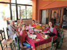 Lunch at La Caseta de Antonio.
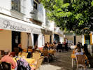 Restaurante La Cueva
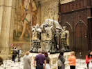 One several graves of Christopher Columbus; this one in the Seville Cathedral.
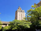 The Giralda of the Seville Cathedral.
 Coll. No. 1784, Carex inops var. heliophila
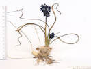 Coll. No. 1786, Muscari botryoides
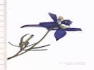 Coll. No. 1787.1, Delphinium nuttallianum
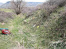 Habitat of Coll. No. 1789, Collinsia parviflora
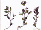 Coll. No. 1789, Collinsia parviflora
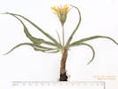 Coll. No. 1791, Nothocalais cuspidata
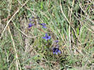 Coll. No. 1792, Delphinium, probably D. nuttallii
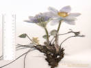 Coll. No. 1793, Pulsatilla nuttalliana
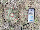 Obs. No. 1603, Escobaria missouriensis
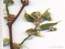 Coll. No. 1798, Celtis reticulata
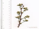 Coll. No. 1798, Celtis reticulata
 Location of Collections 1809 to 1812.1
 Location of Collections 1809 to 1812.1
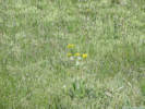 Senecio and Taraxacum for sure, but can you see the Boechera?
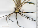 Button-like caudex of Coll. No. 1811, Senecio integerrimus
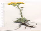 Coll. No. 1817, Packera
 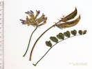 Pieces of Coll. No. 1826, Astragalus shortianus
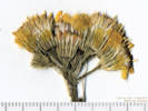 Inflorescence of Coll. No. 1831, Senecio integerrimus
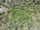 Habitat of Coll. No. 1832, Eleocharis cf. acicularis
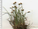 Coll. No. 1832, Eleocharis cf. acicularis
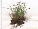 Coll. No. 1832, Eleocharis cf. acicularis
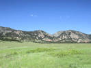 Habitat of Coll. No. 1833, Prunus virginiana
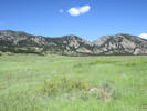 Habitat of Coll. No. 1834, Ribes aureum.
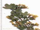 Coll. No. 1834, Ribes aureum.
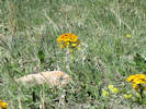 Habit of Coll. No. 1835, Erysimum capitatum
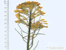 Coll. No. 1835, Erysimum capitatum
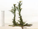 Coll. No. 1836, Arabis pycnocarpa
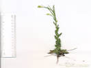 Coll. No. 1836, Arabis pycnocarpa var. pycnocarpa
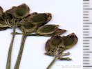 Fruit of Coll. No. 1837, Lomatium orientale
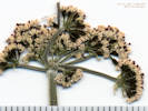 Inflorescence of Coll. No. 1837, Lomatium orientale
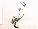 Coll. No. 1837, Lomatium orientale
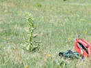 Coll. No. 1840, Frasera speciosa
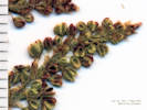 Inflorescence of Coll. No. 1841, Rumex acetosella
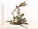 Coll. No. 1841, Rumex acetosella
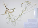 Coll. No. 1845, Sisymbrium altissimim
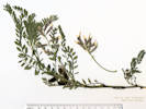 Coll. No. 1851, Astragalus crassicarpus
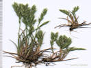 Coll. No. 1852, Vulpia octoflora
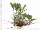 Coll. No. 1852, A little annual Vulpia octoflora
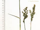 Coll. No. 1855, Poa secunda ssp. secunda
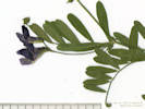 Coll. No. 1857, Vicia americana var. minor
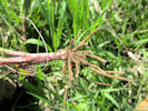 Button-like caudex of Coll. No. 1858, Senecio integerrimus
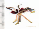 Coll. No. 1866, Oenothera suffrutescens
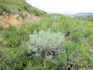 Light-colored variant of Ericameria nauseosa
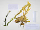 Coll. No. 1872, Arabis pycnocarpa
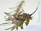 Coll. No. 1873, Cryptantha virgata
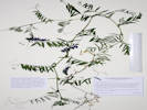 Coll. No. 1875, Vicia villosa
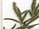 Pistillate catkin of Coll. No. 1880, Salix exigua
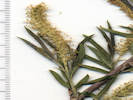 Staminate catkin of Coll. No. 1880, Salix exigua
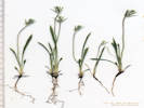 Coll. No. 1882, Plantago patagonica
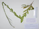 Coll. No. 1887, Turritis glabra
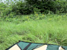 Habitat of four collections in the Survey Field.
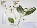 Coll. No. 1897, Senecio integerrimus in Colorado School of Mines Survey Field.
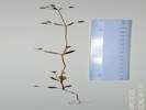 Coll. No. 1899, Collinsia parviflora
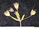 Coll. No. 1899, Collinsia parviflora
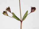 Coll. No. 1899, Collinsia parviflora
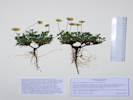 Coll. No. 1901, Erigeron compositus
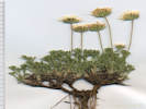 Coll. No. 1901, Erigeron compositus
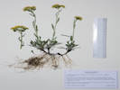 Coll. No. 1902, Packera
  Coll. No. 1903, Aliciella pinnatifida
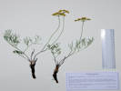 Coll. No. 1904, Harbouria trachypleura
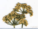 Inflorescence of Coll. No. 1904, Harbouria trachypleura
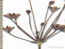 Details of the umbel of Coll. No. 1907, Androsace septentrionalis
 Dissection of Coll. No. 1909, Antennaria parvifolia
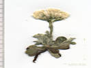 Coll. No. 1909, Antennaria parvifolia
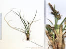 Coll. No. 1910.1, Carex geophila
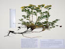 Coll. No. 1911, Potentilla fissa
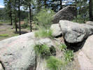 Coll. No. 1913, Carexoccidentalis
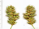 Coll. No. 1913, Carex occidentalis
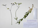 Coll. No. 1922, Silene csereii
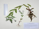 Coll. No. 1923, Veronica anagallis-aquatica
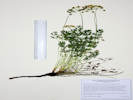 Coll. No. 1925, Aletes acaulis
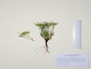 Coll. No. 1927, Townsendia grandiflora
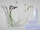 Coll. No. 1928, Carex praegracilis
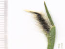 Inflorescence of Coll. No. 1932, Hordeum sp., probably H. jubatum.
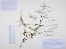 Coll. No. 1938, Rorippa palustris
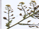 Inflorescence of Coll. No. 1938, Rorippa palustris
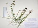 Coll. No. 1939, Carex brevior
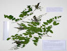 Coll. No. 1940, Amorpha fruticosa
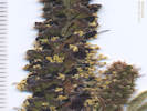 Inflorescence of Coll. No. 1940, Amorpha fruticosa
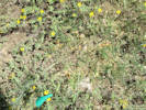 Coll. No. 1943, Astragalus crassicarpus
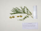 Coll. No. 1943, Astragalus crassicarpus
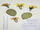 Coll. No. 1948, Opuntia macrorhiza
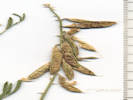 Coll. No. 1949, Astragalus flexuosus
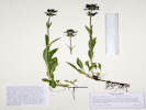 Coll. No. 1950, Penstemon rydbergii
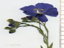 Inflorescence of Coll. No. 1951, Linum lewisii
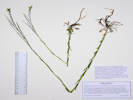 Coll. No. 1952, Boechera stricta
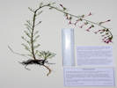 Coll. No. 1953, Ipomopsis aggregata ssp. attenuata
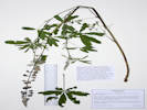 Coll. No. 1954, Lupinus argenteus rubricaulis
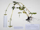 Coll. No. 1955, Valeriana occidentalis
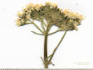 Inflorescence of Coll. No. 1955, Valeriana occidentalis
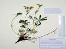 Coll. No. 1956, Potentilla pulcherrima
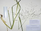 Coll. No. 1979, Glyceria elata