U. S. Interstate Highways
Tom Schweich
|
U. S. Interstate Highways | U. S. Interstate 5 |
|
Tom Schweich |

|
(No Preface) | ||||||||||||||||||||||||||||||||||||||||||||||||||||||||||||||||||||||||||||||||||||||||||||||||
|
Other articles:
|
Junction: British Columbia Highway 99 Canada - United States border United States below | ||||||||||||||||||||||||||||||||||||||||||||||||||||||||||||||||||||||||||||||||||||||||||||||||
|
|
BellinghamExit 255: WA Hwy 542, Sunset Drive, to Bellingham. | ||||||||||||||||||||||||||||||||||||||||||||||||||||||||||||||||||||||||||||||||||||||||||||||||
| Exit 252: Samish Way, to Fairhaven. | |||||||||||||||||||||||||||||||||||||||||||||||||||||||||||||||||||||||||||||||||||||||||||||||||
|
Other articles:
Locations:
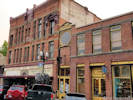
Fairhaven.
|
Fairhaven | ||||||||||||||||||||||||||||||||||||||||||||||||||||||||||||||||||||||||||||||||||||||||||||||||
| Exit 250: Old Fairhaven Parkway, to Fairhaven. | |||||||||||||||||||||||||||||||||||||||||||||||||||||||||||||||||||||||||||||||||||||||||||||||||
|
Other articles:
|
Exit 182: US Interstate 405 | ||||||||||||||||||||||||||||||||||||||||||||||||||||||||||||||||||||||||||||||||||||||||||||||||
| Exit 165: ________ | |||||||||||||||||||||||||||||||||||||||||||||||||||||||||||||||||||||||||||||||||||||||||||||||||
|
Locations: Seattle. |
Seattle | ||||||||||||||||||||||||||||||||||||||||||||||||||||||||||||||||||||||||||||||||||||||||||||||||
|
Other articles:
|
Exit 164: US I-90, east to Boston. | ||||||||||||||||||||||||||||||||||||||||||||||||||||||||||||||||||||||||||||||||||||||||||||||||
|
Other articles:
|
Exit 154: US Interstate 405, Washington Highway 518 | ||||||||||||||||||||||||||||||||||||||||||||||||||||||||||||||||||||||||||||||||||||||||||||||||
|
|
OlympiaExit 105: 14th Avenue SE, into Olympia. | ||||||||||||||||||||||||||||||||||||||||||||||||||||||||||||||||||||||||||||||||||||||||||||||||
|
Other articles:
|
Exit 104: US Highway 101 This is the north end of US Highway 101. | ||||||||||||||||||||||||||||||||||||||||||||||||||||||||||||||||||||||||||||||||||||||||||||||||
| Exit 68: US Highway 12, to Mount Rainier. | |||||||||||||||||||||||||||||||||||||||||||||||||||||||||||||||||||||||||||||||||||||||||||||||||
|
Other articles:
|
Exit 49: Washington Highway 504, Mt St Helens Way, to Mount Saint Helens. | ||||||||||||||||||||||||||||||||||||||||||||||||||||||||||||||||||||||||||||||||||||||||||||||||
|
|
Kelso / LongviewExit 39: Washington Highway 4, Allen Street, to Kelso and Longview. | ||||||||||||||||||||||||||||||||||||||||||||||||||||||||||||||||||||||||||||||||||||||||||||||||
| Exit 7: US Interstate 205, east side of Portland, and US Highway 26 east. | |||||||||||||||||||||||||||||||||||||||||||||||||||||||||||||||||||||||||||||||||||||||||||||||||
|
Washington above
Oregon below | |||||||||||||||||||||||||||||||||||||||||||||||||||||||||||||||||||||||||||||||||||||||||||||||||
|
Other articles:
|
Junction: US Interstate 405, north Portland. | ||||||||||||||||||||||||||||||||||||||||||||||||||||||||||||||||||||||||||||||||||||||||||||||||
|
Other articles:
|
PortlandJunction: US Interstate 84 | ||||||||||||||||||||||||||||||||||||||||||||||||||||||||||||||||||||||||||||||||||||||||||||||||
|
Other articles:
|
Junction: US Interstate 405, south Portland. | ||||||||||||||||||||||||||||||||||||||||||||||||||||||||||||||||||||||||||||||||||||||||||||||||
|
Other articles:
Locations: Albany. |
AlbanyJunction: US Highway 20, west to Newport, or east to Bend.Albany is just west of the highway. | ||||||||||||||||||||||||||||||||||||||||||||||||||||||||||||||||||||||||||||||||||||||||||||||||
|
Other articles:
|
Junction: Beltline Road | ||||||||||||||||||||||||||||||||||||||||||||||||||||||||||||||||||||||||||||||||||||||||||||||||
|
Other articles:
|
Exit 194: Oregon Highway 126 | ||||||||||||||||||||||||||||||||||||||||||||||||||||||||||||||||||||||||||||||||||||||||||||||||
|
Other articles:
|
Exit 188: Oregon Highway 58, southeast to US Highway 97 near Chemult. | ||||||||||||||||||||||||||||||||||||||||||||||||||||||||||||||||||||||||||||||||||||||||||||||||
|
|
Eugene | ||||||||||||||||||||||||||||||||||||||||||||||||||||||||||||||||||||||||||||||||||||||||||||||||
|
Other articles:
|
Junction: Oregon Route 62, "Crater Lake Highway" | ||||||||||||||||||||||||||||||||||||||||||||||||||||||||||||||||||||||||||||||||||||||||||||||||
|
|
Medford | ||||||||||||||||||||||||||||||||||||||||||||||||||||||||||||||||||||||||||||||||||||||||||||||||
|
Oregon California | |||||||||||||||||||||||||||||||||||||||||||||||||||||||||||||||||||||||||||||||||||||||||||||||||
|
Locations: Yreka. |
Yreka | ||||||||||||||||||||||||||||||||||||||||||||||||||||||||||||||||||||||||||||||||||||||||||||||||
| Rest Stop, at Weed Airport. | |||||||||||||||||||||||||||||||||||||||||||||||||||||||||||||||||||||||||||||||||||||||||||||||||
|
|
Weed | ||||||||||||||||||||||||||||||||||||||||||||||||||||||||||||||||||||||||||||||||||||||||||||||||
|
Other articles:
|
Exit 747:
| ||||||||||||||||||||||||||||||||||||||||||||||||||||||||||||||||||||||||||||||||||||||||||||||||
|
Other articles:
|
Exit 738: W. Lake Street | ||||||||||||||||||||||||||||||||||||||||||||||||||||||||||||||||||||||||||||||||||||||||||||||||
|
Other articles:
Locations: Mount Shasta (town). |
Mount ShastaJunction: California Highway 89, south through Lassen Park to Lake Tahoe, and then to U. S. Highway 395. | ||||||||||||||||||||||||||||||||||||||||||||||||||||||||||||||||||||||||||||||||||||||||||||||||
|
Other articles:
|
Junction: California Highway 299, California Highway 44
|
|
Locations: Redding.
| Redding
|
Other articles:
Locations: RedBluff.
| Red BluffJunction: California Highway 36
|
Locations: Elder Creek.
Cross Elder Creek. | Elder Creek drains a portion of the North Coast Ranges into the Sacramento River. It is noted here because the Coast Range Ophiolite crops out across the north, middle, and south forks of Elder Creek to the west.
|
Other articles:
Locations: Corning.
| CorningJunction: Tehama County A9, west to Paskenta.
|
Other articles:
| WilliamsJunction: California Highway 20
|
| Sacramento City Limit
|
Other articles:
Junction: California Highway 99, north to Marysville.
|
|
Other articles:
Junction: US Interstate 80.
| This junction is on the north side of Sacramento, where US Interstate 80 bypasses the downtown area.
|
American River Crossing
|
|
Locations: Sacramento.
| Sacramento
|
Other articles:
Junction:
|
|
Sacramento City Limit |
|
Sacramento County above
| Cross Mokelumne River San Joaquin County below
|
Other articles:
Junction: San Joaquin County Route J11, "Walnut Grove Road"
|
|
Other articles:
Junction: California Highway 12, west to Rio Vista, Fairfield, Santa Rosa and Sebastopol; or east to Lodi and California Highway 49 near San Andreas.
|
|
Other articles:
Junction: California Highway 4, west to Brentwood.
|
|
Other articles:
Junction: California Highway 4, east over Ebbets Pass to California Highway 89 near Markleeville.
|
|
Other articles:
Junction: California Highway 120 | California Highway 120 goes east to Yosemite National Park, Tioga Pass, and Mono Lake on US Hwy 395.
|
Other articles:
Junction: US Interstate 205, west through Tracy, to US Interstate 580 and the San Francisco Bay Area.
|
|
Other articles:
Junction: US Interstate 580, north, then west to the San Francisco Bay Area.
|
|
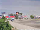
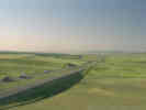 U. S. Interstate 5, south from Tracy to Santa Nella. U. S. Interstate 5, south from Tracy to Santa Nella.
View point for southbound traffic on U. S. Interstate 5.
|
|
Other articles:
Junction: California Highway 140, east through Guistine to Merced and Yosemite.
|
|
Other articles:
Junction: California Highway 152 |
|