U. S. Interstate Highways
Tom Schweich
|
U. S. Interstate Highways | US Interstate 25 |
|
Tom Schweich |

|
From US I-90 in Buffalo, Wyoming to US I-10 in Las Cruces, New Mexico by way of Denver, Colorado. | ||||||||||||||||||||||||||||||||||||||||||||||||||||||||||||||||||||||||||||||||||||||||||||||||||||||||||||||||||||||||||||||||||||||||||||||||||||||||||||||||||||||||||||||||||||||
|
Other articles:
|
Exit 300: US Interstate 90
|
|
Exit 299: E. Hart Street, to Buffalo, WY
|
|
| Buffalo
|
Other articles:
Exit 189: US Highway 20/26 Bypass, Events Drive
|
|
Other articles:
| Exit: 188B: N. Poplar Street, Wyoming Highway 220
|
Locations: North Platte River.
| Cross North Platte River
|
Exit 186: Bryan Stock Trail, N. Beverly St., for Caspar and US Highways 20 and 26.
|
|
| Caspar
|
Other articles:
Exit 185: Curtis Street, for US Highways 20 and 26.
|
|
| Exit 140: WY Highway 59, to Douglas.
|
Locations: North Platte River.
| Cross North Platte River.
|
| Orin JunctionExit 126: US Highway 18, US Highway 20, to points east.
|
Locations: Orin.
| Orin
|
Cross the North Platte River.
|
|
Other articles:
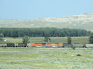
Two BNSF coal trains meet between Orin Junction and Glendo.
|
|
Locations: Glendo.
| GlendoExit 111: A Street, to Glendo.
|
Other articles:
| Dwyer JunctionExit 92: US Highway 26, east to Guernsey and the Oregon Trail ruts.
|
Other articles:
Locations:
Chugwater.
Exit 54: Wyoming Highway 313 to the Chugwater Rest Area and the town of Chugwater.
|
|
Locations: Cheyenne.
| Cheyenne
|
Other articles:
Junction: US Interstate 80
|
|
Wyoming above
| Colorado below
|
Locations: Fort Collins.
| Fort CollinsThe city of Fort Collins is located about 2 miles to the west.
|
Other articles:
Exit 269: Colorado Highway 14, west to Fort Collins, then through the Poudre River Canyon to Walden, east to
well, points east.
|
|
Other articles:
Exit 265: E. Harmony Rd, west to Horsetooth Reservoir.
|
|
Other articles:
Exit 257: US Highway 34, E. Eisenhower Blvd, west to Loveland and then Rocky Mountain National Park.
|
|
Locations: Loveland.
| LovelandThe city of Loveland is about 2 miles to the west.
|
Exit254: Colorado State Highway 60, west.
|
|
Other articles:
Exit 252: Colorado State Highway 60, east.
|
|
Other articles:
Exit 243: Colorado State Highway 60, west to Lyons, or east to Platteville.
|
|
Other articles:
Exit 240: CO State Highway 119, southwest to Boulder by way of the Diagonal Highway.
|
|
Other articles:
Junction: Colorado Highway 7, E. Baseline Road,
|
|
Other articles:
Exit 228: Colorado State Highway 470, Northwest Parkway
|
|
Other articles:
Exit 223: Colorado Highway 128, East and West 120th Avenue.
|
|
Other articles:
Exit 217: US Highway 36, northwest, the Denver-Boulder Turnpike, and then to Estes Park and Rocky Mountain National Park.
|
|
Other articles:
Junction: US Interstate 70, west across the North American Cordillera, or east
|
|
Locations: Denver.
| Denver
|
Other articles:
Junction: Colfax Avenue, US Highway 40
|
|
Other articles:
Junction: US Highway 6, 6th Avenue
|
|
Other articles:
Junction: US Highway 85, "Santa Fe Road"
|
|
Other articles:
Junction: US Highway 285
|
|
Arapahoe County above
| Exit 195: County Line Road 470 Douglas County below
|
Other articles:
Exit 194: Colorado Highway 470
|
|
Douglas County above
| Palmer Divide Avenue / County Line Road El Paso County below ..
|
Other articles:
| MonumentExit 161: Colorado Highway 105, to Monument, and northwest to Palmer Lake.
|
Exit 153: Interquest Parkway
|
|
Other articles:
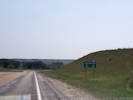
Scenic Viewpoint.
|
|
Exit 151: Briargate Parkway
|
|
Exit 142: West Bijou Street
|
|
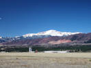
Locations: Colorado Springs.
| Colorado Springs
|
Other articles:
Exit 141: US Highway 24, W. Cimarron Street
|
|
Other articles:
Exit 141:
|
|
| Exit 104: Drew Dix Parkway
|
| Exit 102: Eagleridge Blvd/
|
Other articles:
| Exit 101: US Highway 50, West, and CO Hwy 47, East
|
| Exit 100B: W. 29th Street
|
Other articles:
| Exit 100A: US Highway 50, East
|
| Exit 99B: W. 13th Street
|
| Exit 99A: N. Santa Fe Avenue, and East 4th Street
|
Other articles:
| Exit 98B: East 1st Street, access to CO Hwy 96
|
| Exit 98A:
|
Locations: Pueblo.
| Pueblo
|
| Exit 97:
|
Locations: Huerfano River.
| Cross Huerfano River
|
Other articles:
| Exit 52: Interstate 25 Business, Walsen Avenue, to CO State Highway 69 and Walsenburg Google maps will show this the location of “Farista” though the GNIS treats that as a variant name of Farisita, to the northwest on CO Hwy 69.
|
Other articles:
| WalsenburgExit 50: US Highway 160, west.
|
Other articles:
Exit 49: Interstate 25 Business, Main Street, to downtown Walsenburg.
|
|
Exit 34: US Interstate 258, County Road 60, Lynn Road, , to Aguilar.
|
|
|
|
Other articles:
| TrinidadJunction: US Highway 160, W. Main St., east.
|
Exit 446: US Highway 64, west to Cimmaron and Taos.
|
|
Colorado above
| New Mexico below
|
Exit 452: Cook Avenue, for Raton.
|
|
Other articles:
Locations: Raton.
| Raton
|
| Exit 451: Clayton Road, US Hwy 87, motels, restaurants, &c.
|
Other articles:
Locations: Wolf Creek.
| Cross Wolf Creek Wislizenus' collection of Echinocereus viridiflorus gives Wolf Creek at the colleciton location.
|
Other articles:
| Exit 366: New Mexico State Road 161, to Watrous, Fort Union National Monument.
|
Literature Cited:
Other articles:
Locations: Mora River.
| Cross the Mora River. The Santa Trail crossed the Mora River just to the northwest, and it is likely that many of the older collections referring to that river, were made in this general vicinity. Augustus Fendler passed by near here in 1847, as described in Gray's (1849) Plantae Fendleriana.
|
Locations: Watrous.
| Watrous
|
Other articles:
| Exit 364: New Mexico State Road 161, to Watrous, or NM SR 518 at Buena Vista.
|
Other articles:
Locations: Las Vegas.
| Las VegasExit 345: E. University, State Road 104, to downtown Las Vegas, and New Mexico State Road 518.
|
Other articles:
| Exit 339: US Highway 84, southeast to US I-40 near Santa Rosa, NM, continuing on through Clovis, NM, to Lubbock, TX, and points east.
|
| Santa Fe
|
Other articles:
| Highway commentary is on US Highway 285 North until US Highways 84 and 285 split. Exit 282: US Highway 84, US Highway 285, locally named St. Francis Drive.
|
Other articles:
| Entering Santa Fe from the southwest.
|
Other articles:
| Junction: US Highway 550, west and north through Durango to Ouray and, finally, Montrose.
|
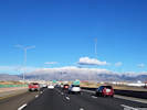
Locations: Sandia Mountains.
| Sandia Mountains to the east.
|
Other articles:
Exit 226: US Interstate 40
|
|
| Albuquerque
|
Other articles:
|
|
Other articles:
Junction: US Interstate 10
|
If you have a question or a comment you may write to me at:
tomas@schweich.com
I sometimes post interesting questions in my FAQ, but I never disclose your full name or address.
|
|
Date and time this article was prepared: 5/12/2025 3:00:10 PM |