Eastern Mojave Vegetation
Tom Schweich
|
Eastern Mojave Vegetation
| U. S. Interstate 40 |
|
Tom Schweich |

|
(No Preface) |
|
Other articles:
Locations: Barstow. |
BarstowJunction:
California city, crossroads for early emigrant trails, railroads and highways in the California Desert, on the Mojave River. Once a small mining center and railroad town in California's Mojave Desert, Barstow is located at the junction of 3 major highways -- Interstate 15, Interstate 40 and State Highway 58. It is centrally located in the western Mojave at the entrance to the Mojave National Preserve and is home of the U.S. Army National Training Center, Marine Corps Logistics Base, NASA's Goldstone Deep Space Network and Burlington Northern-Santa Fe Railroad Yards. Population is 21,500 and elevation is 2,106 feet above sea level. |
|
Other articles:
|
Junction: A Street, for Daggett. |
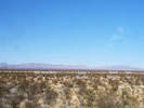
 View of Mojave Valley from Dagget Ridge View of Mojave Valley from Dagget Ridge
|
|
|
Other articles:
|
Junction: National Trails Highway, Old US Hwy 66. |
|
Other articles:
|
|
|
Other articles:
|
Junction: Newberry Road, north to US Interstate 15. |
|
Literature Cited:
Locations: Pisgah Crater. |
Pisgah Crater is a recreation site, with several lava tubes that can be explored. The composition of basalt in the lava flows has also been the subject of controversy regarding the source of the magma reflecting sequential melting of ultramafic to mafic mantle sources. Some papers support that hypothesis, while others suggest contamination by crustal sources. |
|
Locations: Pisgah. |
|
|
Literature Cited:
Locations: Lavic. |
Lavic south of the highway. Psorothamnus fremontii (A. Gray) Barneby, Fremont's Indigo Bush, from near Lavic was studied by Adams and York (2005). This is also a location where Castela emoryi (Gray) Moran and Felger (Crucifixion Thorn) is found. Rockhounds also search for Jasper here. |
|
Other articles:
Locations: Ludlow. |
LudlowJunction: Crucero RoadLudlow is the last stop for gas for eastbound travelers, until you get to Needles. Stop here for gas if you are planning a visit to Mojave National Park. |
|
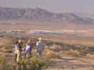
Locations: Old Dad Mountains. |
Old Dad Mountains to the north. |
|
Other articles:
|
Junction: Kelbaker Road, north to the Sweeney Granite Mountains Desert Research Center, aka Granite Mountains Reserve, north to Kelso and Baker. |
|
Locations: Marble Mountains. |
Marble Mountains to the south. |
|
Other articles:
|
Junction: Essex Road, northwest into Mojave National Preserve, or southeast to Essex (no services) and US Highway 66, the National Old Trails Highway. |
|
Other articles:
|
|
|
Other articles:
|
FennerJunction:
|
| Junction: Mountain Springs Road, north to Goffs. | |
| Low pass through the Piute Mountains. | |
| Exit: Camino | |
|
Literature Cited:
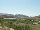
Locations: Ward Valley. |
Ward ValleyWard Valley is named for Ward Station on the Parker Branch of the Atchison, Topeka, & Santa Fe Railway. |
|
|
South PassSouth Pass, a low pass through the Sacramento Mountains. |
|
Other articles:
|
Junction: U. S. Highway 95, north to Las Vegas. |
|
Literature Cited:
Other articles:
Locations: Needles. |
Needles |
|
California above
Cross Colorado River Arizona below | |
|
Other articles:
|
View to the south from the Topock exit. |
|
Other articles:
|
TopockJunction:
|
|
Other articles:
|
Junction: Arizona Highway 95, south through Lake Havasu City, to Parker and Quartzsite. |
|
|
Yucca |
|
Literature Cited:
Other articles:
Locations: Hualapai Mountains. |
Hualapai Mountains to the east. Shreve may have collected Frasera albomarginata in the Hualapai Mountains. |
|
Other articles:
Locations: Kingman. |
Kingman |
|
Other articles:
|
Junction: Arizona Highway 66, following the old route of US Highway 66 through Peach Springs. |
|
Literature Cited:
Other articles:
Locations: Hualapai Mountains. |
Hualapai Mountains to the south. Shreve may have collected Frasera albomarginata in the Hualapai Mountains. |
|
Other articles:
|
Exit 66: Blake Ranch Road, also known as County Highway 151 in part. There is a locality of Frasera albomarginata about 1.5 miles south. |
|
Other articles:
|
Exit 71: US Highway 93 south to Phoenix. |
|
Other articles:
|
SeligmanJunction: Arizona Highway 66 |
|
Other articles:
|
Junction: Arizona Highway 66 |
|
Other articles:
|
Junction: Arizona Highway 66 |
|
|
Ash Fork |
|
Other articles:
|
Junction: Arizona Highway 89, south to Prescott, and then US Highway 93 near Wickenburg. |
|
Other articles:
|
Exit 161: Grand Canyon Avenue, west end of Williams. |
|
Locations: Williams. |
Williams |
| Exit 163: Grand Canyon Blvd | |
|
Other articles:
|
Junction:
|
|
Other articles:
|
Exit 167: S. Garland Prairie Rd, Forest Road 141, Circle Pines Road |
|
Other articles:
|
Exit 171: Ponderosa Road, Forest Road 74, Cool Pines Road |
|
Other articles:
Locations: Maine. |
Exit 178: Garland Prairie Road, to Parks on the north side of the highway, or the ATSF station of Maine on the south side of the road. There is a collection of Frasera speciosa (George E. Osterhout 6997, 6/23/1928, RM 25887) described as "between Grand Canyon and Maine." Typically this is mapped at Tusayan. I think it more likely the collection was made closer to Maine, or perhaps near Sitgreaves Mountain, which is between Grand Canyon and Maine. |
|
Other articles:
|
Exit 191: US Interstate 40 Business, east into Flagstaff. |
|
Other articles:
|
FlagstaffExit 195:
|
|
Locations: Rio de Flag. |
Cross Rio de Flag |
| Exit 198: East Butler Avenue | |
|
Other articles:
|
Exit 201: US Interstate 40 Business, west into Flagstaff. |
|
Other articles:
|
Exit 204:
|
|
Other articles:
|
WinonaExit 211: County Road 394 "Townsend-Winona Road" |
|
Other articles:
|
Exit 245: Arizona Highway 99, north to Leupp. |
|
Other articles:
|
Exit 252: US Interstate 40 Business, W. 3rd St., west entrance to Winslow. |
|
Locations: Winslow. |
Winslow |
|
Other articles:
|
Exit 257: US Interstate 40 Business, Arizona Highway 87, E. 3rd St, east entrance to Winslow. |
|
Other articles:
|
Holbrook, Arizona |
|
Literature Cited:
Other articles:
Locations: Petrified Forest National Park. |
Petrified Forest National ParkThere are three collections of Frasera albomarginata from Petrified Forest National Park. |
|
Other articles:
|
ChambersJunction: US Highway 191, north to Ganado and Chinle. |
|
Other articles:
|
SandersJunction: US Highway 191, south past Witch Wells to St. Johns. |
|
Other articles:
|
Junction: Indian Route 12, north to Window Rock. |
|
Arizona above
New Mexico below | |
|
Other articles:
|
Exit 159: US Interstate 25 |
|
|
Albuquerque |
|
|
Amarillo |
|
|
|
| If you have a question or a comment you may write to me at: tomas@schweich.com I sometimes post interesting questions in my FAQ, but I never disclose your full name or address. |
Date and time this article was prepared: 4/21/2025 8:30:26 PM |