Eastern Mojave Vegetation
Tom Schweich
|
Eastern Mojave Vegetation
| U. S. Highway 66 -- The National Trails Highway |
|
Tom Schweich |

|
(No Preface) | ||||||||||||||||||||||||||||||||||||||||||||||||||||||||||||||||||||
|
|
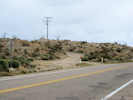
Victorville | ||||||||||||||||||||||||||||||||||||||||||||||||||||||||||||||||||||
|
Other articles:
|
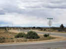
Junction: US Interstate 15 | ||||||||||||||||||||||||||||||||||||||||||||||||||||||||||||||||||||
| Junction: Air Expressway, access to Field Trip Stop P-6 of the 2010 Desert Symposium. | |||||||||||||||||||||||||||||||||||||||||||||||||||||||||||||||||||||
|
Other articles:
|
HelendaleJunction: Vista Road | ||||||||||||||||||||||||||||||||||||||||||||||||||||||||||||||||||||
|
Other articles:
|
Junction: Unknown Road, paralleling the railroad, while National Trails Highway veers east away from the tracks. | ||||||||||||||||||||||||||||||||||||||||||||||||||||||||||||||||||||
|
Other articles:
|
|||||||||||||||||||||||||||||||||||||||||||||||||||||||||||||||||||||
|
Other articles:
|
Junction: Unknown Road, along the bluffs above the railroad, with access to Field Trip Stops P-4 and P-5. | ||||||||||||||||||||||||||||||||||||||||||||||||||||||||||||||||||||
|
Other articles:
|
|||||||||||||||||||||||||||||||||||||||||||||||||||||||||||||||||||||
|
Other articles:
|
Junction: Indian Trail, turn here for access to Stops P-3, P-4, and P-5, of the 2010 Desert Symposium. | ||||||||||||||||||||||||||||||||||||||||||||||||||||||||||||||||||||
|
|
Hodge | ||||||||||||||||||||||||||||||||||||||||||||||||||||||||||||||||||||
|
Other articles:
|
Junction: Hinkley Road | ||||||||||||||||||||||||||||||||||||||||||||||||||||||||||||||||||||
| Junction: Oak Grove Rd, turn northwest for Stop P-2 of the 2010 Desert Symposium. | |||||||||||||||||||||||||||||||||||||||||||||||||||||||||||||||||||||
| Inside the Barstow City Limits, below, National Trails Highway is also known as Main Street, | |||||||||||||||||||||||||||||||||||||||||||||||||||||||||||||||||||||
|
Other articles:
|
Junction: California Highway 58 | ||||||||||||||||||||||||||||||||||||||||||||||||||||||||||||||||||||
|
Junction: Osborne Road, dirt. About 0.35 miles east of California Highway 58, turn south off of Main Street and follow a dirt road to the top of a small hill Field Trip Stop P-1 of the 2010 Desert Symposium. | |||||||||||||||||||||||||||||||||||||||||||||||||||||||||||||||||||||
| Junction: South 1st Avenue | |||||||||||||||||||||||||||||||||||||||||||||||||||||||||||||||||||||
|
|
BarstowThere is a little offset between South and North 1st Avenues. | ||||||||||||||||||||||||||||||||||||||||||||||||||||||||||||||||||||
|
Other articles:
|
Junction: North 1st Avenue, north across the railroad yards, past the Barstow Depot, to Old California Highway 58. | ||||||||||||||||||||||||||||||||||||||||||||||||||||||||||||||||||||
|
Other articles:
|
Junction: US Interstate 15 | ||||||||||||||||||||||||||||||||||||||||||||||||||||||||||||||||||||
|
Other articles:
|
DaggettJunction: Daggett-Yermo Road and A Street | ||||||||||||||||||||||||||||||||||||||||||||||||||||||||||||||||||||
|
Other articles:
|
Junction: Minneola Road | ||||||||||||||||||||||||||||||||||||||||||||||||||||||||||||||||||||
|
Other articles:
|
Junction: US Interstate 40 | ||||||||||||||||||||||||||||||||||||||||||||||||||||||||||||||||||||
|
Other articles:
|
Junction: Newberry Road | ||||||||||||||||||||||||||||||||||||||||||||||||||||||||||||||||||||
|
Other articles:
Locations:
Ludlow.
|
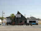
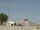
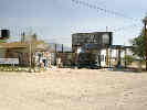
LudlowA couple of gas stations and a café. This might be the last gas station until Needles, because gas at Amboy is always doubtful, no gas at Essex, and gas at Fenner or Goffs is questionable.Junction: US Interstate 40 | ||||||||||||||||||||||||||||||||||||||||||||||||||||||||||||||||||||
|
Other articles:
|
|||||||||||||||||||||||||||||||||||||||||||||||||||||||||||||||||||||
|
Locations: Bagdad. |
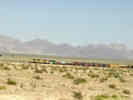
BagdadBagdad is now just a railroad siding on the Burlington Northern Santa Fe. | ||||||||||||||||||||||||||||||||||||||||||||||||||||||||||||||||||||
|
Other articles:
|
Junction: Amboy Road, south through Sheephole Pass to Dale and Twentynine Palms. | ||||||||||||||||||||||||||||||||||||||||||||||||||||||||||||||||||||
| Cross Burlington Northern Santa Fee railroad tracks. | |||||||||||||||||||||||||||||||||||||||||||||||||||||||||||||||||||||
|
Literature Cited:
Other articles:
Locations: Amboy. |
| ||||||||||||||||||||||||||||||||||||||||||||||||||||||||||||||||||||
|
Other articles:
|
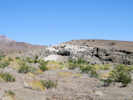
View of outcrop of Bouse Formation. | ||||||||||||||||||||||||||||||||||||||||||||||||||||||||||||||||||||
|
Other articles:
Locations:
Amboy.
|
AmboyRoad junction with former restaurant, motel, and gas station. Services available are unreliable. | ||||||||||||||||||||||||||||||||||||||||||||||||||||||||||||||||||||
|
Locations: Bristol Lake. |
Bristol (Dry) Lake | ||||||||||||||||||||||||||||||||||||||||||||||||||||||||||||||||||||
| Junction: Saltus Road | |||||||||||||||||||||||||||||||||||||||||||||||||||||||||||||||||||||
|
Other articles:
|
Junction: Kelbaker Road Kelbaker Road goes north between the Granite Mountains and the Providence Mountains, through Kelso, and then through the Cima Volcanic Field to Baker. | ||||||||||||||||||||||||||||||||||||||||||||||||||||||||||||||||||||
|
Other articles:
|
|||||||||||||||||||||||||||||||||||||||||||||||||||||||||||||||||||||
|
Other articles:
Locations: Chambless. |
ChamblessTrailer park, gas station, and small grocery store. Thompson (1921) does not mention Chambless.Junction:
| ||||||||||||||||||||||||||||||||||||||||||||||||||||||||||||||||||||
|
Other articles:
|
About 1.2 miles east of Chambless, a small road heads southeast toward Cadiz.
Junction:
| ||||||||||||||||||||||||||||||||||||||||||||||||||||||||||||||||||||
| Cadiz Summit. | |||||||||||||||||||||||||||||||||||||||||||||||||||||||||||||||||||||
|
Other articles:
Locations: Danby. |
1.7 miles southeast is the railroad station of Danby. Danby is the beginning location of Thompson's (1921) route from Danby to Parker. Thompson stated that it was 0.6 mi. from National Old Trails Road to Danby. US Highway 66 has probably been relocated about a mile to the northwest. The old (1921-era) alignment of National Old Trails Road is shown on USGS 7.5" quadrangles and visible on equivalent orthophoto quads.
Junction:
| ||||||||||||||||||||||||||||||||||||||||||||||||||||||||||||||||||||
|
Other articles:
Locations:
Essex.
|
EssexSmall town and railroad siding on the Burlington Northern Santa Fe. Southern end of Essex Road, which is one southern gateway into Mojave National Preserve.Junction: Essex Road, northwest to US Interstate 40 and Mojave National Preserve. | ||||||||||||||||||||||||||||||||||||||||||||||||||||||||||||||||||||
|
Literature Cited:
Other articles:
Locations: Fenner. |
FennerWide spot in the road, sometimes with gas.
Junction:
|
Other articles:
Locations: Goffs.
| Goffs
|
California above
| Arizona below In Arizona, this highway is known as Arizona Highway 66.
|
Other articles:
Junction: US Interstate 40
|
|
Other articles:
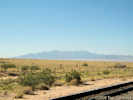
View southeast toward Needles and Mohave Valley.
|
|
Other articles:
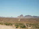
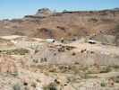
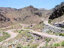
Boundry Cone ahead on Old US Highway 66.
|
|
Other articles:
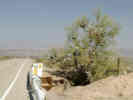
Teddy-Bear Cholla (Opuntia bigelovii) is found at several places along Old US Highway 66.
|
|
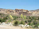
Locations: Boundary Cone.
Old US Highway 66 snakes around the west side of Boundary Cone.
|
|
Other articles:
|
|
Other articles:
Locations:
Oatman.
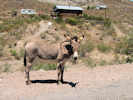
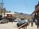
| Oatman
|
Other articles:
Locations:
Goldroad Mine.
|
|
Other articles:
|
|
Other articles:
Locations:
Sitgreaves Pass.
| Sitgreaves Pass
|
Other articles:
|
|
Other articles:
Junction: US Interstate 40, at Exit 53, in northeast Kingman.
|
|
Other articles:
Locations:
Hualapai Mountains.
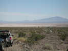
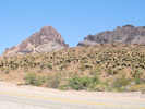
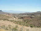
View of Hualapai Mountain to the south.
|
|
| Walapai
|
| Antares
|
| Hackberry
|
| Valentine
|
| Truxton
|
Junction: Indian Reservation Road 9
|
|
| Hualapai Indian Reservation below
|
Other articles:
Junction: Indian Reservation Road 1, "Buck and Doe Road", generally north along the southwest rim of the Grand Canyon.
|
|
Other articles:
Locations:
Peach Springs.
| Peach Springs
|
Junction: Indian Reservation Road 18
|
|
Hualapai Indian Reservation above
|
|
| Grand Canyon Caverns
|
| Hyde Park
|
| Seligman
|
Other articles:
Junction: US Interstate 40, at Exit 121
|
|
Other articles:
Junction: US Interstate 40, at Exit 123
|
|
| Crookton
|
Other articles:
Junction: US Interstate 40, at Exit 139
|
If you have a question or a comment you may write to me at:
tomas@schweich.com
I sometimes post interesting questions in my FAQ, but I never disclose your full name or address.
|
|
Date and time this article was prepared: 5/12/2025 2:59:46 PM |