Topics in this Article:
1800s
1900s
1910s
1920s
1930s
1940s
1950s
1960s
1970s
1980s
1990
1991
1992
1993
1995
1996
1997
1998
1999
2000
2001
2002
2003
2004
2005
2006
2007
2008
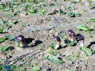
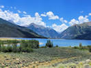
2008 Tour de Swertia albomarginata
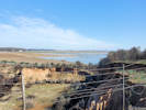
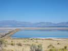
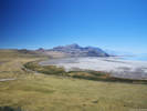
Mono Lake, August 2008
2009
2010
2011
2012
2013
2014
2015
2016
2017
2018
2019
2020
2021
2022
2023
2024
2025
2026
Contents
Literature Cited
|
|
When I first read the field notes of Annie Alexander and Louise Kellogg, I was fascinated by the descriptions they wrote about the places they went and the plants and animals they found there. By publishing my field notes on the Internet I hope to follow a little bit in their tradition.
|
|
|
|
2022
|
|
|
|
January, 2022
Visiting family in Spain, from 1 January to 10 January.
|
|
Locations:
Reserva Natural Concertada Dehesa de Abajo.
|
|
Saturday, 8 January 2022
La Dehesa de Abajo
|
|
Other articles:
• Arapahoe Street:
near 5th;
near 5th;
|
|
Saturday, 15 January 2022
|
|
Other articles:
• 44th Avenue:
at rr trks;
|
|
Thursday, 17 February 2022
|
|
Other articles:
• 5th Street:
near Arapahoe;
|
|
Sunday, 30 January
Walk around the neighborhood.
|
|
Other articles:
• 5th Street:
near Arapahoe;
|
|
Sunday, 6 February 2022
|
|
Other articles:
• Arapahoe Street:
at alley;
|
|
Tuesday, 8 February 2022
|
|
Other articles:
• 5th Street:
near Arapahoe;
|
|
Saturday, 26 February 2022
|
|
Other articles:
• Goldco Circle:
Overlooking n. Golden;
|
|
Tuesday, 15 March
Walk on Goldco Circle.
|
|
Other articles:
• 5th Street:
near Arapahoe;
|
|
Wednesday, 16 March 2022
|
|
Other articles:
• 4th Street:
1004 4th Street;
• Cheyenne Street:
at 4th;
|
|
Thursday, 31 March 2022
|
|
Other articles:
• 5th Street:
near Arapahoe;
|
|
Saturday, 2 April 2022
|
|
Locations:
Stonebridge Homeowners Association.
|
|
Sunday, April 3rd
Stonebridge Tour
|
|
Locations:
Clear Creek Canyon Park.
|
|
Monday, April 18th
Clear Creek Canyon
|
|
Locations:
Wheat Ridge.
|
|
Wednesday, April 20th
Wheat Ridge Siren Test
|
|
Other articles:
• Clear Creek Trail:
at Prospect Pk;
Locations:
Prospect Park.
|
|
Saturday, 23 April 2022
|
|
Other articles:
• Recreational Trail (Pine Ridge Estates):
at game trl;
Locations:
North Hogback Open Space (City of Golden).
|
|
Tuesday, April 26th
Dakota Ridge
One purpose of this trip was to search for Anemone patens var. multifida. None was found.
|
|
|
2757
|
Leucocrinum montanum
|
Native and Naturalized Flora of the Golden Area, Jefferson County, Colorado
Anthericeae
Leucocrinum montanum Nutt. ex A. Gray.
Star Lily.
Dakota Ridge, Jefferson County, Colorado.
Lower slopes of hogback in northernmost Golden, 4.1 km. north northwest of the GNIS location of Golden.
39.7811°N, 105.2377°W.
WGS 1984
Elev. 1867 m.
Southwest facing slope: with Euphorbia esula, Grindelia squarrosa, Taraxacum officinale, Gutierrezia sarothrae, Artemisia ludoviciana, A. frigida, Andropogon gerardi, and Escobaria vivipara.
Collected by permit: City of Golden, 2022, issued: Mar 17, 2022, to: Tom Schweich.
|
Tom Schweich
2757. |
26-Apr-2022 |
|
Sent to EIU.
|
|
|
2758
|
Leucocrinum montanum
|
Native and Naturalized Flora of the Golden Area, Jefferson County, Colorado
Anthericeae
Leucocrinum montanum Nutt. ex A. Gray.
Star Lily.
Dakota Ridge, Jefferson County, Colorado.
Lower western slope of hogback in northernmost Golden, 4.3 km. north northwest of the GNIS location of Golden.
39.7822°N, 105.2384°W.
WGS 1984
Elev. 1873 ,.
Also here: Linum lewisii, Bromus inermis, Yucca glauca, and Liatris punctata.
Seven plants here; one collected.
Collected by permit: City of Golden, 2022, issued: Mar 17, 2022, to: Tom Schweich.
|
Tom Schweich
2758. |
26-Apr-2022 |
|
|
|
|
2759
|
Nothocalais cuspidata
|
Native and Naturalized Flora of the Golden Area, Jefferson County, Colorado
Asteraceae
Nothocalais cuspidata (Pursh) Greene.
Prairie False Dandelion.
Dakota Ridge, Jefferson County, Colorado.
Lower western slope of hogback in northernmost Golden, 4.2 km. north northwest of the GNIS location of Golden.
39.7817°N, 105.2383°W.
WGS 1984
Elev. 1873 m.
About ¼ up the west limb, sparsely vegetated soil; with Rhus trilobata, Yucca glauca, Linum lewisii, Eriogonum alatum, Poa sp., and Euphorbia esula.
Collected by permit: City of Golden, 2022, issued: Mar 17, 2022, to: Tom Schweich.
|
Tom Schweich
2759. |
26-Apr-2022 |
|
Sent to CS.
|
|
|
2760
|
Prunus americana
|
Native and Naturalized Flora of the Golden Area, Jefferson County, Colorado
Rosaceae
Prunus americana Marshall.
American Plum.
Dakota Ridge, Jefferson County, Colorado.
South end of hogback in northernmost Golden, 4.0 km. north northwest of the GNIS location of Golden.
39.7805°N, 105.2371°W.
WGS 1984
Elev. 1855 m.
Starting to bloom, leaves not emerged yet.
South end of clay mines, behind the fence, with Pinus ponderosa.
(I reached through the fence to make the collection; did not climb over it.)
Collected by permit: City of Golden, 2022, issued: Mar 17, 2022, to: Tom Schweich.
|
Tom Schweich
2760. |
26-Apr-2022 |
|
|
|
Locations:
407 Garden Street.
|
|
Thursday, 28 April 2022
Working in Cathy's garden.
|
|
Locations:
Colorado School of Mines Survey Field.
|
|
Friday, 29 April 2022
Colorado School of Mines Survey Field
One purpose of this trip was to search for Anemone patens var. multifida. None was found.
|
|
Locations:
DeLong Park (City of Golden).
|
|
Friday, 6 May 2022
Weeding at DeLong Park.
|
|
|
2761
|
Ranunculus testiculatus
|
|
|
2762
|
Chorispora tenella
|
|
|
2763
|
Polygonum aviculare
|
Native and Naturalized Flora of the Golden Area, Jefferson County, Colorado
Polygonaceae
Polygonum aviculare L.
Prostrate Knotweed.
Delong Park, Jefferson County, Colorado.
New city park (construction in 2021 and 2022) near the intersection of 23rd Street and Vernon Drive, 1.75 km. southeast of the GNIS location of Golden.
Adventive annual weed found in hydroseeded beds.
Collected to prepare educational materials for City of Golden volunteer weeding program.
Collected by permit: City of Golden, 2022, issued: Mar 17, 2022, to: Tom Schweich.
|
Tom Schweich, with Carol Cameron & David Chavez
2763. |
6-May-2022 |
|
|
|
|
2764
|
Erodium cicutarium
|
Native and Naturalized Flora of the Golden Area, Jefferson County, Colorado
Geraniaceae
Erodium cicutarium (L.) L'Her. ex Aiton.
Hemlock-leav'd Crane's-bill.
Delong Park, Jefferson County, Colorado.
New city park (construction in 2021 and 2022) near the intersection of 23rd Street and Vernon Drive, 1.75 km. southeast of the GNIS location of Golden.
Annual or biennial. Colorado Noxious Weed List C.
Collected by permit: City of Golden, 2022, issued: Mar 17, 2022, to: Tom Schweich.
|
Tom Schweich, with Carol Cameron & David Chavez
2764. |
6-May-2022 |
|
|
|
|
2765
|
Capsella bursa-pastoris.
|
Native and Naturalized Flora of the Golden Area, Jefferson County, Colorado
Brassicaceae
Capsella bursa-pastoris (L.) Medik.
Shepherd's Purse.
Delong Park, Jefferson County, Colorado.
New city park (construction in 2021 and 2022) near the intersection of 23rd Street and Vernon Drive, 1.75 km. southeast of the GNIS location of Golden.
Annual.
Collected by permit: City of Golden, 2022, issued: Mar 17, 2022, to: Tom Schweich.
|
Tom Schweich, with Carol Cameron & David Chavez
2765. |
6-May-2022 |
|
|
|
|
2766
|
Lepidium draba
|
Native and Naturalized Flora of the Golden Area, Jefferson County, Colorado
Brassicaceae
Lepidium draba L.
White Top.
Delong Park, Jefferson County, Colorado.
New city park (construction in 2021 and 2022) near the intersection of 23rd Street and Vernon Drive, 1.75 km. southeast of the GNIS location of Golden.
Adventive annual.
Colorado Noxious Weed List B.
Collected by permit: City of Golden, 2022, issued: Mar 17, 2022, to: Tom Schweich.
|
Tom Schweich, with Carol Cameron & David Chavez
2766. |
6-May-2022 |
|
|
|
|
2767
|
Euphorbia myrsinites.
|
Native and Naturalized Flora of the Golden Area, Jefferson County, Colorado
Euphorbiaceae
Euphorbia myrsinites L.
Myrtle Spurge.
Delong Park, Jefferson County, Colorado.
New city park (construction in 2021 and 2022) near the intersection of 23rd Street and Vernon Drive, 1.75 km. southeast of the GNIS location of Golden.
Known to be in this parcel before construction.
Colorado Noxious Weed List A.
Collected by permit: City of Golden, 2022, issued: Mar 17, 2022, to: Tom Schweich.
|
Tom Schweich, with Carol Cameron & David Chavez
2767. |
6-May-2022 |
|
|
|
|
2768
|
Conium maculatum.
|
Native and Naturalized Flora of the Golden Area, Jefferson County, Colorado
Apiaceae
Conium maculatum L.
Common Poison Hemlock.
Delong Park, Jefferson County, Colorado.
New city park (construction in 2021 and 2022) near the intersection of 23rd Street and Vernon Drive, 1.75 km. southeast of the GNIS location of Golden.
Growing on side of small watercourse, probably pre-dates designation of park and construction.
Colorado Noxious Weed List C.
Collected by permit: City of Golden, 2022, issued: Mar 17, 2022, to: Tom Schweich.
|
Tom Schweich, with Carol Cameron & David Chavez
2768. |
6-May-2022 |
|
|
|
|
2769
|
Chenopodium album.
|
Native and Naturalized Flora of the Golden Area, Jefferson County, Colorado
Chenopodiaceae
Chenopodium album L.
Lambsquarters.
Delong Park, Jefferson County, Colorado.
New city park (construction in 2021 and 2022) near the intersection of 23rd Street and Vernon Drive, 1.75 km. southeast of the GNIS location of Golden.
Annual adventive weed.
Collected by permit: City of Golden, 2022, issued: Mar 17, 2022, to: Tom Schweich.
|
Tom Schweich, with Carol Cameron & David Chavez
2769. |
6-May-2022 |
|
|
|
|
2770
|
Lamium amplexicaule.
|
Native and Naturalized Flora of the Golden Area, Jefferson County, Colorado
Lamiaceae
Lamium amplexicaule L.
Henbit.
Delong Park, Jefferson County, Colorado.
New city park (construction in 2021 and 2022) near the intersection of 23rd Street and Vernon Drive, 1.75 km. southeast of the GNIS location of Golden.
39.7486°N, 105.2082°W.
WGS 1984
Elev. 1761 m.
Annual adventive weed.
Collected by permit: City of Golden, 2022, issued: Mar 17, 2022, to: Tom Schweich.
|
Tom Schweich, with Carol Cameron & David Chavez
2770. |
6-May-2022 |
|
|
|
|
2771
|
Descurainia incisa
|
|
Images:
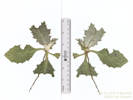
Coll. No. 2772, Onopordum acanthium
|
2772
|
Cirsium sp.
|
Native and Naturalized Flora of the Golden Area, Jefferson County, Colorado
Asteraceae
Onopordum acanthium L.
Scotch Cottonthistle.
(Determination tentative.)
Delong Park, Jefferson County, Colorado.
New city park (construction in 2021 and 2022) near the intersection of 23rd Street and Vernon Drive, 1.75 km. southeast of the GNIS location of Golden.
Basal rosette, new growth densely tomentose.
Collected by permit: City of Golden, 2022, issued: Mar 17, 2022, to: Tom Schweich.
|
Tom Schweich, with Carol Cameron & David Chavez
2772. |
6-May-2022 |
|
|
|
Images:
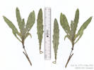
Coll. No. 2773, Cirsium arvense
|
2773
|
Cirsium arvense
|
Native and Naturalized Flora of the Golden Area, Jefferson County, Colorado
Asteraceae
Cirsium arvense (L.) Scop.
Canada Thistle.
Delong Park, Jefferson County, Colorado.
New city park (construction in 2021 and 2022) near the intersection of 23rd Street and Vernon Drive, 1.75 km. southeast of the GNIS location of Golden.
Basal leaves, shallowly dentate, spinulose; petiole narrowly winged, bases tapered.
Colorado Noxious Weed List B.
Collected by permit: City of Golden, 2022, issued: Mar 17, 2022, to: Tom Schweich.
|
Tom Schweich, with Carol Cameron & David Chavez
2773. |
6-May-2022 |
|
|
|
|
2774
|
Convolvulus arvensis.
|
Native and Naturalized Flora of the Golden Area, Jefferson County, Colorado
Convolvulaceae
Convolvulus arvensis L.
Field Bindweed.
Delong Park, Jefferson County, Colorado.
New city park (construction in 2021 and 2022) near the intersection of 23rd Street and Vernon Drive, 1.75 km. southeast of the GNIS location of Golden.
Colorado Noxious Weed List C.
Collected by permit: City of Golden, 2022, issued: Mar 17, 2022, to: Tom Schweich.
|
Tom Schweich, with Carol Cameron & David Chavez
2774. |
6-May-2022 |
|
|
|
|
2775
|
Kochia scoparia.
|
Native and Naturalized Flora of the Golden Area, Jefferson County, Colorado
Chenopodiaceae
Kochia scoparia (L.) Schrad.
Common Red Sage.
Delong Park, Jefferson County, Colorado.
New city park (construction in 2021 and 2022) near the intersection of 23rd Street and Vernon Drive, 1.75 km. southeast of the GNIS location of Golden.
Seedlings. Sterile.
Collected by permit: City of Golden, 2022, issued: Mar 17, 2022, to: Tom Schweich.
|
Tom Schweich, with Carol Cameron & David Chavez
2775. |
6-May-2022 |
|
|
|
|
2775.1
|
Eschscholzia californica
|
|
|
2776
|
Onopordum acanthium
|
Native and Naturalized Flora of the Golden Area, Jefferson County, Colorado
Asteraceae
Onopordum acanthium L.
Scotch Cottonthistle.
Delong Park, Jefferson County, Colorado.
New city park (construction in 2021 and 2022) near the intersection of 23rd Street and Vernon Drive, 1.75 km. southeast of the GNIS location of Golden.
The leaves have been lightly brushed to remove sand, but this has affected the tomentum.
Colorado Noxious Weed List B.
Collected by permit: City of Golden, 2022, issued: Mar 17, 2022, to: Tom Schweich.
|
Tom Schweich, with Carol Cameron & David Chavez
2776. |
6-May-2022 |
|
|
|
|
2776.1
|
Nepeta sp.
|
Native and Naturalized Flora of the Golden Area, Jefferson County, Colorado
Lamiaceae
Nepeta racemosa Lam.
Persian Catmint.
Delong Park, Jefferson County, Colorado.
New city park (construction in 2021 and 2022) near the intersection of 23rd Street and Vernon Drive, 1.75 km. southeast of the GNIS location of Golden.
Purple cast throughout plant, inflorescence immature, possibly N. racemosa Lam. rather than the more common N. cataria L.
Collected by permit: City of Golden, 2022, issued: Mar 17, 2022, to: Tom Schweich.
|
Tom Schweich, with Carol Cameron & David Chavez
2776.1 |
6-May-2022 |
|
|
|
|
2777
|
Rumex crispus.
|
Native and Naturalized Flora of the Golden Area, Jefferson County, Colorado
Polygonaceae
Rumex crispus L.
Curley Dock.
Delong Park, Jefferson County, Colorado.
New city park (construction in 2021 and 2022) near the intersection of 23rd Street and Vernon Drive, 1.75 km. southeast of the GNIS location of Golden.
Sterile specimen, determination tentative.
Collected by permit: City of Golden, 2022, issued: Mar 17, 2022, to: Tom Schweich.
|
Tom Schweich, with Carol Cameron & David Chavez
2777. |
6-May-2022 |
|
|
|
|
2778
|
Lactuca serriola.
|
Native and Naturalized Flora of the Golden Area, Jefferson County, Colorado
Asteraceae
Lactuca serriola L.
Prickly Lettuce.
Delong Park, Jefferson County, Colorado.
New city park (construction in 2021 and 2022) near the intersection of 23rd Street and Vernon Drive, 1.75 km. southeast of the GNIS location of Golden.
Collected by permit: City of Golden, 2022, issued: Mar 17, 2022, to: Tom Schweich.
|
Tom Schweich, with Carol Cameron & David Chavez
2778. |
6-May-2022 |
|
|
|
Other articles:
• 5th Street:
near Arapahoe;
• Arapahoe Street:
at parkway;
|
|
Sunday, 8 May 2022
|
|
Other articles:
• Golden Checklist Flora:
Ranunculus ranunculinus;
Locations:
Apex Park - Northern Parcel.
|
|
Tuesday, 10 May 2022
Apex Park - North, with Cindy Trujillo.
|
|
|
2779
|
Dichanthelium oligosanthes ssp. scribnerianum.
Plants of Jefferson County Open Space
Jefferson County, Colorado
Poaceae
Dichanthemium oligosanthes (J. A. Schultes) Gould ssp. scribnerianum (Nash) Freckmann & Lelong.
Few-Flowered Panicgrass.
Apex Park - Northern Parcel, Jefferson County, Colorado.
Unnamed gulch about 1/3 of the way up the initial Front Range scarp, 3.75 km. south of the GNIS location of Golden.
39.7219°N, 105.2204°W.
WGS 1984
Elev. 1938 m.
Growing in fractures in rocks.
Collected by permit: Jefferson County Open Space, 2022, issued: Apr 5, 2022, to: Tom Schweich.
|
Tom Schweich, with Cindy Trujillo
2779. |
10-May-2022 |
|
|
|
|
2779.1
|
Annual grass with odd “awn.”
Plants of Jefferson County Open Space
Jefferson County, Colorado
Poaceae
Poa bulbosa L.
Bulbous Bluegrass.
Apex Park - Northern Parcel, Jefferson County, Colorado.
Unnamed gulch about 1/3 of the way up the initial Front Range scarp, 3.75 km. south of the GNIS location of Golden.
39.7219°N, 105.2377°W.
WGS 1984
Elev. 1938 m.
Immature.
In soil near but not in the creek.
Collected by permit: Jefferson County Open Space, 2022, issued: Apr 5, 2022, to: Tom Schweich.
|
Tom Schweich, with Cindy Trujillo
2779.1 |
10-May-2022 |
|
|
|
Locations:
Windy Saddle Park.
|
|
Tuesday, 17 May 2022
Windy Saddle Park from the Buffalo Bill Museum to the Survey Field.
|
|
Images:
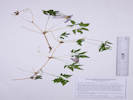
Coll. No. 2780, Clematis columbiana
|
2780
|
Clematis columbiana.
Plants of Jefferson County Open Space
Jefferson County, Colorado
Ranunculaceae
Clematis columbiana (Nutt.) Torr. & A. Gray.
Rock Clematis.
Windy Saddle Park, Jefferson County, Colorado.
Southeast corner of Windy Saddle Park, about 100 m.northeast of, and downslope from, the Buffalo Bill Museum, and 3.6 km. southwest of the GNIS location of Golden.
39.7338°N, 105.2377°W.
WGS 1984
Elev. 2202 m.
Petals light-lavender.
Near top of initial Front Range slope in Douglas Fir forest with Acer glabrum “Rocky Mountain Maple,” Berberis repens, and Mertensia lanceolata.
Variety columbiana if infraspecific names are to be applied.
Collected by permit: Jefferson County Open Space, 2021, issued: Apr 1, 2021, to: Tom Schweich.
|
Tom Schweich, with Cindy Trujillo
2780. |
17-May-2022 |
|
|
|
|
2781
|
Berberis repens.
Plants of Jefferson County Open Space
Jefferson County, Colorado
Berberidaceae
Berberis repens Lindl.
Creeping Barberry.
Windy Saddle Park, Jefferson County, Colorado.
Southeast corner of Windy Saddle Park, about 100 m.northeast of, and downslope from, the Buffalo Bill Museum, and 3.6 km. southwest of the GNIS location of Golden.
39.7338°N, 105.2377°W.
WGS 184
Elev. 2210 m.
Open forest floor near top of initial Front Range slope in Douglas Fir forest with Acer glabrum “Rocky Mountain Maple,” Clematis columbiana, and Mertensia lanceolata.
Collected by permit: Jefferson County Open Space, 2022, issued: Apr 5, 2022, to: Tom Schweich.
|
Tom Schweich, with Cindy Trujillo
2781. |
17-May-2022 |
|
|
|
Images:

Coll. No. 2782, Noccaea fendleri
|
2782
|
Lepidium ?
Plants of Jefferson County Open Space
Jefferson County, Colorado
Brassicaceae
Noccaea fendleri (A. Gray) Holub ssp. glauca (A. Nelson) Al-Shehbaz & M. Koch.
Alpine Pennycress.
Windy Saddle Park, Jefferson County, Colorado.
Southeast corner of Windy Saddle Park, about 140 m. east of, and downslope from, the Buffalo Bill Museum, and 3.6 km. southwest of the GNIS location of Golden.
39.7337°N, 105.2372°W.
WGS 1984
Elev. 2202 m.
Glabrous, basal rosette, clasping stem leaves auriculate, fruit flattened 90° to replum, petals white,
Open forest, Pseudotsuga menziesii, Berberis repens, Frasera speciosa, Taraxacum officinale, small patch ± 60 plants.
Subspecies glauca is the only infraspecific taxon known from Colorado.
Collected by permit: Jefferson County Open Space, 2022, issued: Apr 5, 2022, to: Tom Schweich.
|
Tom Schweich, with Cindy Trujillo
2782. |
17-May-2022 |
|
|
|
|
2783
|
Viola canadensis.
Plants of Jefferson County Open Space
Jefferson County, Colorado
Violaceae
Viola canadensis L.
Canadian White Violet.
Windy Saddle Park, Jefferson County, Colorado.
Southeast corner of Windy Saddle Park, about 375 m. northeast of, and downslope from, the Buffalo Bill Museum, and 3.36 km. southwest of the GNIS location of Golden.
39.7353°N, 105.2358°W.
WGS 1984
Elev. 2070 m.
Edge of Douglas fir forest at bottom of canyon; seen nearby: Anemone patens, Ribes cereum, Amelanchier alnifolia, Acer glabrum, Galium boreale, and Anaphalis margaritacea.
Collected by permit: Jefferson County Open Space, 2022, issued: Apr 5, 2022, to: Tom Schweich.
|
Tom Schweich, with Cindy Trujillo
2783. |
17-May-2022 |
|
|
|
|
2784
|
Anaphalis margaritacea.
Plants of Jefferson County Open Space
Jefferson County, Colorado
Asteraceae
Anaphalis margaritacea (L.) Bentham & Hooker.
Western Pearly Everlasting.
Windy Saddle Park, Jefferson County, Colorado.
Southeast corner of Windy Saddle Park, about 480 m. northeast of, and downslope from, the Buffalo Bill Museum, and 3.30 km. southwest of the GNIS location of Golden.
39.7354°N, 105.2349°W.
WGS 1984
Elev. 2047 m.
Sunny spot at edge of Douglas fir forest, also seen here: Anemone patens, Amelanchier alnifolia, and Viola canadensis.
Collected by permit: Jefferson County Open Space, 2022, issued: Apr 5, 2022, to: Tom Schweich.
|
Tom Schweich, with Cindy Trujillo
2784. |
17-May-2022 |
|
|
|
Locations:
Unnamed Spring.
|
2785
|
Maianthemum stellatum.
Plants of Jefferson County Open Space
Jefferson County, Colorado
Ruscaceae
Maianthemum stellatum (L.) Link.
Starry False Lily of the Valley.
Windy Saddle Park, Jefferson County, Colorado.
Around an unnamed spring in the southeast corner of Windy Saddle Park, about 610 m. northeast of, and downslope from, the Buffalo Bill Museum, and 3.17 km. southwest of the GNIS location of Golden.
39.736°N, 105.234°W.
WGS 1984
Elev. 2018 m.
Also here: Juniperus scopulorum, Noccaea fendleri, Prunus americana, Rubus idaeus var. strigosus, and Frasera speciosa.
Collected by permit: Jefferson County Open Space, 2022, issued: Apr 5, 2022, to: Tom Schweich.
|
Tom Schweich
2785. |
17-May-2022 |
|
|
|
|
2786
|
Carex sp.
Plants of Jefferson County Open Space
Jefferson County, Colorado
Cyperaceae
Carex praegracilis W. Boott.
Clustered Field-Sedge.
Windy Saddle Park, Jefferson County, Colorado.
Unnamed gulch above the Colorado School of Mines Survey Field, beside flowing water from a mine adit, 830 m. northeast of, and downslope from, the Buffalo Bill Museum, and 3.00 km. southwest of the GNIS location of Golden.
39.7367°N, 105.2322°W.
WGS 1984
Elev. 1957 m.
Also collected nearby from this or previous visits: Campanula rotundifolia, Pseudostellaria jamesiana, and Monarda fistulosa.
Collected by permit: Jefferson County Open Space, 2022, issued: Apr 5, 2022, to: Tom Schweich.
|
Tom Schweich, with Cindy Trujillo
2786. |
17-May-2022 |
|
|
|
Images:
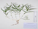
Coll. No. 2787, Pseudostellaria jamesiana
|
2787
|
Pseudostellaria jamesiana.
Plants of Jefferson County Open Space
Jefferson County, Colorado
Caryophyllaceae
Pseudostellaria jamesiana (Torr.) W. A. Weber & R. L. Hartm.
Tuber Starwort.
Windy Saddle Park, Jefferson County, Colorado.
Unnamed gulch above the Colorado School of Mines Survey Field, 875 m. northeast of, and downslope from, the Buffalo Bill Museum, and 2.97 km. southwest of the GNIS location of Golden.
39.7368°N, 105.2318°W.
WGS 1984
Elev. 1950 m.
Growing in rock outcrops on northwest side of a ridge, among Juniperus scopulorum and Cercocarpus montanus.
Collected by permit: Jefferson County Open Space, 2022, issued: Apr 5, 2022, to: Tom Schweich.
|
Tom Schweich, with Cindy Trujillo
2787. |
17-May-2022 |
|
|
|
Other articles:
• Arapahoe Street:
near 5th;
|
|
Saturday, 21 May 2022
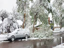
Spring snow storm.
|
|
|
|
Friday, 27 May 2022
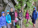
Pre-walk of Colorado Native Plant Society field trip to the mouth of Clear Creek Canyon.
|
|
Other articles:
• Welch Ditch:
at road;
• Peaks to Plains Trail:
along trail;
|
|
Sunday, 29 May 2022
Colorado Native Plant Society field trip to the mouth of Clear Creek Canyon.
|
|
|
|
Monday, 30 May 2022, Memorial Day
Memorial Day service at Rockland Church and beautiful view from the Buffalo Bill Museum.
|
|
Locations:
Rockland Cemetery.
|
|
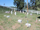
Holstein plot at the Rockland Cemetary. Ralston plot in the background.
|
|
Locations:
Buffalo Bill Memorial Museum.
|
|
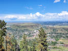
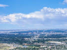
View from Buffalo Bill Museum.
|
|
Other articles:
• 8th Avenue:
at Edgar Mine;
• Colorado Boulevard:
at 9th;
Locations:
Edgar Mine.
Idaho Springs.
|
|
Tuesday, 31 May 2022
Visited the Edgar Mine in Idaho Springs as a possible collecting locality for Physaria vitulifera.
|
|
|
|
Thursday, 2 June 2022
Weeding at DeLong Park.
|
|
Other articles:
• 23rd Street:
at DeLong Park;
Locations:
DeLong Park (City of Golden).
|
|
Tuesday, 7 June 2022
|
|
Other articles:
• 5th Street:
near Arapahoe;
• Crawford Street:
at curve;
Locations:
Apex Park - Northern Parcel.
Tripp Ranch Meadow Open Space.
|
|
Friday, 10 June 2022
Apex north and adjacent Golden parcel.
|
|
Images:
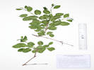
Coll. No. 2788, Rhamnus cathartica
|
2788
|
Rhamnus cathartica.
Plants of Jefferson County Open Space
Jefferson County, Colorado
Rhamnaceae
Rhamnus cathartica L.
European Buckthorn.
Apex Park - Northern Parcel, Jefferson County, Colorado.
Just insude the northeast corner of Apex Park - North, about 61 m. from the northeast property corner, 4.43 km. south of the GNIS location of Golden
39.7251°N, 105.2171°W.
WGS 1984
Elev. 1842 m.
Lf. margin crenate, teeth with dark gland, style 4-parted.
Beside intermittent stream, edge of Prunus americana thicket, with Arctium minus and Cynoglossum officinale. At least three plants here.
Introduced to Colorado; escaping from cultivation into canyons and along streams.
Collected by permit: Jefferson County Open Space, 2022, issued: Apr 5, 2022, to: Tom Schweich.
|
Tom Schweich
2788. |
10-Jun-2022 |
|
|
|
|
2789
|
Helianthus pumilus.
Plants of Jefferson County Open Space
Jefferson County, Colorado
Asteraceae
Helianthus pumilus Nutt.
Little Sunflower.
Apex Park - Northern Parcel, Jefferson County, Colorado.
Along the northern border of the northwest corner, 250 m. from the northwest corner, and 4.37 km. south of the GNIS location of Golden.
39.7254°N, 105.2191°W.
WGS 1984
Elev. 1867 m.
Shortgrass prairie with Artemisia frigida, A. ludoviciana, Heterotheca villosa, Opuntia polyacantha, Eriogonum umbellatum, Tradescantia occidentalis, and Bromus tectorum.
Collected by permit: Jefferson County Open Space, 2022, issued: Apr 5, 2022, to: Tom Schweich.
|
Tom Schweich
2789. |
10-Jun-2022 |
|
|
|
Images:
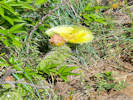
Coll. No. 2790, Opuntia polyacantha, 10 Jun 2022
|
2790
|
Opuntia polyacantha.
Plants of Jefferson County Open Space
Jefferson County, Colorado
Cactaceae
Opuntia polyacantha Haw.
Plains Pricklypear.
Apex Park - Northern Parcel, Jefferson County, Colorado.
Along the northern border of the northeast corner, 260 m. from the northeast corner, and 4.37 km. south of the GNIS location of Golden.
39.7254°N, 105.2192°W.
WGS 1984
Elev. 1862 m.
Edge of Prunus americana and Rhus trilobata thicket, south-facing alluvial ridge with boulders to 50 cm.
Collected by permit: Jefferson County Open Space, 2022, issued: Apr 5, 2022, to: Tom Schweich.
|
Tom Schweich
2790. |
10-Jun-2022 |
|
|
|
|
2791
|
Lithospermum occidentale.
Plants of Jefferson County Open Space
Jefferson County, Colorado
Boraginaceae
Lithospermum occidentale (Mack.) Weakley, Witsell & D. Estes.
Western Marbleseed.
Apex Park - Northern Parcel, Jefferson County, Colorado.
Near bottom of unnamed gulch, along the border with Stonebridge HOA, 256 m. west of the northeast corner, 4.37 km. south of the GNIS location of Golden.
39.7254°N, 105.2192°W.
WGS 1984
Elev. 1862 m.
In a thicket of Prunus americana and Rhus trilobata
Collected by permit: Jefferson County Open Space, 2022, issued: Apr 5, 2022, to: Tom Schweich.
|
Tom Schweich
2791. |
10-Jun-2022 |
|
|
|
|
2792
|
Sphaeralcea coccinea.
Plants of Jefferson County Open Space
Jefferson County, Colorado
Malvaceae
Sphaeralcea coccinea (Nutt.) Rydb.
Cowboy's Delight.
Apex Park - Northern Parcel, Jefferson County, Colorado.
Near the north border with Stonebridge HOA, 220 m. west southwest from the corner, 4.47 km. south of the GNIS location of Golden.
39.7248°N, 105.2186°W.
WGS 1984
Elev. 1867 M.
Across the top of a small alluvial ridge, also here: Artemisia dracunculus, Helianthus pumilus, Xanthisma spinulosum, Alyssum simplex, Bromus tectorum, and Hesperostipa comata.
Collected by permit: Jefferson County Open Space, 2022, issued: Apr 5, 2022, to: Tom Schweich.
|
Tom Schweich
2792. |
10-Jun-2022 |
|
|
|
Images:
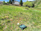
Habitat of Coll. No. 2793, Crepis occidentalis (golf balls for scale).
|
2793
|
Crepis occidentalis.
|
Native and Naturalized Flora of the Golden Area, Jefferson County, Colorado
Asteraceae
Crepis occidentalis Nutt.
Largeflower Hawksbeard.
City of Golden Parcel 40-102-01-032, Jefferson County, Colorado.
Small (1.7 ac) parcel deeded to the city as part of the Tripp Ranch development, sandwiched between Jefferson County Open Space, Stonebridge HOA open space, and private residences, accessed from Crawford St., 4.41 km. south of the GNIS location of Golden.
39.7253°N, 105.2159°W.
WGS 1984
Elev. 1856 m.
Subspecies costata (A. Gray) Babcock & Stebbins, if infraspecific names are to be applied.
Collected by permit: City of Golden, 2022, issued: Mar 17, 2022, to: Tom Schweich.
|
Tom Schweich
2793. |
10-Jun-2022 |
|
|
|
Locations:
Edgar Mine.
|
|
Monday, 13 June 2022
Edgar Mine, Idaho Springs, Colorado.
Six collections of Physaria vitulifera Rydb. made within a radius of 60 to 150 meters of the main portal of the Edgar Mine.
Five other collections of associated species.
Thirty-eight observations of other species; see the Location record for a list.
|
|
Other articles:
• Golden Checklist Flora:
Physaria vitulifera;
|
2794
|
Physaria vitulifera.
|
Plants of Colorado
Brassicaceae
Physaria vitulifera Rydb. Bull. Torrey Bot. Club 28: 278. 1901.
Roundtip Twinpod.
Edgar Mine, Clear Creek County, Colorado.
153 m. east southeast of the mine portal, 1.36 km. west northwest of the GNIS location of Idaho Springs.
39.7473°N, 105.5241°W.
WGS 1984
Elev. 2392 m.
Southeast facing slope, with Juniperus scoparia and Cercocarpus montanus.
Leaves collected for DNA analysis. Approximate topotype.
Collected by permit: Colorado School of Mines, Edgar Mine 2022, issued: May 31, 2022, to: Tom Schweich.
|
Tom Schweich
2794. |
13-Jun-2022 |
|
|
|
Other articles:
• Golden Checklist Flora:
Physaria vitulifera;
|
2795
|
Physaria vitulifera.
|
Plants of Colorado
Brassicaceae
Physaria vitulifera Rydb. Bull. Torrey Bot. Club 28: 278. 1901.
Roundtip Twinpod.
Edgar Mine, Clear Creek County, Colorado.
140 m. east of the mine portal, 1.37 km. west northwest of the GNIS location of Idaho Springs.
39.7475°N, 105.5241°W.
WGS 1984
Elev. 2402 m.
With Juniperus scoparia and Cercocarpus montanus.
Basal leaves removed for DNA analysis. Approximate topotype.
Collected by permit: Colorado School of Mines, Edgar Mine 2022, issued: May 31, 2022, to: Tom Schweich.
|
Tom Schweich
2795. |
13-Jun-2022 |
|
|
|
Images:
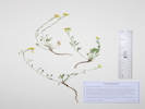
Coll. No. 2796, Physaria montana.
|
2796
|
Physaria montana.
|
Plants of Colorado
Brassicaceae
Physaria montana (A. Gray) Greene.
Mountain Bladderpod.
Edgar Mine, Clear Creek County, Colorado.
138 m. east of the mine portal, 1.37 km. west northwest of the GNIS location of Idaho Springs.
39.7475°N, 105.5241°W.
WGS 1984
Elev. 2416 m.
East-facing, moderately steep slope, with Juniperus scoparia and Cercocarpus montanus.
Seven basal leaves removed for DNA analysis. The plants are all small here, perhaps because of the very dry April.
Collected by permit: Colorado School of Mines, Edgar Mine 2022, issued: May 31, 2022, to: Tom Schweich.
|
Tom Schweich
2796. |
13-Jun-2022 |
|
|
|
Other articles:
• Golden Checklist Flora:
Physaria vitulifera;
|
2797
|
Physaria vitulifera.
|
Plants of Colorado
Brassicaceae
Physaria vitulifera Rydb. Bull. Torrey Bot. Club 28: 278. 1901.
Roundtip Twinpod.
Edgar Mine, Clear Creek County, Colorado.
134 m. east of the mine portal, 1.38 km. west northwest of the GNIS location of Idaho Springs.
39.7475°N, 105.5242°W.
WGS 1984
Elev. 2416 m.
East-facing, moderately steep slope, with Juniperus scoparia and Cercocarpus montanus.
Eight basal leaves removed for DNA analysis.
Collected by permit: Colorado School of Mines, Edgar Mine 2022, issued: May 31, 2022, to: Tom Schweich.
|
Tom Schweich
2797. |
13-Jun-2022 |
|
|
|
Images:

Coll. No. 2798, Packera fendleri
|
2798
|
Packera fendleri.
|
Plants of Colorado
Asteraceae
Packera fendleri (A. Gray) W.A. Weber & Á. Löve.
Fendler’s Ragwort.
Edgar Mine, Clear Creek County, Colorado.
116 m. east southeast of the mine portal, 1.39 km. west northwest of the GNIS location of Idaho Springs.
39.7474°N, 105.5244°W.
WGS 1984
Elev. 2422 m.
South-facing, open rocky slope, with Juniperus scoparia and Cercocarpus montanus.
Collected while collecting approximate topotypes of Physaria vitulifera (P. A. Rydberg, s.n., 26 Aug 1895, NY185631, NY185632, RM1987).
Collected by permit: Colorado School of Mines, Edgar Mine 2022, issued: May 31, 2022, to: Tom Schweich.
|
Tom Schweich
2798. |
13-Jun-2022 |
|
|
|
|
2799
|
Scutellaria brittonii.
|
Plants of Colorado
Lamiaceae
Scutellaria brittonii Porter.
Britton's Skullcap.
Edgar Mine, Clear Creek County, Colorado.
174 m. south of the mine portal, 1.47 km. west northwest of the GNIS location of Idaho Springs.
39.7465°N, 105.5257°W.
WGS 1984
Elev. 2417 m.
South-facing, open rocky slope, with Juniperus scoparia and Cercocarpus montanus.
Collected while collecting approximate topotypes of Physaria vitulifera (P. A. Rydberg, s.n., 26 Aug 1895, NY185631, NY185632, RM1987).
Collected by permit: Colorado School of Mines, Edgar Mine 2022, issued: May 31, 2022, to: Tom Schweich.
|
Tom Schweich
2799. |
13-Jun-2022 |
|
|
|
|
2800
|
Penstemon virens.
|
Plants of Colorado
Plantaginaceae
Penstemon virens Pennell ex Rydb.
Front Range Beardtongue.
Edgar Mine, Clear Creek County, Colorado.
200 m. south of the mine portal, 1.48 km. west northwest of the GNIS location of Idaho Springs.
39.7463°N, 105.5259°W.
WGS 1984
Elev. 2419 m.
South-facing, open rocky slope, with Pinus ponderosa and Cercocarpus montanus.
Collected while collecting approximate topotypes of Physaria vitulifera (P. A. Rydberg, s.n., 26 Aug 1895, NY185631, NY185632, RM1987).
Collected by permit: Colorado School of Mines, Edgar Mine 2022, issued: May 31, 2022, to: Tom Schweich.
|
Tom Schweich
2800. |
13-Jun-2022 |
|
|
|
Other articles:
• Golden Checklist Flora:
Physaria vitulifera;
|
2801
|
Physaria vitulifera.
|
Plants of Colorado
Brassicaceae
Physaria vitulifera Rydb. Bull. Torrey Bot. Club 28: 278. 1901.
Roundtip Twinpod.
Edgar Mine, Clear Creek County, Colorado.
155 m. southwest of the portal, 1.58 km. west northwest of the GNIS location of Idaho Springs
39.747°N, 105.5265°W.
WGS 1984
Elev. 2444 m.
Single plant in a clump of Carex inops var. heliophila at the base of a Cercocarpus montanus.
Approximate topotype of Physaria vitulifera (P. A. Rydberg, s.n., 26 Aug 1895, NY185631, NY185632, RM1987). Eight basal leaves were removed and delivered to KHD for DNA analysis.
Collected by permit: Colorado School of Mines, Edgar Mine 2022, issued: May 31, 2022, to: Tom Schweich.
|
Tom Schweich
2801. |
13-Jun-2022 |
|
|
|
Images:

Habitat of Coll. No. 2802, Arabis pycnocarpa var. pycnocarpa.
|
2802
|
Boechera sp.
|
Plants of Colorado
Brassicaceae
Arabis pycnocarpa M. Hopkins var. pycnocarpa.
Cream Flower Rockcress.
Edgar Mine, Clear Creek County, Colorado.
187 m. west northwest of the portal, 1.69 km. west northwest of the GNIS location of Idaho Springs
39.748°N, 105.527°W.
WGS 1984
Elev. 2450 m.
Basal leaves not withered, hairs simple, flowers light yellow.
In the bank of a road below Ponderosa pines.
Collected while collecting approximate topotypes of Physaria vitulifera (P. A. Rydberg, s.n., 26 Aug 1895, NY185631, NY185632, RM1987).
Collected by permit: Colorado School of Mines, Edgar Mine 2022, issued: May 31, 2022, to: Tom Schweich.
|
Tom Schweich
2802. |
13-Jun-2022 |
|
|
|
Other articles:
• Golden Checklist Flora:
Physaria vitulifera;
|
2803
|
Physaria vitulifera.
|
Plants of Colorado
Brassicaceae
Physaria vitulifera Rydb. Bull. Torrey Bot. Club 28: 278. 1901.
Roundtip Twinpod.
Edgar Mine, Clear Creek County, Colorado.
141 m. northwest of the primary portal, 1.65 km. west northwest of the GNIS location of Idaho Springs
39.748°N, 105.5266°W.
WGS 1984
Elev. 2444 m.
Growing on a dirt mining road berm.
Approximate topotype of Physaria vitulifera (P. A. Rydberg, s.n., 26 Aug 1895, NY185631, NY185632, RM1987). Eight basal leaves removed and distributed to KHD for DNA analysis.
Collected by permit: Colorado School of Mines, Edgar Mine 2022, issued: May 31, 2022, to: Tom Schweich.
|
Tom Schweich
2803. |
13-Jun-2022 |
|
|
|
Other articles:
• Golden Checklist Flora:
Physaria vitulifera;
|
2804
|
Physaria vitulifera.
|
Plants of Colorado
Brassicaceae
Physaria vitulifera Rydb. Bull. Torrey Bot. Club 28: 278. 1901.
Roundtip Twinpod.
Edgar Mine, Clear Creek County, Colorado.
61 m. north of the main portal of the Edgar Mine, 1.54 km. northwest of the GNIS location of Idaho Springs.
39.7481°N, 105.5254°W.
WGS 1984
Elev. 2430 m.
Three caudices of (maybe) one plant.
Growing in fractures of rocks in a road cut. No other taxa in this cut.
Approximate topotype of Physaria vitulifera (P. A. Rydberg, s.n., 26 Aug 1895, NY185631, NY185632, RM1987). Eight basal leaves removed and distributed to KHD for DNA analysis.
Collected by permit: Colorado School of Mines, Edgar Mine 2022, issued: May 31, 2022, to: Tom Schweich.
|
Tom Schweich
2804. |
13-Jun-2022 |
|
|
|
Locations:
Coal Creek.
Ranson/Edwards Homestead Open Space Park.
|
|
Wednesday, 15 June 2022
Ranson/Edwards
|
|
|
2805
|
Physocarpus montanus.
Plants of Jefferson County Open Space
Jefferson County, Colorado
Rosaceae
Physocarpus monogynus (Torr.) J.M. Coult.
Mountain Ninebark.
Ranson/Edwards Homestead Open Space Park, Jefferson County, Colorado.
On an abandoned terrace of Coal Creek, approximately 1.6 mi. west on CO Highway 72 from CO Highway 93 to Plainview Road, 0.8 mi. generally north on Plainview Road, then 440 m. east on an high pressure gas line service road to Coal Creek.
39.8833°N, 105.2592°W.
WGS 1984
Elev. 1933 m.
Terrace on southeast side of Coal Creek with Prunus virginiana and Salix exigua. Also collected nearby: Hesperis matronalis and Vitis riparia.
Collected while searching the banks of Coal Creek for Humulus lupulus “Wild Hops.”
Collected by permit: Jefferson County Open Space, 2022, issued: Apr 5, 2022, to: Tom Schweich.
|
Tom Schweich
2805. |
15-Jun-2022 |
|
|
|
|
2806
|
River grape … sterile.
Some parts combined with the next.
|
|
Images:
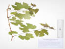
Coll. No. 2807, Vitis riparia
|
2807
|
River grape … in flower.
Plants of Jefferson County Open Space
Jefferson County, Colorado
Vitaceae
Vitis riparia Michx.
Riverbank Grape.
Ranson/Edwards Homestead Open Space Park, Jefferson County, Colorado.
On a terrace of Coal Creek, approximately 1.6 mi. west on CO Highway 72 from CO Highway 93 to Plainview Road, 0.8 mi. generally north on Plainview Road, then 440 m. east on an high pressure gas line service road to Coal Creek.
39.8833°N, 105.2597°W.
WGS 1984
Elev. 1930 m.
In flower.
Sprawling on the ground and growing on Rhus trilobata under Populus angustifolia.
Collected by permit: Jefferson County Open Space, 2022, issued: Apr 5, 2022, to: Tom Schweich.
|
Tom Schweich
2807. |
15-Jun-2022 |
|
|
|
Images:

Coll. No. 2808, Hesperis matronalis
|
2808
|
Hesperis matronalis.
Plants of Jefferson County Open Space
Jefferson County, Colorado
Brassicaceae
Hesperis matronalis L.
Dame's Rocket.
Ranson/Edwards Homestead Open Space Park, Jefferson County, Colorado.
Approximately 1.6 mi. west on CO Highway 72 from CO Highway 93 to Plainview Road, 0.8 mi. generally north on Plainview Road to a high pressure gas line service road, then 356 m.southeast to a terrace on the right bank of Coal Creek.
39.8828°N, 105.2599°W.
WGS 1984
Elev. 1934 m.
Growing in a thicket of Prunus virginiana and Crataegus succulenta.
Colorado Noxious Weed List B.
Collected by permit: Jefferson County Open Space, 2022, issued: Apr 5, 2022, to: Tom Schweich.
|
Tom Schweich
2808. |
15-Jun-2022 |
|
|
|
Images:
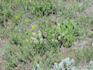
Coll. No. 2809, Astragalus laxmannii var. robustior.
|
2809
|
Astragalus, maybe A. bisulcatus.
Plants of Jefferson County Open Space
Jefferson County, Colorado
Fabaceae
Astragalus laxmannii Jacq. var. robustior (Hook.) Barneby & S. L. Welsh.
Prairie Milkvetch.
Ranson/Edwards Homestead Open Space Park, Jefferson County, Colorado.
Approximately 1.6 mi. west on CO Highway 72 from CO Highway 93 to Plainview Road, 0.8 mi. generally north on Plainview Road to a high pressure gas line service road, about 215 m. east on the pipeline road.
39.8842°N, 105.2605°W.
WGS 1984
Elev. 1939 m.
Caulescent, 23-24 cm., hairs dolibriform, leaflets #17, 19 mm., terminal lflt jointed, calyx tube 5 mm., flowers 17 mm.
Dry terrace above Coal Creek, with Koeleria macrantha.
Collected by permit: Jefferson County Open Space, 2022, issued: Apr 5, 2022, to: Tom Schweich.
|
Tom Schweich
2809. |
15-Jun-2022 |
|
|
|
|
|
Monday, 20 June 2022
Weeding at DeLong Park
|
|
Images:
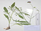
Coll. No. 2810, Knautia macedonica
|
2810
|
|
Native and Naturalized Flora of the Golden Area, Jefferson County, Colorado
Caprifoliaceae
Knautia macedonica Griesb.
Macedonian scabious.
Delong Park, Jefferson County, Colorado.
In the unreconstructed portion of the park, below the houses on Lookout View Court, 1.81 km. southeast of the GNIS location of Golden.
39.7481°N, 105.2081°W.
WGS 1984
Elev. 1764 m.
Flowers deep red.
Probably a garden escapee, now naturalized.
Collected by permit: City of Golden, 2022, issued: Mar 17, 2022, to: Tom Schweich.
|
Tom Schweich
2810. |
20-Jun-2022 |
|
|
|
Locations:
Ranson/Edwards Homestead Open Space Park.
|
|
Tuesday, 21 June 2022
Ranson/Edwards
|
|
|
2811
|
Amorpha fruticosa.
Plants of Jefferson County Open Space
Jefferson County, Colorado
Fabaceae
Amorpha fruticosa L.
False Indigo.
Ranson/Edwards Homestead Open Space Park, Jefferson County, Colorado.
Abandoned channel of Coal Creek, approximately 1.6 mi. west on CO Highway 72 from CO Highway 93 to Plainview Road, 0.8 mi. generally north on Plainview Road to a high pressure gas line service road, then about 520 m. east.
39.8846°N, 105.2583°W.
WGS 1984
Elev. 1922 m.
Shrub, 2 m. tall.
with Crataegus succulenta and Populus angustifolia.
Collected by permit: Jefferson County Open Space, 2022, issued: Apr 5, 2022, to: Tom Schweich.
|
Tom Schweich
2811. |
21-Jun-2022 |
|
|
|
Images:
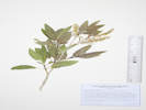
Coll. No. 2812, Populus angustifolia.
|
2812
|
Salix sp.
Plants of Jefferson County Open Space
Jefferson County, Colorado
Salicaceae
Populus angustifolia E. James.
Narrowleaf Cottonwood.
Ranson/Edwards Homestead Open Space Park, Jefferson County, Colorado.
Bar of abandoned channel of Coal Creek, approximately 1.6 mi. west on CO Highway 72 from CO Highway 93 to Plainview Road, 0.8 mi. generally north on Plainview Road to a high pressure gas line service road, then about 520 m. east.
39.8845°N, 105.2583°W.
WGS 1984
Elev. 1922 m.
With Amorpha fruticosa and Crataegus succulenta
Collected by permit: Jefferson County Open Space, 2022, issued: Apr 5, 2022, to: Tom Schweich.
|
Tom Schweich
2812. |
21-Jun-2022 |
|
|
|
Images:
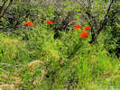
Coll. No. 2813, Papaver orientale.
|
2813
|
Very large, bright red poppy.
Plants of Jefferson County Open Space
Jefferson County, Colorado
Papaveraceae
Papaver orientale L.
Oriental Poppy.
Ranson/Edwards Homestead Open Space Park, Jefferson County, Colorado.
Bar of abandoned channel of Coal Creek, approximately 1.6 mi. west on CO Highway 72 from CO Highway 93 to Plainview Road, 0.8 mi. generally north on Plainview Road to a high pressure gas line service road, then about 500 m. east northeast.
39.8851°N, 105.2579°W.
WGS 1984
Elev. 1923 m.
Approx. 30 flowering stems, petals bright red with purple spot, stamens dark purple.
Also collected in the lower channel: Apocynum ×floribundum, Amorpha fruticosa, Populus angustifolia, and Vitis riparia.
Collected by permit: Jefferson County Open Space, 2022, issued: Apr 5, 2022, to: Tom Schweich.
|
Tom Schweich
2813. |
21-Jun-2022 |
|
|
|
Images:
Small vine of Humulus lupulus
|
|
Small vine of hops Humulus lupulus on a bar of Coal Creek.
|
|
|
|
Wednesday, 22 June 2022
|
|
Other articles:
• 8th Street:
at 8th St Aparts.;
|
|
Saw some of this on the walk home from the Community Center.
|
|
Other articles:
• 5th Street:
near Maple;
|
|
Knautia macedonica (L.) J. M. Coult. in the front yard of 1202 5th Street.
|
|
Locations:
Tin Cup Ridge.
|
|
Tuesday, 28 June 2022
Tin Cup Ridge
|
|
|
2815
|
Hymenopappus filifolia var. polycephalus.
Plants of Jefferson County Open Space
Jefferson County, Colorado
Asteraceae
Hymenopappus filifolius Hook. var. polycephalus (Osterh.) B.L. Turner.
Many-Headed Fine-Leaved Wooly-White.
Tin Cup Ridge, Jefferson County, Colorado.
Lower east slope of the hogback locally called Tin Cup Ridge, the northward extension of Dinosaur Ridge into Golden, 6.33 km. south southeast of the GNIS location of Golden.
39.7139°N, 105.2042°W.
WGS 1984
Elev. 1855 m.
Mixed grasses and forbs with: Rhus trilobata, Artemisia ludoviciana, Heterotheca villosa, Amelanchier alnifolia, and Bromus japonicus.
Collected by permit: Jefferson County Open Space, 2022, issued: Apr 5, 2022, to: Tom Schweich.
|
Tom Schweich
2815. |
28-Jun-2022 |
|
|
|
Images:
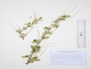
Coll. No. 2816, Cercocarpus montanus.
|
2816
|
Cercocarpus montanus.
Plants of Jefferson County Open Space
Jefferson County, Colorado
Rosaceae
Cercocarpus montanus Raf.
Alder-Leaf Mountain Mahogany.
Tin Cup Ridge, Jefferson County, Colorado.
On the east side, mid-slope, of the hogback locally called Tin Cup Ridge, the northward extension of Dinosaur Ridge into Golden, 6.52 km. south southeast of the GNIS location of Golden.
39.7125°N, 105.2041°W.
WGS 1984
Elev. 1904 m.
Common shrub, to 2 m., on open, rocky slopes. Past-flowering, with developing fruit.
Also here: Rhus trilobata, Artemisia ludoviciana, Ericameria nauseosa var. graveolens, and Heterotheca villosa.
Collected by permit: Jefferson County Open Space, 2022, issued: Apr 5, 2022, to: Tom Schweich.
|
Tom Schweich
2816. |
28-Jun-2022 |
|
|
|
Images:
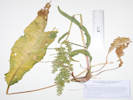
Coll. No. 2817, Rumex crispus
|
2817
|
Rumex crispus.
Plants of Jefferson County Open Space
Jefferson County, Colorado
Polygonaceae
Rumex crispus L.
Curley Dock.
Tin Cup Ridge, Jefferson County, Colorado.
On the east side, steep mid-slope, of the hogback locally called Tin Cup Ridge, the northward extension of Dinosaur Ridge into Golden, 6.55 km. south southeast of the GNIS location of Golden.
39.7123°N, 105.204°W.
WGS 1984
Elev. 1910 m.
Most basal leaves withered.
Growing with: Rhus trilobata, Ericameria nauseosa var. graveolens, and Cercocarpus montanus
Collected by permit: Jefferson County Open Space, 2022, issued: Apr 5, 2022, to: Tom Schweich.
|
Tom Schweich
2817. |
28-Jun-2022 |
|
|
|
Images:
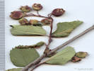
Fruit of Coll. No. 2818, Amelanchier alnifolia.
|
2818
|
Amelanchier alnifolia.
Plants of Jefferson County Open Space
Jefferson County, Colorado
Rosaceae
Amelanchier alnifolia (Nutt.) Nutt. ex M. Roem.
Saskatoon Serviceberry.
Tin Cup Ridge, Jefferson County, Colorado.
Top of steep slope, east side of ridge, hogback locally called Tin Cup Ridge, the northward extension of Dinosaur Ridge into Golden, 6.99 km. south southeast of the GNIS location of Golden.
39.7094°N, 105.2029°W.
WGS 1984
Elev. 1948 m.
Small shrubs to 1 m., forming fruit.
With Cercocarpus montanus.
Collected by permit: Jefferson County Open Space, 2022, issued: Apr 5, 2022, to: Tom Schweich.
|
Tom Schweich
2818. |
28-Jun-2022 |
|
|
|
|
2819
|
Aristida purpurea.
Plants of Jefferson County Open Space
Jefferson County, Colorado
Poaceae
Aristida purpurea Nutt. var. longiseta (Steud.) Vasey.
Purple Threeawn.
Tin Cup Ridge, Jefferson County, Colorado.
Top of ridge of a hogback locally called Tin Cup Ridge, the northward extension of Dinosaur Ridge into Golden, 6.97 km. south southeast of the GNIS location of Golden.
39.7094°N, 105.2029°W.
WGS 1984
Elev. 1949 m.
Long awns.
In a small depression that may hold water at least part of the year, with Plantago patagonica.
Collections of this grass in Golden s.l. are commonly var. longiseta.
Collected by permit: Jefferson County Open Space, 2022, issued: Apr 5, 2022, to: Tom Schweich.
|
Tom Schweich
2819. |
28-Jun-2022 |
|
|
|
|
2819.1
|
Plantago sp.
Plants of Jefferson County Open Space
Jefferson County, Colorado
Plantaginaceae
Plantago patagonica Jacq.
Woolly Plantain.
Tin Cup Ridge, Jefferson County, Colorado.
Top of ridge of a hogback locally called Tin Cup Ridge, the northward extension of Dinosaur Ridge into Golden, 6.97 km. south southeast of the GNIS location of Golden.
39.7094°N, 105.2029°W.
WGS 1984
Elev. 1949 m.
In a small depression that may hold water at least part of the year, with Aristida purpurea var. longiseta. Also collected in the rocks nearby, Delphinium nuttallianum, Amelanchier alnifolia, and Rubus deliciosus.
Collected by permit: Jefferson County Open Space, 2022, issued: Apr 5, 2022, to: Tom Schweich.
|
Tom Schweich
2819.1 |
28-Jun-2022 |
|
|
|
Locations:
Lippincott Ranch.
Lippincott Ranch (North).
|
|
Saturday, 2 July 2022
Lippincott Ranch with John Vickery.
|
|
|
2820
|
Viola, maybe V. adunca.
Plants of Lippincott Ranch
Boulder and Jefferson Counties, Colorado
Violaceae
Viola sp., cf. V. canadensis L.
Canadian White Violet.
Lippincott Ranch, Jefferson County, Colorado.
About mid-way between Bull Gulch and the county boundary, 1.74 km. north northwest of the main gate, 23.4 km. north northwest of Golden
39.9108°N, 105.2783°W.
WGS 1984
Elev. 2035 m.
Edge of a dry watercourse, in deep ponderosa pine forest duff. Also collected here: Symphoricarpos rotundifolius and Lactuca serriola.
Collected by permit: Jefferson County Open Space, 2022, issued: Apr 5, 2022, to: Tom Schweich.
|
Tom Schweich, with John Vickery
2820. |
2-Jul-2022 |
|
|
|
|
2821
|
Lactuca seriola.
Plants of Lippincott Ranch
Boulder and Jefferson Counties, Colorado
Asteraceae
Lactuca serriola L.
Prickly Lettuce.
Lippincott Ranch, Jefferson County, Colorado.
About mid-way between Bull Gulch and the county boundary, 1.74 km. north northwest of the main gate, 23.4 km. north northwest of Golden
39.9107°N, 105.2782°W.
WGS 1984
Elev. 2034 m.
Stem prickly. Leaves, entire, margins and mid-rib prickly. Flowers, yellow.
Edge of a dry watercourse, in deep ponderosa pine forest duff. Also collected here: Symphoricarpos rotundifolius and Viola sp., cf. V. canadensis.
Collected by permit: Jefferson County Open Space, 2022, issued: Apr 5, 2022, to: Tom Schweich.
|
Tom Schweich, with John Vickery
2821. |
2-Jul-2022 |
|
|
|
|
2822
|
Symphoricarpos rotundifolius.
Plants of Lippincott Ranch
Boulder and Jefferson Counties, Colorado
Caprifoliaceae
Symphoricarpos rotundifolius A. Gray.
Roundleaf Snowberry.
Lippincott Ranch, Jefferson County, Colorado.
About mid-way between Bull Gulch and the county boundary, 1.74 km. north northwest of the main gate, 23.4 km. north northwest of Golden.
39.9108°N, 105.2783°W.
WGS 1984
Elev. 2036 m.
Developing fruit, few in number, mostly terminal, though some in axils.
Near a dry watercourse in open ponderosa pine forest.
Collected by permit: Jefferson County Open Space, 2022, issued: Apr 5, 2022, to: Tom Schweich.
|
Tom Schweich, with John Vickery
2822. |
2-Jul-2022 |
|
|
|
Images:
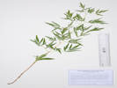
Coll. No. 2823, Clematis, c.f. C. hirsutissima.
|
2823
|
Clematis, with finely divided leaves.
Plants of Jefferson County Open Space
Jefferson County, Colorado
Ranunculaceae
Clematis c.f. C. hirsutissima Pursh.
Hairy Clematis, Sugar Bowls.
Lippincott Ranch, Jefferson County, Colorado.
Northern part of the ranch in Boulder County, 2.3 km. north northwest of the main gate, 23.9 km. north northwest of the GNIS location of Golden.
39.9141°N, 105.2803°W.
WS 1984
Elev. 2061 m.
Finely divided leaf, 2-3 times pinnately compound.
Moderate northeast slope in ponderosa pine woodland, also seen nearby Corallorhiza maculata and Jamesia americana.
Collected by permit: Boulder OSMP, issued: May 27, 2022, to: Tom Schweich.
|
Tom Schweich, with John Vickery
2823. |
2-Jul-2022 |
|
|
|
|
2824
|
Jamesia americana
Plants of Jefferson County Open Space
Jefferson County, Colorado
Hydrangeaceae
Jamesia americana Torr. & A. Gray.
Fivepetal Cliffbush.
Lippincott Ranch (North), Boulder County, Colorado.
In boulders on ridge above south fork of Spring Brook, 2.75 km. south of Eldorado Springs, 23.9 km. north northwest of the GNIS location of Golden
39.9142°N, 105.2806°W.
WGS 1984
Elev. 2062 m.
Also collected nearby: Heuchera bracteata, Clematis hirsutissima, and Urtica dioica.
Collected by permit: Boulder OSMP, issued: May 27, 2022, to: Tom Schweich.
|
Tom Schweich, with John Vickery
2824. |
2-Jul-2022 |
|
|
|
Images:
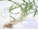
Coll. No. 2825, Elymus glaucus ssp. glaucus.
|
2825
|
Elymus sp.
Plants of Lippincott Ranch
Boulder and Jefferson Counties, Colorado
Poaceae
Elymus glaucus Buckley ssp. glaucus.
Blue Wild Rye.
Lippincott Ranch (North), Boulder County, Colorado.
Northern portion of the ranch in Boulder County, base of boulders above south fork of Spring Creek, 2.33 km. north northwest of the main gate, 2.67 km. south southwest of Eldorado Springs.
39.9144°N, 105.2809°W.
WGS 1984
Elev. 2060 m.
Ponderosa pine forest, also collected here Jamesia americana, Urtica dioica, and Heuchera bracteata.
Collected by permit: Boulder OSMP, issued: May 27, 2022, to: Tom Schweich.
|
Tom Schweich, with John Vickery
2825. |
2-Jul-2022 |
|
Coll. No, 2825, 2 July 2022, characters observed:
Perennial grass, to 85 cm.,
not rhizomatous;
Cauline nodes visible;
Sheath open;
Ligule membraneous, 1 mm.;
Auricles absent;
Blade 250 mm. × 13 mm. wide, flat, lax;
Inflorescence, 1 per culm, two-sided spike, straight or slightly curved but not drooping;
Spikelets, 2 per node, sessile;
Disarticulation between the florets;
Glumes,
lower, 10 mm. + awn 2-4 mm., veins 1,
upper 12 mm. + awn 2-4 mm., ±= lowest floret, veins 5;
Florets, 3 per spikelet;
Lemma, 10 mm., awns 1, 16 mm., slightly curved;
Palea, 9 mm., <lemma, tip bifid.
|
|
Images:
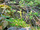
Habitat of Coll. No. 2826, Heuchera bracteata.
|
2826
|
Heuchera bracteata.
Plants of Lippincott Ranch
Boulder and Jefferson Counties, Colorado
Dryopteridaceae
Dryopteris filix-mas (L.) Schott.
Male Fern.
Lippincott Ranch (North), Boulder County, Colorado.
Northern portion of the ranch in Boulder County, very close to the western parcel boundary, base of boulders above south fork of Spring Creek, 2.33 km. north northwest of the main gate, 2.67 km. south southwest of the GNIS location of Eldorado Springs.
39.9144°N, 105.2811°W.
WGS 1984
Elev. 2060 m.
Ponderosa pine forest, also collected here: Jamesia americana, Heuchera bracteata, Urtica dioica, and Elymus glaucus.
Collected by permit: Boulder OSMP, issued: May 27, 2022, to: Tom Schweich.
|
Tom Schweich, with John Vickery
2826.1 |
2-Jul-2022 |
|
|
|
Images:
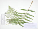
Coll. No. 2826.1, Dryopteris filix-mas.
|
2826.1
|
“Male fern”
Plants of Lippincott Ranch
Boulder and Jefferson Counties, Colorado
Dryopteridaceae
Dryopteris filix-mas (L.) Schott.
Male Fern.
Lippincott Ranch (North), Boulder County, Colorado.
Northern portion of the ranch in Boulder County, very close to the western parcel boundary, base of boulders above south fork of Spring Creek, 2.33 km. north northwest of the main gate, 2.67 km. south southwest of the GNIS location of Eldorado Springs.
39.9144°N, 105.2811°W.
WGS 1984
Elev. 2060 m.
Ponderosa pine forest, also collected here: Jamesia americana, Heuchera bracteata, Urtica dioica, and Elymus glaucus.
Collected by permit: Boulder OSMP, issued: May 27, 2022, to: Tom Schweich.
|
Tom Schweich, with John Vickery
2826.1 |
2-Jul-2022 |
|
|
|
|
2827
|
Utrica dioica.
Plants of Lippincott Ranch
Boulder and Jefferson Counties, Colorado
Urticaceae
Urtica dioica L. ssp. gracilis (Aiton) Seland.
Stinging Nettle.
Lippincott Ranch (North), Boulder County, Colorado.
Northern portion of the ranch in Boulder County, very close to the western parcel boundary, in streambed of south fork of Spring Creek, 2.32 km. north northwest of the main gate, 2.68 km. south southwest of the GNIS location of Eldorado Springs.
39.9143°N, 105.2809°W.
WGS 1984
Elev. 2066 m.
Ponderosa pine forest, also collected nearby: dryopteris filix-mas, Jamesia americana, Heuchera bracteata, and Elymus glaucus.
Collected by permit: Boulder OSMP, issued: May 27, 2022, to: Tom Schweich.
|
Tom Schweich, with John Vickery
2827. |
2-Jul-2022 |
|
|
|
|
2828
|
Silene, dioecious.
Plants of Lippincott Ranch
Boulder and Jefferson Counties, Colorado
Caryophyllaceae
Silene latifolia Poir.
Bladder Campion.
Lippincott Ranch (North), Boulder County, Colorado.
Bank of south fork of Spring Brook, 2.35 km. north northwest of the main gate, 2.63 km. south southwest of the GNIS location of Eldorado Springs.
39.9146°N, 105.2807°W.
WGS 1984
Elev. 2065 m.
Lippincott Ranch is jointly owned by City of Boulder Open Space and Mountain Parks and Jefferson County Open Space.
Collected by permit: Boulder OSMP, issued: May 27, 2022, to: Tom Schweich.
|
Tom Schweich, with John Vickery
2828. |
2-Jul-2022 |
|
|
|
|
2829
|
Glyceria sp.
Plants of Lippincott Ranch
Boulder and Jefferson Counties, Colorado
Poaceae
Glyceria elata (Rydb.) M. E. Jones.
Fowl Manna Grass.
Lippincott Ranch (North), Boulder County, Colorado.
In the streambed of the south fork of Spring Brook, 2.38 km. north northwest of the main gate, and 2.56 km. south southwest of the GNIS location of Eldorado Springs.
39.915°N, 105.2799°W.
WGS 1984
Elev. 2052 m.
Streambed shaded by Ponderosa pines, previously collected nearby: Corylus cornuta, Circaea alpina, and Parietaria pensylvanica. Prosartes trachycarpa also observed nearby.
Collected by permit: Boulder OSMP, issued: May 27, 2022, to: Tom Schweich.
|
Tom Schweich, with John Vickery
2829. |
2-Jul-2022 |
|
|
|
Images:
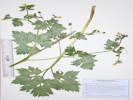
Coll. No. 2830, Ranunculus macounii.
|
2830
|
Ranunculus macounii.
Plants of Lippincott Ranch
Boulder and Jefferson Counties, Colorado
Ranunculaceae
Ranunculus macounii Britton.
Macoun's Buttercup.
Lippincott Ranch (North), Boulder County, Colorado.
Rooted in water of the south fork of Spring Brook, 2.41 km. north northwest of the main gate, 2.55 km. south southwest of the GNIS location of Eldorado Springs.
39.9151°N, 105.2802°W.
WGS 1984
Elev. 2050 m.
Shade streambed under ponderosa pines, previously collected nearby: Corylus cornuta, Circaea alpina, Parietaria pensylvanica, and Glyceria elata. Prosartes trachycarpa also observed nearby.
Collected by permit: Boulder OSMP, issued: May 27, 2022, to: Tom Schweich.
|
Tom Schweich, with John Vickery
2830. |
2-Jul-2022 |
|
|
|
Images:
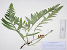
Coll. No. 2831, Papaver orientale.
|
2831
|
Leaves, likely Papaver orientale.
Plants of Lippincott Ranch
Boulder and Jefferson Counties, Colorado
Papaveraceae
Papaver orientale L.
Oriental Poppy.
Lippincott Ranch (North), Boulder County, Colorado.
In deep shade beside north fork of Spring Brook, 2.49 km. north northwest of the main gate, 2.49 km. south southwest of the GNIS location of Eldorado Springs.
39.9156°N, 105.2805°W.
WGS 1984
Elev. 2042 m.
Sterile.
Collected by permit: Boulder OSMP, issued: May 27, 2022, to: Tom Schweich.
|
Tom Schweich, with John Vickery
2831. |
2-Jul-2022 |
|
|
|
|
2832
|
Mentha spicata.
Plants of Lippincott Ranch
Boulder and Jefferson Counties, Colorado
Lamiaceae
Mentha spicata L.
Spearmint.
Lippincott Ranch (North), Boulder County, Colorado.
Middle of small swampy area on the north fork of Spring Brook, 2.52 km. north northwest of the main gate, 2.45 km. south southwest of the GNIS location of Eldorado Springs.
39.9159°N, 105.2803°W.
WGS 1984
Elev. 2045 m.
Very short petioles. Sterile, identified by “spearmint” smell and taste at time of collection.
Deep forest shade, also seen or collected nearby: Ligusticum porteri, Papaver orientale, and Populus tremuloides.
Collected by permit: Boulder OSMP, issued: May 27, 2022, to: Tom Schweich.
|
Tom Schweich, with John Vickery
2832. |
2-Jul-2022 |
|
|
|
Images:
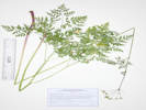
Coll. No. 2833, Ligusticum porteri
|
2833
|
Ligusticum porteri.
Plants of Lippincott Ranch
Boulder and Jefferson Counties, Colorado
Apiaceae
Ligusticum porteri J.M. Coult. & Rose.
Porter's Licorice-Root.
Lippincott Ranch (North), Boulder County, Colorado.
Along the north fork of Spring Brook, 2.53 km. north northwest of the main gate, 2.42 km. south southwest of the GNIS location of Eldorado Springs.
39.916°N, 105.28°W.
WGS 1984
Elev. 2037 m.
Sunny spot, more plants in vegetative state in shade.
Collected by permit: Boulder OSMP, issued: May 27, 2022, to: Tom Schweich.
|
Tom Schweich, with John Vickery
2833. |
2-Jul-2022 |
|
|
|
Images:
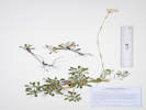
Coll. No. 2834, Antennaria neglecta.
|
2834
|
Antennaria, maybe A. neglecta.
Plants of Lippincott Ranch
Boulder and Jefferson Counties, Colorado
Asteraceae
Antennaria neglecta Greene.
Field Pussy-Toes.
Lippincott Ranch (North), Boulder County, Colorado.
In shade along the north fork of Spring Brook, 2.56 km. north northwest of the main gate, 2.36 km. south southwest of the GNIS location of Eldorado Springs.
39.9164°N, 105.2793°W.
WGS 1984
Elev. 2023 m.
Leaves adaxial glabrous, abaxial tomentose.
Lippincott Ranch is jointly owned by City of Boulder Open Space and Mountain Parks and Jefferson County Open Space.
Collected by permit: Boulder OSMP, issued: May 27, 2022, to: Tom Schweich.
|
Tom Schweich, with John Vikery
2834. |
2-Jul-2022 |
|
|
|
Images:
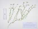
Coll. No. 2835, Erigeron divergens.
|
2835
|
Erigeron divergens.
Plants of Lippincott Ranch
Boulder and Jefferson Counties, Colorado
Asteraceae
Erigeron divergens Torr. & A. Gray.
Spreading Fleabane.
Lippincott Ranch (North), Boulder County, Colorado.
Left bank of the north fork of Spring Brook, 2.59 km. north northwest of the main gate, 2.31 km. south southwest of the GNIS location of Eldorado Springs.
39.9167°N, 105.2791°W.
WGS 1984
Elev. 2019 m.
Sunny spot among ponderosa pines above the creek, also collected or seen nearby: Humulus lupulus, Rumex acetosella, Castilleja rhexifolia, and Smilax lasioneuron.
Lippincott Ranch is jointly owned by City of Boulder Open Space and Mountain Parks and Jefferson County Open Space.
Collected by permit: Boulder OSMP, issued: May 27, 2022, to: Tom Schweich.
|
Tom Schweich, with John Vickery
2835. |
2-Jul-2022 |
|
|
|
Images:
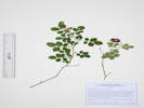
Coll. No. 2836, Rosa eglanteria.
|
2836
|
Rosa eglantera
Plants of Lippincott Ranch
Boulder and Jefferson Counties, Colorado
Rosaceae
Rosa eglanteria L.
Sweetbriar Rose.
Lippincott Ranch (North), Boulder County, Colorado.
Right bank of the north fork of Spring Brook, 2.56 km. north northwest of the main gate, 2.33 km. south southwest of the GNIS location of Eldorado Springs.
39.9165°N, 105.2785°W.
WGS 1984
Elev. 2011 m.
Leaves abaxial dense glandular-stipitate.
Open ponderosa pine forest.
Lippincott Ranch is jointly owned by City of Boulder Open Space and Mountain Parks and Jefferson County Open Space.
Collected by permit: Boulder OSMP, issued: May 27, 2022, to: Tom Schweich.
|
Tom Schweich, with John Vickery
2836. |
2-Jul-2022 |
|
|
|
Images:
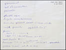
Diagnosis of Coll. No. 2837, Schedonorus arundinaceus.
|
2837
|
Grass.
Plants of Lippincott Ranch
Boulder and Jefferson Counties, Colorado
Poaceae
Schedonorus arundinaceus (Schreb.) Dumort.
Tall Fescue.
Lippincott Ranch (North), Boulder County, Colorado.
South fork of Spring Brook, 2.36 km. north northwest of the main gate, 2.51 km. south southwest of the GNIS location of Eldorado Springs.
39.9152°N, 105.2779°W.
WGS 1984
Elev. 2009 m.
Edge of ponderosa pine woodland, just above the creek.
Lippincott Ranch is jointly owned by City of Boulder Open Space and Mountain Parks and Jefferson County Open Space.
Collected by permit: Boulder OSMP, issued: May 27, 2022, to: Tom Schweich.
|
Tom Schweich, with John Vickery
2837. |
2-Jul-2022 |
|
|
|
|
2838
|
Galium boreale.
Plants of Lippincott Ranch
Boulder and Jefferson Counties, Colorado
Rubiaceae
Galium boreale L.
Bedstraw.
Lippincott Ranch (North), Boulder County, Colorado.
South side of south fork of Spring Brook, 2.33 km. north northwest of the main gate, 2.57 km. south southwest of the GNIS location of Eldorado Springs.
39.9149°N, 105.2786°W.
WGS 1984
Elev. 2025 m.
Perennial.
Amid grasses and forbs under ponderosa pine canopy.
Lippincott Ranch is jointly owned by City of Boulder Open Space and Mountain Parks and Jefferson County Open Space.
Collected by permit: Boulder OSMP, issued: May 27, 2022, to: Tom Schweich.
|
Tom Schweich, with John Vickery
2838. |
2-Jul-2022 |
|
|
|
|
2839
|
Pseudogna …
Plants of Jefferson County Open Space
Jefferson County, Colorado
Asteraceae
Pseudognaphalium canescens (DC.) Anderberg.
Wright's Rabbit-Tobacco.
Lippincott Ranch, Jefferson County, Colorado.
In the saddle between Spring Brook and Bull Gulch drainages, very close to the Boulder/Jefferson County boundary, 2.11 km. north northwest of the main gate, 2.78 km. south southwest of the GNIS location of Eldorado Springs.
39.9134°N, 105.2783°W.
WS 1984
Elev. 2051 m.
Dried out, but still trying to bloom.
Open ponderosa pine woodland.
Lippincott Ranch is jointly owned by City of Boulder Open Space and Mountain Parks and Jefferson County Open Space.
Collected by permit: Jefferson County Open Space, 2022, issued: Apr 5, 2022, to: Tom Schweich.
|
Tom Schweich, with John Vickery
2839. |
2-Jul-2022 |
|
|
|
Literature Cited:
- Scully, Richard W., 2007.
Other articles:
• Field Notes:
1 Jan 2023;
Coll. No. 3278, 21 Jun 2024;
• Glossary:
subpalmate;
Species Lists:
Potentilla hippiana × pulcherrima
|
2840
|
hybrid Potentilla.
Plants of Jefferson County Open Space
Jefferson County, Colorado
Rosaceae
Potentilla hippiana × pulcherrima.
Hybrid Potentilla.
Lippincott Ranch, Jefferson County, Colorado.
In the saddle between Spring Brook and Bull Gulch drainages, very close to the Boulder/Jefferson County boundary, 2.08 km. north northwest of the main gate, 2.82 km. south southwest of the GNIS location of Eldorado Springs.
39.9131°N, 105.2783°W.
WGS 1984
Elev. 2057 m.
In grasses around scattered ponderosa pines.
Lippincott Ranch is jointly owned by City of Boulder Open Space and Mountain Parks and Jefferson County Open Space.
Collected by permit: Jefferson County Open Space, 2022, issued: Apr 5, 2022, to: Tom Schweich.
|
Tom Schweich, with John Vickery
2840. |
2-Jul-2022 |
|
Coll. No. 2840, 2 July 2022, characters observed:
Perennial herb, to 38 cm., terrestrial,
not particularly glandular;
Stems, ascending to erect;
Stipules, entire;
Leaves, compound,
basal,
subpalmate,
leaflets (5)7, 22-48 mm. × 9-14 mm. wide,
toothed entire length, 9 teeth/side,
densely white below, green above,
stem leaves few;
Sepals, 5 mm. × 2 mm. wide, green,
epicalyx bractlets, 4 mm. × 1.2 mm. wide, green;
Petals, 4 mm. × 3.5 mm. wide;
Styles, 2 mm.
|
|
Images:
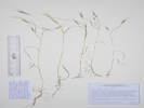
Coll. No. 2841, Bromus sterilis.
|
2841
|
Bromus, maybe B. sterilis.
Plants of Lippincott Ranch
Boulder and Jefferson Counties, Colorado
Poaceae
Bromus sterilis L.
Poverty Brome.
Lippincott Ranch, Jefferson County, Colorado.
About 150 m. north of Bull Gulch, 1.49 km. north northwest of the main gate, 3.38 km. south of the GNIS location of Eldorado Springs.
39.9092°N, 105.2774°W.
WGS 1984
Elev. 2010 m.
Moderate south-facing slope in open ponderosa pine woodland. Other grasses collected nearby: Bromus briziformis, B. lanatipes, and Danthonia spicata.
Lippincott Ranch is jointly owned by City of Boulder Open Space and Mountain Parks and Jefferson County Open Space.
Collected by permit: Jefferson County Open Space, 2022, issued: Apr 5, 2022, to: Tom Schweich.
|
Tom Schweich, with John Vickery
2841. |
2-Jul-2022 |
|
Coll. No. 2841, 2 Jul 2022, characters observed:
Annual grass, 22-33 cm.;
Leaves,
sheath, closed, scantily pilose,
ligule, membranous, 1.5 mm., lacerate,
auricles, absent,
blade,
15 cm., × 1.8 mm. wide, flat;
Inflorescence,
1 per culm,
>leaves,
panicle,
14 cm. × 2.5 cm. wide;
Rachis,
not extended, scabrous;
Spikelets,
#5,
42 mm. × 5 mm. wide,
similar,
borne singly,
pedicels, 25 mm.,
Compression, lateral;
Glumes,
lower, 9 mm.,
upper 13.5 mm., <lowest floret;
Florets, 6 per spikelet;
Axis, scabrous;
Callus, minutely hairy;
Lemma,
16.5 mm., >glumes,
oddly rolled rather than keeled,
mid-vein to margin 0.9-1.1 mm.,
awn, subterminal, 17.5 mm., straight.
|
|
Other articles:
• Arapahoe Street:
near 5th;
|
|
Monday, 4 July 2022
|
|
Locations:
407 Garden Street.
|
2842
|
Monday, 4 July 2022
Elymus repens or E. lanceolatus.
|
Native and Naturalized Flora of the Golden Area, Jefferson County, Colorado
Poaceae
Elymus repens (L.) Gould.
Quack Grass.
Golden, Jefferson County, Colorado.
Private garden on Garden Street, in well of tree, and other slopes, 1.06 km. north of the GNIS location of Golden.
39.7648°N, 105.2234°W.
WGS 1984
Elev. 1759 m.
Colorado Noxious Weed List C.
Collected by permit: City of Golden, 2022, issued: Mar 17, 2022, to: Tom Schweich.
|
Tom Schweich, with Cathy Hansen-Stamp
2842. |
4-Jul-2022 |
|
Coll. No. 2842, 4 July 2022, characters observed:
Perennial grass, 60-130 cm.,
rhizomatous;
Stem, herbaceous;
Internodes, hollow, glabrous;
Leaves,
sheath and blade differentiated
Sheath,
120 mm.,
open,
margin not ciliate;
Ligule,
membraneous,
0.4 mm.;
Auricles, absent;
Blade,
150 mm. × 8.5-9.0 mm. wide,
not lax,
involute,
distal adaxial surface sparsely pilose over veins;
Inflorescence,
1 per culm,
>leaves,
2-sided spike,
130-150 mm. × 9 mm. wide,
Rachis,
not extended,
glaucus,
scabrous on sides;
Spikelets,
many,
18-22 mm. × 6 mm. wide,
overlapping 10 mm.,
similar,
1 per node,
sessile;
Glumes,
lower, 11 mm.,
veins, #5,
bases, terete,
upper,
12 mm.,
<lowest floret,
veins, 6(!, probably 7),
rounded,
membraneous,
awns, 0;
Florets,
8 per spikelet,
at least first 4 bisexual;
Rachilla,
hairy,
not extended;
Lemma,
10.5 mm.,
>glumes,
lanceolate,
rolled to barely keeled distally,
glabrous to barely scabrous distally,
green,
veins, #7,
awn-like tip, ±1 mm.,
straight;
Palea,
9 mm.,
<lemma,
membraneous,
keel, ciliate,
veins, green;
Anthers,
5.3-5.7 mm.;
Stigma,
feathery;
Achene,
unknown;
|
|
Locations:
Tucker Gulch (lower).
|
|
Wednesday, 6 July 2022
Tucker Gulch, from North Ford Street to US Highway 93.
|
|
Images:
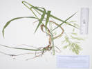
Coll. No. 2843, Bromus inermis
|
2843
|
Bromus inermis.
|
Native and Naturalized Flora of the Golden Area, Jefferson County, Colorado
Poaceae
Bromus inermis Leyss.
Smooth Brome.
Tucker Gulch (lower), Jefferson County, Colorado.
North bank of Tucker Gulch, the stream that drains Golden Gate Canyon, just west of North Ford Street, 2.55km. north northwest of the GNIS location of Golden.
39.7712°N, 105.2317°W.
WGS 1984
Elev. 1796 m.
Streamside with cottonwoods (Populus deltoides), box elders (Acer negundo) and chokecherries (Prunus virginiana).
Valuable agricultural grass that is invasive of native grasslands.
Collected by permit: City of Golden, 2022, issued: Mar 17, 2022, to: Tom Schweich.
|
Tom Schweich
2843. |
6-Jul-2022 |
|
|
|
|
2844
|
Veronica, probably V. anagallis-aquatica.
|
Native and Naturalized Flora of the Golden Area, Jefferson County, Colorado
Plantaginaceae
Veronica anagallis-aquatica L.
Water Speedwell.
Tucker Gulch (lower), Jefferson County, Colorado.
Bed of Tucker Gulch, the stream that drains Golden Gate Canyon, 75 m. west of North Ford Street, 2.57 km. north northwest of the GNIS location of Golden.
39.7713°N, 105.2319°W.
WGS 1984
Elev. 1797 m.
Flowing water of gulch lined by cottonwoods (Populus deltoides), box elders (Acer negundo) and chokecherries (Prunus virginiana).
Native to temperate Eurasia to tropical mountains; widespread non-native in North America.
Collected by permit: City of Golden, 2022, issued: Mar 17, 2022, to: Tom Schweich.
|
Tom Schweich
2844. |
6-Jul-2022 |
|
|
|
Images:
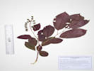
Coll. No. 2845, Prunus virginiana.
|
2845
|
Prunus virginiana.
|
Native and Naturalized Flora of the Golden Area, Jefferson County, Colorado
Rosaceae
Prunus virginiana L.
Chokecherry.
Tucker Gulch (lower), Jefferson County, Colorado.
North bank of Tucker Gulch, the stream draining Golden Gate Canyon, above the stream, 130 m. along gulch generally west of North Ford Street, 2.61 km. north northwest of the GNIS location of Golden.
39.7714°N, 105.2324°W.
WGS 1984
Elev. 1801 m.
Dark red leaves, fruit.
Common native shrub or small tree thriving in urban habitat.
Collected by permit: City of Golden, 2022, issued: Mar 17, 2022, to: Tom Schweich.
|
Tom Schweich
2845. |
6-Jul-2022 |
|
|
|
Images:
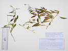
Coll. No. 2486, Lycium chinense
|
2846
|
Undetermined.
|
Native and Naturalized Flora of the Golden Area, Jefferson County, Colorado
Solanaceae
Lycium chinense Mill.
Chinese Desert-Thorn.
(Determination tentative.)
Tucker Gulch (lower), Jefferson County, Colorado.
North boundary of City of Golden parcel, sprawling down slope with yard waste from adjacent privately-owned parcel, about 140 m. west northwest of North Ford Street. 2.64 km. northwest of the GNIS location of Golden.
39.7716°N, 105.2324°W.
WGS 1984
Elev. 1804 m.
One thorn seen on stem, leaves alternate, entire, petals 5 fused at base, floral tube < lobes, ovary position uncertain, stamens 5, stigma entire.
Weedy slope with Bromus inermis, Euphorbia esula, Ulmus pumila, etm.
Collected by permit: City of Golden, 2022, issued: Mar 17, 2022, to: Tom Schweich.
|
Tom Schweich
2846. |
6-Jul-2022 |
|
Coll. No. 2846, 6 Jul 2022, characters observed:
Perennial, herbaceous, sprawling;
Stem, thorn, #1, 6 mm.;
Leaves, alternate, petioles 5 mm., blade 44 mm. × 12 mm. wide, lanceolate to obovate, entire;
Sepals, tube 4 mm. + lobes 1 mm., triangular;
Corolla, united at base, tube 4 mm. + lobes #5, 5-6 mm. × 3.2 mm., radially symmetrical;
Stamens, #5;
Ovary, unknown;
Stigma, entire.
Corolla tube < lobes and ±hidden by calyx = L. chinense Mill. per Jepson Manual of California.
|
|
|
2847
|
Schoenoplectus tabernaemontani.
|
Native and Naturalized Flora of the Golden Area, Jefferson County, Colorado
Cyperaceae
Schoenoplectus tabernaemontani (C.C.Gmel.) Palla.
Softstem Bulrush.
Tucker Gulch (lower), Jefferson County, Colorado.
In the water of Tucker Gulch, the stream draining Golden Gate Canyon, between Joseph Circle and Colorado Highway 93, 2.92 km. northwest of the GNIS location of Golden.
39.7725°N, 105.2352°W.
WGS 1984
Elev. 1810 m.
Collected by permit: City of Golden, 2022, issued: Mar 17, 2022, to: Tom Schweich.
|
Tom Schweich
2847. |
6-Jul-2022 |
|
|
|
|
2847.1
|
Nasturtium officinale
|
Native and Naturalized Flora of the Golden Area, Jefferson County, Colorado
Brassicaceae
Nasturtium officinale W. T. Aiton.
Watercress.
Tucker Gulch (lower), Jefferson County, Colorado.
In the water of Tucker Gulch, the stream draining Golden Gate Canyon, between Joseph Circle and Colorado Highway 93, 2.92 km. northwest of the GNIS location of Golden.
39.7725°N, 105.2352°W.
WGS 1984
Elev. 1810 m.
Urban flora, this location likely disturbed many times by road and other construction. Also collected here: Schoenoplectus tabernaemontani.
Collected by permit: City of Golden, 2022, issued: Mar 17, 2022, to: Tom Schweich.
|
Tom Schweich
2847.1 |
6-Jul-2022 |
|
|
|
Locations:
Kelsey Campground.
Morrison Creek.
|
|
Tuesday, 12 July 2022
Kelsey Campground to Morrison Creek.
|
|
Images:
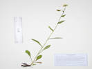
Coll. No. 2848, Erigeron eximius
|
2848
|
Erigeron, buds nodding.
|
Plants of Colorado
Asteraceae
Erigeron eximius Greene.
Splendid Daisy, Sprucefir Fleabane.
Morrison Creek, Jefferson County, Colorado.
Buffalo Creek Recreation Area, upper reaches of Morrison Creek, southwest of Little Scraggy Peak, 1.83 km. west northwest of the Kelsey Campground, and 5.79 km. southwest of the Little Scraggy Trailhead.
39.3089°N, 105.2825°W.
WGS 1984
Elev. 2563 m.
Streamside in shady forest, also collected nearby Aconitum columbianum, Hackelia floribunda, and Geranium caespitosum.
Collected by permit: Pike - San Isabel National Forest, 2022, issued: Mar 29, 2022, to: Tom Schweich.
|
Tom Schweich
2848. |
12-Jul-2022 |
|
|
|
Literature Cited:
- Greene, Edward L., 1898.
Other articles:
• Publication Details:
Rydberg, 1906, publication details;
Locations:
Marshall Pass.
|
|
Edward L. Greene (1898, p. 295) published Erigeron eximius in his Pittonia journal,
citing a location of Marshall Pass, but no collector or collection.
At the time of publication, Greene was at the Catholic University of America in Washington, D.C.
|
5. Some Western Species of Erigeron
|
|
…
|
|
E. eximius. Stems mostly several from a small branching
crown or caudex, slender but rather rigid, 10 to 16
inches high, with few and scattered leaves ; herbage glabrous
and glaucescent, except that the leaf-margins are sparsely
hirsute-ciliate and the upper part of the stem and the peduncles
rather densely granular-glandular, and with a few
short spreading hairs: all the leaves perfectly entire, the
tufted basal ones with spatulate-oblong obtuse blade and
slender petiole ; the cauline from oblanceolate to spatulate
and lanceolate, the middle and uppermost sessile : heads 4
to 9 (rarely 1 or 2), on slender rigid naked peduncles;
bracts of the large involucre few and broad (only about 20),
lanceolate, viscid-granular throughout, and only the very
base hirsute : rays numerous and narrow, \ inch long or
more, lilac-purple to rose-purple, rarely white.
|
|
Species abundant in pine woods below Marshall Pass,
Colorado, and particularly on the lower slopes of Little
Ouray Mountain in the same region, in rather dry ground;
the allied, yet very different, E. Coulteri being as common in
more moist and shady situations in the same district.
|
I have found no records in SEINet identifying a type for E. eximius.
There are several collections of Erigeron near Marshall Pass, but only one is likely E. eximius.
It is Charles S. Crandall #2850 (NY2096920, CS110740).
Initially determined E. superbus, CS110740 was annotated “ =E. eximius HDH 1949”
The label states “Plants of Colorado, from Herb. State Agric. College, Colo.,” now Colorado State University, Fort Collins.
The label also states “Distributed by The New York Botanical Garden.”
HUH Botanist credits Crandall with 41 collections in 1896, some of which are lichens.
SEINet (2022) lists 832 collections, concentrated mostly around Fort Collins, but including eight collections at or near Marshall Pass on 23 August 2022.
Whether or how E. L. Greene saw Crandall's collection is unknown.
|
|
Literature Cited:
- Rydberg, Per Axel, 1901a.
|
|
Rydberg (1901, p. 24) published E. viscidus.
The image of the type (NY168579) shows a plant that looks quite different from E. eximius.
|
Erigeron viscidus sp. nov.
|
|
A low cespitose perennial. Stems ascending, a little over 1
dm. high, more or less hirsute and glandular-puberulent, especially
above ; leaves 3-5 cm. long, oblanceolate, dark green, sparingly
hirsute and ciliate on the entire margins : heads few : disk about 1
cm. high and 1 5 mm. broad : bracts very numerous, subequal in
one series, narrowly linear, fuscous, acuminate, glandular-puberulent,
but not hirsute : rays very numerous, pale blue, about 8 mm.
long and .5 mm. wide.
|
|
This species is intermediate between E. glandulosus and E.
macranthus. It has the habit of the former, although larger, and
the large heads and numerous narrow rays of the latter. It grows
in wet ground, at an altitude of about 2700 m.
|
|
Colorado: Near the Gray-Back Mining Camps, 1900,
Rydberg & Vreeland, 5416.
|
|
|
Literature Cited:
- Rydberg, Per Axel, 1906.
Other articles:
• Golden Checklist Flora:
Rydberg, 1906;
Locations:
Marshall Pass.
|
|
Rydberg (1906) published E. superbus crediting Greene for the name.
No collections were cited, though a larger distribution than E. eximius was noted.
|
28. Erigeron superbus Greene. In the mountains of Colo. Alt. 7500-12,000
ft. Mountains near Empire; near Pagosa Peak; Minnehaha; Breckenridge ;
Villa Grove; Idaho Springs; Artist's Glen and Halfway House, Pike's Peak;
Box Canon, west of Ouray ; Baxter's ranch ; chaparral-covered hills southeast
of Ouray ; mountains between Sunshine and Ward ; Stove Prairie Hill ;
Marshall Pass.
|
Material designated a type of E. superbus would be C. F. Baker, #679, 15 August 1899, near Pagosa Peak, Mineral County, Colorado (GH6778, MO2616792, NY168557, RM22981, & RM160730).
The database record of NY168557 showing a locality of “near Pagosa Springs” is a transcription error.
The labels note that the collection was determined by Dr. Edw. L. Greene.
Pagosa Peak is now in Mineral County, whereas Pagosa Springs is now in Archuleta County.
Rydberg (1906) does not mention either E. eximius or E. formosissimus, but does accept E. viscidus Rydb.
(=E. formosissimus var. viscidus (Rydb.) Cronquist).
|
|
Literature Cited:
- Coulter, John M., and Aven Nelson, 1909.
|
|
Coulter & Nelson (1909, p. 525) ...
|
9. Erigeron formosissimus Greene, Bull. Torr. Bot. Club 25: 121. 1898.
Perennial, somewhat tufted, 3-5 dm. high, the stems erect or at base slightly
decumbent: basal leaves oblanceolate, obtuse, entire, 1 -nerved, 6-12 cm. long,
including the long, winged petiole, green and glabrous or cinereous-pubescent,
ciliolate-margined; those of the stem 2-4 cm. long or more, oblong-lanceolate,
acute, sessile: stem somewhat hirsute-pubescent, ending in few to several
large heads: involucre low-hemispherical, 16-20 mm. broad; the biserial equal
bracts with spreading green tips and with little pubescence: rays 100 or more,
narrow, almost 18 mm. long, light rose-color to deep purple. (E. glabellus
mollis. E. eximius Greene; E. incanescens
and E. viscidus Rydb. l. c. 28: 23 & 24. 1901.)
— Throughout our range.
|
|
|
Literature Cited:
- Harrington, H. D., 1964, 2nd ed..
|
|
Harrington (1954, p. 570, & 2nd ed., 1964, p. 568, 570) accepts E. superbus
and places E. eximius in synonomy with E. formosissimus var. viscidus.
This seems odd given that Harrington annotated Crandall #2850 to E. eximius in 1949.
|
|
Literature Cited:
- Weber, William A., and Ronald C. Wittmann, 2012.
|
|
Weber & Wittmann (2012) accept E. eximius implying that E. superbus is a synonym.
|
|
Literature Cited:
- Ackerfield, Jennifer, 2015.
|
|
Ackerfield (2015) accepts E. eximius without mention of E. superbus.
|
|
Literature Cited:
- POWO, 2021 - 2026.
|
|
Plants of the World (Kew, 2022) lists two heterotypic synonyms for E. eximius
- Erigeron eldensis Greene in Leafl. Bot. Observ. Crit. 2: 196 (1912)
- Erigeron superbus Greene in Fl. Colorado: 361, 364 (1906)
|
|
Images:
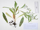
Coll. No. 2849, Hackelia floribunda.
|
2849
|
Tall Boraginaceae, with hooked prickles on the nutlets.
Photographed 17 November 2022.
|
Plants of Colorado
Boraginaceae
Hackelia floribunda (Lehm.) I. M. Johnst.
Many-Flowered Stickseed.
Morrison Creek, Jefferson County, Colorado.
In Morrison Creek where crossed by the horse trail (possibly an old road), 1.93 km. west northwest of Kelsey Campground, 5.73 km. southwest of the Little Scraggy Trailhead.
39.3099°N, 105.2829°W.
WGS 1984
Elev. 2547 m.
Largest specimens about 1 m. tall, bluish-white flowers, nutlets with prickles connate at the base.
Edges of forest along creek; also collected here: Erigeron eximius, Aconitum columbianum, and Geranium caespitosum.
Collected by permit: Pike - San Isabel National Forest, 2022, issued: Mar 29, 2022, to: Tom Schweich.
|
Tom Schweich
2849. |
12-Jul-2022 |
|
|
|
Images:
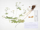
Coll. No. 2850, Geranium richardsonii.
|
2850
|
Geranium, with white petals.
|
Plants of Colorado
Geraniaceae
Geranium richardsonii Fisch. & Trautv.
Richardson's Geranium.
Morrison Creek, Jefferson County, Colorado.
Buffalo Creek Recreation Area, in a glade beside Morrison Creek where crossed by the horse trail (possibly an old road), 1.93 km. west northwest of Kelsey Campground, 5.73 km. southwest of the Little Scraggy Trailhead.
39.3098°N, 105.2829°W.
WGS 1984
Elev. 2545 m.
Edges of forest along creek; also collected here: Erigeron eximius, Aconitum columbianum, and Hackelia floribunda.
Collected by permit: Pike - San Isabel National Forest, 2022, issued: Mar 29, 2022, to: Tom Schweich.
|
Tom Schweich
2850. |
12-Jul-2022 |
|
|
|
|
2850.1
|
Erigeron, same as Coll. No. 2848
|
|
|
2851
|
“Monkshood”
|
Plants of Colorado
Ranunculaceae
Aconitum columbianum Nutt.
Columbian Monkshood.
Morrison Creek, Jefferson County, Colorado.
Buffalo Creek Recreation Area, rooted in the creek bed of Morrison Creek near where crossed by the horse trail (possibly an old road), 1.93 km. west northwest of Kelsey Campground, 5.73 km. southwest of the Little Scraggy Trailhead.
39.3099°N, 105.2829°W.
WGS 1984
Elev. 2542 m.
Numerous plants here, just starting to bloom.
Edges of forest along creek; also collected here: Erigeron eximius, Geranium richardsonii, and Hackelia floribunda.
Collected by permit: Pike - San Isabel National Forest, 2022, issued: Mar 29, 2022, to: Tom Schweich.
|
Tom Schweich
2851. |
12-Jul-2022 |
|
|
|
|
2852
|
Death Camas.
|
Plants of Colorado
Melanthiaceae
Anticlea elegans (Pursh) Rydb.
Mountain Death Camas.
Morrison Creek, Jefferson County, Colorado.
On forest floor above Morrison Creek. 2.02 km. northwest of Kelsey Campground, 5.48 km. southwest of the Little Scraggy Trailhead.
39.3118°N, 105.2828°W.
WGS 1984
Elev. 2534 m.
2 plants, mostly in bud.
Collected by permit: Pike - San Isabel National Forest, 2022, issued: Mar 29, 2022, to: Tom Schweich.
|
Tom Schweich
2852. |
12-Jul-2022 |
|
|
|
Images:
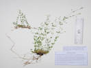
Coll. No. 2853, Arenaria lanuginosa var. saxosa.
|
2853
|
Unknown, maybe Polemoniaceae(?) — Ha!
|
Plants of Colorado
Caryophyllaceae
Arenaria lanuginosa (Michx.) Rohrb. var. saxosa (A. Gray) Zarucchi, R. L. Hartman & Rabeler.
Spreading Sandwort.
Morrison Creek, Jefferson County, Colorado.
Beside horse trail (former road?), on forest floor above Morrison Creek. 2.10 km. northwest of Kelsey Campground, 5.38 km. southwest of the Little Scraggy Trailhead.
39.3126°N, 105.2829°W.
WGS 1984
Elev. 2524 m.
Perennial, stems and pedicels with small downward-pointing hairs, petals, 5, white,
Forest-shaded open, east-facing slope; also seen or collected here: Sedum lanceolatum and Anticlea elegans.
Collected by permit: Pike - San Isabel National Forest, 2022, issued: Mar 29, 2022, to: Tom Schweich.
|
Tom Schweich
2853. |
12-Jul-2022 |
| Coll. No. 2853, 12 July 2022, characters observed:
Perennial, to 20 cm., herbaceous, rhizomatous;
Stems, small downward-pointing hairs;
Leaves, opposite,
stipules (papery or not) absent,
connate,
14 mm. × 3 mm. wide,
narrowly elliptic;
Inflorescence, open cyme;
Pedicels, small downward-pointing hairs;
Sepals, distinct;
Petals, 3 mm. × 1.5 mm. wide, not clawed, entire, white;
Stamens, ≥#8;
Style, #3;
Seeds, unknown.
|
|
|
2854
|
Death Camas.
|
Plants of Colorado
Melanthiaceae
Anticlea elegans (Pursh) Rydb.
Mountain Death Camas.
Morrison Creek, Jefferson County, Colorado.
On forest floor above Morrison Creek. 2.10 km. northwest of Kelsey Campground, 5.38 km. southwest of the Little Scraggy Trailhead.
39.3127°N, 105.2829°W.
WGS 1984
Elev. 2524 m.
Just starting to bloom.
Collected by permit: Pike - San Isabel National Forest, 2022, issued: Mar 29, 2022, to: Tom Schweich.
|
Tom Schweich
2854. |
12-Jul-2022 |
|
|
|
Images:
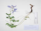
Coll. No. 2855, Aquilegia coerulea
|
2855
|
Aquilegia coerulea.
|
Plants of Colorado
Ranunculaceae
Aquilegia coerulea E. James.
Colorado Blue Columbine.
Morrison Creek, Jefferson County, Colorado.
In shaded forest beside Morrison Creek, 2.21 km. northwest of the Kelsey Campground, 5.22 km. southwest of the Little Scraggy Trailhead.
39.314°N, 105.2829°W.
WGS 1984
Elev. 2500 m.
Collected by permit: Pike - San Isabel National Forest, 2022, issued: Mar 29, 2022, to: Tom Schweich.
|
Tom Schweich
2855. |
12-Jul-2022 |
|
|
|
|
2856
|
Castilleja, probably C. integra, but deeper red than most.
|
Plants of Colorado
Orobanchaceae
Castilleja integra A. Gray.
Wholeleaf Indian Paintbrush.
Morrison Creek, Jefferson County, Colorado.
In a meadow on the right bank of Morrison Creek, 2.13 km. northwest of Kelsey Campground, and 5.26 km. southwest of the Little Scraggy Trailhead.
39.3135°N, 105.2825°W.
WGS 1984
Elev. 2504 m.
“Flowers” are a deeper red than usually seen.
West-facing slope with a few aspens.
Collected by permit: Pike - San Isabel National Forest, 2022, issued: Mar 29, 2022, to: Tom Schweich.
|
Tom Schweich
2856. |
12-Jul-2022 |
|
|
|
Images:
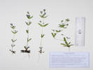
Coll. No. 2857, Gentianella amarella ssp. acuta.
|
2857
|
Small annual Gentian.
|
Plants of Colorado
Gentianaceae
Gentianella amarella (L.) Börner ssp. acuta (Michx.) J. M. Gillett.
Autumn Dwarf Gentian.
Morrison Creek, Jefferson County, Colorado.
Just north of a saddle, barely in the Morrison Creek watershed, at an old metal gate on the horse trail (possibly an old road), 1.75 km. west northwest of the Kelsey Campground, 5.91 km. southwest of the Little Scraggy Trailhead.
39.308°N, 105.2821°W.
WGS 1984
Elev. 2865 m.
Flowers magenta, fading to blue.
Shaded open forest, i.e., little to no middlestory; also collected nearby: Erigeron eximius.
Collected by permit: Pike - San Isabel National Forest, 2022, issued: Mar 29, 2022, to: Tom Schweich.
|
Tom Schweich
2857. |
12-Jul-2022 |
|
|
|
|
2858
|
Packera, probably P. fendleri.
|
Plants of Colorado
Asteraceae
Packera fendleri (A. Gray) W.A. Weber & Á. Löve.
Fendler’s Ragwort.
Little Scraggy Peak, Jefferson County, Colorado.
In a meadow at the saddle between Morrison Creek and Gunbarrel Creek, 1.52 km. west northwest of Kelsey Campground, and 1.24 km. southwest of Little Scraggy Peak.
39.3071°N, 105.2802°W.
WGS 1984
Elev. 2574 m.
Open meadow with a few ponderosa pines, also seen or collected here: Frasera speciosa, Lithospermum multiflorum, and Ceanothus fendleri.
Collected by permit: Pike - San Isabel National Forest, 2022, issued: Mar 29, 2022, to: Tom Schweich.
|
Tom Schweich
2858. |
12-Jul-2022 |
|
|
|
Other articles:
• Forest Road 435:
along the road;
Locations:
Salt Creek.
|
|
Monday, 18 July 2022
Salt Creek, Park County
|
|
Other articles:
• CLOSED Forest Road 435A:
at Coll. No. 2859.;
|
2859
|
A new (to me) Penstemon.
|
Plants of Colorado
Plantaginaceae
Penstemon teucrioides Greene.
Germander Beardtongue.
Salt Creek, Park County, Colorado.
Along the recently closed Forest Road 435A about 435 m. east of its junction with Forest Road 435 “Salt Creek Road,” 6.76 km, northwest of Antero Junction, 22.0 km. northeast of Buena Vista.
38.9591°N, 106.0047°W.
WGS 1984
Elev. 2823 m.
Flowers lavender, fading brown to blue.
In an old road, 4 plants, more up the road. Also here: Astragalus crassicarpus.
Also Coll. No. 2862, 377 m. northwest.
Collected by permit: Pike - San Isabel National Forest, 2022, issued: Mar 29, 2022, to: Tom Schweich.
|
Tom Schweich
2859. |
18-Jul-2022 |
|
Stem retrorsely hairy;
Inflorescence retrorsely hairy and somewhat glandular;
Bracts somewhat reduced in size;
Calyx margin scarious proximal ⅓;
Corolla 18-19 mm., lavender, fading to brown tube and blue lobes;
Staminode, 14 mm., glabrous proximal 9 mm., then increasingly hairy to densely hairy tip.
Weber & Wittmann (2012) will guide you to P. linarioides ssp. coloradoensis which they note is expected but not collected in Colorado.
They do not accept P. teucrioides.
Ackerfield (2015) will also guide you to P. linarioides ssp. coloradoensis though based upon the hairiness of the staminode.
However, per Southwest Colorado Wildflowers (https://www.swcoloradowildflowers.com) that plant is much larger, more upright,
and with more broad leaves.
That leaves us with the choice between P. caespitosus and P. teucrioides.
I went with the latter mostly because of leaf shape, much more narrow in the latter than in the former.
However, it would not surprise me if we decide the two species intergrade.
The greatest clarity comes from Harrington (1964, 2nd ed., p. 493) who specifically focuses on leaf width, i.e., “ … usually not over 1.5 mm. width … ” points to P. teucrioides. Harrington's description adds clarity by noting the leaves of P. teucrioides are involute, a character observed in our plant.
Also with regard to the staminode, Harrington notes:
- P. linarioides ssp. coloradoensis: barely widened distally, bearded with a rather dense tuft of hairs near the apex, very sparsely bearded proximally.
- P. teucrioides: slender throughout, bearded most of its length.
- P. caespitosus: slender, strongly bearded virtually its entire length.
Regardless, just a cursory review of voucher images suggests that a careful examination of vouchers of the two taxa might be called for.
|
|
Literature Cited:
- Gray, Asa, 1862.
|
|
Gray (1862) published P. caespitosus from a variety of sources,
including Nuttall's 1834 trip to Oregon Territory,
but also Parry, Hall & Harbour, especially Hall & Harbour, no. 393.
|
→→→ Axilliflori, nempe ramis
(e caulibus caespitoso-humifusis) usque
ad apicem subaequaliter foliosis.
|
|
34. P. caespitosus, Nutt. in herb. Acad. Philad.
(P. pumilus, Benth. quoad pl. Fremont., non Nutt.)
Depressus, cinereo-puberulus ;
ramis confertis e basi humifusa vel repente adscendentibus foliosissimis
poll, longis) ; foliis lanceolato- seu lineari-spathulatis
mucronato-apiculatis aveniis (5-9 lin. longis) ; pedunculis axillaribus brevibus
secundis mox decurvo-patentibus apice folioso-bibracteatis flores
1-3 assurgentes brevi-pedicellatos gerentibus ; sepalis e basi latiore
marginibus scariosa lineari-lanceolatis foliaceis ; corolla (6-9 lin.
longa) cajruleo-purpurea tubulosa, tubo superne sensim subampliato
intus plicis 2 intrusis percurso, limbo breviter bilabiate, lobis subsequalibus ;
filamento sterili longe barbato.
|
|
— Rocky Mountains, Nuttall (a diminutive specimen in herb. Acad. Philad.),
Fremont (a poor specimen in herb. Torr.),
Parry, Hall and Harbour, coll. 1862 (no. 393), at the Middle Park,
also on “"rocky ledges of the upper Platte,
growing in spreading decumbent patches : flowers blue, with purplish tips,
and streaked with pink lines, first found by Mr. J. Harbour.” Parry in litt.
Very fine and full specimens (received as this
article is going to press) are given in the recent collection above
mentioned, both of the form gathered by Nuttall, with the leaves only
about half an inch long and scarcely a line wide, and of a luxuriant
form, with larger leaves, and flowers three fourths of an inch long
on longer pedicels. The leaves on decumbent branches are all
turned to the upper side, and often falcate, while the peduncles are
rigidly turned to the lower side of the branch. The species is a
well-marked one, and the most dwarf of the genus.
|
|
|
Literature Cited:
- Greene, Edward L., 1901.
Locations:
Sapinero.
|
|
Greene (1901, v. 3, p. 23) published P. teucrioides from specimens that were not well in flower.
|
Pentstemon teucrioides. Suffrutescent, low, the slender
tufted stems erect, 2 to 5 inches high, leafy throughout and
floriferous from below the middle, the whole herbage
cinereous-pubescent: leaves spatulate-linear, entire, almost pungently acute,
less than 1 inch long, usually exceeding the
internodes : flowers 5 or more in each subcapitate and
short-pedicelled glomerule, all forming as it were a secund raceme
along the upper one-half and more of the stem : segments
of the calyx subulate-lanceolate, acute, entire, wholly herbaceous :
narrow and strongly bilabiate deep-purple corolla
about | inch long, glabrous ; sterile filament bearded
almost from the base with orange-yellow hairs ; anthers
glabrous.
|
|
Collected at Sapinero, 19 June; said to be common there,
on dry ground, n. 186. The specimens are not well in
flower ; and the aspect of the plant, particularly as to its
inflorescence, is singularly like that of a Teucrium.
|
|
|
Images:
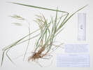
Coll. No. 2860, Bromus porteri.
|
2860
|
Soft hairy brome.
|
Plants of Colorado
Poaceae
Bromus porteri (J.M. Coult.) Nash.
Nodding Brome.
Salt Creek, Park County, Colorado.
Small valley just north of Salt Creek, near recently closed Forest Road 435A, 6.87 km. northwest of Antero Junction, 22.2 km. northeast of Buena Vista.
38.9603°N, 106.0041°W.
WGS 1984
Elev. 2824 m.
Inflorescence nodding, very soft hairy.
Growing in and next to a small wash. Also here: Artemisia frigida.
Collected by permit: Pike - San Isabel National Forest, 2022, issued: Mar 29, 2022, to: Tom Schweich.
|
Tom Schweich
2860. |
18-Jul-2022 |
| Coll. No. 2860, 18 July 2022, characters observed:
Perennial grass, 45 cm., caespitose;
Leaves,
sheath,
130 mm.,
open about ½-way;
collar minutely hairy,
ligule, 2 mm.,
blade, 130 mm. × 4 mm. wide, flat, scabrous;
Inflorescence,
nodding,
1 per culm,
panicle;
Rachis, ascending hairy, not quite appressed;
Spikelets,
many,
23 mm. × 2.8 mm. wide,
similar,
pedicels, 44 mm.;
Compression, unremarkable;
Glumes,
soft spreading hairy,
lower, 7.5 mm., veins, 3,
upper 8.5 mm.,
< lowest floret,
veins, 3, converging,
awns, 0, but mid-vein goes strongly right to the tip;
Florets, 8 per spikelet;
Callus, few short hairs;
Lemma,
10.5 mm.,
> glumes,
rolled,
hairy.
veins, 5, convergent,
awns, 1, 1 mm., subterminal, straight;
Palea,
9.5 mm., < lemma,
membranous, ciliate,
tip rounded;
Stamens, 3;
Anthers, 2.2 mm.
|
|
Literature Cited:
- Coulter, John Merle, 1885.
Other articles:
• CO-82:
at Twin Lakes;
Locations:
Buffalo Peaks.
Twin Lakes.
|
|
|
1. B. Kalmii, Gray, var. Porteri. Stem 12 to 18 inches high, smooth:
sheaths and leaves minutely scabrous : panicle 6 inches long, compound, branches
minutely downy ; spikelets an inch long, canescent with short oppressed silky
hairs, 7 to 9-flowered : outer glumes each 3-nerved, obtuse : flowering glume
7-nerved; its awn 1½ lines long. — Colorado, at Twin Lakes (Porter), Buffalo
Peaks, and Sierra Madre Range (Coulter).
|
Charles C. Parry made a collection in 1861 on upper Clear Creek.
Thomas C. Porter collected the type of B. porteri at Twin Lakes, Lake County on July 25, 1872 (PH8608, MO2699792).
John M. Coulter made an additional collection at Buffalo Peaks, July 23, 1873 (MO248035).
This collection has been designated an isosyntype.
There are several other collections in the 1872-1885 time frame, but none referencing “Sierra Madre” as a location.
The “Sierra Madre Range” may refer to the Sangre de Cristo Mountains in Costilla County, Colorado,
rather than the current Sierra Madre Range in Routt County, Colorado and Carbon County, Wyoming.
|
|
Literature Cited:
- Nash, George V., 1895.
|
|
|
Bromus Porteri (Coulter).
|
|
Bromus Kalmii var. Porteri Coulter, Man. Rocky Mt. Region,
425. 1885.
|
|
Culms 1½°-3° tall, erect, simple, pubescent below the nodes.
Sheaths shorter than the internodes, glabrous or sometimes softly
pubescent; ligule ½'' long, truncate; leaves 1"-3"' wide, rough,
those of the culm 4'-9' long, the basal narrow and about one-half
of the length of the culm ; panicle 3'-6' in length, its branches
drooping and flexuous, at least when old, the nodes of the axis
pubescent; spikelets 5-10-flovvered, 9''-15'' long, on slender
flexuous pedicels; empty scales pubescent, the first narrower than
the second, both 3-nerved; flowering scales 5"-6" long, obtuse,
5-7 nerved, densely pubescent with long silky hairs; awn 1"-2"'
long.
|
|
In dry soil, South Dakota to Montana, south to western Nebraska,
New Mexico and Arizona.
|
|
This plant is readily distinguished from B. Kalmii by its 3-nerved
second scale and longer flowering scales. In B. Kalmii
the second scale is 5-7-nerved and the flowering scale about 4"
long.
|
|
|
Images:
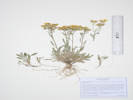
Coll. No. 2861, Packera fendleri.
|
2861
|
Packera fendleri.
|
Plants of Colorado
Asteraceae
Packera fendleri (A. Gray) W.A. Weber & Á. Löve.
Fendler’s Ragwort.
Salt Creek, Park County, Colorado.
Small valley north of Salt Creek, formerly accessed by recently closed Forest Road 435A, 6.85 km. northwest of Antero Junction, 22.3 km. northeast of Buena Vista.
38.9607°N, 106.0031°W.
WGS 1984
Elev. 2829 m.
Sparse vegetation on a sheetflow slope below a small hill with junipers and pines. Also collected here: Penstemon teucrioides and Bromus porteri.
Collected by permit: Pike - San Isabel National Forest, 2022, issued: Mar 29, 2022, to: Tom Schweich.
|
Tom Schweich
2861. |
18-Jul-2022 |
|
|
|
Images:
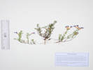
Coll. No. 2862, Penstemon teucrioides.
|
2862
|
The same Penstemon, very common.
|
Plants of Colorado
Plantaginaceae
Penstemon teucrioides Greene.
Germander Beardtongue.
Salt Creek, Park County, Colorado.
Small valley north of Salt Creek, 6.86 km. northwest of Antero Junction, 22.4 km. northeast of Buena Vista.
38.961°N, 106.0024°W.
WGS 1984
Elev. 2829 m.
Flowers lavender, fading brown to blue.
On a sparsely vegetated outwash slope.
Also Coll. No. 2859, 377 m. southwest.
Collected by permit: Pike - San Isabel National Forest, 2022, issued: Mar 29, 2022, to: Tom Schweich.
|
Tom Schweich
2862. |
18-Jul-2022 |
|
|
|
Literature Cited:
- Nuttall, Thomas, 1818.
- Smith, Scott, 2007.
Other articles:
• CLOSED Forest Road 435A:
74999;
|
2863
|
Platanthera sp.
|
Plants of Colorado
Orchidaceae
Platanthera huronensis (Nutt.) Lindl.
Huron Green Orchid.
Salt Creek, Park County, Colorado.
Small valley north of Salt Creek, formerly accessed by recently closed Forest Road 435A, 6.86 km. northwest of Antero Junction, 22.3 km. northeast of Buena Vista.
38.9606°N, 106.0014°W.
WGS 1984
Elev. 2820 m.
Bank of small spring-fed creek, at least 8 plants here, widely spaced along creek.
Collected by permit: Pike - San Isabel National Forest, 2022, issued: Mar 29, 2022, to: Tom Schweich.
|
Tom Schweich
2863. |
18-Jul-2022 |
|
|
|
Images:
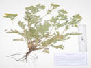
Coll. No. 2864, Potentilla pensylvanica.
|
2864
|
Potentilla, maybe P. pennsylvanica
|
Plants of Colorado
Rosaceae
Potentilla pensylvanica L.
Prairie Cinquefoil.
Salt Creek, Park County, Colorado.
Small valley north of Salt Creek, formerly accessed by recently closed Forest Road 435A, 6.70 km. northwest of Antero Junction, 22.3 km. northeast of Buena Vista.
38.9601°N, 106.0017°W.
WGS 1984
Elev. 2824 m.
On open ground with Artemisia tridentata, A. frigida, Koeleria macrantha, and Nassella viridula.
Collected by permit: Pike - San Isabel National Forest, 2022, issued: Mar 29, 2022, to: Tom Schweich.
|
Tom Schweich
2864. |
18-Jul-2022 |
|
|
|
|
2865
|
Oenothera suffrutescens.
|
Plants of Colorado
Onagraceae
Oenothera suffrutescens (Ser.) W. L. Wagner & Hoch.
Linda Tarde.
Salt Creek, Park County, Colorado.
Small valley north of Salt Creek, formerly accessed by recently closed Forest Road 435A, 6.64 km. northwest of Antero Junction, 22.2 km. northeast of Buena Vista.
38.9595°N, 106.002°W.
WGS 1984
Elev. 2821 m.
Junction of two small washes, with various sagebrushes, Thermopsis rhombifolia, Allium cernuum, and Mentzelia sp.
Collected by permit: Pike - San Isabel National Forest, 2022, issued: Mar 29, 2022, to: Tom Schweich.
|
Tom Schweich
2865. |
18-Jul-2022 |
|
|
|
Images:
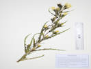
Coll. No. 2866, Mentzelia speciosa.
|
2866
|
Mentzelia sp.
|
Plants of Colorado
Loasaceae
Mentzelia speciosa Osterh.
Plains Blazing Star.
Salt Creek, Park County, Colorado.
Small valley north of Salt Creek, formerly accessed by recently closed Forest Road 435A, 6.64 km. northwest of Antero Junction, 22.2 km. northeast of Buena Vista.
38.9594°N, 106.002°W.
WGS 1984
Elev. 2821 m.
Petals yellow.
Junction of two small washes, with various sagebrushes, Thermopsis rhombifolia, Allium cernuum, and Oenothera suffrutescens sp.
Collected by permit: Pike - San Isabel National Forest, 2022, issued: Mar 29, 2022, to: Tom Schweich.
|
Tom Schweich
2866. |
19-Jul-2022 |
|
|
|
Other articles:
• CLOSED Forest Road 435A:
at Coll. No. 2867.;
|
2867
|
Campanula parryi.
|
Plants of Colorado
Campanulaceae
Campanula parryi A. Gray.
Parry's Bellflower.
Salt Creek, Park County, Colorado.
Along the recently closed Forest Road 435A, about 180 m. east of it's junction with Forest Road 435 “Salt Creek Road,” 6.72 km. northwest of Antero Junction, 21.8 km. northeast of Buena Vista.
38.9583°N, 106.0055°W.
WGS 1984
Elev. 2826 m.
On the floor of an aspen glade just north of Salt Creek.
Collected by permit: Pike - San Isabel National Forest, 2022, issued: Mar 29, 2022, to: Tom Schweich.
|
Tom Schweich
2867. |
19-Jul-2022 |
|
|
|
Other articles:
• CLOSED Forest Road 435A:
at col loc;
|
2868
|
Oenothera sp.
|
Plants of Colorado
Onagraceae
Oenothera cespitosa Nutt. ssp. macroglottis (Rydb.) W.L. Wagner.
Tufted Evening Primrose.
Salt Creek, Park County, Colorado.
Along the recently closed Forest Road 435A, about 150 m. east of it's junction with Forest Road 435 “Salt Creek Road,” 6.80 km. northwest of Antero Junction, 21.7 km. northeast of Buena Vista.
38.958°N, 106.0067°W.
WGS 1984
Elev. 2828 m.
Flowers closed.
Collected by permit: Pike - San Isabel National Forest, 2022, issued: Mar 29, 2022, to: Tom Schweich.
|
Tom Schweich
2868. |
18-Jul-2022 |
|
|
|
Other articles:
• CLOSED Forest Road 435A:
at col loc;
|
2869
|
Physaria sp.
|
Plants of Colorado
Brassicaceae
Physaria vitulifera Rydb. Bull. Torrey Bot. Club 28: 278. 1901.
Roundtip Twinpod.
Salt Creek, Park County, Colorado.
Along the recently closed Forest Road 435A, about 150 m. east of it's junction with Forest Road 435 “Salt Creek Road,” 6.80 km. northwest of Antero Junction, 21.7 km. northeast of Buena Vista.
38.958°N, 106.0067°W.
WGS 1984
Elev. 2828 m.
Fruit only, no flowers.
Collected by permit: Pike - San Isabel National Forest, 2022, issued: Mar 29, 2022, to: Tom Schweich.
|
Tom Schweich
2869. |
18-Jul-2022 |
|
|
|
|
2870
|
Androsace, probably A. septentrionalis.
|
Plants of Colorado
Primulaceae
Androsace septentrionalis L.
Pygmyflower Rockjasmine.
Salt Creek, Park County, Colorado.
In a small valley, north of Salt Creek and Pike-San Isabel National Forest Road 435 "Salt Creek Road," 3.2 mi. by road west of US Highway 285, 145 km. southwest of the GNIS location of Golden
38.9583°N, 106.0115°W.
WGS 1984
Elev. 2851 m.
Growing at the base of grasses and forbs.
Collected by permit: Pike - San Isabel National Forest, 2022, issued: Mar 29, 2022, to: Tom Schweich.
|
Tom Schweich
2870. |
18-Jul-2022 |
|
|
|
Locations:
West Tennessee Creek.
|
|
Tuesday, 19 July 2022
West Tennessee Creek
|
|
|
2871
|
Astragalus sp.
|
Plants of Colorado
Fabaceae
Astragalus alpinus L.
Alpine Milkvetch.
West Tennessee Creek, Lake County, Colorado.
Along an old, closed forest road on the north side of West Tennessee Creek, 0.94 km. southeast of Lily Lake, 15.9 km. north northwest of Leadville.
39.3475°N, 106.3614°W.
WGS 1984
Elev. 3167 m.
Fruit dark-green, black hairy, pendant.
Common on forest floor.
Collected by permit: Pike - San Isabel National Forest, 2022, issued: Mar 29, 2022, to: Tom Schweich.
|
Tom Schweich
2871. |
19-Jul-2022 |
|
|
|
Images:
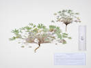
Coll. No. 2872, Lupinus caespitosus var. utahensis
|
2872
|
Lupinus sp.
|
Plants of Colorado
Fabaceae
Lupinus caespitosus Nutt. var. utahensis (S. Watson) B. J. Cox.
Utah Lupine.
West Tennessee Creek, Lake County, Colorado.
Along an old, closed forest road on the north side of West Tennessee Creek, 0.94 km. southeast of Lily Lake, 15.9 km. north northwest of Leadville.
39.3475°N, 106.3613°W.
WGS 1984
Elev. 3170 m.
Common on forest floor.
Collected by permit: Pike - San Isabel National Forest, 2022, issued: Mar 29, 2022, to: Tom Schweich.
|
Tom Schweich
2872. |
19-Jul-2022 |
|
This entity, notwithstanding whatever name we might apply to it, would appear to be the only caespitose Lupine in Colorado.
|
|
Literature Cited:
- Watson, Sereno, 1873b.
|
|
Watson (1873b) published utahensis as a variety of Lupinus aridus Douglas.
|
|
Literature Cited:
- Cox, Billy Joe, 1972a.
|
|
B. J. Cox (1972) Ph.D. dissertation on the Lupinus lepidus - Lupinus caespitosus complex.
|
|
Literature Cited:
- Cox, Billy Joe, 1972b.
|
|
Apparently Cox also published some parts of his dissertation in Transactions of the Academy of Science - Saint Louis. I have been unable to acess a copy of that publication. So this is a placeholder for publication of Lupinus caespitosus var. utahensis (S. Watson) B. J. Cox.
|
|
Literature Cited:
- Cox, Billy Joe, 1973.
|
|
Cox (1973) looked at chemosystematics of the complex.
I don't see anything particularly helpful in determining the correct name for this taxon.
I do note, however, that Literature Cited cites Cox's dissertation but no publication in Transactions of the Missouri Academy of Science, St. Louis.
|
|
Literature Cited:
- Weber, William A., and Ronald C. Wittmann, 2012.
|
|
Weber & Wittmann (2012) treat our plant as L. lepidus Douglas ssp. caespitosus (Nuttall) Detling.
|
|
Literature Cited:
- Ackerfield, Jennifer, 2015.
|
|
Ackerfield (2015) treats this taxon as L. lepidus Douglas ex Lindl. var. utahensis (S. Watson) C. L. Hitchc.
|
|
|
2873
|
Zigadenus elegans.
|
Plants of Colorado
Melanthiaceae
Anticlea elegans (Pursh) Rydb.
Mountain Death Camas.
West Tennessee Creek, Lake County, Colorado.
Along an old, closed forest road on the north side of West Tennessee Creek, 810 m. southeast of Lily Lake, and 15.9 km. north northwest of Leadville.
39.3477°N, 106.3626°W.
WGS 1984
Elev. 3168 m.
Open forest.
Collected by permit: Pike - San Isabel National Forest, 2022, issued: Mar 29, 2022, to: Tom Schweich.
|
Tom Schweich
2873. |
19-Jul-2022 |
|
|
|
|
2873.1
|
Potentilla sp., somewhat confused.
|
Plants of Colorado
Rosaceae
Potentilla gracilis Hook. var. fastigiata (Nutt.) S. Watson.
Slender Cinquefoil.
West Tennessee Creek, Lake County, Colorado.
Along an old, closed forest road on the north side of West Tennessee Creek, 810 m. southeast of Lily Lake, and 15.9 km. north northwest of Leadville.
39.3477°N, 106.3626°W.
WGS 1984
Elev. 3168 m.
Lvs green on top, silver below. Lflts toothed fully to distal ¾. Non-glandular.
Open forest.
Collected by permit: Pike - San Isabel National Forest, 2022, issued: Mar 29, 2022, to: Tom Schweich.
|
Tom Schweich
2873.1 |
19-Jul-2022 |
|
|
|
Images:
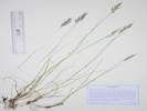
Coll. No. 2873.2, Danthonia intermedia.
|
2873.2
|
A brome-like grass that reminds me of Schizachne purpurescens.
|
Plants of Colorado
Poaceae
Danthonia intermedia Vasey.
Timber Oatgrass.
West Tennessee Creek, Lake County, Colorado.
Along an old, closed forest road on the north side of West Tennessee Creek, 810 m. southeast of Lily Lake, and 15.9 km. north northwest of Leadville.
39.3477°N, 106.3626°W.
WGS 1984
Elev. 3168 m.
Lemmas glabrous on back, pilose on margins.
Open forest, also collected here: Potentilla gracilis and Anticlea elegans.
Collected by permit: Pike - San Isabel National Forest, 2022, issued: Mar 29, 2022, to: Tom Schweich.
|
Tom Schweich
2873.2 |
19-Jul-2022 |
|
|
|
Literature Cited:
- Bell, Charles D., and Robert W. Patterson, 2000.
- Gray, Asa, 1870.
- Hankamp, Paul, Charles D. Bell, and Robert Patterson, 2016.
|
2874
|
White Phlox, maybe P. hoodii.
|
Plants of Colorado
Polemoniaceae
Leptosiphon nuttallii (Gray) J. M. Porter & L. A. Johnson ssp. nuttallii.
Nuttall's Linanthus.
West Tennessee Creek, Lake County, Colorado.
Along an old, closed forest road on the north side of West Tennessee Creek, 780 m. southwest of Lily Lake, and 16.0 km. north northwest of Leadville
39.3476°N, 106.363°W.
WGS 1984
Elev. 3183 m.
Edges of open forest, on slope above flood plain.
Distances measured from GNIS point features.
Collected by permit: Pike - San Isabel National Forest, 2022, issued: Mar 29, 2022, to: Tom Schweich.
|
Tom Schweich
2874. |
19-Jul-2022 |
|
Proposed by A. Gray (1870) in his revision of the Polemoniaceae.
|
15. G. Nuttallii, n. sp. Spithamaea ad pedalem ; caulibus e basi
suffrutescente plurimis simpliciusculis ; foliis 3 - 7-partitis internodio
saepius brevioribus, segmentis angusto-linearibus mucronatis (lin. 6-9
longis) ; floribus in glomerulum foliosum confertis; ovulis in loculis
binis. — Siphonella montana & S. parviflora, Nutt. herb. — Rocky
Mountains of Colorado and Utah to the Sierra Nevada in California,
Nuttall, Fremont, Anderson, Brewer, Watson. — Tube of corolla four
or five, the lobes two or three lines long.
|
|
|
Images:

Coll. No. 2874, Agoseris aurantiaca var. purpurea.
|
2875
|
Agoseris aurantica, much smaller than I though they would be.
|
Plants of Colorado
Asteraceae
Agoseris aurantiaca (Hooker) Greene var. purpurea (A. Gray) Cronquist.
Orange-Flower Goat-Chicory.
West Tennessee Creek, Lake County, Colorado.
Along an old, closed forest road on the north side of West Tennessee Creek, 770 m. southeast of Lily Lake, 16.0 km. north northwest of Leadville.
39.3478°N, 106.363°W.
WGS 1984
Elev. 3177 m.
Phyllaries imbricate, 3 mm. wide, ciliate distally, purple-blotched; cypselae gradually tapered to beak.
Open ground, nine plants seen, not showy, easy to overlook.
Distances measured from GNIS point features.
Collected by permit: Pike - San Isabel National Forest, 2022, issued: Mar 29, 2022, to: Tom Schweich.
|
Tom Schweich
2875. |
19-Jul-2022 |
|
|
|
|
2876
|
Eriogonum umbellatum var. majus.
|
Plants of Colorado
Polygonaceae
Eriogonum umbellatum Torrey, Ann. Lyceum Nat. Hist. New York. 2: 241. 1827. var. majus Hook.
Subalpine Sulphur-Flower Buckwheat.
West Tennessee Creek, Lake County, Colorado.
Along an old, closed forest road on the north side of West Tennessee Creek, 770 m. southeast of Lily Lake, 16.0 km. north northwest of Leadville.
39.3477°N, 106.363°W.
WGS 1984
Elev. 3176 m.
Light yellow flowers, just a little darker than cream-colored.
Open ground on edges of forest.
Distances measured from GNIS point features.
Collected by permit: Pike - San Isabel National Forest, 2022, issued: Mar 29, 2022, to: Tom Schweich.
|
Tom Schweich
2876. |
19-Jul-2022 |
|
|
|
|
2877
|
Eremogone, maybe E. congesta.
|
Plants of Colorado
Caryophyllaceae
Eremogone congesta (Nutt.) Ikonn. var. congesta.
Ball-Head Matted Sandwort.
West Tennessee Creek, Lake County, Colorado.
Along an old, closed forest road on the north side of West Tennessee Creek, 740 m. southeast of Lily Lake, 16.0 km. north northwest of Leadville.
39.3473°N, 106.3638°W.
WGS 1984
Elev. 3176 m.
More delicate than some.
Nearly bare soil on bench above creek.
Distances measured from GNIS point features.
Collected by permit: Pike - San Isabel National Forest, 2022, issued: Mar 29, 2022, to: Tom Schweich.
|
Tom Schweich
2877. |
19-Jul-2022 |
|
|
|
Images:
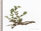
Coll. No. 2877.1, Arenaria lanuginosa var. saxosa.
|
2877.1
|
Stellaria sp. ???
|
Plants of Colorado
Caryophyllaceae
Arenaria lanuginosa (Michx.) Rohrb. var. saxosa (A. Gray) Zarucchi, R. L. Hartman & Rabeler.
Spreading Sandwort.
West Tennessee Creek, Lake County, Colorado.
Along an old, closed forest road on the north side of West Tennessee Creek, 740 m. southeast of Lily Lake, 16.0 km. north northwest of Leadville.
39.3473°N, 106.3638°W.
WGS 1984
Elev. 3176 m.
Very few in shade.
Bare soil with a few trees on bench above the flood plain of the creek.
Distances measured from GNIS point features.
Collected by permit: Pike - San Isabel National Forest, 2022, issued: Mar 29, 2022, to: Tom Schweich.
|
Tom Schweich
2877.1 |
19-Jul-2022 |
|
|
|
Images:
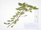
Coll. No. 2878, Shepherdia canadensis.
|
2878
|
Unknown; I would have thought something in the Rhamnaceae.
|
Plants of Colorado
Elaeagnaceae
Shepherdia canadensis (L.) Nutt.
Russet Buffalo-Berry.
West Tennessee Creek, Lake County, Colorado.
Along an old, closed forest road on the north side of West Tennessee Creek, 740 m. southeast of Lily Lake, 15.9 km. north northwest of Leadville.
39.3465°N, 106.3651°W.
WGS 1984
Elev. 3179 m.
In bud, flowers not open yet.
Low shrub under trees of open forest.
Distances measured from GNIS point features.
Collected by permit: Pike - San Isabel National Forest, 2022, issued: Mar 29, 2022, to: Tom Schweich.
|
Tom Schweich
2878. |
19-Jul-2022 |
|
|
|
|
2879
|
Pedicularis groenlandica
|
Plants of Colorado
Orobanchaceae
Pedicularis groenlandica Retz.
Elephanthead Lousewort.
West Tennessee Creek, Lake County, Colorado.
At the end of an old, closed forest road on the north side of West Tennessee Creek, 720 m. south of Lily Lake, 16.1 km. north northwest of Leadville.
39.3458°N, 106.3685°W.
WGS 1984
Elev. 3198 m.
Marshy area under forest trees.
Distances measured from GNIS point features.
Collected by permit: Pike - San Isabel National Forest, 2022, issued: Mar 29, 2022, to: Tom Schweich.
|
Tom Schweich
2879. |
19-Jul-2022 |
|
|
|
Images:
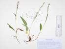
Coll. No. 2878.1, Bistorta vivipara.
|
2879.1
|
Sorta looks like Bistorta, so maybe B. vivipara
|
Plants of Colorado
Polygonaceae
Bistorta vivipara (L.) Delarbre.
Alpine Bistort.
West Tennessee Creek, Lake County, Colorado.
At the end of an old, closed forest road on the north side of West Tennessee Creek, 720 m. south of Lily Lake, 16.1 km. north northwest of Leadville.
39.3458°N, 106.3685°W.
WGS 1984
Elev. 3198 m.
Marshy place under forest trees., with Pedicularis groenlandica.
Distances measured from GNIS point features.
Collected by permit: Pike - San Isabel National Forest, 2022, issued: Mar 29, 2022, to: Tom Schweich.
|
Tom Schweich
2879.1 |
19-Jul-2022 |
|
|
|
Locations:
West Tennessee Creek.
|
|
At the the of the road is a camping area that had a picnic table at one time.
|
|
|
2880
|
Geum triflorum.
|
Plants of Colorado
Rosaceae
Geum triflorum Pursh.
Old Man's Whiskers.
West Tennessee Creek, Lake County, Colorado.
On a former oxbow of West Tennessee Creek, 830 m. southeast of Lily Lake, 15.9 km. north northwest of Loeadville.
39.3464°N, 106.3639°W.
WGS 1984
Elev. 3171 m.
Open area, also collected here; Penstemon procerus, Caltha leptosepala, and Rhodiola rhodantha.
Distances measured from GNIS point features.
Collected by permit: Pike - San Isabel National Forest, 2022, issued: Mar 29, 2022, to: Tom Schweich.
|
Tom Schweich
2880. |
19-Jul-2022 |
|
|
|
|
2880.1
|
Penstemon rydbergii
|
Plants of Colorado
Plantaginaceae
Penstemon procerus Douglas ex Graham var. procerus.
Pincushion Beardtongue.
West Tennessee Creek, Lake County, Colorado.
On a former oxbow of West Tennessee Creek, 830 m. southeast of Lily Lake, 15.9 km. north northwest of Loeadville.
39.3464°N, 106.3639°W.
WGS 1984
Elev. 3171 m.
Open area, also collected here; Geum triflorum, Caltha leptosepala, and Rhodiola rhodantha.
Distances measured from GNIS point features.
Collected by permit: Pike - San Isabel National Forest, 2022, issued: Mar 29, 2022, to: Tom Schweich.
|
Tom Schweich
2880.1 |
19-Jul-2022 |
|
|
|
Images:
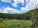
Westward view on West Tennessee Creek.
|
2881
|
Something I don't recognize …
|
Plants of Colorado
Asteraceae
Artemisia borealis Pall. Ssp. borealis.
Boreal Wormwood.
(Syn: A. campestris L. var. purshii (Besser ex Hook.) Cronquist,
Oligosporus groenlandicus (Hornemann) Á. Löve & D. Löve)
West Tennessee Creek, Lake County, Colorado.
Edge of forest on west-facing slope above West Tennessee Creek, 870 m. southeast of Lily Lake, 15.9 km. north northwest of Leadville.
39.3471°N, 106.3625°W.
WGS 1984
Elev. 3166 m.
Dry gravelly slope under a pine.
Distances measured from GNIS point features.
Collected by permit: Pike - San Isabel National Forest, 2022, issued: Mar 29, 2022, to: Tom Schweich.
|
Tom Schweich
2881. |
19-Jul-2022 |
|
|
|
Images:
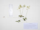
Coll. No. 2882, Pyrola chlorantha.
|
2882
|
Wintergreen
|
Plants of Colorado
Ericaceae
Pyrola chlorantha Sw.
Green-Flowered Wintergreen.
North Fork West Tennessee Creek, Lake County, Colorado.
Between West Tennessee Creek and its North Fork, near the intersection of a closed forest road and the Colorado Trail, 1.12 km. southeast of Lily Lake, 15.7 km. north northwest of Leadville.
39.3465°N, 106.3603°W.
WGS 1984
Elev. 3206 m.
Shaded forest with little to no understory.
Distances measured from GNIS point features.
Collected by permit: Pike - San Isabel National Forest, 2022, issued: Mar 29, 2022, to: Tom Schweich.
|
Tom Schweich
2882. |
19-Jul-2022 |
|
|
|
Other articles:
• CO-82:
at Brumley;
Locations:
Brumley.
Leadville.
|
|
Wednesday, 20 July 2022
Brumley, and around.
|
|
Other articles:
• CO-82:
at Brumley;
|
2883
|
Penstemon whippleanus.
|
Plants of Colorado
Plantaginaceae
Penstemon whippleanus A. Gray.
Whipples Penstemon.
Brumley, Lake County, Colorado.
Subalpine forest on a bank between the access road to the Sno-Tel station and the highway, about 11 road miles generally west on Colorado Highway 82 from the town of Twin Lakes, 175 km. southwest of Golden.
39.089°N, 106.5419°W.
WGS 1984
Elev. 3232 m.
Brumley was a stage stop on the route across Independence Pass.
Collected by permit: Pike - San Isabel National Forest, 2022, issued: Mar 29, 2022, to: Tom Schweich.
|
Tom Schweich
2883. |
20-Jul-2022 |
|
|
|
|
2884
|
Mertensia lanceolata.
|
Plants of Colorado
Boraginaceae
Mertensia ciliata (Torr.) G. Don.
Tall Fringed Bluebells.
Brumley, Lake County, Colorado.
On the bank of Lake Creek, beside the access road to the Sno-Tel station, about 11 road miles generally west on Colorado Highway 82 from the town of Twin Lakes, 175 km. southwest of Golden.
39.0892°N, 106.5421°W.
WGS 1984
Elev. 3234 m.
On the bank of the creek, also collected here: Gentiana parryi, Chamerion angustifolium, and Aconitum columbianum,
Collected by permit: Pike - San Isabel National Forest, 2022, issued: Mar 29, 2022, to: Tom Schweich.
|
Tom Schweich
2884. |
20-Jul-2022 |
|
|
|
Other articles:
• CO-82:
at Brumley;
|
2885
|
Aconitum columbianum.
|
Plants of Colorado
Ranunculaceae
Aconitum columbianum Nutt.
Columbian Monkshood.
Brumley, Lake County, Colorado.
On the bank of Lake Creek, beside the access road to the Sno-Tel station, about 11 road miles generally west on Colorado Highway 82 from the town of Twin Lakes, 175 km. southwest of Golden.
39.0892°N, 106.5421°W.
WGS 1984
Elev. 3234 m.
On the bank of the creek, also collected here: Gentiana parryi, Chamerion angustifolium, and Mertensia ciliata.
Collected by permit: Pike - San Isabel National Forest, 2022, issued: Mar 29, 2022, to: Tom Schweich.
|
Tom Schweich
2885. |
20-Jul-2022 |
|
|
|
Other articles:
• CO-82:
at pullout;
|
|
Relocate to next stop, about 1/2 mile north on CO 82, and on the east side of the road.
|
|
|
2886
|
Erigonum umbellatum var. majus.
|
Plants of Colorado
Polygonaceae
Eriogonum umbellatum Torrey, Ann. Lyceum Nat. Hist. New York. 2: 241. 1827. var. majus Hook.
Subalpine Sulphur-Flower Buckwheat.
Brumley, Lake County, Colorado.
About ½ mile north of Brumley on the east side of the road, about 12 road miles on Colorado Highway 82 generally west from Twin Lakes, Lake County, Colorado; 175 km. southwest of Golden.
39.0949°N, 106.542°W.
WGS 1984
Elev. 3248 m.
All infested with aphids tended by biting (!) black ants.
Treeless slope (avalanche chute?) above the highway.
Collected by permit: Pike - San Isabel National Forest, 2022, issued: Mar 29, 2022, to: Tom Schweich.
|
Tom Schweich
2886. |
20-Jul-2022 |
|
|
|
|
2887
|
Aquilegia coerulea.
p>
|
Plants of Colorado
Ranunculaceae
Aquilegia coerulea E. James.
Colorado Blue Columbine.
Brumley, Lake County, Colorado.
About ½ mile north of Brumley on the east side of the road, about 12 road miles on Colorado Highway 82 generally west from Twin Lakes, Lake County, Colorado; 175 km. southwest of Golden.
39.0953°N, 106.5419°W.
WGS 1984
Elev. 3262 m.
About 60 m. above the highway on hummocky treeless slope that may be an avalanche chute.
Collected by permit: Pike - San Isabel National Forest, 2022, issued: Mar 29, 2022, to: Tom Schweich.
|
Tom Schweich
2887. |
20-Jul-2022 |
|
|
|
|
2888
|
Linum lewisii.
|
Plants of Colorado
Linaceae
Linum lewisii Pursh.
Prairie Blue Flax.
Brumley, Lake County, Colorado.
About ½ mile north of Brumley on the east side of the road, about 12 road miles on Colorado Highway 82 generally west from Twin Lakes, Lake County, Colorado; 175 km. southwest of Golden.
39.0953°N, 106.5419°W.
WGS 1984
Elev. 3267 m.
Styles > stamens for all flowers examined and collected.
About 60 m. above the highway on hummocky treeless slope that may be an avalanche chute.
Collected by permit: Pike - San Isabel National Forest, 2022, issued: Mar 29, 2022, to: Tom Schweich.
|
Tom Schweich
2888. |
20-Jul-2022 |
|
|
|
|
2888.1
|
Erysimum capitatum.
|
Plants of Colorado
Brassicaceae
Erysimum capitatum (Hook.) Greene.
Sanddune Wallflower.
Brumley, Lake County, Colorado.
About ½ mile north of Brumley on the east side of the road, about 12 road miles on Colorado Highway 82 generally west from Twin Lakes, Lake County, Colorado; 175 km. southwest of Golden.
39.0953°N, 106.5419°W.
WGS 1984
Elev. 3267 m.
About 60 m. above the highway on hummocky treeless slope that may be an avalanche chute.
Collected by permit: Pike - San Isabel National Forest, 2022, issued: Mar 29, 2022, to: Tom Schweich.
|
Tom Schweich
2888.1 |
20-Jul-2022 |
|
|
|
|
2889
|
Campanula rotundifolia.
|
Plants of Colorado
Campanulaceae
Campanula rotundifolia L.
Harebell.
Brumley, Lake County, Colorado.
About ½ mile north of Brumley on the east side of the highway, about 12 road miles on Colorado Highway 82 generally west from Twin Lakes, Lake County, Colorado; 175 km. southwest of Golden.
39.0953°N, 106.5411°W.
WGS 1984
Elev. 3279 m.
About 140 m. above the highway on hummocky slope (avalanche chute?) with a few small willows.
Collected by permit: Pike - San Isabel National Forest, 2022, issued: Mar 29, 2022, to: Tom Schweich.
|
Tom Schweich
2889. |
20-Jul-2022 |
|
|
|
Other articles:
• CO-82:
at pullout;
Locations:
Brumley.
|
2890
|
Fern.
|
Plants of Colorado
Dryopteridaceae
Cystopteris fragilis (L.) Bernh.
Brittle Bladderfern.
Brumley, Lake County, Colorado.
About ½ mile north of Brumley on the east side of the highway, about 12 road miles on Colorado Highway 82 generally west from Twin Lakes, Lake County, Colorado; 175 km. southwest of Golden.
39.0954°N, 106.541°W.
WGS 1984
Elev. 3279 m.
About 140 m. above the highway in a rock pile of hummocky terrain (avalanche chute?) with a few small willows.
Collected by permit: Pike - San Isabel National Forest, 2022, issued: Mar 29, 2022, to: Tom Schweich.
|
Tom Schweich
2890. |
20-Jul-2022 |
|
Coll. No. 2890, 20 July 2022, characters observed:
Plants, terrestrial, to 35 cm.;
Fronds,
petiole scales very sparse,
widest at middle,
bipinnately compound + lobed,
abaxial surface glabrous,
margins flat;
Sori,
between midrib and leaflet margin,
round,
indusium hood-like at base then divided into filiform segments.
|
|
|
|
Back at Brumley …
|
|
Other articles:
• CO-82:
at Brumley;
|
2891
|
Pedicularis groenlandica.
|
Plants of Colorado
Orobanchaceae
Pedicularis groenlandica Retz.
Elephanthead Lousewort.
Brumley, Lake County, Colorado.
Edge of slough beside the North Fork of Lake Creek, near the access road to the Sno-Tel station, about 11 road miles generally west on Colorado Highway 82 from the town of Twin Lakes, 175 km. southwest of Golden.
39.0895°N, 106.5421°W.
WGS 1984
Elev. 3236 m.
Common on edge of slough (former channel of the creek).
Brumley was a stage stop on the route across Independence Pass.
Collected by permit: Pike - San Isabel National Forest, 2022, issued: Mar 29, 2022, to: Tom Schweich.
|
Tom Schweich
2891. |
20-Jul-2022 |
|
|
|
Other articles:
• CO-82:
at Brumley;
• Glossary:
pollinium;
|
2892
|
Platanthera sp.
|
Plants of Colorado
Orchidaceae
Platanthera aquilonis Sheviak.
Northern Green Orchid.
Brumley, Lake County, Colorado.
Edge of slough beside the North Fork of Lake Creek, near the access road to the Sno-Tel station, about 11 road miles generally west on Colorado Highway 82 from the town of Twin Lakes, 175 km. southwest of Golden.
39.0895°N, 106.5421°W.
WGS 1984
Elev. 3235 m.
Common on edge of slough (former channel of the creek).
Brumley was a stage stop on the route across Independence Pass.
Collected by permit: Pike - San Isabel National Forest, 2022, issued: Mar 29, 2022, to: Tom Schweich.
|
Tom Schweich
2892. |
20-Jul-2022 |
|
I went with P. aquilonis because the lip petal is not rounded-dilated at the base and the polonia are loose and free of the anther sacs.
|
|
Images:
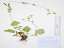
Coll. No. 2893, Geum macrophyllum var. perincisum
|
2893
|
Geum macrophyllum.
|
Plants of Colorado
Rosaceae
Geum macrophyllum Willd. var. perincisum (Rydb.) Raup.
Large-leaf Avens.
Brumley, Lake County, Colorado.
Edge of slough beside the North Fork of Lake Creek, near the access road to the Sno-Tel station, about 11 road miles generally west on Colorado Highway 82 from the town of Twin Lakes, 175 km. southwest of Golden.
39.0895°N, 106.5422°W.
WGS 1984
Elev. 3236 m.
Common on edge of slough (former channel of the creek).
Brumley was a stage stop on the route across Independence Pass.
Collected by permit: Pike - San Isabel National Forest, 2022, issued: Mar 29, 2022, to: Tom Schweich.
|
Tom Schweich
2893. |
20-Jul-2022 |
|
|
|
Other articles:
• Field Notes:
Coll. No. 3106, 18 Jul 2023;
|
2894
|
“Marsh Marigold” growing above the creek.
|
Plants of Colorado
Ranunculaceae
Caltha chionophila Greene.
Marsh Marigold.
Brumley, Lake County, Colorado.
On bank of North Fork of Lake Creek, near the access road to the Sno-Tel station, about 11 road miles generally west on Colorado Highway 82 from the town of Twin Lakes, 175 km. southwest of Golden.
39.0895°N, 106.5422°W.
WGS 1984
Elev. 3236 m.
Uncommon.
Brumley was a stage stop on the route across Independence Pass.
Collected by permit: Pike - San Isabel National Forest, 2022, issued: Mar 29, 2022, to: Tom Schweich.
|
Tom Schweich
2894. |
20-Jul-2022 |
|
|
|
Literature Cited:
- Greene, Edward L., 1899d.
|
|
Greene (1899) says this about C. leptosepala and then describes C. chionophila citing Baker's collection.
|
C. leptosepala, DC. Syst. i. 310 ? Hook. Fl. T. x, fig.
1, doubtless. Basal leaves erect on long and rather slender
petioles, round-oval, obtuse, with subcordate or subsagittate
base and short rather open sinus, the margin coarsely and
somewhat irregularly crenate or crenate-dentate ; the cauline
one smaller, more nearly truncate at base, petiolate, inserted
about midway of the stem, its stipules lanceolate-subulate,
not clasping, the node indistinct, the lateral peduncle shorter
and more slender than the terminal one: sepals 6 to 10,
oblong-linear, obtuse: filaments linear-filiform, thrice the
length of the anthers, the whole stamen surpassing the
rather few pistils; mature carpels substipitate.
|
|
The plant here described answers well to the original
account given of C. leptosepala, and to Hooker's figure. But
still its habitat, as far as I can read it in the herbaria, is
different from that assigned by De Caudolle. No such specimens
are in my herbarium, nor in that of the National Museum,
but there are three sheets of it in that of the Canadian
Survey at Ottawa, namely, n. 1,251, from mountains south
of the Zularaeen River, B. C, 27 July, 1888, collected by
Dawson ; n. 1,252, Tsi-Tsutl Mountains, B. C, in swamps and
marshy meadows, 14 July, 1896, by the same ; and n. 19,246,
from Maclennan River, Fraser River, B. C, 31 July, 1898.
They are all British Columbian specimens, and may therefore
not improbably represent the real C. leptosepala.
|
Regretfully, Greene does not give us the etymology of “chionophila.”
Stearn (2004, p. 384) states “chion- in Gk. Comp., snow-”
So our plant could be known as the “Snow-loving Marsh-marigold,” and be pronounced ‘ki-on-o-PHIL-a.’
|
C. chionophila Acaulescent, with stoutish peduncles
and scapes, and leaves thick and firm in texture, their outline
from oval-subsagittate to obovate-subreniform, or even
somewhat panduriform by an evident constriction below
the middle, the whole margin usually coarsely and sharply
dentate: earliest scapes either not equalling the leaves op
little exceeding them : sepals 10 or fewer, oblong to obovate,
large, the flower often 1½ inches in diameter: stamens very
short, the filaments not longer than the anthers and widely
dilated, of oblong outline, and even the connective subulate-dilated:
mature carpels not known.
|
|
Obtained in the mountains of southern Colorado, near
Pagosa Peak, at an altitude of 11,000 feet., by Mr. C. F.
Baker, 28 Aug., 1899 ; and some earlier specimens in the U. S.
Herbarium from southern Utah appear to be referable here,
namely, those from Fish Lake at 9,000 feet, Marcus Jones,
8 Aug., 1894; also others from Marysvale, by the same collector
in the same year.
|
|
|
Literature Cited:
- Wefferling, Keir M., and Sara B. Hoot, 2017.
|
|
Wefferling & Hoot (2017) published a key to distinguish C. chionophila and C. leptosepala.
|
Key to Caltha leptosepala polyploid complex
|
|
1. Leaves as broad as leaf length or broader; filaments filiform (i.e., narrower than anthers) and generally longer than carpels; in
Coastal Ranges (British Columbia and Alaska), Cascades (Washington, Oregon, California), Klamath - Siskiyous (Oregon, Cali-
fornia), or Sierra Nevada (California, western Nevada)
|
|
C. biflora
|
|
- Leaves longer than broad
|
|
2
|
|
2. Filaments broader and generally shorter than carpels; in U.S.A. Rockies or Basin and Range (Steens, Ruby Mtns.)
|
|
C. chionophila
|
|
- Filaments no broader than anthers (broadly filiform to about as wide as anthers) and generally longer than carpels; in all regions
except southern Rockies
|
|
C. leptosepala
|
|
|
Literature Cited:
- Wefferling, Keir M., and Sara B. Hoot, 2018.
|
|
Wefferling & Hoot (2018) investigated the phylogeography of western North American subalpine marsh marigolds.
|
Hexaploids Caltha biflora and C. chionophila diverged in the Upper Miocene
to Lower Pleistocene (chloroplast and nuclear dataset estimates overlapping at the
Miocene–Pliocene boundary), and upon secondary contact formed allododecaploid
C. leptosepala bidirectionally and at least three times.
|
|
|
Other articles:
• CO-82:
at view of reservoir;
Locations:
Twin Lakes Reservoir.
|
|
Overview and information booth for Twin Lakes Reservoir.
|
|
Other articles:
• Forest Road 189:
on the road;
Locations:
Tennessee Park.
Unnamed Gulch on Forest Road 189.
|
|
Thursday, 21 July 2022
Small meadow along Forest Road 189.
|
|
|
2895
|
Eriogonum umbellatum var. majus.
|
Plants of Colorado
Polygonaceae
Eriogonum umbellatum Torrey, Ann. Lyceum Nat. Hist. New York. 2: 241. 1827. var. majus Hook.
Subalpine Sulphur-Flower Buckwheat.
Unnamed Gulch 1, Lake County, Colorado.
Along Forest Road 189, about 1 km. west of County Road 18 “East Tennessee Road,” 7.37 km. north northwest of the GNIS location of Leadville.
39.2988°N, 106.3163°W.
WGS 1984
Elev. 3109 m.
A few of these plants have flowers at the base of the umbels.
Openings in aspen forest, surrounded by big sagebrush and willows.
Collected by permit: Pike - San Isabel National Forest, 2022, issued: Mar 29, 2022, to: Tom Schweich.
|
Tom Schweich
2895. |
21-Jul-2022 |
|
|
|
|
2896
|
Erigeron sp., maybe E. glacialis.
|
Plants of Colorado
Asteraceae
Erigeron subtrinervis Rydb. ex Porter & Britton.
Threenerve Daisy.
Unnamed Gulch, Lake County, Colorado.
Along Forest Road 189, about 1 km. west of County Road 18 “East Tennessee Road,” 7.37 km. north northwest of the GNIS location of Leadville.
39.2988°N, 106.3164°W.
WGS 1984
Elev. 3108 m.
Openings in aspen forest, surrounded by big sagebrush and willows.
Collected by permit: Pike - San Isabel National Forest, 2022, issued: Mar 29, 2022, to: Tom Schweich.
|
Tom Schweich
2896. |
21-Jul-2022 |
|
|
|
|
2897
|
Koeleria macrantha ?
|
Plants of Colorado
Poaceae
Koeleria macrantha (Ledeb.) Schult.
Prairie Junegrass.
Unnamed Gulch, Lake County, Colorado.
Along Forest Road 189, about 1 km. west of County Road 18 “East Tennessee Road,” 7.37 km. north northwest of the GNIS location of Leadville.
39.2988°N, 106.3163°W.
WGS 1984
Elev. 3108 m.
Im bloom.
Openings in aspen forest, surrounded by big sagebrush and willows.
Collected by permit: Pike - San Isabel National Forest, 2022, issued: Mar 29, 2022, to: Tom Schweich.
|
Tom Schweich
2897. |
21-Jul-2022 |
|
|
|
Other articles:
• Forest Road 189:
on the road;
|
2898
|
Dasiophora fruticosa.
|
Plants of Colorado
Rosaceae
Dasiophora fruticosa (L.) Rydb.
Shrubby Cinquefoil, Golden Hardtack.
Unnamed Gulch, Lake County, Colorado.
Along Forest Road 189, about 1 km. west of County Road 18 “East Tennessee Road,” 7.37 km. north northwest of the GNIS location of Leadville.
39.2987°N, 106.3162°W.
WGS 1984
Elev. 3108 m.
Openings in aspen forest, surrounded by patches of big sagebrush and willows.
Collected by permit: Pike - San Isabel National Forest, 2022, issued: Mar 29, 2022, to: Tom Schweich.
|
Tom Schweich
2898. |
21-Jul-2022 |
|
|
|
|
2899
|
Populus tremuloides.
|
Plants of Colorado
Salicaceae
Populus tremuloides Michx.
Quaking Aspen.
Unnamed Gulch, Lake County, Colorado.
Along Forest Road 189, about 1 km. west of County Road 18 “East Tennessee Road,” 7.37 km. north northwest of the GNIS location of Leadville.
39.2989°N, 106.3163°W.
WGS 1984
Elev. 3106 m.
Sterile.
Openings in aspen forest, mixed with patches of big sagebrush and willows.
Collected by permit: Pike - San Isabel National Forest, 2022, issued: Mar 29, 2022, to: Tom Schweich.
|
Tom Schweich
2899. |
21-Jul-2022 |
|
|
|
|
2900
|
Phlox, maybe P. hoodii.
|
Plants of Colorado
Polemoniaceae
Leptosiphon nuttallii (Gray) J. M. Porter & L. A. Johnson ssp. nuttallii.
Nuttall's Linanthus.
Unnamed Gulch, Lake County, Colorado.
Along Forest Road 189, about 1 km. west of County Road 18 “East Tennessee Road,” 7.37 km. north northwest of the GNIS location of Leadville.
39.2988°N, 106.3163°W.
WGS 1984
Elev. 3107 m.
Openings in aspen forest, mixed with patches of big sagebrush and willows.
Collected by permit: Pike - San Isabel National Forest, 2022, issued: Mar 29, 2022, to: Tom Schweich.
|
Tom Schweich
2900. |
21-Jul-2022 |
|
|
|
Other articles:
• Forest Road 189:
on the road;
• Taxa Notes:
Notes on Calochortus gunnisonii, Watson, 1871;
|
2901
|
Calochortus gunnisonii.
|
Plants of Colorado
Liliaceae
Calochortus gunnisonii S. Watson.
Gunnison's Mariposa Lily.
Unnamed Gulch, Lake County, Colorado.
Along Forest Road 189, about 1 km. west of County Road 18 “East Tennessee Road,” 7.37 km. north northwest of the GNIS location of Leadville.
39.2987°N, 106.3161°W.
WGS 1984
Elev. 3107 m.
Petals white to light lavender to lavender, fading blue-purplish.
Openings in aspen forest, mixed with patches of big sagebrush and willows.
Collected by permit: Pike - San Isabel National Forest, 2022, issued: Mar 29, 2022, to: Tom Schweich.
|
Tom Schweich
2901. |
21-Jul-2022 |
|
|
|
|
2902
|
Potentilla, probably P. hippiana.
|
Plants of Colorado
Rosaceae
Potentilla hippiana Lehm. var. hippiana.
Wooly Cinquefoil.
Unnamed Gulch, Lake County, Colorado.
Along Forest Road 189, about 1 km. west of County Road 18 “East Tennessee Road,” 7.37 km. north northwest of the GNIS location of Leadville.
39.2989°N, 106.3162°W.
WGS 1984
Elev. 3105 m.
Leaflets more distinctly bicolored than those collected in Jefferson County.
Openings in aspen forest, mixed with patches of big sagebrush and willows.
Collected by permit: Pike - San Isabel National Forest, 2022, issued: Mar 29, 2022, to: Tom Schweich.
|
Tom Schweich
2902. |
21-Jul-2022 |
|
Coll. No. 2902, 21 July 2022, characters observed:
Perennial, to 30 cm.;
Leaves,
basal,
compound,
leaflets, #9,
bases not decurrent,
toothed most of length,
sericeous adaxially, greenish,
tomentose + sericeous abaxially, white;
cauline,
stipules entire;
Calyx,
bractlets, same colors as sepals.
|
|
|
2903
|
Some kind of sunflower with nodding flowers, maybe Helianthella quinquenervis.
|
Plants of Colorado
Asteraceae
Helianthella quinquenervis (Hook.) A. Gray.
Five-Nerve Little Sunflower.
Unnamed Gulch, Lake County, Colorado.
Along Forest Road 189, about 1 km. west of County Road 18 “East Tennessee Road,” 7.37 km. north northwest of the GNIS location of Leadville.
39.2986°N, 106.3165°W.
WGS 1984
Elev. 3107 m.
With nodding flowers, growing inside a small aspen grove.
Openings in aspen forest, mixed with patches of big sagebrush and willows.
Collected by permit: Pike - San Isabel National Forest, 2022, issued: Mar 29, 2022, to: Tom Schweich.
|
Tom Schweich
2903. |
21-Jul-2022 |
|
|
|
Other articles:
• Forest Road 189:
on the road;
|
2904
|
Orthocarpus luteus.
|
Plants of Colorado
Orobanchaceae
Orthocarpus luteus Nutt.
Yellow Owls Clover.
Unnamed Gulch, Lake County, Colorado.
Along Forest Road 189, about 1 km. west of County Road 18 “East Tennessee Road,” 7.37 km. north northwest of the GNIS location of Leadville.
39.2987°N, 106.3169°W.
WGS 1984
Elev. 3102 m.
Openings in aspen forest, mixed with patches of big sagebrush and willows.
Collected by permit: Pike - San Isabel National Forest, 2022, issued: Mar 29, 2022, to: Tom Schweich.
|
Tom Schweich
2904. |
21-Jul-2022 |
|
|
|
Other articles:
• Forest Road 189:
on the road;
|
2905
|
Pedicularis parryi.
|
Plants of Colorado
Orobanchaceae
Pedicularis parryi A. Gray.
Parry's Lousewort.
Unnamed Gulch, Lake County, Colorado.
Along Forest Road 189, about 1 km. west of County Road 18 “East Tennessee Road,” 7.37 km. north northwest of the GNIS location of Leadville.
39.2988°N, 106.317°W.
WGS 1984
Elev. 3101 m.
Corolla pale yellow.
Openings in aspen forest, mixed with patches of big sagebrush and willows.
Collected by permit: Pike - San Isabel National Forest, 2022, issued: Mar 29, 2022, to: Tom Schweich.
|
Tom Schweich
2905. |
21-Jul-2022 |
|
|
|
Other articles:
• Forest Road 189:
on the road;
|
2906
|
Penstemon procerus.
|
Plants of Colorado
Orobanchaceae
Pedicularis parryi A. Gray.
Parry's Lousewort.
Unnamed Gulch, Lake County, Colorado.
Along Forest Road 189, about 1 km. west of County Road 18 “East Tennessee Road,” 7.37 km. north northwest of the GNIS location of Leadville.
39.2988°N, 106.317°W.
WGS 1984
Elev. 3101 m.
Corolla pale yellow.
Openings in aspen forest, mixed with patches of big sagebrush and willows.
Collected by permit: Pike - San Isabel National Forest, 2022, issued: Mar 29, 2022, to: Tom Schweich.
|
Tom Schweich
2905. |
21-Jul-2022 |
|
Flowers mostly held horizontal, corollas 12 mm.
|
|
Locations:
DeLong Park (City of Golden).
|
|
Thursday, 18 Aug 2022
Weeding at DeLong Park.
|
|
Images:
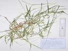
Coll. No. 2907, Cenchrus longispinus.
|
2907
|
Cenchrus sp. ?
|
Native and Naturalized Flora of the Golden Area, Jefferson County, Colorado
Poaceae
Cenchrus longispinus (Hack.) Fern.
Longspine Sandbur.
Delong Park, Jefferson County, Colorado.
In planted native grass beds, along 23rd Street, opposite Vernon Drive, 1.72 km. southeast of the GNIS location of Golden.
39.7489°N, 105.2083°W.
WGS 1984
Elev. 1761 m.
Not previously collected in or near Golden; unclear whether this grass was previously here, brought in with the soil amendment, or was a contaminant in the seed mix.
DeLong Park was a private residence that was left fallow for a number of years, then converted to a city park in 2021-2022.
Collected by permit: City of Golden, 2022, issued: Mar 17, 2022, to: Tom Schweich.
|
Tom Schweich
2907. |
18-Aug-2022 |
|
|
|
Other articles:
• Glossary:
waif;
|
2908
|
Ambrosia sp.
|
Native and Naturalized Flora of the Golden Area, Jefferson County, Colorado
Asteraceae
Ambrosia acanthicarpa Hook.
Flat-Spine Burr-Ragweed.
Delong Park, Jefferson County, Colorado.
In planted native grass beds, along 23rd Street, opposite Vernon Drive, 1.72 km. southeast of the GNIS location of Golden.
39.7489°N, 105.2083°W.
WGS 1984
Elev. 1761 m.
Not previously collected in or near Golden; unclear whether this Ambrosia was previously here, brought in with the soil amendment, or was a contaminant in the seed mix.
DeLong Park was a private residence that was left fallow for a number of years, then converted to a city park in 2021-2022.
Collected by permit: City of Golden, 2022, issued: Mar 17, 2022, to: Tom Schweich.
|
Tom Schweich
2908. |
18-Aug-2022 |
|
Possibly a waif.
|
|
Images:
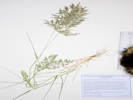
Coll. No. 2909, Eragrostis cilianensis.
|
2909
|
“Stink Grass”
|
Native and Naturalized Flora of the Golden Area, Jefferson County, Colorado
Poaceae
Eragrostis cilianensis (All.) Vignolo ex Janch.
Stinkgrass.
DeLong Park, Jefferson County, Colorado.
In planted native grass beds, along 23rd Street, opposite Vernon Drive, 1.72 km. southeast of the GNIS location of Golden.
39.7489°N, 105.2083°W.
WGS 1984
Elev. 1761 m.
Crateriform glands on mid-ribs of leaf blades, pedicels, and keels of glumes and lemmas.
Unclear whether this grass was previously here, brought in with the soil amendment, or was a contaminant in the seed mix.
DeLong Park was a private residence that was left fallow for a number of years, then converted to a city park in 2021-2022.
Collected by permit: City of Golden, 2022, issued: Mar 17, 2022, to: Tom Schweich.
|
Tom Schweich
2909. |
18-Aug-2022 |
|
|
|
|
|
Stinkgrass.
|
Native and Naturalized Flora of the Golden Area, Jefferson County, Colorado
Poaceae
Eragrostis cilianensis (All.) Vignolo ex Janch.
Stinkgrass.
Golden, Jefferson County, Colorado.
In the alley between 4th and 5th Streets, running from Arapahoe to Cheyenne Street, 1.20 km. northwest of the GNIS location of Golden.
39.7612°N, 105.229°W.
WGS 1984
Elev. 1755 m.
Small plants, growing in dry gravels of alley. Crateriform glands on mid-ribs of leaf blades, pedicels, and keels of glumes and lemmas.
With Lactuca serriola, Sonchus asper, Kochia scoparia, Chamaesyce sp., Polygonum aviculare,and Parthenocissus quinquefolia. Common weed.
Collected by permit: City of Golden, 2022, issued: Mar 17, 2022, to: Tom Schweich.
|
Tom Schweich
2910. |
21-Aug-2022 |
|
|
|
|
2911
|
We found more bur grass.
|
Native and Naturalized Flora of the Golden Area, Jefferson County, Colorado
Poaceae
Cenchrus longispinus (Hack.) Fern.
Longspine Sandbur.
DeLong Park, Jefferson County, Colorado.
In planted native grass beds, along 23rd Street, opposite Vernon Drive, 1.72 km. southeast of the GNIS location of Golden.
39.7489°N, 105.2082°W.
WGS 1984
Elev. 1761 m.
Not previously collected in or near Golden; unclear whether this grass was previously here, brought in with the soil amendment, or was a contaminant in the seed mix.
DeLong Park was a private residence that was left fallow for a number of years, then converted to a city park in 2021-2022. Native to Colorado, but usually found in sandy habitats.
Collected by permit: City of Golden, 2022, issued: Mar 17, 2022, to: Tom Schweich.
|
Tom Schweich
2911. |
25-Aug-2022 |
|
|
|
Other articles:
• Arapahoe Street:
near 5th;
|
|
Thursday 8 September 2022
Weeding at DeLong Park.
|
|
Images:
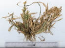
Coll. No. 2912, Panicum miliaceum.
|
2912
|
Panicum milliaceum.
|
Native and Naturalized Flora of the Golden Area, Jefferson County, Colorado
Poaceae
Panicum miliaceum L.
Proso Millet.
DeLong Park, Jefferson County, Colorado.
Bottom of watercourse, along 23rd Street, opposite Vernon Drive, 1.72 km. southeast of the GNIS location of Golden.
39.7488°N, 105.2084°W.
WGS 1984
Elev. 1760 m.
This plant was probably weed-whacked at least once, which may account for its poor condition.
Not previously collected in Golden; unclear whether this grass was previously here, brought in with the soil amendment, or was a contaminant in the seed mix.
DeLong Park was a private residence that was left fallow for a number of years, then converted to a city park in 2021-2022. Colorado Noxious Weed List C.
Collected by permit: City of Golden, 2022, issued: Mar 17, 2022, to: Tom Schweich.
|
Tom Schweich
2912. |
8-Sep-2022 |
|
|
|
Images:
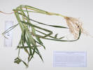
Coll. No. 2913, Echinochloa crus-galli.
|
2913
|
Echinochloa sp.
|
Native and Naturalized Flora of the Golden Area, Jefferson County, Colorado
Poaceae
Echinochloa crus-galli (L.) P. Beauv.
Barnyardgrass.
DeLong Park, Jefferson County, Colorado.
Scattered mainly around the front entrance on 23rd Street, 1.72 km. southeast of the GNIS location of Golden.
39.7489°N, 105.2083°W.
WGS 1984
Elev. 1761 m.
These are medium size; there are others double in height, and others that have been mowed and are quite short.
Not previously collected in Golden; unclear whether this grass was previously here, brought in with the soil amendment, or was a contaminant in the seed mix.
DeLong Park was a private residence that was left fallow for a number of years, then converted to a city park in 2021-2022.
Collected by permit: City of Golden, 2022, issued: Mar 17, 2022, to: Tom Schweich.
|
Tom Schweich
2913. |
8-Sep-2022 |
|
|
|
|
|
Thursday, 15 September 2022
Weeding at DeLong Park
|
|
Other articles:
• Glossary:
waif;
|
2914
|
Cycloloma atriplicifolium, in red.
|
Native and Naturalized Flora of the Golden Area, Jefferson County, Colorado
Chenopodiaceae
Cycloloma atriplicifolium (Spreng.) J. M. Coult.
Winged-Pigweed.
DeLong Park (City of Golden), Jefferson County, Colorado.
Hydroseeded “native” area, north corner of park on 23rd Street opposite Table Drive, 1.74 km. southeast of the GNIS location of Golden.
39.7489°N, 105.2081°W.
WGS 1984
Elev. 1762 m.
Mature, i.e., stems and inflorescence red and fruit wings well-developed, whereas Coll. No. 2915 is immature.
Not previously collected in Golden; unclear whether this plant was previously here, brought in with the soil amendment, or was a contaminant in the seed mix.
DeLong Park was a private residence that was left fallow for a number of years, then converted to a city park in 2021-2022.
Collected by permit: City of Golden, 2022, issued: Mar 17, 2022, to: Tom Schweich.
|
Tom Schweich, with Laurel Starr
2914. |
15-Sep-2022 |
|
Possibly a waif.
|
|
Other articles:
• Glossary:
waif;
|
2915
|
Cycloloma atriplicifolium, in green.
|
Native and Naturalized Flora of the Golden Area, Jefferson County, Colorado
Chenopodiaceae
Cycloloma atriplicifolium (Spreng.) J. M. Coult.
Winged-Pigweed.
DeLong Park (City of Golden), Jefferson County, Colorado.
Hydroseeded “native” area, north corner of park on 23rd Street opposite Table Drive, 1.74 km. southeast of the GNIS location of Golden.
39.7489°N, 105.2081°W.
WGS 1984
Elev. 1762 m.
Immature, stems and fruit still green, and wings just beginning to develop. For a mature specimen see, Coll. No. 2914.
Not previously collected in Golden; unclear whether this plant was previously here, brought in with the soil amendment, or was a contaminant in the seed mix.
DeLong Park was a private residence that was left fallow for a number of years, then converted to a city park in 2021-2022.
Collected by permit: City of Golden, 2022, issued: Mar 17, 2022, to: Tom Schweich.
|
Tom Schweich, with Laurel Starr
2915. |
15-Sep-2022 |
|
Possibly a waif.
|
|
|
2916
|
Ambrosia artemisifolia.
|
Native and Naturalized Flora of the Golden Area, Jefferson County, Colorado
Asteraceae
Ambrosia psilostachya DC.
Western Ragweed.
DeLong Park (City of Golden), Jefferson County, Colorado.
Hydroseeded “native” area, north corner of park on 23rd Street opposite Table Drive, 1.74 km. southeast of the GNIS location of Golden.
39.7489°N, 105.208°W.
WGS 1984
Elev. 1762 m.
Common in all open spaces of Golden including nearby slopes of South Table Mountain; unclear whether this plant was previously here, brought in with the soil amendment, or was a contaminant in the seed mix.
DeLong Park was a private residence that was left fallow for a number of years, then converted to a city park in 2021-2022.
Collected by permit: City of Golden, 2022, issued: Mar 17, 2022, to: Tom Schweich.
|
Tom Schweich
2916. |
15-Sep-2022 |
|
|
|
Locations:
Ranson/Edwards Homestead Open Space Park.
|
|
Sunday, 18 September 2022
Field trip with Colorado Native Plant Society.
|
|
Other articles:
• Tucker Gulch Trail:
near crossing;
at 2nd;
Locations:
Schweich Hill.
|
|
Tuesday, 20 September 2022
|
|
Images:
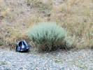
Coll. No. 2917, Artemisia absinthum.
|
2917
|
Wednesday, 21 September 2022
Have been watching this plant in a neighbor's garden. It is clearly an Artemisia but one that I am not familiar with. Went today to collect some and key it out.
|
Native and Naturalized Flora of the Golden Area, Jefferson County, Colorado
Asteraceae
Artemisia absinthium L.
Common Wormwood.
407 Garden Street, Jefferson County, Colorado.
On the shoulder of the road at 407 Garden Street, 1.39 km. north of the GNIS location of Golden.
39.765°N, 105.2234°W.
WGS 1984
Elev. 1756 m.
Leaves 2-3 times pinnatifid, receptacles hairy.
Also here: Artemisia ludoviciana, Cirsium arvensis. Ratibida columnifera, Convolvulus arvensis, Linum lewisii, and Elymus repens.
Naturalized at edge of residential street, more in nearby yard, but not planted by this homeowner. All removed by homeowner following identification. Colorado Noxious Weed List B.
Collected by permit: City of Golden, 2022, issued: Mar 17, 2022, to: Tom Schweich.
|
Tom Schweich, with Cathy Hansen-Stamp
2917. |
21-Sep-2022 |
|
|
|
Other articles:
• U. S. Highway 6:
in Woodside;
at Price;
Locations:
Beckwith Plateau.
Price.
|
|
Friday, 23 September 2022
Golden, CO to Price, UT.
|
|
Other articles:
• Interstate 15:
17700;
Locations:
Layton.
Price.
|
|
Saturday, 24 September 2022
Price, UT to Layton, UT
|
|
Other articles:
• UT Highway 96:
in Scofield;
Locations:
Scofield.
|
|
|
|
Other articles:
• UT Highway 96:
at Mtn Vw CG;
Locations:
Scofield Reservoir.
|
|
Potty break at Scofield State Park, Mountain View Campground.
|
|
Locations:
Helper.
|
|
Helper, the Western Mining and Railroad Museum.
The 2-story annex building has been added since I visited in 2008.
|
|
Locations:
Layton.
|
|
Sunday, 25 September 2022
Layton, UT
|
|
Other articles:
• W. Antelope Drive:
41000;
Locations:
Antelope Island.
Great Salt Lake.
|
|
|
|
Other articles:
• Buffalo Point Road:
30000;
Locations:
Buffalo Point.
Great Salt Lake.
|
|
Visit to Buffalo Point.
|
|
Other articles:
• W. Antelope Drive:
mid-island;
|
|
Herds of bison on both sides of the road.
|
|
Other articles:
• W. Antelope Drive:
90000;
|
|
Fielding Garr Ranch
|
|
Other articles:
• US I-84:
Boise;
Locations:
Boise.
Layton.
|
|
Monday, 26 September 2022
Layton, UT to Boise, ID
|
|
Other articles:
• US Hwy 30:
at Fossil Beds N M;
Locations:
Hagerman Fossil Beds N. M..
|
|
Stop at Haggerman Fossil Beds National Monument Visitor's Center
|
|
Other articles:
• Bell Rapids Road:
at Snake R Olook;
Locations:
Snake River.
|
|
Snake River Overlook
|
|
Other articles:
• Bell Rapids Road:
at Oregon Trl Olook;
|
|
Oregon Trail Overlook
|
|
Other articles:
• US Hwy 30:
along the highway;
Locations:
Snake River.
|
|
Overlook along US Highway 30.
|
|
Locations:
Boise.
|
|
Dinner and a walk around downtown Boise with Simone.
|
|
Other articles:
• U. S. Highway 20:
Bend;
• US Highway 97:
Bend;
Locations:
Bend.
Boise.
|
|
Tuesday, 27 September 2022
Boise, ID to Bend, OR
|
|
Other articles:
• Sodhouse Lane:
at Malheur NWR;
Locations:
Malheur National Wildlife Refuge.
|
|
Malheur National Wildlife Refuge
|
|
Locations:
Bend.
Yachats.
|
|
Wednesday, 28 September 2022
Bend, OR to Yachats, OR
|
|
Other articles:
• U. S. Highway 20:
029990;
at Sisters;
Locations:
Sisters.
|
|
View of Broken Top and North Sister from the highway.
|
|
Other articles:
• Oregon Highway 242 “McKenzie Highway”:
28Sep 2022;
|
|
View of Mount Washington
|
|
Other articles:
• Oregon Highway 242 “McKenzie Highway”:
at McKenzie Pass;
Locations:
McKenzie Pass.
|
|
McKenzie Pass
|
|
Other articles:
• Oregon Highway 242 “McKenzie Highway”:
near Scott Lake;
Locations:
Scott Lake.
|
|
Scott Lake
|
|
Other articles:
• Oregon Highway 126:
at wayside;
|
|
Brief stop at Jennie B. Harris State Wayside.
|
|
Other articles:
• Oregon Highway 126:
near Belnap Bridge;
|
|
Belnap Bridge
|
|
Other articles:
• Sunshine Acres Drive:
at 137½ Sunshine Acres Dr.;
|
|
The converted garage we lived in from 1969 to 1971, 137 1/2 Sunshine Acres Drive.
|
|
Other articles:
• U. S. Highway 101:
at Yachats;
Locations:
Yachats.
|
|
Thursday, 29 September 2022
Yachats, OR
|
|
Locations:
Yachats.
|
|
Walk along the bluffs in Yachats.
|
|
Other articles:
• U. S. Highway 101:
at Cape Perpetua;
at Capt Cook Trlhd.;
Locations:
Cape Perpetua.
|
|
On top of and around Cape Perpetua.
|
|
Other articles:
• U. S. Highway 101:
at Yachats;
Locations:
Yachats.
|
|
Lunch at the Luna Sea Fish House.
|
|
Locations:
Albany.
Yachats.
|
|
Friday, 30 September 2022
Yachats, OR to Albany, OR
|
|
Other articles:
• U. S. Highway 101:
at interp. ctr.;
Locations:
Waldport.
|
|
View of the Alsea Bay Bridge and a short visit to the Alsea Bay Historic Interpretive Center (recommended).
|
|
Literature Cited:
- Centala, Maxine, 2013.
Other articles:
• U. S. Highway 101:
at Seal Rocks;
Locations:
Seal Rock.
|
|
Visit to Seal Rocks, generally thought to be formed by the Ginkgo Flow of the Columbia River Flood Basalts.
|
|
Other articles:
• U. S. Highway 101:
in Newport;
in Yaquina Bay;
Locations:
Newport.
|
|
Newport
|
|
Other articles:
• U. S. Highway 101:
in Yaquina Bay;
Locations:
Yaquina Bay.
|
|
Walking along the docks in Yaquina Bay.
|
|
Other articles:
• U. S. Highway 101:
at Yaquina Head;
Locations:
Yaquina Head.
|
|
Lighthouse at Yaquina Head.
|
|
Other articles:
• U. S. Highway 20:
in Albany;
• Interstate 15:
at state line;
Locations:
Albany.
|
|
Saturday, 1 October 2022
Albany, OR
|
|
Locations:
Albany.
|
|
Family visit and lunch at Martha & Richard's.
|
|
Locations:
Albany.
John Day.
|
|
Sunday, 2 October 2022
Albany, OR to John Day, OR
|
|
Other articles:
• U. S. Highway 20:
at Hse Rk CG;
|
|
Pulled off the highway to sniff the forest.
|
|
Other articles:
• U. S. Highway 20:
at Hackleman Grove;
|
|
Hackleman Old Growth Grove.
Closed to use.
|
|
Other articles:
• US Hwy 26:
at Burnt Rch Rd;
Locations:
Painted Hills.
|
|
Painted Hills, part of John Day Fossil Beds N. M.
|
|
Other articles:
• Oregon Highway 19:
at V. C.;
Locations:
John Day Fossil Beds National Monument.
|
|
Stop at the Thomas Condon Paleontology Center.
|
|
Locations:
John Day Fossil Beds National Monument.
|
|
|
|
Other articles:
• Interstate 15:
at Exit 69;
Locations:
John Day.
Pocatello.
|
|
Monday, 3 October 2022
John Day, OR to Pocatello, ID
|
|
Other articles:
• US I-84:
25000;
|
|
Into Idaho from Oregon.
|
|
Other articles:
• Interstate 15:
at Exit 69;
Locations:
Pocatello.
|
|
Monday night in Pocatello.
|
|
Locations:
Pocatello.
|
|
Tuesday, 4 October 2022
Pocatello, ID to Golden, CO
|
|
|
|
[Previous Page]
[Next Page]
Go to page: [1800s] [1900s] [1910s] [1920s] [1930s] [1940s] [1950s] [1960s] [1970s] [1980s] [1990] [1991] [1992] [1993] [1994] [1995] [1996] [1997] [1998] [1999] [2000] [2001] [2002] [2003] [2004] [2005] [2006] [2007] [2008] [2009] [2010] [2011] [2012] [2013] [2014] [2015] [2016] [2017] [2018] [2019] [2020] [2021] [2022] [2023] [2024] [2025] [2026] [A]
|
|
If you have a question or a comment you may write to me at:
tomas@schweich.com
I sometimes post interesting questions in my FAQ, but I never disclose your full name or address.
|
[Home Page] [Site Map]
Date and time this article was prepared:
10/2/2026 12:48:38 PM
|
 Eastern Mojave Vegetation