Topics in this Article:
1800s
1900s
1910s
1920s
1930s
1940s
1950s
1960s
1970s
1980s
1990
1991
1992
1993
1995
1996
1997
1998
1999
2000
2001
2002
2003
2004
2005
2006
2007
2008
2008 Tour de Swertia albomarginata
Mono Lake, August 2008
2009
2010
2011
2012
2013
2014
2015
2016
2017
2018
2019
2020
2021
2022
2023
2024
2025
Contents
Literature Cited
|
|
When I first read the field notes of Annie Alexander and Louise Kellogg, I was fascinated by the descriptions they wrote about the places they went and the plants and animals they found there. By publishing my field notes on the Internet I hope to follow a little bit in their tradition.
|
|
|
|
2025
|
|
|
|
January, 2025
|
|
Other articles:
• Golden Checklist Flora:
Cottonwood Open Space;
• Welch Ditch:
near boundary;
Locations:
Cottonwood Natural Area.
View to southeast from Welch Ditch across Cottonwood Natural Area.
|
|
Thursday, 2 January 2025
Walked the Cottonwood Natural Area with several residents and members of Stewards of Golden Open Space.
 View to the north across Cottonwood Natural Area. |
 View to the southeast, high school at left, surge pond in center, Lookout Mountain Youth Services at right. |
 Berries of a Lycium, either L. barbarum or L. chinense, in Kinney Run. |
 View to the south across the Cottonwood Natural Area. |
 Golden High School as seen from the end of the social trail through Cottonwood Natural Area. |
|
|
Literature Cited:
- Sovell, John R., and Susan S. Panjabi, 2021.
Other articles:
• Kinney Run Trail:
at end;
near bridge;
n. end of o. s.;
along rck wall;
at intersection;
Locations:
Kinney Run South.
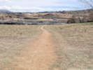
|
|
Friday, 3 January 2025
Kinney Run South
 Continuation of Kinney Run Trail at the end of Tripp Drive. |
 Just the north side of the bridge. |
 Along the trail. |
 Coarse sediments over fine. |
 Winter scene in Kinney Run South. |
 Discarded desk chair in Kinney Run South. |
 Discarded bicycle in Kinney Run South open space. |
 Method of connecting a barbed-sire fence to the cliff. |
 View north through Golden Valley. |
 View south through Kinney Run South. |
|
|
Other articles:
• Magpie Gulch Trail:
at mtn bike trl;
Locations:
New Loveland Mine Park.
The first few bicycle tracks visible on Monday, 3 February 2025
|
|
Monday, 3 February 2025
|
|
Other articles:
• Magpie Gulch Trail:
at mtn bike trl;
• Field Notes:
19 Dec 2024;
23 Mar 2025;
Locations:
New Loveland Mine Park.
Bicycle tracks on Wednesday, 5 February 2025
|
|
Wednesday, 5 February 2025
I made Fix-It report #32913
Planted the following seeds:
- Asclepias incarnata
- Arnica fugens
- Helianthus pauciflora subrhomboidea
- Senecio integerrimus
- Erysimum capitatum
- Astragalus drummondii
- Monarda pectinata
- Mentzelia muda
- Leptodactylon pungens
- Ipomopsis aggregata
- Eriogonum effusum
- Sphaeralcea coccinea
- Mirabilis multiflora
- Penstemon secundiflorus
- Penstemon virens
- Penstemon virgatus
- Achnatherum hymenoides
- Sporobolus cryptandrus
|
|
|
|
Thursday, 6 February 2025
Fix-It report 32943. Someone has been riding their mountain bikes through the park and surrounding open space (creating new "social trails"). I think some simple signage, filling the hole, and blocking their current paths with simple "do not enter" held by a couple of wooden stakes tape would hopefully discourage further destruction of our park and open space.
|
|
Other articles:
• Magpie Gulch Trail:
at mtn bike trl;
at mtn bike trl;
Locations:
New Loveland Mine Park.
Digging and piling up of dirt.
|
|
Friday, 7 February 2025
Mountain bike jump and trails in New Loveland Mine Park.
Fix-It Report #32971.
Someone has been riding their mountain bikes through the park and surrounding open space (creating new "social trails"). I think some simple signage, filling the hole, and blocking their current paths with simple "do not enter" held by a couple of wooden stakes tape would hopefully discourage further destruction of our park and open space.
The response on Fix-It was:
Thank you for your report. Two previous reports about this trail were already submitted to FixIt! so staff are aware. Staff will be adding signage to that entire area identifying it a s sensitive area and asking to people to stay out. The signs will be located in way that would deter use of this specific trail. It is likely that additional steps may be required but are working to get the signs in place ASAP. Specific to the jump, this afternoon staff worked to remove or replace the material. ~ Parks Staff
 Downhill runout from mountain bike jump. |
 Mountain bike jump. |
 Mountain bike trails in New Loveland Mine Park. |
|
|
Other articles:
• Field Notes:
19 Dec 2024;
5 Feb 2025;
Locations:
New Loveland Mine Park.
Backhoe tracks through the natural area of New Loveland Mine Park.
|
|
Sunday, 23 March 2025
Filed Fix-It Report #33832
On Friday, March 21, 2025, a contractor installed the footings for public art in New Loveland Mine Park. While on my way to the Community Center, I observed them setting up, and then working on the footing for the northerly art piece, and observed them again later in the morning digging out the hole for the footing. It was pretty clear they had run their little backhoe down the concrete trail. Unfortunately, after digging out the southerly footing, the contractor used the social trail to return their backhoe to the parking lot. This is evident in the attached photo as there are two new tracks that span the social trail. The damaged width in the natural area of New Loveland Mine Park is now at least 8 feet wide. This is not the first time a piece of equipment has been driven up the social trail. See Fix-It Report #32059, in which one of our own Stormwater guys drove a Skid-Steer up the the same trail. I had understood in your response to Fix-It reports #32913, #32943, and #32971, that there would be some signage placed around the natural area that "identifying it as sensitive area and asking to people to stay out. The signs will be located in way that would deter use of this specific trail. It is likely that additional steps may be required but are working to get the signs in place ASAP." So far there is no signage, and no other obvious attempt to protect the natural area from unnecessary damage. Since the city's contractors dug a pretty big hole and placed forms around it, I assume that concrete will be poured into the holes. Please direct the contractor not to drive a cement truck through the natural area.
.
|
|
Other articles:
• Magpie Gulch Trail:
social train down;
Locations:
New Loveland Mine Park.
Rehabilitation of the social trail through New Loveland Mine Park.
|
|
Saturday, 29 March 2025
Walk through New Loveland Mine Park.
 Signage at the mountain bike trail. |
|
|
Other articles:
• Magpie Gulch Trail:
at mtn bike trl;
social trail Cyn Vw Dr;
Locations:
New Loveland Mine Park.
Signage at south end of closed social trail.
|
|
Sunday, 30 March 2025
 Signage at lower end of mountain bike trail. |
|
|
Other articles:
• Interstate 70:
132610;
Locations:
Green River.
View from Tamarisk Restaurant in Green River.
|
|
Monday, 31 March 2025
Golden, CO, to Richfield, UT
|
|
Other articles:
• Interstate 70:
Richfield;
Locations:
Richfield.
Five inches of snow overnight in Richfield, Utah.
|
|
Tuesday, 1 April 2025
Richfield, UT, to Pahrump, NV
|
|
Other articles:
• U. S. Highway 91:
n. slope;
404700;
at Mojave Desert Joshua Tree Rd;
View south on Old Highway 91 to Littlefield, Arizona.
View north to the Red Mountains and then the Pine Valley Mountains.
|
|
Old Highway 91
 View south towards the pass through the Beaver Dam Mountains. |
 Joshua tree along Old Highway 91. |
|
|
Other articles:
• Scenic Loop Drive:
at visitor ctr;
at Calico I;
along road;
at o'look;
Locations:
Red Rock Canyon National Conservation Area.
View from the Visitor Center.
|
|
Red Rock Canyon
 Cross-bedded sandstone at Calico I. |
 Blackbrush along the road. |
 Calico Basin seen from High Point Overlook. |
 “Mohave Yucca” — Yucca schidigera K. E. Ortiges in bloom at the High Point Overlook. |
 View south from High Point Overlook |
 Looking towards Red Rock Canyon from the High Point Overlook. |
|
|
Other articles:
• Bell Vista Road:
somewhere;
Red stems from last year's Eriogonum inflatum.
|
|
Wednesday, 2 April 2025
Pahrump, NV, to Bakersfield, CA. Just out of Pahrump we drove west and through some small unnamed hills.
|
|
Other articles:
• California Highway 127:
at Death Valley Junction;
• CA Hwy 190:
Towne Pass;
at sea level;
at Zabriskie Point;
at Gower Gulch;
• Dantes View Road:
near top;
at Dantes View;
• Furnace Creek Wash Road:
at Billie Mine;
12000;
• Panamint Valley Road:
near CA 190;
• Trona Wildrose Road:
at Panamint Valley Road;
at Pass;
Locations:
Billie Mine.
Dante's View.
Death Valley.
Death Valley Junction.
Panamint Valley.
Ryan.
Towne Pass.
Zabriskie Point.
The Amargosa Opera House at Death Valley Junction (2025).
|
|
Death Valley
 Roads in Death Valley Junction. |
 Last part of the road to Dante's View. |
 Floor of Death Valley from Dante's View (2025). |
 Panamint Mountains across Death Valley (2025). |
 Billie Mine across Furnace Creek Wash. |
 Ryan. |
 Manley Beacon from Zabriskie Point. |
 Diversion of Furnace Creek Wash into Gower Gulch. |
 Sea Level. |
 Tucki Mountain from the Sea Level sign. |
 View south towards Furnace Creek from the Sea Level sign. |
 Towne Pass, elevation 4956 feet. |
 Landscape beside the road at Towne Pass. |
 Looking back across Panamint Valley in the direction of Towne Pass. |
 Telescope Peak from the floor of Panamint Valley. |
 Panamint Valley and Panamint Range (2025). |
|
|
Other articles:
• Trona Road:
Trona;
Locations:
Trona.
Chemical plant in Trona.
|
|
Trona
 Chemical plant in Trona. |
|
|
Other articles:
• CA Hwy 178:
just below Walker Pass;
Locations:
Walker Pass.
Leptosyne bigelovii (A. Gray) A. Gray “Bigelow's tickseed” beside Highway 178.
|
|
Walker Pass
|
|
|
|
Woolgrowers Restaurant
|
|
|
|
Thursday, 3 April 2025
Bakersfield, CA, to San Luis Obispo, CA
|
|
Other articles:
• California Highway 33:
s. edge McKittrick;
out there somewhere;
Locations:
McKittrick.
Oil fields between McKittrick and Taft.
|
|
Lost between McKittrick and Taft.
 South side of McKittrick. |
|
|
|
|
Carrizo Plain
|
|
Other articles:
• Shell Creek Road:
n. of Shell Ck;
at Shell Creek tree;
along road;
Locations:
Shell Creek.
The oak tree at Shell Creek, April 2025.
|
|
Shell Creek
 North on Shell Creek Road, April 2025. |
 South on Shell Creek Road, April 2025. |
 Castilleja exserta (A.Heller) T.I.Chuang & Heckard “Purple Owl's-clover” along Shell Creek Road. |
 A field of Goldfields. |
 North on Shell Creek Road. |
 Baby Blue Eyes, Goldfields, and Tidy-Tips. |
|
|
Other articles:
• Avila Beach Drive:
at Avila Beach;
Locations:
Port San Luis.
San Luis Obispo Bay.
California Thrasher.
|
|
Friday, 4 April 2025
San Luis Obispo to Avila Beach, CA
 Sea otter and baby by the Port San Luis Pier. |
 Sunset at San Luis Obispo Bay. |
 San Luis Obispo Bay in the morning. |
|
|
Other articles:
• Halcyon Road:
15000;
Locations:
Arroyo Grande Cemetery.
Headstone for Pat and Tom Rafferty.
|
|
Saturday, 5 April 2025
Avila Beach, CA
 Headstone for Grammy & Grampy Halter |
 Headstone for Frank W. Halter |
 Headstone for Beverley Jane Halter. |
 Headstone for Lloyd Wilson Halter. |
|
|
Other articles:
• Bishop Street:
at Terrace Hill;
Locations:
San Luis Obispo.
Terrace Hill.
View west of San Luis Obispo from Terrace Hill.
|
|
Sunday, 6 April 2025
Avila Beach, San Luis Obispo, and Cambria, CA
 Site of the former roundhouse at San Luis Obispo. |
 Interpretive panel for Terrace Hill. |
 View northeast from Terrace Hill. |
 Trail map for Terrace Hill. |
 City of San Luis Obispo, Open Space Rules. |
|
|
Other articles:
• Santa Barbara Avenue:
at rr mus.;
Pacific Coast Railway Boxcar #1200 Group
Pacific Coast Railway boxcar.
|
|
San Luis Obispo Railroad Museum
 Arch bar trucks of the older boxcar. |
 California, San Luis Obispo County, California, San Luis Obispo County, San Luis Obispo Railroad Museum |
|
|
Other articles:
• Windsor Boulevard:
at Fiscalini Rch Pres;
Locations:
Fiscalini Ranch Preserve.
View north along the cliffs from Fiscalini Ranch Preserve.
|
|
Fiscalini Ranch Preserve Bluff Trail
 Taraxia ovata (Nutt. ex Torr. & A. Gray) Small in the Fiscalini Ranch Preserve. |
 Skunk doing some daytime hunting. |
|
|
Other articles:
• Interstate 15:
at Zzyzx Road;
Locations:
Zzyzx.
The Zzyzx Road exit from Interstate 15.
|
|
Monday, 7 April 2025
Avila Beach, CA, to Las Vegas, NV
|
|
Other articles:
• Interstate 70:
at rest area;
View southeast across Utahraptor Ridge to the La Sal Mountains.
|
|
Tuesday, 8 April 2025
Las Vegas, NV, to Grand Junction, CO
|
|
|
|
Wednesday, 9 April 2025
Grand Junction, CO, to Golden, CO
|
|
|
|
Saturday, 12 April 2025
New Loveland Mine Park
|
|
Other articles:
• 6th Avenue Trail:
31500;
• Golden Checklist Flora:
Parfet Prehistoric Preserve;
Locations:
Parfet Prehistoric Preserve.
South end of Parfet Prehistoric Preserve.
|
|
Wednesday, 30 April 2025
Parfet Prehistoric Preserve
|
|
Other articles:
• Golden Checklist Flora:
Cerastium arvense strictum;
Cerastium arvense ssp. strictum in New Loveland Mine Park.
|
|
Walk through New Loveland Mine Park enroute to Coffee with a Councilor.
|
|
Locations:
Coliseum Mine.
|
|
SMM, The Leading Metals Information Provider. May 6, 2025. https://news.metal.com/newscontent/103312571
DOI Grants Permit for Colossus Rare Earth Project Development
On April 8, the Department of the Interior (DOI) granted Dateline Resources a permit to continue developing the Colossus rare earth project. The project had been long delayed due to its location within the Mojave National Preserve in San Bernardino County. Australian mining company stated that the DOI confirmed their development rights under the Mining Law and the California Desert Protection Act. The DOI's approval has paved the way for the development of the second rare earth mine in the US. Currently, there is only one operational rare earth mine in the US, namely the eponymous rare earth mine of MP Materials, located just 10 kilometers away from the project.
|
|
|
Other articles:
• North and South Platte River Road:
at W. Pine Ck. Rd.;
• County Route 96:
South Platte;
Locations:
South Platte.
Intersection of Pine Creek Road and Platte River Road.
|
|
Sunday, 11 May 2025
South Fork of the South Platte River
 Recreation Information. |
 South Platte Hotel. |
 South Fork (left) and North Fork (right) of the South Platte. |
|
|
Locations:
Parfet Prehistoric Preserve.
Old industrial installation, probably related to the former clay mine.
Fossil Trace Golf Course from Parfet Prehistoric Preserve.
|
|
Monday, 12 May 2025
Walk-through of Parfet Prehistoric Preserve.
 Old industrial installation, probably related to the former clay mine. |
|
|
Other articles:
• Golden Checklist Flora:
Agoseris glauca;
Coll. No. 3385, Agoseris glauca.
|
3385
|
Agoseris, probably A. glauca.
|
|
Locations:
North Table Mountain.
North Table Mountain Park.
|
|
Friday, 16 May 2025
North Table Mountain.
|
|
Literature Cited:
- Beahm, Douglas L., et al., 2023.
Other articles:
• US Highway 191:
at B113 Big Indian Rd;
Locations:
Velvet Mine.
|
|
|
Utah leaders praise Trump’s fast-tracking of a ‘vital’ uranium mine.
Environmentalists say the move ‘beggars belief.’
|
|
“There’s no reason permitting can’t be both timely and responsible —
and we’re hopeful this project will prove just that," said Gov. Spencer Cox.
|
|
By Anastasia Hufham
| May 16, 2025, 6:00 a.m.
| Salt Lake Tribune
|
|
State leaders have nothing but praise for the Trump administration’s decision to significantly
shorten the environmental review process of a southeastern Utah uranium project.
|
|
Earlier this week, the Department of the Interior announced it was fast-tracking the permitting
process for Anfield Energy Inc.’s plans to reopen the Velvet-Wood uranium mine in San Juan County.
The environmental assessment for the project must be completed by the Bureau of Land Management
in just 14 days — as opposed to the prior timeline of months or years.
|
|
“We’re excited to see the Department of the Interior highlight a Utah project as one of the first to benefit from a faster, more efficient permitting process,” said Gov. Spencer Cox in a statement. “For years, we’ve called for commonsense reforms that make it easier to build without sacrificing environmental stewardship. There’s no reason permitting can’t be both timely and responsible — and we’re hopeful this project will prove just that.”
freestar
|
|
President Donald Trump in January issued an executive order announcing a “national energy emergency,” which was followed by Interior Secretary Doug Burgum’s move to shorten environmental reviews.
|
|
The Velvet-Wood mine, near Utah’s Lisbon Valley, will produce both uranium and vanadium. The former can be processed into fuel for nuclear reactors, while the latter is commonly used in steel alloys.
|
|
The BLM reports the project will “result in only three acres of new surface disturbance given the underground mining plan and the existing surface disturbance from the old Velvet Mine.” The older mine shut down in the 1980s and produced 400,000 tons of ore between 1979 and 1984, according to Anfield Energy. The company said that the site currently boasts over 5 million pounds of uranium ore to be mined.
|
|
“As a past-producing uranium and vanadium mine with a small environmental footprint, Velvet-Wood is well-suited for this accelerated review,” said Anfield Energy CEO Corey Dias. “This marks a major milestone for Anfield as we look to play a meaningful role in rebuilding America’s domestic uranium and vanadium supply chain and reducing reliance on imports from Russia and China.”
|
|
|
|
“We’re deeply concerned about the use of a bogus ‘emergency’ authority to gut a searching environmental review of a uranium mining project, and are watching this one closely,” said Taylor McKinnon, southwest director for the nonprofit Center for Biological Diversity.
|
|
An environmental assessment, according to the BLM, “identifies environmental effects of a proposed action and determines their significance.” These assessments are mandated by the National Environmental Policy Act (NEPA) for certain projects.
freestar
|
|
“The idea that you can do any NEPA review in 14 days is hard to believe,” said Aaron Weiss, deputy director for the environmental nonprofit Center for Western Priorities.
|
|
“The idea that you could do a NEPA review in 14 days for a uranium mine,” he added, “beggars belief.”
|
|
A group of 15 states sued the Trump administration last week over his emergency declaration, arguing the president is violating environmental laws by fast-tracking energy projects nationwide.
|
|
Sen. John Curtis said in a statement that “the amount of time spent on environmental reviews doesn’t automatically determine their quality or thoroughness. We can streamline permitting without cutting corners or undermining public trust.”
|
|
“The Velvet-Wood uranium mine is a vital project — one that will reduce America’s reliance on adversarial nations like Russia for uranium, strengthen our national security and bolster domestic energy production,” Curtis continued. “It will also help advance a cleaner energy future through expanded nuclear power.”
freestar
|
|
The mine’s reopening comes as Utah’s leaders have increasingly touted nuclear power as a solution to soaring energy demands in the state and nationwide.
|
|
Last year, Cox proposed setting aside millions in funding for developing nuclear infrastructure as part of his “Operation Gigawatt.” Lawmakers also passed a sweeping bill aimed at preparing Utah for the construction of small modular reactors, which are still in development.
|
|
“Energy development is a national security issue, and I appreciate the Department of the Interior for acting responsibly and expeditiously to address one of the most significant challenges our country is facing,” Utah Senate President Stuart Adams said in a statement about the Velvet-Wood mine’s expedited permitting.
|
|
Emy Lesofski, director of the Utah Office of Energy Development, said “our citizens deserve adequate, reliable, affordable and clean energy, and nuclear helps us meet those goals.”
|
|
“If the United States is committed to securing its energy independence,” she continued, “the entire nuclear supply chain needs to be seriously considered.”
|
|
That supply chain starts with the mining of uranium ore. Then, the mined ore can be transported to a mill, which processes the rock into yellowcake, or “uranium concentrate.” The yellowcake is taken to other facilities for conversion into gas, which further concentrates the uranium, before it is enriched into a powder and compressed into the small pellets that power nuclear reactors.
|
|
Utah is home to the last conventional uranium mill in the U.S.: the White Mesa Mill just outside of Blanding, which is owned by Energy Fuels Inc. The company also owns uranium mines in Utah and Arizona.
|
|
Curtis Moore, Energy Fuels’ senior vice president of marketing and corporate development, said Anfield Energy has not reached out about processing ore at the mill.
|
|
“However, the White Mesa Mill is the only facility in the country able to safely process uranium ore into natural uranium concentrates, the first step in the production of fuel for clean, 24/7/365 nuclear energy,” Moore said. “When the time is right, we would be happy to discuss options for milling their ore to ensure that their operations adhere to the highest safety standards.”
|
|
Anfield Energy has plans to open its own mill, also in Utah, called the Shootaring Mill. That mill was built in 1980 and started producing yellowcake in 1982, but closed just six months later due to a sharp decline in the price of uranium.
|
|
The Shootaring Mill is not yet accepting or processing ore, Dias said, but Anfield Energy is working with the state to update the mill’s license. The company hopes to begin producing yellowcake there in 2027.
|
|
|
Other articles:
• North Table Mountain Trail:
s. of watercourse;
Coll. No. 3386, Senecion integerrimus.
|
3386
|
Senecio integerrimus
|
|
|
3387
|
Agoseris parviflora
|
|
Locations:
Tin Cup Ridge.
Balsamorhiza sagitatta “Arrow-leaf Balsamroot” on Tin Cup Ridge.
Penstemon virens at Tin Cup Ridge.
|
|
Wednesday, 21 May 2025
Tin Cup Ridge
 Balsamorhiza sagitatta on Tin Cup Ridge. |
|
|
|
3388
|
Very small Brassicaceae
|
|
|
3389
|
|
|
|
3390
|
Rhus trilobata trilobata
|
|
|
3391.1
|
Lappula occidentalis
|
|
|
3391.2
|
Gilia sp.
|
Coll. No. 3392, Agoseris glauca on Tin Cup Ridge.
|
3392
|
Agoseris, likely A. parviflora
|
Coll. No. 3393, Crepis occidentalis on Tin Cup Ridge.
|
3393
|
Crepis occidentalis
|
|
|
|
Wednesday, 28 May 2025
Golden, CO to Grand Island, NE
|
|
Other articles:
• US Highway 34:
Yuma;
Locations:
Yuma.
Phone booth in Yuma. Is it the last one?
|
|
Yuma, Colorado
 Eastward on US Highway 34 in Yuma. |
 Westward on US Highway 34 in Yuma. |
|
|
Other articles:
• US Highway 34:
28500;
Western boundary of Nebraska on US Highway 34.
|
|
Cross into Nebraska.
|
|
Other articles:
• Nebraska Highway 27:
at state line;
Northern boundary of Kansas, southern boundary of Nebraska.
Info kiosk for Land and Sky Scenic Byway of Kansas.
|
|
 South into Kansas on Highway 27. |
|
|
|
|
Thursday, 29 May 2025
Grand Island, NE to Alliance, NE
|
|
Other articles:
• Nebraska Highway 22:
in Scotia;
Locations:
Scotia.
Interesting buildings in Scotia.
|
|
Scotia, Nebraska
 Interesting buildings in Scotia. |
 Former church in Scotia. |
|
|
Other articles:
• Nebraska Highway 11:
at North Loup;
near N. Loup;
Locations:
North Loup.
Grain bins in North Loup.
|
|
North Loup
 North Loup Popcorn Days. |
|
|
Other articles:
• Glossary:
demulcent;
• Nebraska Highway 11:
at Elyria;
Locations:
Fort Hartsuff.
Sign for Fort Hartsuff State Historical Park.
|
|
Fort Hartsuff State Historical Park
 Commandant's House at Fort Hartsuff. |
 Package of Mullein in the Pharmacy at Fort Hartsuff. |
 More of the pharmacy at Fort Hartsuff. |
 More of the pharmacy at Fort Hartsuff. |
|
|
Other articles:
• Nebraska Highway 91:
bet. Dunning & Brewster;
Countryside between Brewster and Dunning, Nebraska.
|
|
Between Brewster and Dunning
|
|
Other articles:
• Nebraska Highway 2:
41120;
Locations:
Seneca.
Post Office, Seneca, Nebraska
|
|
Seneca
 City Jail, Seneca, NE |
 Two houses in Seneca, Nebraska. |
|
|
Other articles:
• Nebraska Highway 2:
at Gaston;
Locations:
Middle Loup.
Westbound empty coal trail in the BNSF Sand Hills Subdivision.
|
|
Gaston Road, into the west side of the Nebraska National Forest.
 Upstream view of the Middle Loup River. |
 Downstream view of Middle Loup River. |
 Rumex venosus by the Middle Loup River. |
|
|
Other articles:
• Nebraska Highway 2:
at fairgrounds;
Hyannis, NE, across Beem Lake.
Grant County Fairgrounds, near Hyannis, NE.
|
|
Stopped at the Grant County Fairgrounds near Hyannis.
 Ranch across the highway from the fairgrounds. |
|
|
|
|
Friday, 30 May 2025
Alliance, NE to Golden, CO
|
|
Other articles:
• 5 Rocks Road:
at Country Club Rd;
Locations:
Scotts Bluff.
Scotts Bluff from Country Club Drive.
|
|
We turned up Country Club Drive for a photo, much to the disgust of local residents.
|
|
Other articles:
• Old Oregon Trail:
70000;
Wagon display at Scotts Bluff National Monument.
Six ox-power military freight wagon.
|
|
Scotts Bluff National Monument.
 View south of bluff. |
|
|
Other articles:
• Old Oregon Trail:
70000;
View west from top of Scotts Bluff.
|
|
View from the top of Scotts Bluff
|
|
Other articles:
• Nebraska Highway 71:
69940;
Pumpkin Creek drainage, Banner County.
|
|
|
|
Other articles:
• State Highway 71:
at NE 71;
• Nebraska Highway 71:
at CO 71;
Welcome to Nebraska
Welcome to Colorful Colorado.
|
|
|
|
Other articles:
• U. S. Highway 6:
at pkg;
Locations:
Parfet Open Space.
Parasailer on final approach.
|
|
June, 2025
Sunday, 1 June 2025
Parfet Open Space.
 Leaves of winter fat — Krascheninnikovia lanata. |
 Winter fat (Krascheninnikovia lanata) in Parfet Open Space. |
 Parasailer lands in Parfet Open Space. |
|
|
|
3394
|
Senecio integerrimus
|
|
|
3395
|
Juncus, probably J. arcticus var. balticus.
|
|
|
3396
|
Oenothera howardii.
|
|
|
3397
|
Hybanthus verticillatus.
|
|
Other articles:
• North Table Loop:
above social trail;
• North Table Mountain Trail:
at watercourse;
Locations:
North Table Mountain.
North Table Mountain Park.
Watercourse with dense vegetation in the City of Golden North Table Mountain Open Space.
|
|
Sunday, 8 June 2025
Colorado Native Plant Society field trip to North Table Mountain.
 Orobanche fasciculata on top of the mesa. |
 Head of landslide(?) |
 Head of landslide(?) |
|
|
Other articles:
• North Table Loop:
near Golden Cliffs Trl;
Rosa acicularis ssp. sayi on North Table Mountain.
|
3398
|
Rosa acicularis ssp. sayi.
|
|
Locations:
DeLong Park (City of Golden).
|
|
Tuesday, 10 June 2025
Weeding at DeLong Park.
|
|
|
3399
|
Sonchus, maybe S. arvensis.
|
|
Locations:
Ranson/Edwards Homestead Open Space Park.
|
|
Wednesday, 11 June 2025
Searching for Crassula aquatica at Ranson/Edwards.
|
|
Locations:
Clear Creek Canyon Park.
|
|
Thursday, 12 June 2025
Wildflower walk for Golden Community Center Front Porch.
|
|
Other articles:
• Forest Road 211:
at view point;
at N Twin Ck;
at Molly Gulch;
Locations:
Molly Gulch.
North Twin Creek.
Twin Creek.
Wigwam Creek.
Wigwam Creek drainae.
|
|
Wednesday, 18 June 2025
Collecting at Twin Creeks
 Molly Gulch looking upstream. |
 Molly Gulch looking downstream. |
 Orobanche fasciculata along FR 211. |
|
|
|
3400
|
Lithospermum multiflorum.
|
|
Locations:
Twin Creek.
Twin Creek enters Goose Creek.
|
3401
|
“dogwood,” probably Cornus sericea ssp. sericea.
|
|
|
3402
|
Geum, probably G. macrophyllum.
|
|
|
3403
|
Veronica sp.
|
|
|
|
Serial number 3404 skipped accidently.
|
|
|
3405
|
Erigeron, probably E. flagillaris.
|
|
|
3405.1
|
Something in the Ranunculaceae, maybe Anemonastrum canadense
|
|
|
3406
|
Cymopterus lemmonii.
|
|
|
3407
|
Carex inops ssp. heliophila.
|
|
|
3407.1
|
Carex, different from above.
|
|
|
3407.2
|
A rush of some sort.
|
|
|
3408
|
Galium boreale.
|
|
|
3409
|
Hesperostipa comata.
|
|
Locations:
Twin Creek.
Coll. No. 3410, Rosa arkansana.
|
3410
|
Rosa arkansana.
|
|
|
3411
|
Humulus sp.
|
|
Locations:
Twin Creek.
Looking upstream.
Looking downstream toward Sheep Rock.
|
|
The midpoint of Twin Creek between Goose Creek and FR 211.
|
|
|
3412
|
Packera fendleri.
|
|
|
3413
|
Packera fendleri.
|
|
Locations:
North Twin Creek.
|
|
North Twin Creek
|
|
|
3414
|
Penstemon, probably P. virens
|
|
|
3415
|
Oxytropis lambertii
|
|
|
3416
|
Sedum lanceolatum
|
|
|
3417
|
Scutellaria brittonii
|
|
|
3418
|
Jamesia americana
|
|
|
3419
|
Heuchera parvifolia
|
|
|
3420
|
Synthyris plantaginea
|
|
|
3421
|
Geranium, probably G. caespitosum.
|
|
|
3422
|
Castilleja integra
|
|
Other articles:
• Social Trail:
along trail;
Locations:
North Table Mountain Open Space (City of Golden).
Head scarp of an ancient land slide.
|
|
Monday, 23 June 2025
North Table Mountain Open Space.
|
|
|
3423
|
Lupinus argenteus
|
|
|
3424
|
Bromus japonicus
|
|
|
3425
|
Monarda fistulosa
|
|
|
3426
|
Heterotheca villosa
|
|
|
3427
|
Achillea millefolium
|
|
Other articles:
• Social Trail:
at Coll. No. 3428;
Coll. No. 3428, Ligusticum porteri.
Dried basal leaf of Coll. No. 3428, Ligusticum porteri.
|
3428
|
Ligusticum porteri
|
Native and Naturalized Flora of the Golden Area, Jefferson County, Colorado
Apiaceae
Ligusticum porteri J.M. Coult. & Rose.
Porter's Licorice-Root.
North Table Mountain Open Space (City of Golden), Jefferson County, Colorado.
Along a social trail in the northern part of the North Table Mountain Open Space, beside one of the larger watercourses coming down from the top of the mesa, 2.4 km. north of the GNIS location of Golden.
39.77721°N, 105.22487°W.
WGS 1984
Elev. 1903 m.
Basal leaves reddish at base.
Seen or collected narby: Ericameria nauseosa var. graveolens, Campanula rotundifolia, Prunus americana, P. virginiana, Acer glabrum, and Bromus inermis.
Collected by permit: City of Golden, 2025, issued: Mar 14, 2025, to: Tom Schweich.
|
Tom Schweich
3428. |
23-Jun-2025 |
|
 Dried inflorescence of Coll. No. 3428, Ligusticum porteri. |
 Coll. No. 3428, Ligusticum porteri. |
|
|
|
3429
|
Acer glabrum
|
|
Locations:
North Table Mountain Open Space (City of Golden).
Head scarp of an ancient land slide.
|
|
Friday, 27 June 2025
North Table Mountain Open Space.
|
|
Other articles:
• County Route 126.:
at ranch;
at FR 528G;
Locations:
North Twin Creek.
North Fork between Pine Valley and Buffalo Creek.
|
|
Wednesday, Juny 2, 2025
North Twin Creek
 Target-shooting range. |
 Forest Road 528G |
|
|
Other articles:
• Notes on Colorado Flora:
Heracleum maximum;
Coll. No. 3430, Heracleum maximum.
|
3430
|
Heracleum maximum
|
|
|
3431
|
Rudbeckia laciniata.
|
|
|
3432
|
“Shoorting Stars”
|
|
|
3432.1
|
“Enchanter's Nightshade”
|
|
|
|
The roses here have few narrow prickles on new growth, and 7 (9) leaflets, but they are not in bloom. They are probably R. acicularis var. sayi.
|
Coll. No. 3433, Rudbeckia hirta var. pulchellum
|
3433
|
Rudbeckia hirta var. pulcherrima.
|
|
|
3434
|
Geranium with plain white petals, maybe G. richardson.
|
|
|
3425
|
Betula occidentalis
|
|
|
3436
|
Cymopterus lemmonii.
|
Coll. No. 3437, Platanthera?
|
3437
|
Orchid, looks like a Platanthera.
|
|
|
3437.1
|
Mertensia.
|
Small wetland around creek below burned slopes.
|
3438
|
Dasiphora fruticosa.
|
|
|
3439
|
Carex sp., probably C. stipata.
|
|
|
3439.1
|
Juncus sp.
|
|
|
3439.2
|
Juncus sp.
|
|
|
3440
|
Potentilla, maybe P. hippiana.
|
|
|
3441
|
Linaria vulgaris.
|
|
|
3442
|
Ipomopsis aggregata.
|
|
|
3443
|
Oenothera coronopfolia.
|
|
Other articles:
• Golden Checklist Flora:
Avena fatua;
Obs. No. 4231, Avena fatua.
|
3444
|
Avena fatua.
|
|
|
|
Monday, 7 July 2025
Tucker Gulch, Welch Ditch, Kinney Run, Parfet Open Space.
|
|
Locations:
Tucker Gulch (lower).
Coll. No. 3445, Tanacetum parthenium.
|
3445
|
Tanacetum parthenium.
|
|
Locations:
Cottonwood Natural Area.
|
3446
|
Solanum dulcamara.
|
|
Locations:
Parfet Open Space.
|
3447
|
Krascheninnikovia lanata.
|
|
Locations:
Parfet Open Space.
Observation No. 4232, Ericameria nauseosa var. nauseosa.
|
|
Ericameria nauseosa var. nauseosa.
|
|
Locations:
South Table Mountain Park.
|
|
Thursday, 10 July 2025
South Table Mountain
|
Coll. No. 3448, Solanum elaeagnifolium.
|
3448
|
Solanum elaeagnifolium.
|
|
|
3449
|
Physalis hederifolia.
|
|
Ringed milkweed beetle on Asclepias speciosa.
|
|
Tuesday, 15 July 2025
Weeding at DeLong Park and Milkweed Beetles.
|
|
Locations:
Parfet Open Space.
Spring in Parfet Open Space.
|
|
Wednesday, 16 July 2025
 View of Parfet Open Space. |
|
|
|
3450
|
Agrostis sp.
|
Coll. No. 3451, Juncus torreyi with gall in inflorescence.
Coll. No. 3451, Juncus torreyi.
|
3451
|
Juncus torreyi with some inflorescences containing galls caused by Livia.
 Coll. No. 3451, Juncus torreyi without gall in inflorescence. |
|
|
|
3452
|
Clematis ligusticifolia.
|
|
Locations:
North Golden Hogback Open Space.
|
|
Sunday, 20 July 2025
North Golden Hogback
|
|
|
3453
|
Berteroa incana.
|
|
|
3454
|
Poa compressa.
|
|
|
3455
|
Solidago, likely S. missouriensis.
|
|
|
3456
|
Salix sp.
|
|
|
3457
|
Thelespermum megapotamicum.
|
|
Other articles:
• Forest Road 211:
along road;
Locations:
North Twin Creek.
Syntheris plantaginea along the trail, shoulder of ridge south of North Twin Creek.
|
|
Monday, 21 July 2025
North Twin Creek
 Cut-Leaf Coneflower in the creek. |
 Forest glade just above the forks of North Twin Creek. |
 View uphill on closed F. R. 541. |
 View downhill on closed F. R. 541. |
 View of location where there was Mentzelia speciosa. |
|
|
|
3458
|
Koeleria macrantha.
|
|
|
3458.1
|
Rhizomatous grass.
|
|
|
3459
|
Allium cernuum.
|
|
|
3460
|
Achillea millefolium.
|
|
|
3461
|
Arctostaphylos uva-ursi.
|
|
|
3462
|
Apocynum sp., probably A. androsaemifolium.
|
|
|
3463
|
Elymus elymoides.
|
|
|
3464
|
Rubus idaeus.
|
|
|
3465
|
Erigeron? Symphyotrichum?
|
|
|
3466
|
Heterotheca foliolosa.
|
|
|
3467
|
Bromus, nodding inflorescence, soft hairy spikelets.
|
|
|
3468
|
Anticlea elegans.
|
|
|
3469
|
Heracleum maximum.
|
View across North Twin Creek just above the forks.
|
3470
|
Holodiscus sp.
|
|
|
3471
|
Solidago sp.
|
|
|
3472
|
Arctostaphylos uva-ursi.
|
|
Locations:
Grampsas North Open Space (City of Golden).
View of Grampsas North Open Space from the south end.
View of Grampsas North Open Space from the north end.
|
|
Friday, 25 July 2025
|
Coll. No. 3473, Juniperis scopulorum.
|
3473
|
Juniperus scopulorum ?
|
Native and Naturalized Flora of the Golden Area, Jefferson County, Colorado
Cupressaceae
Juniperus scopulorum Sarg.
Rocky Mountain Juniper.
Grampsas North Open Space (City of Golden), Jefferson County, Colorado.
Northern portion of the Tony Grampsas Memorial Sports Complex, northeast slope of small alluvial hill, southeast side of North Table Mountain, 4.02 km. (geodesic) northeast of the GNIS location of Golden.
39.78112°N, 105.18784°W.
WGS 1984
Elev. 1743 m.
Sole shrub on north slope, with Artemisia dracunculus, Mirabilis linearis, Eriogonum alatum, and Elymus elymoides.
This area was designated a City of Golden open space in 2025.
Collected by permit: City of Golden, 2025, issued: Mar 14, 2025, to: Tom Schweich.
|
Tom Schweich
3473. |
25-Jul-2025 |
| Coll. No. 3473, characters observed:
Small tree, 1.5 m.,
±upright,
with whip-like branches,
Leaves,
2 kinds,
overlap, very little <¼,
margins, entire,
gland < distance to apex;
Cones,
terminal,
all of one size (implies cones maturing in one year).
The alternative would be J. virginiana or perhaps J. scopulorum × virginiana.
|
Coll. No. 3474, Physalis longifolia.
|
3474
|
Solanum longifolia.
|
Native and Naturalized Flora of the Golden Area, Jefferson County, Colorado
Solanaceae
Physalis longifolia Nutt.
Longleaf Groundcherry.
Grampsas North Open Space (City of Golden), Jefferson County, Colorado.
Northern portion of the Tony Grampsas Memorial Sports Complex, against the north fence, 4.23 km. northeast of the GNIS location of Golden.
39.78355°N, 105.18764°W.
WGS 1984
Elev. 1731 m.
Also here or nearby: Cirsium arvense, Onopordum acanthium, Symphyotrichum ericoides, Nepeta cataria, Elaeagnus angustifolia, Ailanthus altissima, and Bromus inermis.
This area was designated a City of Golden open space in 2025.
Collected by permit: City of Golden, 2025, issued: Mar 14, 2025, to: Tom Schweich.
|
Tom Schweich
3474. |
25-Jul-2025 |
|
|
Coll. No. 3475, Physalis hederifolia.
|
3475
|
Physalis hederifolia.
|
Native and Naturalized Flora of the Golden Area, Jefferson County, Colorado
Solanaceae
Physalis hederifolia A. Gray.
Ivy-Leaved Ground Cherry.
Grampsas North Open Space (City of Golden), Jefferson County, Colorado.
Approximate center of the open space, northern portion of the Tony Grampsas Memorial Sports Complex, 4.11 km. (geodesic) northeast of the GNIS location of Golden.
39.78215°N, 105.18775°W.
WGS 1984
Elev. 1733 m.
With Ambrosia psilostachya, many Ericameria nauseosa var. graveolens, Chenopodium album, and Bromus japonicus.
This area was designated a City of Golden open space in 2025.
Collected by permit: City of Golden, 2025, issued: Mar 14, 2025, to: Tom Schweich.
|
Tom Schweich
3475. |
25-Jul-2025 |
|
|
|
Locations:
Grampsas North Open Space (City of Golden).
Obs. No. 4302, Juglans nigra fruit.
Obs. No. 4302, Juglans nigra leaf.
|
|
Xanthoceras sorbifolium Juglans nigra “Black Walnut”
 Obs. No. 4302, Juglans nigra in Grampsas North Open Space. |
|
Obs. No. 4312, Cylindropuntia imbricata.
|
|
Cylindropuntia imbricata.
|
|
Locations:
Coal Creek.
Coal Creek Canyon Study Area, Lacey Parcel.
Coal Creek flow in late July.
|
|
Monday, 28 July 2025
|
|
|
3476
|
Eriogonum arcuatum.
|
|
|
3477
|
Bouteloua gracilis.
|
|
|
3478
|
Lactuca sp., maybe L. ludoviciana.
|
|
|
3479
|
Anaphalis margaritacea as a WAG.
|
|
|
3480
|
Lysimachia ciliata.
|
|
|
3480.1
|
Cirsium arvense.
|
|
|
3481
|
Solidago, probably S. gigantea.
|
|
|
3482
|
Schoenoplectus tabernaemontani
|
|
|
3483
|
Silene latifolia
|
Coll. No. 3484, Campanula rapunculoides.
|
3484
|
Campanula rapunculoides.
|
|
|
3485
|
Bromus porteri
|
|
|
|
Daucus carota
|
|
Locations:
Parfet Open Space.
Juncus torreyi infected with Livia sp.
|
|
Friday, 15 August 2025
Parfet Open Space
|
|
|
3487
|
Kraschinnikovia lanata.
|
|
Other articles:
• Forest Road 211:
along road.;
at spring;
at camp site;
Locations:
North Twin Creek.
Tarryall Mountains, East Slope.
East slope of Tarryall Mountains from Camp Site 8.
|
|
Monday, 18 August 2025
 FR 211 from above, just north of the spring. |
 View to the south from Camp Site 8 |
 Spring on the side of F. R. 211. |
|
|
|
3488
|
Artemisia ludoviciana.
|
|
|
3489
|
Amaranth sp.
|
|
|
3489.1
|
Dieteria bigelovii
|
|
|
3490
|
Anaphalis or Pseudognaphalium
|
|
Other articles:
• Notes on Colorado Flora:
Aletes anisatus;
Bowl of grus with Coll. No. 3491, Aletes anisatus.
Coll. No. 3491, Aletes anisatus.
|
3491
|
Aletes anisatus
|
|
|
3492
|
Muhlenbergia montana
|
Coll. No. 3493, Mentzelia speciosa.
|
3493
|
Mentzelia speciosa
|
|
|
3494
|
Phacelia sp., probably P. hastata.
|
Coll. No. 3495, Hymenothrix dissecta.
|
3495
|
Hymenothrix dissecta.
|
|
|
3496
|
Liatris punctata.
|
|
|
3497
|
Solidago, maybe S. missouriensis
|
|
|
3498
|
Bouteloua gracilis.
|
|
|
3499
|
Senecio spartioides
|
|
|
3500
|
Ceanothus fendleri.
|
Coll. No. 3501, Pericome caudata.
|
3501
|
Pericome caudata.
|
|
Other articles:
• Notes on Colorado Flora:
Aletes anisatus;
Obs. No. 4387, Aletes anisatus growing on a disintegrating outcrop of granite.
|
|
Aletes anisatus growing in grus on a disintegrating outcrop of Pikes Peak granite.
|
|
Locations:
Ranson/Edwards Homestead Open Space Park.
|
|
Sunday, 31 August 2025
Ranson/Edwards, in search of the wild tarweed.
|
Habitat of Coll. No. 3502, Madia glomerata.
Coll. No. 3502, Madia glomerata.
|
3502
|
Madia glomerata.
|
|
Other articles:
• Forest Road 211:
at camp site 2;
at camp site 3;
at Camp Site 5;
along road;
at Camp Site 6;
at camp site;
at Camp Site 9;
Locations:
Twin Creek.
View of Sheeprock from Camp Site 5.
|
|
Wednesday, 3 September 2025
North Fork of South Twin Creek.
 Tarryall Mountains from Camp Site 5. |
 Camp Site 5 along Forest Road 211. |
 Camp Site 6 along FR 211. |
 Camp Site 8 along Forest Road 211. |
 Camp Site 9, with North Twin Creek in the middleground. |
 Camp Site 3 along Forest Road 211. |
 Camp Site 2 along Forest Road 211. |
|
|
|
3503
|
Chenopodium sp.
|
|
|
3504
|
Eriocoma robusta.
|
|
|
3505
|
Euphorbia sp.
|
|
|
3506
|
Erigeron sp., rays white.
|
|
|
3507
|
Artemisia frigida.
|
|
Other articles:
• Forest Road 211:
at parking;
Locations:
Twin Creek.
Twin Creek, above its confluence with North Twin Creek.
|
|
Twin Creek above its confluence with North Twin Creek.
|
|
|
3508
|
Symphyotrichum laeve.
|
|
|
3509
|
Grass, maybe Muhlenbergia wrightii.
|
|
|
3510
|
Ericameria, maybe E. parryi.
|
Foundations and water trough along Twin Creek.
|
|
Foundations above Twin Creek.
|
Coll. No. 3511, Alnus incana.
|
3511
|
Alder?
|
|
|
3512
|
Alder
|
|
|
3512.1
|
Alder
|
|
|
3513
|
Trifolium sp.
|
|
|
3514
|
Leucanthemum vulgare.
|
Obs. No. 4391, Grindelia squarrosa.
|
|
Grindelia squarrosa, in my garden.
|
|
Locations:
DeLong Park (City of Golden).
Obs. No. 4392, Grindelia subalpina in DeLong Park.
|
|
Grindelia subalpina.
|
|
Locations:
Parfet Open Space.
|
|
Thursday, 11 September 2025
Parfet Open Space
|
Coll. No. 3515, Symphyotrichum ericoides.
|
3515
|
Symphyotrichum ericoides
|
|
|
3516
|
Liatris punctata
|
|
|
3517
|
Dieteria sp. ??
|
Coll. No. 3518, Atriplex canescens.
|
3518
|
Atriplex canescens
|
|
|
3519
|
Artemisia campestris
|
|
|
3520
|
Xanthisma spinulosum.
|
Coll. No. 3521, Grindelia inornata.
Leaves of Coll. No. 3521, Grindelia inornata.
|
3521
|
Grindelia subalpina.
|
|
|
3522
|
Gutierrezia sarothrae.
|
Obs. No. 4396, Grindelia subalpina.
|
|
Obs. No. 4396, Grindelia subalpina.
|
|
|
3523
|
Cenchrus longispinus
|
Native and Naturalized Flora of the Golden Area, Jefferson County, Colorado
Poaceae
Cenchrus longispinus (Hack.) Fern.
Longspine Sandbur.
New Loveland Mine Park, Jefferson County, Colorado.
Approximate center of park, in mowed verge of natural area adjacent to sidewalk, in a strip about 1 m. wide by 9 m. long, 1.02 km. (geodesic) northwest of the GNIS location of Golden.
39.75833°N, 105.2325°W.
WGS 1984
Elev. 1765 m.
This area receives some water that flows across the sidewalk from the turf area.
Collected by permit: City of Golden, 2025, issued: Mar 14, 2025, to: Tom Schweich.
|
Tom Schweich
3523. |
14-Sep-2025 |
|
|
|
Locations:
Grampsas North Open Space (City of Golden).
Grampsas North Open Space from the southwest corner, 15 September 2025.
|
|
Monday, 15 September 2025
Grampsas North Open Space.
|
|
|
3524
|
Ericameria nauseosa var. nauseosa.
|
Native and Naturalized Flora of the Golden Area, Jefferson County, Colorado
Asteraceae
Ericameria nauseosa (Pall. ex Pursh) G. I. Nesom & G. I. Baird var. nauseosa.
Rubber Rabbitbush.
Grampsas North Open Space (City of Golden), Jefferson County, Colorado.
Northern portion of the Tony Grampsas Memorial Sports Complex, lower northeast slope of small alluvial hill, southeast side of North Table Mountain, 4.06 km. (geodesic) northeast of the GNIS location of Golden.
39.78109°N, 105.18715°W.
WGS 1984
Elev. 1733 m.
With: Artemisia dracunculus, Alyssum simplex, Opuntia macrorhiza, Bromus tectorum, and Hesperostipa comata.
Compare to Coll. No. 3528 of var. graveolens collected 131 m. to the northwest. This area was designated a City of Golden open space in 2025.
Collected by permit: City of Golden, 2025, issued: Mar 14, 2025, to: Tom Schweich.
|
Tom Schweich
3524. |
15-Sep-2025 |
|
|
|
|
3525
|
Artemisia dracunculus.
|
Native and Naturalized Flora of the Golden Area, Jefferson County, Colorado
Asteraceae
Artemisia dracunculus L.
Tarragon, Dragonwort.
Grampsas North Open Space (City of Golden), Jefferson County, Colorado.
Northern portion of the Tony Grampsas Memorial Sports Complex, lower northeast slope of small alluvial hill, southeast side of North Table Mountain, 4.02 km. (geodesic) northeast of the GNIS location of Golden.
39.781°N, 105.18767°W.
WGS 1984
Elev. 1742 m.
Also here: Thelesperma megapotamicum, Alyssum simplex, Pediomelum tenuiflorum, Linaria dalmatica, and Hesperostipa comata.
This area was designated a City of Golden open space in 2025.
Collected by permit: City of Golden, 2025, issued: Mar 14, 2025, to: Tom Schweich.
|
Tom Schweich
3525. |
15-Sep-2025 |
|
|
|
|
3526
|
Brickellia eupatoroides.
|
Native and Naturalized Flora of the Golden Area, Jefferson County, Colorado
Asteraceae
Brickellia eupatorioides (L.) Shinners.
False Boneset.
Grampsas North Open Space (City of Golden), Jefferson County, Colorado.
Northern portion of the Tony Grampsas Memorial Sports Complex, lowest northeast slope of small alluvial hill, southeast side of North Table Mountain, 4.10 km. (geodesic) northeast of the GNIS location of Golden.
39.78176°N, 105.18728°W.
WGS 1984
Elev. 1730 m.
Also here: Symphyotrichum ericoides, Pediomelum tenuiflorum, Potentilla recta, and Bromus inermis.
This area was designated a City of Golden open space in 2025.
Collected by permit: City of Golden, 2025, issued: Mar 14, 2025, to: Tom Schweich.
|
Tom Schweich
3526. |
15-Sep-2025 |
|
|
Secund head of Coll. No. 3527, Symphyotrichum ericoides.
|
3527
|
Symphyotrchum ericoides.
|
Native and Naturalized Flora of the Golden Area, Jefferson County, Colorado
Asteraceae
Symphyotrichum ericoides (Linnaeus) G. L. Nesom.
White Heath Aster.
Grampsas North Open Space (City of Golden), Jefferson County, Colorado.
Northern portion of the Tony Grampsas Memorial Sports Complex, lowest northeast slope of small alluvial hill, southeast side of North Table Mountain, 4.10 km. (geodesic) northeast of the GNIS location of Golden.
39.78184°N, 105.18739°W.
WGS 1984
Elev. 1731 m.
Also here: Ambrosia psilostachya, Brickellia eupatorioides, Ericameria nauseosa var. graveolens, Potentilla recta, and Bromus inermis.
Collected by permit: City of Golden, 2025, issued: Mar 14, 2025, to: Tom Schweich.
|
Tom Schweich
3527. |
15-Sep-2025 |
|
|
Sea of “Goldy-locks” at Grampsas North Open Space.
|
3528
|
Ericameria nauseosa var. graveolens.
|
Native and Naturalized Flora of the Golden Area, Jefferson County, Colorado
Asteraceae
Ericameria nauseosa (Pall. ex Pursh) G.L.Nesom & G.I.Baird var. graveolens (Nutt.) Reveal & Schuyler.
Goldy-Locks.
Grampsas North Open Space (City of Golden), Jefferson County, Colorado.
Northern portion of the Tony Grampsas Memorial Sports Complex, flat field, southeast side of North Table Mountain, 4.10 km. (geodesic) northeast of the GNIS location of Golden.
39.78213°N, 105.18787°W.
WGS 1984
Elev. 1732 m.
Dense stand of Ericameria nauseosa var. graveolens with Ambrosia psilostachya, Chenopodium album, Physalis hederifolia, and Bromus japonicus.
Compare to Coll. No. 3524 of var. nauseosa collected 131 m. to the southeast. This area was designated a City of Golden open space in 2025.
Collected by permit: City of Golden, 2025, issued: Mar 14, 2025, to: Tom Schweich.
|
Tom Schweich
3528. |
15-Sep-2025 |
|
|
|
|
3529
|
Chenopodium album.
|
Native and Naturalized Flora of the Golden Area, Jefferson County, Colorado
Chenopodiaceae
Chenopodium album L.
Lambsquarters.
Grampsas North Open Space (City of Golden), Jefferson County, Colorado.
Northern portion of the Tony Grampsas Memorial Sports Complex, flat field, southeast side of North Table Mountain, 4.10 km. (geodesic) northeast of the GNIS location of Golden.
39.7821°N, 105.18791°W.
WGS 1984
Elev. 1732 m.
Dense stand of Ericameria nauseosa var. graveolens with Ambrosia psilostachya, Physalis hederifolia, and Bromus japonicus.
This area was designated a City of Golden open space in 2025.
Collected by permit: City of Golden, 2025, issued: Mar 14, 2025, to: Tom Schweich.
|
Tom Schweich
3529. |
15-Sep-2025 |
|
|
|
Locations:
North Table Mountain Open Space (City of Golden).
|
|
Thursday, 18 September 2025
North Table Mountain Open Space.
|
Coll. No. 3530, Grindelia subalpina.
|
3530
|
Grindelia subalpina.
|
Native and Naturalized Flora of the Golden Area, Jefferson County, Colorado
Asteraceae
Grindelia subalpina Greene.
Subalpine Gumweed.
North Table Mountain Open Space (City of Golden), Jefferson County, Colorado.
Along a social trail towards the north end of the City of Golden North Table Mountain Open Space, in a hummocky area that is probably an ancient landslide, 3.0 km. north of the GNIS location of Golden
39.77643°N, 105.22546°W.
WGS 1984
Elev. 1908 m.
Leaves dentate-apiculate.
Also seen or collected here: Heterotheca villosa, Symphyotrichum porteri, Lupinus argenteus, Monarda fistulosa, Bromus inermis, and B. japonicus.
Collected by permit: City of Golden, 2025, issued: Mar 14, 2025, to: Tom Schweich.
|
Tom Schweich
3530. |
18-Sep-2025 |
|
Coll. No. 3530, 18 September 2025, characters observed:
Perennial herb, 45-60 cm.;
Stem,
light brown, glabrous;
Leaves,
cauline,
alternate,
sessile,
blade 45 mm. × 12 mm. wide,
reduced distally,
oblanceolate,
adaxially glandular,
margins,
dentate, teeth separated 3-5 mm., apiculate;
Inflorescence,
heads,
#3-4 per stem,
not overtopped by leaves,
showy,
gummy exudate;
Involucre,
10 mm. × 13 mm. wide,
globose,
resinous;
Phyllaries,
in 5± unequal graduated series,
lower << rest of involucre,
upper 8 mm. × 1.3 mm. wide,
resinous,
margins, flat,
tips, acuminate, lower coiled 360°;
Pappus,
few, well developed bristles, 3.5 mm, readily falling;
Style,
2-branched,
stigmatic portion 0.6 mm. + appendages 0.6 mm.;
Cypsela,
1.6 mm. × 0.6 mm. wide,
black,
glabrous.
|
|
|
3531
|
Heliomeris ?
|
Native and Naturalized Flora of the Golden Area, Jefferson County, Colorado
Asteraceae
Heliomeris multiflora Nutt. var. multiflora.
Showy Golden Eye.
North Table Mountain Open Space (City of Golden), Jefferson County, Colorado.
Along a social trail towards the north end of the North Table Mountain Open Space, in a flat area that is probably the head of an ancient landslide, 2.5 km. north of the GNIS location of Golden.
39.77799°N, 105.22516°W.
WGS 1984
Elev. 1909 m.
Also seen or collected nearby: Ericameria nauseosa vars. graveolens and nauseosa, Symphyotrichum ericoides, Symphoricarpos sp., Calochortus gunnisonii, and Nassella viridula.
Same as Coll. No. 3533.
Collected by permit: City of Golden, 2025, issued: Mar 14, 2025, to: Tom Schweich.
|
Tom Schweich
3531. |
18-Sep-2025 |
|
Coll. No. 3531 & 3533, 18 September 2025, characters observed:
Perennial herb, to 45 cm.;
Stem,
proximally glabrate to strigose distally;
Leaves,
cauline,
opposite to few alternate distally,
petiole, 3 mm.,
blade 52 mm. × 13 mm. wide,
reduced distally,
rhombo-lanceolate,
strigose,
margins, mostly entire, larger leaves barely serrulate;
Inflorescence,
heads, 4-10 per stem,
showy,
not overtopped by leaves;
Peduncles, indistinct;
Involucre,
5.5 mm. × 10 mm. wide,
hemispheric;
Phyllaries,
in 2-3 ±equal series,
5.5 mm. × 1.5 mm. wide,
green,
veins, #3, prominent adaxially,
margins, flat,
tips, acute;
Receptacle, paleate;
Palea, 5 mm. × 0.9 mm. wide;
Perianth, 2 or more whorls;
Ray flowers,
many,
tube, 1.2 mm. + blade 7 mm. × 2.8 mm. wide,
yellow,
sterile;
Disk flowers,
many,
tube 2.5 mm. + lobes 0.5 mm.,
yellow,
bisexual;
Pappus, absent;
Cypsela,
1.5 mm. × 0.6 mm. wide,
obconic,
glabrous,
light brown,
beakless.
|
|
|
3532
|
Symphyotrichum ericoides.
|
Native and Naturalized Flora of the Golden Area, Jefferson County, Colorado
Asteraceae
Symphyotrichum ericoides (Linnaeus) G. L. Nesom.
White Heath Aster.
North Table Mountain Open Space (City of Golden), Jefferson County, Colorado.
Along a social trail towards the north end of the North Table Mountain Open Space, in a flat area that is probably the head of an ancient landslide, 2.52 km. (geodesic) north of the GNIS location of Golden.
39.77806°N, 105.22517°W.
WGS 1984
Elev. 1909 m.
Heads secund.
With Heliomeris multiflora var. multiflora, Symphoricarpos sp., Monarda fistulosa, Pediomelum tenuiflorum, Calochortus gunnisonii, and Nassella viridula.
This area was designated a City of Golden Open Space in 2025.
Collected by permit: City of Golden, 2025, issued: Mar 14, 2025, to: Tom Schweich.
|
Tom Schweich
3532. |
18-Sep-2025 |
|
|
Coll. No. 3533, Heliomeris multiflora var. multiflora.
|
3533
|
Heliomeris ??
|
Native and Naturalized Flora of the Golden Area, Jefferson County, Colorado
Asteraceae
Heliomeris multiflora Nutt. var. multiflora.
Showy Golden Eye.
North Table Mountain Open Space (City of Golden), Jefferson County, Colorado.
Along a social trail towards the north end of the North Table Mountain Open Space, in a hummocky area that is probably an ancient landslide, 2.42 km. north of the GNIS location of Golden
39.77712°N, 105.22502°W.
WGS 1984
Elev. 1910 m.
Also seen or collected nearby: Artemisia ludoviciana, Ericameria nauseosa vars. graveolens and nauseosa, Gutierrezia sarothrae, Liatris punctata, Turritis glabra, Toxicoscordiom paniculatum, and Bromus inermis.
Same as Coll. No. 3531.
Collected by permit: City of Golden, 2025, issued: Mar 14, 2025, to: Tom Schweich.
|
Tom Schweich
3533. |
18-Sep-2025 |
|
Coll. No. 3531 & 3533, 18 September 2025, characters observed:
Perennial herb, to 45 cm.;
Stem,
proximally glabrate to strigose distally;
Leaves,
cauline,
opposite to few alternate distally,
petiole, 3 mm.,
blade 52 mm. × 13 mm. wide,
reduced distally,
rhombo-lanceolate,
strigose,
margins, mostly entire, larger leaves barely serrulate;
Inflorescence,
heads, 4-10 per stem,
showy,
not overtopped by leaves;
Peduncles, indistinct;
Involucre,
5.5 mm. × 10 mm. wide,
hemispheric;
Phyllaries,
in 2-3 ±equal series,
5.5 mm. × 1.5 mm. wide,
green,
veins, #3, prominent adaxially,
margins, flat,
tips, acute;
Receptacle, paleate;
Palea, 5 mm. × 0.9 mm. wide;
Perianth, 2 or more whorls;
Ray flowers,
many,
tube, 1.2 mm. + blade 7 mm. × 2.8 mm. wide,
yellow,
sterile;
Disk flowers,
many,
tube 2.5 mm. + lobes 0.5 mm.,
yellow,
bisexual;
Pappus, absent;
Cypsela,
1.5 mm. × 0.6 mm. wide,
obconic,
glabrous,
light brown,
beakless.
|
|
|
3534
|
Ericameria nauseosa var. nauseosa.
|
Native and Naturalized Flora of the Golden Area, Jefferson County, Colorado
Asteraceae
Ericameria nauseosa (Pall. ex Pursh) G. I. Nesom & G. I. Baird var. nauseosa.
Rubber Rabbitbush.
North Table Mountain Open Space (City of Golden), Jefferson County, Colorado.
Along a social trail towards the north end of the North Table Mountain Open Space, in a flat area that is probably the head of an ancient landslide, 2.41 km. (geodesic) north of the GNIS location of Golden.
39.77703°N, 105.22501°W.
WGS 1984
Elev. 1912 m.
With Artemisia ludoviciana, Carduus nutans, Heliomeris multiflora var. multiflora, Turritis glabra, Toxicoscordion paniculatum, and Bromus inermis.
This area was designated a City of Golden open space in 2025. Compare to Coll. No. 3535 of var. graveolens which was collected about 15 meters to the north.
Collected by permit: City of Golden, 2025, issued: Mar 14, 2025, to: Tom Schweich.
|
Tom Schweich
3534. |
18-Sep-2025 |
|
Stem leafy. Blades 1-nerved. Involucre 5.5-7.5. Phyllaries outer barely arachnose, ciliate, inner glabrous. Apices erect.
Corolla 6.5 lobes glabrous. Style appendages > stigmatic portion. Pappi 5.0. Cypselae hairy.
Somewhat ambiguous.
|
|
|
3535
|
Ericameria nauseosa var. graveolens.
|
Native and Naturalized Flora of the Golden Area, Jefferson County, Colorado
Asteraceae
Ericameria nauseosa (Pall. ex Pursh) G.L.Nesom & G.I.Baird var. graveolens (Nutt.) Reveal & Schuyler.
Goldy-Locks.
North Table Mountain Open Space (City of Golden), Jefferson County, Colorado.
Along a social trail towards the north end of the North Table Mountain Open Space, in a flat area that is probably the head of an ancient landslide, 2.42 km. (geodesic) north of the GNIS location of Golden.
39.77713°N, 105.22501°W.
WGS 1984
Elev. 1912 m.
With Artemisia ludoviciana, Carduus nutans, Heliomeris multiflora var. multiflora, Turritis glabra, Toxicoscordion paniculatum, and Bromus inermis.
This area was designated a City of Golden open space in 2025. Compare to Coll. No. 3534 of var. nauseosa which was collected about 15 meters to the south.
Collected by permit: City of Golden, 2025, issued: Mar 14, 2025, to: Tom Schweich.
|
Tom Schweich
3535. |
18-Sep-2025 |
|
If I followed our Flora of Colorado (Ackerfield, 2022), I would have reversed the determinations, such that the small
one (#3534) with ciliate phyllary margins would be var. graveolens and the big one (#3535) with simple phyllary margins
would have been var. nauseosa.
|
Coll. No. 3536, Solidago rigida var. humilis.
|
3536
|
Solidago, maybe S. rigida.
|
Native and Naturalized Flora of the Golden Area, Jefferson County, Colorado
Asteraceae
Solidago rigida L. var. humilis Porter.
Stiff Goldenrod.
North Table Mountain Open Space (City of Golden), Jefferson County, Colorado.
On an old road that formerly went to the top of the mesa, in an area of hummocky terrain that is probably an ancient landslide, 2.3 km. (geodesic) north of the GNIS location of Golden.
39.77675°N, 105.2252°W.
WGS 1984
Elev. 1912 m.
Leaves 1-nerved, inflorescence flat-topped, phyllaries with 5 parallel nerves.
Low shrubs and grasses, with: Achillea millefolium, Grindelia subalpina, Gutierrezia sarothrae, Heterotheca villosa, Liatris punctata, Bromus inermis and B. japonicus.
This area was designated a City of Golden open space in 2025.
Collected by permit: City of Golden, 2025, issued: Mar 14, 2025, to: Tom Schweich.
|
Tom Schweich
3536. |
18-Sep-2025 |
|
Looking at the data in SEINet, this would appear to be the first collection of this taxon from Golden.
|
|
|
3537
|
Gutierrezia sarothrae.
|
Native and Naturalized Flora of the Golden Area, Jefferson County, Colorado
Asteraceae
Gutierrezia sarothrae (Pursh) Britton & Rusby.
Broom Snakeweed.
North Table Mountain Open Space (City of Golden), Jefferson County, Colorado.
On an old road that formerly went to the top of the mesa, in an area of hummocky terrain that is probably an ancient landslide, 2.37 km. (geodesic) north of the GNIS location of Golden.
39.77679°N, 105.22514°W.
WGS 1984
Elev. 1913 m.
Low shrubs and grasses, with: Achillea millefolium, Grindelia subalpina, Heterotheca villosa, Liatris punctata, Solidago rigida var. humilis, Bromus inermis and B. japonicus.
This collection is from an old shrub, but there aren't many shrubs here. This area was designated a City of Golden open space in 2025.
Collected by permit: City of Golden, 2025, issued: Mar 14, 2025, to: Tom Schweich.
|
Tom Schweich
3537. |
18-Sep-2025 |
|
|
Coll. No. 3538, Symphyotrichum porteri.
|
3538
|
Symphyotrichum porteri.
|
Native and Naturalized Flora of the Golden Area, Jefferson County, Colorado
Asteraceae
Symphyotrichum porteri (A. Gray) G.L. Nesom.
Smooth White Aster.
North Table Mountain Open Space (City of Golden), Jefferson County, Colorado.
Beside the City of Golden North Table Mountain Trail, in an area of hummocky terrain that is probably an ancient landslide, 2.33 km. (geodesic) north of the GNIS location of Golden.
39.77623°N, 105.22594°W.
WGS 1984
Elev. 1900 m.
Petals white with a slight lavender cast.
With Liatris punctata, Solidago rigida var. humilis, Symphyotrichum ericoides, Monarda fistulosa, and Carex inops ssp. heliophila.
This area was designated a City of Golden open space in 2025.
Collected by permit: City of Golden, 2025, issued: Mar 14, 2025, to: Tom Schweich.
|
Tom Schweich
3538. |
18-Sep-2025 |
|
|
|
Other articles:
• North Table Loop:
half-way;
Locations:
North Table Mountain Park.
Experimental Plot on North Table Mountain
|
|
Sunday, 21 September 2025
CoNPS field trip to North Table Mountain.
|
|
Other articles:
• U. S. Hwy 89:
at US I-84;
• Interstate 80:
east edge of basin;
at Exit 323;
• US I-84:
at Exit 87;
Locations:
Ogden.
Uintah Junction.
Rainy day on US Interstate 80 at its summit in the Sherman Mountain.
|
|
Tuesday, 23 September 2025
Golden, CO to Ogden, UT
 Abraham Lincoln contemplates the fate of democracy along US Interstate 80. |
 Westward descent into the Great Divide Basin. |
 Ridge of Wasatch Range seen from out motel window. |
|
|
Locations:
Pendleton.
|
|
Wednesday, 24 September 2025
Ogden, UT to Pendleton, OR
|
|
Other articles:
• US I-84:
Pendleton;
Locations:
Pendleton.
Silverton.
Sunrise in Pendletom.
|
|
Thursday, 25 September 2025
Pendleton, OR to Silverton, OR
 View of downtown Pendleton from above SE 3rd Street. |
 View of downtown Pendleton from above SE 3rd Street. |
 Pendleton Woolen Mills. |
|
|
Other articles:
• US I-84:
at Exit 76;
Locations:
Mayer State Park.
Looking across the Columbia River from Mayer State Park.
|
|
Stopped to take a break at Mayer State Park.
 Fragile Riparian Area – Do Not Enter |
|
|
Other articles:
• Historic Columbia River Highway:
11160;
at Horsetail Falls;
Locations:
Horsetail Falls.
Multnomah Falls.
Horsetail Falls
|
|
Various waterfalls along Historic Columbia River Highway.
 Many visitors at Multnomah Falls. |
 Multnomah Falls. |
|
|
Other articles:
• Historic Columbia River Highway:
at Vista House;
Locations:
Crown Point.
Vista House.
View upriver from Crown Point.
|
|
Crown Point and Vista House.
 View down river from Crown Point. |
 Vista House on Crown Point. |
|
|
Locations:
Silverton.
|
|
Friday, 26 September 2025
Silverton, OR
|
|
Locations:
Silverton.
Covered pedestrian bridge over Silver Creek.
Silver Creek in Silverton, Oregon.
|
|
Silverton, Oregon
|
|
Locations:
Silverton.
Frank Lloyd Wright's Usonian House concepts.
Interior of Gordon House.
|
|
Gordon House Tour
 “Front” entrance to Gordon House. |
 Exterior of Gordon House. |
 Exterior of Gordon House. |
|
|
Locations:
Silverton.
|
|
Saturday, 27 September 2025
Silverton, OR
|
|
Locations:
Silverton.
Yachats.
|
|
Sunday, 28 September 2025
Silverton, OR to Yachats, OR
|
|
Locations:
Silverton.
Oregon Garden Resort.
Upper end of the Oregon Garden.
|
|
Oregon Garden Resort
|
|
Locations:
Yachats.
|
|
Monday, 29 September 2025
Yachats, OR
|
|
Other articles:
• U. S. Highway 101:
at Devil's Churn;
at Capt Cook Trlhd.;
Locations:
Cape Perpetua.
Spouting Horn at a low-ish (+1 ft) tide.
|
|
Cape Perpetua
 Polypodium scouleri in a tree at Devils Churn. |
 Scrophularia lanceolata at Devils Churn Trail. |
|
|
Other articles:
• U. S. Highway 101:
near Amanda's Statue;
Locations:
Amanda's Statue.
Amanda's Trail of Sorrow.
|
|
Amanda's Statue
 Broken Promises; Forced Internment. |
 Amanda's Statue. |
 Amanda's Statue. |
|
|
Other articles:
• U. S. Highway 101:
s. of town;
Locations:
Yachats.
The Yachats River enters the ocean.
|
|
 Salal (Gaultheria shallon) on the Coast (804) Trail. |
|
|
Locations:
Yachats.
|
|
Tuesday, 30 September 2025
Yachats, OR to Lakeview, OR
|
|
Other articles:
• Oregon Route 31:
Coll. No. 3539, 30 Sep 2025;
Locations:
McCarty Butte.
Coll. No. 3539, Ericameria nauseosa var. oreophila.
|
3539
|
Ericameria nauseosa
Plants of the Great Basin California and Nevada
Asteraceae
Ericameria nauseosa (Pall. ex Pursh) G. I. Nesom & G. I. Baird var. oreophila (A.Nelson) G.L.Nesom & G.I.Baird.
Great Basin Rabbitbrush.
McCarty Butte, Lake County, Oregon.
Roadside beside Oregon Highway 31, 4.7 km. east of McCarty Butte, the nearest GNIS-recognized geographical feature, 33 miles southeast of La Pine, Oregon.
43.32194°N, 121.17361°W.
WGS 1984
Elev. 1379 m.
|
Tom Schweich
3539. |
30-Sep-2025 |
|
Coll. No. 3539, 30 September 2025, characters observed:
Perennial shrub, 40 cm.;
Stem,
proximal,
dull white,
tomentose, resinous,
almost to the involucres;
Leaves,
cauline, alternate,
sessile,
blade 20-37 mm. × (barely) 1 mm. wide,
reduced distally,
sulcate (not flat),
linear,
entire,
tomentose;
Heads,
discoid;
Involucre,
10 mm. × 4 mm. wide,
obconic,
glabrous;
Phyllaries,
unequal,
4±-series,
outer << rest of involucre,
inner 7-9 mm. × 1.8-1.2 mm. wide,
glabrous,
mid-vein,
±raised, visible along length,
margins, flat, scarious,
tips, acute;
Receptacle, epaleate;
Flowers of 1 kind;
Disk flowers,
#5±,
tube 8-9 mm. + lobes 1 mm.,
yellow,
throat expanding gradually,
few short hairs proximally, otherwise glabrous;
Pappus,
many,
well-developed bristles,
7 mm.,
±equal;
Anther,
base rounded;
Style,
filiform,
2-branched,
brush-like appendages,
style 8.63 mm. + stigma 1.75 mm. + appendage 1.3 mm. (n=4);
Stigma, > style appendages;
Cypsela,
4-6 mm. × 0.6 mm. wide,
compressed front-to-back,
brown,
hairy.
Corolla lobes short for var. oreophila, but otherwise that seems to be the best fit.
 Coll. No. 3539, Ericameria nauseosa var. oreophila. |
|
|
Locations:
Yachats.
Sunny morning in Yachats.
|
|
Sunny morning in Yachats.
|
|
Other articles:
• U. S. Highway 101:
at Strawberry Hill;
Locations:
Strawberry Hill.
The coast at Strawberry Hill.
|
|
Strawberry Hill
|
|
Other articles:
• Oregon Route 31:
at Summer Lake;
Locations:
Summer Lake.
Cliffs above Summer Lake.
|
|
Summer Lake
|
|
Other articles:
• Oregon Route 31:
at NF 29;
View to the southeast past Harvey Ranch to the south end of Summer Lake.
View to the north along the west side of Summer Lake.
|
|
Stopped for a couple photos at Government Harvey Road.
|
|
|
|
October 2025
|
|
|
|
Wednesday, 1 October 2025
Lakeview, OR to Salt Lake City, UT
|
|
Other articles:
• Oregon Route 140:
72900;
Locations:
Parsnip Creek.
Oregon Highway 140 traverses the Parsnip Creek watershed.
|
|
Along Parship Creek.
|
|
Other articles:
• Oregon Route 140:
at Doherty Slide;
Locations:
Doherty Slide.
Oregon Highway 140 climbs Doherty Slide from Guano Valley onto Guano Rim.
|
|
Doherty Slide on the Guano Rim.
|
|
Other articles:
• Interstate 80:
near Pequop Mtns;
Locations:
Pequop Mountains.
Pequop Mountains from the west.
|
|
|
|
Other articles:
• Interstate 80:
on the downhill;
Descending the Pequop Mountains eastbound, Pilot Peak in the left distance.
|
|
|
|
Other articles:
• Interstate 80:
near Arnold;
One of several wildlife bridges in this area.
|
|
Wildlife bridge in the Toana Range.
|
|
Other articles:
• Interstate 80:
near Wendover;
The descent into Wendover.
|
|
The descent into Wendover.
|
|
|
|
Thursday, 2 October 2025
Salt Lake City, UT to Golden, CO
|
|
|
|
Tuesday, 7 October 2025
|
Coll. No. 3540, Ambrosia trifida.
|
3540
|
Cyclachena xanthiifolia. Ambrosia trifida.
|
Native and Naturalized Flora of the Golden Area, Jefferson County, Colorado
Asteraceae
Ambrosia trifida L.
Giant Ragweed.
Golden, Jefferson County, Colorado.
North edge of privately-owned vacant land at approximately 1300 Avery Street.
39.77806°N, 105.23349°W.
WGS 1984
Immediately adjacent to asphalt driveway with Ambrosia psilostachya.
Coordinates estimated with GoogleEarth. Encountered as part of a native plant rescue activity.
Collected by permit: Chris Ball, Owner, 2025, issued: Jul 1, 2025, to: Golden Weedbusters.
|
Tom Schweich
3540. |
7-Oct-2025 |
|
Coll. No, 3540, 7 Oct 2025, characters observed:
Annual, 60 cm.;
Stem, erect;
Leaves, opposite,
petioles 4-8 mm.,
unlobed or palmately 3-lobed,
unlobed, ellipto-lanceolate, 75 mm. × 21 mm. wide, margin crenate-serrate, adaxial green papillose-hispid, abaxial green papillose hispid;
Pistillate heads, clustered in axils;
Staminate heads, peduncles 1-1.3 mm., involucres cup-shaped, with black nerves;
Burs, obpyramidal, body 5 mm. × 3 mm. wide + beak 3 mm. = 8 mm.,
spines, 5 in one series, distal.
|
|
Other articles:
• Kinney Run Trail:
at sm. hill;
Locations:
Kinney Run.
The stump of the large juniper, showing a broad area of duff.
|
|
Wednesday, 8 October 2025
Raw/random notes on Wildfire Mitigation in Kinney Run
On Wednesday October 8, 2025, I walked Kinney Run to review the results of a Wildfire Mitigation Program.
According to my records I have previously been in Kinney Run for the purpose of examining vegetation or collecting plants fifteen times: 12 Apr 2018, 16 May 2018, 7 July 2018, 2 Jun 2019, 26 Oct 2019, 27 Apr 2020, May 15, 2020, 24 July 2020, 31 Jul 2020, 11 Aug 2020, 17 Aug 2020, 28 Aug 2020, 8 May 2021, 30 Mar 2023, and 4 Sep 2024.
In general it appears to me that about half the Rocky Mountain juniper (Juniperus scopulorum Sarg.) biomass was removed,
taking primarily large trees.
Unfortunately, a large juniper was removed at the northern end of the slick rock.
This juniper grew in a fracture of the slick rock.
There was slick rock entirely behind the tree, and the tip of the tree was below the top of the ridge.
It is unclear why this juniper was taken when others of similar size and closer to houses were left behind.
This juniper was specifically requested to remain by Stewards.
It is a known resting-place for wildlife.
I have a video of a coyote flushed from under this juniper.
Trunk diameter at the stump was 14 inches.
A preliminary count of rings on the stump shows that this juniper was a minimum of 70 years old.
I found four roundtip twinpod (Physaria vitulifera Rydb) that were within the drip line of former tree.
Roundtip twinpod is a tracked Colorado rare plant G3/S3: Vulnerable, found locally in a restricted range.
The plants appear to have survived removal of the tree; only one showed signs of damage.
There were also weeds within the drip line of the former tree: including mullein, hound’s tongue, and myrtle spurge.
These weeds are now exposed to full sun in rich soil derived from juniper duff.
Will they now overrun the roundtip twinpod?
At the south end, a significant amount of cover for large mammals was removed.
The vegetation at the south end, just north of Tripp Ranch,
in an area where much box elder (Acer negundo L., Golden’s native maple) was removed,
I previously observed a bobcat resting in this area.
Other hikers on the trail stated that the bobcat also had two kittens, though I did not see them.
Along the trail to the north, the box elders on the east side of the trail have been thinned.
I think this might be considered an improvement as it gives the trail a more open feel.
At the hops (Humulus neomexicanus (A. Nelson & Cockerell) Rydb.) location,
some hawthorn (Crataegus succulenta Schrad. ex Link.) has been pulled out,
but other dead stems supporting the hops vines were left in place.
Well done!
I would note though that there are many weeds here, including Canada thistle, teasel, mullein, and hound’s tongue.
The Siberian elms (Ulmus pumila L., Noxious List C) appear to have been left in place, with light pruning in some cases.
If the elms were cut down the stumps would have to be treated to prevent regrowth.
In the limestone quarry, junipers with stumps of 14 inches and 12 inches were cut down whereas two trees with 6” DBH were allowed to remain.
Given the location relative to houses, this seems reasonable.
 Large juniper that was removed. |
|
|
|
|
[Previous Page]
[Next Page]
Go to page: [1800s] [1900s] [1910s] [1920s] [1930s] [1940s] [1950s] [1960s] [1970s] [1980s] [1990] [1991] [1992] [1993] [1994] [1995] [1996] [1997] [1998] [1999] [2000] [2001] [2002] [2003] [2004] [2005] [2006] [2007] [2008] [2009] [2010] [2011] [2012] [2013] [2014] [2015] [2016] [2017] [2018] [2019] [2020] [2021] [2022] [2023] [2024] [2025] [A]
|
|
If you have a question or a comment you may write to me at:
tomas@schweich.com
I sometimes post interesting questions in my FAQ, but I never disclose your full name or address.
|
[Home Page] [Site Map]
Date and time this article was prepared:
11/8/2025 1:34:42 PM
|