 Eastern Mojave Vegetation
Tom Schweich
 Eastern Mojave Vegetation
| Field Notes (Continued) |
|
Tom Schweich |

Topics in this Article: 1800s 1900s 1910s 1920s 1930s 1940s 1950s 1960s 1970s 1980s 1990 1991 1992 1993 1995 1996 1997 1998 1999 2000 2001 2002 2003 2004 2005 2006 2007 2008 2008 Tour de Swertia albomarginata Mono Lake, August 2008 2009 2010 2011 2012 2013 2014 2015 2016 2017 2018 2019 2020 2021 2022 2023 2024 2025 Contents Literature Cited |
When I first read the field notes of Annie Alexander and Louise Kellogg, I was fascinated by the descriptions they wrote about the places they went and the plants and animals they found there. By publishing my field notes on the Internet I hope to follow a little bit in their tradition. | |
|
|
1900s | |
|
Literature Cited:
Locations: Golden. |
May 5, 1900. The landslide below the old smelter moved again (VanHorn, 1972). | |
|
Literature Cited:
Locations: Castle Rock. |
May 26, 1900. A great mass of rock broke off the face of Castle Rock with a report like a cannon (VanHorn, 1972). | |
|
Literature Cited:
Locations: Clear Creek Canyon. Golden. |
November 8, 1902. The ground north of Clear Creek and below the smelter is moving the Colorado and Southern Railroad tracks (VanHorn, 1972). | |
|
Literature Cited:
Locations: Golden. |
November 29, 1902. A man almost stepped into a cave-in of an old coal cavern southwest of Golden (VanHorn, 1972). | |
|
Literature Cited:
Locations: Golden. |
March 14, 1903. A yawning chasm that should be fenced has formed at the little [new] White Ash Coal mine [called the New (Little) White Ash in the present report] north of Golden (VanHorn, 1972). | |
|
Literature Cited:
Locations: Golden. Welch Ditch. |
April 4, 1903. A flow of 40,000 gallons of water per day from an old coal mine was intercepted by the tunnel through the Laramie Formation for the Welch Ditch southwest of Golden (VanHorn, 1972). | |
|
|
1904 | |
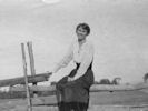
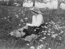
 Irma Shaw, 1904 Irma Shaw, 1904
 Irma Shaw, 1904 Irma Shaw, 1904
 Irma Shaw, 1904 Irma Shaw, 1904
|
Irma Shaw Photograph taken in 1904. Possibly in upstate New York, Lowville, NY. | |
|
|
1906 | |
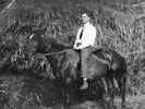
 Robert Shaw Robert Shaw
|
Robert Shaw Born about 1884 Brother of Irma Photograph taken 1906. | |
|
|
1907 | |
|
SCHWEICH LECTURE ON BIBLICAL ARCHAEOLOGY The Leopold Schweich Trust Fund was set up in 1907, a gift from Constance Schweich in memory of her father. It provided for public lectures to be delivered on subjects related to ‘the archaeology, art, history, languages and literature of Ancient Civilization with reference to Biblical Study’. A special lecture has been commissioned this year to mark the centenary of the Schweich lectures. | ||
|
Other articles:
|
February 14, 1907: Marriage of Miss Irma Hemenway Shaw and Robert P. Schweich. | |
|
Literature Cited:
Locations: Golden. |
April 20, 1907. A man was buried alive in a ditch being dug for a retaining wall on the landslide below the smelter (VanHorn, 1972). | |
|
Literature Cited:
Other articles:
Locations: North Table Mountain. Tramway Quarry. |
May 4, 1907. Cracks opened in the ground below the Tramway Quarry [SE 1/4 sec. 22, T. 3 S., R. 70 W.] on the south side of North Table Mountain and the ground seemed to be moving. A huge mass of rock ploughed down the mountain below the quarry (VanHorn, 1972). | |
|
Literature Cited:
Locations: Golden. |
June 15, 1907. Ground near 14th and Ford Streets in Golden caved into Kinney Run [Kenneys Creek] (VanHorn, 1972). | |
|
Literature Cited:
Locations: Clear Creek. |
July 13, 1907. A flood on Clear Creek was caused by a cloudburst near Black Hawk. Water was as much as 5 feet deep on 11th Street and was running 2 feet over the top of the Ford Street bridge. The Washington Street bridge was moved off its abutments. There was much damage to the railroad west of Golden and flood debris was found 20 "feet above the bed of Clear Creek. Damage amounted to about $50,000 [reported in the Oct. 20, 1907, issue] (VanHorn, 1972). | |
|
Literature Cited:
Other articles:
Locations: North Table Mountain. Tramway Quarry. |
September 16, 1907. A 12- by 12- by 12-foot boulder fell from the Tramway Quarry [SE 1/4 sec. 22, T. 3 S., R. 70 W.] on the south side of North Table Mountain and lodged in the Church Ditch just above a house (VanHorn, 1972). | |
|
Literature Cited:
Locations: Clear Creek. |
July 10, 1909. A cloudburst west of Golden caused Clear Creek to rise 5 feet in 20 minutes. Lawns and irrigation ditches were covered with sand and boulders (VanHorn, 1972). | |
|
Literature Cited:
Locations: Tucker Gulch (lower). |
July 31, 1909. A flood on Tucker Gulch washed out all bridges between Golden Gate Canyon and Clear Creek except the Colorado and Southern Railroad bridge which was completely covered with water. Flood waters reached to Washington Avenue (VanHorn,1972). | |
|
Literature Cited:
Locations: North Table Mountain. |
April 4, 1914. A man was seriously injured at the rock quarry on North Table Mountain when pieces of basalt [latite] fell from the cliff without warning (VanHorn, 1972). | |
|
Literature Cited:
Locations: South Table Mountain. |
July 18, 1914. On Saturday morning the biggest slide ever reported here took place just east of the Frank Owen's Ranch on South Table Mountain. Large crevices opened just below the Welch [Golden Canal] Ditch. A great mass of earth several hundred feet across moved several feet down the mountain. Some ground moved as a unit but some was badly cracked. The Agricultural Ditch was destroyed and the level ground at the base of the mountain was lifted into a ridge 15 feet high (VanHorn, 1972). | |
|
[Previous Page]
[Next Page]
Go to page: [1800s] [1900s] [1910s] [1920s] [1930s] [1940s] [1950s] [1960s] [1970s] [1980s] [1990] [1991] [1992] [1993] [1994] [1995] [1996] [1997] [1998] [1999] [2000] [2001] [2002] [2003] [2004] [2005] [2006] [2007] [2008] [2009] [2010] [2011] [2012] [2013] [2014] [2015] [2016] [2017] [2018] [2019] [2020] [2021] [2022] [2023] [2024] [2025] [A] | ||
| If you have a question or a comment you may write to me at: tomas@schweich.com I sometimes post interesting questions in my FAQ, but I never disclose your full name or address. |
Date and time this article was prepared: 5/12/2025 2:50:06 PM |
|