
|
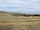
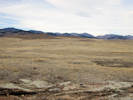
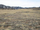
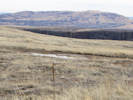
Trail on top of North Table Mountain.
|
|
Other articles:
• Mesa Top Trail:
at jct;
|
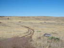
Junction: Mesa Top Trail
This first segment of the Tilting Mesa Trail, down to the “Tilting Mesa Cut-Off” has become a segment in the Mesa Top Trail.
|
|
Other articles:
• Golden Checklist Flora:
Heliotropium curassavicum;
Puccinellia distans;
• Field Notes:
8 Nov 2015;
Coll. No. 1959, 21 Jun 2018;
Coll. No. 1959.1, 21 Jun 2018;
Coll. No. 1959.2, 21 Jun 2018;
Coll. No. 1959.3, 21 Jun 2018;
16 Mar 2020;
Locations:
Vaca Lake.
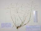
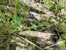 Coll. No. 1959, Heliotropium curassavicum Coll. No. 1959, Heliotropium curassavicum
|
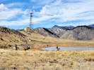
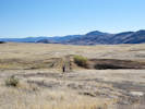
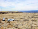
Horsepeople riding in the closed area at Vaca Lake. |
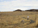
Location of Coll. No. 1959, Heliotropium curassavicum |
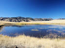
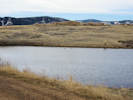
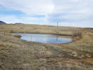
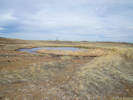
Pond on top of North Table Mountain |
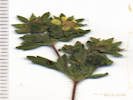
Coll. No. 1959.2, Puccinellia distans |
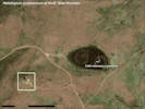
Location of Coll. No. 1959, Heliotropium curassavicum |
Coll. No. 1959, Heliotropium curassavicum |
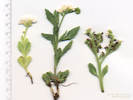
Coll. No. 1959.3, Potentilla rivalis |
Pond at summit.
|
|
Other articles:
• Field Notes:
8 Nov 2015;
 Tilting Mesa Trail diverges to the northeast and Mesa Top Trail Tilting Mesa Trail diverges to the northeast and Mesa Top Trail
|
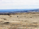
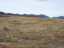
View northeast to Mesa Top Trail.
|
|
Other articles:
• “Tilting Mesa Cut-Off”:
at Tilting Mesa Trl;
|
Trail runs southwest-northeast above. From here up, this segment of the Tilting Mesa Trail has become part of the Mesa Top Trail.
Junction: Tilting Mesa Cut-Off, formerly this was just a spur trail northwest to Mesa Top Trail that passes between radio tower and pond. With the closure of the Mesa Top Trail along the north side of the pond, this “cut-off” has become a part of the Mesa Top Trail.
|
|
Other articles:
• Golden Checklist Flora:
Pinus ponderosa;
• Field Notes:
Wednesday, 13 Jul 2016;
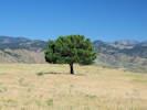 Ponderosa pine on top of North Table Mountain. Ponderosa pine on top of North Table Mountain.
|
Ponderosa Pine to the west.
|
|
|
About 150 m east is the GNIS location of Ladwig Properties Mine. I believe this is a mistake, and the actual Ladwig Properties Mine is about 3 miles to the west.
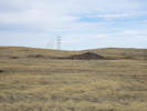
Spur trail northwest to Mesa Top Trail, passes between radio tower and pond.
|
|
Other articles:
• Field Notes:
Thursday, March 3rd;
 Debris pile of prospect. Debris pile of prospect.
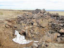 Pit and debris pile at prospect. Pit and debris pile at prospect.
|
Prospect near Tilting Mesa Trail. |
Pile of rocks about 300 m east of trail. Some sort of prospect.
|
|
Other articles:
• Field Notes:
8 Nov 2015;
 Tilting Mesa Trail crosses dam of artificial pond Tilting Mesa Trail crosses dam of artificial pond
|
Closed trail east past prospect to Cottonwood Canyon.
|
|
Other articles:
• Field Notes:
Thursday, March 3rd;
Coll. No. 1958, 21 Jun 2018;
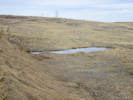
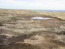
 Ephemeral pond beside trail. Ephemeral pond beside trail.
|
Ephemeral artificial pond, spoils piles in distance. Myosurus minimus and Plagiobothrys scouleri var. hispidulus have been found here.
|
|
Other articles:
• Field Notes:
Thursday, March 3rd;
 Pond below dam, evidence of leakage. Pond below dam, evidence of leakage.
|
Ephemeral artificial pond.
|
|
Other articles:
• Field Notes:
Thursday, March 3rd;
 Ephemeral pond near Tilting Mesa Trail. Ephemeral pond near Tilting Mesa Trail.
|
|
|
|
Trail runs north-south above
Trail runs east-west below
|
|
Other articles:
• Field Notes:
Thursday, March 3rd;
16 Mar 2020;
 Open Space trail crew trying to repair damage by Xcel trucks. Open Space trail crew trying to repair damage by Xcel trucks.
 Open Space trail crew trying to repair damage by Xcel trucks. Open Space trail crew trying to repair damage by Xcel trucks.
|
Artificial ephemeral pond; dam in right middleground. |
Ephemeral pool from south; artificial dam highlighted. |
About 700 meters south is a shallow saddle which has been slightly enhanced on the west side to make an ephemeral pond.
|
|
Other articles:
• Field Notes:
8 Nov 2015;
Thursday, March 3rd;
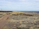
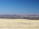 Denver from Tilting Mesa Trail Denver from Tilting Mesa Trail
 Junipers where Cottonwood Canyon Trail reaches top of the mesa. Junipers where Cottonwood Canyon Trail reaches top of the mesa.
|
Small artificial ephemeral pool along south edge of scrapped area. |
Scrapped area, south side, looking west. |
Spoils piles, scrapped area in foreground. |
Northern part of scrapped area; spoils pile in left middleground. |
Spoils piles in scrapped area. |
Small ephemeral pond in disturbed area. |
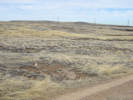
Piles of dirt, appear to be spoils from prospecting activity. Less obvious on the ground but clearly visible on aerial imagery is that this is a roughly L-shaped area (about 400 m × 450 m) in which the top soil has been scraped into piles, presumably to expose the underlying bed rock.
|
|
|
Closed trail runs north to radio tower.
|
|
Other articles:
• Field Notes:
Thursday, March 3rd;
 Pond beside Tilting Mesa Trail. Pond beside Tilting Mesa Trail.
|
Artificial pond north of trail; appears to have perennial water because of cattails.
|
|
Other articles:
• Lichen Peak Trail:
at Tilting Mesa Trl;
• Field Notes:
Thursday, March 3rd;
 Lichen Peak Trail Lichen Peak Trail
|
Junction: Lichen Peak Trail, to the north.
|
|
Other articles:
• North Table Loop:
North Table Mountain;
|
Junction: North Table Loop
|
|
If you have a question or a comment you may write to me at:
tomas@schweich.com
I sometimes post interesting questions in my FAQ, but I never disclose your full name or address.
|
[Home Page] [Site Map]
Date and time this article was prepared:
5/12/2025 2:48:47 PM
|
 Eastern Mojave Vegetation