 Eastern Mojave Vegetation
 Eastern Mojave Vegetation
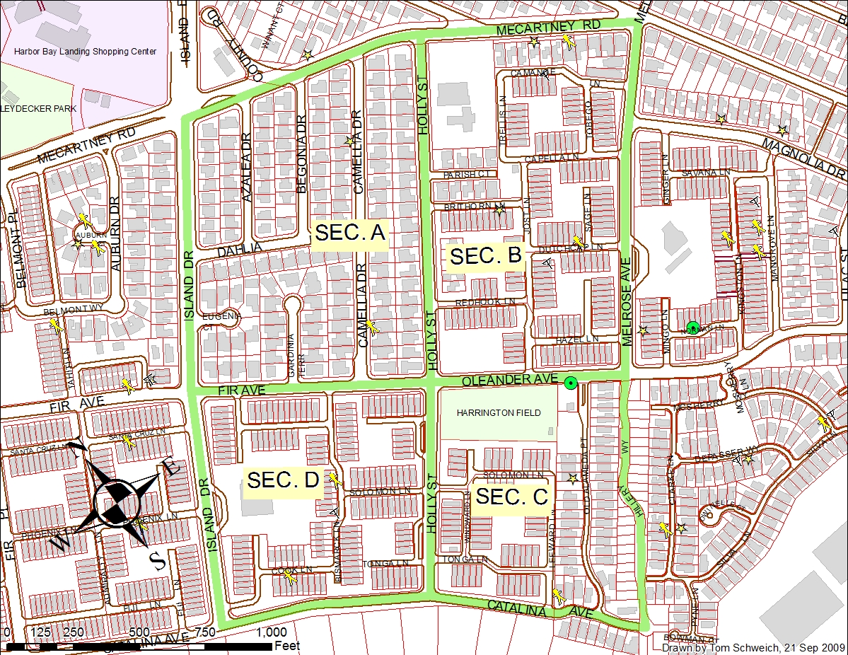
| Map for Alameda CERT Exercise |
|
|

If you have a question or a comment about this photograph you may write to me at: tomas@schweich.com I sometimes post interesting questions in my FAQ, but I never disclose your full name or address. |

This map was requested by the team planning an Alameda CERT exercise on October 3, 2009. The exercise simulates a neighborhood size-up following an earthquake. A Command Post will be set up and teams will be deployed as they would be to size-up a neighborhood using FRS radios for communications. The scale of this drill covers a large area on Bay Farm and we need as many CERT volunteers as possible to assess the damage. At the same time, we will be distributing important Preparedness Information to the neighborhood.
Article records that use this photograph:
Other photos about Alameda or Maps.
|
|
Date and time this page was prepared: 4/21/2025 8:32:25 PM |