If you have a question or a comment about this photograph you may write to me at:
tomas@schweich.com
I sometimes post interesting questions in my FAQ, but I never disclose your full name or address.
|

Photographed October 8, 2017.
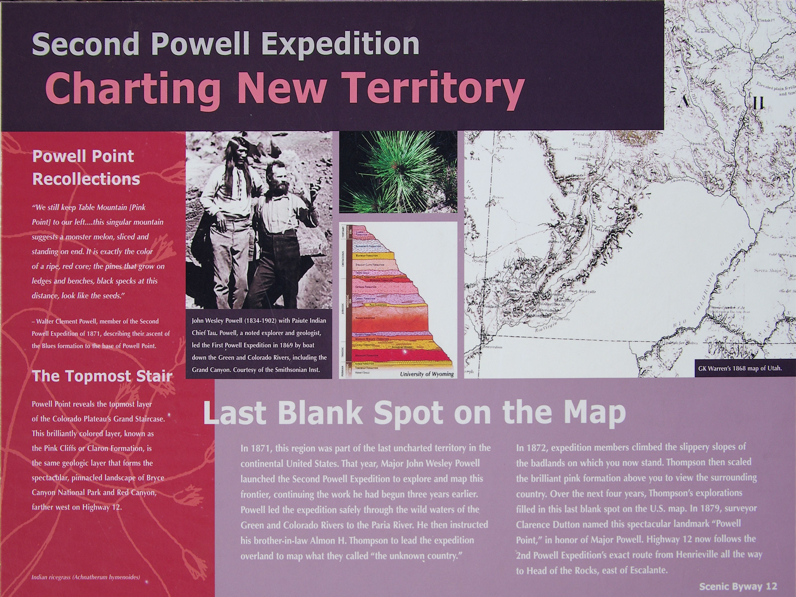
Second Powell Expedition: Charting New Territory
Powell Point Recollections
“We still keep Table Mountain (Pink Point) to our left ...
this singular mountain suggests a monster melon, sliced and standing on end.
It is exactly the color of a ripe, red core;
the pines that grow on ledges and benches, black specks at this distance,
look like weeds.”
– Walter Clement Powell, member of the Second Powell Expedition of 1871,
describing their ascent of the Blues Formation to the base of Powell Point.
The Topmost Stair
Powell Point reveals the topmost layer of the Colorado Plateau's
Grand Staircase.
This brilliantly colored layer, known as the Pink Cliffs or Claron Formation,
is the same geologic layer that forms the spectacular,
pinnacled landscape of Bryce Canyon National Park and Red Canyon,
farther west on Highway 12.
Last Blank Spot on the Map
In 1871, this region was part of the last uncharted territory in the
continental United States.
That year, Major John Wesley Powell launched the Second Powell Expedition
to explore and map this frontier,
continuing the work he had begun three years earlier.
Powell led the expedition safely through the wild waters of the
Green and Colorado Rivers to the Paria River.
He then instructed his brother-in-law Almon H. Thompson
to lead the expedition overland to map what they called
“the unknown country.”
In 1872, expedition members climbed the slippery slopes of
the badlands on which you now stand.
Thompson then scaled the brilliant pink formation
above you to view the surrounding country.
Over the next four years, Thompson's explorations
filled in this last blank spot on the U. S. map.
In 1879, surveyor Clarence Dutton named this spectacular landmark
“Powell Point,” in honor of Major Powell.
Highway 12 now follows the 2nd Powell Expedition's exact route
from Henrieville all the way to Head of the Rocks, east of Escalante.
|
Location records that use this photograph:
Article records that use this photograph:
Other photos about Geography - Utah or Garfield County.
|
|
[Home Page]
Date and time this page was prepared:
3/23/2025 6:13:43 PM
|
|
 Eastern Mojave Vegetation
 Eastern Mojave Vegetation

