Eastern Mojave Vegetation
Tom Schweich
|
Eastern Mojave Vegetation
| Basin Road - Mojave Desert |
|
Tom Schweich |

|
(No Preface) | |
|
Other articles:
|
| |
|
Literature Cited:
Other articles:
|
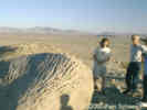
Ventifact Hill
The easily accessible vertifacts at "Ventifact Hill," east of Afton Canyon, are just a few of the many spectacular examples of sandblasted rocks that are to be found in the east-central Mojave Desert. They have formed in a corridor of wind transport which moved sand from the Mojave River eastward through the Devil's Playground, and ultimately towards the Kelso Dunes. Most of the ventifacts in this region are fossil or relict in nature, attesting to a time of greater sediment availability and possibly higher velocity winds. Today, areas of active ventifact formation are limited to a few hill crests where dune sand is being reworked by bidirectional winds (From the Author's Introduction, Laity, 2000). | |
 Chilopsis linearis "Desert Willow" Chilopsis linearis "Desert Willow"
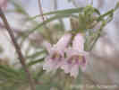 Chilopsis linearis "Desert Willow" Chilopsis linearis "Desert Willow"
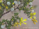 Larrea tridentata "Creosote Bush" Larrea tridentata "Creosote Bush"
|
| |
|
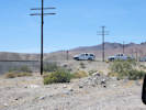
Junction: Iron Mine Road
The road to the right goes to an operating iron mine. There is a locked gate in the valley between the mountains ahead. However, before you get to the gate is a small dug pond that held water in April 2000. | ||
|
Literature Cited:
Other articles:
|
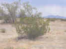
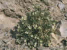
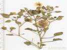
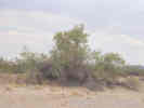
The metamorphosed Paleozoic limestone has been mined since the Pacific Marble Quarries Company opened operations in 1925. The iron deposits on the opposite side of the ridge have been mined since the 1930's (Reynolds & Reynolds, 2000) Growing in the rocks and limestone cliffs, I found several "Rock Nettles" (Eucnide urens). My collection Number 213 was taken from this plant. | |
|
Other articles:
Locations:
Basin.
|
Cross Union Pacific Railroad tracks. | |
|
Other articles:
|
Junction:
| |
| If you have a question or a comment you may write to me at: tas4@schweich.com I sometimes post interesting questions in my FAQ, but I never disclose your full name or address. |
Date and time this article was prepared: 5/10/2024 10:57:28 AM |