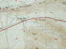
Exit 99: MT Highway 91, Moose Creek Road
|
Other articles:
• Montana Highway 91:
north of Glen;
|
Exit 85: MT Highway 91, Brownes Bridge Road., north of Glen and Burma Road.
|
|
Other articles:
• Interstate 15 - Business:
at US I-15 Exit 63;
|
Exit 63: US Interstate 15 Busines, North, to Dillon, north.
|
|
Locations:
Dillon.
|
Dillon
|
|
Other articles:
• Interstate 15 - Business:
at US I-15 Exit 62;
|
Exit 62: US Interstate 15 Business, South, to Dillon, south.
|
|
|
Exit 0: South Valley Road, to Monida.
|
|
|
Montana above
Idaho below
|
|
|
Junction: US Highway 20, east to Yellowstone.
|
|
|
Exit 190:
, to somewhere.
|
|
|
Idaho
|
|
|
Exit 119: US Highway 20, east.
|
|
|
Idaho Falls
|
|
Other articles:
• U. S. Highway 20:
Idaho Falls;
|
Exit 118: US Highway 20, Broadway, west, or into downtown.
|
|
Other articles:
• US Hwy 26:
at I-15 N;
|
Exit 116: I-15 Bus., US Highway 26, W. Sunnyside Road, business route through downtown Idaho Falls.
|
|
Other articles:
• US Hwy 26:
at I-15 S;
|
Blackfoot
Exit 93: US Highway 26, northwest.
|
|
|
Chubbuck
|
|
Other articles:
• Interstate 86:
at Exit 63;
|
Exit 72: US Interstate 86, west to Boise, Idaho, and Portland, Oregon.
|
|
|
Exit 71: Pocatello Creek Road
|
|
Other articles:
• Field Notes:
3 Oct 2022;
3 Oct 2022;
Locations:
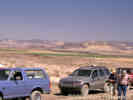
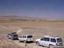
Pocatello.
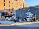 Brick 243 Gastropub and Thrive Artisanal Bowls and Wraps. Brick 243 Gastropub and Thrive Artisanal Bowls and Wraps.
|
Pocatello
Exit 69: Center Street, to downtown Pocatello.
|
|
Other articles:
• US Hwy 30:
29600;
|
Exit 47: US Highway 30, east and south to US I-80 at its Exit 66, just west of Little America.
|
|
Other articles:
• U. S. Highway 91:
at US I-15;
|
Exit 36: US Highway 91, south past Zenda to Logan, then west back to US I-15.
|
|
|
Idaho above
Utah below
|
|
|
Utah
|
|
Other articles:
• US I-84:
at I-15;
|
Tremonton
Junction: US Interstate 84, at its Exit 41
|
|
Other articles:
• U. S. Highway 91:
Brigham City;
|
Brigham City
Junction: US Highway 91, east to Logan, then north back to US I-15.
A reason to take US Highway 91 as an alternate to Interstate 15 would be to see the spillway of Pleistocene Lake Bonneville into the Snake River drainage.
The bedrock threshold that established the Provo shoreline is at Red Rock Pass, while an earlier failed alluvial dam is placed at Zenda.
|
|
Other articles:
• Field Notes:
24 Sep 2022;
Locations:
Layton.
|
Layton
|
|
Other articles:
• W. Antelope Drive:
at US I15;
|
Junction:
- W. Antelope Drive, the road to Antelope Island. Also known variously as W 1700 S, Antelope Island Road, W Antelope Island Causeway, and East Side Road, all the way to Fielding Garr Ranch.
- Utah State Route 127, part way to the causeway, to intersection with S 4500W, Utah SR 110.
|
|
Locations:
Salt Lake City.
|
Salt Lake City
|
|
Other articles:
• Interstate 80:
at US I-15 North;
|
Junction: U. S. Interstate 80, West, across Nevada to San Francisco.
|
|
Other articles:
• Interstate 80:
at US I-15 South;
|
Junction: U. S. Interstate 80, east to Wyoming
|
|
Locations:
Salt Lake Valley.
|
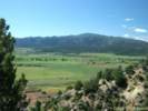
American Fork
The approximate south end of Salt Lake Valley
|
|
Other articles:
• U. S. Highway 6:
at I-15 N;
|
Junction: US Highway 6, east to Colorado.
|
|
Locations:
Spanish Fork.
|
Spanish Fork
|
|
Other articles:
• U. S. Highway 6:
at I-15 S;
|
Junction: US Highway 6, west.
|
|
Locations:
Santaquin.
|
Santaquin
|
|
Locations:
Scipio.
|
Scipio
|
|
Other articles:
• U. S. Highway 50:
at US Hwy 50 North;
|
Junction: U. S. Highway 50, east through Salina to US Interstate 70.
|
|
Locations:
Holden.
|
Holden
|
|
Other articles:
• U. S. Highway 50:
at US Hwy 50 South;
|
Junction: U. S. Highway 50, west across Utah and Nevada to Sacramento, California.
|
|
Other articles:
• Interstate 70:
at US I-15;
|
Junction: U. S. Interstate 70, east across Utah and Colorado.
|
|
|
Junction: Utah Highway 160, north side of Beaver, use this exit for Utah Highway 21 when coming from the north.
|
|
Other articles:
• Utah Highway 21:
Beaver;
|
Beaver
No Exit: UT Highway 21, west through Minersville and Milford to the Nevada border near Great Basin National Park and US Highway 50.
|
|
|
Junction: Utah Highway 160, south side of Beaver, use this exit for Utah Highway 21 when coming from the south.
|
|
|
Beaver River basin to the north ...
Beaver Ridge
Parowan Valley to the south.
|
|
|
Beaver County above
Iron County below
|
|
Locations:
Parowan Valley.
|
Parowan Valley
|
|
|
Junction: Utah Highway 271, access road to Paragonah.
|
|
Locations:
Paragonah.
Red Creek.
|
Paragonah
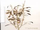
Red Creek exits through the Hurricane Cliffs into Paragonah. On Red Creek, S. L. Welsh made a collection of Frasera albomarginata.
|
|
|
Parowan
|
|
Other articles:
• Utah Highway 130:
at I-15;
|
Junction: Utah Highway 130, north to Minersville.
|
|
Locations:
Cedar City.
|
Cedar City
|
|
Other articles:
• Utah Highway 56:
at US I-15;
|
Junction: Utah Highway 56, West to Nevada.
|
|
Other articles:
• Utah Highway 14:
Cedar City;
|
Junction: Utah Highway 14, East.
|
|
Other articles:
• Field Notes:
May 31st, Kolob Cyns.;
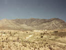
 Fort Harmony and the Harmony Mountains across US I-15. Fort Harmony and the Harmony Mountains across US I-15.
|
View of Fort Harmony, and the Harmony Mountains across US Interstate 15.
|
|
Other articles:
• Field Notes:
May 31st, Kolob Cyns.;
Locations:
Kolob Canyons, Zion National Park.
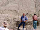
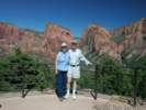 Cheryl and Tom at the Kolob Canyons Overlook. Cheryl and Tom at the Kolob Canyons Overlook.
|
Overlook in Kolob Canyons, Zion National Park.
|
|
Other articles:
• Field Notes:
May 31st, Kolob Cyns.;
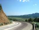 Looking southwest along US I-15 near Kolob Canyons. Looking southwest along US I-15 near Kolob Canyons.
|
View southwest toward Saint George along US Interstate 15.
|
|
Locations:
Browse Area Guard Station.
|
Exit 30: Forest Service Road, possibly F. R. 037, up South Fork Ash Creek and Mill Creek to the Browse Area Guard Station, collection locality of Frasera speciosa
|
|
Other articles:
• Blackbrush:
406500;
• Utah Highway 17:
Anderson Junction;
|
Anderson Junction
Exit 27: Utah Highway 17, South to Toquerville, and UT Highway 9 to Zion National Park,
or to UT Highway 59, AZ Highway 389, to Kanab, Utah, Page, Arizona, and points east.
|
|
Literature Cited:
- Post, Douglas M., 1956.
Other articles:
• Frasera albomarginata:
near Italian Spring;
Locations:
Italian Spring.
|
Cross Grapevine Wash. Grapevine Wash drains Italian Wash, which drains Italian Spring. There is a collection of Frasera albomarginata from Italian Spring.
|
|
Other articles:
• Oak Grove Road:
at US I-15;
|
Exit 23: Silver Reef Road, to Oak Grove Road and the Oak Grove Campground.
|
|
Other articles:
• Frasera albomarginata:
near Silver Reef;
near Leeda;
Locations:
Leeds.
Silver Reef.
|
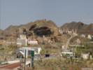
Leeds
Site of Silver Reef to the north.
|
|
Other articles:
• Utah Highway 9:
at US I-15;
|
Exit 16: Utah Highway 9,
- East: to Hurricane and Zion National Park.
- Also to Fredonia, AZ, and Kanab, UT, by way of Utah Highway 59 and Arizona Highway 389.
|
|
|
Exit 8: Saint George Blvd., UT Highway 34
|
|
Other articles:
• U. S. Highway 91:
at St. George;
Locations:
Saint George.
|
Saint George
|
|
Other articles:
• Utah Highway 18:
at US I-15;
• Riverside Drive:
10000;
|
Exit 6:- Bluff Street, UT Hwy18, west side of St. George.
- Riverside Drive, to southeastern Saint George.
|
|
|
Exit 2: Southern Parkway, Sun River Parkway.
This is the approximate location of the crossing of the Old Spanish Trail from east to west. To the west the trail skirted the south side of Bloomington Hill and ascended Curly Hollow Wash. From the east the trail descended Fort Pearce Wash.
|
|
|
Utah above.
Arizona below.
|
|
Other articles:
• Field Notes:
30 May 2005;
Locations:
Virgin River.
 Virgin River Gorge Recreation Area, Washington County, Utah Virgin River Gorge Recreation Area, Washington County, Utah
|
Virgin River Gorge Recreation Area. We stopped here for lunch one time and watched some rafters launch their raft, and drift downstream into the gorge.
|
|
Other articles:
• Field Notes:
30 May 2005;
Locations:
Virgin River.
 Virgin River in its gorge, near the upper end. Virgin River in its gorge, near the upper end.
|
I have driven through the Virgin River Gorge on US I-15 twice in the northeasterly direction, and neither time have I seen a good place to stop for a photograph.
|
|
Literature Cited:
- Douglass, John, Norman Meek, Ronald I. Dorn and Mark W. Schmeeckle, 2009.
Locations:
The Narrows.
Virgin River Gorge.
|
The Narrows of the Virgin River Gorge.
As an application of their criteria-based methodology for determining the mechanism of transverse drainage
development, Douglass, et al. (2009) determined antecedence as
the mechanism for transverse drainage through Virgin River Gorge.
|
|
Other articles:
• Black Rock Mountain Road:
at US I-15;
|
Exit 27: Black Rock Mountain Road
|
|
Locations:
Beaver Dam Mountains.
Virgin Mountains.
|
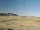
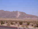
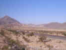
Beaver Dam Mountains to the northwest. Vrigin Mountains to the southeast.
|
|
Other articles:
• U. S. Highway 91:
Littlefield;
Locations:
Littlefield.
|
Littlefield
|
|
Literature Cited:
- Comstock, J. P., T. A. Cooper, and J. R. Ehleringer, 1988.
Other articles:
• Summaries of Literature:
Patterns of Canopy Development and Carbon Gain;
|
The road north from Littlefield goes to the Joshua Tree Natural Area in southwestern Utah. I have been unable to find a name for this road. Comstock, Cooper and Ehleringer's (1988) site two for their study of patterns of canopy development and carbon gain is 16 km north of Littlefield within the Joshua Tree Natural Area.
|
|
Other articles:
• Field Notes:
1 Oct 2022;
|
Arizona above
Nevada below
|
|
|
Nevada
|
|
Other articles:
• Interstate 15 - Business:
at I-15S;
|
Junction: N. Sandhill Blvd., E. Pioneer Blvd., I-15 Business
|
|
Locations:
Mesquite.
|
Mesquite
|
|
Other articles:
• Interstate 15 - Business:
at I-15S;
|
Junction: W. Mesquite Blvd., Interstate 15 Business
|
|
Locations:
Bunkerville.
|
Bunkerville to the southeast across the Virgin River.
|
|
Literature Cited:
- Kartesz, John Thomas, 1988.
Locations:
Virgin Mountains.
Virgin Peak.
|
Virgin Mountains in Clark County, Nevada, to the southeast across the Virgin River.
|
|
Other articles:
• Nevada State Route 170:
at US I-15;
|
Junction: Nevada State Route 170, to Bunkerville and Gold Butte Road.
|
|
Other articles:
• NV State Route 12:
at US I-15;
|
Junction: Nevada State Route 12
|
|
Other articles:
• Nevada State Route 168:
at US I-15;
|
Glendale
Junction: Nevada State Route 168, for Glendale, to Moapa, and US Highway 93 at Coyote Springs.
|
|
Other articles:
• NV State Route 169:
at US I-15;
|
Junction: Nevada State Route 169
|
|
Other articles:
• U. S. Highway 93:
at US I-15;
|
Junction: U. S. Highway 93, North.
|
|
|
Las Vegas, North City Limit.
|
|
Other articles:
• U. S. Highway 93:
at US I-15;
• U. S. Highway 95:
Las Vegas;
• U. S. Interstate 515:
11000;
|
Junction:
- U. S. Interstate 515, southeast through Las Vegas to Henderson, Nevada.
- U. S. Highway 93, south to Kingman, Wickenburg and Phoenix.
- U. S. Highway 95, north, to Beatty, Tonopah, Fallon, etc., south to Searchlight.
|
|
Other articles:
• Nevada State Route 159:
at US I-15;
|
Junction: Nevada State Route 159 "W. Charleston Blvd."
|
|
Locations:
Las Vegas.
|
Las Vegas
|
|
|
Las Vegas, South City Limit.
|
|
Other articles:
• NV Highway 160:
60000;
|
Junction: Nevada Highway 160, the Blue Diamond Highway, which goes to Blue Diamond, and Pahrump.
|
|
Locations:
Potosi Mountain.
|
The high mountain to the west of U. S. Interstate 15 is Potosi Mountain, considered to be a southern extension of the Spring Mountains.
|
|
Other articles:
• NV Hwy 161:
Jean;
Locations:
Goodsprings.
Jean.
Sheep Mountain.
|
Jean
Junction: NV Hwy 161, to Goodsprings and Sandy ValleySheep Mountain, type locality of the Goodsprings Dolomite, is across the valley to the southeast.
|
|
Literature Cited:
- Guest, Bernard, Nathan Niemi, and Brian Wernicke, 2007.
Other articles:
• Glossary:
hypabyssal;
Locations:
Devil Peak.
|
Devil Peak at the south end of the Mesquite Valley |
Devil Peak to the northwest.Devil Peak is a small (~2.5 km diameter) hypabyssal rhyolite dome that intruded into Paleozoic carbonate strata of the southern Spring Mountains (Guest, et al., 2007). It is also the probable source for megabreccia sheets, pyroclastic deposits, and obsidian rock avalanche deposits that make up the crest of Black Butte. These deposits are evidence for about 30 km of dextral slip along the Stateline Fault System.
|
|
Locations:
Primm.
 Primm, Nevada, as seen from the northeast slopes of Clark Mountain. Primm, Nevada, as seen from the northeast slopes of Clark Mountain.
|
Primm
|
|
Other articles:
• Keany Pass Road:
at Primm;
|
Junction: Primm Road to Keany Pass Road.
|
|
|
Nevada above
California below
|
|
|
California
|
|
Other articles:
• Nipton Road:
at US I-15;
• Field Notes:
Thursday, 22 January;
Locations:
Lakeview.
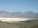
 Ivanpah Lake and Primm Ivanpah Lake and Primm
|
The Ivanpah Bird Fryer in operation. |
Primm at Stateline. |
Junction: Nipton Road.This is the former location of Lakeview, California. Annie Alexander and Louise Kellogg collected here on May 17, 1940. I found the location indicated on a 1939 edition of a AAA highway map.
|
|
Other articles:
• Zinc Mine Road:
at Mountain Pass;
• Field Notes:
MDQRC, May 1991;
Locations:
Mountain Pass.
 Mountain Pass Mine in 1991. Mountain Pass Mine in 1991.
|
Mountain Pass
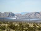
View of the Unocal processing plant at the Mountain Pass Rare Earth Mine |
The largest known rare earth deposits in the world exist near Mountain Pass Summit. Today, the Molybdenum Corporation of America is processing the highly concentrated rare earth ore, the only remaining productive mining activity in the area.
Prior to 1924, an unpaved road known as Arrowhead Trail, which was oil-treated shortly thereafter, generally followed meandering "dry" streambeds through Mountain Pass and Wheaton Canyon. Between 1933 and 1937, a greatly improved two-lane highway was constructed, which served as U.S. Highway 91 and 466 until 1963.
|
|
Locations:
Clark Mountain Station.
 Location of Clark Mountain Station. Location of Clark Mountain Station.
|
Clark Mountain Station
Annie Alexander and Louise Kellogg stayed at Clark Mountain Station May 12-16, 1939.
|
|
Other articles:
• Kessler Springs Road:
at Valley Wells;
• Kingston Road:
Valley Wells;
Locations:
Valley Wells.
|
Valley Wells
No gasoline (May 2000, September 2000). Gasoline (May 2003)
Junction:
- Kingston Road, north, leads to Excelsior Mine Road and the Kingston Range. This is a good road that ultimately leads to Tecopa Hot Springs on California Highway 127.
- Kessler Springs Road, south, is one gateway road into the Mojave National Preserve.
|
|
Locations:
Clark Mountain.
Halloran Summit.
Yucca Grove.
 Clark Mountain, California, from Halloran Summit. Clark Mountain, California, from Halloran Summit.
|
Halloran Summit
Gasoline and some services available (September 2000). I believe this is the former location of Yucca Grove. It was on the north side of then US Highways 91 and 466, and included an Auto Camp, in addition to gasoline and other services.
|
|
Other articles:
• Halloran Springs Road:
at US I-15;
at Halloran Springs;
Locations:
Halloran Springs.
|
Halloran Springs
No services (September 2000)
Junction: Halloran Springs Road, west to Silver Lake on California Highway 127.
|
|
Other articles:
• California Highway 127:
at Baker;
• Kelbaker Road:
in Baker;
• Tonopah & Tidewater:
Baker;
Locations:
Baker.
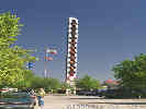 The World's Tallest Thermometer in Baker, CA. The World's Tallest Thermometer in Baker, CA.
|
Baker
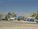
The Mad Greek Restaurant in Baker, California. |
Road Junctions at Baker:
- Kelbaker Road, south is one gateway road into Mojave National Preserve, leading through the Cima Volcanoc Field to Kelso, and then to U. S. Interstate 40.
- California Highway 127, the southern gateway to Death Valley, north to Shoshone and Death Valley Junction.
|
|
|
|
|
|
|
|
|
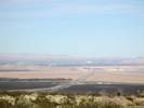
View of Little Cow Hole Mountain. The photo is taken from Zzyzx Road, but a similar view can be had from US I-15.
|
|
Other articles:
• Zzyzx Road:
at US I-15;
• FAQ:
Zzyzx;
Locations:
Zzyzx.
 The Zzyzx Road exit from Interstate 15 The Zzyzx Road exit from Interstate 15
|
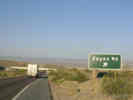
Junction: Zzyzx Road
|
|
|
Soda Springs Desert Studies Center
|
|
Literature Cited:
- Schoenherr, Allan A, 1992.
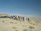
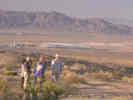
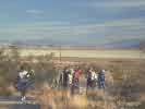 Class at Desert Studies Center. Class at Desert Studies Center.
|
I've been privileged to stay here for several classes and field trips. In this photograph, Allan Schoenherr, author of A Natural History of California, leads an early morning field trip to examine traps set along a transect the previous night. For information about the center see, http://biology.fullerton.edu:80/facilities/zzyzx.html
|
|
Locations:
Soda Mountains.
 Soda Mountains from the shores of Soda Lake. Soda Mountains from the shores of Soda Lake.
|
Soda Mountains to the north.
|
|
Other articles:
• Arrowhead Trail:
at Rasor Rd;
|
Junction: Rasor Road
|
|
Literature Cited:
- Laity, June, 2000.
Other articles:
• Field Notes:
200004290020;
 Ventifact on top of Ventifact Hill Ventifact on top of Ventifact Hill
|
Ventifact Hill
U. S. Interstate 15 looking east toward Baker and Las Vegas from Ventifact Hill |
The easily accessible vertifacts at "Ventifact Hill," east of Afton Canyon, are just a few of the many spectacular examples of sandblasted rocks that are to be found in the east-central Mojave Desert. They have formed in a corridor of wind transport which moved sand from the Mojave River eastward through the Devil's Playground, and ultimately towards the Kelso Dunes. Most of the ventifacts in this region are fossil or relict in nature, attesting to a time of greater sediment availability and possibly higher velocity winds. Today, areas of active ventifact formation are limited to a few hill crests where dune sand is being reworked by bidirectional winds (From the Author's Introduction, Laity, 2000).
|
|
Literature Cited:
- Evans, James R., 1962.
Other articles:
• Eastern Mojave Geology:
the Cronese Cat;
 The Cronese "Cat" The Cronese "Cat"
|
The Cronese "Cat," a falling sand dune on the west side of the Cronese Basin, as seen from US Interstate 15. Evans (1962) studied these sand dunes, and his work is summarized in my article on eastern Mojave geology.
|
|
Other articles:
• Basin Road:
at I15;
Locations:
Cronese Basin.
|
Junction: Basin Road.
|
|
Other articles:
• Field Notes:
Coll. No. 216, 26 Apr 2000;
 Coll. No. 216, Parkinsonia aculeata Coll. No. 216, Parkinsonia aculeata
|
Along the washes at Basin Road are some Palo Verde trees.
|
 Cronese Basin with Cave Mountain. Cronese Basin with Cave Mountain.
|
The Cronese Basin with Cave Mountain on the south (left) side. The Basin Road overpass over U. S. Interstate 15 can be seen at the extreme left.
|
|
|
Cave Mountain, south of the highway.
|
|
Literature Cited:
- Meek, Norman, 2000.
Other articles:
• Afton Road:
at US I-15;
• Field Notes:
200004290020;
20050419080;
Locations:
Afton Canyon.
|
Field trip stop on the shore of Lake Manix |
Junction: Afton RoadThe history of lakes in the eastern Afton basin is very short compared with most Mojave Desert basins. The basin apparently did not exist prior to the rapid rise of the Cady Mountains in the Middle Pleistocene, as the oldest lacustrine evidence in eastern Afton basin is no older than about 300 ka. Afton area lacustrine sections provide evidence for three major lake events.
The most prominent lake stand occurred during OIS 6 (Illinoian). All of the thick green clays visible in the Afton area are from this lake stand. Some of the clays have gypsum crystals, suggesting that this lake eventually dessicated. The Illinoian lake was followed by a lengthy dry interval probably starting in the Sangamon (OIS 5e).
Next a tufa deposit dated at 80 ka, suggests that an OIS 4 lake reached an elevation of 525 m. Correlable strata are located near Camp Cady.
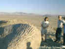
Finally, there are several beach ridges and tufas at elevation of 542.5 m, show in the photograph at left, that have been reliably dated by radiocarbon methods to between 21.5 and 18 ka. This is slightly above the approximate elevation of the topographic divide into Coyote Basin, suggesting the maximum level of Lake Manix was maintained internally by overflows into Coyote Basin.
Sometime about 18 ka., water overtopped the lowest rim of the Manix basin immediately above Afton Canyon and the water spilled out, removing that part of the canyon above the lake floor in a matter of hours. Since that time the Mojave River has continued to cut Afton Canyon, and the landscape is still adjusting to the rapid base level drop (Meek, 2000)
|
 Who is this guy? Why does he keep showing up in my Mojave Desert photos? Who is this guy? Why does he keep showing up in my Mojave Desert photos?
|
Between Field Road and Afton Road, US I-15 passes through lake beds of Pleistocene Lake Manix.
|
|
Other articles:
• Yermo Road:
at Field Rd;
|
Junction: Field Road, access to Field, a station on the Union Pacific, and access to Camp Cady Wildlife Area via Yermo Road.
|
|
Locations:
Manix.
|
Manix Overcrossing, Alvord Mountain Road.
There is no freeway exit here. The nearest exits are Harvard Road to the west and Field Road to the east.
|
|
|
Camp Cady Wildlife Area
|
|
Locations:
Camp Cady.
 Vicinity of Camp Cady on the Mojave River. Vicinity of Camp Cady on the Mojave River.
|
Camp Cady
Former military fort, guarding the Mojave Road, on the Mojave River about 1 1/2 miles south of US I-15.
|
|
Literature Cited:
- Reynolds, Robert E., 2011.
Other articles:
• Field Notes:
23 Apr 2011;
Locations:
Lime Hill.
|
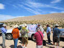
Field discussion of the geology in today's field trip. |
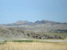
Lime Hill on the north side of the highway. Lime Hill is made up of Miocene Barstow Formation sediments overlain by a thick gravel sequence.
|
|
Literature Cited:
- Laity, June, 2000.
Other articles:
• Field Notes:
20 Apr 2002;
Locations:
Harvard Hill.
|
Agriculture in the Central Mojave. |
There are many ranches in the Lower Mojave Valley that rely on pumping of groundwater for the crops. The combination of soil disturbance and declining water tables has destabilized the landscape resulting in increased sand movement and dust storms that have been blamed for fatal highway accidents (Laity, 2000).
|
|
Other articles:
• Harvard Road:
at US I-15;
|
Junction: Harvard Road, access to Harvard Hill, east to Camp Cady Wildlife Area, and south across Mojave Valley to Newberry Springs.
|
|
Other articles:
• Field Notes:
20 Apr 2002;
Locations:
Harvard Hill.
 Climax vegetation on Harvard Hill. Climax vegetation on Harvard Hill.
|
US I-15 as seen from Harvard Hill. |
Harvard Hill
|
|
Other articles:
• Minneola Road:
at US I-15;
|
Minneola Road
|
 View of Mojave Valley from Dagget Ridge View of Mojave Valley from Dagget Ridge
|
|
|
Other articles:
• Calico Road:
at US I-15;
|
Junction Road: Calico Road.
|
|
Other articles:
• Daggett-Yermo Road:
at US I-15;
|
Junction: Ghost Town Road and Daggett-Yermo Road
|
|
Other articles:
• Ghost Town Road:
at US I-15;
|
Junction: Ghost Town Road
|
|
Other articles:
• Fort Irwin Road:
us US I-15;
|
Junction: Fort Irwin Road
|
|
Other articles:
• Old California Highway 58:
at US I-15;
|
Junction: Old California Highway 58
|
|
Other articles:
• U. S. Highway 66:
at US I-15;
|
Junction: Main Street, and National Trails Highway, old US Highway 66.
|
|
Locations:
Barstow.
|
Barstow
California city, crossroads for early emigrant trails, railroads and highways in the California Desert, on the Mojave River. Once a small mining center and railroad town in California's Mojave Desert, Barstow is located at the junction of 3 major highways -- Interstate 15, Interstate 40 and State Highway 58. It is centrally located in the western Mojave at the entrance to the Mojave National Preserve and is home of the U.S. Army National Training Center, Marine Corps Logistics Base, NASA's Goldstone Deep Space Network and Burlington Northern-Santa Fe Railroad Yards. Population is 21,500 and elevation is 2,106 feet above sea level
|
|
Other articles:
• U. S. Interstate 40:
at Barstow;
|
Junction: U. S. Interstate 40, east across the Colorado River at Needles, across northern Arizona, New Mexico, and parts east to Wilmington, North Carolina.
|
|
Other articles:
• California Highway 247:
at US I-15;
|
Junction:- Barstow Road,
- California Highway 247
|
|
Other articles:
• California Highway 58:
just west of Barstow;
|
Junction: California Highway 58, west through Mojave and Bakersfield to US Highway 101 at Santa Margarita.
|
|
Other articles:
• Lenwood Road:
80000;
|
Junction: Lenwood Road.
|
|
Locations:
Mojave River.
|
Cross Mojave River.
|
|
Other articles:
• U. S. Highway 66:
at US I-15;
Locations:
Victorville.
|
Victorville
Junction: National Trails Highway, old US Highway 66.
|
|
Other articles:
• California Highway 18:
at US I-15 N;
|
Junction: California Highway 18, east to Apple Valley, and Lucerne Valley.
|
|
Other articles:
• California Highway 18:
at US I-15 S;
|
Junction: California Highway 18, west to Palmdale and US I-5 near Gorman
|
|
Locations:
Antelope Valley.
Hesperia.
|
To the southeast the Mojave River debouches from the San Bernardino Mountains into Antelope Valley, before making its way north through Victorville.
|
|
Locations:
Antelope Valley.
Hesperia.
|
Junction: Phelan Road, Hesperia to the east.
|
|
Other articles:
• U. S. Highway 395:
at US I-15;
|
Junction: U. S. Highway 395.
|
|
|
Cajon Pass
|
|
Other articles:
• California Highway 138:
at Cajon Jct;
|
Junction: California Highway 138
|
|
Other articles:
• US I-10:
at I-15;
|
Junction: U. S. Interstate 10, west to Los Angeles, east to San Bernardino.
|
|
Other articles:
• California Highway 78:
at US I-15;
|
Junction: California Highway 78
|
|
Locations:
San Diego.
|
San Diego
|
|
If you have a question or a comment you may write to me at:
tas4@schweich.com
I sometimes post interesting questions in my FAQ, but I never disclose your full name or address.
|
[Home Page] [Site Map]
Date and time this article was prepared:
5/10/2024 11:11:23 AM
|
 U. S. Interstate Highways
