Eastern Mojave Vegetation
Tom Schweich
|
Eastern Mojave Vegetation
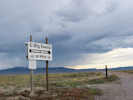
| U. S. Highway 50 |
|
Tom Schweich |

|
(No Preface) | ||||||||||||||||||||||||||||||||||||||||||||||||||||||||||||||||||||||||||||||||||||||||||||||||||||||||||||||||||||||||||||||||||||||||||||||||||||||||||||||||||||||||||||||||||||||||||||||||||||||||||||||||||||||||||||||||||||||||||||||||||||||||||||||||||||||||||||||||||||||||||||||||||||||||||||||||||||||||||||||||||||||||||||||||||||||||||||||||||||||||||||||||||||||||||||||||||||||||||||||||||||||||||||||||||||||||||||||||||||||||||||||
|
Other articles:
|
Junction: U. S. Interstate 80, west to San Francisco, or east through Sacramento, and over the Sierra Nevada.
|
|
| West Sacramento
|
Bridge over the Sacramento | Sacramento City Limits
|
Other articles:
Junction: |
|
Other articles:
| SacramentoJunction: California Highway 99, south to Fresno and Bakersfield, rejoining US Interstate 5 near the Grapevine.
|
Sacramento City Limits |
|
Other articles:
| PlacervilleJunction: California Highway 49, south to Jackson, Angels Camp, Sonora, etc., or north to Auburn and the Yuba River.
|
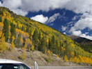
| Echo SummitElevation: 7377 ft (2248 m).
|
Other articles:
|
|
Other articles:
Junction:California Highway 89, south over Luther Pass to Hope Valley, through Markleville, and then over Monitor Pass to US Hwy 395.
|
|
Other articles:
Junction: California Highway 89, north on the west side of Lake Tahoe to Truckee, Lassen National Park, and ultimately to Mount Shasta.
|
|
Locations:
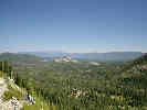
Lake Tahoe.
| South Lake TahoeSouth Lake Tahoe
|
California above
| Nevada below
|
Lake Tahoe State Park -- Cave Rock Unit.
|
|
Literature Cited:
Locations: Cave Rock.
Cave Rock. | Prominent hornblende trachyte plug, eroded by wave action during probable Tahoe-age highstands of Lake Tahoe. Tsumani wave heights of up to 6m could be expected here. An 1879 issue of the San Francisco Examiner reporteda possible tsunami at Glenbrook, and attributed collapse of rocks at Cave Rock to this event (Schweickert, et al., 2000, p. 14).
|
Junction:Nevada Highway 207, east over Daggett Pass and into the Carson Valley.
|
|
Shakespeare Point
|
|
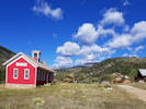
Locations: Glenbrook.
Glenbrook
|
|
Literature Cited:
Captain Pomin Rock to the north and west of US Hwy 50 is a hornblende latite plug that intrudes a hornblende trachyte unit (Schweickert, et al., 2000).
|
|
Other articles:
Spooner Junction, Junction: |
|
| Spooner Summit
|
Junction: U. S. Highway 395, South, From this junction, US Hwy 50 continues west to Lake Tahoe and Sacramento. US Hwy 395 continues south to Bridgeport, Bishop, etc.
|
|
| Carson City
|
Other articles:
Junction: U. S. Highway 395, North , From this junction, US Hwy 50 continues east across central Nevada. US Hwy 395 continues north to Reno.
|
|
| Empire
|
Other articles:
Junction: Nevada Highway 341, Turn off to Virginia City.
|
|
| Dayton
|
| Silver SpringsJunction: Alt U. S. Highway 95.
|
Lyon County, Nevada | Churchill County, Nevada
|
Other articles:
Junction: U. S. Highway Alternate 50, northwest to U. S. Interstate 80 at Fernley, Nevada. Typically, we exit US Hwy 50 here and go to I-80 to cross the Sierra Nevada.
|
|
Other articles:
Locations: Fallon.
| FallonJunction: U. S. Highway 95
|
Grimes Point Archeological Area.
|
|
| Salt WellsSalt Wells Brothel.
|
Literature Cited:
Locations: Rainbow Mountain.
Turnoff to Rainbow Mountain, ~0.4 miles southeast of the Salt Wells Brothel. This would be the location of Caskey, Bell, and Slemmons (2000) field trip Stop 1, Wave-modified Paleoscarp (?) and 6 July 1954 Fault Ruptures, about 2.5 miles north.
|
|
| Eight Mile FlatSalt dry lake.
|
Literature Cited:
Road south-southeast to Huck Salt Mine. Hike 0.3 miles south to Stop 2, Channel Exposure and Holocene Paleoseismicity on the Four Mile Flat Fault, of Caskey, Bell, and Slemmons (2000). | Four Mile Flat of the Salt Wells Basin is to the southeast, whereas Eight Mile Flat is to the northwest.
|
Literature Cited:
Other articles:
Locations: Sand Mountain.
| Sand Mountain
|
| Sand Springs Range
|
| Sand Springs Pass
|
Junction: Nevada Highway 839
|
|
Other articles:
Locations: Frenchman.
| Frenchman
|
Locations: Dixie Valley.
Dixie Valley, to the north.
|
|
| Fairview ValleyMilitary Restricted Area.
|
Fairview Historical Marker
|
|
Junction: Nevada Highway 121, North, into Dixie Valley
|
|
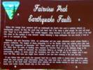
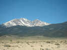
Locations: Fairview Peak.
Fairview Peak
|
|
| Drumm Summit
|
Literature Cited:
Other articles:
Locations: Fairview Peak.
|
The Fairview Peak fault zone is the most readily accessible area of 14 examples of historical surface faulting in the Basin and Range Province. It also provides a classic example of the kinds of seismo tectonic events that, with many repetitions in the last 10 or 20 million years, have developed the geologic features of this province (Slemmons, David B., and John W. Bell, 1987).
|
Locations:
Chalk Mountain.
The little white conical mountain to the north of the highway is Chalk Mountain.
|
|
| West Gate
|
Other articles:
Junction: Nevada Highway 361, south to Gabbs.
|
|
Other articles:
The Shoe Tree.
|
|
Other articles:
Junction: Nevada Highway 722. This highway goes east, and rejoins U. S. Highway 50 near Austin.
|
|
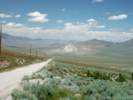
Locations: Clan Alpine Mountains.
Clan Alpine Mountains to the north.
|
|
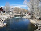
Camp Creek Camp Ground.
|
|
| Cold Springs
|
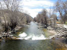
| Edwards Creek Valley
|
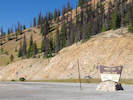
| New Pass SummitElevation: 6,348 ft. Desatoya Mountains to the south; New Pass Range to the north.
|
| Smith Creek Valley
|
| Shoshone Mountains
|
| Mt Airy Summit
|
| Reese River Valley
|
Other articles:
Junction: Nevada Highway 722
|
|
| Toiyabe Range
|
Literature Cited:
"Large 'islands' like ... the Toiyabe Range still support mammals that need special habitats or food: the carniverous ermine, relict on six island mountains, and the white-tailed jackrabbit, a six-and-a-half-pound herbivore dependent on large meadows (Trimble, 1989)."
|
|
Other articles:
Junction: Nevada State Route 305, north to Battle Mountain.
|
|
Locations:
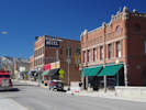
Austin.
| AustinThree motels, three restaurants (Carol's Country Kitchen was good).
|
| Austin SummitAt Austin Summit, 5 miles east of Austin, elevation 7,484 feet, take the dirt road south, past fenced off spring to summit, local resident noted that the road remains good as it descends a canyon on the east side of the Toiyabe Range.
|
One of the things that surprised me was that the central Nevada
mountain ranges are bare above the Pinyon-Juniper belt. Not until
we got to eastern Nevada did a Ponderosa Pine or Rocky Mountain
White Fir zone appear above the Pinyons and Junipers. Why might this
be?
|
|
| Scott SummitElevation, 7,267 feet.
|
Other articles:
Junction: Nevada Highway 378, south to US Highway 6 near Tonopah.
|
|
Other articles:
Locations:
Toiyabe Range.
|
|
Locations:
Big Smoky Valley.
Hickison Petroglyph Recreation Area.
| Big Smoky Valley
|
Other articles:
Locations:
Big Smoky Valley.
Highway passes from Big Smoky Valley to Monitor Valley by way of Hickison Summit.
|
|
Locations:
Hickison Petroglyph Recreation Area.
| Hickison SummitElevation 6,564 feet.
|
| Monitor Valley
|
| Lander County above Eureka County below
|
Literature Cited:
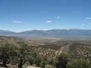
| At the summit north of the Twin Spring Hills, looking across Antelope Valley to the Mountain Boy Range. Diamond Peak in the Diamond Mountains in the background.
|
Locations: Antelope Valley.
| Antelope ValleyAntelope Valley is south of US Highway 50, about opposite of Lone Mountain.
|
| Lone MountainThis small white mountain, north of the highway, appears to be vegetated by Junipers, with few Pinyons. A few small roads approach the mountain from the south. There are many roads on the east side.
|
Locations: Kobeh Valley.
| Kobeh Valley
|
Literature Cited:
Locations: Devils Gate.
| Devils GateDevils Gate is Stop 2-1 and 2-2 of Cook and Corby (2004, pp. 59-72) discussion of the Whistler Mountain Limestone and associated rocks.
|
| Diamond Mountains
|
Literature Cited:
|
|
Other articles:
Junction: Nevada Highway 278.
|
|
Other articles:
Locations:
Ruby Hill.
View of Ruby Hill, the Eureka Mining district and the northern end of the Fish Creek Mountains.
|
|
Literature Cited:
Locations:
Eureka.
| Eureka
|
Junction: |
|
Literature Cited:
Other articles:
Locations: Adams Hill.
Junction: |
|
Other articles:
Locations: Windfall Canyon.
Junction: Windfall Mine Road | Windfall Canyon and the Windfall Mine to the southwest. This is also the north end of the road through Secret Canyon.
|
Literature Cited:
Other articles:
Locations: Pinto Summit.
| Pinto SummitElevation: 7,376 feet.
|
Literature Cited:
Other articles:
Locations: Pinto Canyon.
| Pinto CanyonKartesz (1988) states that Frasera albomarginata is found in Pinto Canyon. However, I haven't found any collections.
|
Other articles:
Locations: Secret Canyon.
Junction: Nevada Highway 379, turn here for Secret Canyon.
|
|
| Eureka County above White Pine County below
|
Other articles:
Junction: Nevada Highway 892, north through Newark Valley to a dirt road that leads eventually to Elko.
|
|
| Pancake SummitElevation: 6,517 feet.
|
Other articles:
Junction: Road south to Belmont Mill. | Frasera albomarginata has been collected along this road 2.3 miles south of US Highway 50.
|
Other articles:
West slope, White Pine Range
|
|
Other articles:
Locations: Antelope Mountain. Little Antelope Summit.
| Little Antelope SummitElevation: 7,433 feet.Antelope Mountain is north of Little Antelope Summit. H. D. Ripley collected Frasera albomarginata near here, collection at CAS.
|
Other articles:
Junction: Road North Into Long Valley, about 1 mile east of Little Antelope Summit. | There is a collection of Frasera albomarginata from a location about 2 1/2 miles north on this road.
|
Other articles:
|
|
Other articles:
Junction: County Route 11, NF 401, Green Spring Road, this road also gives access to Illipah Reservoir, and Forest Road 400.
|
|
Literature Cited:
Other articles:
Junction: White Pine County Route 3 "Long Valley Road", north through Long Valley to the Ruby Valley. | Kartesz (1988) states that Frasera albomarginata is found in Long Valley.
|
Locations: Butte Mountains. Jakey Valley.
| Jakey ValleyThe Butte Mountains form the north end of Jakey Valley.
|
Other articles:
|
|
Other articles:
West slope, Egan Range
|
|
Other articles:
Junction: Route 17, "Thirty Mile Road', gives access to the Butte Mountains, Butte Valley, and Long Valley via Long Valley Canyon.
|
|
| Robinson SummitElevation: 7,607 feet.
|
Other articles:
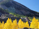
Frasera albomarginata growing among Junipers on the south side of the highway.
|
|
Other articles:
Locations:
Keystone.
Robinson Mining District.
| Keystone Junction
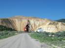
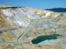
The first mine discovered in the Robinson Mining District, was the Elijah, near Lane City. The famed open-pit copper mines of Eastern Nevada including the Liberty Pit, largest in the state, are located in this mining district. Through the first half of the 20th century, this area produced nearly a billion dollars in copper, gold and silver. The huge mounds visible from here are waste rock which was removed to uncover the ore. Lane City, originally called Mineral City, was settled in 1869 and had a population of 400. At Mineral City was the Ragsdale Station--a hotel and a stage station. There is a collection of Frasera albomarginata from Keystone.
|
Other articles:
Locations:
Gleason Creek.
Robinson Canyon.
West of Ely, Nevada, US Highway 50 climbs up through Robinson Canyon to the mining area at Ruth.
|
|
Other articles:
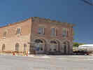
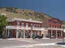
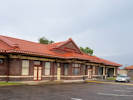
Locations: Ely.
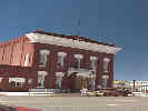
| ElyJunction:
Larger town, stock up here. Ely receives 73% of the sunshine possible at its latitude. There is a collection of Frasera albomarginata from the vicinity of Ely.
|
Other articles:
Junction: Cave Valley Road, south between the Schell Creek Range and the Egan Range into Cave Valley.
|
|
Other articles:
Junction: Nevada State Route 486, east to Cave Valley Lake and then north.
|
|
| Schell Creek Range
|
Other articles:
|
|
Other articles:
Locations: Connors Pass.
| Connors PassElevation: 7,723 feet.There is a collection of Frasera albomarginata from Connors Pass.
|
Other articles:
Locations:
Connors Pass.
|
|
Other articles:
Locations:
Snake Range.
|
|
Other articles:
Junction: U. S. Highway 93, South, through Pioche, Caliente, and Alamo to Las Vegas.
|
|
Other articles:
Junction: Osceola Road, through former mining town of Osceola, good dirt road, but steep hills to climb in the easterly direction.
|
|
| Sacramento PassElevation: 7,154 feet.
|
Other articles:
Junction: Osceola Road, through former mining town of Osceola, good dirt road, but steep downgrade in the westerly direction.
|
|
Other articles:
|
|
Other articles:
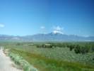
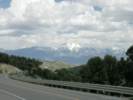
View of Wheeler Peak in Great Basin National Park to the south.
|
|
Other articles:
Junction: Nevada Highway 487, south to Baker and Great Basin National Park.
|
|
Literature Cited:
Great Basin National Park is 11 miles off of U. S. Hwy 50 on Nevada Highways 487 and 488. | To the north is the northern Snake Range. See: Miller, Gans, and Lee's (1987) discussion of the Snake Range decollement.
|
Nevada above
| Utah below
|
Other articles:
Junction: Ferguson Desert Road, south through the Ferguson Desert to Utah Highway 21.
|
|
Literature Cited:
| Junction: Mile and a Half Road, north to Conger Mountain. About 11 miles north of this intersection are Field Trip Stops 1-2 and 1-3 of Cook and Corboy (2004, pp. 45-57), discussing the Pilot Shale, Joana Limestone, and Chainman Shale.
|
Literature Cited:
Locations: Confusion Range.
| Confusion RangeIn Kings Canyon of the Confusion is Field Trip Stop 1-1 of Cook and Corboy (2004, pp. 38-44) discussing the Middle Silurian and Early Devonian Laketown Dolomite and overlying Sevy Dolomite.
|
| Sevier DesertHere we noticed the large ant hills
|
Literature Cited:
Locations: Sevier Lake.
| Sevier LakeOnce a part of Lake Bonneville, Sevier Lake occupies the largest southern basin of that huge Pleistocene Lake. The Sevier River dominates the hydrological budget of Sevier Lake.
|
Other articles:
Junction: road to U-Dig Fossils.
|
|
| Hinckley
|
| Delta
|
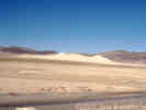
West of Holden along U. S. Hwy 50 are numerous stabilized sand dunes,
known as the "Little Sahara Dunes,
rise to impressive stature.
|
|
| Holden
|
Other articles:
Junction: U. S. Interstate 15, South., south to Cedar City and Saint George.
|
|
Other articles:
Junction: U. S. Interstate 15, North, north to Provo and Salt Lake City.
|
|
| Scipio
|
Other articles:
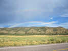
Rainbow just south of Scipio.
|
|
Junction: UT Hwy 28
|
|
Other articles:
Junction: US Highway 89, South, in the western part of Salina.
|
|
| Salina
|
Other articles:
Junction: U. S. Interstate 70 | Joint route with Interstate 70 below
|
Utah above
| US Interstate 70 Colorado below
|
Other articles:
Joint route with US I-70 above
| Junction: US Interstate 70, at Exit 15. Separate route from US I-70 below
|
Junction: US Interstate 70 Business, North Avenue
|
|
Junction: Colorado State Highway 340,westbound over the Colorado River, at the intersection of Grand Avenue and 1st Street.
|
|
Ute Street westbound, Pitkin Avenue eastbound, S 5th Street southbound.
|
|
Other articles:
Junction: Colorado Highway 141, north to US Interstate 70 Business, and US Highway 6.
|
|
| WhitewaterJunction: Colorado Highway 141, west to Gateway.
|
Other articles:
|
|
Other articles:
Junction: Colorado State Highway 92, east to Hotchkiss, then south to the north rim of the Black Canyon of the Gunnison River.
|
|
| Delta
|
Other articles:
| MontroseJunction: US Highway 550
|
| Cimarron
|
Other articles:
Junction: Colorado Highway 92, west along the north rim of the Black Canyon of the Gunnison River, then north through Crawford to Hotchkiss, then west to Delta, rejoining US Highway 50.
|
|
Locations: Sapinero.
| SapineroThe original site of Sapinero was about 1 mile north on Soap Creek
|
Other articles:
Junction: Colorado Highway 149, south through Lake City and Creede to South Fork.
|
|
| GunnisonJunction: Colorado Highway 135, N/S Main Street
|
Other articles:
| Junction: Colorado State Highway 114, through the Cochetopa Hills, over the Continental Divide, to US Highway 285 at Saguache.
|
Locations: Parlin.
Parlin
|
|
Junction: County Route 887 “Waunita Hot Springs Road”
|
|
Doyleville
|
|
Gunnison County above
| Saguache County below
|
Other articles:
Locations: Sargents.
| SargentsJunction: Marshall Pass Road, over Marshall Pass to Mears Junction on US Highway 285.
|
Saguache County above
| Gunnison County below
|
Other articles:
Locations:
Monarch Pass.
| Gunnison County above ... Gunnison (Colorado) River basin above Monarch Pass, 11,306 ft. / 3446 m. Continental Divide Arkansas River basin below Chaffee County below
|
Other articles:
Locations:
Monarch (historical).
|
|
Locations: Garfield.
Garfield
|
|
Other articles:
Locations:
Maysville.
Maysville
|
|
Other articles:
Junction: US Highway 285, north.
|
|
Other articles:
Junction: US Highway 285, south.
|
|
Literature Cited:
Locations:
Salida.
| Salida, CO
|
Locations: Coaldale.
| Coaldale
|
Other articles:
| Texas CreekJunction: Colorado Highway 69, south to Westcliffe.Looks like there was a wye on the D&RGW just east of Texas Creek.
|
Other articles:
Junction: County Road 3, south, in the direction of Copper Gulch, Temple Canyon, and Royal Gorge Bridge.
|
|
Other articles:
Junction: Colorado State Highway 9, north.
|
|
Other articles:
Junction: County Road 3A, to Royal Gorge Bridge and Park.
|
|
Other articles:
Locations:
Cañon City.
| Cañon City
|
Other articles:
Junction: 9th Street, Colorado State Highway 115
|
|
Other articles:
Junction: Colorado State Highway 115, north to Colorado Springs, or south to Florence.
|
|
Other articles:
Junction: Interstate 25, north.
|
|
Locations: Pueblo.
| Pueblo
|
Other articles:
Junction: Interstate 25, South.
|
|
Baxter
|
|
Devine
|
|
Nyberg
|
|
Fort Reynolds
|
|
Locations: Huerfano River.
| Cross Huerfano River.
|
Nepesta
|
|
| Fowler
|
Elder
|
|
Manzanola
|
|
| Rocky Ford
|
Swink
|
|
Other articles:
Junction: Grant Avenue, US Highway 350
|
|
Locations: La Junta.
| La JuntaJunction: Colorado Avenue
|
Other articles:
Junction: Adams Avenue, Colorado Highway 109
|
|
| Las Animas
|
Other articles:
Junction: Colorado Highway 194, west to Bent's Old Fort.
|
|
Other articles:
Junction: US Highway 287, north.
|
|
Junction: Colorado Highway 196
|
|
Other articles:
| LamarJunction:
|
Other articles:
| GranadaJunction: US Highway 385, north along the eastern border of Colorado.
|
Colorado above
| Kansas below
|
Kansas above
| Missouri below
|
Missouri above
| Illinois below
|
Illinois above
| Ohio below
|
Ohio above
| West Virginia below
|
Virginia below
| District of Columbia below
|
District of Columbia above
| Maryland below
|
West Virginia above
| Virginia below
|
| Ocean City, MarylandJunction: Philadelphia AvenueEnd of highway.
If you have a question or a comment you may write to me at:
tas4@schweich.com
I sometimes post interesting questions in my FAQ, but I never disclose your full name or address.
|
|
Date and time this article was prepared: 4/27/2024 3:30:51 PM |