Eastern Mojave Vegetation
Tom Schweich
|
Eastern Mojave Vegetation
| Field Notes (Continued) |
|
Tom Schweich |

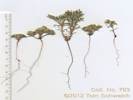
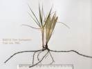
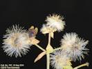
Topics in this Article: 1800s 1900s 1910s 1920s 1930s 1940s 1950s 1960s 1970s 1980s 1990 1991 1992 1993 1995 1996 1997 1998 1999 2000 2001 2002 2003 2004 2005 2006 2007 2008 2008 Tour de Swertia albomarginata Mono Lake, August 2008 2009 2010 2011 2012 2013 2014 2015 2016 2017 2018 2019 2020 2021 2022 2023 2024 Contents Literature Cited |
When I first read the field notes of Annie Alexander and Louise Kellogg, I was fascinated by the descriptions they wrote about the places they went and the plants and animals they found there. By publishing my field notes on the Internet I hope to follow a little bit in their tradition. | |||||||||||||||||||||||||||||||||||||||||||||||||||||||||||||||||||||||||||||||||||||||||||||||||||||||||||||||||||||||||||||||||||||||||||||||||||||||||||||||||||||||||||||||||||||||||||||||||||||||||||||||||||||||||||||||||||||||||||||||||||||||||||||||||||||||||||||||||||||||||||||||||||||||||||||||||||||||||||||||||||||||||||||||||||||||||||||||||||||||||||||||||||||||||||||||||||||||||||||||||||||||||||||||||||||||||||||||||||||||||||||||||||||||||||||||||||||||||||||||||||||||||||||||||||||||||||||||||||||||||||||||||||||||||||||||||||||||||||||||||||||||||||||||||||||||||||||||||||||||||||||||||||||||
|
|
2011 | |||||||||||||||||||||||||||||||||||||||||||||||||||||||||||||||||||||||||||||||||||||||||||||||||||||||||||||||||||||||||||||||||||||||||||||||||||||||||||||||||||||||||||||||||||||||||||||||||||||||||||||||||||||||||||||||||||||||||||||||||||||||||||||||||||||||||||||||||||||||||||||||||||||||||||||||||||||||||||||||||||||||||||||||||||||||||||||||||||||||||||||||||||||||||||||||||||||||||||||||||||||||||||||||||||||||||||||||||||||||||||||||||||||||||||||||||||||||||||||||||||||||||||||||||||||||||||||||||||||||||||||||||||||||||||||||||||||||||||||||||||||||||||||||||||||||||||||||||||||||||||||||||||||||
|
|
Saturday, April 23rd | |||||||||||||||||||||||||||||||||||||||||||||||||||||||||||||||||||||||||||||||||||||||||||||||||||||||||||||||||||||||||||||||||||||||||||||||||||||||||||||||||||||||||||||||||||||||||||||||||||||||||||||||||||||||||||||||||||||||||||||||||||||||||||||||||||||||||||||||||||||||||||||||||||||||||||||||||||||||||||||||||||||||||||||||||||||||||||||||||||||||||||||||||||||||||||||||||||||||||||||||||||||||||||||||||||||||||||||||||||||||||||||||||||||||||||||||||||||||||||||||||||||||||||||||||||||||||||||||||||||||||||||||||||||||||||||||||||||||||||||||||||||||||||||||||||||||||||||||||||||||||||||||||||||||
|
Literature Cited:
Other articles:
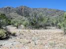
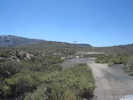
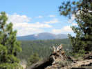
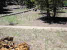
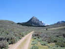
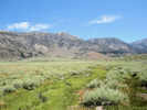
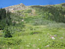
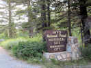
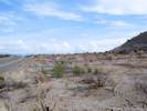
Locations: Lime Hill. |
| |||||||||||||||||||||||||||||||||||||||||||||||||||||||||||||||||||||||||||||||||||||||||||||||||||||||||||||||||||||||||||||||||||||||||||||||||||||||||||||||||||||||||||||||||||||||||||||||||||||||||||||||||||||||||||||||||||||||||||||||||||||||||||||||||||||||||||||||||||||||||||||||||||||||||||||||||||||||||||||||||||||||||||||||||||||||||||||||||||||||||||||||||||||||||||||||||||||||||||||||||||||||||||||||||||||||||||||||||||||||||||||||||||||||||||||||||||||||||||||||||||||||||||||||||||||||||||||||||||||||||||||||||||||||||||||||||||||||||||||||||||||||||||||||||||||||||||||||||||||||||||||||||||||||
|
Other articles:
|
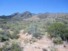
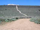
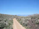
These furrows may have been made during an attempt at agriculture. | |||||||||||||||||||||||||||||||||||||||||||||||||||||||||||||||||||||||||||||||||||||||||||||||||||||||||||||||||||||||||||||||||||||||||||||||||||||||||||||||||||||||||||||||||||||||||||||||||||||||||||||||||||||||||||||||||||||||||||||||||||||||||||||||||||||||||||||||||||||||||||||||||||||||||||||||||||||||||||||||||||||||||||||||||||||||||||||||||||||||||||||||||||||||||||||||||||||||||||||||||||||||||||||||||||||||||||||||||||||||||||||||||||||||||||||||||||||||||||||||||||||||||||||||||||||||||||||||||||||||||||||||||||||||||||||||||||||||||||||||||||||||||||||||||||||||||||||||||||||||||||||||||||||||
|
Other articles:
|
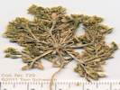
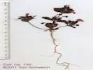
729 |
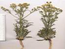
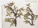
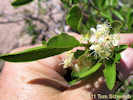
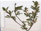
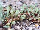
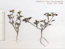
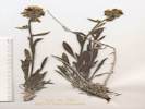
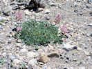
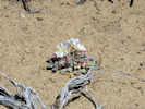
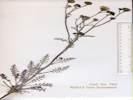
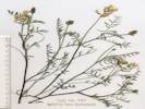
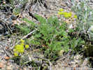
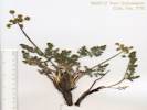
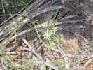
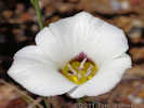
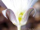
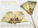
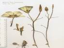
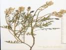
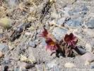
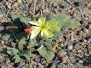
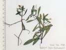
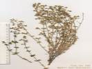
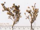
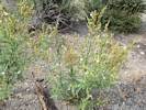
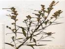
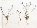
Lepidium flavum Torr. Yellow Pepperweed.
Harvard Maze, San Bernardino County, California. Harvard Maze, an area of patterned soil possibly scraped to obtain gravel, 3.5 road miles northeast of the Harvard Road exit of US Interstate 15, by way of Harvard Road and the powerline road, and 24 miles east northeast of Barstow. 35.0101°N, 116.6256°W. WGS 1984. Elev. 580 m. Coll. No. 729, 31 Dec 2011, characters observed while keying: Annual glabrous throughout; Leaves basal withering, pinnately-lobed (found on only the largest specimen), cauline present, bases simple; Flowers radial; Petals yellow; Stamens 6; Ovary ovoid; Style exserted from fruit notch 0.6-0.9 mm; Fruit young erect, unsegmented, winged, mature dehiscent; Seeds 2. | ||||||||||||||||||||||||||||||||||||||||||||||||||||||||||||||||||||||||||||||||||||||||||||||||||||||||||||||||||||||||||||||||||||||||||||||||||||||||||||||||||||||||||||||||||||||||||||||||||||||||||||||||||||||||||||||||||||||||||||||||||||||||||||||||||||||||||||||||||||||||||||||||||||||||||||||||||||||||||||||||||||||||||||||||||||||||||||||||||||||||||||||||||||||||||||||||||||||||||||||||||||||||||||||||||||||||||||||||||||||||||||||||||||||||||||||||||||||||||||||||||||||||||||||||||||||||||||||||||||||||||||||||||||||||||||||||||||||||||||||||||||||||||||||||||||||||||||||||||||||||||||||||||||||
|
Other articles:
|
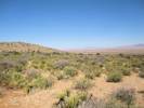
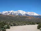
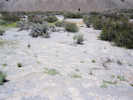
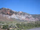
Outcrop of Peach Spring Tuff in the Alvord Mountain area. | |||||||||||||||||||||||||||||||||||||||||||||||||||||||||||||||||||||||||||||||||||||||||||||||||||||||||||||||||||||||||||||||||||||||||||||||||||||||||||||||||||||||||||||||||||||||||||||||||||||||||||||||||||||||||||||||||||||||||||||||||||||||||||||||||||||||||||||||||||||||||||||||||||||||||||||||||||||||||||||||||||||||||||||||||||||||||||||||||||||||||||||||||||||||||||||||||||||||||||||||||||||||||||||||||||||||||||||||||||||||||||||||||||||||||||||||||||||||||||||||||||||||||||||||||||||||||||||||||||||||||||||||||||||||||||||||||||||||||||||||||||||||||||||||||||||||||||||||||||||||||||||||||||||||
|
Other articles:
|
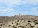
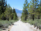
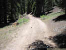
View from the road to the microwave tower. | |||||||||||||||||||||||||||||||||||||||||||||||||||||||||||||||||||||||||||||||||||||||||||||||||||||||||||||||||||||||||||||||||||||||||||||||||||||||||||||||||||||||||||||||||||||||||||||||||||||||||||||||||||||||||||||||||||||||||||||||||||||||||||||||||||||||||||||||||||||||||||||||||||||||||||||||||||||||||||||||||||||||||||||||||||||||||||||||||||||||||||||||||||||||||||||||||||||||||||||||||||||||||||||||||||||||||||||||||||||||||||||||||||||||||||||||||||||||||||||||||||||||||||||||||||||||||||||||||||||||||||||||||||||||||||||||||||||||||||||||||||||||||||||||||||||||||||||||||||||||||||||||||||||||
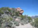
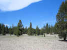
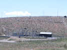
 Resistant limestone ledge on sand ridge. Resistant limestone ledge on sand ridge.
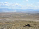
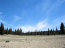
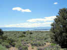
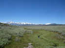
 View northeast across basin to Goldstone gravel ridge. View northeast across basin to Goldstone gravel ridge.
|
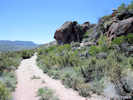
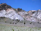
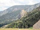
Field trip stop at a ledge of resistant limestone. | |||||||||||||||||||||||||||||||||||||||||||||||||||||||||||||||||||||||||||||||||||||||||||||||||||||||||||||||||||||||||||||||||||||||||||||||||||||||||||||||||||||||||||||||||||||||||||||||||||||||||||||||||||||||||||||||||||||||||||||||||||||||||||||||||||||||||||||||||||||||||||||||||||||||||||||||||||||||||||||||||||||||||||||||||||||||||||||||||||||||||||||||||||||||||||||||||||||||||||||||||||||||||||||||||||||||||||||||||||||||||||||||||||||||||||||||||||||||||||||||||||||||||||||||||||||||||||||||||||||||||||||||||||||||||||||||||||||||||||||||||||||||||||||||||||||||||||||||||||||||||||||||||||||||
|
|
Sunday, April 24th | |||||||||||||||||||||||||||||||||||||||||||||||||||||||||||||||||||||||||||||||||||||||||||||||||||||||||||||||||||||||||||||||||||||||||||||||||||||||||||||||||||||||||||||||||||||||||||||||||||||||||||||||||||||||||||||||||||||||||||||||||||||||||||||||||||||||||||||||||||||||||||||||||||||||||||||||||||||||||||||||||||||||||||||||||||||||||||||||||||||||||||||||||||||||||||||||||||||||||||||||||||||||||||||||||||||||||||||||||||||||||||||||||||||||||||||||||||||||||||||||||||||||||||||||||||||||||||||||||||||||||||||||||||||||||||||||||||||||||||||||||||||||||||||||||||||||||||||||||||||||||||||||||||||||
|
|
Sunday, April 24, 2011 | |||||||||||||||||||||||||||||||||||||||||||||||||||||||||||||||||||||||||||||||||||||||||||||||||||||||||||||||||||||||||||||||||||||||||||||||||||||||||||||||||||||||||||||||||||||||||||||||||||||||||||||||||||||||||||||||||||||||||||||||||||||||||||||||||||||||||||||||||||||||||||||||||||||||||||||||||||||||||||||||||||||||||||||||||||||||||||||||||||||||||||||||||||||||||||||||||||||||||||||||||||||||||||||||||||||||||||||||||||||||||||||||||||||||||||||||||||||||||||||||||||||||||||||||||||||||||||||||||||||||||||||||||||||||||||||||||||||||||||||||||||||||||||||||||||||||||||||||||||||||||||||||||||||||
|
Other articles:
|
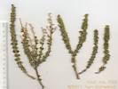
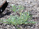
730 |
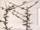
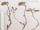
Mimulus bigelovii (A. Gray) A. Gray var. cuspidatus A. L. Grant. Bigelow's Monkeyflower.
I picked up this little one thinking it was Mimulus nanus var. mephiticus. Furnace Creek Wash, Inyo County, California. Along Furnace Creek Wash Road, about 2.5 miles south of the Billie Mine and Ryan. 36.3019°N, 116.6792°W. Elev. 870 m. Coll. No. 730, 1 Jan 2012, characters observed while keying: Stem internodes lower < upper; nodes: most with 2 flowers; Leaves distal >> basal; Caylx sparsely long hairy (definitely not puberulent); Corolla tube 13 mm, limb 10 mm, throat floor yellow at mouth; Stigma included (though appears at end of corolla tube- throat when flowers dehisce), lobes ~equal. | ||||||||||||||||||||||||||||||||||||||||||||||||||||||||||||||||||||||||||||||||||||||||||||||||||||||||||||||||||||||||||||||||||||||||||||||||||||||||||||||||||||||||||||||||||||||||||||||||||||||||||||||||||||||||||||||||||||||||||||||||||||||||||||||||||||||||||||||||||||||||||||||||||||||||||||||||||||||||||||||||||||||||||||||||||||||||||||||||||||||||||||||||||||||||||||||||||||||||||||||||||||||||||||||||||||||||||||||||||||||||||||||||||||||||||||||||||||||||||||||||||||||||||||||||||||||||||||||||||||||||||||||||||||||||||||||||||||||||||||||||||||||||||||||||||||||||||||||||||||||||||||||||||||||
|
|
Tuesday, April 26th | |||||||||||||||||||||||||||||||||||||||||||||||||||||||||||||||||||||||||||||||||||||||||||||||||||||||||||||||||||||||||||||||||||||||||||||||||||||||||||||||||||||||||||||||||||||||||||||||||||||||||||||||||||||||||||||||||||||||||||||||||||||||||||||||||||||||||||||||||||||||||||||||||||||||||||||||||||||||||||||||||||||||||||||||||||||||||||||||||||||||||||||||||||||||||||||||||||||||||||||||||||||||||||||||||||||||||||||||||||||||||||||||||||||||||||||||||||||||||||||||||||||||||||||||||||||||||||||||||||||||||||||||||||||||||||||||||||||||||||||||||||||||||||||||||||||||||||||||||||||||||||||||||||||||
|
Other articles:
Locations:
Johnson.
Little Dragoon Mountains.
|
| |||||||||||||||||||||||||||||||||||||||||||||||||||||||||||||||||||||||||||||||||||||||||||||||||||||||||||||||||||||||||||||||||||||||||||||||||||||||||||||||||||||||||||||||||||||||||||||||||||||||||||||||||||||||||||||||||||||||||||||||||||||||||||||||||||||||||||||||||||||||||||||||||||||||||||||||||||||||||||||||||||||||||||||||||||||||||||||||||||||||||||||||||||||||||||||||||||||||||||||||||||||||||||||||||||||||||||||||||||||||||||||||||||||||||||||||||||||||||||||||||||||||||||||||||||||||||||||||||||||||||||||||||||||||||||||||||||||||||||||||||||||||||||||||||||||||||||||||||||||||||||||||||||||||
|
Other articles:
|
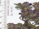
731 |
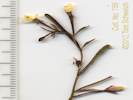
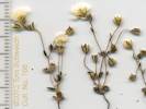
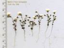
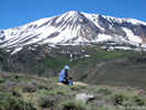
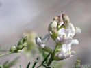
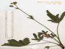
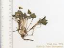
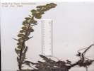
Frasera albomarginata S. Watson. Johnson, Cochise County, Arizona. Four miles north of Exit 322 of US Interstate 10 on N. 7 Dash Road, at the north boundary of the private property of the Nord Resources, Inc., Johnson Camp Mine. This location is about 2 miles north of the former town of Johnson. 32.1296°N, 110.0756°W. WGS 1984. Access and permission to collect courtesy of Nord Resources, Inc. This population is disjunct by 184 miles from the nearest collection. | ||||||||||||||||||||||||||||||||||||||||||||||||||||||||||||||||||||||||||||||||||||||||||||||||||||||||||||||||||||||||||||||||||||||||||||||||||||||||||||||||||||||||||||||||||||||||||||||||||||||||||||||||||||||||||||||||||||||||||||||||||||||||||||||||||||||||||||||||||||||||||||||||||||||||||||||||||||||||||||||||||||||||||||||||||||||||||||||||||||||||||||||||||||||||||||||||||||||||||||||||||||||||||||||||||||||||||||||||||||||||||||||||||||||||||||||||||||||||||||||||||||||||||||||||||||||||||||||||||||||||||||||||||||||||||||||||||||||||||||||||||||||||||||||||||||||||||||||||||||||||||||||||||||||
|
Other articles:
|
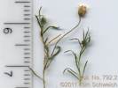
732 |
Mortonia scabrella A. Gray. Rio Grande Saddlebush.
Johnson, Cochise County, Arizona. Four miles north of Exit 322 of US Interstate 10 on N. 7 Dash Road, at the north boundary of the private property of the Nord Resources, Inc., Johnson Camp Mine. This location is about 2 miles north of the former town of Johnson. 32.1296°N, 110.0756°W. Collected with Frasera albomarginata. Access and permission to collect courtesy of Nord Resources, Inc. | ||||||||||||||||||||||||||||||||||||||||||||||||||||||||||||||||||||||||||||||||||||||||||||||||||||||||||||||||||||||||||||||||||||||||||||||||||||||||||||||||||||||||||||||||||||||||||||||||||||||||||||||||||||||||||||||||||||||||||||||||||||||||||||||||||||||||||||||||||||||||||||||||||||||||||||||||||||||||||||||||||||||||||||||||||||||||||||||||||||||||||||||||||||||||||||||||||||||||||||||||||||||||||||||||||||||||||||||||||||||||||||||||||||||||||||||||||||||||||||||||||||||||||||||||||||||||||||||||||||||||||||||||||||||||||||||||||||||||||||||||||||||||||||||||||||||||||||||||||||||||||||||||||||||
|
Other articles:
|
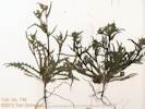
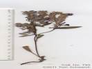
733 |
Rhus microphylla Engelm. ex A. Gray.
Johnson, Cochise County, Arizona. Four miles north of Exit 322 of US Interstate 10 on N. 7 Dash Road, at the north boundary of the private property of the Nord Resources, Inc., Johnson Camp Mine. This location is about 2 miles north of the former town of Johnson. 32.1296°N, 110.0755°W. WGS 1984. Collected with Frasera albomarginata. Access and permission to collect courtesy of Nord Resources, Inc. | ||||||||||||||||||||||||||||||||||||||||||||||||||||||||||||||||||||||||||||||||||||||||||||||||||||||||||||||||||||||||||||||||||||||||||||||||||||||||||||||||||||||||||||||||||||||||||||||||||||||||||||||||||||||||||||||||||||||||||||||||||||||||||||||||||||||||||||||||||||||||||||||||||||||||||||||||||||||||||||||||||||||||||||||||||||||||||||||||||||||||||||||||||||||||||||||||||||||||||||||||||||||||||||||||||||||||||||||||||||||||||||||||||||||||||||||||||||||||||||||||||||||||||||||||||||||||||||||||||||||||||||||||||||||||||||||||||||||||||||||||||||||||||||||||||||||||||||||||||||||||||||||||||||||
|
Other articles:
|
734 |
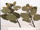
Rhus virens Lindh. ex A. Gray var. choriophylla (Woot. & Standl.) L.D. Benson. Evergreen Sumac.
Johnson, Cochise County, Arizona. Four miles north of Exit 322 of US Interstate 10 on N. 7 Dash Road, at the north boundary of the private property of the Nord Resources, Inc., Johnson Camp Mine. This location is about 2 miles north of the former town of Johnson. 32.1296°N, 110.0755°W. WGS 1984. Collected with Frasera albomarginata. Access and permission to collect courtesy of Nord Resources, Inc. | ||||||||||||||||||||||||||||||||||||||||||||||||||||||||||||||||||||||||||||||||||||||||||||||||||||||||||||||||||||||||||||||||||||||||||||||||||||||||||||||||||||||||||||||||||||||||||||||||||||||||||||||||||||||||||||||||||||||||||||||||||||||||||||||||||||||||||||||||||||||||||||||||||||||||||||||||||||||||||||||||||||||||||||||||||||||||||||||||||||||||||||||||||||||||||||||||||||||||||||||||||||||||||||||||||||||||||||||||||||||||||||||||||||||||||||||||||||||||||||||||||||||||||||||||||||||||||||||||||||||||||||||||||||||||||||||||||||||||||||||||||||||||||||||||||||||||||||||||||||||||||||||||||||||
|
Other articles:
|
Berberis haematocarpa Wooten. Red Barberry.
Johnson, Cochise County, Arizona. Four miles north of Exit 322 of US Interstate 10 on N. 7 Dash Road, at the north boundary of the private property of the Nord Resources, Inc., Johnson Camp Mine. This location is about 2 miles north of the former town of Johnson. 32.1296°N, 110.0755°W. WGS 1984. Collected with Frasera albomarginata. Access and permission to collect courtesy of Nord Resources, Inc. There are two barberrys in Cochise County, B. haematocarpa and B. wilcoxii. I'm thinking this one is B. haematocarpa based upon the narrow aspect of the leaves relative to the length, and the elevation and habitat. Collection discarded. | |||||||||||||||||||||||||||||||||||||||||||||||||||||||||||||||||||||||||||||||||||||||||||||||||||||||||||||||||||||||||||||||||||||||||||||||||||||||||||||||||||||||||||||||||||||||||||||||||||||||||||||||||||||||||||||||||||||||||||||||||||||||||||||||||||||||||||||||||||||||||||||||||||||||||||||||||||||||||||||||||||||||||||||||||||||||||||||||||||||||||||||||||||||||||||||||||||||||||||||||||||||||||||||||||||||||||||||||||||||||||||||||||||||||||||||||||||||||||||||||||||||||||||||||||||||||||||||||||||||||||||||||||||||||||||||||||||||||||||||||||||||||||||||||||||||||||||||||||||||||||||||||||||||||
|
Other articles:
|
736 |
Prosopis velutina Wooten. Velvet Mesquite.
Johnson, Cochise County, Arizona. Four miles north of Exit 322 of US Interstate 10 on N. 7 Dash Road, at the north boundary of the private property of the Nord Resources, Inc., Johnson Camp Mine. This location is about 2 miles north of the former town of Johnson. 32.1296°N, 110.0755°W. WGS 1984. Collected with Frasera albomarginata. Access and permission to collect courtesy of Nord Resources, Inc. The few flowers that are open have free petals, not fused, and the plant is moderately hairy, so I'm pretty sure it's P. velutina. | ||||||||||||||||||||||||||||||||||||||||||||||||||||||||||||||||||||||||||||||||||||||||||||||||||||||||||||||||||||||||||||||||||||||||||||||||||||||||||||||||||||||||||||||||||||||||||||||||||||||||||||||||||||||||||||||||||||||||||||||||||||||||||||||||||||||||||||||||||||||||||||||||||||||||||||||||||||||||||||||||||||||||||||||||||||||||||||||||||||||||||||||||||||||||||||||||||||||||||||||||||||||||||||||||||||||||||||||||||||||||||||||||||||||||||||||||||||||||||||||||||||||||||||||||||||||||||||||||||||||||||||||||||||||||||||||||||||||||||||||||||||||||||||||||||||||||||||||||||||||||||||||||||||||
|
Other articles:
|
737 |
Johnson, Cochise County, Arizona. Four miles north of Exit 322 of US Interstate 10 on N. 7 Dash Road, at the north boundary of the private property of the Nord Resources, Inc., Johnson Camp Mine. This location is about 2 miles north of the former town of Johnson. 32.1296°N, 110.0755°W. WGS 1984. Collected with Frasera albomarginata. Access and permission to collect courtesy of Nord Resources, Inc. | ||||||||||||||||||||||||||||||||||||||||||||||||||||||||||||||||||||||||||||||||||||||||||||||||||||||||||||||||||||||||||||||||||||||||||||||||||||||||||||||||||||||||||||||||||||||||||||||||||||||||||||||||||||||||||||||||||||||||||||||||||||||||||||||||||||||||||||||||||||||||||||||||||||||||||||||||||||||||||||||||||||||||||||||||||||||||||||||||||||||||||||||||||||||||||||||||||||||||||||||||||||||||||||||||||||||||||||||||||||||||||||||||||||||||||||||||||||||||||||||||||||||||||||||||||||||||||||||||||||||||||||||||||||||||||||||||||||||||||||||||||||||||||||||||||||||||||||||||||||||||||||||||||||||
|
Other articles:
|
738 |
Garrya wrightii Torr. Wright's Silk-Tassel.
Johnson, Cochise County, Arizona. Four miles north of Exit 322 of US Interstate 10 on N. 7 Dash Road, at the north boundary of the private property of the Nord Resources, Inc., Johnson Camp Mine. This location is about 2 miles north of the former town of Johnson. 32.1275°N, 110.0765°W. WGS 1984. Collected with Frasera albomarginata. Access and permission to collect courtesy of Nord Resources, Inc. Collection discarded. | ||||||||||||||||||||||||||||||||||||||||||||||||||||||||||||||||||||||||||||||||||||||||||||||||||||||||||||||||||||||||||||||||||||||||||||||||||||||||||||||||||||||||||||||||||||||||||||||||||||||||||||||||||||||||||||||||||||||||||||||||||||||||||||||||||||||||||||||||||||||||||||||||||||||||||||||||||||||||||||||||||||||||||||||||||||||||||||||||||||||||||||||||||||||||||||||||||||||||||||||||||||||||||||||||||||||||||||||||||||||||||||||||||||||||||||||||||||||||||||||||||||||||||||||||||||||||||||||||||||||||||||||||||||||||||||||||||||||||||||||||||||||||||||||||||||||||||||||||||||||||||||||||||||||
|
Other articles:
|
739 |
Pinus cembroides Zucc. Mexican Pinyon.
Johnson, Cochise County, Arizona. Four miles north of Exit 322 of US Interstate 10 on N. 7 Dash Road, at the north boundary of the private property of the Nord Resources, Inc., Johnson Camp Mine. This location is about 2 miles north of the former town of Johnson. 32.1275°N, 110.0765°W. WGS 1984. Collected with Frasera albomarginata. Access and permission to collect courtesy of Nord Resources, Inc. Collection discarded. | ||||||||||||||||||||||||||||||||||||||||||||||||||||||||||||||||||||||||||||||||||||||||||||||||||||||||||||||||||||||||||||||||||||||||||||||||||||||||||||||||||||||||||||||||||||||||||||||||||||||||||||||||||||||||||||||||||||||||||||||||||||||||||||||||||||||||||||||||||||||||||||||||||||||||||||||||||||||||||||||||||||||||||||||||||||||||||||||||||||||||||||||||||||||||||||||||||||||||||||||||||||||||||||||||||||||||||||||||||||||||||||||||||||||||||||||||||||||||||||||||||||||||||||||||||||||||||||||||||||||||||||||||||||||||||||||||||||||||||||||||||||||||||||||||||||||||||||||||||||||||||||||||||||||
|
Other articles:
|
740 |
Quercus turbinella
Johnson, Cochise County, Arizona. Four miles north of Exit 322 of US Interstate 10 on N. 7 Dash Road, at the north boundary of the private property of the Nord Resources, Inc., Johnson Camp Mine. This location is about 2 miles north of the former town of Johnson. 32.1275°N, 110.0765°W. WGS 1984. Collected with Frasera albomarginata. Access and permission to collect courtesy of Nord Resources, Inc. Collection discarded. | ||||||||||||||||||||||||||||||||||||||||||||||||||||||||||||||||||||||||||||||||||||||||||||||||||||||||||||||||||||||||||||||||||||||||||||||||||||||||||||||||||||||||||||||||||||||||||||||||||||||||||||||||||||||||||||||||||||||||||||||||||||||||||||||||||||||||||||||||||||||||||||||||||||||||||||||||||||||||||||||||||||||||||||||||||||||||||||||||||||||||||||||||||||||||||||||||||||||||||||||||||||||||||||||||||||||||||||||||||||||||||||||||||||||||||||||||||||||||||||||||||||||||||||||||||||||||||||||||||||||||||||||||||||||||||||||||||||||||||||||||||||||||||||||||||||||||||||||||||||||||||||||||||||||
|
Other articles:
|
741 |
Cercocarpus montanus Raf. Alder-Leaf Mountain Mahogany.
Johnson, Cochise County, Arizona. Four miles north of Exit 322 of US Interstate 10 on N. 7 Dash Road, at the north boundary of the private property of the Nord Resources, Inc., Johnson Camp Mine. This location is about 2 miles north of the former town of Johnson. 32.1275°N, 110.0765°W. WGS 1984. Collected with Frasera albomarginata. Access and permission to collect courtesy of Nord Resources, Inc. Collection discarded. | ||||||||||||||||||||||||||||||||||||||||||||||||||||||||||||||||||||||||||||||||||||||||||||||||||||||||||||||||||||||||||||||||||||||||||||||||||||||||||||||||||||||||||||||||||||||||||||||||||||||||||||||||||||||||||||||||||||||||||||||||||||||||||||||||||||||||||||||||||||||||||||||||||||||||||||||||||||||||||||||||||||||||||||||||||||||||||||||||||||||||||||||||||||||||||||||||||||||||||||||||||||||||||||||||||||||||||||||||||||||||||||||||||||||||||||||||||||||||||||||||||||||||||||||||||||||||||||||||||||||||||||||||||||||||||||||||||||||||||||||||||||||||||||||||||||||||||||||||||||||||||||||||||||||
|
Other articles:
|
742 |
Frasera albomarginata S. Watson.
Johnson, Cochise County, Arizona. 3.3 miles north of Exit 322 of US Interstate 10 on N. 7 Dash Road, near the north boundary of the private property of the Nord Resources, Inc., Johnson Camp Mine. This location is about 1.5 miles north of the former town of Johnson. 32.1219°N, 110.0707°W. WGS 1984. Elev. 1527 m. Access and permission to collect courtesy of Nord Resources, Inc. | ||||||||||||||||||||||||||||||||||||||||||||||||||||||||||||||||||||||||||||||||||||||||||||||||||||||||||||||||||||||||||||||||||||||||||||||||||||||||||||||||||||||||||||||||||||||||||||||||||||||||||||||||||||||||||||||||||||||||||||||||||||||||||||||||||||||||||||||||||||||||||||||||||||||||||||||||||||||||||||||||||||||||||||||||||||||||||||||||||||||||||||||||||||||||||||||||||||||||||||||||||||||||||||||||||||||||||||||||||||||||||||||||||||||||||||||||||||||||||||||||||||||||||||||||||||||||||||||||||||||||||||||||||||||||||||||||||||||||||||||||||||||||||||||||||||||||||||||||||||||||||||||||||||||
|
Other articles:
|
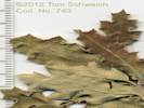
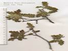
743 |
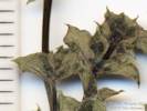
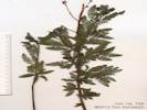
Quercus pungens Liebm. Pungent Oak.
Det. per Leslie Landrum via John Anderson, 1/23/2012. Benson, Cochise County, Arizona. At the pass on 3 Links Road, 7.4 miles east of Cascabel Road, 28 road miles east-northeast of Benson, Arizona. 32.2052°N, 110.1957°W. WGS 1984. Common on limestone. Coll. No. 743, 7 Jan 2012, characters observed: Leaves elliptic, margins wavy, toothed, reddish on top, grayish on bottom, sunken veins on top, stellate hairs top and bottom. Collection discarded. | ||||||||||||||||||||||||||||||||||||||||||||||||||||||||||||||||||||||||||||||||||||||||||||||||||||||||||||||||||||||||||||||||||||||||||||||||||||||||||||||||||||||||||||||||||||||||||||||||||||||||||||||||||||||||||||||||||||||||||||||||||||||||||||||||||||||||||||||||||||||||||||||||||||||||||||||||||||||||||||||||||||||||||||||||||||||||||||||||||||||||||||||||||||||||||||||||||||||||||||||||||||||||||||||||||||||||||||||||||||||||||||||||||||||||||||||||||||||||||||||||||||||||||||||||||||||||||||||||||||||||||||||||||||||||||||||||||||||||||||||||||||||||||||||||||||||||||||||||||||||||||||||||||||||
|
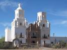
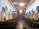
Locations:
San Xavier del Bac Mission.
|
||||||||||||||||||||||||||||||||||||||||||||||||||||||||||||||||||||||||||||||||||||||||||||||||||||||||||||||||||||||||||||||||||||||||||||||||||||||||||||||||||||||||||||||||||||||||||||||||||||||||||||||||||||||||||||||||||||||||||||||||||||||||||||||||||||||||||||||||||||||||||||||||||||||||||||||||||||||||||||||||||||||||||||||||||||||||||||||||||||||||||||||||||||||||||||||||||||||||||||||||||||||||||||||||||||||||||||||||||||||||||||||||||||||||||||||||||||||||||||||||||||||||||||||||||||||||||||||||||||||||||||||||||||||||||||||||||||||||||||||||||||||||||||||||||||||||||||||||||||||||||||||||||||||||
|
Other articles:
|
||||||||||||||||||||||||||||||||||||||||||||||||||||||||||||||||||||||||||||||||||||||||||||||||||||||||||||||||||||||||||||||||||||||||||||||||||||||||||||||||||||||||||||||||||||||||||||||||||||||||||||||||||||||||||||||||||||||||||||||||||||||||||||||||||||||||||||||||||||||||||||||||||||||||||||||||||||||||||||||||||||||||||||||||||||||||||||||||||||||||||||||||||||||||||||||||||||||||||||||||||||||||||||||||||||||||||||||||||||||||||||||||||||||||||||||||||||||||||||||||||||||||||||||||||||||||||||||||||||||||||||||||||||||||||||||||||||||||||||||||||||||||||||||||||||||||||||||||||||||||||||||||||||||||
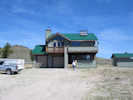
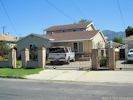 House that my dad build; 12956 Woodcock Street. House that my dad build; 12956 Woodcock Street.
|
House that my dad built: 12956 Woodcock Street, San Fernando. | |||||||||||||||||||||||||||||||||||||||||||||||||||||||||||||||||||||||||||||||||||||||||||||||||||||||||||||||||||||||||||||||||||||||||||||||||||||||||||||||||||||||||||||||||||||||||||||||||||||||||||||||||||||||||||||||||||||||||||||||||||||||||||||||||||||||||||||||||||||||||||||||||||||||||||||||||||||||||||||||||||||||||||||||||||||||||||||||||||||||||||||||||||||||||||||||||||||||||||||||||||||||||||||||||||||||||||||||||||||||||||||||||||||||||||||||||||||||||||||||||||||||||||||||||||||||||||||||||||||||||||||||||||||||||||||||||||||||||||||||||||||||||||||||||||||||||||||||||||||||||||||||||||||||
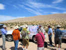
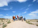
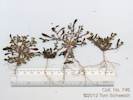
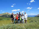
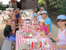
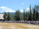
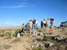
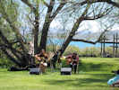
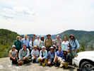 Participants in the 2011 Mimulus workshop Participants in the 2011 Mimulus workshop
|
Group Photo | |||||||||||||||||||||||||||||||||||||||||||||||||||||||||||||||||||||||||||||||||||||||||||||||||||||||||||||||||||||||||||||||||||||||||||||||||||||||||||||||||||||||||||||||||||||||||||||||||||||||||||||||||||||||||||||||||||||||||||||||||||||||||||||||||||||||||||||||||||||||||||||||||||||||||||||||||||||||||||||||||||||||||||||||||||||||||||||||||||||||||||||||||||||||||||||||||||||||||||||||||||||||||||||||||||||||||||||||||||||||||||||||||||||||||||||||||||||||||||||||||||||||||||||||||||||||||||||||||||||||||||||||||||||||||||||||||||||||||||||||||||||||||||||||||||||||||||||||||||||||||||||||||||||||
|
Other articles:
|
2 June 2011 | |||||||||||||||||||||||||||||||||||||||||||||||||||||||||||||||||||||||||||||||||||||||||||||||||||||||||||||||||||||||||||||||||||||||||||||||||||||||||||||||||||||||||||||||||||||||||||||||||||||||||||||||||||||||||||||||||||||||||||||||||||||||||||||||||||||||||||||||||||||||||||||||||||||||||||||||||||||||||||||||||||||||||||||||||||||||||||||||||||||||||||||||||||||||||||||||||||||||||||||||||||||||||||||||||||||||||||||||||||||||||||||||||||||||||||||||||||||||||||||||||||||||||||||||||||||||||||||||||||||||||||||||||||||||||||||||||||||||||||||||||||||||||||||||||||||||||||||||||||||||||||||||||||||||
|
|
Tuesday, June 14th | |||||||||||||||||||||||||||||||||||||||||||||||||||||||||||||||||||||||||||||||||||||||||||||||||||||||||||||||||||||||||||||||||||||||||||||||||||||||||||||||||||||||||||||||||||||||||||||||||||||||||||||||||||||||||||||||||||||||||||||||||||||||||||||||||||||||||||||||||||||||||||||||||||||||||||||||||||||||||||||||||||||||||||||||||||||||||||||||||||||||||||||||||||||||||||||||||||||||||||||||||||||||||||||||||||||||||||||||||||||||||||||||||||||||||||||||||||||||||||||||||||||||||||||||||||||||||||||||||||||||||||||||||||||||||||||||||||||||||||||||||||||||||||||||||||||||||||||||||||||||||||||||||||||||
|
Other articles:
Locations:
Mono Diggins.
|
| |||||||||||||||||||||||||||||||||||||||||||||||||||||||||||||||||||||||||||||||||||||||||||||||||||||||||||||||||||||||||||||||||||||||||||||||||||||||||||||||||||||||||||||||||||||||||||||||||||||||||||||||||||||||||||||||||||||||||||||||||||||||||||||||||||||||||||||||||||||||||||||||||||||||||||||||||||||||||||||||||||||||||||||||||||||||||||||||||||||||||||||||||||||||||||||||||||||||||||||||||||||||||||||||||||||||||||||||||||||||||||||||||||||||||||||||||||||||||||||||||||||||||||||||||||||||||||||||||||||||||||||||||||||||||||||||||||||||||||||||||||||||||||||||||||||||||||||||||||||||||||||||||||||||
|
Other articles:
Locations:
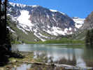
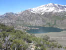
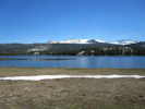
Grant Lake.
|
| |||||||||||||||||||||||||||||||||||||||||||||||||||||||||||||||||||||||||||||||||||||||||||||||||||||||||||||||||||||||||||||||||||||||||||||||||||||||||||||||||||||||||||||||||||||||||||||||||||||||||||||||||||||||||||||||||||||||||||||||||||||||||||||||||||||||||||||||||||||||||||||||||||||||||||||||||||||||||||||||||||||||||||||||||||||||||||||||||||||||||||||||||||||||||||||||||||||||||||||||||||||||||||||||||||||||||||||||||||||||||||||||||||||||||||||||||||||||||||||||||||||||||||||||||||||||||||||||||||||||||||||||||||||||||||||||||||||||||||||||||||||||||||||||||||||||||||||||||||||||||||||||||||||||
|
|
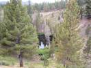
Wednesday, June 15th | |||||||||||||||||||||||||||||||||||||||||||||||||||||||||||||||||||||||||||||||||||||||||||||||||||||||||||||||||||||||||||||||||||||||||||||||||||||||||||||||||||||||||||||||||||||||||||||||||||||||||||||||||||||||||||||||||||||||||||||||||||||||||||||||||||||||||||||||||||||||||||||||||||||||||||||||||||||||||||||||||||||||||||||||||||||||||||||||||||||||||||||||||||||||||||||||||||||||||||||||||||||||||||||||||||||||||||||||||||||||||||||||||||||||||||||||||||||||||||||||||||||||||||||||||||||||||||||||||||||||||||||||||||||||||||||||||||||||||||||||||||||||||||||||||||||||||||||||||||||||||||||||||||||||
|
Other articles:
Locations:
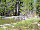
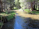
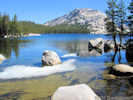
Rush Creek.
|
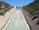
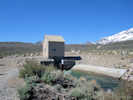
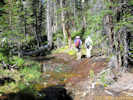
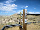
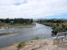
Visit to the Rush Creek return ditch gatehouse. | |||||||||||||||||||||||||||||||||||||||||||||||||||||||||||||||||||||||||||||||||||||||||||||||||||||||||||||||||||||||||||||||||||||||||||||||||||||||||||||||||||||||||||||||||||||||||||||||||||||||||||||||||||||||||||||||||||||||||||||||||||||||||||||||||||||||||||||||||||||||||||||||||||||||||||||||||||||||||||||||||||||||||||||||||||||||||||||||||||||||||||||||||||||||||||||||||||||||||||||||||||||||||||||||||||||||||||||||||||||||||||||||||||||||||||||||||||||||||||||||||||||||||||||||||||||||||||||||||||||||||||||||||||||||||||||||||||||||||||||||||||||||||||||||||||||||||||||||||||||||||||||||||||||||
|
Other articles:
Locations:
Pumice Valley.
|
|
Other articles:
|
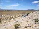
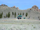
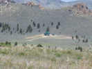
Stop at West Portal, not much to see here.
|
|
|
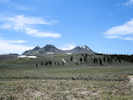
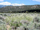
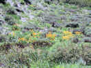
(37,86963, -119.07834) Bitterbrush dominant, Sagebrush, Two-colored Phacelia, Ground Smoke, Crinkle Mat, Mentzelia, Ericameria nauseosus.
|
|
Other articles:
|
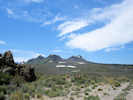
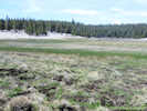
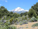
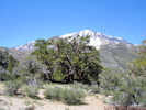
View across the Aeolian Buttes to Mt. Gibb.
|
|
Other articles:
|
Rocks by aqueduct road, with Bitterbrush, Ericameria nauseosus (blue-green), Chrysothamnus viscidiflorus (with a twist), and lesser amounts of Sagebrush.
|
|
Other articles:
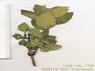
744
|
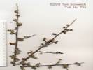
Prunus emarginata (Douglas) Eaton. Bitter Cherry.
| Aeolian Buttes, Mono County, California. Around rocks on northeast side of Aeolian Buttes, just above the Aqueduct Road. 37.8661°N, 119.0743°W. WGS 1984 Elev. 6990 ft. Approximately six plants in a small area. Coll. No. 744, 7 Jan 2012, characters observed while keying: Perennial, woody, erect shrub; Twigs with a terminal bud; Leaves alternate, in clusters, simple, entire, obovate, veins pinnate, gland-toothed; Infloresence a short (20 mm) raceme (not an umbel); Sepal entire (not gland-toothed); Flowers 6-8; Hypanthium urn-shaped, slightly narrowed at top; Ovary superior, 2 mm, glabrous; Style 1, 5 mm, linear (not tapered); Pistil 1; Stamens many (obs: 25); and Fruit glabrous.
|
Other articles:
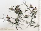
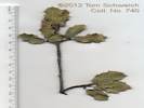
745
|
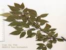
Ribes cereum Douglas var. cereum . Wax Currant.
| Aeolian Buttes, Mono County, California. Around rocks on northeast side of Aeolian Buttes, just above the Aqueduct Road, about 1 mile east of US Highway 395. 37.8661°N, 119.0743°W. WGS 1984. Elev. 6990 ft. Approximately four large-size plants in this area.
Coll. No. 745, 7 Jan 2012, characters observed while keying: Perennial, woody, erect shrub; Nodal spines 0; Bract tip truncate; Sepals white-greem, 6 mm; Hypanthium tube-shaped, clearly exceeding the ovary, > 2 × longer than wide; Style glabrous (expected to be hairy); and Anther tip rounded with a cup-like depression.
|
Other articles:
Locations:
Pumice Valley.
|
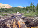
Drove through the burned area near Mono Craters in Pumice Valley. This area burned in the Mono Craters fire of July 25-27, 2010.
|
|
Other articles:
|
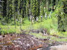
Edge of burned area (37.90466, -119.04371, 6885 ft.), also here: Gayophytum, Tiquilia (sterile), and more Sagebrush than Bitterbrush.
|
|
Other articles:
746
|
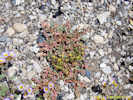
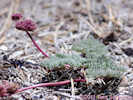
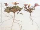
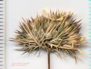
Calyptridium roseum Rosy Pussy Paws.
| Pumice Valley, Mono County, California. Pumice flats near the north end of Mono Craters, just south of California Highway 120 on Inyo Forest Road 1N11, 3 miles northeast of US Highway 395. 37.9047°N, 119.0437°W. WGS 1984. Elev. 6885 ft. Found on the edge of an area that burned July 26-27, 2010. Coll. No. 746, 8 Jan 2012, characters observed while keying: Annual; Leaves fleshy; Flowers on pedicels, 1-3 mm; Sepals2; Petals 2, white; Stamen 1; Anther yellow (TJM keys will say rose to pink, but they look yellow to me); Style absent; Stigma sessile; Capsule oblong.
|
Other articles:
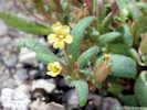
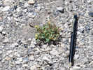
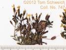
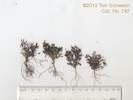
747
|
|
Pumice Valley, Mono County, California. Pumice flats near the north end of Mono Craters, just south of California Highway 120 on Inyo Forest Road 1N11, 3 miles northeast of US Highway 395. 37.9047°N, 119.0437°W. WGS 1984. Elev. 2105 m. Very small and yellow, growing adjacent to the more common magenta flowered M. nanus var. mephiticus. Found on the edge of an area that burned July 26-27, 2010. Mature material is Coll. No. 799, made at the same location, 11 Sep 2011. 15 June 2011:
Coll. No. 747, 15 Jan 2012, characters observed while keying: Annual; Pedicels 4-7 mm (4.0, 5.0, 5.0, 6.0, 7.0), > calyx; Calyx 2.5-3.5 mm (2.5, 3.0, 3.0, 3.5, 3.5), puberulent, slightly inflated in fruit, lobes equal, < tube, rounded, glabrous; Corolla 2-3 mm, limb 2 mm, single color, yellow, one or more red spots.
|
Other articles:
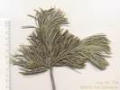
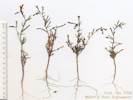
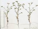
748
|
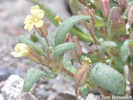
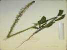
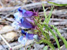
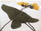
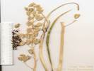
Phacelia bicolor Torr. ex S. Watson var. bicolor. Two-Color Phacelia.
| Pumice Valley, Mono County, California. Pumice flats near the north end of Mono Craters, just south of California Highway 120 on Inyo Forest Road 1N11, 3 miles northeast of US Highway 395. 37.9047°N, 119.0437°W. WGS 1984. Elev. 6885 ft. Found on the edge of an area that burned July 26-27, 2010. Coll. No. 748, 16 Jan 2012, characters observed while keying: Annual of widely varying sizes, generally less than 2 dm.; Stem sometimes branched at base, decumbent to erect, sparsely glandular hairy; Leaf ovate in outline, to 2 cm, odd pinnate; Leaflets toothed to 2°-pinnate; Pedicels 1-2 mm, glandular hairy; Bracts strap-like, 5 mm, glandular hairy; Corolla 13 mm x 8-10 mm wide, deciduous, tube yellow, lobes blue; Stamens 6 mm; Filaments few small hairs near base, but are glabrous rather than the expected puberulent; Ovary bristly near top; Style 4 mm, small straight hairy rather than the expected puberulent.
|
Literature Cited:
Other articles:
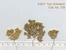
749
|
|
Pumice Valley, Mono County, California. Pumice flats near the north end of Mono Craters, just south of California Highway 120 on Inyo Forest Road 1N11, 3 miles northeast of US Highway 395. 37.9047°N, 119.0437°W. WGS 1984. Elev. 6885 ft. Found on the edge of an area that burned July 26-27, 2010. Coll. No. 749, 16 Jan 2012, characters observed while keying: Annual to 15 cm; Stem light-colored (dark when dry); Leaves to 10 cm, linear, pinnately lobed; Floral bracts 3 to 5-toothed, white base, green margin, not concealing fruit; Petals yellow, orange at base; Style 2 mm; Fruit 8 mm x 2-3 mm wide, not curved; Seeds in more than one row above the mid-fruit; Elevation 2100 m. Originally determined as Mentzelia albicaulis. However, using Brokaw (2011), keys to M. montana because floral bracts have 3-5 teeth, the relatively small white patch on the floral bracts, and the relatively small (8-10 mm), straight fruit.
|
Other articles:
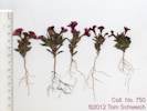
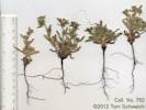
750
|
Mimulus nanus Hook. & Arn. var. nanus. Dwarf Purple Monkey Flower.
| Pumice Valley, Mono County, California. Pumice flats near the north end of Mono Craters, just south of California Highway 120 on Inyo Forest Road 1N11, 3 miles northeast of US Highway 395. 37.9047°N, 119.0437°W. WGS 1984. Elev. 6885 ft. Found on the edge of an area that burned July 26-27, 2010. Most collections at this locality are determined as var. mephiticus, but short lengths of hairs on leaves and calyces of this collection are strongly suggestive of var. nanus. Coll. No. 750, 16 Jan 2012, characters observed while keying: Annual 4-5 cm; Flower nodes with 2 flowers; Leaves puberulent, tip rounded, gland tipped hairs 0.1-0.2 mm mostly along margins; Pedicel 2-3 mm; Calyx 7 mm., gland tipped hairs 0.1-0.2 mm; Corolla bilateral, tube throat 12-15 mm., externally glabrous; Anthers ciliate; Stigma at end of corolla tube throat, > stamens, edges ciliate; Fruit fragile (definitely not hard).
|
|
Intersection of 1S03 (37.88897, -119.04247, 6990 ft.), primarily Bitterbrush, some Sagebrush, two Eriogonum (spergulinum and one more, maybe baileyi).
|
|
Other articles:
|
End of Road
|
|
Other articles:
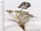
751
|
Lupinus duranii Eastw. Mono Lake Lupine.
| Pumice Valley, Mono County, California. West base of Mono Craters at end of Inyo Forest Road 1S18, 4 air miles east of the south intersection of US Highway 395 and California Highway 120. 37.8832°N, 119.018°W. WGS 1984. Elev. 2287 m. Open volcanic sand flats with a significant western exposure may account for the relatively small dimensions of this collection.
Originally assumed to be L. duranii when collected. Could be determined as L. breweri on the basis of smaller stipules, petioles, pedicels and flowers than typically seen in L. duranii. However, given the west-facing sand slope on which this collection was made, I am assuming it is just a small L. duranii.
|
Other articles:
752
|
Calyptridium umbellatum (Torr.) Greene.
| Pumice Valley, Mono County, California. West base of Mono Craters at end of Inyo Forest Road 1S09, 4 air miles east of the south intersection of US Highway 395 and California Highway 120. 37.8832°N, 119.018°W. WGS 1984. Elev. 2287 m. Inflorescence terminal.
|
Other articles:
753
|
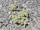
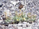
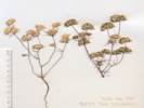
Cryptantha confertiflora (Greene) Payson. Basin Yellow Cryptantha.
| Pumice Valley, Mono County, California. West base of Mono Craters at end of Inyo Forest Road 1S09, 4 air miles east of the south intersection of US Highway 395 and California Highway 120. 37.8832°N, 119.018°W. WGS 1984. Elev. 2287 m. Large yellow.
|
Other articles:
|
Started back down the road into the valley.
|
|
Other articles:
|
|
|
Other articles:
|
Abronia turbinata in bud. (37.83923, -119.03487, 7426 ft.)
|
|
Other articles:
|
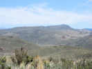
View down 1S38 (northwest) to Warren Bench.
|
|
Other articles:
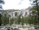
Locations:
Bald Mountain.
Punch Bowl.
|
|
|
|
| Thursday, June 16th
|
Other articles:
|
Took the 120 Cut-Off to Sagehen Meadow.
|
|
Other articles:
Locations:
Sagehen Meadow.
Sagehen Peak.
|
|
|
Other articles:
Locations:
Sagehen Meadow.
|
|
|
Other articles:
|
I was a little upset when we had to clear the brush from private property for 200 feet around the house. However, from this perspective, it doesn't look so bad.
|
|
Other articles:
|
At Crooked Meadows in mid-June, there were no flowers yet.
|
|
Other articles:
754
|
|
|
Other articles:
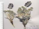
755
|
Eatonella nivea (D.C.Eaton) A. Gray. Approximately 0.7 mi east on Forest Road 1N23 from California Highway 120. Northeast flank of a gravel pit.
|
|
Other articles:
747
|
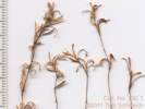
Mimulus suksdorfii growing with Calyptridium roseum and Phacelia bicolor at the boundary of the burned area.
|
|
Other articles:
Locations:
Parker Lake.
|
|
|
Other articles:
Locations:
Parker Creek.
|
Parker Creek, just below Parker Lake
|
|
|
| Saturday, June 18th
|
|
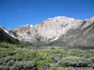
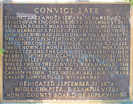
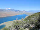
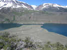
Field trip to Convict Lake with Cathy Rose.
|
|
Other articles:
Locations:
Punch Bowl.
|
Used Forest Road 01S126 to access the Punch Bowl.
|
|
Other articles:
Locations: Punch Bowl.
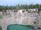
756
|
Calyptridium umbellatum, I thought maybe this was C. monospermum until I got it out of the ground.
| Calyptridium umbellatum (Torr.) Greene. Punch Bowl, Mono County, California. On one of the more level sand flats among the explosion pits and domes 0.75 km northeast of the explosion pit commonly called the Punch Bowl. 37.8196°N, 119.0208°W. WGS 1984. Elev. 2343 m.
|
Other articles:
Locations:
Punch Bowl.
757
|
Galium multiflorum, determination tentative, sterile collection.
| Galium multiflorum Kellogg. Many-Flower Bedstraw. Punch Bowl, Mono County, California. Growing around rocks in Jeffrey pine needles in a small valley between two plug domes, 0.6 km northeast of the Punch Bowl. 37.8194°N, 119.0233°W. WGS 1984. Elev. 2353 m. Determination tentative, sterile and juvenile collection. Collection discarded.
|
Other articles:
Locations:
Punch Bowl.
758
|
Chaemabataria millifolium (Torr.) Maxim. Desert Sweet.
| Punch Bowl, Mono County, California. On loose talus slopes in narrow defile between rhyolite plug domes, 0.6 km northeast of Punch Bowl. 37.8191°N, 119.0229°W. WGS 1984. Elev. 2353 m. Sterile collection. No buds forming yet.
|
Other articles:
Locations:
Convict Lake.
Laurel Mountain.
|
|
|
Other articles:
Locations:
Convict Lake.
|
|
|
|
| Sunday, June 19th
|
Other articles:
Locations:
Dunderberg Peak.
|
|
|
Other articles:
759
|
Camissonia parvula (Torr. & A. Gray) P. H. Raven. Lewis River Suncup.
| Mono Lake basin, Mono County, California. Along Goat Ranch Road, 3.25 miles east northeast of the intersection of US Highway 395 and California Highway 167 (sometimes called Pole Line Road). 38.0647°N, 119.1064°W. WGS 1984. Elev. 2057 m. With Pinyons (no Junipers), Sagebrush, Bitterbrush, and Ephedra, in the mixed sandy and rocky ground where the foot of the Bodie Hills meets the Mono Dunes. Coll. No. 759, 18 Jan 2012, characters observed while keying: Annual rosette not present; Leaf linear, to 2 cm., margin wavy to lightly dentate; Infloresence nodding; Sepals 3 (3.5) mm., separating at anthesis, not joined at tip; Petals 4, yellow, 4 mm x 2 mm wide; Anthers extend to base of stigma (TJDM & TJM2 keys state anthers surround stigma, but I don't see them that high); Style 2 mm.; Stigma spheric,to 1.5 mm dia.; and Capsule sessile.
|
Other articles:
760
|
Oenothera cespitosa Nutt. ssp. marginata (Hook. & Arn.) Munz. Tufted Evening Primrose.
| Mono Basin, Mono County, California. Along Goat Ranch Road, 3.25 miles east northeast of the intersection of US Highway 395 and California Highway 167 (sometimes called Pole Line Road). 38.0643°N, 119.1065°W. WGS 1984. Elev. 2054 m. With Pinyons (no Junipers), Sagebrush, Bitterbrush, and Ephedra, in the mixed sandy and rocky ground where the foot of the Bodie Hills meets the Mono Dunes. Coll. No. 760, 18 Jan 2012, characters observed while keying: Perennial, to 10 cm.; Buds erect (not nodding); Petals 4, 25 mm., white, fading to red-purple; Stamens 8; Stigma 4; Fruit 25 mm., stalk-like base absent, slightly s-shaped, weakly ovate (not appearing cylindric); Seed 2 mm., cavity margin entire.
|
Other articles:
761
|
Cryptantha watsonii (A. Gray) Greene. Watson's Cryptantha.
| Mono Lake basin, Mono County, California. Along Goat Ranch Road, 3.25 miles east northeast of the intersection of US Highway 395 and California Highway 167 (sometimes called Pole Line Road). 38.0644°N, 119.1066°W. WGS 1984. Elev. 2061 m. With Pinyons (no Junipers), Sagebrush, Bitterbrush, and Ephedra, in the mixed sandy and rocky ground where the foot of the Bodie Hills meets the Mono Dunes. One of three Cryptanthas collected at this location. Coll. No. 761, 19 Jan 2012, characters observed while keying: Annual 20-40 cm, generally taller than wide; Leaf 12-40 mm, linear; Bracts present; Calyx lobes 3 mm, hairs straight not hooked, lobe tip bristles straight; Corolla limb quite small (1-2 mm); Nutlets 4, approximately equal size, smooth, scar centered, extends to tip.
|
Other articles:
762
|
Cryptantha micrantha (Torr.) I. M. Johnst. var. micrantha Redroot Cryptantha.
| Mono Basin, Mono County, California. Along Goat Ranch Road, 3.25 miles east northeast of the intersection of US Highway 395 and California Highway 167 (sometimes called Pole Line Road). 38.0644°N, 119.1066°W. WGS 1984. With Pinyons (no Junipers), Sagebrush, Bitterbrush, and Ephedra, in the mixed sandy and rocky ground where the foot of the Bodie Hills meets the Mono Dunes. One of three Cryptanthas collected at this location. Coll. No. 762, 19 Jan 2012, characters observed while keying: Annual root red-purple, staining; Calyx not circumscissile; Corolla limb 2-3 mm when dry, appendages minute, persistent.
|
Other articles:
763
|
Cryptantha circumscissa (Hook. & Arn.) I. M. Johnst. Var. circumscissa. Cushion Cryptantha.
| Mono Basin, Mono County, California. Along Goat Ranch Road, 3.25 miles east northeast of the intersection of US Highway 395 and California Highway 167 (sometimes called Pole Line Road). 38.0644°N, 119.1066°W. WGS 1984. Elev. 2061 m. With Pinyons (no Junipers), Sagebrush, Bitterbrush, and Ephedra, in the mixed sandy and rocky ground where the foot of the Bodie Hills meets the Mono Dunes. One of three Cryptanthas collected at this location. Coll. No. 763, 19 Jan 2012, characters observed while keying: Annual 2-5 cm, generally wider than tall, root reddish but not staining; LeafBracts present; Calyx circumscissile; Corolla white, limb 2 mm when dry.
|
Other articles:
764.1
|
Chaenactis douglasii (Hook.) Hook. & Arn. var. douglasii. Along Goat Ranch Road, 3.25 miles east northeast of the intersection of US Highway 395 and California Highway 167 (sometimes called Pole Line Road). With Pinyons (no Junipers), Sagebrush, Bitterbrush, and Ephedra, in the mixed sandy and rocky ground where the foot of the Bodie Hills meets the Mono Dunes. 6/19/2011 Mono Lake basin, Mono County, California. | Coll. No. 764.1, 20 Jan 2012, characters observed while keying: Annual, maybe biennial, not thistle-like, not scapose, proximal hairs cobwebby; Leaves basal and cauline, deeply lobed, margins rolled (i.e., leaf blade not flat); Heads 20+; Receptacle not chaffy; Phyllaries in 2+ series, 7-9 mm x 2 mm wide; Flowers yellow, no ray flowers; Achenes pappus of scales, one series, not awl-shaped.
|
Other articles:
Locations:
Hector Station.
764
|
|
Hector Station, Mono County, California. On Goat Ranch Road, 5.3 miles by road east north east of the intersection of US Highway 395 and California Highway 167 (Pole Line Road). 38.0829°N, 119.0852°W. WGS 1984. Elev. 2058 m. Coll. No. 764, 20 Jan 2012, characters observed while keying: Annual terrestrial; Stem solid throughout, glabrous; Leaves basal clasping, petioles not ciliate, mid-cauline 4-6 cm, dentate, petioled 3-4 cm; Pedicels mostly straight, few upcurved; Sepals ±erect; Petals 7 mm, white, oblanceolate (between linear and spoon-shaped); Stamens 6, equal, exserted; Anthers coiled in maturity; Ovary stalk above receptacle distinct in flower; Fruit spreading. Distinguished from Streptanthus and Caulanthus because stamens are exserted, and ovary stalk above receptacle distinct in flower.
|
Other articles:
765
|
Distichlis spicata (L.) E. Greene. Saltgrass.
| Bridgeport Canyon, Mono County, California. On Goat Ranch Road, 5.3 miles by road east north east of the intersection of US Highway 395 and California Highway 167 (Pole Line Road). 38.0829°N, 119.0851°W. WGS 1984. Elev. 2057 m. Sterile collection. The dimorphism represents male and female stems. I spent a lot of time digging this collection out, to determine whether the similar grass culms were part of the same plant. This collection showed that it is so. However, it is a sterile collections, so I discarded it. My collection no. 839, made at Sulphur Pond, has good male and female flowers.
|
Other articles:
766
|
Linanthus inyoensis (I. M. Johnst.) J. M. Porter & L. A. Johnson.
| Bridgeport Canyon, Mono County, California. Top of small ridge to west of Coyote Springs Road, 0.8 miles north northwest from Goat Ranch Road, 9.8 miles by road northeast from the intersection of US Highway 395 and California Highway 167, by way of Cottonwood Canyon Road. 38.1092°N, 119.0653°W. WGS 1984. Elev. 2119 m. In the field determined as Gilia inyoensis and described as follows: two opposite leaves below with a bud in the axils so I don't think these two leaves were cotelydons, alternate leaves above, entire, thichomes glandular, corolla white, stamens barely exserted, pollen yellow. Coll. No. 766, 20 Jan 2012, characters observed while keying: Annual, to 3 cm; Stem thread-like; Leaves basal opposite, cauline alternate; Infloresence in loose racemes; Pedicels 1-2 mm; Calyx 2.5 mm, membranous, rupturing as capsule matures, sparse gland-dotted hairs; Flowers 5 mm, 2 x calyx, (interior of flower glabrous, no pubesence or rings of hairs); Corolla funnel-form, 5 mm, tube and limb roughly equal; Stamens 5, equally inserted; Filament bases hard to see, but nothing hairy visible at base of flower; Pollen yellow.
|
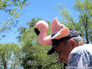 Added this flamingo to my life list at the Mono Lake Picnic. Added this flamingo to my life list at the Mono Lake Picnic.
 Singer-songwriters Keith Greeninger and Dayan Kai sing at the Mono Lake Chautauqua picnic. Singer-songwriters Keith Greeninger and Dayan Kai sing at the Mono Lake Chautauqua picnic.
|
Mono Lake Picnic. Singer-songwriters Keith Greeninger and Dayan Kai treated the audience to several hours of great music, and I added this flamingo to my life list.
|
|
|
| Monday, June 20th
|
Other articles:
Locations:
Copper Mountain.
|
|
|
Other articles:
Locations:
Copper Mountain.
Mill Creek Powerhouse.
|
|
|
Other articles:
|
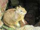
Stopped here to look for plants to collect. Found this fawn instead. It didn't move a muscle, except for breathing. Took its photo, and went somewhere else to collect. One of those magic moments that happen now and then.
|
|
Other articles:
|
Cheryl reads her book while I botanize. Photograph taken last day of Spring, June 20, 2011, high on the Horseshoe Canyon Moraine above Grant Lake. Mt. Wood in the background.
|
|
Other articles:
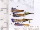
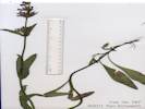
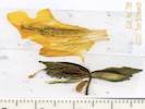
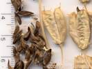
767
|
Astragalus whitneyi A. Gray var. whitneyi. Balloonpod Milkvetch.
| Field description notes, upright plant, pink flowers, red mottling visible on very young pods. Horseshoe Canyon Moraine, Mono County, California. On the ridge of Horseshoe Canyon Moraine overlooking Grant Lake, 1.4 miles south of the Rush Creek Return Ditch Gatehouse on Forest Road 1S104. 37.8427°N, 119.098°W. WGS 1984. Elev. 2356 m. Coll. No. 767, 20 Jan 2012, characters observed while keying: Perennial not densely hairy; Stipules connate into a sheath; Leaf hairs simple, appressed; Leaflets of mid-cauline leaves < 23 (Obs: 11, 13, 17), not spiny; Pedicel 1 mm; Calyx 5 mm, base symmetric, pedicel attached ±middle; Fruit young glabrous and stipitate (has a stalk), red mottling visible on very young pods.
|
Other articles:
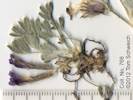
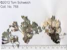
768
|
|
Horseshoe Canyon Moraine, Mono County, California. On the ridge of Horseshoe Canyon Moraine overlooking Grant Lake, 1.4 miles south of the Rush Creek Return Ditch Gatehouse on Forest Road 1S104. 37.8427°N, 119.098°W. WGS 1984. Elev. 2356 m. Coll. No. 768, 22 Jan 2012, characters observed while keying: Perennial to 5 cm, generally of GB, rather than D, or CA-FP; Caudex base beset with old leaf bases; Pubesence simple, attached at basal end (rather than middle); Leaves bases persistent; Stipules not connate into a sheath; Leaflets 5, 3 mm wide, not spine-tipped, terminal leaflet jounted to mid-rib; Flowers pink-purple; Pods pubescent, obscuring pod surface, trichomes long wavy (maybe varying in length, but unable to distinguish separate short and long hairs).
|
Other articles:
769
|
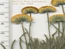
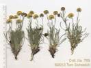
Erigeron aphanactis (A. Gray) Greene var. aphanactis. Rayless Shaggy Fleabane.
| Horseshoe Canyon Moraine, Mono County, California. On the ridge of Horseshoe Canyon Moraine overlooking Grant Lake, 1.4 miles south of the Rush Creek Return Ditch Gatehouse on Forest Road 1S104. 37.8427°N, 119.098°W. WS 1984. Elev. 2354 m. Coll. No. 769, 22 Jan 2012, characters observed while keying: Perennial herb to 10 cm; Stem branched in proximal 1/2; Leaves entire, cauline reduced; Inforesence 1-few-flowered; Phyllaries in 2 series, 5 mm x 1 mm wide, hairy, not enfolding marginal achenes, margins white (scarious), tips green to brown (not black); Flowers rays absent, disk flowers yellow; Achenes with a pappus of 12± bristles.
|
Other articles:
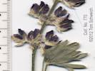
770
|
Lupinus argenteus var. montigenus
cauline leaves plentiful, calyx spur or bulge > 1 mm, banner back hairy, keel ciliate middle to distal end.
| Horseshoe Canyon Moraine, Mono County, California. On the ridge of Horseshoe Canyon Moraine overlooking Grant Lake, 1.4 miles south of the Rush Creek Return Ditch Gatehouse on Forest Road 1S104. 37.8426°N, 119.0979°W. WGS 1984. Elev. 2357 m. Coll. No. 770, 22 Jan 2012, characters observed while keying: Perennial herb; Leaves basal ?, cauline leaves plentiful, petioles 5-8 cm; Leaflets 7 to 3 cm x 1 cm wide, hairs straight appressed, Calyx definitely bulged, but <= 1 mm; Flower to 10 mm; Banner back hairy; Keel strongly ciliate distal end, few cilia proximal end; Style persistent; Pods hairy, 1 cm (but may not be mature).
|
Other articles:
|
|
|
Other articles:
|
We came down the steep inner face of the moraine. I could probably go back up this, but would rather not with the camper on the back of the truck.
|
|
Other articles:
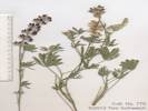
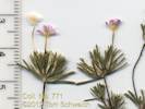
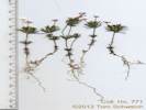
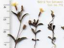
771
|
|
Coll. No. 771, 22 Jan 2012, characters observed while keying: Annual 6-7 cm; Leaves cauline palmately lobed; Flowers in dense bracted heads; Bracts membrane to 1 mm wide compared to bract width 0.5 mm, white ciliate; Corolla salverform, tume 10-15 mm, long exserted, limb 6 mm, throat yellow, lobes lavender.
|
Other articles:
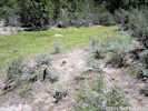
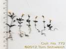
772
|
|
Grant Lake Overlook, Mono County, California. On the dry sandy edge of a small meadow below Inyo Forest Road 01S31B, about 400 m northeast of Grant Lake Overlook, 2.9 miles south of the Rush Creek Return Ditch Gatehouse. 37.821°N, 119.1024°W. WGS 1984. Elev. 2322 m.
|
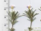
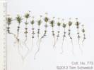
Other articles:
773
|
|
Horseshoe Canyon Moraine, Mono County, California. In a forest opening on both sides of Inyo Forest Road 01S31 at the northeast base of Reversed Peak. 37.8132°N, 119.0963°W. WGS 1984. Elev. 2516 m.
|
 Coll. No. 774, Gilia brecciarum ssp. brecciarum Coll. No. 774, Gilia brecciarum ssp. brecciarum
 Coll. No. 774, Gilia brecciarum var. brecciarum Coll. No. 774, Gilia brecciarum var. brecciarum
774
|
| Gilia brecciarum M. E. Jones ssp. brecciarum. Nevada Gilia. Horseshoe Canyon Moraine, Mono County, California. Between lateral moraines on Inyo Forest Road 01S31, 1.8 miles north of Reversed Peak, and 2.2 miles south of the Rush Creek Return Ditch Gatehouse. 37.8303°N, 119.0964°W. WGS 1984. Elev. 2367 m. Coll. No. 774, 23 Jan 2012, characters observed while keying: Annual 10-20 cm; Stem scapose (as opposed to leafy); Leaves basal 25 mm x 7 mm wide, deeply pinnately lobed, lobes pointed but not bristly, petiole winged, cobwebby hairs, not glandular, cauline reduced above, 6 mm, alternate, expanded at base, with glandular trichomes and few hairs; Infloresence open; Flowers in heads of 2-3; Calyx lobes equal, membranous between the segments; Corolla long funnelform not quite salverform, 10 mm, 2 x calyx, throat yellow, wider than tube, exserted from calyx, lobes < tube, pink at center to purple at edges; Seeds > 1 / chamber, gelatinous when wet. Difficult to key, various keys will easily go to Aliciella leptomeria and Allophyllum giliodes, but repeated careful working led to Gilia brecciarum. Makes me think that all the collections of these three taxa in the Mono Lake basin should be reviewed.
|
Other articles:
775
|
|
Horseshoe Canyon Moraine, Mono County, California. Between lateral moraines on Inyo Forest Road 01S31 “Reversed Peak:rdquo; road, 1.5 miles south of the Rush Creek Return Ditch Gatehouse, and 2.6 miles north of Reversed Peak. 37.8412°N, 119.0923°W. WGS 1984. Elev. 2314 m. Coll. No. 775, 23 Jan 2012, characters observed while keying: Perennial herb Leaves with sheathing bases, 4° pinnate compund; Infloresence umbellate; Bracts 0 Bractlets present, glabrous; Fruit not sufficiently developed to key.
|
 Coll. No. 776, Viola purpurea var. aurea Coll. No. 776, Viola purpurea var. aurea
776
|
Viola purpurea Kellogg ssp. aurea (Kellogg) J.C. Clausen. Goosefoot Viola.
| Horseshoe Canyon Moraine, Mono County, California. Between lateral moraines on Inyo Forest Road 01S31, 1.5 miles south of the Rush Creek Return Ditch Gatehouse, and 2.6 miles north of Reversed Peak. 37.8413°N, 119.0924°W. WGS 1984. Elev. 2307 m. Coll. No. 776, 23 Jan 2012, characters observed while keying; Perennial to 8 cm; Leaves entire and slightly toothed, basal, cauline, borne on short stems, glabrous adaxially, tomentose abaxially; Flowers yellow. Keys give option of tomentose or not, irrespective of which side of the leaf, and the few photos of V. aurea show tomentum on both sides of leaf. Perhaps the common name results from the shape of leaves resembling some leaves in Chenopodium.
|
|
| Tuesday, June 21stToday we did some plant hunting with Cathy Rose.
|
Other articles:
617
|
Stopped to see the Yellow Spinecape near Benton Crossing.
|
|
Other articles:
|
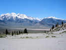
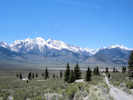
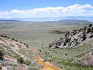
View across Long Valley.
|
|
Other articles:
|
|
|
Other articles:
|
Locality of Eatonella nivea at Poles 205-7853E and 205-7854E.
|
|
|
| Wednesday, June 22nd
|
Other articles:
777
|
|
Jordan, Mono County, California. Alluvial fans at base of Copper Mountain, 0.5 mile north of Jordan, 0.7 mile west of the intersection of US Highway 395 and Mill Creek Powerhouse Road. 38.0481°N, 119.1765°W. WGS 1984. Elev. 2132 m.
|
Other articles:
778
|
Penstemon speciosus Royal Penstemon.
| Jordan, Mono County, California. Alluvial fans at base of Copper Mountain, 0.5 mile north of Jordan, 0.7 mile west of the intersection of US Highway 395 and Mill Creek Powerhouse Road. 38.0481°N, 119.1765°W. WGS 1984. Elev. 2139 m.
|
Other articles:
|
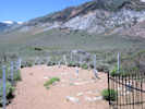
Cemetery
|
|
Other articles:
Locations:
Copper Mountain.
|
Mine
|
|
Other articles:
779
|
Cryptantha confertiflora (Greene) Payson. Basin Yellow Cryptantha. (Syn: Oreocarya confertifolia Greene, per Taylor (2010))
| Copper Mountain, Mono County, California. At the mine tunnel in a canyon of Copper Mountain, 1.1 miles west of the intersection of US Highway 395 and Mill Creek Powerhouse Road. 38.0505°N, 119.1845°W. WGS 1984. Elev. 2298 m.
|
 Coll. No. 780, Phacelia heterophylla ssp. virgata Coll. No. 780, Phacelia heterophylla ssp. virgata
780
|
Phacelia heterophylla Pursh subsp. virgata (Greene) Heckard. Varileaf Phacelia.
| Copper Mountain, Mono County, California. Above the mine tunnel in a canyon of Copper Mountain, 1.1 miles west of the intersection of US Highway 395 and Mill Creek Powerhouse Road. 38.0505°N, 119.1845°W. WGS 1984. Elev. 2299 m.
|
 Coll. No. 781, Ceanothus velutinus Coll. No. 781, Ceanothus velutinus
781
|
Ceanothus velutinus Dougl. ssp. velutinus. Snowbush Ceanothus.
| Copper Mountain, Mono County, California. In a limestone canyon of Copper Mountain, just below the mine tunnel, 1.1 miles west of the intersection of US Highway 395 and Mill Creek Powerhouse Road. 38.0505°N, 119.1836°W. WGS 1984. Elev. 2278 m. Coll. No. 781, 24 Jan 2012, characters observed while keying: Perennial shrub; Twigs not thorn-like; Leaves alternate, ovate, 6-7 cm, 3-ribbed from base, leathery, sticky glabrous adaxially, puberulent abaxially, margin serrate, teeth gland-tipped; Stipules scale-like; Petioles 10-17 mm; Flowers conspicuous, white; Petals 5.
|
Other articles:
782
|
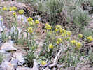
Balsamorhiza sagittata (Pursh) Nutt.
| Copper Mountain, Mono County, California. In a limestone canyon of Copper Mountain, just below the mine tunnel, 1.1 miles west of the intersection of US Highway 395 and Mill Creek Powerhouse Road. 38.0505°N, 119.1836°W. WGS 1984. Elev. 2281 m.
|
Other articles:
Locations:
Copper Mountain.
|
Mill Site
|
|
Other articles:
783
|
Astragalus cf. whitneyi. Not mature enough to reliably determine. Will have to go back another time and look for fruit.
| Astragalus whitneyi A. Gray var. whitneyi. Balloonpod Milkvetch. Copper Mountain, Mono County, California. On the access road to the canyon with the mill and mine dump, in the center and wet margin of the road, with water was running down one of the tire tracks; 0.85 mile west northwest of the intersection of US Highway 395 and Mill Creek Powerhouse Road. 38.053°N, 119.1786°W. WGS 1984. Elev. 2163 m. Coll. No. 783, 22 June 2011, characters observed while keying: Perennial herb, of Great Basin, to 30 cm., not obviously gland-dotted, sparse hairs of one kind; Leaf, 1-pinnate, leaflets 11-17, largest 18 mm. × 3 mm. wide, leaf main axis extending as a leaflet, terminal leaflet jointed to midrib, hairs simple, tip without gland; Stipules, free, not spiny, lower stipule sheaths fused around stem; Inflorescence, calyx and corolla conspicuous, flowers many (±12) in a head-like raceme; Calyx, base asymmetric but not strongly so, upper side not pouched; Sepals, fused 5 mm. + free 2 mm. = 7 mm.; Flowers, bilateral; Corolla, 13 mm., white to pink, banner 10 mm., wings ±=keel, keel lip rounded; Style tip and stigma glabrous; Fruit, not available.
|
Other articles:
|
Saw this sandpiper and two chicks in the streambed of Rattlesnake Gulch.
|
|
|
| June 23, 2011
|
|
|
|
Other articles:
Locations:
Lee Vining Canyon.
|
|
|
Other articles:
|
Snow around the recently opened Tioga Pass entrance station.
|
|
Other articles:
Locations:
Tuolumne Meadows.
|
High water in Tuolumne Meadow.
|
|
Other articles:
Locations:
Tenaya Lake.
|
Stopped at the usual picnic spot on the south side of Tenaya Lake. A little watery and icy.
|
|
Locations:
Morro Bay.
|
|
|
Locations:
San Juan Bautista.
|
|
|
Other articles:
|
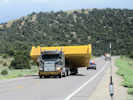
Mine dump truck bed being shipped on US Hwy 50.
|
|
Other articles:
|
|
|
Other articles:
|
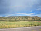
Rainbow just south of Scipio.
|
|
 Morrison Natural History Museum Morrison Natural History Museum
|
Morrison Natural History Museum
|
|
Other articles:
|
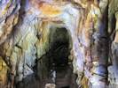
Lebanon Silver Mine Tour
|
|
Other articles:
Locations:
Burning Bear Campground.
|
|
|
Other articles:
Locations:
Guanella Pass.
|
|
|
Other articles:
|
|
|
Other articles:
Locations:
West Geneva Iron Deposit Mine.
|
|
|
Other articles:
Locations:
West Geneva Iron Deposit Mine.
|
At lower fen on Geneva Creek.
|
|
Other articles:
Locations:
West Geneva Iron Deposit Mine.
|
Another lower fen on Geneva Creek.
|
|
Other articles:
|
|
|
Other articles:
Locations:
Wind River Basin.
|
|
|
Other articles:
Locations:
Thermopolis.
|
|
|
 Squash Blossom Necklace Squash Blossom Necklace
|
Squash Blossom Necklace in the William Cody Museum, Cody, Wyoming.
|
|
Other articles:
Locations:
Sedge Creek.
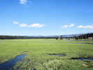
|
Sedge Creek beside Yellowstone Lake.
|
|
Other articles:
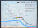
Locations:
Mud Volcano.
|
|
|
Other articles:
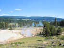
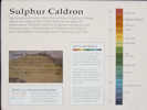
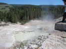
Locations:
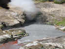
Sulphur Caldron.
|
|
|
Other articles:
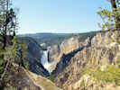
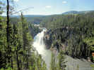
Locations:
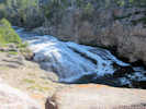
Lower Falls of the Yellowstone River.
|
Lower Yellowstone Falls from Artist Point.
|
|
Other articles:
Locations:
Upper Falls of the Yellowstone River.
|
Upper Falls of the Yellowstone River.
|
|
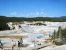
Other articles:
Locations:
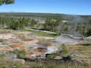
Norris Geyser Basin.
|
|
|
Other articles:
Locations:
Gibbon Falls.
|
Gibbon Falls
|
|
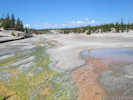
Other articles:
Locations:
Artist Paintpot.
|
Artist Paintpot
|
|
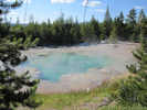
Other articles:
Locations:
Roaring Mountain.
|
Roaring Mountain
|
|
Other articles:
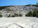
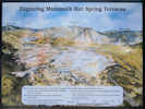
Locations:
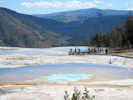
Mammoth Hot Springs.
|
|
|
Other articles:
Locations:
Apollinaris Spring.
Willow Park.
|
|
|
Other articles:
Locations:
Fountain Paint Pot.
|
|
|
Other articles:
|
Wading in the Madison River.
|
|
Other articles:
Locations:
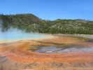
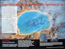
Grand Prismatic Spring.
|
|
|
Other articles:
Locations:
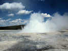
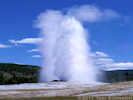
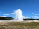
Old Faithful Geyser.
|
|
|
Other articles:
|
Leaving via the South Entrance Road.
|
|
Other articles:
Locations:
Willow Flats.
|
Willow Flats
|
|
Other articles:
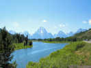
Locations:
Oxbow Bend.
|
Oxbow Bend.
|
|
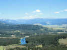
Other articles:
Locations:
Signal Mountain.
|
The view from Signal Mountain.
|
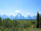
|
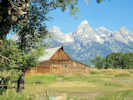
Locations:
Teton Range.
|
Mormon Row
|
|
Other articles:
Locations:
Afton.
|
Afton, Wyoming
|
|
Other articles:
Locations:
Salt River Pass.
|
Salt River Pass
|
|
|
Dave and Sydney (Shaw) Clough in Hawaii.
|
|
Literature Cited:
Locations: Copper Mountain.
|
|
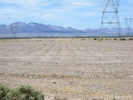
Goleta Mine (Quartz).It is on the eastern base of the Sierra Nevada Mountains, 6 miles N.E. of Lundy. It is one of a series of mines on an immense ore deposit running N. and S. This has not yet been opened sufficiently to show its pitch; the eastern wall is limestone, the western a porphyry-like rock. On the eastern side of this deposit is a vein of copper ore (malachite), 6 to 20 ft. in width, and averaging 8 per cent of metallic copper. The copper carbonate impregnates an exceedingly crushed and decomposed rock. On the west is the gold and silver vein. This is much decomposed on the surface and in most of the workings, the quartz being honeycombed and in places almost replaced by the decomposed rock-mass and iron oxides. The quartz is evidently a replacement of the rock along the mineralized zone. The deposit is opened by two tunnels. The lower one is 1,190 ft. long and has not yet cut the ore body. The upper tunnel is 359 ft. above, and has a length of 360 ft. The copper vein has been drifted on N. 156 ft. and S. 182 ft. The upper tunnel runs through the quartz vein 67 ft. without striking the western wall. A drift has been run N. 40 ft. and S. 30 ft. From the south drift a winze has been sunk 56 ft. There are two cross-cuts on the vein from the north drift, 23 and 47 ft., without reaching the western wall. From the south drift two other cross-cuts have been run, respectively 38 and 49 ft. long. In places the decomposed ore is replaced by hard quartz, carrying iron sulphurets. The value of the ore is about equally distributed between gold and silver. On the same mine to the south and 400 ft. above, a shaft has been sunk 65 ft. on the vein. At this point the vein is 24 ft. wide. This is perhaps the largest ore deposit in the county, being traceable for over 7,000 ft. See our VIIIth Report, pp. 364 to 365. Goleta Mining Company, 330 Pine Street, San Francisco, owners. Montecito Mine (Quartz).It lies 6 miles N.E. of Lundy, and joins the Goleta on the south. On this claim two tunnels have been run, 33 and 80 ft. long, respectively, cross-cutting the vein, but without reaching the western wall. A shaft has been sunk 40 ft. The character of the ore is the same as the Goleta. 1). E. Jones, of Lundy, Superintendent. Native Wonder and Mono Queen Claims (Quartz). These properties were discovered the past year and have been only slightly developed. The Native Wonder is situated on the north side of a steep canon, west of Mono Lake, while the Mono Queen is opposite, on the south side of the cation. The Native Wonder runs nearly E. and W., and has been opened by a short drift showing a vein 18 in. in thickness. The Mono Queen is a blanket vein, and has been opened by a tunnel 70 ft. long. The ore is honeycombed, and is said to be high grade. E. C. Mattly, of Mono Lake, owner. Spartan Mine (Quartz).This mine lies S. of that part of the Sterling Company's mine which was formerly known as the Detroit Copper Mine. Two tunnels have been run to cross-cut the vein. The upper is 120 ft. long, of which 90 ft. is in mineralized vein matter. The other tunnel, 180 ft. below, has at present a length of 245 ft., and is being run through limestone. The vein matter is partly a mineralized limestone and partly a porphyry. M. R. Burns, of Lundy, owner. Sterling (Detroit Copper). Mine (Quartz).The property of the Sterling Company lies about 6 miles N.E. of Lundy. One claim lies north of the Goleta, and on the same ore body, and the other south of the Montecito. The claim on the north has been opened by a shaft 115 ft. deep. That on the south was formerly known as the Detroit Copper Mine, and was described in our VIIIth Report, pp. 364 to 365. In past years a large amount of work was done on this mine in an attempt to extract copper from an E. and W. vein. Sterling Mining Company, No.330 Pine Street, San Francisco, owners; D. E. Jones, of Lundy, Superintendent.
|
|
| Thursday, 8 September 2011
|
Other articles:
Locations:
Valentine Reserve Ecological Study Area.
|
At Valentine Reserve, locked up pretty tight.
|
|
Other articles:
Locations:
Mill City.
|
|
|
Other articles:
|
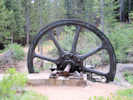
Mammoth City |
|
 Plaque for Mammoth Consolidated Mines Plaque for Mammoth Consolidated Mines
 Cabin at Mammoth Consolidated Mine Cabin at Mammoth Consolidated Mine
 Compressor at Mammoth Consolidated Mine Compressor at Mammoth Consolidated Mine
|
|
|
Other articles:
Locations:
Panorama Dome.
|
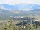
View of Mammoth Lakes and Long Valley from Panorama Dome.
|
|
Other articles:
Locations:
Mammoth Rock.
Panorama Dome.
|
|
|
Other articles:
Locations:
Inyo Crater Lakes.
|
|
|
Other articles:
|
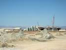
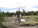
Geothermal Well | Sign says: Well No. 44 16, Lease ?A-740, Operator: Mammoth Pacific, (760) 934-4893 5190047, 44-16, Magma 44 -16, Magma Power Company, Inyo Dome Fed Un, 37.6864, -119.0034, Elev: 2450, Drilled: 1799, Logged: 1451, 1, Date Logged: 27JUN05, Logged by Colin Williams & Frederick Grubb using USGS logging truck Unocals deep well IDFU 44-16 penetrated the caldera fill, Tertiary volcanic rocks and metamorphic rocks to a depth of 2000m near the Inyo Craters (Figure 6). The well encountered temperatures of 218oC at 1100m, the highest yet measured in Long Valley, but proved unproductive because of a limited thickness of reservoir rocks and the incursion of cold water beneath the production zone (Suemnicht, G. A., 1987, "Results of Deep Drilling in the Western Moat of Long Valley, CA," EOS, Vol. 68, No. 40, pp. 785-998.). Quoted in: Gene A. Suemnicht [EGS Inc., Santa Rosa, CA 95403], LONG VALLEY CALDERA GEOTHERMAL AND MAGMATIC SYSTEMS, [Long Valley Caldera, Field Trip, May 27, 2011], California Geothermal Energy Collaborative, Long Valley, California
|
Other articles:
Locations:
Smokey Bear Flat.
|
Smokey Bear Flat.
|
|
|
| Friday, September 9, 2011
|
Other articles:
Locations:
Silver Lake.
|
Billions
Trillions! To conduct wars in Iraq, Afghanistan, Pakistan, and Libya, but no dollars to keep the poopers open in Silver Lake.
|
|
Other articles:
784
|
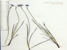
Sisyrinchium idahoense var. occidentale (Bicknell) Hend. Idaho Blue-Eyed Grass.
| Silver Lake, Mono County, California. Grassy meadow just upstream of Silver Lake. 37.7707°N, 119.1246°W. WGS 1984. Elev. 2204 m. Coll. No. 784, 3 Dec 2011, characters observed while keying: Rhizome compact; Stem unbranched, narrow (1 mm); Bracts Inner 12-14 mm, translucent margins ended at tip, Outer 16-19 mm; Perianth blue, outer parts 10-14 mm.
|
Other articles:
785
|
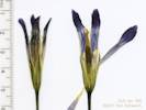
Gentianopsis holopetala (A. Gray) H. H. Iltis. Sierra Fringed Gentian.
| Gull Lake, Mono County, California. Marshy area west side of Gull Lake, about 50 m west of the Gull Meadows Parking Lot. 37.7745°N, 119.0876°W. WGS 1984. Elev. 2327 m. Coll. No. 784, 3 Dec 2011, characters observed while keying: Rhizome compact; Stem unbranched, narrow (1 mm); Bracts Inner 12-14 mm, translucent margins ended at tip, Outer 16-19 mm; Perianth blue, outer parts 10-14 mm.
|
Other articles:
786
|
| Erythranthe primuloides (Benth.) G.L. Nesom & N.S. Fraga. Primrose Monkey Flower. Gull Lake, Mono County, California. Marshy area west side of Gull Lake, about 50 m west of the Gull Meadows Parking Lot. 37.7745°N, 119.0876°W. WGS 1984. Elev. 2327 m.
|
Other articles:
Locations:
Smokey Bear Flat.
|
Oenothera xylocarpa blooming early on a September morning.
|
|
Other articles:
|
Botanizing around Silver Meadows. "Silver Meadows" seems to be an local name for this meadow.
|
|
|
| Saturday, September 10, 2011
|
Other articles:
Locations:
Jordan Spring.
|
View of Jordan Spring
|
|
Other articles:
787
|
Penstemon rydbergii var. oreocharis. (Greene) N. H. Holmgren. Rydberg's Penstemon.
| Jordan Spring, Mono County, California. Northwestern Mono Basin, Copper Mountain area, Humboldt-Toiyabe National Forest. Collected near the water trough in the lower part of Jordan Spring. Fairly common in other nearby areas. 38.0559°N, 119.2095°W. WGS 1984. Elev. 2716 m. Coll. No. 787, 15 Dec 2011, characters observed while keying: Perennial herb, to 6 dm; Leaves opposite, lower elliptic, entire, obtuse, to 8 cm, petiole to 3 cm, glabrous, proximal caluine leaves well developed; Infloresence axis glabrous; Pedicels glabrous (i.e., not glandular); Calyx 4 mm; Corolla blue, 9-12 mm; Stamens 2 unequal pairs, 7 and 9 mm; Anthers glabrous, dehiscing full length; Staminode glabrous, one observed with three large hairs or small protuberences on margin.
|
Other articles:
788
|
| Erythranthe guttata (Fisch. ex DC.) G.L. Nesom. Seep Monkeyflower. Jordan Spring, Mono County, California. Northwestern Mono Basin, Copper Mountain area, Humboldt-Toiyabe National Forest. At the watering trough in the lower part of the spring. 38.0559°N, 119.2093°W. WGS 1984. Elev. 2731 m. Coll. No. 788, 15 Dec 2011, characters observed while keying: Herb terrestrial, in wet places, to 5 dm tall. Leaves cauline, opposite, to 40 mm, round, not lobed or dissected, toothed to 2 mm, fused at base around stem; Infloresence 15-20 fls; Pedicel (5-13 mm) > calyx (9-15 mm); Calyx not spurred at base, angled in cross-section, cleft < 1/2 length (?), asymmetrically inflated in fruit; Corolla tubular (not rotate), yellow, not red-spotted, 25 mm, deciduous, upper lobes not united, lower lobes not pouched upwards, reflexed downward; Stamens fertile 4, unequal length, staminode absent; Stigma maybe weakly 2-lobed (not capitate); Fruit 6 mm.
|
Other articles:
789
|
Toxicoscordion venenosum (S. Watson) Rydb. var. venenosum. (Syn: Zigadenus venenosus S. Watson var. venenosus) Meadow Death Camas.
| Jordan Spring, Mono County, California. In the drying north edge of the wet area, mid way between top and bottom of spring. 38.0559°N, 119.2094°W. WGS 1984. Elev. 2731 m. Dried material. In the drying north edge of the wet area, mid-way between top and bottom of spring. Coll. No. 789, 14 Dec 2011, characters observed while keying: Leaves linear; Infloresence fruit branches 45° from main axis; Fruit 2 cm; Seeds 9 mm, not winged (eliminates Veratrum), brown (eliminates Camassia).
|
|
Calochortus -- not collected.
|
|
Other articles:
791
|
Navarretia breweri (A. Gray) Greene. Brewer's Navarretia.
| Jordan Spring, Mono County, California. Northwestern Mono Basin, Copper Mountain area, Humboldt-Toiyabe National Forest. 38.0559°N, 119.2094°W. WGS 1984. Elev. 2731 m. Dry areas in sagebrush around the spring. Coll. No. 791, 15 Dec 2011, characters observed while keying: Annual, to 12 cm, prickly when dry; Stem branched, ascending, minutely puberulent glandular; Leaves pinnately lobed, needle-like, lobed to near base; Infloresence many flowers in heads, minutely glandular (not hairy like Eriastrum); Corolla yellow, narrow tube, 5 mm.
|
Other articles:
792
|
| Erythranthe primuloides (Benth.) G.L. Nesom & N.S. Fraga. Primrose Monkey Flower. Jordan Spring, Mono County, California. Northwestern Mono Basin, Copper Mountain area, Humboldt-Toiyabe National Forest. 38.0562°N, 119.21°W. WGS 1984. Elev. 2742 m.
|
Other articles:
792.1
|
In the collection of Mimulus primuloides was this thing. By the seed pods, I think I would start looking in Onagraceae.
| Undetermined. Unknown Evening Primrose. Jordan Spring, Mono County, California. Northwestern Mono Basin, Copper Mountain area, Humboldt-Toiyabe National Forest. 38.0562°N, 119.21°W. WGS 1984. Elev. 2742 m.
|
Other articles:
|
In the collection of Mimulus primuloides was this thing.
| Undet. Jordan Spring, Mono County, California. Northwestern Mono Basin, Copper Mountain area, Humboldt-Toiyabe National Forest. 38.0562°N, 119.21°W. WGS 1984. Elev. 2742 m. Flowers have 5 sepals and 5 petals, but 10 stamens, and some sort of inner bract or bract appendage that makes the free stamens appear to be exterior to the petal. I would guess Caryophyllaceae.
|
Literature Cited:
Other articles:
793
|
|
Jordan Spring, Mono County, California. Northwestern Mono Basin, Copper Mountain area, Humboldt-Toiyabe National Forest. 38.0562°N, 119.21°W. WGS 1984. Elev. 2743 m. In the edges of sagebrush about mid-level of the spring. Coll. No. 793, 15 Dec 2011, characters observed while keying: Annual or Perennial herb, to 15 cm; Stem pubescent with sparse long hairs, not particularly glandular; Leaves simple; Infloresence scorpoid, elingate, 4 cm.; Calyx 5-merous, hairy (not ciliate), to 5(6) mm in fruit; Corollas blue, 6 mm wide, deciduous; Stamens 5-6 mm, exserted; Filaments glabrous at base, subtended by bristles. Identified as var. dudleyi when collected but changed to var. humilis on the short length of the calyx and stamens.
|
Other articles:
794
|
Drymocallis glandulosa var. glandulosa ?
| Jordan Spring, Mono County, California. Northwestern Mono Basin, Copper Mountain area, Humboldt-Toiyabe National Forest. 38.0562°N, 119.2109°W. WGS 1984. Elev. 2748 m. Generally finished flowering on the date collected. 12/29/2011, Coll. No. 794, characters observed while keying: Perennial, without stolons; Flowers opening widely; Sepals ±= petals; Petals yellow, 4.5-6.0 mm wide; Style attached below middle of achene, widest in middle, not warty; and Achenes glabrous. This keys to Drymocallis glandulosa var. glandulosa which has not been previously collected in the Mono Lake basin. I note that Taylor (2010) notes his collection of Potentilla glandulosa subsp. reflexa (JEPS96966) at Witcher Meadow, which Ertter has annotated as Drymocallis. I determined my collection 707 made at Pilot Spring as Drymocallis glandulosa var. reflexa. However, that collection had much narrower petals.
|
Other articles:
795
|
Montia chammisoi (Spreng.) Greene. Toad Lily.
| Jordan Spring, Mono County, California. Northwestern Mono Basin, Copper Mountain area, Humboldt-Toiyabe National Forest. 38.0562°N, 119.2108°W. WGS 1984. Elev. 2748 m.
|
Other articles:
Locations:
Jordan Spring.
796
|
Potentilla gracilis Hook. var. fastigiata (Nutt.) S. Watson Slender Cinquefoil.
| Jordan Spring, Mono County, California. Northwestern Mono Basin, Copper Mountain area, Humboldt-Toiyabe National Forest. 38.0563°N, 119.2108°W. WGS 1984. Elev. 2748 m. Collected late season, but still with unopened buds; heavily infested with aphids. 30 Dec 2011, Coll. No. 796, characters observed while keying: Perennial herb, to 3 dm; Stolons 0; Stem ascending, lightly hairy, hairs similar length; Leaves palmately compound, basal leaves prominent in flowering; Leaflets regular toothed, teeth 11-15, ± 1/2 toward vein, surfaces similarly hairy; Pedicels 18 mm, straight; Flowers 7-10, in cymes; Sepals 5, < petals; Petals 5, 6 mm wide, slightly 2-lobed; Receptacle in fruit not strawberry-like; Stamens many (> 10); Style jointed to fruit, 2 mm, slender; and Achenes smooth, glabrous, not fleshy coated.
|
Other articles:
797
|
|
Copper Mountain, Mono County, California. In a narrow limestone canyon on the east face of Copper Mountain, 8.6 miles by road north of Lee Vining, California. 38.0518°N, 119.1816°W. WGS 1984. Elev. 2251 m. Coll. No. 797, 10 Sep 2011, characters observed while keying: Perennial, to 25 cm., woody at base; Stem glabrous; Leaves, whorls of 4 in unequal pairs, larger 7 mm. × 4.5 mm. wide, smaller 5.5 mm. × 2.5 mm. wide, containing elongate light-colored cells, tip acuminate; Corolla, lobes 4; Fruit, 8 mm. wide, including hairs, hairs straight.
|
Other articles:
798
|
Eriogonum microthecum var. laxiflorum
| Copper Mountain, Mono County, California. In a narrow limestone canyon on the east face of Copper Mountain. 38.052°N, 119.1832°W. WGS 1984. Elev. 2267 m Coll. No, 798, 30 Dec 2011, characters observed while keying: Perennial erect shrub with woody branches; Leaves not fasciculate, slightly revolute; Infloresence of solitary involucres, branches equal in size; Perianth base not expanded into a small stipe and jointed with pedicel; Flowers white to pink.
|
|
| Sunday, September 11, 2011
|
Other articles:
799
|
Dried material, Mimulus suksdorfii, to be combined with Coll. No. 747.
| Erythranthe suksdorfii (A. Gray) N.S. Fraga. Suksdorf's monkeyflower. Pumice Valley, Mono County, California. Pumice flats near the north end of Mono Craters, just south of California Highway 120 on Inyo Forest Road 1N11, 3 miles northeast of US Highway 395. 37.9119°N, 119.0457°W. WGS 1984. Elev. 2097 m. Dried material. Combined with collection no. 747.
|
Other articles:
800
|
|
Mono Craters, Mono County, California. North end of Mono Craters, south side of CA Highway 120 about 3.2 miles east of US Highway 395 in an area that burned in 2010. 37.9151°N, 119.0452°W. WGS 1984. Elev. 2072 m. Calyx with dark green stripes as in N. acuminata, but other differential characters as in N. attenuata. Coll. No, 800, 30 Dec 2011, characters observed while keying: Annual herb, not particularly sticky; Leaves cauline, short-petioled; Calyx 7-8 mm, lobes equal, dark green striped when fresh; Corolla tubular, 20-25 mm; Fruit capsule, smooth.
|
Other articles:
801
|
Dried material, Eatonella nivea.
| Eatonella nivea (D.C.Eaton) A. Gray. White False Tickhead. Mono Basin, Mono County, California. Approximately 0.7 mi east on Forest Road 1N23 from California Highway 120, 6.2 miles by road east of the south junction of US Highway 395 and California Highway 120. Northeast flank of a gravel pit. 37.9196°N, 118.9978°W. WGS 1984. Elev. 2037 m. The materials of this collection were combined with Coll. No. 755 when deposited at UC and CAS.
|
Literature Cited:
|
Wark, et al. (2007), applied Titanium in quartz analysis to quartz phenocryst rims in Bishop Tuff to determine that hot mafic melts injected into deeper parts of the magma system were the likely source of heat and CO2, raising the possibility that eruption and caldera collapse owe their origin to a recharge event.
|
|
 Rita (Schweich) Gundersen Rita (Schweich) Gundersen
|
Rita (Schweich) Gundersen | Age 83, will be honored on July 11th in Lakeville, MN Rita died peacefully in Phoenix, Ariz., Dec. 28, 2011. Born Sept. 9, 1928, Rita was the daughter of Jacob and Margaret Schweich. She is survived by her 5 children and their families Patricia (Timothy) Keith, Jean Berg (Kimberly), William Berg (Jim), Richard (Connie) Berg and Catherine Babick, 11 grand and 6 great grand children; brothers Lawrence (Bonnie) Schweich, John (Gloria) Schweich and Robert Schweich; sisters-in-law Betty Schweich, Arlene Schweich and Mary Schweich and brother-in-law Gary Frighetto. She dearly loved her family and cherished each and every friend. Rita will be remembered for her generosity, beautiful smile and enthusiasm for life. July 11th, 2012: There will be a 10:00AM Reception at All Saints Catholic Church, 19795 Holyoke Ave., Lakeville, MN followed by 10:30AM Rosary and 11:00AM Mass. Rita will be laid to rest at All Saints Cemetery in Lakeville after Mass. Please join Family and Friends at the Chart House in Lakeville following the Services.
|
|
[Previous Page]
[Next Page]
| Go to page: [1800s] [1900s] [1910s] [1920s] [1930s] [1940s] [1950s] [1960s] [1970s] [1980s] [1990] [1991] [1992] [1993] [1994] [1995] [1996] [1997] [1998] [1999] [2000] [2001] [2002] [2003] [2004] [2005] [2006] [2007] [2008] [2009] [2010] [2011] [2012] [2013] [2014] [2015] [2016] [2017] [2018] [2019] [2020] [2021] [2022] [2023] [2024] [A]
If you have a question or a comment you may write to me at:
tas4@schweich.com
I sometimes post interesting questions in my FAQ, but I never disclose your full name or address.
|
|
Date and time this article was prepared: 4/27/2024 3:25:04 PM | ||||||||||||||||||||||||||||||||||||||||||||||||||||||||||||||||||||||||||||||||||||||||