
Topics in this Article:
1800s
1900s
1910s
1920s
1930s
1940s
1950s
1960s
1970s
1980s
1990
1991
1992
1993
1995
1996
1997
1998
1999
2000
2001
2002
2003
2004
2005
2006
2007
2008
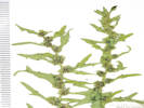
2008 Tour de Swertia albomarginata
Mono Lake, August 2008
2009
2010
2011
2012
2013
2014
2015
2016
2017
2018
2019
2020
2021
2022
2023
2024
Contents
Literature Cited
|
|
When I first read the field notes of Annie Alexander and Louise Kellogg, I was fascinated by the descriptions they wrote about the places they went and the plants and animals they found there. By publishing my field notes on the Internet I hope to follow a little bit in their tradition.
|
|
|
|
2023
|
|
|
|
March 2023
|
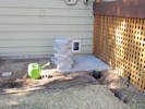
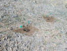
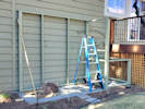
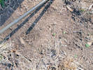
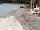
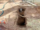 Step 1. Move the sprinklers and landscaping. Step 1. Move the sprinklers and landscaping.
|
|
Step 1. Move the landscaping and sprinklers.
|
|
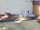
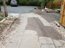
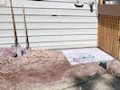 Concrete pavers in place, plants not moved yet. Concrete pavers in place, plants not moved yet.
|
|
29 March 2023
Concrete pavers.
|
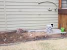
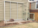
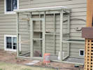
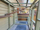
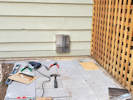 Tunnel cut through siding. Tunnel cut through siding.
|
|
2:18 PM, Tunnel cut through siding.
|
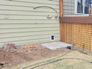 Outside tunnel portal installed. Outside tunnel portal installed.
|
|
4:05 PM, Tunnel portal installed.
|
|
Locations:
DeLong Park (City of Golden).
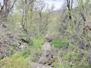
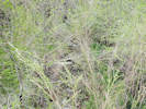
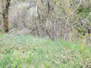
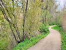
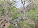
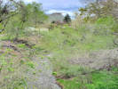
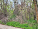
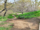
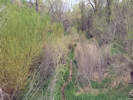
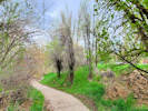
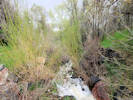
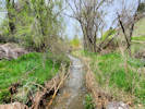
Kinney Run.
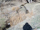 Hairy Willow Herb in Kinney Run. Hairy Willow Herb in Kinney Run.
 Wild hops (Humulus lupulus) in Kinney Run. Wild hops (Humulus lupulus) in Kinney Run.
|
|
Walk in Kinney Run with Suzy Stutzmann and Laurel Starr.
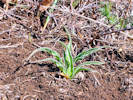
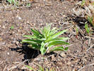
White Top plants arising from a rhizome. |
|
|
|
|
31 March 2023
|
|
Locations:
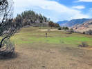
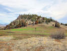
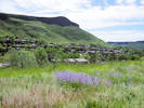
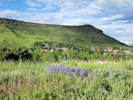
Dinosaur Ridge.
|
|
Hogback Fire
| Date
| Inc #
| Name
| Type
| Location
| Comment
|
| 3/31/2023 14:51
| JEX-233
PN P59A (1522)
| Hogback
| Wildfire
| Jefferson COunty, Hwy 93
| Approx 3 miles North of Morrison, CA
|
|
|
|
|
April 2023
|
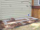
 Four foot block of pavers; plants moved. Four foot block of pavers; plants moved.
|
|
Four foot solid block of pavers.
|
|
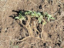
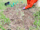
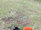
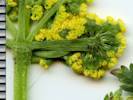
 Senecio integerrimus weeded on Schweich Hill. Senecio integerrimus weeded on Schweich Hill.
|
|
2 April 2023
Weeding at Schweich Hill.
|
 Plants moved to new position. Plants moved to new position.
|
|
Some of the plants moved.
|
|
 All the plants moved, but not the rock yet. All the plants moved, but not the rock yet.
|
|
3 April 2023
Moved the buckwheat and the Gaillardia. Moving the rock is next.
|
|
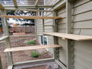
 Added the shelf inside. Added the shelf inside.
|
|
6 April 2023
Built and installed the shelf.
|
|
 Moved the rock and completed the outline of pavers. Moved the rock and completed the outline of pavers.
 Solny watches from the window. Solny watches from the window.
|
|
7 April 2023
Moved the rock and then completed the outline of the pavers. The tunnel has bubble wrap inside it to hold the carpet against the walls until the glue dries.
|
|
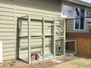
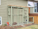
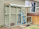
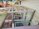
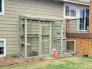
 Section 1 framed. Section 1 framed.
|
|
9 April 2023
Framed Section 1.
|
 Section 1 frame primed. Section 1 frame primed.
|
|
Primed Section 1. Note how I had to move it to prime the back sides.
|
|
 Section 1 painted and moved into place. Section 1 painted and moved into place.
|
|
11 April 2023
Section 1 painted (2 coats) and moved into place.
|
|
Locations:
Schweich Hill.
 Crepis occidentalis (?) on Schweich Hill. Crepis occidentalis (?) on Schweich Hill.
|
|
10 April 2023
Weeding at Schweich Hill.
|
|
Other articles:
• Dakota Ridge Trail:
along ridge;
at viewpoint;
along ridge;
along trail.;
near jct.;
Locations:
Dinosaur Ridge.
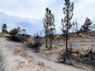
 Northern edge of burned area. Northern edge of burned area.
|
|
13 April 2023
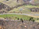
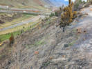
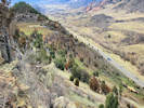
Field trip to Dinosaur Ridge to review damage from Hogback Fire.
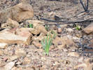
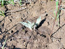
Likely Toxicoscordion paniculatum whose leaf tips were scorched by the Hogback Fire (2023). |
View to the northwest of the Hogback Fire. |
Burned ponderosas and junipers at the observation site. |
Area burned by the Hogback Fire to the southwest. |
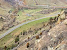
Area burned by the Hogback Fire to the northwest. |
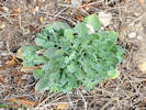
Possible Physaria vitulifera × bellii. |
View southward across the water gap after the Hogback Fire. |
View northward from burned to unburned areas. |
View northward across the water gap partially burned by the Hogback Fire. |
|
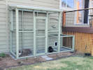
 The catio on 13 April 2023. The catio on 13 April 2023.
|
|
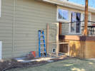
Today I assembled and erected the back wall.
|
|
|
|
Saturday, 15 April 2023
|
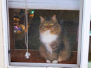
 Solny and Myshka want to know when the catio will be finished. Solny and Myshka want to know when the catio will be finished.
 The catio on 15 April 2023. The catio on 15 April 2023.
|
|
Today's progress was to paint the front surfaces of the back wall.
|
|
|
|
Sunday, 16 April 2023
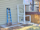
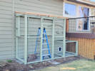
Front wall in place and primed.
|
 Basic framing and priming ot front wall. Basic framing and priming ot front wall.
|
|
Basic framing on front wall.
|
|
|
|
Monday, 17 April 2023
|
|
|
|
DeLong Weedbuster work day and a supply run to Home Depot.
|
 Door outline framed, plus some miscellaneous pieces for wire placement. Door outline framed, plus some miscellaneous pieces for wire placement.
|
|
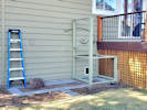
Door framed and miscellaneous framing and pieces cut.
|
|
|
|
Tuesday, 18 April 2023
|
 One coat of paint. One coat of paint.
|
|
Future tunnel portal framed. One coat of paint all over.
|
|
|
|
Wednesday, 19 April
|
 All the framing in place. Second coat of paint. Also finished the door; primed and one coat of paint. All the framing in place. Second coat of paint. Also finished the door; primed and one coat of paint.
|
|
Cool and windy today. Installed the last pre-painted frames, primed and one coat of paint on the door.
|
|
|
|
Earth Day, Saturday, April 22, 2023
|
|
Other articles:
• 23rd Street:
at DeLong Park;
Locations:
DeLong Park (City of Golden).
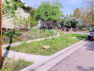
 DeLong Park on Earth Day, April 22, 2023. DeLong Park on Earth Day, April 22, 2023.
|
|
Earth Day at DeLong Park sh=nowed out.
|
|
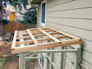
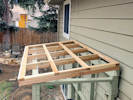
 Starting to frame the roof. Starting to frame the roof.
|
|
Sunday, 23 April 2023
Working on the roof.
|
|
Other articles:
• 23rd Street:
near Table Dr;
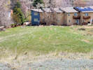
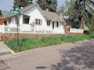
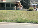 A dandelion-filled lawn. A dandelion-filled lawn.
 Purlins installed, now blocking between the purlins. Purlins installed, now blocking between the purlins.
|
|
Monday, 24 April
Weeding at DeLong Park.
Purlins installed, now blocking between the purlins. |
|
|
Locations:
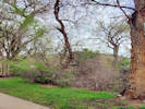
Golden History Park.
 Unknown horticultural Liliaceae at Golden History Park Unknown horticultural Liliaceae at Golden History Park
|
|
Tuesday, 25 April 2023
Walk through at Golden History Park.
|
|
|
|
Thursday, 27 April 2023
|
|
Locations:
Schweich Hill.
 Nothocalai cuspidata “Prairie False Dandelion” on Schweich Hill. Nothocalai cuspidata “Prairie False Dandelion” on Schweich Hill.
 Car tracks on Schweich Hill. Car tracks on Schweich Hill.
|
|
Weeding at Schweich Hill.
|
 Catio on 27 April 2023 Catio on 27 April 2023
 Roof on 27 April 2023, before priming. Roof on 27 April 2023, before priming.
|
|
Today's progress on the catio, finished blocking the roof and prime painted.
|
|
|
|
Friday, 28 April 2023
|
|
Other articles:
• Arapahoe Street:
at parkway;
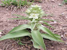
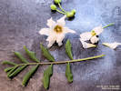
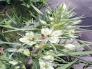
 Frasera speciosa beginning to bloom in my parkway (4/28/2023) Frasera speciosa beginning to bloom in my parkway (4/28/2023)
|
|
Frasera speciosa blooming in my parkway.
|
|
Other articles:
• Arapahoe Street:
near 5th;
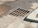 The vault in the storm drain is full again. The vault in the storm drain is full again.
|
|
The vault of the storm drain at 5th and Arapahoe is full again.
|
 First coat of paint on the roof framing, 28 Apr 2023. First coat of paint on the roof framing, 28 Apr 2023.
|
|
Today I put the first coat of paint on the roof framing.
|
|
|
|
Saturday, 29 April 2023
|
|
Other articles:
• Arapahoe Street:
at parkway;
 Last night, someone broke off an irrigation pipe, stuck the pipe on the support, and bent the support over. Last night, someone broke off an irrigation pipe, stuck the pipe on the support, and bent the support over.
 Bootprints of whoever vandalized my parkway sprinklers. Bootprints of whoever vandalized my parkway sprinklers.
|
|
Senseless vandalism in my parkway.
|
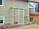
 Roof frame painted, corrugated supports installed. Roof frame painted, corrugated supports installed.
 Different view (29 Apr 2023). Different view (29 Apr 2023).
 View from the deck of the polycarbonate sheet supports. View from the deck of the polycarbonate sheet supports.
|
|
Painted the roof frame, installed drip edge, and installed corrugated supports.
|
|
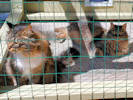
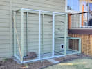
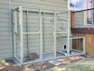
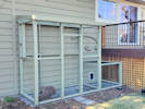
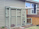
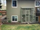
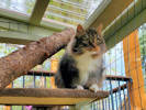
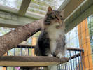
 Catio enclosure complete (4/30/2023). Catio enclosure complete (4/30/2023).
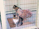 Solny and Myshka, first time in the full enclosure. Solny and Myshka, first time in the full enclosure.
 How do I get out of here? How do I get out of here?
|
|
Sunday, 30 April 2023
Catio enclosure finished.
Myshka figured out how to jump up on the 2x4. |
|
|
|
|
May 2023
|
|
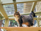 Solny on the upper shelf. Solny on the upper shelf.
 Finished enclosure with a few temporary shelves. Finished enclosure with a few temporary shelves.
 Finished enclosure with a few temporary shelves. Finished enclosure with a few temporary shelves.
|
|
Tuesday, 2 May 2023
Installed 3 shelves temporarily until the carpet order comes in.
Bare shelves inside the enclosure. |
|
|
|
|
Thursday, 4 May 2023
|
|
Locations:
Schweich Hill.
 “Nuttall's Violet” on Schweich Hill. “Nuttall's Violet” on Schweich Hill.
 Weeding patch that started with Western Hawks-beard. Weeding patch that started with Western Hawks-beard.
|
|
Weeding with Cathy at Schweich Hill.
Three weeding patches on Schweich Hill. |
|
 Putting the landscaping back together. Putting the landscaping back together.
|
|
Worked around the catio putting the landscaping back together.
|
|
Locations:
Golden History Park.
|
|
Friday, 5 May 2023
Walk through at Golden History Park.
|
 Two flowers open. Two flowers open.
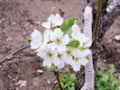 Flowers on a Bartlett Pear, Pyrus communis L. Flowers on a Bartlett Pear, Pyrus communis L.
|
|
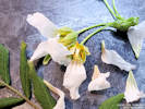
Frasera speciosa beginning to bloom.
|
|
|
|
Monday, 8 May 2023
|
|
Locations:
Schweich Hill.
 Laterally migrating social trail on Schweich Hill. Laterally migrating social trail on Schweich Hill.
 First fully open flower in Schweich Hill. First fully open flower in Schweich Hill.
|
|
Looking at migrating trails on Schweich Hill.
|
|
|
|
Tuesday, 9 May 2023
|
|
Locations:
Eagle Ridge.
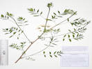
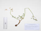
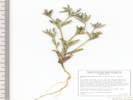
 Coll. No. 2918, Musineon divaricatum. Coll. No. 2918, Musineon divaricatum.
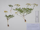 Coll. No. 2918, Musineon divaricatum. Coll. No. 2918, Musineon divaricatum.
|
2918
|
|
Native and Naturalized Flora of the Golden Area, Jefferson County, Colorado
Apiaceae
Musineon divaricatum (Pursh) Raf.
Leafy Wildparsley.
Eagle Ridge, Jefferson County, Colorado.
West-southwest-facing slope of Eagle Ridge, a locally named ridge of upturned Dakota Group between US Highway 6 and Eagleridge Drive, between Stonebridge entrance and Kinney Run, 3.75 km. south southeast of the GNIS location of Golden.
39.7301°N, 105.2139°W.
WGS 1984
Elev. 1825 m.
Also here: Lomatium orientale, Helianthus pumilis, Mertensia lanceolata, Astragalus drummondii, Scutellaria brittonii, and Cercocarpus montanus.
Collected by permit: City of Golden, 2023, issued: Mar 13, 2023, to: Tom Schweich.
|
Tom Schweich
2918. |
9-May-2023 |
|
Coll. No. 2918, Musineon divaricatum. |
Coll. No. 2918, Musineon divaricatum. |
|
|
|
|
Stalking the wild pseudo-cymopterus. (Turns out it was Musineon divaricatum.)
|
|
|
|
On top of Eagle Ridge.
|
|
|
|
Friday, 12 May 2023
|
|
Other articles:
• Tucker Gulch Trail:
at crossing;
Locations:
Tucker Gulch (lower).
 Lower bridge over Tucker Gulch. Lower bridge over Tucker Gulch.
|
|
Review of Tucker Gulch.
View downstream from the bridge. |
View upstream from the bridge. |
|
|
Other articles:
• Tucker Gulch Trail:
bet. X-ings;
Locations:
Tucker Gulch (lower).
 Large colony of prickly pear in front of a thicket of box elder and siberian elm. Large colony of prickly pear in front of a thicket of box elder and siberian elm.
|
|
|
|
Other articles:
• Tucker Gulch Trail:
at wire xing;
Locations:
Tucker Gulch (lower).
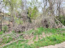
 Tangle of brush. Tangle of brush.
|
|
|
|
Other articles:
• Tucker Gulch Trail:
just above bridge;
at crossing;
just below bridge;
Locations:
Tucker Gulch (lower).
 Multi-trunk box elder and then a chokecherry on the creek-side of the trail. Multi-trunk box elder and then a chokecherry on the creek-side of the trail.
|
|
At the bridge.
View upstream from the second bridge. |
View downstream from the second bridge. |
Tangle of down branches just above the bridge. |
|
|
Other articles:
• Tucker Gulch Trail:
near Fairy Garden;
Locations:
Tucker Gulch (lower).
 Tangle of down branches above the bridge. Tangle of down branches above the bridge.
|
|
Between the bridge and the fairy garden.
|
|
Other articles:
• Tucker Gulch Trail:
at 2nd;
Locations:
Tucker Gulch (lower).
 Upper end of the social trail. Upper end of the social trail.
|
|
Nearing 1st Street.
|
|
Other articles:
• Tucker Gulch Trail:
near 1st;
Locations:
Tucker Gulch (lower).
 Myrtle spurge above the Tucker Gulch Trail. Myrtle spurge above the Tucker Gulch Trail.
|
|
Myrtle spurge on the hillside above the trail.
Myrtle spurge above the Tucker Gulch Trail. |
|
|
Other articles:
• Tucker Gulch Trail:
near 1st;
Locations:
Tucker Gulch (lower).
 View downstream from the 1st Street bridge. View downstream from the 1st Street bridge.
|
|
View downstream from the bridge.
|
|
Other articles:
• Tucker Gulch Trail:
near East St.;
below 1st St;
Locations:
Tucker Gulch (lower).
 View from East Street down to the creek. View from East Street down to the creek.
|
|
|
|
Other articles:
• Tucker Gulch Trail:
near crossing;
near crossing;
Locations:
Tucker Gulch (lower).
 View downstream from the crossing. View downstream from the crossing.
|
|
View upstream at the crossing. |
|
|
|
|
Saturday, 13 May 2023
|
|
Literature Cited:
- Buerki, Sven, Porter P. Lowry II, nadir Alvarez, Sylvain G. Razafimandimbison, Phillipe Kupfer, & Martin W. Callmander, 2010.
- Zhou, Q., Cai, Q., Zheng, Y., Wu, Z., & Mao, J, 2019.
Other articles:
• Golden Checklist Flora:
Xanthoceras sorbifolium;
|
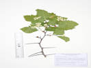
2919
|
|
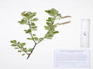
Native and Naturalized Flora of the Golden Area, Jefferson County, Colorado
Sapindaceae
Xanthoceras sorbifolium Bunge.
Yellowhorn.
Golden, Jefferson County, Colorado.
Near the Cheyenne Street end of the alley between 4th and 5th Streets, 1.22 km. northwest of the GNIS location of Golden.
39.7609°N, 105.2296°W.
WGS 1984
Elev. 1764 m.
North side of alley, rooted between telephone pole and fence post, also here Ericameria nauseosa var. graveolens, and various annual weeds.
Planted in the former garden at 409 Cheyenne Street (K. Boland, pers. Comm, 2023), though in a different location than where this collection was found. The original location was destroyed by housing construction.
Collected by permit: City of Golden, 2023, issued: Mar 13, 2023, to: Tom Schweich.
|
Tom Schweich
2919. |
13-May-2023 |
|
Coll. No. 2919, 13 May 2023, characters observed:
Perennial woody shrub or small tree, to 2 m.;
Stem, unarmed;
Leaves,
alternate, ovate, 95 mm. × 45 mm. wide,
compound, pinnate,
leaflets #11, 24 mm. × 8 mm. wide, lanceolate,
sharply serrate distally,
adaxial surface minutely hairy on veins,
abaxial surface puberulent;
Inflorescence, clusters on previous year's stems;
Flowers borne singly;
Petioles, 18 mm.;
Sepals, #5, 8 mm. × 5 mm. wide, ovate, rounded;
Petals, #5, free to base, 20 mm. × 7 mm., oblanceolate, margin crisped(?), greenish-yellow to white distally, ciliate at base;
Nectary(???) 5-lobed, orange, club-shaped;
Stamens, #8, included, different lengths;
Anthers, 1 mm., versatile, yellow;
Stigmas, #1, bifid.
Leaf and flower of Coll. No. 2919, Xanthoceras sorbifolium in the alley. |
Details of Coll. No. 2919, Xanthoceras sorbifolium in the alley. |
Coll. No. 2919, Xanthoceras sorbifolium in the alley. |
Fruit of Xanthoceras sorbifolium |
Coll. No. 2919, Xanthoceras sorbifolium |
|
|
|
|
Sunday, 14 May 2023, Mother's Day
|
|
Other articles:
• Welch Ditch:
along the ditch;
at cascade;
Locations:
Welch Ditch.
 Cascade coming from Windy Saddle. Cascade coming from Windy Saddle.
|
|
Walk up the Peaks-to-Plains Trail and on part of the Welch Ditch
Viola canadensis beside the Welch Ditch. |
|
|
|
|
Monday, 15 May 2023
The day the sewer vacuum truck showed up.
|
|
Other articles:
• Arapahoe Street:
at alley;
 The sewer cleanout truck down at the gulch. The sewer cleanout truck down at the gulch.
 Alley after passage of the sewer cleanout truck. Alley after passage of the sewer cleanout truck.
|
|
The city sewer cleanout truck makes a neighborhood visit.
Alley after passage of the sewer cleanout truck. |
|
|
|
|
Tuesday, 16 May 2023
Schweich Hill and catio work.
|
 Tire tracks in the southeast corner. Tire tracks in the southeast corner.
 Lower part of social trail. Lower part of social trail.
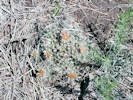 Escobaria missouriensis in bloom on Schweich Hill. Escobaria missouriensis in bloom on Schweich Hill.
|
|
Weeding at Schweich Hill.
Location of measured cross-section. |
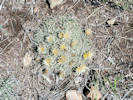
Escobaria missouriensis in bloom on Schweich Hill. |
A section where smooth brome was weeded several weeks previously. |
|
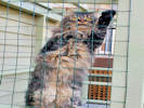
 Solny on the new top shelf, accessed by the pine branch. Solny on the new top shelf, accessed by the pine branch.
 Solny on the new top shelf, accessed by the pine branch. Solny on the new top shelf, accessed by the pine branch.
|
|
Covered two shelves with indoor-outdoor carpet.
|
|
|
|
Wednesday, 17 May 2023
|
 Domestic honey bee on Frasera speciosa. Domestic honey bee on Frasera speciosa.
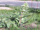 The larger of several Frasera speciosa blooming in my parkway. The larger of several Frasera speciosa blooming in my parkway.
|
|
The larger of two Frasera speciosa blooming in my parkway.
|
 Inside of catio with new covered shelf and pine log. Inside of catio with new covered shelf and pine log.
|
|
Inside of the catio.
|
|
|
|
Saturday, 20 May 2023
|
|
Other articles:
• Arapahoe Street:
at parkway;
near 5th;
 Parkway at 5th and Arapahoe Streets, 20 May 2023 Parkway at 5th and Arapahoe Streets, 20 May 2023
 Parkway on 20 May 2023. Parkway on 20 May 2023.
|
|
The parkway
|
|
|
|
Sunday, 21 May 2023
Schweich Hill, weeding and a collection.
|
|
|
|
Sunday, 21 May 2023
|
|
|
2920
|
Lomatium orientale
|
Native and Naturalized Flora of the Golden Area, Jefferson County, Colorado
Apiaceae
Lomatium orientale J.M. Coult. & Rose.
Salt-and-Pepper.
Schweich Hill, Jefferson County, Colorado.
Near northern boundary, near the bottom of the original hill slope, 2.30 km. northwest of the GNIS location of Golden
39.7687°N, 105.2327°W.
WGS 1984
Elev. 1809 m.
with Artemisia ludoviciana, in an area of encroaching smooth brome.
Collected by permit: City of Golden, 2023, issued: Mar 13, 2023, to: Tom Schweich.
|
Tom Schweich
2920. |
21-May-2023 |
|
|
 Echinocereus viridiflorus in a place just cleared of Alyssum simplex. Echinocereus viridiflorus in a place just cleared of Alyssum simplex.
|
|
Weeding at Schweich Hill.
|
|
|
|
Monday, 22 May 2023
|
|
|
|
Monday, 22 May 2023
|
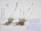 Coll. No. 2921, Coll. No. 2921, Festuca saximontana Poa sp.
|
2921
|
Revegetation grass.
Plants of Jefferson County Open Space
Jefferson County, Colorado
Poaceae
Festuca saximontana Rydb.
Rocky Mountain Fescue.
Poa sp., Jan Wingate, 4/23/2024, “reveg. grass?”
Magpie Gulch, Jefferson County, Colorado.
Mouth of the canyon of Magpie Gulch, along an old road, about 115 m. west of the parcel boundary, 2.16 km. west northwest of the GNIS location of Golden.
39.7599°N, 105.2398°W.
WGS 1984
Elev. 1809 m.
Most likely a revegetation grass in an open grassland.
Collected by permit: Jefferson County Open Space, 2023, issued: Apr 10, 2023, to: Tom Schweich.
|
Tom Schweich, with Cindy Trujillo
2921. |
22-May-2023 |
|
Collection No. 2921, 22 May 2023, characters observed:
Perennial grass, 25 cm., cespitose;
Stem,
glabrous below inflorescence;
Leaves,
Sheath, 19-20 mm., open;
Ligule,
membranous,
1 mm.,
auricles, absent;
Blade,
40-42 mm. × >1 mm. wide,
involute [conduplicate?];
Inflorescence,
1 per culm,
>leaves,
panicle,
55 mm. × 8 mm. wide,
branched 2×;
Rachis,
not extended beyond upper spikelet,
scabrous;
Spikelets,
few (17±),
7 mm. × 2 mm. wide,
1 per node,
pedicels 3 mm.;
Compression, lateral;
Glumes,
lower,
4 mm.,
veins, 3,
upper,
4.5 mm.,
≤lowest floret,
veins, 5,
keeled,
awns, 0;
Florets,
3 per spikelet;
Axis,
extended beyond upper floret;
Lemma,
4.5 mm.,
proximally glabrous,
distally short wavy hairy,
keel, glabrous;
Palea,
3.5 mm.,
<lemma;
Anthers,
1.3 mm.;
Achene,
brown.
|
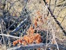
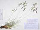 Coll. No. 2922, Festuca trachyphylla. Coll. No. 2922, Festuca trachyphylla.
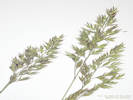 Inflorescence of Coll. No. 2922, Festuca trachyphylla. Inflorescence of Coll. No. 2922, Festuca trachyphylla.
|
2921
|
2922
Revegetation grass.
Plants of Jefferson County Open Space
Jefferson County, Colorado
Poaceae
Festuca trachyphylla (Hack.) Krajina.
Hard Fescue.
Magpie Gulch, Jefferson County, Colorado.
Mouth of the canyon of Magpie Gulch, along an old road, about 165 m. west of the parcel boundary, 2.20 km. west northwest of the GNIS location of Golden.
39.7601°N, 105.2401°W.
WGS 1984
Elev. 1844 m.
Most likely a revegetation grass in an open grassland.
Collected by permit: Jefferson County Open Space, 2023, issued: Apr 10, 2023, to: Tom Schweich.
|
Tom Schweich, with Cindy Trujillo
2922. |
22-May-2023 |
|
Coll. No. 2922, 22 May 2023, characters observed:
Perennial grass, 40 cm., cespitose;
Leaves,
sheath, 21-28 mm., open,
ligule, membranous, 0.2 mm., extremely short,
auricles, minimal, 0.5 mm.
[see illustration in Shaw (2008, fig. 242)],
blade, 23-80 mm. × 0.6 mm. wide,
involute [conduplicate?];
Inflorescence,
1 per culm,
contracted panicle,
55 mm. × 9 mm.;
Spikelets,
many,
8 mm. × 2 mm. wide,
borne singly,
pedicels, 2 mm.;
Disarticulation,
between florets;
Glumes,
lower, 2.5 mm.
upper, 4 mm.,
<lowest floret,
veins, 3, ±parallel,
awns, 0,
margins, distally ciliate;
Florets,
4 per spikelet;
Axis,
short hairy or long scabrous,
not extended beyond upper floret;
Lemma,
4.5 mm.,
>glumes,
pubescent distally,
veins, ≥5, glabrous,
awns, 1, attached end of lemma, 1.5 mm., straight;
Palea,
4 mm.,
<lemma,
Anthers,
3 mm.
|
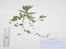 Coll. No. 2923, Parietaria pensylvanica. Coll. No. 2923, Parietaria pensylvanica.
|
2923
|
Parietaria pennsylvanica
Plants of Jefferson County Open Space
Jefferson County, Colorado
Urticaceae
Parietaria pensylvanica Willd.
Pennsylvania Pellitory.
Magpie Gulch, Jefferson County, Colorado.
Small branch of Magpie Gulch, southeast-facing slope, 450 m. west of entrance gate, 2.48 km. west northwest of the GNIS location of Golden.
39.7598°N, 105.2427°W.
With grasses around the base of a small boulder in a moist spot in full sun.
Collected by permit: Jefferson County Open Space, 2023, issued: Apr 10, 2023, to: Tom Schweich.
|
Tom Schweich, with Cindy Trujillo
2923. |
22-May-2023 |
|
|
 Coll. No. 2924, Gilia ophthalmoides Coll. No. 2924, Gilia ophthalmoides
|
2924
|
Aliciella, maybe A. pinnatifida Gilia, per the arachnoid, cottony hairs.
Plants of Jefferson County Open Space
Jefferson County, Colorado
Polemoniaceae
Gilia ophthalmoides Brand.
Pinyon Gilia.
Magpie Gulch, Jefferson County, Colorado.
On the ridge between Magpie and Nightbird gulches, along a social and/or game trail, 430 m. northwest of the gate to the parcel, 2.48 km. west northwest of the GNIS location of Golden.
39.7613°N, 105.2421°W.
WGS 1984
Elev. 1898 m.
Plant slightly sticky, lower stem with arachnoid, cottony hairs, tube and throat extended 3 mm. when dry, corolla throat yellow, petals abaxial purple, adaxial white.
Exposed ridge with Cercocarpus montanus the dominant shrub.
Uncommon; there are only six other collections within 15 km.
Collected by permit: Jefferson County Open Space, 2023, issued: Apr 10, 2023, to: Tom Schweich.
|
Tom Schweich, with Cindy Trujillo
2924. |
22-May-2023 |
|
|
|
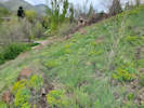
Locations:
Magpie Gulch.
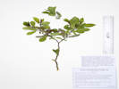
 Small Celtis reticulata (?) in Magpie Gulch. Small Celtis reticulata (?) in Magpie Gulch.
|
|
|
|
Locations:
Magpie Gulch.
 View up Magpie Gulch. View up Magpie Gulch.
 View down Magpie Gulch. View down Magpie Gulch.
|
|
Part-way up Magpie Gulch.
|
|
Locations:
Magpie Gulch.
 Packera fendleri on the ridge between Magpie and Nightbird gulches. Packera fendleri on the ridge between Magpie and Nightbird gulches.
 A large specimen of Echinocereus viridiflorus. A large specimen of Echinocereus viridiflorus.
|
|
Plants on the ridge between Magpie and Nightbird gulches.
|
|
Locations:
DeLong Park (City of Golden).
|
|
Thursday, 25 May 2023
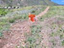
Weeding at DeLong Park
|
|
Locations:
Schweich Hill.
 Sporobolus cryptandrus in the loose gravel of the trail. Sporobolus cryptandrus in the loose gravel of the trail.
 A patch that I have been weeding of smooth brome. A patch that I have been weeding of smooth brome.
|
|
Friday, 26 May 2023
Weeding on Schweich Hill
|
|
|
|
Sunday, 28 May 2023
|
|
Other articles:
• Illinois Street:
bet. 6th Av and public st.;
Locations:
Deadman Gulch.
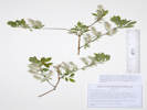
 Coll. No. 2925, Rhamnus cathartica on the bank of Deadman Gulch. Coll. No. 2925, Rhamnus cathartica on the bank of Deadman Gulch.
|
2925
|
Rhamnus cathartica
|
Native and Naturalized Flora of the Golden Area, Jefferson County, Colorado
Rhamnaceae
Rhamnus cathartica L.
European Buckthorn.
Deadman Gulch, Jefferson County, Colorado.
Also locally called “Kinney Run,” in a triangular city parcel along the projection of Illinois Street below US Highway 6.
39.7373°N, 105.2151°W.
WGS 1984
Elev. 1782 m.
One plant with 22 stems, rooted in bank of creek.
With Salix exigua and Prunus virginiana.
Collected by permit: City of Golden, 2023, issued: Mar 13, 2023, to: Tom Schweich.
|
Tom Schweich
2925. |
28-May-2023 |
|
Coll. No. 2925, Rhamnus cathartica. |
|
|
Locations:
Eagle Ridge.
 Coll. No. 2925, Agoseris parviflora. Coll. No. 2925, Agoseris parviflora.
|
2926
|
Crepis occidentalis
|
Native and Naturalized Flora of the Golden Area, Jefferson County, Colorado
Asteraceae
Agoseris parviflora (Nutt.) D. Dietr.
Steppe Goat-Chicory.
Eagle Ridge, Jefferson County, Colorado.
Local name for a small hogback composed of vertically-upturned Cretaceous-age Dakota Group between Deadman Gulch and US Highway 6, about 3.5 km. south of the GNIS location of Golden.
39.7316°N, 105.2141°W.
WGS 1984
Elev. 1853 m.
Teeth mostly in 5+ pairs; flower color yellow.
Nearly flat soil along top of hogback, with Helianthus pumilis, Cercocarpus montanus, Penstemon virens, Alyssum simplex, Erodium cicutarium, and Bromus tectorum.
Collected by permit: City of Golden, 2023, issued: Mar 13, 2023, to: Tom Schweich.
|
Tom Schweich
2926. |
28-May-2023 |
|
|
|
Other articles:
• Arapahoe Street:
near 5th;
 “Native Prairie Plants” “Native Prairie Plants”
|
|
I added a sign from Prairie Moon Nursery to the parkway.
|
|
Locations:
Schweich Hill.
 Penstemon secundiflorus “Sidebells Penstemon” on Schweich Hill. Penstemon secundiflorus “Sidebells Penstemon” on Schweich Hill.
 Penstemon virens “Front Range Beardtongue” on Schweich Hill. Penstemon virens “Front Range Beardtongue” on Schweich Hill.
|
|
Tuesday, 30 May 2023
Mostly weeding on Schweich Hill.
|
|
Locations:
Magpie Gulch.
 Golden from Magpie Gulch. Golden from Magpie Gulch.
 Small cascade in Magpie Gulch. Small cascade in Magpie Gulch.
|
|
Wednesday, 31 May 2023
Small cascade in Magpie Gulch. |
|
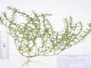
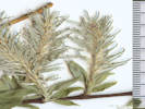
 Coll. No. 2927, Dodecatheon pulchellum in Magpie Gulch. Coll. No. 2927, Dodecatheon pulchellum in Magpie Gulch.
 Coll. No. 2927, Dodecatheon pulchellum Coll. No. 2927, Dodecatheon pulchellum
|
2927
|
Dodecatheon pulchellum
Plants of Jefferson County Open Space
Jefferson County, Colorado
Primulaceae
Dodecatheon pulchellum (Raf.) Merr.
Beautiful Shootingstar.
[=Primula pauciflora (Durand) A. L. Mast & Reveal]
Magpie Gulch, Jefferson County, Colorado.
In Mt. Galbraith Park, beside a bed rock cascade of the creek in Magpie Gulch, about 900 m. west of the gate to the parcel, 2.81 km. west northwest of the GNIS location of Golden.
39.7588°N, 105.246°W.
WGS 1984
Elev. 1902 m.
Mesic habitat formed by rock outcrops, with Populus × acuminata, Acer glabrum, Physocarpus monogynus, Rubus deliciosus, Ribes cereum, and Prunus virginiana.
Collected by permit: Jefferson County Open Space, 2023, issued: Apr 10, 2023, to: Tom Schweich.
|
Tom Schweich, with Cindy Trujillo
2927. |
31-May-2023 |
|
|
 Coll. No. 2928, Heuchera parvifolia. Coll. No. 2928, Heuchera parvifolia.
|
2928
|
Heuchera bracteata
Plants of Jefferson County Open Space
Jefferson County, Colorado
Saxifragaceae
Heuchera parvifolia Nutt. ex Torr. & A. Gray.
Littleleaf Alumroot.
Magpie Gulch, Jefferson County, Colorado.
In Mt. Galbraith Park, beside a bed rock cascade of the creek in Magpie Gulch, about 900 m. west of the gate to the parcel, 2.81 km. west northwest of the GNIS location of Golden.
39.7588°N, 105.2461°W.
WGS 1984
Elev. 1897 m.
Mesic habitat formed by rock outcrops, with Populus × acuminata, Acer glabrum, Physocarpus monogynus, Rubus deliciosus, Ribes cereum, and Prunus virginiana.
Collected by permit: Jefferson County Open Space, 2023, issued: Apr 10, 2023, to: Tom Schweich.
|
Tom Schweich, with Cindy Trujillo
2928. |
31-May-2023 |
|
|
|
Other articles:
• Golden Checklist Flora:
Lomatium orientale;
 Coll. No. 2929, Lomatium orientale. Coll. No. 2929, Lomatium orientale.
|
2929
|
Lomatium orientale.
Plants of Jefferson County Open Space
Jefferson County, Colorado
Apiaceae
Lomatium orientale J.M. Coult. & Rose.
Salt-and-Pepper.
Magpie Gulch, Jefferson County, Colorado.
In Mt. Galbraith Park, beside a bed rock cascade of the creek in Magpie Gulch, about 900 m. west of the gate to the parcel, 2.81 km. west northwest of the GNIS location of Golden.
39.7589°N, 105.2462°W.
WGS 1984
Elev. 1893 m.
Dry slope west and away from rock cascade.
Collected by permit: Jefferson County Open Space, 2023, issued: Apr 10, 2023, to: Tom Schweich.
|
Tom Schweich, with Cindy Trujillo
2929. |
21-May-2023 |
|
|
|
Other articles:
• Golden Checklist Flora:
Crataegus erythropoda;
 Coll. No. 2930, Crataegus erythropoda. Coll. No. 2930, Crataegus erythropoda.
|
2930
|
Crataegus succulenta
Plants of Jefferson County Open Space
Jefferson County, Colorado
Rosaceae
Crataegus erythropoda Ashe.
Cerro Hawthorn.
Magpie Gulch, Jefferson County, Colorado.
In Mt. Galbraith Park, beside the creek in Magpie Gulch, about 1100 m. west of the gate to the parcel, 2.99 km. west northwest of the GNIS location of Golden.
39.7585°N, 105.2477°W.
WGS 1984
Elev. 1930 m.
Collected by permit: Jefferson County Open Space, 2023, issued: Apr 10, 2023, to: Tom Schweich.
|
Tom Schweich, with Cindy Trujillo
2930. |
31-May-2023 |
|
|
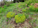
 Coll. No. 2931, Mentzelia albicaulis. Coll. No. 2931, Mentzelia albicaulis.
|
2931
|
Mentzelia sp.
Plants of Jefferson County Open Space
Jefferson County, Colorado
Loasaceae
Mentzelia albicaulis (Douglas ex Hook.) Douglas ex Torr. & A. Gray.
White-Stem Blazing Star.
Magpie Gulch, Jefferson County, Colorado.
Mount Galbriath Park, north side of Magpie gulch, 2.87 km. west northwest of the GNIS location of Golden.
39.7596°N, 105.2463°W.
WGS 1984
Elev. 1925 m.
Leaves deeply pinnatifid; petals short, yellow.
Steep, sunny, grassy slope about 100 m. above creek. Also collected here: Euphorbia brachycera.
Collected by permit: Jefferson County Open Space, 2023, issued: Apr 10, 2023, to: Tom Schweich.
|
Tom Schweich, with Cindy Trujillo
2931. |
21-May-2023 |
|
|
|
Other articles:
• Golden Checklist Flora:
Euphorbia peplus;
 Coll. No. 2931.1, Euphorbia peplus. Coll. No. 2931.1, Euphorbia peplus.
|
2931.1
|
Euphorbia brachycera
Plants of Jefferson County Open Space
Jefferson County, Colorado
Euphorbiaceae
Euphorbia peplus L.
Petty Spurge.
Magpie Gulch, Jefferson County, Colorado.
Mount Galbraith Park, north side of Magpie gulch, about 850 m. west of the parcel gate, 2.87 km. west northwest of the GNIS location of Golden.
39.7596°N, 105.2463°W.
WGS 1984
Elev. 1925 m.
Annual, erect; leaves alternate, oblanceolate, entire.
Steep, sunny, grassy slope about 100 m. above creek. Also collected here: Mentzelia albicaulis.
Collected by permit: Jefferson County Open Space, 2023, issued: Apr 10, 2023, to: Tom Schweich.
|
Tom Schweich, with Cindy Trujillo
2931.1 |
31-May-2023 |
|
|
 Coll. No. 2932, Corydalis aurea. Coll. No. 2932, Corydalis aurea.
|
2932
|
Corydalis aurea
Plants of Jefferson County Open Space
Jefferson County, Colorado
Fumariaceae
Corydalis aurea Willd.
Scrambled Eggs.
Magpie Gulch, Jefferson County, Colorado.
Mount Galbraith Park, north side of Magpie gulch, about 730 m. west of the parcel gate, 2.87 km. west northwest of the GNIS location of Golden.
39.7596°N, 105.2453°W.
WGS 1984
Elev. 1912 m.
Steep, sunny, grassy slope about 85 m. above creek.
Collected by permit: Jefferson County Open Space, 2023, issued: Apr 10, 2023, to: Tom Schweich.
|
Tom Schweich, with Cindy Trujillo
2932. |
31-May-2023 |
|
|
 Coll. No. 2933, Allium textile Coll. No. 2933, Allium textile
|
2933
|
Allium textile.
Plants of Jefferson County Open Space
Jefferson County, Colorado
Alliaceae
Allium textile A. Nelson & J.F. Macbr.
Textile Onion.
Magpie Gulch, Jefferson County, Colorado.
Mount Galbraith Park, north side of Magpie gulch, about 490 m. west of the parcel gate, 2.55 km. west northwest of the GNIS location of Golden.
39.7608°N, 105.243°W.
WGS 1984
Elev. 1917 m.
Bulb coat fibrous, appearing woven; flowers white.
Moderately steep east-facing grassy slope above patch of Cercocarpus montanus; also here: Phlox multiflora.
Common.
Collected by permit: Jefferson County Open Space, 2023, issued: Apr 10, 2023, to: Tom Schweich.
|
Tom Schweich, with Cindy Trujillo
2933. |
31-May-2023 |
|
|
 Coll. No. 2934, Descurainia pinnata ssp. brachycarpa. Coll. No. 2934, Descurainia pinnata ssp. brachycarpa.
|
2934
|
Descurainia sp.
Plants of Jefferson County Open Space
Jefferson County, Colorado
Brassicaceae
Descurainia pinnata (Walter) Britton ssp. brachycarpa (Richardson) Detling, Amer.Midl. Naturalist. 22: 509.
Western Tansymustard.
Magpie Gulch, Jefferson County, Colorado.
Mount Galbraith Park, north side of Magpie gulch, about 400 m. west northwest of the parcel gate, 2.46 km. west northwest of the GNIS location of Golden.
39.7607°N, 105.2421°W.
WGS 1984
Elev. 1892 m.
Stem branched distally, stellate-hairy then glandular; leaves bi-pinnate; rachis glandular; sepals yellow; fruit fusiform, glabrous; seeds biseriate; valves distinct mid-vein; ovules 18±.
Around the edges of a large patch of Rhus trilobata.
Collected by permit: Jefferson County Open Space, 2023, issued: Apr 10, 2023, to: Tom Schweich.
|
Tom Schweich, with Cindy Trujillo
2934. |
31-May-2023 |
|
|
|
|
|
June 2023
|
|
|
|
Friday, June 2, 2023
Schweich Hill and Cathy's garden.
|
|
Locations:
Schweich Hill.
 Penstemon secundiflorus “Sidebells Penstemon” on Schweich Hill. Penstemon secundiflorus “Sidebells Penstemon” on Schweich Hill.
 Penstemon virens “Front Range Beardtongue” on Schweich Hill. Penstemon virens “Front Range Beardtongue” on Schweich Hill.
|
|
Schweich Hill
|
 “Baby Slippers” Hybanthus verticillatus found in a yard in Golden. “Baby Slippers” Hybanthus verticillatus found in a yard in Golden.
|
|
Found in a private garden in Golden.
|
|
Locations:
Schweich Hill.
 Penstemon virens on Schweich Hill, with North Table Mountain in the background. Penstemon virens on Schweich Hill, with North Table Mountain in the background.
|
|
Evening walk on Schweich Hill.
|
|
|
|
Saturday, 3 June 2023
Rainy Earth Day.
|
|
Other articles:
• Golden Gate Canyon Road:
along the road;
Locations:
Guy Gulch.
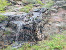
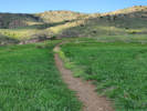
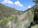
 View southeast of Guy Gulch. View southeast of Guy Gulch.
|
|
Tuesday, 6 June 2023
View northwest along Guy Gulch. |
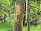
Bear sign. |
|
|
Other articles:
• Golden Checklist Flora:
Arabis pycnocarpa;
 Coll. No. 2935, Arabis pycnocarpa var. pcynocarpa. Coll. No. 2935, Arabis pycnocarpa var. pcynocarpa.
|
2935
|
Arabis pycnocarpa
Plants of the Douglas Mountain Study Area
Jefferson County Open Space, Colorado, USA
Brassicaceae
Arabis pycnocarpa M. Hopkins var. pycnocarpa.
Cream Flower Rockcress.
Guy Gulch, Jefferson County, Colorado.
Douglas Mountain Study Area, area along Guy Gulch, north side of Jefferson County Road 70 and near western boundary, 17.6 km. northwest of the GNIS location of Golden.
39.803°N, 105.3671°W.
WGS 1984
Elev. 2437 m.
South-facing slope, with Artemisia frigida, Cirsium undulatum, and Ribes cereum.
Collected by permit: Jefferson County Open Space, 2023, issued: Apr 10, 2023, to: Tom Schweich.
|
Tom Schweich, with John Vickery
2935. |
6-Jun-2023 |
|
|
|
Other articles:
• Golden Checklist Flora:
Camelina microcarpa;
 Coll. No. 2936, Camelina microcarpa. Coll. No. 2936, Camelina microcarpa.
|
2936
|
Camelina microcarpa
Plants of the Douglas Mountain Study Area
Jefferson County Open Space, Colorado, USA
Brassicaceae
Camelina microcarpa Andrz. ex DC.
Little-Podded False Flax.
Guy Gulch, Jefferson County, Colorado.
Douglas Mountain Study Area, area along Guy Gulch, north side of Jefferson County Road 70 and near western boundary, 17.6 km. northwest of the GNIS location of Golden.
39.803°N, 105.3671°W.
WGS 1984
Elev. 2437 m.
Simple and forked hairs; stem leaves auriculate, simple; petals 3.5 mm., yellow; fruit 6 mm.; valve midvein obscure.
With Cercocarpus montanus and Ribes cereum.
Collected by permit: Jefferson County Open Space, 2023, issued: Apr 10, 2023, to: Tom Schweich.
|
Tom Schweich, with John Vickery
2936. |
6-Jun-2023 |
|
|
|
|
2936.1
|
Scutellaria brittonii.
Plants of the Douglas Mountain Study Area
Jefferson County Open Space, Colorado, USA
Lamiaceae
Scutellaria brittonii Porter.
Britton's Skullcap.
Guy Gulch, Jefferson County, Colorado.
Douglas Mountain Study Area, area along Guy Gulch, north side of Jefferson County Road 70 and near western boundary, 17.6 km. northwest of the GNIS location of Golden.
39.803°N, 105.3671°W.
WGS 1984
Elev. 2437 m.
With Cercocarpus montanus and Ribes cereum.
Collected by permit: Jefferson County Open Space, 2023, issued: Apr 10, 2023, to: Tom Schweich.
|
Tom Schweich, with John Vickery
2936.1 |
6-Jun-2023 |
|
|
|
|
2936.2
|
Plants of the Douglas Mountain Study Area
Jefferson County Open Space, Colorado, USA
Rosaceae
Potentilla fissa Nutt. ex Torr. & A.Gray.
Bigflower Cinquefoil.
Guy Gulch, Jefferson County, Colorado.
Douglas Mountain Study Area, area along Guy Gulch, north side of Jefferson County Road 70 and near western boundary, 17.6 km. northwest of the GNIS location of Golden.
39.803°N, 105.3671°W.
WGS 1984
Elev. 2437 m.
With Cercocarpus montanus and Ribes cereum.
Collected by permit: Jefferson County Open Space, 2023, issued: Apr 10, 2023, to: Tom Schweich.
|
Tom Schweich, with John Vickery
2936.2 |
6-Jun-2023 |
|
|
|
|
2937
|
Sun sedge,
Plants of the Douglas Mountain Study Area
Jefferson County Open Space, Colorado, USA
Cyperaceae
Carex inops L.H. Bailey ssp. heliophila (Mack.) Crins.
Sun Sedge.
Guy Gulch, Jefferson County, Colorado.
Douglas Mountain Study Area, area along Guy Gulch, about 47 m. above the road, north side of Jefferson County Road 70 and near western boundary, 17.6 km. northwest of the GNIS location of Golden.
39.8032°N, 105.3673°W.
WGS 1984
Elev. 2444 m.
On the nose of a low ridge with Ribes cereum, and Artemisia frigida.
Common.
Collected by permit: Jefferson County Open Space, 2023, issued: Apr 10, 2023, to: Tom Schweich.
|
Tom Schweich, with John Vickery
2937. |
6-Jun-2023 |
|
|
|
|
2938
|
Physaria montana.
Plants of the Douglas Mountain Study Area
Jefferson County Open Space, Colorado, USA
Brassicaceae
Physaria montana (A. Gray) Greene.
Mountain Bladderpod.
Guy Gulch, Jefferson County, Colorado.
Douglas Mountain Study Area, area along Guy Gulch, about 75 m. above the road, north side of Jefferson County Road 70 and near western boundary, 17.6 km. northwest of the GNIS location of Golden.
39.8034°N, 105.3673°W.
WGS 1984
Elev. 2456 m.
With Pinus ponderosa, Pediocactus simpsonii, and Cercocarpus montanus.
Collected by permit: Jefferson County Open Space, 2023, issued: Apr 10, 2023, to: Tom Schweich.
|
Tom Schweich, with John Vickery
2938. |
6-Jun-2023 |
|
|
|
|
2938.1
|
Alyssum simplex
Plants of the Douglas Mountain Study Area
Jefferson County Open Space, Colorado, USA
Brassicaceae
Alyssum simplex Rudolphi.
European Madwort.
Guy Gulch, Jefferson County, Colorado.
Douglas Mountain Study Area, area along Guy Gulch, about 75 m. above the road, north side of Jefferson County Road 70 and near western boundary, 17.6 km. northwest of the GNIS location of Golden.
39.8034°N, 105.3673°W.
WGS 1984
Elev. 2456 m.
With Pinus ponderosa, Physaria montana, Pediocactus simpsonii, and Cercocarpus montanus.
Collected by permit: Jefferson County Open Space, 2023, issued: Apr 10, 2023, to: Tom Schweich.
|
Tom Schweich, with John Vickery
2938.1 |
6-Jun-2023 |
|
|
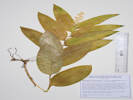
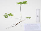
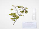 Coll. No. 2939, Acer glabrum im bloom. Coll. No. 2939, Acer glabrum im bloom.
|
2939
|
Acer glabrum in bloom.
Plants of Jefferson County Open Space
Jefferson County, Colorado
Sapindaceae
Acer glabrum Torr.
Rocky Mountain Maple.
Guy Gulch, Jefferson County, Colorado.
Douglas Mountain Study Area, area along Guy Gulch, about 100 m. above the road, north side of Jefferson County Road 70 and near western boundary, 17.7 km. northwest of the GNIS location of Golden.
39.8036°N, 105.3674°W.
WGS 1984
Elev. 2461 m.
Off the east side of a small ridge, also here, Collinsia parviflora on sunny ground around the maple.
Collected by permit: Jefferson County Open Space, 2023, issued: Apr 10, 2023, to: Tom Schweich.
|
Tom Schweich, with John Vickery
2939. |
6-Jun-2023 |
|
|
|
|
2939.1
|
Collinsia parviflora.
Plants of the Douglas Mountain Study Area
Jefferson County Open Space, Colorado, USA
Plantaginaceae
Collinsia parviflora Lindl.
Maiden Blue-eyed Mary.
Guy Gulch, Jefferson County, Colorado.
Douglas Mountain Study Area, area along Guy Gulch, about 100 m. above the road, north side of Jefferson County Road 70 and near western boundary, 17.7 km. northwest of the GNIS location of Golden.
39.8036°N, 105.3674°W.
WGS 1984
Elev. 2461 m.
With Juniperus scopulorum, Artemisia frigida, Eriogonum jamesii, and Cercocarpus montanus.
Collected by permit: Jefferson County Open Space, 2023, issued: Apr 10, 2023, to: Tom Schweich.
|
Tom Schweich, with John Vickery
2939.1 |
6-Jun-2023 |
|
|
|
|
2940
|
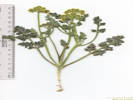
Harbouria trachypleura.
Plants of the Douglas Mountain Study Area
Jefferson County Open Space, Colorado, USA
Apiaceae
Harbouria trachypleura (A. Gray) J.M. Coult. & Rose.
Whiskbroom Parsley.
Guy Gulch, Jefferson County, Colorado.
Douglas Mountain Study Area, area along Guy Gulch, about 80 m. above the road, north side of Jefferson County Road 70 and near western boundary, 17.7 km. northwest of the GNIS location of Golden.
39.8036°N, 105.3677°W.
WGS 1984
Elev. 2460 m.
Nose of small southeast plunging ridge, with Heterotheca villosa and Cercocarpus montanus.
Collected by permit: Jefferson County Open Space, 2023, issued: Apr 10, 2023, to: Tom Schweich.
|
Tom Schweich, with John Vickery
2940. |
6-Jun-2023 |
|
|
|
|
2941
|
Senecio integerrimus.
Plants of the Douglas Mountain Study Area
Jefferson County Open Space, Colorado, USA
Asteraceae
Senecio integerrimus Nutt.
Columbia Ragwort.
Guy Gulch, Jefferson County, Colorado.
Douglas Mountain Study Area, area along Guy Gulch, about 80 m. above the road, north side of Jefferson County Road 70 and near western boundary, 17.7 km. northwest of the GNIS location of Golden.
39.8036°N, 105.3678°W.
WGS 1984
Elev. 2466 m.
leaves toothed.
Nose of small southeast plunging ridge, with Juniperus scopulorum, Pediocactus simpsonii, Mertensia lanceolata, and Cercocarpus montanus.
Collected by permit: Jefferson County Open Space, 2023, issued: Apr 10, 2023, to: Tom Schweich.
|
Tom Schweich, with John Vickery
2941. |
6-Jun-2023 |
|
|
|
Other articles:
• Golden Checklist Flora:
Maianthemum racemosum amplexicaule;
 Coll. No. 2942, Maianthemum racemosum ssp. amplexicaule. Coll. No. 2942, Maianthemum racemosum ssp. amplexicaule.
|
2942
|
Maianthemum racemosa ssp. amplexicaule.
Plants of the Douglas Mountain Study Area
Jefferson County Open Space, Colorado, USA
Ruscaceae
Maianthemum racemosum (L.) Link ssp. amplexicaule (Nutt.) LaFrankie.
Feathery False Lily of the Valley.
Guy Gulch, Jefferson County, Colorado.
Douglas Mountain Study Area, area along Guy Gulch, about 75 m. above the road, north side of Jefferson County Road 70 and near western boundary, 17.8 km. northwest of the GNIS location of Golden.
39.8036°N, 105.3679°W.
WGS 1984
Elev. 2467 m.
Nose of small southeast plunging ridge, in deep soil under Juniperus scopulorum, with Ribes cereum.
Collected by permit: Jefferson County Open Space, 2023, issued: Apr 10, 2023, to: Tom Schweich.
|
Tom Schweich, with John Vickery
2942. |
6-Jun-2023 |
|
Placed in Asparagaceae by Ackerfield (2022) and Plants of the World (Kew, 2023), but retained in Ruscaceae by APG4.
|
|
|
2942.1
|
Mertensia lanceolata.
Plants of the Douglas Mountain Study Area
Jefferson County Open Space, Colorado, USA
Boraginaceae
Mertensia lanceolata (Pursh) DC.
Prairie Bluebells.
Guy Gulch, Jefferson County, Colorado.
Douglas Mountain Study Area, area along Guy Gulch, about 75 m. above the road, north side of Jefferson County Road 70 and near western boundary, 17.8 km. northwest of the GNIS location of Golden.
39.8036°N, 105.3679°W.
WGS 1984
Elev. 2467 m.
Nose of small southeast plunging ridge, in deep soil under Juniperus scopulorum, with Ribes cereum.
Collected by permit: Jefferson County Open Space, 2023, issued: Apr 10, 2023, to: Tom Schweich.
|
Tom Schweich, with John Vickery
2942.1 |
6-Jun-2023 |
|
|
|
Other articles:
• Golden Checklist Flora:
Erigeron vetensis;
 Coll. No. 2943, Erigeron vetensis. Coll. No. 2943, Erigeron vetensis.
|
2943
|
Erigeron vetensis.
Plants of the Douglas Mountain Study Area
Jefferson County Open Space, Colorado, USA
Asteraceae
Erigeron vetensis Rydb.
Early Bluetop Fleabane.
Guy Gulch, Jefferson County, Colorado.
Douglas Mountain Study Area, area along Guy Gulch, about 100 m. above the road, north side of Jefferson County Road 70 and near western boundary, 17.8 km. northwest of the GNIS location of Golden.
39.8038°N, 105.3679°W.
WGS 1984
Elev. 2475 m.
Nose of small southeast plunging ridge, with Pediocactus simpsonii, Eriogonum jamesii, and Cercocarpus montanus.
Collected by permit: Jefferson County Open Space, 2023, issued: Apr 10, 2023, to: Tom Schweich.
|
Tom Schweich, with John Vickery
2943. |
6-Jun-2023 |
|
|
|
|
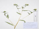
2944
|
Astragalus shortianus,
Plants of the Douglas Mountain Study Area
Jefferson County Open Space, Colorado, USA
Fabaceae
Astragalus shortianus [Nutt. ex] Torr. & A.Gray.
Short's Milkvetch.
Guy Gulch, Jefferson County, Colorado.
Douglas Mountain Study Area, area along Guy Gulch, about 120 m. above the road, north side of Jefferson County Road 70 and near western boundary, 17.8 km. northwest of the GNIS location of Golden.
39.804°N, 105.3678°W.
WGS 1984
Elev. 2473 m.
This collection is two plants that each have been split in two, plus various parts from other plants in this little colony.
Nose of small southeast plunging ridge. Seems to be arranged in little colonies of 5-6 plants. Open grassy slope with some Cercocarpus montanus.
Collected by permit: Jefferson County Open Space, 2023, issued: Apr 10, 2023, to: Tom Schweich.
|
Tom Schweich, with John Vickery
2944. |
6-Jun-2023 |
|
|
|
Other articles:
• Golden Checklist Flora:
Microsteris gracilis;
 Coll. No. 2945, Microsteris gracilis. Coll. No. 2945, Microsteris gracilis.
 Coll. No. 2945, Microsteris gracilis. Coll. No. 2945, Microsteris gracilis.
|
2945
|
Microsteris gracilis.
Plants of the Douglas Mountain Study Area
Jefferson County Open Space, Colorado, USA
Polemoniaceae
Microsteris gracilis (Douglas ex Hook.) Greene.
Slender Phlox.
Guy Gulch, Jefferson County, Colorado.
Douglas Mountain Study Area, area along Guy Gulch, about 160 m. above the road, north side of Jefferson County Road 70 and near western boundary, 17.8 km. northwest of the GNIS location of Golden.
39.8044°N, 105.368°W.
WGS 1984
Elev. 2479 m.
Nose of small southeast plunging ridge, with Heterotheca villosa, Ribes cereum, and Cercocarpus montanus.
Collected by permit: Jefferson County Open Space, 2023, issued: Apr 10, 2023, to: Tom Schweich.
|
Tom Schweich, with John Vickery
2945. |
6-Jun-2023 |
|
|
|
|
2945.1
|
Draba nemorosa.
Plants of the Douglas Mountain Study Area
Jefferson County Open Space, Colorado, USA
Brassicaceae
Draba nemorosa L.
Woodland Whitlow Grass.
Guy Gulch, Jefferson County, Colorado.
Douglas Mountain Study Area, area along Guy Gulch, about 160 m. above the road, north side of Jefferson County Road 70 and near western boundary, 17.8 km. northwest of the GNIS location of Golden.
39.8044°N, 105.368°W.
WGS 1984
Elev. 2484 m.
Nose of small southeast plunging ridge, with Heterotheca villosa, Ribes cereum, and Cercocarpus montanus.
Collected by permit: Jefferson County Open Space, 2023, issued: Apr 10, 2023, to: Tom Schweich.
|
Tom Schweich, with John Vickery
2945.1 |
6-Jun-2023 |
|
|
|
|
2946
|
Poa.
Plants of the Douglas Mountain Study Area
Jefferson County Open Space, Colorado, USA
Poaceae
Poa pratensis L.
Kentucky Bluegrass.
Guy Gulch, Jefferson County, Colorado.
Douglas Mountain Study Area, area along Guy Gulch, about 220 m. above the county road, north side of Jefferson County Road 70 and near western boundary, 17.8 km. northwest of the GNIS location of Golden.
39.8048°N, 105.3679°W.
WGS 1984
Elev. 2488 m.
On a small southeast-facing ridge, with Artemisia dracunculus, Sedum lanceolatum, and Eriogonum jamesii.
Collected by permit: Jefferson County Open Space, 2023, issued: Apr 10, 2023, to: Tom Schweich.
|
Tom Schweich, with John Vickery
2946. |
6-Jun-2023 |
|
|
|
|
2947
|
Antennaria rosea.
Plants of the Douglas Mountain Study Area
Jefferson County Open Space, Colorado, USA
Asteraceae
Antennaria rosea Greene.
Rosy Pussytoes.
Guy Gulch, Jefferson County, Colorado.
Douglas Mountain Study Area, area along Guy Gulch, about 210 m. above the county road, north side of Jefferson County Road 70 and near western boundary, 17.8 km. northwest of the GNIS location of Golden.
39.8048°N, 105.368°W.
WGS 1984
Elev. 2488 m.
Collected by permit: Jefferson County Open Space, 2023, issued: Apr 10, 2023, to: Tom Schweich.
|
Tom Schweich, with John Vickery
2947. |
6-Jun-2023 |
|
|
 Coll. No. 2948, Salix scouleriana. Coll. No. 2948, Salix scouleriana.
|
2948
|
Salix, maybe S. scouleriana?
Plants of the Douglas Mountain Study Area
Jefferson County Open Space, Colorado, USA
Salicaceae
Salix scouleriana Barratt ex Hook.
Scouler's Willow.
Guy Gulch, Jefferson County, Colorado.
Douglas Mountain Study Area, area along Guy Gulch, about 315 m. above the county road, north side of Jefferson County Road 70 and near western boundary, 17.8 km. northwest of the GNIS location of Golden.
39.8054°N, 105.3676°W.
WGS 1984
Elev. 2494 m.
Floral bracts black; young stamens red.
Openings in forest, east-facing slope below top of ridge, bottom of rock outcrop, well above stream, with Ribes cereum, Jamesia americana, and Acer glabrum.
Collected by permit: Jefferson County Open Space, 2023, issued: Apr 10, 2023, to: Tom Schweich.
|
Tom Schweich, with John Vickery
2948. |
6-Jun-2023 |
|
|
|
|
2949
|
Carex sp.
Plants of the Douglas Mountain Study Area
Jefferson County Open Space, Colorado, USA
Plantaginaceae
Penstemon virens Pennell ex Rydb.
Front Range Beardtongue.
Guy Gulch, Jefferson County, Colorado.
Douglas Mountain Study Area, area along Guy Gulch, about 340 m. above the county road, north side of Jefferson County Road 70 and near western boundary, 17.9 km. northwest of the GNIS location of Golden.
39.8058°N, 105.3678°W.
WGS 1984
Elev. 2501 m.
Flowers just beginning to open.
Open rocky slope.
Collected by permit: Jefferson County Open Space, 2023, issued: Apr 10, 2023, to: Tom Schweich.
|
Tom Schweich, with John Vickery
2950. |
6-Jun-2023 |
|
|
|
|
2950
|
Penstemon virens.
Plants of the Douglas Mountain Study Area
Jefferson County Open Space, Colorado, USA
Plantaginaceae
Penstemon virens Pennell ex Rydb.
Front Range Beardtongue.
Guy Gulch, Jefferson County, Colorado.
Douglas Mountain Study Area, area along Guy Gulch, about 340 m. above the county road, north side of Jefferson County Road 70 and near western boundary, 17.9 km. northwest of the GNIS location of Golden.
39.8058°N, 105.3678°W.
WGS 1984
Elev. 2501 m.
Flowers just beginning to open.
Open rocky slope.
Collected by permit: Jefferson County Open Space, 2023, issued: Apr 10, 2023, to: Tom Schweich.
|
Tom Schweich, with John Vickery
2950. |
6-Jun-2023 |
|
|
 Coll. No. 2951, Osnorhiza depauperata. Coll. No. 2951, Osnorhiza depauperata.
|
2951
|
Osmorhiza, probably O. depauperata.
Plants of the Douglas Mountain Study Area
Jefferson County Open Space, Colorado, USA
Apiaceae
Osmorhiza depauperata Phil.
Blunt-Fruit Sweet-Cicely.
Guy Gulch, Jefferson County, Colorado.
Along stream tributary to Guy Gulch, about 310 m. north of County Road 70, near the western boundary of the study area, 17.7 km. northwest of the GNIS location of Golden.
39.805°N, 105.3671°W.
WGS 1984
Elev. 2464 m.
Shaded floor of small gulch.
Collected by permit: Jefferson County Open Space, 2023, issued: Apr 10, 2023, to: Tom Schweich.
|
Tom Schweich, with John Vickery
2951. |
6-Jun-2023 |
|
|
|
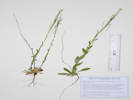
|
2952
|
Androsace septentrionalis.
Plants of the Douglas Mountain Study Area
Jefferson County Open Space, Colorado, USA
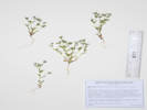
Primulaceae
Androsace septentrionalis L.
Pygmyflower Rockjasmine.
Guy Gulch, Jefferson County, Colorado.
Along stream tributary to Guy Gulch about 90 m. north of County Road 70, near the western boundary of the study area, 17.7 km. northwest of the GNIS location of Golden.
39.8033°N, 105.3671°W.
WGS 1984
Elev. 2448 m.
Bracts lanceolate.
Sunny spot, on shoulder of abandoned stream bar, with Rubus deliciosus and Bromus inermis.
Collected by permit: Jefferson County Open Space, 2023, issued: Apr 10, 2023, to: Tom Schweich.
|
Tom Schweich, with John Vickery
2952. |
6-Jun-2023 |
|
|
|
|
|
Wednesday, 7 June 2023
|
|
Other articles:
• Golden Checklist Flora:
Blitum nuttallianum;
 Coll. No. 2953, Blitum nuttallianum. Coll. No. 2953, Blitum nuttallianum.
 Inflorescence of Coll. No. 2953, Blitum nuttallianum. Inflorescence of Coll. No. 2953, Blitum nuttallianum.
|
2953
|
Amaranth, maybe A. blitoides.
|
Native and Naturalized Flora of the Golden Area, Jefferson County, Colorado
Chenopodiaceae
Blitum nuttallianum Schult.
Nuttall's Povertyweed.
Golden, Jefferson County, Colorado.
Southwest parkway at 900 5th Street, Golden.
39.7609°N, 105.2286°W.
WGS 1984
Elev. 1755 m.
Adventive “weed” in an area planted with purchased seed of Colorado native plants.
Collected by permit: City of Golden, 2023, issued: Mar 13, 2023, to: Tom Schweich.
|
Tom Schweich
2953. |
7-Jun-2023 |
|
|
|
Locations:
Stonebridge Homeowners Association.
 Stonebridge common area. Stonebridge common area.
 Stonebridge common area. Stonebridge common area.
|
|
Tuesday, 13 June 2023
|
|
|
2954
|
Bromus, maybe B. carinatus. Phfft!
cheat grass.
|
|
Other articles:
• Golden Gate Canyon Road:
at Centennial Ranch;
Locations:
Guy Gulch.
 View northwest on Guy Gulch, 14 June 2023. View northwest on Guy Gulch, 14 June 2023.
|
|
Wednesday, 14 June 2023
Guy Gulch in Douglas Mountain Study Area.
|
 Coll. No. 2955, Salix × fragilis. Coll. No. 2955, Salix × fragilis.
|
2955
|
Salix × fragilis.
Plants of the Douglas Mountain Study Area
Jefferson County Open Space, Colorado, USA
Salicaceae
Salix × fragilis L.
Crack Willow.
Guy Gulch, Jefferson County, Colorado.
Along the creek in Guy Gulch, 115 m. southwest of the ranch house, 15.9 km. northwest of the GNIS location of Golden.
39.7943°N, 105.3549°W.
WGS 1984
Elev. 2337 m.
Trees, huge trunks, branches break easily, ♀ catkins.
Collected by permit: Jefferson County Open Space, 2023, issued: Apr 10, 2023, to: Tom Schweich.
|
Tom Schweich, with John Vickery
2955. |
14-Jun-2023 |
|
|
 Coll. No. 2956, Salix lasiandra var. caudata. Coll. No. 2956, Salix lasiandra var. caudata.
 Catkin of Coll. No. 2956, Salix lasiandra var. caudata. Catkin of Coll. No. 2956, Salix lasiandra var. caudata.
|
2956
|
Salix sp.
Plants of the Douglas Mountain Study Area
Jefferson County Open Space, Colorado, USA
Salicaceae
Salix lasiandra Benth. Var. caudata (Nutt.) Sudw.
Greenleaf Willow.
Guy Gulch, Jefferson County, Colorado.
Along the creek in Guy Gulch, 95 m. southwest of the Centennial Ranch house, 2.48 km. south of Mt. Tom, 12.2 km. (geodesic) northwest of the GNIS location of Golden.
39.7942°N, 105.3549°W.
WGS 1984
Elev. 2340 m.
Staminate catkins, small multi-trunk.
Collected by permit: Jefferson County Open Space, 2023, issued: Apr 10, 2023, to: Tom Schweich.
|
Tom Schweich, with John Vickery
2956. |
14-Jun-2023 |
| Coll. No. 2956, 14 Jun 2023, characters observed:
Shrub, tall, multistem, > 1 m.;
Stems,
current year's yellow-brown, shiny (like shellacked),
prior year's medium brown;
Leaves,
petiole, 2-3 mm., without glands,
blade, elliptic,
52 mm. × 18 mm. wide,
margin, serrulate,
tip, acute to acuminate,
glabrous;
Catkins,
staminate,
peduncles, 9-14 mm., leafy,
catkin, 40 mm., elongate;
Floral bracts,
yellowish-tan,
tips, eglandular, rounded to erose?,
proximally velutinous (short wavy);
Stamens, 5-6;
Filaments, not hairy.
|
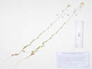
 Coll. No. 2957, Ranunculus repens. Coll. No. 2957, Ranunculus repens.
|
2957
|
Ranunculus, maybe R. repens.
Plants of the Douglas Mountain Study Area
Jefferson County Open Space, Colorado, USA
Ranunculaceae
Ranunculus repens L.
Creeping Buttercup.
Guy Gulch, Jefferson County, Colorado.
Wet area from small creek entering Guy Gulch from the northeast, southwest side of County Road 70, 107 m. southwest of the ranch house, 15.8 km. northwest of the GNIS location of Golden.
39.7942°N, 105.3546°W.
WGS 1984
Elev. 2336 m.
Semi-aquatic; rooting at nodes, basal leaves compound; petals 11-12 mm. × 9 mm. wide, yellow.
Collected by permit: Jefferson County Open Space, 2023, issued: Apr 10, 2023, to: Tom Schweich.
|
Tom Schweich, with John Vickery
2957. |
14-Jun-2023 |
|
|
|
|
2958
|
Rumex acetosella.
Plants of the Douglas Mountain Study Area
Jefferson County Open Space, Colorado, USA
Polygonaceae
Rumex acetosella L.
Sheep Sorrel.
Guy Gulch, Jefferson County, Colorado.
Beside small creek entering Guy Gulch from the northeast, southwest side of County Road 70, 107 m. southwest of the ranch house, 15.8 km. northwest of the GNIS location of Golden.
39.7942°N, 105.3546°W.
WGS 1984
Elev. 2336 m.
Open, sunny field with short grasses.
Collected by permit: Jefferson County Open Space, 2023, issued: Apr 10, 2023, to: Tom Schweich.
|
Tom Schweich, with John Vickery
2958. |
14-Jun-2023 |
|
|
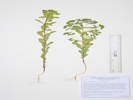
 Coll. No. 2959, Salix bebbiana. Coll. No. 2959, Salix bebbiana.
 Catkin of Coll. No. 2959, Salix bebbiana. Catkin of Coll. No. 2959, Salix bebbiana.
|
2959
|
Salix sp.
Plants of the Douglas Mountain Study Area
Jefferson County Open Space, Colorado, USA
Salicaceae
Salix bebbiana Sarg.
Bebb Willow.
Guy Gulch, Jefferson County, Colorado.
Beside the creek of Guy Gulch, southwest side of County Road 70, 96 m. southwest of the ranch house, 2.48 km. south of Mt. Tom, 12.2 km. (geodesic) northwest of the GNIS location of Golden.
39.7941°N, 105.3548°W.
WGS 1984
Elev. 2342 m.
Pistillate catkins, young stems reddish.
Bank of creek.
Collected by permit: Jefferson County Open Space, 2023, issued: Apr 10, 2023, to: Tom Schweich.
|
Tom Schweich, with John Vickery
2959. |
14-Jun-2023 |
|
Coll. No. 2959, 14 Jun 2023, characters observed:
Shrub, multi-stem, > 1 m.;
Stems,
not pruinose,
current year reddish brown;
Leaves,
alternate,
elliptic,
20 mm. × 9 mm. wide,
petiole 2-3 mm.,
pubescent both sides;
Catkins,
pistillate,
35 mm.,
open, loosely flowered,
floral bracts, tan,
stipe, 3 mm.;
Capsules,
6 mm.,
pubescent.
|
|
|
2959.1
|
Equisetum sp.
Plants of the Douglas Mountain Study Area
Jefferson County Open Space, Colorado, USA
Equisetaceae
Equisetum arvense L.
Field Horsetail.
Guy Gulch, Jefferson County, Colorado.
In the creek of Guy Gulch, southwest side of County Road 70, 125 m. southwest of the ranch house, 15.8 km. northwest of the GNIS location of Golden.
39.7941°N, 105.3548°W.
WGS 1984
Elev. 2342 m.
Collected by permit: Jefferson County Open Space, 2023, issued: Apr 10, 2023, to: Tom Schweich.
|
Tom Schweich, with John Vickery
2959.1 |
14-Jun-2023 |
|
|
|
|
2960
|
Antennaria parvifolia
Plants of the Douglas Mountain Study Area
Jefferson County Open Space, Colorado, USA
Asteraceae
Antennaria rosea Greene.
Rosy Pussytoes.
Guy Gulch, Jefferson County, Colorado.
Southwest side of the creek and County Road 70, 180 m. southwest of the ranch house, 15.9 km. northwest of the GNIS location of Golden.
39.7936°N, 105.3548°W.
WGS 1984
Elev. 2342 m.
Lowest northeast-facing hill slope, edge of forest.
Collected by permit: Jefferson County Open Space, 2023, issued: Apr 10, 2023, to: Tom Schweich.
|
Tom Schweich, with John Vickery
2960. |
14-Jun-2023 |
|
|
|
|
2961
|
Antennaria parvifolia
Plants of the Douglas Mountain Study Area
Jefferson County Open Space, Colorado, USA
Asteraceae
Antennaria parvifolia Nutt.
Small-Leaf Pussytoes.
Guy Gulch, Jefferson County, Colorado.
Southwest side of the creek and County Road 70, 200 m. southwest of the ranch house, 15.8 km. northwest of the GNIS location of Golden.
39.7934°N, 105.3541°W.
WGS 1984
Elev. 2337 m.
Rose, but tall, large involucre and corolla.
Lowest northeast-facing hill slope, edge of forest.
Collected by permit: Jefferson County Open Space, 2023, issued: Apr 10, 2023, to: Tom Schweich.
|
Tom Schweich, with John Vickery
2961. |
14-Jun-2023 |
|
|
 Coll. No. 2962, Salix boothii. Coll. No. 2962, Salix boothii.
 Catkin of Coll. No. 2962, Salix boothii. Catkin of Coll. No. 2962, Salix boothii.
|
2962
|
Salix famelica.
Plants of the Douglas Mountain Study Area
Jefferson County Open Space, Colorado, USA
Salicaceae
Salix boothii Dorn.
Booth's Willow.
Guy Gulch, Jefferson County, Colorado.
On the bank of the creek in Guy Gulch, 155 m. south of the Centennial Ranch house, 2.56 km. south of Mt. Tom, 12.1 km. (geodesic) northwest of the GNIS location of Golden.
39.7934°N, 105.3538°W.
WGS 1984
Elev. 2335 m.
Multi-stem, catkin bracts dark brown.
Collected by permit: Jefferson County Open Space, 2023, issued: Apr 10, 2023, to: Tom Schweich.
|
Tom Schweich, with John Vickery
2962. |
14-Jun-2023 |
|
Coll. No. 2962, 14 June 2023, characters observed:
Shrub, tall, multi-stem;
Height, > 1 m.;
Stems,
not pruinose,
current year's near black,
prior year's grayish to yellowish;
Leaves,
alternate,
petiole, 4-5 mm., without glands,
blade, 42 mm. × 19 mm. wide,
oblong to ovate,
surfaces glabrate (hairs velutinous (short, soft, curvy)),
margin serrulate;
Catkins,
pistillate,
leafy pedunculate,
28 mm. × 10 mm. wide,
elongate,
densely flowered;
Floral bracts,
1.5 mm.,
black,
villous;
Stipe, 0.5 mm.;
Capsules,
4.5-6.5 mm.,
slender,
pubescent on proximal margins;
Style, 1.7-1.8 mm.
|
|
|
2963
|
Fragaria, probably F. vesca.
Plants of the Douglas Mountain Study Area
Jefferson County Open Space, Colorado, USA
Rosaceae
Fragaria vesca L.
Woodland Strawberry.
Guy Gulch, Jefferson County, Colorado.
Southwest side of the creek and County Road 70, 220 m. southwest of the ranch house, 15.8 km. northwest of the GNIS location of Golden.
39.7933°N, 105.354°W.
WGS 1984
Elev. 2335 m.
Stream terrace in open shade under Douglas fir.
Collected by permit: Jefferson County Open Space, 2023, issued: Apr 10, 2023, to: Tom Schweich.
|
Tom Schweich, with John Vickery
2963. |
14-Jun-2023 |
|
|
|
|
2964
|
Viola canadensis
Plants of the Douglas Mountain Study Area
Jefferson County Open Space, Colorado, USA
Violaceae
Viola canadensis L.
Canadian White Violet.
Guy Gulch, Jefferson County, Colorado.
Southwest side of the creek and County Road 70, 237 m. south of the ranch house, 15.7 km. northwest of the GNIS location of Golden.
39.7932°N, 105.3537°W.
WGS 1984
Elev. 2337 m.
In the shade on a stream terrace.
Collected by permit: Jefferson County Open Space, 2023, issued: Apr 10, 2023, to: Tom Schweich.
|
Tom Schweich, with John Vickery
2964. |
14-Jun-2023 |
|
|
|
|
2965
|
Barbarea, most likely B. vulgaris.
Plants of the Douglas Mountain Study Area
Jefferson County Open Space, Colorado, USA
Brassicaceae
Barbarea vulgaris R. Br.
Garden Yellowrocket.
Guy Gulch, Jefferson County, Colorado.
Southwest side of the creek and County Road 70, 326 m. south southeast of the ranch house, 15.6 km. northwest of the GNIS location of Golden.
39.7927°N, 105.3529°W.
WGS 1984
Elev. 2333 m.
Partly sunny location amid hillside brush and floodplain trees.
Collected by permit: Jefferson County Open Space, 2023, issued: Apr 10, 2023, to: Tom Schweich.
|
Tom Schweich, with John Vickery
2965. |
14-Jun-2023 |
|
|
|
|
2966
|
Cypress??
Plants of the Douglas Mountain Study Area
Jefferson County Open Space, Colorado, USA
Cupressaceae
Juniperus scopulorum Sarg.
Rocky Mountain Juniper.
Guy Gulch, Jefferson County, Colorado.
Southwest side of the creek and County Road 70, 326 m. south southeast of the ranch house, 15.6 km. northwest of the GNIS location of Golden.
39.7927°N, 105.3528°W.
WGS 1984
Elev. 2333 m.
Small tree, 2.5-3 m.; leaf barely overlaps that immediately above, margin entire, surface gland long; no fruit.
Edge of flood plain, between hillslope brush and flood plain trees.
Collected by permit: Jefferson County Open Space, 2023, issued: Apr 10, 2023, to: Tom Schweich.
|
Tom Schweich, with John Vickery
2966. |
14-Jun-2023 |
|
|
|
|
2967
|
Delphnium nuttallianum.
Plants of the Douglas Mountain Study Area
Jefferson County Open Space, Colorado, USA
Ranunculaceae
Delphinium nuttallianum Pritz.
Twolobe Larkspur.
Guy Gulch, Jefferson County, Colorado.
Southwest side of the creek and County Road 70, 503 m. south southeast of the ranch house, just north of a small gulch, 15.5 km. northwest of the GNIS location of Golden.
39.7917°N, 105.3519°W.
WGS 1984
Elev. 2329 m.
Perennial from a cluster of tuber-like roots; sepals blue-purple; follicles flaring outward.
Open northeast-facing slope.
Collected by permit: Jefferson County Open Space, 2023, issued: Apr 10, 2023, to: Tom Schweich.
|
Tom Schweich, with John Vickery
2967. |
14-Jun-2023 |
|
|
|
|
2968
|
Micranthes rhomboidea.
Plants of the Douglas Mountain Study Area
Jefferson County Open Space, Colorado, USA
Saxifragaceae
Micranthes rhomboidea (Greene) Small.
Diamondleaf Saxifrage.
Guy Gulch, Jefferson County, Colorado.
Mouth of a small gulch tributary to Guy Gulch, southwest side of the creek and County Road 70, 530 m. south southeast of the ranch house, 15.5 km. northwest of the GNIS location of Golden.
39.7915°N, 105.352°W.
WGS 1984
Elev. 2333 m.
Collected by permit: Jefferson County Open Space, 2023, issued: Apr 10, 2023, to: Tom Schweich.
|
Tom Schweich, with John Vickery
2968. |
14-Jun-2023 |
|
|
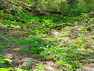 Coll. No. 2968.1, Clematis grosseserrata. Coll. No. 2968.1, Clematis grosseserrata.
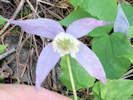 Coll. No. 2968.1, Clematis grosseserrata. Coll. No. 2968.1, Clematis grosseserrata.
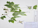 Coll. No. 2968.1, Clematis grosseserrata. Coll. No. 2968.1, Clematis grosseserrata.
|
2968.1
|
Clematis grosseserrata.
Plants of the Douglas Mountain Study Area
Jefferson County Open Space, Colorado, USA
Ranunculaceae
Clematis grosseserrata (Rydb.) Ackerfield.
Western Blue Virgin's-Bower.
Guy Gulch, Jefferson County, Colorado.
Mouth of a small gulch tributary to Guy Gulch, southwest side of the creek and County Road 70, 530 m. south southeast of the ranch house, 15.5 km. northwest of the GNIS location of Golden.
39.7915°N, 105.352°W.
WGS 1984
Elev. 2333 m.
Shaded floor of the drainage, with Micranthes rhomboidea.
Collected by permit: Jefferson County Open Space, 2023, issued: Apr 10, 2023, to: Tom Schweich.
|
Tom Schweich, with John Vickery
2968.1 |
14-Jun-2023 |
|
|
|
Other articles:
• Golden Checklist Flora:
Physaria vitulifera;
|
2969
|
Physaria vitulifera.
Plants of the Douglas Mountain Study Area
Jefferson County Open Space, Colorado, USA
Brassicaceae
Physaria vitulifera Rydb. Bull. Torrey Bot. Club 28: 278. 1901.
Roundtip Twinpod.
Guy Gulch, Jefferson County, Colorado.
Mouth of a small gulch tributary to Guy Gulch, southwest side of the creek and County Road 70, 530 m. south southeast of the ranch house, 15.5 km. northwest of the GNIS location of Golden.
39.7914°N, 105.352°W.
WGS 1984
Elev. 2334 m.
Few plants here; collection split in half.
Open southeast-facing rocky slope
Collected by permit: Jefferson County Open Space, 2023, issued: Apr 10, 2023, to: Tom Schweich.
|
Tom Schweich, with John Vickery
2969. |
14-Jun-2023 |
|
|
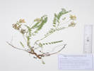 Coll. No. 2970, Astragalus parryi Coll. No. 2970, Astragalus parryi
|
2970
|
Astragalus, probably A. parryi.
Plants of the Douglas Mountain Study Area
Jefferson County Open Space, Colorado, USA
Fabaceae
Astragalus parryi A. Gray.
Parry's Milkvetch.
Guy Gulch, Jefferson County, Colorado.
Steep slope above Guy Gulch, southwest side of the creek and County Road 70, 490 m. south southeast of the ranch house, 15.5 km. northwest of the GNIS location of Golden.
39.7917°N, 105.3522°W.
WGS 1984
Elev. 2339 m.
Developing fruit is sickle-shaped, villous.
Steep slope, sunny, southeast aspect.
Collected by permit: Jefferson County Open Space, 2023, issued: Apr 10, 2023, to: Tom Schweich.
|
Tom Schweich, with John Vikery
2970. |
14-Jun-2023 |
|
Coll. No. 2970, 14 June 2023, characters observed:
Perennial herb, to 20 cm.,
caulescent,
hairs basifixed;
Stem,
distal spreading hairs;
Stipules, free;
Leaf, compound,
leaflets, 19#;
Calyx,
not inflated in fruit;
Flowers, white;
Fruit,,
in a loose raceme,
stipe, 0.3 mm.,
14 mm. × 5.5 mm. wide,
arcuate,
obcompressed ?? (not seen in dried specimen),
white villous.
|
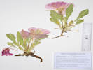 Coll. No. 2971, Oenothera cespitosa ssp. macroglottis Coll. No. 2971, Oenothera cespitosa ssp. macroglottis
|
2971
|
Oenothera cespitosa.
Plants of the Douglas Mountain Study Area
Jefferson County Open Space, Colorado, USA
Onagraceae
Oenothera cespitosa Nutt. ssp. macroglottis (Rydb.) W.L. Wagner.
Tufted Evening Primrose.
Guy Gulch, Jefferson County, Colorado.
Steep slope above Guy Gulch, southwest side of the creek and County Road 70, 406 m. south southeast of the ranch house, 15.6 km. (planar) northwest of the GNIS location of Golden.
39.7922°N, 105.3527°W.
WGS 1984
Elev. 2346 m.
Flowers white, fading pink.
Steep rocky hillside, below a rock outcrop and an Acer glabrum
Collected by permit: Jefferson County Open Space, 2023, issued: Apr 10, 2023, to: Tom Schweich.
|
Tom Schweich, with John Vickery
2971. |
14-Jun-2023 |
|
|
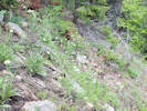 Coll. No. 2972, Anaphalis margaritacea Coll. No. 2972, Anaphalis margaritacea
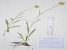 Coll. No. 2972, Anaphalis margaritacea. Coll. No. 2972, Anaphalis margaritacea.
|
2972
|
Anaphalis margaritacea.
Plants of the Douglas Mountain Study Area
Jefferson County Open Space, Colorado, USA
Asteraceae
Anaphalis margaritacea (L.) Bentham & Hooker.
Western Pearly Everlasting.
Guy Gulch, Jefferson County, Colorado.
Steep slope above Guy Gulch, southwest side of the creek and County Road 70, 380 m. south southeast of the ranch house, 15.6 km. (planar) northwest of the GNIS location of Golden.
39.7923°N, 105.353°W.
WGS 1984
Elev. 2356 m.
Very steep slope among Douglas fir.
Collected by permit: Jefferson County Open Space, 2023, issued: Apr 10, 2023, to: Tom Schweich.
|
Tom Schweich, with John Vickery
2972. |
14-Jun-2023 |
|
|
|
Locations:
DeLong Park (City of Golden).
|
|
Thursday, 15 June 2023
DeLong Park
|
|
|
2973
|
Melilotus officinalis.
|
Native and Naturalized Flora of the Golden Area, Jefferson County, Colorado
Fabaceae
Melilotus officinalis (L.) Lam.
Yellow Sweet Clover.
DeLong Park (City of Golden), Jefferson County, Colorado.
New Golden city park (construction in 2021 and 2022) near the intersection of 23rd Street and Vernon Drive, 1.75 km. southeast of the GNIS location of Golden.
39.7488°N, 105.208°W.
WGS 1984
Elev. 1787 m.
Naturalized in the park, which was fallow for many years and now is being weeded by volunteers to keep the park pesticide-free.
Collected by permit: City of Golden, 2023, issued: Mar 13, 2023, to: Tom Schweich.
|
Tom Schweich
2973. |
15-Jun-2022 |
|
|
|
|
2974
|
Dactylis glomerata.
|
Native and Naturalized Flora of the Golden Area, Jefferson County, Colorado
Poaceae
Dactylis glomerata L.
Orchard Grass.
DeLong Park (City of Golden), Jefferson County, Colorado.
New Golden city park (construction in 2021 and 2022) near the intersection of 23rd Street and Vernon Drive, 1.75 km. southeast of the GNIS location of Golden.
39.749°N, 105.208°W.
WGS 1984
Elev. 1787 m.
Naturalized in the park, which was fallow for many years and now is being weeded by volunteers to keep the park pesticide-free.
Collected by permit: City of Golden, 2023, issued: Mar 13, 2023, to: Tom Schweich.
|
Tom Schweich
2974. |
15-Jun-2023 |
|
|
|
|
2975
|
Trifolium repens.
|
Native and Naturalized Flora of the Golden Area, Jefferson County, Colorado
Fabaceae
Trifolium repens L.
White Clover.
DeLong Park (City of Golden), Jefferson County, Colorado.
New Golden city park (construction in 2021 and 2022) near the intersection of 23rd Street and Vernon Drive, 1.75 km. southeast of the GNIS location of Golden.
39.7489°N, 105.208°W.
WGS 1984
Elev. 1779 m.
Creeping and rooting at nodes; leaves glabrous; heads pedunculate; many flowers per head.
Naturalized in the park, which was fallow for many years and now is being weeded by volunteers to keep the park pesticide-free.
Collected by permit: City of Golden, 2023, issued: Mar 13, 2023, to: Tom Schweich.
|
Tom Schweich
2975. |
15-Jun-2023 |
|
|
|
|
|
Northward extension of Eagle Ridge. This parcel is known as Tract A of Eagle Ridge Center Filing 2 Replat B.
|
|
|
2977
|
Sphaeralcea coccinea.
|
Native and Naturalized Flora of the Golden Area, Jefferson County, Colorado
Malvaceae
Sphaeralcea coccinea (Nutt.) Rydb.
Cowboy's Delight.
Eagle Ridge, Tract A, Jefferson County, Colorado.
City-owned parcel north of “Eagle Ridge” between CSM Survey Field and US Highway 6, about 50 m. northwest of the Kinney Run Trail, 2.38 km. (geodesic) south of the GNIS location of Golden
39.7344°N, 105.2163°W.
WGS 1984
Elev. 1800 m.
Petal color flaming orange (#ED6332), fading blue-purple.
Common in this field, drier patch dominated by Artemisia ludoviciana, stiff clay soil.
Collected by permit: City of Golden, 2023, issued: Mar 13, 2023, to: Tom Schweich.
|
Tom Schweich
2977. |
19-Jun-2023 |
|
|
|
|
2978
|
Crepis occidentalis.
|
Native and Naturalized Flora of the Golden Area, Jefferson County, Colorado
Asteraceae
Crepis occidentalis Nutt.
Largeflower Hawksbeard.
Eagle Ridge, Tract A, Jefferson County, Colorado.
City-owned parcel north of “Eagle Ridge” between CSM Survey Field and US Highway 6, about 50 m. northwest of the Kinney Run Trail, 2.38 km. (geodesic) south of the GNIS location of Golden
39.7344°N, 105.2163°W.
WGS 1984
Elev. 1802 m.
Common in this field of remnant mixed-grass prairie, drier patch dominated by Artemisia ludoviciana, stiff clay soil.
Subsp. costata if infraspecific names are to be applied.
Collected by permit: City of Golden, 2023, issued: Mar 13, 2023, to: Tom Schweich.
|
Tom Schweich
2978. |
19-Jun-2023 |
|
|
|
|
2979
|
Nassella viridula.
|
Native and Naturalized Flora of the Golden Area, Jefferson County, Colorado
Poaceae
Nassella viridula (Trin.) Barkworth.
Green Needlegrass.
Eagle Ridge, Tract A, Jefferson County, Colorado.
City-owned parcel north of “Eagle Ridge” between CSM Survey Field and US Highway 6, about 70 m. northwest of the Kinney Run Trail, 2.37 km. (geodesic) south of the GNIS location of Golden
39.7345°N, 105.2164°W.
WGS 1984
Elev. 1806 m.
In bloom.
Common in this field, drier patch dominated by Artemisia ludoviciana, stiff clay soil.
Collected by permit: City of Golden, 2023, issued: Mar 13, 2023, to: Tom Schweich.
|
Tom Schweich
2979. |
19-Jun-2023 |
|
|
|
|
2980
|
Linum lewisii.
|
Native and Naturalized Flora of the Golden Area, Jefferson County, Colorado
Linaceae
Linum lewisii Pursh.
Prairie Blue Flax.
Eagle Ridge, Tract A, Jefferson County, Colorado.
City-owned parcel north of “Eagle Ridge” between CSM Survey Field and US Highway 6, about 70 m. northwest of the Kinney Run Trail, 2.37 km. (geodesic) south of the GNIS location of Golden.
39.7345°N, 105.2164°W.
WGS 1984
Elev. 1802 m.
Common in this field of remnant mixed-grass prairie, drier patch dominated by Artemisia ludoviciana, stiff clay soil.
Collected by permit: City of Golden, 2023, issued: Mar 13, 2023, to: Tom Schweich.
|
Tom Schweich
2980. |
19-Jun-2023 |
|
|
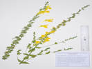 Coll. No. 2981, Linaria dalmatica. Coll. No. 2981, Linaria dalmatica.
|
2981
|
Linaria dalmatica.
|
Native and Naturalized Flora of the Golden Area, Jefferson County, Colorado
Plantaginaceae
Linaria dalmatica (L.) Mill.
Dalmatian ToadFlax.
Eagle Ridge, Tract A, Jefferson County, Colorado.
City-owned parcel north of “Eagle Ridge” between CSM Survey Field and US Highway 6, about 100 m. northwest of the Kinney Run Trail, 2.35 km. (geodesic) south of the GNIS location of Golden.
39.7346°N, 105.2168°W.
WGS 1984
Elev. 1803 m.
Perennial.
Common in this field of remnant mixed-grass prairie, drier patch dominated by Artemisia ludoviciana, stiff clay soil.
Colorado Noxious Weed List B. EDDMapS No. 11644454.
iNaturalist Observation 192499979.
Collected by permit: City of Golden, 2023, issued: Mar 13, 2023, to: Tom Schweich.
|
Tom Schweich
2981. |
19-Jun-2023 |
|
|
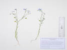 Coll. No. 2982, Linum pratense. Coll. No. 2982, Linum pratense.
|
2982
|
Linum pratense.
|
Native and Naturalized Flora of the Golden Area, Jefferson County, Colorado
Linaceae
Linum pratense (Norton) Small.
Meadow Flax.
Colorado School of Mines Survey Field, Jefferson County, Colorado.
Eastern, or lower, parcel of the survey field, within Golden city limits, 175 m. northwest of the Kinney Run Trail, 2.31 km. south of the GNIS location of Golden.
39.7349°N, 105.2175°W.
WGS 1984
Elev. 1809 M.
Annual, small blue flowers, short styles.
Shoulder of ridge, southeast aspect.
Also collected here, Astragalus drummondii and Delphinium carolinium ssp. virescens.
Collected by permit: City of Golden, 2023, issued: Mar 13, 2023, to: Tom Schweich.
|
Tom Schweich
2982. |
19-Jun-2023 |
|
|
|
|
2983
|
Delphinium carolinum var. virescens.
|
Native and Naturalized Flora of the Golden Area, Jefferson County, Colorado
Ranunculaceae
Delphinium carolinianum Walter ssp. virescens (Nutt.) R.E. Brooks.
Plains Larkspur.
Colorado School of Mines Survey Field, Jefferson County, Colorado.
Eastern, or lower, parcel of the survey field, within Golden city limits, 175 m. northwest of the Kinney Run Trail, 2.31 km. south of the GNIS location of Golden.
39.7349°N, 105.2175°W.
WGS 1984
Elev. 1810 m.
Shoulder of ridge, southeast aspect, with Coll. No. 2982, Linum pratense
Collected by permit: City of Golden, 2023, issued: Mar 13, 2023, to: Tom Schweich.
|
Tom Schweich
2983. |
19-Jun-2023 |
|
|
|
|
2984
|
Astragalus drummondii
|
Native and Naturalized Flora of the Golden Area, Jefferson County, Colorado
Fabaceae
Astragalus drummondii Dougl. ex Hook.
Drummond's Milkvetch.
Colorado School of Mines Survey Field, Jefferson County, Colorado.
Eastern, or lower, parcel of the survey field, within Golden city limits, 175 m. northwest of the Kinney Run Trail, 2.31 km. south of the GNIS location of Golden.
39.7349°N, 105.2175°W.
WGS 1984
Elev. 1807 m.
Perennial, large upright Astragalus with white flowers.
Common, shoulder of ridge, southeast aspect, with Linum pratense and Delphinium carolinianum ssp. virescens.
Collected by permit: City of Golden, 2023, issued: Mar 13, 2023, to: Tom Schweich.
|
Tom Schweich
2984. |
19-Jun-2023 |
|
|
|
|
2985
|
Hesperostipa comata.
|
Native and Naturalized Flora of the Golden Area, Jefferson County, Colorado
Poaceae
Hesperostipa comata (Trin. & Rupr.) Barkworth.
Needle and Thread.
Colorado School of Mines Survey Field, Jefferson County, Colorado.
Eastern, or lower, parcel of the survey field, within Golden city limits, 190 m. northwest of the Kinney Run Trail, 2.30 km. south of the GNIS location of Golden.
39.735°N, 105.2176°W.
WGS 1984
Elev. 1810 m.
In bloom.
Near top of small ridge, with Alyssum simplex, Pediomelum tenuiflorum, Linaria dalmatica, Agropyron cristatum, Bromus japonicus, and Nassella viridula.
Collected by permit: City of Golden, 2023, issued: Mar 13, 2023, to: Tom Schweich.
|
Tom Schweich
2985. |
19-Jun-2023 |
|
|
|
|
2986
|
Agropyron cristatum.
|
Native and Naturalized Flora of the Golden Area, Jefferson County, Colorado
Poaceae
Agropyron cristatum (L.) Gaertn.
Crested Wheat Grass.
Colorado School of Mines Survey Field, Jefferson County, Colorado.
Eastern, or lower, parcel of the survey field, within Golden city limits, 215 m. northwest of the Kinney Run Trail, 2.28 km. south of the GNIS location of Golden.
39.7351°N, 105.2179°W.
WGS 1984
Elev. 1817 m.
Few in bloom.
Top of ridge in disturbed mixed-grass prairie.
Collected by permit: City of Golden, 2023, issued: Mar 13, 2023, to: Tom Schweich.
|
Tom Schweich
2986. |
19-Jun-2023 |
|
|
|
|
2987
|
Koeleria macrantha.
|
Native and Naturalized Flora of the Golden Area, Jefferson County, Colorado
Poaceae
Koeleria macrantha (Ledeb.) Schult.
Prairie Junegrass.
Colorado School of Mines Survey Field, Jefferson County, Colorado.
Eastern, or lower, parcel of the survey field, within Golden city limits, 232 m. northwest of the Kinney Run Trail, 2.27 km. south of the GNIS location of Golden.
39.7352°N, 105.2181°W.
WGS 1984
Elev. 1816 m.
In bloom.
Just on the north side of a small ridge. Mixed grass prairie, highest Great Plains at base of Rocky Mountain Front Range.
Collected by permit: City of Golden, 2023, issued: Mar 13, 2023, to: Tom Schweich.
|
Tom Schweich
2987. |
19-Jun-2023 |
|
|
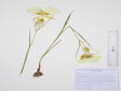 Coll. No. 2988, Calochortus gunnisonii. Coll. No. 2988, Calochortus gunnisonii.
|
2988
|
Calochortus gunnisonii.
|
Native and Naturalized Flora of the Golden Area, Jefferson County, Colorado
Liliaceae
Calochortus gunnisonii S. Watson.
Gunnison's Mariposa Lily.
Colorado School of Mines Survey Field, Jefferson County, Colorado.
Eastern, or lower, parcel of the survey field, within Golden city limits, 247 m. northwest of the Kinney Run Trail, 2.26 km. south of the GNIS location of Golden.
39.7353°N, 105.2182°W.
WGS 1984
Elev. 1813 m.
First flowers open.
Two-thirds of way up the north-facing slope, with Astragalus drummondii, Sphaeralcea coccinea, Hesperostipa comata, and Nassella viridula. Mixed grass prairie, highest Great Plains at base of Rocky Mountain Front Range.
Collected by permit: City of Golden, 2023, issued: Mar 13, 2023, to: Tom Schweich.
|
Tom Schweich
2988. |
19-Jun-2023 |
|
|
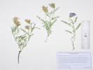 Coll. No. 2989, Astragalus agrestis. Coll. No. 2989, Astragalus agrestis.
|
2989
|
Astragalus agrestis.
|
Native and Naturalized Flora of the Golden Area, Jefferson County, Colorado
Fabaceae
Astragalus agrestis Douglas ex G. Don.
Purple Milkvetch.
Colorado School of Mines Survey Field, Jefferson County, Colorado.
Eastern, or lower, parcel of the survey field, within Golden city limits, 247 m. northwest of the Kinney Run Trail, 2.24 km. south of the GNIS location of Golden.
39.7355°N, 105.2186°W.
WGS 1984
Elev. 1806 m.
Flowers and developing fruit.
Mixed grass prairie, highest Great Plains at base of Rocky Mountain Front Range. Lower north-facing slope, with Achillea millefolium, Tragopogon dubius, Sphaeralcea coccinea, Linaria dalmatica, Bromus inermis, and Koeleria macrantha,
Collected by permit: City of Golden, 2023, issued: Mar 13, 2023, to: Tom Schweich.
|
Tom Schweich
2989. |
19-Jun-2023 |
|
|
|
|
2990
|
Apocynum × floribundum.
|
Native and Naturalized Flora of the Golden Area, Jefferson County, Colorado
Apocynaceae
Apocynum ×floribundum Greene.
Dogbane.
Deadman Gulch, Jefferson County, Colorado.
Between the 6th Avenue Trail and the creek of Deadman Gulch, 2.24 km. (geodesic) south of GNIS location of Golden
39.7359°N, 105.215°W.
WGS 1984
Elev. 1787 m.
Leaves spreading to ascending; corolla >2× calyx, lobes spreading to reflexed.
Highly disturbed habitat between trails.
Collected by permit: City of Golden, 2023, issued: Mar 13, 2023, to: Tom Schweich.
|
Tom Schweich
2990. |
19-Jun-2023 |
|
|
|
|
2991
|
Rhamnus cathartica.
|
Native and Naturalized Flora of the Golden Area, Jefferson County, Colorado
Rhamnaceae
Rhamnus cathartica L.
European Buckthorn.
Deadman Gulch, Jefferson County, Colorado.
Also locally called “Kinney Run,” in a triangular city parcel along the projection of Illinois Street below US Highway 6.
39.7373°N, 105.2151°W.
WGS 1984
Elev. 1785 m.
One plant with 22 stems, rooted in bank of creek.
With Salix exigua and Prunus virginiana.
Same plant as Coll. No. 2925. EDDMapS Record Id. 11613828.
Collected by permit: City of Golden, 2023, issued: Mar 13, 2023, to: Tom Schweich.
|
Tom Schweich
2991. |
19-Jun-2023 |
|
|
|
Locations:
Ranson/Edwards Homestead Open Space Park.
|
|
Thursday, 22 Jun 2023
Ranson/Edwards with Cathy Hanson-Stamp.
|
|
Locations:
Guy Gulch.
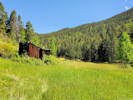 Meadow above Guy Gulch. Meadow above Guy Gulch.
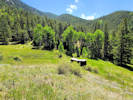 Meadow above Guy Gulch. Meadow above Guy Gulch.
|
|
Friday, 23 June 2023
Guy Gulch. John Vickery was also out there, but we never saw each other.
|
|
|
2992
|
Erigeron flagellaris.
Plants of the Douglas Mountain Study Area
Jefferson County Open Space, Colorado, USA
Asteraceae
Erigeron flagellaris A. Gray.
Trailing Fleabane.
Guy Gulch, Jefferson County, Colorado.
North of Guy Gulch, accessed by a ranch road off of Pyrenees Lane, on the southwest-facing slope just a few meters west of the line shack, 1.12 km. west southwest of Mt. Tom, 13.8 km. (geodesic) northwest of the GNIS location of Golden.
39.8129°N, 105.3637°W.
WGS 1984
Elev. 2607 m.
Open grassy slope with Rumex acetosella, Cerastium arvense, Microsteris gracilis, and Bouteloua gracilis.
Collected by permit: Jefferson County Open Space, 2023, issued: Apr 10, 2023, to: Tom Schweich.
|
Tom Schweich, with John Vickery
2992. |
23-Jun-2023 |
|
|
|
|
2993
|
Cerastium arvense var. strictum.
Plants of the Douglas Mountain Study Area
Jefferson County Open Space, Colorado, USA
Caryophyllaceae
Cerastium arvense L. ssp. strictum Gaudin.
Field Chickweed.
Guy Gulch, Jefferson County, Colorado.
North of Guy Gulch, accessed by a ranch road off of Pyrenees Lane, on the southwest-facing slope just a few meters north of the line shack, 1.12 km. west southwest of Mt. Tom, 13.8 km. (geodesic) northwest of the GNIS location of Golden.
39.8129°N, 105.3636°W.
WGS 1984
Elev. 2609 m.
Also collected here: Achillea millefolium, Artemisia frigida, Physaria montana, Microsteris gracilis, and Boutelous gracilis.
Collected by permit: Jefferson County Open Space, 2023, issued: Apr 10, 2023, to: Tom Schweich.
|
Tom Schweich, with John Vickery
2993. |
23-Jun-2023 |
|
|
|
|
2994
|
Microsteris gracilis
Plants of the Douglas Mountain Study Area
Jefferson County Open Space, Colorado, USA
Polemoniaceae
Microsteris gracilis (Douglas ex Hook.) Greene.
Slender Phlox.
Guy Gulch, Jefferson County, Colorado.
North of Guy Gulch, accessed by a ranch road off of Pyrenees Lane, on the southwest-facing slope just a few meters north of the line shack, 1.12 km. west southwest of Mt. Tom, 13.8 km. (geodesic) northwest of the GNIS location of Golden.
39.8129°N, 105.3636°W.
WGS 1984
Elev. 2609 m.
Also collected here: Achillea millefolium, Artemisia frigida, Physaria montana, Cerastium arvense, and Boutelous gracilis.
Collected by permit: Jefferson County Open Space, 2023, issued: Apr 10, 2023, to: Tom Schweich.
|
Tom Schweich, with John Vickery
2994. |
23-Jun-2023 |
|
|
|
|
2995
|
Harbouria trachypleura.
Plants of the Douglas Mountain Study Area
Jefferson County Open Space, Colorado, USA
Apiaceae
Harbouria trachypleura (A. Gray) J.M. Coult. & Rose.
Whiskbroom Parsley.
Guy Gulch, Jefferson County, Colorado.
North of Guy Gulch, accessed by a ranch road off of Pyrenees Lane, on the southwest-facing slope 30 m. northwest of the line shack, 1.13 km. west southwest of Mt. Tom, 13.8 km. (geodesic) northwest of the GNIS location of Golden.
39.8131°N, 105.3638°W.
WGS 1984
Elev. 2612 m.
Rocky hillslope with Juniperus communis var. depressa, Pinus ponderosa, and Rubus deliciosus.
Collected by permit: Jefferson County Open Space, 2023, issued: Apr 10, 2023, to: Tom Schweich.
|
Tom Schweich, with John Vickery
2995. |
23-Jun-2023 |
|
|
|
|
2996
|
Rubus deliciosus.
Plants of the Douglas Mountain Study Area
Jefferson County Open Space, Colorado, USA
Rosaceae
Rubus deliciosus Torr.
Delicious raspberry.
Guy Gulch, Jefferson County, Colorado.
North of Guy Gulch, accessed by a ranch road off of Pyrenees Lane, on the southwest-facing slope 28 m. northwest of the line shack, 1.14 km. west southwest of Mt. Tom, 13.8 km. (geodesic) northwest of the GNIS location of Golden.
39.8129°N, 105.3639°W.
WGS 1984
Elev. 2618 m.
Open slope, southeast aspect, with Juniperus communis var. depressa, Pinus ponderosa, and Potentilla fissa.
Collected by permit: Jefferson County Open Space, 2023, issued: Apr 10, 2023, to: Tom Schweich.
|
Tom Schweich, with John Vickery
2996. |
23-Jun-2023 |
|
|
|
|
2997
|
Juniperus communis depressa.
Plants of the Douglas Mountain Study Area
Jefferson County Open Space, Colorado, USA
Cupressaceae
Juniperus communis L. var. depressa Pursh.
Common Juniper.
Guy Gulch, Jefferson County, Colorado.
North of Guy Gulch, accessed by a ranch road off of Pyrenees Lane, on the southwest-facing slope 32 m. west northwest of the line shack, 1.14 km. west southwest of Mt. Tom, 13.8 km. (geodesic) northwest of the GNIS location of Golden.
39.8129°N, 105.3639°W.
WGS 1984
Elev. 2616 m.
Large mature shrub, 3-4 m. diameter, though degenerate in the middle.
Open southwest-facing slope between Pinus ponderosa with Penstemon secundiflorus, Potentilla fissa, and Rubus deliciosus.
Collected by permit: Jefferson County Open Space, 2023, issued: Apr 10, 2023, to: Tom Schweich.
|
Tom Schweich, with John Vickery
2997. |
23-Jun-2023 |
|
|
|
|
2998
|
Potentilla fissa.
Plants of the Douglas Mountain Study Area
Jefferson County Open Space, Colorado, USA
Rosaceae
Potentilla fissa Nutt. ex Torr. & A.Gray.
Bigflower Cinquefoil.
Guy Gulch, Jefferson County, Colorado.
North of Guy Gulch, accessed by a ranch road off of Pyrenees Lane, on the southwest-facing slope 40 m. west northwest of the line shack, 1.15 km. west southwest of Mt. Tom, 13.8 km. (geodesic) northwest of the GNIS location of Golden.
39.813°N, 105.364°W.
WGS 1984
Elev. 2617 m.
Open southwest-facing slope between Pinus ponderosa with Juniperus communis var. depressa, Penstemon secundiflorus, and Rubus deliciosus.
Collected by permit: Jefferson County Open Space, 2023, issued: Apr 10, 2023, to: Tom Schweich.
|
Tom Schweich, with John Vickery
2998. |
23-Jun-2023 |
|
|
|
|
2999
|
Penstemon secundiflorus.
Plants of the Douglas Mountain Study Area
Jefferson County Open Space, Colorado, USA
Plantaginaceae
Penstemon secundiflorus Benth.
Sidebells Penstemon.
Guy Gulch, Jefferson County, Colorado.
North of Guy Gulch, accessed by a ranch road off of Pyrenees Lane, on the southwest-facing slope 40 m. west northwest of the line shack, 1.15 km. west southwest of Mt. Tom, 13.8 km. (geodesic) northwest of the GNIS location of Golden.
39.813°N, 105.364°W.
WGS 1984
Elev. 2618 m.
Open southwest-facing slope between Pinus ponderosa with Juniperus communis var. depressa, Potentilla fissa, and Rubus deliciosus.
Collected by permit: Jefferson County Open Space, 2023, issued: Apr 10, 2023, to: Tom Schweich.
|
Tom Schweich, with John Vickery
2999. |
23-Jun-2023 |
|
|
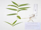 Coll. No. 3000, Maianthemum stellatum. Coll. No. 3000, Maianthemum stellatum.
|
3000
|
Maianthemum stellatum.
Plants of the Douglas Mountain Study Area
Jefferson County Open Space, Colorado, USA
Ruscaceae
Maianthemum stellatum (L.) Link.
Starry False Lily of the Valley.
Guy Gulch, Jefferson County, Colorado.
North of Guy Gulch, accessed by a ranch road off of Pyrenees Lane, on the southwest-facing slope 80 m. south of the line shack, 1.16 km. west southwest of Mt. Tom, 13.8 km. (geodesic) northwest of the GNIS location of Golden.
39.8121°N, 105.3637°W.
WGS 1984
Elev. 2595 m.
Under Douglas fir on upper bank of creek with Mertensia lanceolata.
Collected by permit: Jefferson County Open Space, 2023, issued: Apr 10, 2023, to: Tom Schweich.
|
Tom Schweich, with John Vickery
3000. |
23-Jun-2023 |
|
|
|
|
3001
|
Senecio integerrimus.
Plants of the Douglas Mountain Study Area
Jefferson County Open Space, Colorado, USA
Asteraceae
Senecio integerrimus Nutt.
Columbia Ragwort.
Guy Gulch, Jefferson County, Colorado.
North of Guy Gulch, accessed by a ranch road off of Pyrenees Lane, in a flat area 143 m. southwest of the line shack, 1.24 km. west southwest of Mt. Tom, 13.8 km. (geodesic) northwest of the GNIS location of Golden.
39.8119°N, 105.3646°W.
WGS 1984
Elev. 2588 m.
Open ground amid lodgepole pines.
Collected by permit: Jefferson County Open Space, 2023, issued: Apr 10, 2023, to: Tom Schweich.
|
Tom Schweich, with John Vickery
3001. |
23-Jun-2023 |
|
|
|
|
3002
|
Mertensia lanceolata.
Plants of the Douglas Mountain Study Area
Jefferson County Open Space, Colorado, USA
Boraginaceae
Mertensia lanceolata (Pursh) DC.
Prairie Bluebells.
Guy Gulch, Jefferson County, Colorado.
North of Guy Gulch, accessed by a ranch road off of Pyrenees Lane, on a stream bank 80 m. south of the line shack, 1.16 km. west southwest of Mt. Tom, 13.8 km. (geodesic) northwest of the GNIS location of Golden.
39.8121°N, 105.3637°W.
WGS 1984
Elev. 2590 m.
Shaded shoulder of stream bank with Pinus ponderosa. Also collected here: Maianthemum stellatum.
Collected by permit: Jefferson County Open Space, 2023, issued: Apr 10, 2023, to: Tom Schweich.
|
Tom Schweich, with John Vickery
3002. |
23-Jun-2023 |
|
|
|
|
3003
|
Ribes cereum.
Plants of the Douglas Mountain Study Area
Jefferson County Open Space, Colorado, USA
Grossulariaceae
Ribes cereum Douglas.
Wax Currant.
Guy Gulch, Jefferson County, Colorado.
North of Guy Gulch, accessed by a ranch road off of Pyrenees Lane, in a pile of rocks 25 m. southwest of the line shack, 1.14 km. west southwest of Mt. Tom, 13.8 km. (geodesic) northwest of the GNIS location of Golden.
39.8127°N, 105.3638°W.
WGS 1984
Elev. 2605 m.
Perhaps an artificial pile of rocks, with Geranium caespitosum.
Collected by permit: Jefferson County Open Space, 2023, issued: Apr 10, 2023, to: Tom Schweich.
|
Tom Schweich, with John Vickery
3003. |
23-Jun-2023 |
|
|
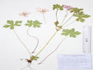 Coll. No. 3004, Geranium caespitosum. Coll. No. 3004, Geranium caespitosum.
|
3004
|
Geranium caespitosum.
Plants of the Douglas Mountain Study Area
Jefferson County Open Space, Colorado, USA
Geraniaceae
Geranium caespitosum James.
Pineywoods Geranium.
Guy Gulch, Jefferson County, Colorado.
North of Guy Gulch, accessed by a ranch road off of Pyrenees Lane, in a pile of rocks 25 m. southwest of the line shack, 1.14 km. west southwest of Mt. Tom, 13.8 km. (geodesic) northwest of the GNIS location of Golden.
39.8127°N, 105.3638°W.
WGS 1984
Elev. 2605 m.
Perhaps an artificial pile of rocks, possibly containing a spring, with Ribes cereum.
Collected by permit: Jefferson County Open Space, 2023, issued: Apr 10, 2023, to: Tom Schweich.
|
Tom Schweich, with John Vickery
3004. |
23-Jun-2023 |
|
|
|
|
3005
|
Arabis pycnocarpa.
Plants of the Douglas Mountain Study Area
Jefferson County Open Space, Colorado, USA
Brassicaceae
Arabis pycnocarpa M. Hopkins.
Cream Flower Rockcress.
Guy Gulch, Jefferson County, Colorado.
North of Guy Gulch, accessed by a ranch road off of Pyrenees Lane, meadow 28 m. south of the line shack, 1.13 km. west southwest of Mt. Tom, 13.8 km. (geodesic) northwest of the GNIS location of Golden.
39.8126°N, 105.3636°W.
WGS 1984
Elev. 2605 m.
Open grasses.
Collected by permit: Jefferson County Open Space, 2023, issued: Apr 10, 2023, to: Tom Schweich.
|
Tom Schweich, with John Vickery
3005. |
23-Jun-2023 |
|
|
|
|
3006
|
Stellaria longipes.
Plants of the Douglas Mountain Study Area
Jefferson County Open Space, Colorado, USA
Caryophyllaceae
Stellaria longipes Goldie ssp. longipes.
Longstalk Starwort.
Guy Gulch, Jefferson County, Colorado.
North of Guy Gulch, accessed by a ranch road off of Pyrenees Lane, meadow 35 m. northeast of the line shack, 1.09 km. west southwest of Mt. Tom, 13.8 km. (geodesic) northwest of the GNIS location of Golden.
39.8131°N, 105.3634°W.
WGS 1984
Elev. 2612 m.
In still water beside creek, with Portulaca oleracea and Noccaea fendleri.
Collected by permit: Jefferson County Open Space, 2023, issued: Apr 10, 2023, to: Tom Schweich.
|
Tom Schweich, with John Vickery
3006. |
23-Jun-2023 |
|
|
|
|
|
|
|
|
|
|
|
|
3007
|
Carex inops var. heliophila.
Plants of the Douglas Mountain Study Area
Jefferson County Open Space, Colorado, USA
Cyperaceae
Carex inops L.H. Bailey ssp. heliophila (Mack.) Crins.
Sun Sedge.
Guy Gulch, Jefferson County, Colorado.
Meadow north of Guy Gulch, accessed by a ranch road off of Pyrenees Lane, 20 m. southwest of the line shack, 1.13 km. west southwest of Mt. Tom, 13.8 km. (geodesic) northwest of the GNIS location of Golden.
39.8127°N, 105.3637°W.
WGS 1984
Elev. 2604 m.
Growing on a small ranch road berm.
Collected by permit: Jefferson County Open Space, 2023, issued: Apr 10, 2023, to: Tom Schweich.
|
Tom Schweich, with John Vickery
3007. |
23-Jun-2023 |
|
|
|
Locations:
DeLong Park (City of Golden).
|
|
Thursday, 29 June 2023
DeLong Park, Bio-Blitz and Weeding
|
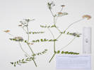 Coll. No. 3008, Securigera varia. Coll. No. 3008, Securigera varia.
|
3008
|
Securigera varia.
|
Native and Naturalized Flora of the Golden Area, Jefferson County, Colorado
Fabaceae
Securigera varia (L.) Lassen.
Purple Crownvetch.
DeLong Park (City of Golden), Jefferson County, Colorado.
On the bank of the Welch Ditch near the south bridge and stairs down to 24th Street, 1.39 km. southeast of the GNIS location of Golden.
39.7479°N, 105.2083°W.
WGS 1984
Elev. 1768 m.
With Bromus inermis and Fraxinus pensylvanica.
There is also a dense infestation in the watercourse parallel to 23rd Street. EDDMapS Record ID 11652866.
Collected by permit: City of Golden, 2023, issued: Mar 13, 2023, to: Tom Schweich.
|
Tom Schweich
3008. |
29-Jun-2023 |
|
|
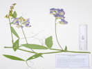 Coll. No. 3009, Lathyrus latifolius. Coll. No. 3009, Lathyrus latifolius.
|
3009
|
Lathyrus latifolia.
|
Native and Naturalized Flora of the Golden Area, Jefferson County, Colorado
Fabaceae
Lathyrus latifolius L.
Perennial Pea Vine.
DeLong Park (City of Golden), Jefferson County, Colorado.
In the natural area, up on the slope above Welch Ditch and sidewalk, aligned with extension of 24th Street, 1.39 km. southeast of the GNIS location of Golden.
39.748°N, 105.2081°W.
WGS 1984
Elev. 1770 m.
Flower color varies from pink to vivid magenta.
Full sun on southwest slope.
EDDSMapS Record Id 11652895.
Collected by permit: City of Golden, 2023, issued: Mar 13, 2023, to: Tom Schweich.
|
Tom Schweich
3009. |
29-Jun-2023 |
|
|
|
|
3010
|
Nassella viridula.
|
Native and Naturalized Flora of the Golden Area, Jefferson County, Colorado
Poaceae
Nassella viridula (Trin.) Barkworth.
Green Needlegrass.
DeLong Park (City of Golden), Jefferson County, Colorado.
In the natural area, up on the slope above Welch Ditch and sidewalk, aligned with extension of 24th Street, 1.39 km. southeast of the GNIS location of Golden.
39.7479°N, 105.2081°W.
WGS 1984
Elev. 1770 m.
In bloom.
Full sun on southwest slope.
May have been planted during park construction.
Collected by permit: City of Golden, 2023, issued: Mar 13, 2023, to: Tom Schweich.
|
Tom Schweich
3010. |
29-Jun-2023 |
|
|
|
|
3011
|
Helianthus pumilis.
|
Native and Naturalized Flora of the Golden Area, Jefferson County, Colorado
Asteraceae
Helianthus pumilus Nutt.
Little Sunflower.
DeLong Park (City of Golden), Jefferson County, Colorado.
In the natural area of a new city park (construction in 2021 and 2022), up on the slope above Welch Ditch and sidewalk, aligned with extension of 24th Street, 1.39 km. southeast of the GNIS location of Golden.
39.7479°N, 105.208°W.
WGS 1984
Elev. 1772 m.
In bloom.
Likely to be native here, other likely natives seen: Opuntia macrorhiza, Comandra umbellata ssp. pallida and Carex inops ssp. heliophila.
Collected by permit: City of Golden, 2023, issued: Mar 13, 2023, to: Tom Schweich.
|
Tom Schweich
3011. |
29-Jun-2023 |
|
|
|
|
3011.1
|
Agropyron cristatum.
|
Native and Naturalized Flora of the Golden Area, Jefferson County, Colorado
Poaceae
Agropyron cristatum (L.) Gaertn.
Crested Wheat Grass.
DeLong Park (City of Golden), Jefferson County, Colorado.
In the northeast corner of a new city park (construction in 2021 and 2022), along 23rd Street near its intersection with Table Drive, 1.34 km. southeast of the GNIS location of Golden.
39.749°N, 105.208°W.
WGS 1984
Elev. 1776 m.
Unclear whether presence here predates park construction or was brought in with soil amendment.
This area of the park also seriously infested with Lepidium draba.
Collected by permit: City of Golden, 2023, issued: Mar 13, 2023, to: Tom Schweich.
|
Tom Schweich
3011.1 |
29-Jun-2023 |
|
|
|
|
3012
|
Elymus canadensis.
|
Native and Naturalized Flora of the Golden Area, Jefferson County, Colorado
Poaceae
Elymus canadensis L.
Canadian Wildrye.
DeLong Park (City of Golden), Jefferson County, Colorado.
Growing on the banks of the watercourse in north-central natural area of the park (construction in 2021 and 2022), along 23rd Street near its intersection with Vernon Drive, 1.33 km. southeast of the GNIS location of Golden.
39.7489°N, 105.2083°W.
WGS 1984
Elev. 1774 m.
Not listed in the original seeding mixture. Unclear whether presence here predates park construction, was brought in with soil amendment, or was a contaminant in original mixture used in seeding the park.
Probably variety canadensis if infraspecific names are to be applied.
Collected by permit: City of Golden, 2023, issued: Mar 13, 2023, to: Tom Schweich.
|
Tom Schweich
3012. |
29-Jun-2023 |
|
|
|
|
3013
|
Secale cereale.
|
Native and Naturalized Flora of the Golden Area, Jefferson County, Colorado
Poaceae
Secale cereale L.
Cereal Rye.
DeLong Park (City of Golden), Jefferson County, Colorado.
New city park (construction in 2021 and 2022), along the eastern border at watercourse, 1.36 km. southeast of the GNIS location of Golden.
39.7487°N, 105.2079°W.
WGS 1984
Elev. 1772 m.
Not native. Not listed in the original seeding mixture. Unclear whether presence here predates park construction, was brought in with soil amendment, or was a contaminant in original mixture used in seeding the park.
Collected by permit: City of Golden, 2023, issued: Mar 13, 2023, to: Tom Schweich.
|
Tom Schweich
3013. |
29-Jun-2023 |
|
|
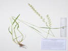 Coll. No. 3014, Lolium multiflorum. Coll. No. 3014, Lolium multiflorum.
|
3014
|
Lolium perenne.
|
Native and Naturalized Flora of the Golden Area, Jefferson County, Colorado
Poaceae
Lolium multiflorum Lam.
Annual Ryegrass.
DeLong Park (City of Golden), Jefferson County, Colorado.
New city park (construction in 2021 and 2022), just south of bridge along 23rd Street near its intersection with Vernon Drive. 1.32 km. southeast of the GNIS location of Golden.
39.7488°N, 105.2083°W.
WGS 1984
Elev. 1762 m.
Blades rolled in bud, spikelets edge-wise, florets 8-12, lemma awns 0-6 mm.
This area was re-seeded with native grasses, but this common turf grass probably pre-dates park construction.
Characters intermediate with L. perenne; perhaps a hybrid.
Collected by permit: City of Golden, 2023, issued: Mar 13, 2023, to: Tom Schweich.
|
Tom Schweich
3014. |
29-Jun-2023 |
|
|
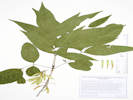 Coll. No. 3015, Fraxinus pennsylvanica. Coll. No. 3015, Fraxinus pennsylvanica.
|
3015
|
Fraxinus pensylvanica.
|
Native and Naturalized Flora of the Golden Area, Jefferson County, Colorado
Oleaceae
Fraxinus pennsylvanica Marshall.
Green Ash.
DeLong Park (City of Golden), Jefferson County, Colorado.
New city park (construction in 2021 and 2022), rooted in the bank of the Welch Ditch along the southwest boundary. 1.35 km. southeast of the GNIS location of Golden.
39.7483°N, 105.2084°W.
WGS 1984
Elev. 1763 m.
Medium-sized trees; probably pre-date the park.
Various Colorado authors disagree about nativity of this tree to Colorado. Earliest collection in 1891 at State Agricultural College, Ft. Collins.
Collected by permit: City of Golden, 2023, issued: Mar 13, 2023, to: Tom Schweich.
|
Tom Schweich
3015. |
29-Jun-2023 |
|
|
|
|
3016
|
Bromus japonicus.
|
Native and Naturalized Flora of the Golden Area, Jefferson County, Colorado
Poaceae
Bromus japonicus Thunb.
Japanese Cheat Grass.
DeLong Park (City of Golden), Jefferson County, Colorado.
New city park (construction in 2021 and 2022), northeast of shelter, in "native" beds, 1.33 km. southeast of the GNIS location of Golden.
39.7487°N, 105.2083°W.
WGS 1984
Elev. 1765 m.
Collected by permit: City of Golden, 2023, issued: Mar 13, 2023, to: Tom Schweich.
|
Tom Schweich
3016. |
29-Jun-2023 |
|
|
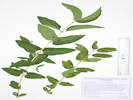 Coll. No. 3017, Lonicera tatarica. Coll. No. 3017, Lonicera tatarica.
|
3017
|
Lonicera, likely L. tatarica.
|
Native and Naturalized Flora of the Golden Area, Jefferson County, Colorado
Caprifoliaceae
Lonicera tatarica L.
Tatarian Honeysuckle.
DeLong Park (City of Golden), Jefferson County, Colorado.
New city park (construction in 2021 and 2022), southeastern "natural" area of park, 1.39 km. southeast of the GNIS location of Golden.
39.7483°N, 105.208°W.
WGS 1984
Elev. 1765 m.
Fruit is twin berries growing on last years' twigs
With Prunus virginiana.
Widely distributed in Colorado; likely naturalized and no longer just a garden escapee. EDDMapS Record ID 11653694.
Collected by permit: City of Golden, 2023, issued: Mar 13, 2023, to: Tom Schweich.
|
Tom Schweich
3017. |
29-Jun-2023 |
|
|
|
Locations:
Guy Gulch.
|
|
Monday, 3 July 2023
Douglas Mountain Study Area with John Vickery
|
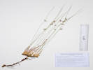 Coll. No. 3018, Juncus arcticus var. balticus. Coll. No. 3018, Juncus arcticus var. balticus.
|
3018
|
Juncus arcticus var. balticus.
Plants of the Douglas Mountain Study Area
Jefferson County Open Space, Colorado, USA
Juncaceae
Juncus arcticus (Willd.) Trautv. var. balticus (Willdenow) Trautvetter.
Arctic Rush.
Guy Gulch, Jefferson County, Colorado.
Abandoned stream terrace, southwest side of County Road 70, 1.13 km. northwest of Centennial Ranch house, 13.3 km. (geodesic) northwest of the GNIS location of Golden.
39.801°N, 105.3646°W.
WGS 1984
Elev. 2407 m.
Collected by permit: Jefferson County Open Space, 2023, issued: Apr 10, 2023, to: Tom Schweich.
|
Tom Schweich, with John Vickery
3018. |
3-Jul-2023 |
|
Subject to label mixup with #3145, per Jan Wingate, 4/23/2024.
|
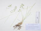 Coll. No. 3019, Poa pratensis. Coll. No. 3019, Poa pratensis.
|
3019
|
Poa sp.
Plants of the Douglas Mountain Study Area
Jefferson County Open Space, Colorado, USA
Poaceae
Poa pratensis L.
Kentucky Bluegrass.
Guy Gulch, Jefferson County, Colorado.
Sunny spot on a slope just above an abandoned stream terrace, southwest side of County Road 70, 1.13 km. northwest of Centennial Ranch house, 13.3 km. (geodesic) northwest of the GNIS location of Golden.
39.8009°N, 105.3645°W.
WGS 1987
Elev. 2407 m.
Perennial, rhizomatous, cobwebby, lemma and palea glabrous on lateral veins and intercostal regions.
Collected by permit: Jefferson County Open Space, 2023, issued: Apr 10, 2023, to: Tom Schweich.
|
Tom Schweich, with John Vickery
3019. |
3-Jul-2023 |
|
|
|
|
3020
|
Salix, pistillate catkins.
Plants of the Douglas Mountain Study Area
Jefferson County Open Space, Colorado, USA
Salicaceae
Salix bebbiana Sarg.
Bebb Willow.
Guy Gulch, Jefferson County, Colorado.
Bank of the creek in Guy Gulch, southwest side of County Road 70, 1.13 km. northwest of Centennial Ranch house, 13.3 km. (geodesic) northwest of the GNIS location of Golden.
39.8009°N, 105.3647°W.
WGS 1984
Elev. 2409 m.
Tall, multi-trunk shrub, not pruinose, pistillate catkins, floral bracts tan, capsules pubescent.
Collected by permit: Jefferson County Open Space, 2023, issued: Apr 10, 2023, to: Tom Schweich.
|
Tom Schweich, with John Vickery
3020. |
3-Jul-2023 |
|
|
|
Other articles:
• Field Notes:
Coll. No. 3112, 18 Jul 2023;
Coll. No. 3139, 20 Jul 2023;
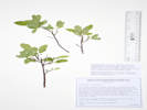 Coll. No. 3021, Vaccinium sp. Coll. No. 3021, Vaccinium sp.
|
3021
|
Vaccinium sp.
See also Coll. Nos. 3112 and 3139.
Plants of the Douglas Mountain Study Area
Jefferson County Open Space, Colorado, USA
Ericaceae
Vaccinium L.
Blueberry.
Guy Gulch, Jefferson County, Colorado.
Abandoned stream channel of the creek in Guy Gulch, southwest side of County Road 70, 1.13 km. northwest of Centennial Ranch house, 13.3 km. (geodesic) northwest of the GNIS location of Golden.
39.8009°N, 105.3646°W.
WGS 1984
Elev. 2409 m.
In a thicket under Betula occidentalis, Ribes cereum, and Rubus deliciosus.
Compare to Coll. No. 3112 and 3139, Vaccinium sp. from Lake County.
Collected by permit: Jefferson County Open Space, 2023, issued: Apr 10, 2023, to: Tom Schweich.
|
Tom Schweich, with John Vickery
3021. |
3-Jul-2023 |
| Coll. No. 3021, 3 July 2023, characters observed:
Perennial, low-growing;
Twigs of current season,
terete,
reddish-brown,
glabrous;
Leaves,
oblanceolate to oblong,
34 mm. × 14 mm. wide,
smaller leaves broadest above middle,
margins serrulate entire length.
Harrington (1964 2nd ed.): Vaccinium caespitosum.
Weber & Wittmann (2012): V. myrtillus.
Ackerfield (2022): V. membranaceum.
|
|
|
3022
|
Ranunculus sp.
Plants of the Douglas Mountain Study Area
Jefferson County Open Space, Colorado, USA
Ranunculaceae
Ranunculus glaberrimus Hook. var. ellipticus (Greene) Greene.
Sagebrush Buttercup.
Guy Gulch, Jefferson County, Colorado.
Edge of forest near the creek in Guy Gulch, southwest side of County Road 70, 1.14 km. northwest of Centennial Ranch house, 13.3 km. (geodesic) northwest of the GNIS location of Golden.
39.8007°N, 105.3649°W.
WGS 1984
Elev. 2412 m.
Also collected here: Pseudocymopterus montanus.
Collected by permit: Jefferson County Open Space, 2023, issued: Apr 10, 2023, to: Tom Schweich.
|
Tom Schweich, with John Vickery
3022. |
3-Jul-2023 |
|
|
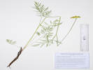 Coll. No. 3023, Pseudocymopterus montanus. Coll. No. 3023, Pseudocymopterus montanus.
|
3023
|
Pseudocymopterus montanus.
Plants of the Douglas Mountain Study Area
Jefferson County Open Space, Colorado, USA
Apiaceae
Pseudocymopterus montanus (A. Gray) J. M. Coult. & Rose.
Alpine False Springparsley.
Guy Gulch, Jefferson County, Colorado.
Edge of forest near the creek in Guy Gulch, southwest side of County Road 70, 1.14 km. northwest of Centennial Ranch house, 13.3 km. (geodesic) northwest of the GNIS location of Golden.
39.8007°N, 105.3649°W.
WGS 1984
Elev. 2412 m.
Grasses surrounded by Douglas fir forest, Mertensia lanceolata, Aquilegia coerulea, Fragaria vesca, and Viola canadensis.
Collected by permit: Jefferson County Open Space, 2023, issued: Apr 10, 2023, to: Tom Schweich.
|
Tom Schweich, with John Vickery
3023. |
3-Jul-2023 |
|
|
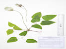 Coll. No. 3024, Clematis grosseserrata. Coll. No. 3024, Clematis grosseserrata.
|
3024
|
Clematis in fruit.
Plants of the Douglas Mountain Study Area
Jefferson County Open Space, Colorado, USA
Ranunculaceae
Clematis grosseserrata (Rydb.) Ackerfield.
Western Blue Virgin's-Bower.
Guy Gulch, Jefferson County, Colorado.
Edge of Douglas fir forest near the creek in Guy Gulch, southwest side of County Road 70, 1.15 km. northwest of Centennial Ranch house, 13.3 km. (geodesic) northwest of the GNIS location of Golden.
39.8009°N, 105.3649°W.
WGS 1984
Elev. 2417 m.
In fruit.
Collected by permit: Jefferson County Open Space, 2023, issued: Apr 10, 2023, to: Tom Schweich.
|
Tom Schweich, with John Vickery
3024. |
3-Jul-2023 |
|
|
|
|
3025
|
Symphoricarpos rotundifolius.
Plants of the Douglas Mountain Study Area
Jefferson County Open Space, Colorado, USA
Caprifoliaceae
Symphoricarpos rotundifolius A. Gray.
Roundleaf Snowberry.
Guy Gulch, Jefferson County, Colorado.
Terrace above creek in Guy Gulch, southwest side of County Road 70, 1.17 km. northwest of Centennial Ranch house, 13.3 km. (geodesic) northwest of the GNIS location of Golden.
39.801°N, 105.3651°W.
WGS 1984
Elev. 2415 m.
Corolla tube 11 mm. + lobes 1 mm. spreading, white to pale yellow, glabrous within, anthers on evident filaments.
Open grassland with a few Douglas fir and aspens.
Collected by permit: Jefferson County Open Space, 2023, issued: Apr 10, 2023, to: Tom Schweich.
|
Tom Schweich, with John Vickery
3025. |
3-Jul-2023 |
|
|
|
|
3026
|
Castilleja integra.
Plants of the Douglas Mountain Study Area
Jefferson County Open Space, Colorado, USA
Orobanchaceae
Castilleja integra A. Gray.
Wholeleaf Indian Paintbrush.
Guy Gulch, Jefferson County, Colorado.
Terrace above creek in Guy Gulch, southwest side of County Road 70, 1.19 km. northwest of Centennial Ranch house, 13.3 km. (geodesic) northwest of the GNIS location of Golden.
39.8012°N, 105.3652°W.
WGS 1984
Elev. 2418 m.
Grassy opening between Douglas fir forest and aspens and willows along the creek, with Achillea millefolium, Artemisia frigida, and Koeleria macrantha.
Collected by permit: Jefferson County Open Space, 2023, issued: Apr 10, 2023, to: Tom Schweich.
|
Tom Schweich, with John Vickery
3026. |
3-Jul-2023 |
|
|
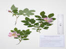 Coll. No. 3027, Rosa acicularis ssp. sayi. Coll. No. 3027, Rosa acicularis ssp. sayi.
|
3027
|
Rosa woodsii.
Plants of the Douglas Mountain Study Area
Jefferson County Open Space, Colorado, USA
Rosaceae
Rosa acicularis Lindl. ssp. sayi (Schwein.) W. H. Lewis.
Say's Acicular Rose.
Guy Gulch, Jefferson County, Colorado.
Terrace above creek in Guy Gulch, southwest side of County Road 70, 1.18 km. northwest of Centennial Ranch house, 13.3 km. (geodesic) northwest of the GNIS location of Golden.
39.801°N, 105.3652°W.
WGS 1984
Elev. 2416 m.
Prickles on new growth, leaflets #7.
Around the base of a Douglas fir and Rocky Mountain maple.
Collected by permit: Jefferson County Open Space, 2023, issued: Apr 10, 2023, to: Tom Schweich.
|
Tom Schweich, with John Vickery
3027. |
3-Jul-2023 |
|
|
|
|
3028
|
Lithospermum multiflorum.
Plants of the Douglas Mountain Study Area
Jefferson County Open Space, Colorado, USA
Boraginaceae
Lithospermum multiflorum Torrey ex A. Gray.
Many Flowered Stoneseed.
Guy Gulch, Jefferson County, Colorado.
Terrace above creek in Guy Gulch, southwest side of County Road 70, 1.20 km. northwest of Centennial Ranch house, 13.4 km. (geodesic) northwest of the GNIS location of Golden.
39.8011°N, 105.3654°W.
WGS 1984
Elev. 2416 m.
Open edge of Douglas fir forest.
Limited material, flowers just beginning to open.
Collected by permit: Jefferson County Open Space, 2023, issued: Apr 10, 2023, to: Tom Schweich.
|
Tom Schweich, with John Vickery
3028. |
3-Jul-2023 |
|
|
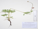 Coll. No. 3028.1, Anemone multifida. Coll. No. 3028.1, Anemone multifida.
|
3028.1
|
Anemone multifida.
Plants of the Douglas Mountain Study Area
Jefferson County Open Space, Colorado, USA
Ranunculaceae
Anemone multifida Poir.
Pacific Anemone.
Guy Gulch, Jefferson County, Colorado.
Small delta at mouth of gulch tributary to Guy Gulch, southwest side of County Road 70, 1.20 km. northwest of Centennial Ranch house, 13.4 km. (geodesic) northwest of the GNIS location of Golden.
39.8011°N, 105.3654°W.
WGS 1984
Elev. 2416 m.
Flowers reddish-purple.
Open edge of Douglas fir forest.
Collected by permit: Jefferson County Open Space, 2023, issued: Apr 10, 2023, to: Tom Schweich.
|
Tom Schweich, with John Vickery
3028.1 |
3-Jul-2023 |
|
|
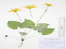 Coll. No. 3029, Arnica cordifolia. Coll. No. 3029, Arnica cordifolia.
|
3029
|
Arnica cordifolia.
Plants of the Douglas Mountain Study Area
Jefferson County Open Space, Colorado, USA
Asteraceae
Arnica cordifolia Hook.
Heart-Leaf Leopardbane.
Guy Gulch, Jefferson County, Colorado.
Just inside the mouth of a small gulch tributary to Guy Gulch, southwest side of County Road 70, 1.19 km. northwest of Centennial Ranch house, 13.4 km. (geodesic) northwest of the GNIS location of Golden.
39.8009°N, 105.3655°W.
WGS 1984
Elev. 2417 m.
More seen further up the gulch.
Collected by permit: Jefferson County Open Space, 2023, issued: Apr 10, 2023, to: Tom Schweich.
|
Tom Schweich, with John Vickery
3029. |
3-Jul-2023 |
|
|
|
|
3030
|
Aquilegia coerulea.
Plants of the Douglas Mountain Study Area
Jefferson County Open Space, Colorado, USA
Ranunculaceae
Aquilegia coerulea E. James.
Colorado Blue Columbine.
Guy Gulch, Jefferson County, Colorado.
Just inside the mouth of a small gulch tributary to Guy Gulch, southwest side of County Road 70, 1.19 km. northwest of Centennial Ranch house, 13.4 km. (geodesic) northwest of the GNIS location of Golden.
39.8009°N, 105.3655°W.
WGS 1984
Elev. 2423 m.
More seen farther up the gulch.
Collected by permit: Jefferson County Open Space, 2023, issued: Apr 10, 2023, to: Tom Schweich.
|
Tom Schweich, with John Vickery
3030. |
3-Jul-2023 |
|
|
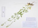 Coll. No. 3031, Draba streptocarpa. Coll. No. 3031, Draba streptocarpa.
|
3031
|
Draba with twisted fruit.
Plants of the Douglas Mountain Study Area
Jefferson County Open Space, Colorado, USA
Brassicaceae
Draba streptocarpa A. Gray.
Twisted-fruit Whitlow-grass.
Guy Gulch, Jefferson County, Colorado.
Deep shade of a small gulch tributary to Guy Gulch, 105 m. southwest of County Road 70, 1.19 km. northwest of Centennial Ranch house, 13.4 km. (geodesic) northwest of the GNIS location of Golden.
39.8008°N, 105.3656°W.
WGS 1984
Elev. 2423 m.
Fruit flat and twisted.
Collected by permit: Jefferson County Open Space, 2023, issued: Apr 10, 2023, to: Tom Schweich.
|
Tom Schweich, with John Vickery
3031. |
3-Jul-2023 |
|
Coll. No. 3031, 3 Jul 2023, characters observed:
Perennial (short-lived?), to 40 cm.,
hairs various combinations of simple and forked, but not dolabriform or stellate;
Leaves,
basal, withered,
cauline,
simple,
sessile,
lanceolate,
30 mm. ×7 mm. wide,
diminishing gradually,
margin entire;
Inflorescence,
raceme,
ebracteate;
Sepals,
#4,
1 row,
2.4 mm. × 1 mm. wide,
oblong,
color, green,
margin scarious,
abaxially hairy;
Petals,
3.5 mm. × 1.4 mm. wide,
obovate,
entire,
yellow;
Anthers,
0.4 mm.,
ovate;
Style,
0.7 mm.;
Stigma,
capitate;
Fruit,
pedicels, 12 mm., ascending,
body, 10.5 mm. × 2.2 mm. wide (4.77:1),
pubescent
(maybe slightly more pubescent along margin but not “glabrous with simple hairs along the margin”).
|
|
|
3032
|
Thalictrum fendleri.
Plants of the Douglas Mountain Study Area
Jefferson County Open Space, Colorado, USA
Ranunculaceae
Thalictrum fendleri Engelm. ex A. Gray.
Fendler's Meadow Rue.
Guy Gulch, Jefferson County, Colorado.
Deep shade of a small gulch tributary to Guy Gulch, 125 m. southwest of County Road 70, 1.19 km. northwest of Centennial Ranch house, 13.4 km. (geodesic) northwest of the GNIS location of Golden.
39.8007°N, 105.3657°W.
WGS 1984
Elev. 2424 m.
Staminate plants in bloom.
Collected by permit: Jefferson County Open Space, 2023, issued: Apr 10, 2023, to: Tom Schweich.
|
Tom Schweich, with John Vickery
3032. |
3-Jul-2023 |
|
|
|
|
3032.1
|
Draba with twisted fruit?
|
|
Literature Cited:
- Rose, Jeffrey P., 2021.
- Rose, Jeffrey P., Cassio A. P. Toledo, Emily Moriarty Lemmon, Alan R, Lemmon, and Kenneth J. Sytsma, 2021.
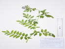 Coll. No. 3034, Polemonium foliosissimum. Coll. No. 3034, Polemonium foliosissimum.
|
3034
|
Polemonium foliosissimum.
Plants of the Douglas Mountain Study Area
Jefferson County Open Space, Colorado, USA
Polemoniaceae
Polemonium foliosissimum A. Gray.
Towering Jacob's Ladder.
Guy Gulch, Jefferson County, Colorado.
Deep shade of a small gulch tributary to Guy Gulch, 150 m. southwest of County Road 70, 1.21 km. northwest of Centennial Ranch house, 13.4 km. (geodesic) northwest of the GNIS location of Golden.
39.8005°N, 105.366°W.
WGS 1984
Elev. 2439 m.
Limited material for collection.
Collected by permit: Jefferson County Open Space, 2023, issued: Apr 10, 2023, to: Tom Schweich.
|
Tom Schweich, with John Vickery
3034. |
3-Jul-2023 |
|
|
|
|
3034.1
|
Hackelia floribunda.
Plants of the Douglas Mountain Study Area
Jefferson County Open Space, Colorado, USA
Boraginaceae
Hackelia floribunda (Lehm.) I. M. Johnst.
Many-Flowered Stickseed.
Guy Gulch, Jefferson County, Colorado.
Deep shade of a small gulch tributary to Guy Gulch, 145 m. southwest of County Road 70, 1.20 km. northwest of Centennial Ranch house, 13.4 km. (geodesic) northwest of the GNIS location of Golden.
39.8005°N, 105.3659°W.
WGS 1984
Elev. 2438 m.
Also collected here: Polemonium foliosissimum.
Collected by permit: Jefferson County Open Space, 2023, issued: Apr 10, 2023, to: Tom Schweich.
|
Tom Schweich, with John Vickery
3034.1 |
3-Jul-2023 |
|
|
|
|
3035
|
Physocarpus montanus.
Plants of the Douglas Mountain Study Area
Jefferson County Open Space, Colorado, USA
Rosaceae
Physocarpus monogynus (Torr.) J.M. Coult.
Mountain Ninebark.
Guy Gulch, Jefferson County, Colorado.
On a steep slope between two smaller gulches, deep shade of a small gulch tributary to Guy Gulch, 165 m. southwest of County Road 70, 1.21 km. northwest of Centennial Ranch house, 13.4 km. (geodesic) northwest of the GNIS location of Golden.
39.8004°N, 105.3662°W.
WGS 1984
Elev. 2444 m.
Collected by permit: Jefferson County Open Space, 2023, issued: Apr 10, 2023, to: Tom Schweich.
|
Tom Schweich, with John Vickery
3035. |
3-Jul-2023 |
|
|
|
|
3035.1
|
Clematis grosseserrata.
Plants of the Douglas Mountain Study Area
Jefferson County Open Space, Colorado, USA
Ranunculaceae
Clematis grosseserrata (Rydb.) Ackerfield.
Western Blue Virgin's-Bower.
Guy Gulch, Jefferson County, Colorado.
On a steep slope between two smaller gulches, deep shade of a small gulch tributary to Guy Gulch, 165 m. southwest of County Road 70, 1.21 km. northwest of Centennial Ranch house, 13.4 km. (geodesic) northwest of the GNIS location of Golden.
39.8004°N, 105.3662°W.
WGS 1984
Elev. 2444 m.
In Fruit; was in flower on 14 Jun 2023.
Collected by permit: Jefferson County Open Space, 2023, issued: Apr 10, 2023, to: Tom Schweich.
|
Tom Schweich, with John Vickery
3035.1 |
3-Jul-2023 |
|
|
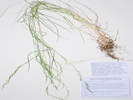 Coll. No. 3036, unknown grass. Coll. No. 3036, unknown grass.
|
3036
|
Difficult grass.
Plants of the Douglas Mountain Study Area
Jefferson County Open Space, Colorado, USA
Poaceae
Undetermined.
Grass Family.
Guy Gulch, Jefferson County, Colorado.
On a steep slope between two smaller gulches, deep shade of a small gulch tributary to Guy Gulch, 170 m. southwest of County Road 70, 1.21 km. northwest of Centennial Ranch house, 13.4 km. (geodesic) northwest of the GNIS location of Golden.
39.8004°N, 105.3662°W.
WGS 1984
Elev. 2447 m.
steep slope, almost a wall
Collected by permit: Jefferson County Open Space, 2023, issued: Apr 10, 2023, to: Tom Schweich.
|
Tom Schweich, with John Vickery
3036. |
3-Jul-2023 |
|
Coll. No. 3036, 3 July 2023, characters observed:
Perennial grass, to 60 cm.,
not evidently rhizomatous;
Leaves,
sheath,
100 mm.,
open,
glabrous,
ligule,
membranous,
< 1 mm.,
blade
120 mm. × 1.5 mm. wide,
flat,
glabrous;
Inflorescence,
1 per culm,
panicle,
150 mm. × 5 mm. wide;
Rachis,
not extended;
Disarticulation,
between florets,
florets falling separately;
Glumes,
lower,
2 mm.,
veins, 3,
upper,
2.5 mm.,
<lowest floret,
veins, 3,
scabrous,
awns, 0;
Florets,
2 per spikelet;
Callus,
slightly hairy,
not cobwebby;
Lemma,
2.3 mm.,
broad,
green,
keel and margin with proximal short wavy hairs,
scabrous distally,
veins, 3(5),
awns, 0;
Palea,
1.7 mm.,
< lemma,
membranous,
glabrous.
|
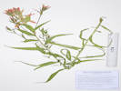 Coll. No. 3037, Castilleja miniata. Coll. No. 3037, Castilleja miniata.
|
3037
|
Castilleja miniata.
Plants of the Douglas Mountain Study Area
Jefferson County Open Space, Colorado, USA
Orobanchaceae
Castilleja miniata Hook.
Giant Red Indian Paintbrush.
Guy Gulch, Jefferson County, Colorado.
Small ridge between two smaller gulches, deep shade of a gulch tributary to Guy Gulch, 260 m. southwest of County Road 70, 1.60 km. northwest of Centennial Ranch house, 13.4 km. (geodesic) northwest of the GNIS location of Golden.
39.8003°N, 105.3665°W.
WGS 1984
Elev. 2461 m.
Stems pilose, not tomentose, lanceolate leaves and bracts with no lobes.
Collected by permit: Jefferson County Open Space, 2023, issued: Apr 10, 2023, to: Tom Schweich.
|
Tom Schweich, with John Vickery
3037. |
3-Jul-2023 |
|
|
|
|
3038
|
Erysimum capitatum.
Plants of the Douglas Mountain Study Area
Jefferson County Open Space, Colorado, USA
Brassicaceae
Erysimum capitatum (Hook.) Greene.
Sanddune Wallflower.
Guy Gulch, Jefferson County, Colorado.
Small ridge between two smaller gulches, deep shade of a gulch tributary to Guy Gulch, 265 m. southwest of County Road 70, 1.23 km. (geodesic) northwest of Centennial Ranch house, 13.4 km. (geodesic) northwest of the GNIS location of Golden.
39.7997°N, 105.3668°W.
WGS 1984
Elev. 2473 m.
Collected by permit: Jefferson County Open Space, 2023, issued: Apr 10, 2023, to: Tom Schweich.
|
Tom Schweich, with John Vickery
3038. |
3-Jul-2023 |
|
|
|
|
3039
|
Jamesia americana
Plants of the Douglas Mountain Study Area
Jefferson County Open Space, Colorado, USA
Hydrangeaceae
Jamesia americana Torr. & A. Gray.
Fivepetal Cliffbush.
Guy Gulch, Jefferson County, Colorado.
Small ridge between two smaller gulches, shade of a gulch tributary to Guy Gulch, 280 m. southwest of County Road 70, 1.23 km. (geodesic) northwest of Centennial Ranch house, 13.4 km. (geodesic) northwest of the GNIS location of Golden.
39.7996°N, 105.367°W.
WGS 1984
Elev. 2469 m.
Collected by permit: Jefferson County Open Space, 2023, issued: Apr 10, 2023, to: Tom Schweich.
|
Tom Schweich, with John Vickery
3039. |
3-Jul-2023 |
|
|
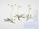 Coll. No. 3040, Packera werneriifolia. Coll. No. 3040, Packera werneriifolia.
|
3040
|
Packera werneriifolia.
Plants of the Douglas Mountain Study Area
Jefferson County Open Space, Colorado, USA
Asteraceae
Packera werneriifolia (A. Gray) W. A. Weber & Á. Löve.
Hoary Groundsel.
Guy Gulch, Jefferson County, Colorado.
Open shade on a forested hillside above Guy Gulch, 290 m. southwest of County Road 70, 1.15 km. (geodesic) northwest of Centennial Ranch house, 13.4 km. (geodesic) northwest of the GNIS location of Golden.
39.799°N, 105.3663°W.
WGS 1984
Elev. 2488 m.
Gentle north-facing slope in Douglas fir forest with little to no middlestory.
Collected by permit: Jefferson County Open Space, 2023, issued: Apr 10, 2023, to: Tom Schweich.
|
Tom Schweich
3040. |
3-Jul-2023 |
|
|
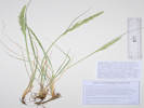 Coll. No. 3041, Calamagrostis purpurascens. Coll. No. 3041, Calamagrostis purpurascens.
|
3041
|
Grass.
Plants of the Douglas Mountain Study Area
Jefferson County Open Space, Colorado, USA
Poaceae
Calamagrostis purpurascens R. Br.
Purple Reedgrass.
Guy Gulch, Jefferson County, Colorado.
Beside well-established game trail in open shade on a forested hillside above Guy Gulch, 290 m. southwest of County Road 70, 1.15 km. (geodesic) northwest of Centennial Ranch house, 13.4 km. (geodesic) northwest of the GNIS location of Golden.
39.7991°N, 105.3656°W.
WGS 1984
Elev. 2500 m.
Gentle north-facing slope in Douglas fir forest with little to no middlestory.
Collected by permit: Jefferson County Open Space, 2023, issued: Apr 10, 2023, to: Tom Schweich.
|
Tom Schweich, with John Vickery
3041. |
3-Jul-2023 |
|
Coll. No. 3041, 3 July 2023, characters observed:
Perennial grass, to 40 cm.,
no rhizomes seen;
Leaves,
sheath,
12 cm.,
open,
ligule,
membranous,
4 mm.,
auricles, 0,
blade,
15 cm. × 3 mm. wide,
flat,
scabrous, also adaxially densely and minutely hairy between the ribs;
Inflorescence,
<leaves,
1 per culm,
panicle,
110 mm. × 12 mm. wide;
Rachis, not extended;
Spikelets,
many,
8 mm. × 1 mm. wide,
similar;
Glumes,
lower,
6 mm.,
veins, 1,
upper,
5 mm.,
> lowest floret,
veins, 1 (3?),
keeled,
awns, 0;
Florets,
1* per spikelet;
*Rachilla,
extended beyond upper floret as though there could be another floret up there,
hairy;
Callus,
short straight white hairs;
Lemma,
4 mm.,
< glumes,
green,
veins, 5, glabrous,
tip, toothed,
awns, 1, 7 mm., bent,
attached, near base of lemma;
Palea,
4 mm.,
< lemma,
membranous;
Achene,
1.7 mm.,
green.
|
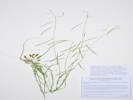 Coll. No. 3042, Boechera spatifolia. Coll. No. 3042, Boechera spatifolia.
|
3042
|
Mustard, compare to Boechera spatifola.
Plants of the Douglas Mountain Study Area
Jefferson County Open Space, Colorado, USA
Brassicaceae
Boechera spatifolia (Rydb.) Windham & Al-Shebaz.
Spoonleaf Rockcress.
Guy Gulch, Jefferson County, Colorado.
Open forest slope above Guy Gulch, 130 m. southwest of County Road 70, 1.09 km. (geodesic) northwest of Centennial Ranch house, 13.3 km. (geodesic) northwest of the GNIS location of Golden.
39.8°N, 105.3649°W.
WGS 1984
Elev. 2442 m.
Collected by permit: Jefferson County Open Space, 2023, issued: Apr 10, 2023, to: Tom Schweich.
|
Tom Schweich, with John Vickery
3042. |
3-Jul-2023 |
|
Coll. No. 3042, 3 July 2023, characters observed:
Perennial herb,
45 cm. to 50 cm.,
hairs, simple,
occasional forked hairs at base of stem;
Leaves,
basal,
simple,
petiole, 15 mm.,
blade 18 mm. × 5.5 mm. wide,
margin, toothed, ciliate,
tip, acute,
cauline,
18 mm. × 1.3 mm. wide,
auriculate, 1+mm.,
linear,
entire;
Inflorescence,
elongating;
Sepals,
1 row;
Petals,
3 mm. × 0.7 mm. wide,
color, white;
Fruit,
pedicels, 10 mm., spreading,
body, 45 mm., × 1.3 mm. wide,
descending or pendant;
Ovules,
biseriate.
|
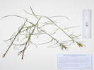 Coll. No. 3043, Castilleja linariifolia. Coll. No. 3043, Castilleja linariifolia.
|
3043
|
Castilleja linarifolia.
Plants of the Douglas Mountain Study Area
Jefferson County Open Space, Colorado, USA
Orobanchaceae
Castilleja linariifolia Benth.
Wyoming Indian Paintbrush.
Guy Gulch, Jefferson County, Colorado.
Top of very steep slope above creek, 90 m. southwest of County Road 70, 1.09 km. (geodesic) northwest of Centennial Ranch house, 13.3 km. (geodesic) northwest of the GNIS location of Golden.
39.8001°N, 105.3644°W.
WGS 1984
Elev. 2429 m.
Very narrow leaves.
Collected by permit: Jefferson County Open Space, 2023, issued: Apr 10, 2023, to: Tom Schweich.
|
Tom Schweich, with John Vickery
3043. |
3-Jul-2023 |
|
|
|
|
3043.1
|
Anaphalis? Or Pseudognaphalium?
Plants of the Douglas Mountain Study Area
Jefferson County Open Space, Colorado, USA
Asteraceae
Anaphalis margaritacea (L.) Bentham & Hooker.
Western Pearly Everlasting.
Guy Gulch, Jefferson County, Colorado.
Top of very steep slope above creek, 90 m. southwest of County Road 70, 1.09 km. (geodesic) northwest of Centennial Ranch house, 13.3 km. (geodesic) northwest of the GNIS location of Golden.
39.8001°N, 105.3644°W.
WGS 1984
Elev. 2429 m.
Collected by permit: Jefferson County Open Space, 2023, issued: Apr 10, 2023, to: Tom Schweich.
|
Tom Schweich, with John Vickery
3043.1 |
3-Jul-2023 |
|
|
|
|
3044
|
Oenothera coronopifolia
Plants of the Douglas Mountain Study Area
Jefferson County Open Space, Colorado, USA
Onagraceae
Oenothera coronopifolia Torr. & A. Gray.
Crownleaf Evening Primrose. Hierba de San Juan..
Guy Gulch, Jefferson County, Colorado.
Roadside, Golden Gate Canyon Road (County Road 70), 1.10 km. (geodesic) northwest of Centennial Ranch house, 13.25 km. (geodesic) northwest of the GNIS location of Golden.
39.8011°N, 105.364°W.
WGS 1984
Elev. 2423 m.
Collected by permit: Jefferson County Open Space, 2023, issued: Apr 10, 2023, to: Tom Schweich.
|
Tom Schweich, with John Vickery
3044. |
3-Jul-2023 |
|
|
|
Locations:
Golden.
|
|
Tuesday, 4 July 2023
Yard work
|
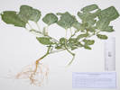 Coll. No. 3045, Amaranthus albus. Coll. No. 3045, Amaranthus albus.
|
3045
|
Amaranthus albus
|
|
Locations:
DeLong Park (City of Golden).
|
|
Thursday, 6 July 2023
DeLong Park
|
|
Other articles:
• Lubahn Trail (north loop):
at spur;
at a wet spot;
along trail;
at switch back;
below plaque;
• Lubahn Trail (South Loop):
Castle Rock;
• Olivine Trail:
at Lubahn Trl;
Locations:
Castle Rock.
South Table Mountain.
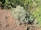 Ericameria nauseosa var. nauseosa beside the Lubahn Trail. Ericameria nauseosa var. nauseosa beside the Lubahn Trail.
|
|
Friday, 7 July 2023
South Table Mountain, via Lubahn Trail and Olivine Trail.
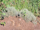
Exposed roots of Ericameria nauseosa var. nauseosa beside the Lubahn Trail. |
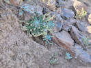
Physaria vitulifera beside the Lubahn Trail on South Table Mountain. |
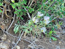
Townsendia grandiflora along the Lubahn Trail. |
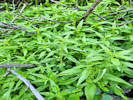
Parietaria pensylvanica on a wet slope under Rhus trilobata |
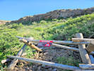
Where they closed the trail. |
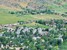
Schweich Hill from Castle Rock on South Table Mountain. |
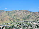
Magpie Gulch (left) and Nightbird Gulch (right) seen from Castle Rock on South Table Mountain. |
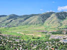
Survey Field and Lookout Mountain from Castle Rock on South Table Mountain. |
|
|
Other articles:
• Lubahn Spur:
below the outcrop;
 Coll. No. 3046, Parietaria pensylvanica on a wet slope under Symphoricarpos occidentalis. Coll. No. 3046, Parietaria pensylvanica on a wet slope under Symphoricarpos occidentalis.
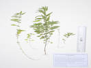 Coll. No. 3046, Parietaria pensylvanica. Coll. No. 3046, Parietaria pensylvanica.
|
3046
|
Parietaria pensylvanica.
|
Native and Naturalized Flora of the Golden Area, Jefferson County, Colorado
Urticaceae
Parietaria pensylvanica Willd.
Pennsylvania Pellitory.
South Table Mountain, Jefferson County, Colorado.
Along the re-routed Lubahn Trail, below the basalt rim of South Table Mountain, 1.15 km. east southeast of the GNIS location of Golden.
39.7538°N, 105.2079°W.
WGS 1984
Elev. 1861 m.
Wet slope above Lubahn Trail under Rhus trilobata, Symphoricarpos sp., and Cercocarpus montanus.
Spring 2023 was recognized as “wetter than average.”
Collected by permit: City of Golden, 2023, issued: Mar 13, 2023, to: Tom Schweich.
|
Tom Schweich
3046. |
7-Jul-2023 |
|
|
|
Other articles:
• Olivine Trail:
near Old Quarry Trl;
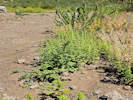 Coll. No. 3047, Dysphania botrys. Coll. No. 3047, Dysphania botrys.
|
3047
|
Dysphania botrys.
Plants of Jefferson County Open Space
Jefferson County, Colorado
Chenopodiaceae
Dysphania botrys (L.) Mosyakin & Clemants.
Jerusalem Oak Goosefoot.
South Table Mountain, Jefferson County, Colorado.
Beside the Olivine Trail, near its intersection with the Old Quarry Trail, 1.28 km. east southeast of the GNIS location of Golden.
39.7532°N, 105.2065°W.
WGS 1984
Elev. 1891 m.
Open, sandy ground, disturbed area beside trail.
Collected by permit: Jefferson County Open Space, 2023, issued: Apr 10, 2023, to: Tom Schweich.
|
Tom Schweich
3047. |
7-Jul-2023 |
|
|
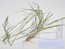 Coll. No. 3048, Sporobolus cryptandrus. Coll. No. 3048, Sporobolus cryptandrus.
|
3048
|
Sporobolus cryptandrus.
Plants of Jefferson County Open Space
Jefferson County, Colorado
Poaceae
Sporobolus cryptandrus (Torr.) A. Gray.
Sand Drop-seed.
South Table Mountain, Jefferson County, Colorado.
West side of the mesa, beside the Olivine Trail, near its intersection with the Old Quarry Trail, 1.30 km. east southeast of the GNIS location of Golden.
39.753°N, 105.2062°W.
WGS 1984
Elev. 1890 m.
Disturbed trail-side, dry and sunny, Cercocarpus montanus the dominant shrub.
Collected by permit: Jefferson County Open Space, 2023, issued: Apr 10, 2023, to: Tom Schweich.
|
Tom Schweich
3048. |
7-Jul-2023 |
|
|
|
Locations:
Kelsey Campground.
Morrison Creek.
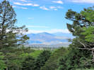 View to the southeast from Little Scraggy Trail to Thunder Butte and Pikes Peak. View to the southeast from Little Scraggy Trail to Thunder Butte and Pikes Peak.
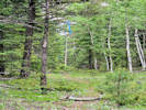 Horse trail markings at the head of Morrison Creek. Horse trail markings at the head of Morrison Creek.
|
|
Monday, 10 July 2023
Kelsey Campground to Morrison Creek.
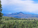
Another view of Thunder Butte and Pikes Peak; this one after the hail storm. |
Solny (short for Solnyshka) knowsn what a press full of new collections on the dryer is good for. |
|
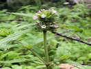 Coll. No. 3049, Dracocephalum parviflorum. Coll. No. 3049, Dracocephalum parviflorum.
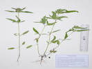 Coll. No. 3049, Dracocephalum parviflorum. Coll. No. 3049, Dracocephalum parviflorum.
|
3049
|
Annual Lamiaceae Dracocephalum parviflorum.
|
Plants of Colorado
Lamiaceae
Dracocephalum parviflorum Nutt.
American Dragonhead.
Morrison Creek, Jefferson County, Colorado.
Small swale tributary to Morrison Creek, near crossing of Little Scraggy Trail, 1.08 km. southwest of Little Scraggy Peak, 50.3 km. south of Golden.
39.3078°N, 105.2841°W.
WGS 1984
Elev. 2365 m.
annual
Lodgepole pine, Douglas fir, and aspen with Aquilegia coerulea and Acer glabrum.
Collected by permit: Pike San Isabel National Forest, 2023, issued: Jul 1, 2023, to: Tom Schweich.
|
Tom Schweich
3049. |
10-Jul-2023 |
|
|
|
Literature Cited:
- Nuttall, Thomas, 1818.
|
|
Described by Nuttall (1818) from collections mane at Fort Mandan.
The type is at PH.
|
5. * [Dracocephalum] parviflorum. Flowers, verticillate, subcapitate;
leaves ovate-lanceolate, deeply serrate, and petiolate,
bractes foliaceous, ovate, ciliate, and serrate, serratures
conspicuously mucronate; upper segment of the
calix much larger than the rest; flower scarcely longer
than the calix. Hab. Around Fort Mandan, on the Missouri;
on the borders of thickets. Obs. Biennial; nearly
smooth, stem, and petioe a little pubescent; flowers almost
imbricated in a leafy capitulum, very small, and
nearly white; calix awned, arid and membranaceous, semiquinquefid;
bractes divaricately awned; upper lip of
the corolla emarginate, arched; lower 3-lobed central
lobe subcrenate. Flowering time, July. Apparently allied
to D. Moldavica, but the leaves are entirely destitute
of punctures: scarcely a congener with D. virginianum,
and closely allied to Melissa.
|
|
Principally a Siberian genus.
|
|
|
|
3050
|
Pedicularis canadensis.
|
Plants of Colorado
Orobanchaceae
Pedicularis canadensis L.
Canadian Lousewort.
Morrison Creek, Jefferson County, Colorado.
Small terrace above Morrison Creek, near crossing of Little Scraggy Trail, 1.14 km. southwest of Little Scraggy Peak, 50.0 km. south of Golden.
39.3075°N, 105.2847°W.
WGS 1984
Elev. 2369 m.
Being worked over by a large bumble bee. Also collected here: Oryzopsis asperifolia.
Collected by permit: Pike San Isabel National Forest, 2023, issued: Jul 1, 2023, to: Tom Schweich.
|
Tom Schweich
3050. |
10-Jul-2023 |
|
|
|
|
3051
|
Oryzopsis asperifolia.
|
Plants of Colorado
Poaceae
Oryzopsis asperifolia Michx.
White-Grain Mountain Rice-Grass.
Morrison Creek, Jefferson County, Colorado.
Small terrace above Morrison Creek, near crossing of Little Scraggy Trail, 1.14 km. southwest of Little Scraggy Peak, 50.0 km. south of Golden.
39.3075°N, 105.2847°W.
WGS 1984
Elev. 2374 m.
Damp forest floor; also collected here; Osmorhiza depauperata, Pyrola chlorantha, and Pedicularis canadensis; shattering as fast as I can collect it.
Collected by permit: Pike San Isabel National Forest, 2023, issued: Jul 1, 2023, to: Tom Schweich.
|
Tom Schweich
3051. |
10-Jul-2023 |
|
|
|
|
3052
|
Bryophyte?
|
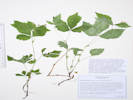 Coll. No. 3053, Rubus pubescens. Coll. No. 3053, Rubus pubescens.
|
3053
|
Rosaceae?
|
Plants of Colorado
Rosaceae
Rubus pubescens Raf.
Dwarf Red Blackberry.
Morrison Creek, Jefferson County, Colorado.
Small terrace above Morrison Creek, near crossing of Little Scraggy Trail, 1.15 km. southwest of Little Scraggy Peak, 50.0 km. south of Golden; accessed by way of Kelsey Campground and Jefferson County Road 126.
39.3074°N, 105.2846°W.
WGS 1984
Elev. 2528 m.
Forested, shaded, wet bank of creek; also collected nearby: Osmorhiza depauperata, Pyrola chlorantha, Pedicularia canadensis, and Oryzopsis asperifolia.
Collected by permit: Pike San Isabel National Forest, 2023, issued: Jul 1, 2023, to: Tom Schweich.
|
Tom Schweich
3053. |
10-Jul-2023 |
|
Coll. No. 3053, 10 July 2023, characters observed:
Creeping perennial, to 25 cm.,
without stolons;
Stem,
unarmed,
villous, glabrate proximally;
Stipules, 8 mm., leaf-like, lobed;
Leaves,
alternate,
compound,
ternate,
leaflets,
ovate,
68 mm. × 33 mm. wide,
serrate above middle,
margins villous,
tips, acuminate on smaller leaflets, otherwise acute,
adaxial, glabrous,
abaxial, soft straight hairs on veins;
Inflorescence,
2-4 flowers;
Petiole,
12 mm.,
stipitate glandular;
Flowers, actinomorphic, hypanthium present;
Sepals,
4 mm. × 1.5 mm. wide,
joined at base,
without bracteoles;
Petals,
5 mm. × 2 mm. wide,
spoon-shaped,
free to hypanthium,
white, fading pink;
Stamens,
many.
|
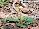 Coll. No. 3054, Pyrola chlorantha Coll. No. 3054, Pyrola chlorantha
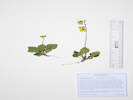 Coll. No. 3054, Pyrola chlorantha. Coll. No. 3054, Pyrola chlorantha.
|
3054
|
Pyrola chlorantha.
|
Plants of Colorado
Ericaceae
Pyrola chlorantha Sw.
Green-Flowered Wintergreen.
Morrison Creek, Jefferson County, Colorado.
Small terrace above Morrison Creek, near crossing of Little Scraggy Trail, 1.16 km. southwest of Little Scraggy Peak, 50.0 km. south of Golden; accessed by way of Kelsey Campground and Jefferson County Road 126.
39.3072°N, 105.2847°W.
WGS 1984
Elev. 2550 m.
Many plants here, 2 in bloom, 1 in bud.
Forested, shaded, wet bank of creek; also collected nearby: Osmorhiza depauperata, Rubus pubescens, Pedicularis canadensis, and Oryzopsis asperifolia.
Collected by permit: Pike San Isabel National Forest, 2023, issued: Jul 1, 2023, to: Tom Schweich.
|
Tom Schweich
3054. |
10-Jul-2023 |
|
|
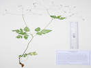 Coll. No. 3055, Osmorhiza depauperata. Coll. No. 3055, Osmorhiza depauperata.
|
3055
|
Osmorhiza depauperata.
|
Plants of Colorado
Apiaceae
Osmorhiza depauperata Phil.
Blunt-Fruit Sweet-Cicely.
Morrison Creek, Jefferson County, Colorado.
Small terrace above Morrison Creek, near crossing of Little Scraggy Trail, 1.16 km. southwest of Little Scraggy Peak, 50.0 km. south of Golden; accessed by way of Kelsey Campground and Jefferson County Road 126.
39.3073°N, 105.2847°W.
WGS 1984
Elev. 2555 m.
In fruit, no flowers seen.
Forested, shaded, wet bank of creek; also collected nearby: Pyrola chlorantha, Rubus pubescens, Pedicularis canadensis, and Oryzopsis asperifolia.
Collected by permit: Pike San Isabel National Forest, 2023, issued: Jul 1, 2023, to: Tom Schweich.
|
Tom Schweich
3055. |
10-Jul-2023 |
|
|
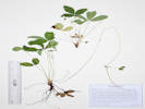 Coll. No. 3056, Fragaria vesca. Coll. No. 3056, Fragaria vesca.
|
3056
|
Fragaria, likely F. vesca.
|
Plants of Colorado
Rosaceae
Fragaria vesca L.
Woodland Strawberry.
Morrison Creek, Jefferson County, Colorado.
Small terrace above Morrison Creek, near crossing of Little Scraggy Trail, 1.20 km. southwest of Little Scraggy Peak, 50.1 km. south of Golden; accessed by way of Kelsey Campground and Jefferson County Road 126.
39.3068°N, 105.2847°W.
WGS 1984
Elev. 2570 m.
Forested, shaded, wet bank of creek; also collected nearby: Osmorhiza depauperata, Pyrola chlorantha, Rubus pubescens, Pedicularis canadensis, and Oryzopsis asperifolia.
Collected by permit: Pike San Isabel National Forest, 2023, issued: Jul 1, 2023, to: Tom Schweich.
|
Tom Schweich
3056. |
10-Jul-2023 |
|
|
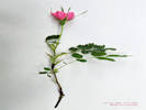 Coll. No. 3057, Rosa woodsii Coll. No. 3057, Rosa woodsii
|
3057
|
Rosa acicularis ssp. sayi.
|
Plants of Colorado
Rosaceae
Rosa acicularis Lindl. ssp. sayi (Schwein.) W. H. Lewis.
Say's Acicular Rose.
Morrison Creek, Jefferson County, Colorado.
Steep slope above Morrison Creek, near crossing of Little Scraggy Trail, 1.18 km. southwest of Little Scraggy Peak, 50.1 km. south of Golden; accessed by way of Kelsey Campground and Jefferson County Road 126.
39.3068°N, 105.2845°W.
WGS 1984
Elev. 2581 m.
Prickles on new growth, seven leaflets per leaf, bracts very long, petals short, color intense.
Deep shade of forest; also collected nearby: Osmorhiza depauperata, Pyrola chlorantha, Fragaria vesca, Rubus pubescens, Pedicularis canadensis, and Oryzopsis asperifolia.
Limited material for collection.
Collected by permit: Pike San Isabel National Forest, 2023, issued: Jul 1, 2023, to: Tom Schweich.
|
Tom Schweich
3057. |
10-Jul-2023 |
|
|
|
|
3058
|
Physocarpus monogynus.
|
Plants of Colorado
Rosaceae
Physocarpus monogynus (Torr.) J.M. Coult.
Mountain Ninebark.
Morrison Creek, Jefferson County, Colorado.
Bouldery slope above Morrison Creek, near crossing of Little Scraggy Trail, 1.13 km. southwest of Little Scraggy Peak, 50.0 km. south of Golden; accessed by way of Kelsey Campground and Jefferson County Road 126.
39.3076°N, 105.2847°W.
WGS 1984
Elev. 2580 m.
Lodgepole pine, Douglas fir, aspen, with Juniperus comunis var. depressa and Acer glabrum.
Collected by permit: Pike San Isabel National Forest, 2023, issued: Jul 1, 2023, to: Tom Schweich.
|
Tom Schweich
3058. |
10-Jul-2023 |
|
|
|
|
3059
|
Geum macrophylum.
|
Plants of Colorado
Rosaceae
Geum macrophyllum Willd.
Large-leaf Avens.
Morrison Creek, Jefferson County, Colorado.
Shaded streamside along Morrison Creek near where joined by horse trail (probably an old road), 848 m. southwest of Little Scraggy Peak, 49.8 km. south of the GNIS location of Golden; accessed by way of Kelsey Campground and Jefferson County Road 126.
39.31°N, 105.283°W.
WGS 1984
Elev. 2541 m.
Also collected here: Erigeron eximus, Hackelia floribunda, Geranium richardsonii, and Aconitum columbianum.
Collected by permit: Pike San Isabel National Forest, 2023, issued: Jul 1, 2023, to: Tom Schweich.
|
Tom Schweich
3059. |
10-Jul-2023 |
|
|
|
|
3060
|
Brassicaceae
|
Plants of Colorado
Brassicaceae
Arabis pycnocarpa M. Hopkins var. pycnocarpa.
Cream Flower Rockcress.
Morrison Creek, Jefferson County, Colorado.
Open forest near the divide between Morrison Creek and Sixmile Creek, 966 m. southwest of Little Scraggy Peak, 49.8 km. south of the GNIS location of Golden; accessed by way of Kelsey Campground and Jefferson County Road 126.
39.3076°N, 105.2818°W.
WGS 1984
Elev. 2564 m.
Also collected here: Pseudocymopterus montanus.
On the horse trail (old road?) just north of the Little Scraggy Trail.
Collected by permit: Pike San Isabel National Forest, 2023, issued: Jul 1, 2023, to: Tom Schweich.
|
Tom Schweich
3060. |
10-Jul-2023 |
|
Coll. No. 3060, 10 Jul 2023, characters observed:
Perennial herb, terrestrial,
25 cm. to 40 cm. tall,
hairs, mostly simple, rarely forked;
Stem,
erect,
leafy,
proximal, hairy,
distal, glabrous;
Leaves,
basal,
withering,
petiole, 4 mm.,
blade, 14 mm. × 7 mm. wide,
oblanceolate,
margin, several small teeth,
tip, rounded,
cauline,
sessile,
13 mm. × 3 mm. wide,
oblong,
margin, few small teeth;
Inflorescence,
raceme,
40 mm. × 10 mm. wide,
not bracted,
not one-sided;
Flowers,
radial;
Sepals,
#4,
rows, #1,
2.5 mm. × 0.8 mm. wide,
ovate,
color, green,
glabrous;
Petals,
4 mm. × 1.2 mm. wide,
obovate,
margin, entire,
color, white, lavender tint when dry;
Stamens,
#6,
3 & 3.5 mm.;
Filaments,
plain;
Anthers,
0.5&nbp;mm.,
ovate;
Stigma,
capitate;
Fruit,
pedicels, 7 mm., ascending,
body, 10.5 mm., ascending;
Ovules,
biseriate.
|
|
|
3061
|
Pseudocymopteris montanus.
|
Plants of Colorado
Brassicaceae
Arabis pycnocarpa M. Hopkins var. pycnocarpa.
Cream Flower Rockcress.
Morrison Creek, Jefferson County, Colorado.
Open forest near the divide between Morrison Creek and Sixmile Creek, 966 m. southwest of Little Scraggy Peak, 49.8 km. south of the GNIS location of Golden; accessed by way of Kelsey Campground and Jefferson County Road 126.
39.3076°N, 105.2818°W.
WGS 1984
Elev. 2564 m.
Also collected here: Pseudocymopterus montanus.
On the horse trail (old road?) just north of the Little Scraggy Trail.
Collected by permit: Pike San Isabel National Forest, 2023, issued: Jul 1, 2023, to: Tom Schweich.
|
Tom Schweich
3060. |
10-Jul-2023 |
|
|
|
|
3062
|
Oenothera coronopifolia.
|
Plants of Colorado
Onagraceae
Oenothera coronopifolia Torr. & A. Gray.
Crownleaf Evening Primrose. Hierba de San Juan..
Morrison Creek, Jefferson County, Colorado.
Along the Little Scraggy Trail, in Gunbarrel Creek drainage, 950 m. south of Little Scraggy Peak, 49.2 km. south of the GNIS location of Golden; accessed by way of Kelsey Campground and Jefferson County Road 126.
39.3062°N, 105.2767°W.
WGS 1984
Elev. 2577 m.
Alluvial soil below rock outcrops, with Ceanothus fendleri and Acer glabrum.
Collected by permit: Pike San Isabel National Forest, 2023, issued: Jul 1, 2023, to: Tom Schweich.
|
Tom Schweich
3062. |
10-Jul-2023 |
|
|
|
|
3063
|
Holodiscus dumosus.
|
Plants of Colorado
Rosaceae
Holodiscus discolor (Pursh) Maxim. Var. microphyllus (Rydb.) Jeps.
Ocean Spray.
Morrison Creek, Jefferson County, Colorado.
Along the Little Scraggy Trail, in Gunbarrel Creek drainage, 950 m. south of Little Scraggy Peak, 50.1 km. south of the GNIS location of Golden; accessed by way of Kelsey Campground and Jefferson County Road 126.
39.3063°N, 105.2768°W.
WGS 1984
Elev. 2581 m.
Hillside with rock outcrops and boulders; also here: Jamesia americana and Acer glabrum.
Collected by permit: Pike San Isabel National Forest, 2023, issued: Jul 1, 2023, to: Tom Schweich.
|
Tom Schweich
3063. |
10-Jul-2023 |
|
|
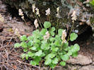 Heuchera hallii observed beside the Little Scraggy Trail. Heuchera hallii observed beside the Little Scraggy Trail.
|
|
Heuchera hallii observed.
|
|
Literature Cited:
- Gray, Asa, 1863.
|
|
Enumerated and described by Asa Gray (1863) ...
|
... H. Hallii. ‡ Rocks, on mountains of medium elevation. ...
|
‡ Heuchera Hallii (sp. nov.) :
hirsutula; thyrso racemiformi suhlaxo 16-30-floro: bracteis pedicellos vix
superantibus ; florihus albidis (nunc roseo tinctis?): calyce lato-campanulato 5-lobo, lobis,
lato-ovatis; petalis spathulatis obtusis exsertis: staminibus stylisque inclusis. Scapes usually a
span high. Flowers about three lines long, but the calyx twice the breadth of that of H. bracteata,
and very different in shape. Pedicels, when fully developed, sometimes nearly as long as the flower.
Leaves as in the preceding species [H. bracteata], considerably variable.
|
|
|
Other articles:
• Golden Gate Canyon Road:
at Centennial Ranch;
39000;
Locations:
Guy Gulch.
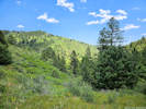 View across Guy Gulch from the high point of the day. View across Guy Gulch from the high point of the day.
|
|
Wednesday, 12 July 2023
Guy Gulch
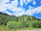
Where we went Wednesday, 12 July 2023. |
|
|
|
3064
|
Astragalus, likely A. flexuosus.
Plants of the Douglas Mountain Study Area
Jefferson County Open Space, Colorado, USA
Fabaceae
Astragalus flexuosus G. Don.
Flexible Milkvetch.
Guy Gulch, Jefferson County, Colorado.
Open flat, possible former parking area across County Road 70 from the Centennial Ranch house, 2.43 km. south of Mount Tom, 12.2 km. west northwest of the GNIS location of Golden.
39.7946°N, 105.3545°W.
WGS 1984
Elev. 2238 M.
Spreading horizontally to 1 m.
Collected by permit: Jefferson County Open Space, 2023, issued: Apr 10, 2023, to: Tom Schweich.
|
Tom Schweich, with John Vickery
3064. |
12-Jul-2023 |
|
|
|
|
3065
|
Silene, maybe S. latifolia.
Plants of the Douglas Mountain Study Area
Jefferson County Open Space, Colorado, USA
Caryophyllaceae
Silene latifolia Poir.
Bladder Campion.
Guy Gulch, Jefferson County, Colorado.
Around the base of a concrete structure, across County Road 70 from the Centennial Ranch house, 2.43 km. south of Mount Tom, 12.2 km. west northwest of the GNIS location of Golden.
39.7946°N, 105.3547°W.
WGS 1984
Elev. 2343 m.
Basal leaves 0, flowers white, flowers imperfect.
Most have been eaten.
Collected by permit: Jefferson County Open Space, 2023, issued: Apr 10, 2023, to: Tom Schweich.
|
Tom Schweich, with John Vickery
3065. |
12-Jul-2023 |
|
|
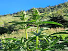 Coll. No. 3066, Dracocephalum parviflorum. Coll. No. 3066, Dracocephalum parviflorum.
|
3066
|
Dracocephalum parviflorum.
Plants of the Douglas Mountain Study Area
Jefferson County Open Space, Colorado, USA
Lamiaceae
Dracocephalum parviflorum Nutt.
American Dragonhead.
Guy Gulch, Jefferson County, Colorado.
Around the base of a concrete structure, across County Road 70 from the Centennial Ranch house, 2.43 km. south of Mount Tom, 12.2 km. west northwest of the GNIS location of Golden.
39.7946°N, 105.3547°W.
WGS 1984
Elev. 2346 m.
Side of concrete structure, also collected here: Ambrosia psilostachya, Silene latifolia, and Astragalus flexuosus.
Collected by permit: Jefferson County Open Space, 2023, issued: Apr 10, 2023, to: Tom Schweich.
|
Tom Schweich, with John Vickery
3066. |
12-Jul-2023 |
|
|
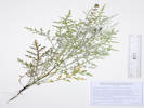 Coll. No. 3067, Ambrosia tomentosa. Coll. No. 3067, Ambrosia tomentosa.
|
3067
|
Ambrosia psilostachya.
Plants of the Douglas Mountain Study Area
Jefferson County Open Space, Colorado, USA
Asteraceae
Ambrosia tomentosa Nutt.
Skeleton-Leaf Bursage.
Guy Gulch, Jefferson County, Colorado.
Just southeast of a concrete structure, across County Road 70 from the Centennial Ranch house, 2.43 km. south of Mount Tom, 12.2 km. west northwest of the GNIS location of Golden.
39.7945°N, 105.3546°W.
WGS 1984
Elev. 2345 m.
Also collected nearby: Astragalus flexuosus, Silene latifolia, and Dracocephalum parviflorum.
Collected by permit: Jefferson County Open Space, 2023, issued: Apr 10, 2023, to: Tom Schweich.
|
Tom Schweich, with John Vickery
3067. |
12-Jul-2023 |
|
|
|
|
3068
|
Scrophularia lanceolata.
Plants of the Douglas Mountain Study Area
Jefferson County Open Space, Colorado, USA
Scrophulariaceae
Scrophularia lanceolata Pursh.
Lanceleaf Figwort.
Guy Gulch, Jefferson County, Colorado.
Around the base of a willow in a former meander of the creek, 115 m. west across County Road 70 from the Centennial Ranch house, 2.43 km. south of Mount Tom, 12.3 km. west northwest of the GNIS location of Golden.
39.7947°N, 105.3554°W.
WGS 1984
Elev. 2349 m.
One in bloom, four-five more in bud, with Hackelia floribunda.
Collected by permit: Jefferson County Open Space, 2023, issued: Apr 10, 2023, to: Tom Schweich.
|
Tom Schweich, with John Vickery
3068. |
12-Jul-2023 |
|
|
|
|
3069
|
Geum macrophyllum.
Plants of the Douglas Mountain Study Area
Jefferson County Open Space, Colorado, USA
Rosaceae
Geum macrophyllum Willd.
Large-leaf Avens.
Guy Gulch, Jefferson County, Colorado.
Around the base of a willow in a former meander of the creek, 130 m. west across County Road 70 from the Centennial Ranch house, 2.43 km. south of Mount Tom, 12.3 km. west northwest of the GNIS location of Golden.
39.7947°N, 105.3554°W.
WGS 1984
Elev. 2347 m.
Limited material, some eaten; with Hackellia floribunda
Collected by permit: Jefferson County Open Space, 2023, issued: Apr 10, 2023, to: Tom Schweich.
|
Tom Schweich, with John Vickery
3069. |
12-Jul-2023 |
|
|
|
|
3070
|
Hackellia floribunda.
Plants of the Douglas Mountain Study Area
Jefferson County Open Space, Colorado, USA
Boraginaceae
Hackelia floribunda (Lehm.) I. M. Johnst.
Many-Flowered Stickseed.
Guy Gulch, Jefferson County, Colorado.
Around the base of a willow in a former meander of the creek, 130 m. west across County Road 70 from the Centennial Ranch house, 2.43 km. south of Mount Tom, 12.3 km. west northwest of the GNIS location of Golden.
39.7947°N, 105.3553°W.
WGS 1984
Elev. 2347 m.
Large perennial herb, more than 1 m. tall.
Around willow with Ribes inerme, Geum macrophyllum, and Scrophularia lanceolata.
Collected by permit: Jefferson County Open Space, 2023, issued: Apr 10, 2023, to: Tom Schweich.
|
Tom Schweich, with John Vickery
3070. |
12-Jul-2023 |
|
|
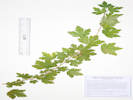 Coll. No. 3071, Ribes inerme. Coll. No. 3071, Ribes inerme.
|
3071
|
Ribes inerme.
Plants of the Douglas Mountain Study Area
Jefferson County Open Space, Colorado, USA
Grossulariaceae
Ribes inerme Rydb.
White Stem Gooseberry.
Guy Gulch, Jefferson County, Colorado.
Around the base of a willow in a former meander of the creek, 135 m. west across County Road 70 from the Centennial Ranch house, 2.43 km. south of Mount Tom, 12.3 km. west northwest of the GNIS location of Golden.
39.7947°N, 105.3554°W.
WGS 1984
Elev. 2348 m.
At the base of a willow in an abandoned meander of the creek, with Hackellia floribunda, Geum macrophyllum, and Scrophularia lanceolata.
Collected by permit: Jefferson County Open Space, 2023, issued: Apr 10, 2023, to: Tom Schweich.
|
Tom Schweich, with John Vickery
3071. |
12-Jul-2023 |
|
|
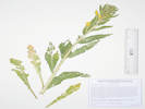 Coll. No. 3072, Oenothera biennis. Coll. No. 3072, Oenothera biennis.
|
3072
|
Oenothera biennis.
Plants of the Douglas Mountain Study Area
Jefferson County Open Space, Colorado, USA
Onagraceae
Oenothera biennis L.
King's-Cureall.
Guy Gulch, Jefferson County, Colorado.
Around the base of a willow in a former meander of the creek, 125 m. west across County Road 70 from the Centennial Ranch house, 2.43 km. south of Mount Tom, 12.3 km. west northwest of the GNIS location of Golden.
39.7948°N, 105.3553°W.
WGS 1984
Elev. 2348 m.
Collection is halved infloresence plus basal leaves; not much material to work with.
Placed in O. biennis on the strength of long hairs and short glandular hairs on the ovary, but see Ackerfield (2022) note regarding presence of O. biennis in Colorado.
Collected by permit: Jefferson County Open Space, 2023, issued: Apr 10, 2023, to: Tom Schweich.
|
Tom Schweich, with John Vickery
3072. |
12-Jul-2023 |
|
|
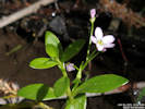 Coll. No. 3073, Montia chamissoi. Coll. No. 3073, Montia chamissoi.
|
3073
|
Montia chamissoi.
Plants of the Douglas Mountain Study Area
Jefferson County Open Space, Colorado, USA
Montiaceae
Montia chamissoi (Spreng.) Greene.
Toad Lily.
Guy Gulch, Jefferson County, Colorado.
In still water beside the creek, 115 m. west across County Road 70 from the Centennial Ranch house, 2.43 km. south of Mount Tom, 12.3 km. west northwest of the GNIS location of Golden.
39.7948°N, 105.3552°W.
WGS 1984
Elev. 2348 m.
Collected by permit: Jefferson County Open Space, 2023, issued: Apr 10, 2023, to: Tom Schweich.
|
Tom Schweich, with John Vickery
3073. |
12-Jul-2023 |
|
|
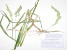 Coll. No. 3074, Phalaris arundinacea. Coll. No. 3074, Phalaris arundinacea.
|
3074
|
Calamovilfa longifolia.
Plants of the Douglas Mountain Study Area
Jefferson County Open Space, Colorado, USA
Poaceae
Phalaris arundinacea L.
Reed Canarygrass.
Guy Gulch, Jefferson County, Colorado.
In still water beside the creek, 94 m. west across County Road 70 from the Centennial Ranch house, 2.42 km. south of Mount Tom, 12.3 km. west northwest of the GNIS location of Golden.
39.7948°N, 105.3551°W.
WGS 1984
Elev. 2346 m.
Also nearby in still water: Montia chamissoi.
Collected by permit: Jefferson County Open Space, 2023, issued: Apr 10, 2023, to: Tom Schweich.
|
Tom Schweich, with Cindy Trujillo and John Vickery
3074. |
12-Jul-2023 |
|
Coll. No. 3074, 12 Jul 2023, characters observed:
Perennial grass, to 150 cm.,
still water beside creek,
rhizomatous;
Leaves,
sheath, open, 140 mm.,
ligule, membraneous, 5 mm.,
blade, 160 mm. ×8 mm. wide, flat;
Inflorescence, panicle;
Spikelets,
5-6 mm.;
Florets, 1, though subtended on opposite sides by 2 small hairy bits of tissue that could be sterile florets;
Glumes, lower, 5 mm., upper, 6 mm., wingless, keeled, barely scabrous;
Lemma, 4 mm., awns absent;
Palea, 3 mm.
|
|
|
3075
|
Rosa, probably R. woodsii.
Plants of the Douglas Mountain Study Area
Jefferson County Open Space, Colorado, USA
Rosaceae
Rosa acicularis Lindl. ssp. sayi (Schwein.) W. H. Lewis.
Say's Acicular Rose.
Guy Gulch, Jefferson County, Colorado.
Terrace below hill slope, 150 m. west northwest across County Road 70 from the Centennial Ranch house, 2.39 km. south of Mount Tom, 12.3 km. west northwest of the GNIS location of Golden.
39.7951°N, 105.3557°W.
WGS 1984
Elev. 2350 m.
Prickles on new growth, leaflets 7, flowers intense rose.
Old tree blow-down with Acer glabrum and Symphoricarpos occidentalis and a colony of rhubarb nearby.
Collected by permit: Jefferson County Open Space, 2023, issued: Apr 10, 2023, to: Tom Schweich.
|
Tom Schweich, with Cindy Trujillo and John Vickery
3075. |
12-Jul-2023 |
|
|
|
|
3077
|
Thalictrum fendleri, pistillate plants.
Plants of the Douglas Mountain Study Area
Jefferson County Open Space, Colorado, USA
Ranunculaceae
Thalictrum fendleri Engelm. ex A. Gray.
Fendler's Meadow Rue.
Guy Gulch, Jefferson County, Colorado.
Shaded streamside, 185 m. west northwest across County Road 70 from the Centennial Ranch house, 2.35 km. south of Mount Tom, 12.4 km. west northwest of the GNIS location of Golden.
39.7955°N, 105.3559°W.
WGS 1984
Elev. 2353 m.
Pistillate plants.
Collected by permit: Jefferson County Open Space, 2023, issued: Apr 10, 2023, to: Tom Schweich.
|
Tom Schweich, with John Vickery and Cindy Trujillo
3077. |
12-Jul-2023 |
|
|
|
|
3078
|
Eriogonum umbellatum.
Plants of the Douglas Mountain Study Area
Jefferson County Open Space, Colorado, USA
Polygonaceae
Eriogonum umbellatum Torr. var. umbellatum.
Sulphur-Flower Buckwheat.
Guy Gulch, Jefferson County, Colorado.
Sunny mouth of a small gulch tributary to Guy Gulch, 130 m. southwest across County Road 70 from the Centennial Ranch house, 2.52 km. south of Mount Tom, 12.2 km. west northwest of the GNIS location of Golden.
39.7939°N, 105.355°W.
WGS 1984
Elev. 2346 m.
There are several inflorescences in this collection that have a single branch and several that have an extra whorl of bracts as in variety ramulosum, a variety local to the Front Range.
Collected by permit: Jefferson County Open Space, 2023, issued: Apr 10, 2023, to: Tom Schweich.
|
Tom Schweich, with Cindy Trujillo and John Vickery
3078. |
12-Jul-2023 |
|
|
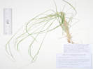 Coll. No. 3079, Piptatherum micranthum. Coll. No. 3079, Piptatherum micranthum.
|
3079
|
Grass, maybe Piptatherum or Piptatheriopsis.
Plants of the Douglas Mountain Study Area
Jefferson County Open Space, Colorado, USA
Poaceae
Piptatherum micranthum (Trin. & Rupr.) Barkworth.
Littleseed Ricegrass.
Guy Gulch, Jefferson County, Colorado.
Dry former roadside in the shaded mouth of a small gulch tributary to Guy Gulch, 190 m. southwest across County Road 70 from the Centennial Ranch house, 2.56 km. south of Mount Tom, 12.3 km. west northwest of the GNIS location of Golden.
39.7936°N, 105.3556°W.
WGS 1984
Elev. 2353 m.
Collected by permit: Jefferson County Open Space, 2023, issued: Apr 10, 2023, to: Tom Schweich.
|
Tom Schweich, with Cindy Trujillo and John Vickery
3079. |
12-Jul-2023 |
| Coll. No. 3079, 12 July 2023, characters observed:
Perennial grass, to 50 cm.,
caespitose;
Leaves,
sheath,
75 mm.,
open,
ligule,
membranous,
1.5 mm.,
blade,
250 mm. × 3.2 mm. wide,
some flat, some involute;
Inflorescence,
1 per culm,
<leaves,
panicle,
contracted [more so than would be expected],
120 mm. × 5 mm. wide;
Rachis,
not extended;
Compression,
not remarkable;
Glumes,
lower,
3.2 mm.,
veins, 5(7?),
upper,
3.5 mm.
>lowest floret,
veins, 5(7?),
membranous to transparent distally,
awns, 0;
Florets,
1 per spikelet;
Lemma,
2.2 mm.,
<glumes,
coriaceous,
rolled,
sparsely pubescent,
veins, 3,
awns,
#1, 9 mm.,
wavy,
deciduous;
Palea,
2 mm.,
<lemma,
coriaceous.
|
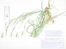 Coll. No. 3080, Coll. No. 3080, Elymus lanceolatus Agropyron cristatum.
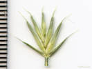 Spikelet of Coll. No. 3080, Spikelet of Coll. No. 3080, Elymus lanceolatus Agropyron cristatum.
|
3080
|
Some kind of wheatgrass.
Plants of the Douglas Mountain Study Area
Jefferson County Open Space, Colorado, USA
Poaceae
Elymus lanceolatus (Scribn. & J. G. Sm.) Gould.
Thickspike Wheatgrass.
Guy Gulch, Jefferson County, Colorado.
Dry former roadside in the shaded mouth of a small gulch tributary to Guy Gulch, 192 m. southwest across County Road 70 from the Centennial Ranch house, 2.56 km. south of Mount Tom, 12.3 km. west northwest of the GNIS location of Golden.
39.7935°N, 105.3556°W.
WGS 1984
Elev. 2353 m.
Collected by permit: Jefferson County Open Space, 2023, issued: Apr 10, 2023, to: Tom Schweich.
|
Tom Schweich, with Cindy Trujillo and John Vickery
3080. |
12-Jul-2023 |
|
Coll. No. 3080, 12 July 2023, characters observed:
Perennial grass, to 75 cm.,
not obviously rhizomatous;
Leaves,
sheath,
93 mm.,
open,
ligule,
membranous,
auricles, minimal, 0.5 mm., lanceolate,
blade,
160 mm. × 3.2 mm. wide,
flat,
adaxial pilose;
Inflorescence,
2-sided spike,
45 mm. × 7 mm. wide;
Spikelets,
many,
12 mm. × 12 mm. wide,
overlapping about ⅔ or 8 mm.,
similar,
borne singly,
glumes and florets spreading;
Glumes,
lower,
5 mm. + awn, 3 mm.
veins, 5,
upper,
5 mm. × 1.5 mm. wide + awn 3.5 mm.,
<lowest floret,
veins, 5,
keeled;
Florets,
5 per spikelet;
Lemma,
7.5 mm.,
>glumes,
keeled,
barely scabrous on veins,
veins, 5,
tip, bifid,
awns, #1, 2.8 mm., straight;
Palea,
5.8 mm.,
<lemma,
membranous,
keel, ciliate,
tip, bifid;
Anthers,
3 mm.
Agropyron cristatum, Jan Wingate, 4/23/2024.
|
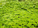 Coll. No. 3081, Circaea alpina. Coll. No. 3081, Circaea alpina.
|
3081
|
Circaea alpina “Enchanter's Nightshade”
Plants of the Douglas Mountain Study Area
Jefferson County Open Space, Colorado, USA
Onagraceae
Circaea alpina L.
Small Enchanter's Nightshade.
Guy Gulch, Jefferson County, Colorado.
Small forested gulch tributary to Guy Gulch, 205 m. southwest across County Road 70 from the Centennial Ranch house, 2.52 km. south of Mount Tom, 12.2 km. west northwest of the GNIS location of Golden.
39.7936°N, 105.3558°W.
WGS 1984
Elev. 2367 m.
Large patch in deep shade on floor and south slope of gulch.
Collected by permit: Jefferson County Open Space, 2023, issued: Apr 10, 2023, to: Tom Schweich.
|
Tom Schweich, with Cindy Trujillo and John Vickery
3081. |
12-Jul-2023 |
|
|
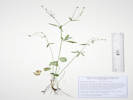 Coll. No. 3082, Ranunculus abortivus. Coll. No. 3082, Ranunculus abortivus.
|
3082
|
Ranunculus sp.
Plants of the Douglas Mountain Study Area
Jefferson County Open Space, Colorado, USA
Ranunculaceae
Ranunculus abortivus L.
Littleleaf Buttercup.
Guy Gulch, Jefferson County, Colorado.
Small forested gulch tributary to Guy Gulch, 192 m. southwest across County Road 70 from the Centennial Ranch house, 2.56 km. south of Mount Tom, 12.3 km. west northwest of the GNIS location of Golden.
39.7935°N, 105.3559°W.
WGS 1984
Elev. 2364 m.
Floor of gulch, also collected here: Circaea alpina, Prosartes trachycarpa, and Piptatherum micranthum.
Collected by permit: Jefferson County Open Space, 2023, issued: Apr 10, 2023, to: Tom Schweich.
|
Tom Schweich, with John Vickery and Cindy Trujillo
3082. |
12-Jul-2023 |
|
Coll. No. 3082, 12 July 2023, characters observed:
Annual or perennial herb,
semi-aquatic,
30 cm.,
not creeping or rooting at nodes;
Leaves,
dimorphic,
basal, simple, margin, crenate,
cauline, compound or very deeply lobed;
Sepals,
glabrous;
Petals,
yellow,
claw 0.5 mm. + blade 1.5 mm. = 2.0 mm.;
Achenes,
1.3 mm.
beak very small, curved,
globose,
glabrous.
|
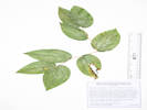 Coll. No. 3083, Prosartes trachycarpa. Coll. No. 3083, Prosartes trachycarpa.
|
3083
|
Prosartes trachycarpa.
Plants of the Douglas Mountain Study Area
Jefferson County Open Space, Colorado, USA
Liliaceae
Prosartes trachycarpa S. Watson.
Roughfruit Fairybells.
Guy Gulch, Jefferson County, Colorado.
Small forested gulch tributary to Guy Gulch, 192 m. southwest across County Road 70 from the Centennial Ranch house, 2.56 km. south of Mount Tom, 12.3 km. west northwest of the GNIS location of Golden.
39.7935°N, 105.3559°W.
WGS 1984
Elev. 2368 m.
Immature fruit.
On the bank of the gulch, also collected here: Circaea alpina, Ranunculus abortivus, and Piptatherum micranthum.
Collected by permit: Jefferson County Open Space, 2023, issued: Apr 10, 2023, to: Tom Schweich.
|
Tom Schweich, with John Vickery and Cindy Trujillo
3083. |
12-Jul-2023 |
|
|
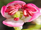 Coll. No. 3084, Pyrola asarifolia. Coll. No. 3084, Pyrola asarifolia.
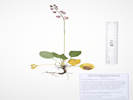 Coll. No. 3084, Pyrola asarifolia. Coll. No. 3084, Pyrola asarifolia.
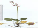 Coll. No. 3084, Pyrola asarifolia. Coll. No. 3084, Pyrola asarifolia.
|
3084
|
Pyrola asarifolia.
Plants of the Douglas Mountain Study Area
Jefferson County Open Space, Colorado, USA
Ericaceae
Pyrola asarifolia Michx.
Liverleaf Wintergreen.
Guy Gulch, Jefferson County, Colorado.
Small forested gulch tributary to Guy Gulch, 227 m. southwest across County Road 70 from the Centennial Ranch house, 2.56 km. south of Mount Tom, 12.3 km. west northwest of the GNIS location of Golden.
39.7937°N, 105.3563°W.
WGS 1984
Elev. 2375 m.
Many rosettes, 1 plant in bud, 1 plant in bloom.
On the floor of the gulch, also collected here: Circaea alpina, Ranunculus abortivus, Prosartes trachycarpa, and Piptatherum micranthum.
Collected by permit: Jefferson County Open Space, 2023, issued: Apr 10, 2023, to: Tom Schweich.
|
Tom Schweich, with Cindy Trujillo and John Vickery
3084. |
12-Jul-2023 |
|
|
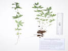 Coll. No. 3085, Galium triflorum. Coll. No. 3085, Galium triflorum.
|
3085
|
Galium, probably G. triflorum.
Plants of the Douglas Mountain Study Area
Jefferson County Open Space, Colorado, USA
Rubiaceae
Galium triflorum Michx.
Fragrant Bedstraw.
Guy Gulch, Jefferson County, Colorado.
Small forested gulch tributary to Guy Gulch, 260 m. southwest across County Road 70 from the Centennial Ranch house, 2.56 km. south of Mount Tom, 12.4 km. west northwest of the GNIS location of Golden.
39.7937°N, 105.3568°W.
WGS 1984
Elev. 2376 m.
Very deep forest duff on a small shaded divide between two drainages.
Collected by permit: Jefferson County Open Space, 2023, issued: Apr 10, 2023, to: Tom Schweich.
|
Tom Schweich, with Cindy Trujillo and John Vickery
3085. |
12-Jul-2023 |
|
|
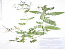 Coll. No. 3086, Veronica americana. Coll. No. 3086, Veronica americana.
|
3086
|
Veronica sp.
Plants of the Douglas Mountain Study Area
Jefferson County Open Space, Colorado, USA
Plantaginaceae
Veronica americana (Raf.) Benth.
American Speedwell.
Guy Gulch, Jefferson County, Colorado.
Small forested gulch tributary to Guy Gulch, 282 m. southwest across County Road 70 from the Centennial Ranch house, 2.56 km. south of Mount Tom, 12.4 km. west northwest of the GNIS location of Golden.
39.7938°N, 105.3571°W.
WGS 1984
Elev. 2382 m.
Leaves petiolate, inflorescence of axillary racemes.
Growing in water at bottom of gulch.
Collected by permit: Jefferson County Open Space, 2023, issued: Apr 10, 2023, to: Tom Schweich.
|
Tom Schweich, with John Vickery and Cindy Trujillo
3086. |
12-Jul-2023 |
|
|
|
|
3087
|
Collomia linearis.
Plants of the Douglas Mountain Study Area
Jefferson County Open Space, Colorado, USA
Polemoniaceae
Collomia linearis Nutt.
Tiny Trumpet.
Guy Gulch, Jefferson County, Colorado.
Small forested gulch tributary to Guy Gulch, 345 m. southwest across County Road 70 from the Centennial Ranch house, 2.56 km. south of Mount Tom, 12.5 km. west northwest of the GNIS location of Golden.
39.794°N, 105.358°W.
WGS 1984
Elev. 2397 m.
Beside sunny dry trail on the north side of the gulch.
Collected by permit: Jefferson County Open Space, 2023, issued: Apr 10, 2023, to: Tom Schweich.
|
Tom Schweich, with Cindy Trujillo and John Vickery
3087. |
12-Jul-2023 |
|
|
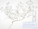 Coll. No. 3087, Gayophytum ramosissimum. Coll. No. 3087, Gayophytum ramosissimum.
|
3088
|
Gayophytum, maybe G. ramosissimum.
Plants of the Douglas Mountain Study Area
Jefferson County Open Space, Colorado, USA
Onagraceae
Gayophytum ramosissimum Torr. & A. Gray.
Pinyon Groundsmoke.
Guy Gulch, Jefferson County, Colorado.
Mouth of a small forested gulch tributary to Guy Gulch, 140 m. southwest across County Road 70 from the Centennial Ranch house, 2.55 km. south of Mount Tom, 12.2 km. west northwest of the GNIS location of Golden.
39.7936°N, 105.3547°W.
WGS 1984
Elev. 2348 m.
Annuals found on dry soil, top of gopher mounds.
Collected by permit: Jefferson County Open Space, 2023, issued: Apr 10, 2023, to: Tom Schweich.
|
Tom Schweich, with Cindy Trujillo
3088. |
12-Jul-2023 |
|
|
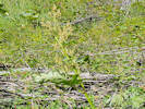 “Rhubarb” Rheum × hybridum, on the hillside in Guy Gulch. “Rhubarb” Rheum × hybridum, on the hillside in Guy Gulch.
|
|
Rheum × hybridum
|
 Visit with my cousin Sydney. Visit with my cousin Sydney.
|
|
Visit with my cousin Sydney
|
|
Other articles:
• Forest Road 435:
along the road;
Locations:
Salt Creek.
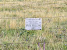 State Land Trust sign on fence along Forest Road 435 “Salt Creek Road.” State Land Trust sign on fence along Forest Road 435 “Salt Creek Road.”
|
|
Monday, 17 Jul 2023
Salt Creek
|
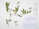 Coll. No. 3089, Symphyotrichum spathulatum. Coll. No. 3089, Symphyotrichum spathulatum.
|
3089
|
Erigeron, probably not E. subtrinervis.
|
Plants of Colorado
Asteraceae
Symphyotrichum spathulatum (Lindl.) G. L. Nesom.
Western Mountain Aster.
Salt Creek, Park County, Colorado.
Terrace above Salt Creek, just off Forest Road 435 “Salt Creek Road,” 2.8 mi. by road west of US Highway 285, 111 km. southwest of Golden.
38.9572°N, 106.0044°W.
WGS 1984
Elev. 2822 m.
Dry, lightly shaded, terrace above the creek. Also collected here: Lappula occidentalis, Astragalus hallii, and seen: Dodecatheon pulchellum, and Iris missouriensis.
Variety spathulatum, if infraspecific names are to be applied.
Collected by permit: Pike San Isabel National Forest, 2023, issued: Jul 1, 2023, to: Tom Schweich.
|
Tom Schweich
3089. |
17-Jul-2023 |
|
Coll. No. 3089, 17 July 2023, characters observed:
Perennial herb, 18 cm.;
Stem,
ascending,
glabrate, pilose below heads,
hairs multicellular with clear crosswalls,
glandular immediately below head;
Leaves,
basal,
petiole, 22 mm.,
blade, 40 mm. × 8 mm. wide,
oblong / elliptical / oblanceolate,
cauline,
reduced,
33 mm. × 4 mm.,
sessile,
linear-lanceolate,
sparsely pilose,
margins, entire, closely appressed ciliate;
Inflorescence,
1-5 heads per stem;
Phyllaries,
in 3± series,
chartaceous proximally,
green distally,
midvein green,
tips, acute;
Flowers, of 2 kinds;
Ray flowers,
tube 2 mm. + blade 9 mm. × 2 mm. wide,
blue,
fertile;
Disk flowers,
many,
yellow;
Pappus,
in two series,
very short hairs and well-developed bristles,
pappus of ray and disk flowers alike.
Erigeron sp. Collections made within 15 km. of this one:
Taxa Count: 18
ASTERACEAE
- Erigeron canus
- Erigeron compositus
- Erigeron concinnus var. concinnus
- Erigeron elatior
- Erigeron eximius
- Erigeron flagellaris
- Erigeron formosissimus
- Erigeron formosissimus var. viscidus
- Erigeron grandiflorus
- Erigeron leiomerus
- Erigeron lonchophyllus
- Erigeron pinnatisectus
- Erigeron pumilus var. pumilus
- Erigeron simplex
- Erigeron speciosus
- Erigeron subtrinervis
- Erigeron vagus
- Erigeron vetensis
Symphyotrichum:
Taxa Count: 6
ASTERACEAE
- Aster foliaceus
- Aster spathulatus
- Symphyotrichum ascendens
- Symphyotrichum foliaceum
- Symphyotrichum foliaceum var. parryi
- Symphyotrichum spathulatum
|
|
|
3090
|
Lappula ???
|
Plants of Colorado
Boraginaceae
Lappula occidentalis (S. Watson) Greene var. occidentalis.
Stickseed.
Salt Creek, Park County, Colorado.
Terrace above Salt Creek, 100 m. northeast on the right bank of the creek, along Forest Road 435 “Salt Creek Road,” 2.8 mi. by road west of US Highway 285, 111 km. southwest of Golden.
38.9577°N, 106.0039°W.
WGS 1984
Elev. 2822 m.
Dry soil at break in slope above creek. Also collected here: Symphyotrichum spathulatum, Astragalus hallii, and seen: Dodecatheon pulchellum, and Iris missouriensis.
Collected by permit: Pike San Isabel National Forest, 2023, issued: Jul 1, 2023, to: Tom Schweich.
|
Tom Schweich
3090. |
17-Jul-2023 |
|
|
|
|
3091
|
Astragalus sp.
|
Plants of Colorado
Fabaceae
Astragalus hallii A. Gray var. hallii.
Hall's Milkvetch.
Salt Creek, Park County, Colorado.
Terrace above Salt Creek, 135 m. northeast on the right bank of the creek, along Forest Road 435 “Salt Creek Road,” 2.8 mi. by road west of US Highway 285, 111 km. southwest of Golden.
38.9578°N, 106.0035°W.
WGS 1984
Elev. 2823 m.
Sprawling from buried central caudex, flowers magenta fading blue, fruit dehiscing early.
Also collected here: Symphyotrichum spathulatum, Lappula occidentalis, and seen: Dodecatheon pulchellum, and Iris missouriensis.
Collected by permit: Pike San Isabel National Forest, 2023, issued: Jul 1, 2023, to: Tom Schweich.
|
Tom Schweich
3091. |
17-Jul-2023 |
|
|
|
|
3092
|
Potentilla hippiana.
|
Plants of Colorado
Rosaceae
Potentilla hippiana Lehm. var. hippiana.
Wooly Cinquefoil.
Salt Creek, Park County, Colorado.
About 590 m. east of the crossing of Salt Creek by Forest Road 435 “Salt Creek Road,” 3.0 mi. by road west of US Highway 285, 111 km. southwest of Golden.
38.9586°N, 106.0011°W.
WGS 1984
Elev. 2816 m.
Drying flat away from creek, with Oenothera coronopifolia, Artemisia frigida, Gutierrezia sarothrae, Juncus articus, and a sedge, probably Carex inops var. heliophila.
Collected by permit: Pike San Isabel National Forest, 2023, issued: Jul 1, 2023, to: Tom Schweich.
|
Tom Schweich
3092. |
17-Jul-2023 |
|
|
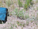 Coll. No. 3093, Euphorbia sp. Coll. No. 3093, Euphorbia sp.
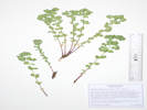 Coll. No. 3093, Euphorbia brachycera. Coll. No. 3093, Euphorbia brachycera.
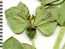 Mature cyathium of Coll. No. 3093, Euphorbia brachycera. Mature cyathium of Coll. No. 3093, Euphorbia brachycera.
|
3093
|
Euphorbia, maybe E. brachyceras.
|
Plants of Colorado
Euphorbiaceae
Euphorbia brachycera Engelm.
Horned Spurge.
Salt Creek, Park County, Colorado.
Along the fence line, about 630 m. east of the crossing of Salt Creek by Forest Road 435 “Salt Creek Road,” 3.0 mi. by road west of US Highway 285, 111 km. southwest of Golden.
38.96°N, 106.0012°W.
WGS 1984
Elev. 2821 m.
Uncommon.
Open mud-cracked flat, with Dasiphora fruticosa, Koeleria macrantha, Antennaria sp., and Gutierrezia sarothrae.
Collected by permit: Pike San Isabel National Forest, 2023, issued: Jul 1, 2023, to: Tom Schweich.
|
Tom Schweich
3093. |
17-Jul-2023 |
|
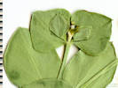
Young cyathium of Coll. No. 3093, Euphorbia brachycera. |
|
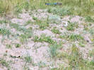 Coll. No. 3094, Potentilla anserina. Coll. No. 3094, Potentilla anserina.
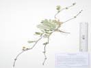 Coll. No. 3094, Rosaceae Argentina anserina. Coll. No. 3094, Rosaceae Argentina anserina.
|
3094
|
Potentilla anserina.
|
Plants of Colorado
Rosaceae
Argentina anserina (L.) Rydb.
Silver Weed Cinquefoil.
Salt Creek, Park County, Colorado.
Along the fence line, about 636 m. northeast of the crossing of Salt Creek by Forest Road 435 “Salt Creek Road,” 3.0 mi. by road west of US Highway 285, 111 km. southwest of Golden.
38.9605°N, 106.0014°W.
WGS 1984
Elev. 2821 m.
Dry bank of small spring-fed creek, with Antennaria sp., and Artemisia frigida.
Collected by permit: Pike San Isabel National Forest, 2023, issued: Jul 1, 2023, to: Tom Schweich.
|
Tom Schweich
3094. |
17-Jul-2023 |
|
|
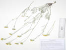 Coll. No. 3095, Hymenopappus filifolius var. cinereus. Coll. No. 3095, Hymenopappus filifolius var. cinereus.
|
3095
|
Hymenopappus filifolius.
|
Plants of Colorado
Asteraceae
Hymenopappus filifolius Hook. var. cinereus (Rydb.) I. M. Johnst.
Fine Leaved Wooly White.
Salt Creek, Park County, Colorado.
Along the fence line, about 636 m. northeast of the crossing of Salt Creek by Forest Road 435 “Salt Creek Road,” 3.0 mi. by road west of US Highway 285, 111 km. southwest of Golden.
38.9613°N, 106.0021°W.
WGS 1984
Elev. 2828 m.
In stiff, dry soil that appears subject to sheet flow, with: Penstemon teucroides and Packera fendleri.
Collected by permit: Pike San Isabel National Forest, 2023, issued: Jul 1, 2023, to: Tom Schweich.
|
Tom Schweich
3095. |
17-Jul-2023 |
|
|
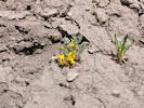 Coll No. 3096, Corydalis aurea. Coll No. 3096, Corydalis aurea.
|
3096
|
Corydalis aurea.
Combined with Coll. No. 3097.
|
|
|
3097
|
Corydalis aurea.
|
Plants of Colorado
Fumariaceae
Corydalis aurea Willd.
Scrambled Eggs.
Salt Creek, Park County, Colorado.
Banks of an arroyo, about 520 m. northeast of the crossing of Salt Creek by Forest Road 435 “Salt Creek Road,” 3.0 mi. by road west of US Highway 285, 111 km. southwest of Golden.
38.9601°N, 106.0027°W.
WGS 1984
Elev. 2826 m.
Larger plants on the south side of the arroyo, smaller plants on the north side.
Collected by permit: Pike San Isabel National Forest, 2023, issued: Jul 1, 2023, to: Tom Schweich.
|
Tom Schweich
3097. |
17-Jul-2023 |
|
|
|
|
3097.1
|
Rumex, maybe R. triangulivalvis.
|
Plants of Colorado
Polygonaceae
Rumex triangulivalvis (Danser) Rech. f.
Triangular-Valved Dock.
Salt Creek, Park County, Colorado.
Banks of an arroyo, about 520 m. northeast of the crossing of Salt Creek by Forest Road 435 “Salt Creek Road,” 3.0 mi. by road west of US Highway 285, 111 km. southwest of Golden.
38.96011°N, 106.00271°W.
WGS 1984
Elev. 2826 m.
South slope of a developing arroyo.
Collected by permit: Pike San Isabel National Forest, 2023, issued: Jul 1, 2023, to: Tom Schweich.
|
Tom Schweich
3097.1 |
17-Jul-2023 |
|
|
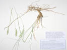 Coll. No. 3098, Coll. No. 3098, Elymus lanceolatus var. lanceolatus Pascopyrum smithii.
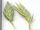 Spikelets of Coll. No. 3098, Spikelets of Coll. No. 3098, Elymus lanceolatus var. lanceolatus Pascopyrum smithii.
|
3098
|
Some sort of wheatgrass.
|
Plants of Colorado
Poaceae
Elymus lanceolatus (Scribn. & J. G. Sm.) Gould var. lanceolatus.
Thickspike Wheatgrass.
Salt Creek, Park County, Colorado.
Base of hills, about 255 m. northeast of the crossing of Salt Creek by Forest Road 435 “Salt Creek Road,” 3.0 mi. by road west of US Highway 285, 111 km. southwest of Golden.
38.95896°N, 106.00535°W.
WGS 1984
Elev. 2835 m.
Strongly rhizomatous.
Occasional at base of hills, stiff soil, edge of Ponderosa pine forest, also out on the plain.
Collected by permit: Pike San Isabel National Forest, 2023, issued: Jul 1, 2023, to: Tom Schweich.
|
Tom Schweich
3098. |
17-Jul-2023 |
|
Pascopyrum smithii, 4/24/2024, Jan Wingate
|
|
|
3099
|
Eriogonum alatum.
|
Plants of Colorado
Polygonaceae
Eriogonum alatum Torrey in L. Sitgreaves, Rep. Exped. Zuni Colorado Rivers. 168, plate 8. 1853.
Winged Buckwheat.
Salt Creek, Park County, Colorado.
Base of hills, about 260 m. northeast of the crossing of Salt Creek by Forest Road 435 “Salt Creek Road,” 3.0 mi. by road west of US Highway 285, 111 km. southwest of Golden.
38.95898°N, 106.0053°W.
WGS 1984
Elev. 2839 m.
Edge of ponderosa pine forest, with Artemisia tridentata and Thermopsis rhombifolia.
Collected by permit: Pike San Isabel National Forest, 2023, issued: Jul 1, 2023, to: Tom Schweich.
|
Tom Schweich
3099. |
17-Jul-2023 |
|
|
|
|
3100
|
Eremogone, most likely E. fendleri.
|
Plants of Colorado
Caryophyllaceae
Eremogone fendleri (A. Gray) Ikonnikov.
Fendler's Sandwort.
Salt Creek, Park County, Colorado.
Base of hills, about 240 m. northeast of the crossing of Salt Creek by Forest Road 435 “Salt Creek Road,” 3.0 mi. by road west of US Highway 285, 111 km. southwest of Golden.
38.95884°N, 106.00545°W.
WGS 1984
Elev. 2839 m.
Open ground at edge of ponderosa pine forest.
Collected by permit: Pike San Isabel National Forest, 2023, issued: Jul 1, 2023, to: Tom Schweich.
|
Tom Schweich
3100. |
17-Jul-2023 |
|
|
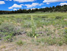 Obs. No. 3350, Frasera speciosa in the middle of a small valley near Salt Creek, Park County, Colorado. Obs. No. 3350, Frasera speciosa in the middle of a small valley near Salt Creek, Park County, Colorado.
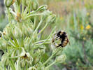 Obs. No. 3350, Bumble bee on Frasera speciosa in the middle of a small valley near Salt Creek, Park County, Colorado. Obs. No. 3350, Bumble bee on Frasera speciosa in the middle of a small valley near Salt Creek, Park County, Colorado.
|
|
Frasera speciosa along the north fence line in the middle of the valley. In addition, seven rosettes were seen.
|
|
Locations:
Lily Lake.
North Fork West Tennessee Creek.
West Tennessee Creek.
 Lily Lake and vicinity. Lily Lake and vicinity.
|
|
Tuesday, 18 July 2023
|
 Habitat of Coll. No. 3101, Artemisia borealis, edge of flood plain of West Tennessee Creek. Habitat of Coll. No. 3101, Artemisia borealis, edge of flood plain of West Tennessee Creek.
|
3101
|
Artemisia borealis, approximately the same location as when found last year.
|
Plants of Colorado
Asteraceae
Artemisia borealis Pall. ssp. borealis.
Boreal Wormwood.
West Tennessee Creek, Lake County, Colorado.
Edge of forest on west-facing slope above West Tennessee Creek, 588 m. (geodesic) southeast of Lily Lake, 12.3 km. (geodesic) north northwest of Leadville.
39.3472°N, 106.3631°W.
WGS 1984
Elev. 3166 m.
Near base of slope above former meander of West Tennessee Creek, with Leptosiphon nuttallii and Arenaria congesta.
Coordinates estimated from GoogleEarth. Distances measured from GNIS point features.
Collected by permit: Pike San Isabel National Forest, 2023, issued: Jul 1, 2023, to: Tom Schweich.
|
Tom Schweich
3101. |
18-Jul-2023 |
|
|
|
|
3101.1
|
Antennaria sp.
|
Plants of Colorado
Asteraceae
Antennaria rosea Greene.
Rosy Pussytoes.
West Tennessee Creek, Lake County, Colorado.
Edge of forest on west-facing slope above West Tennessee Creek, 588 m. (geodesic) southeast of Lily Lake, 12.3 km. (geodesic) north northwest of Leadville.
39.3472°N, 106.3631°W.
WGS 1984
Elev. 3166 m.
Near base of slope above former meander of West Tennessee Creek, with Artemisia borealis, Leptosiphon nuttallii and Arenaria congesta.
Coordinates estimated from GoogleEarth. Distances measured from GNIS point features.
Collected by permit: Pike San Isabel National Forest, 2023, issued: Jul 1, 2023, to: Tom Schweich.
|
Tom Schweich
3101.1 |
18-Jul-2023 |
|
|
|
Locations:
West Tennessee Creek.
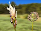 Coll. No. 3102.1, Danthonia intermedia and Coll. No. 3102, Phleum alpina. Coll. No. 3102.1, Danthonia intermedia and Coll. No. 3102, Phleum alpina.
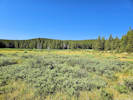 General view of the flood plain of West Tennessee Creek. General view of the flood plain of West Tennessee Creek.
|
3102
|
Phleum alpinum ???
|
Plants of Colorado
Poaceae
Phleum alpinum L.
Alpine Timothy.
West Tennessee Creek, Lake County, Colorado.
Former meander of West Tennessee Creek, 575 m. (geodesic) southeast of Lily Lake, 12.3 km. (geodesic) north northwest of Leadville.
39.3471°N, 106.3635°W.
WGS 1984
Elev. 3166 m.
Grass with a spike-like inflorescence.
Collected with Danthonia intermedia.
Collected by permit: Pike San Isabel National Forest, 2023, issued: Jul 1, 2023, to: Tom Schweich.
|
Tom Schweich
3102. |
18-Jul-2023 |
|
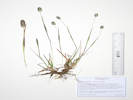
Coll. No. 3102, Phleum alpinum. |
|
Coll. No. 3102.1, Danthonia intermedia and Coll. No. 3102, Phleum alpina.
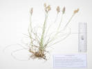 Coll. No. 3102.1, Danthonia intermedia. Coll. No. 3102.1, Danthonia intermedia.
|
3102.1
|
Grass Danthonia intermedia
|
Plants of Colorado
Poaceae
Danthonia intermedia Vasey.
Timber Oatgrass.
West Tennessee Creek, Lake County, Colorado.
Former meander of West Tennessee Creek, 575 m. (geodesic) southeast of Lily Lake, 12.3 km. (geodesic) north northwest of Leadville.
39.3471°N, 106.3634°W.
WGS 1984
Elev. 3166 m.
Grass with a compressed panicle, lemma hairs restricted to margins.
Collected with Phleum alpina.
Collected by permit: Pike San Isabel National Forest, 2023, issued: Jul 1, 2023, to: Tom Schweich.
|
Tom Schweich
3102.1 |
18-Jul-2023 |
|
|
|
|
3102.2
|
Potentilla sp.
|
Plants of Colorado
Rosaceae
Potentilla gracilis Hook. var. fastigiata (Nutt.) S. Watson.
Slender Cinquefoil.
West Tennessee Creek, Lake County, Colorado.
Former meander of West Tennessee Creek, 575 m. (geodesic) southeast of Lily Lake, 12.3 km. (geodesic) north northwest of Leadville.
39.3471°N, 106.3635°W.
WGS 1984
Elev. 3166 m.
Collected with Danthonia intermedia, and Phleum alpunum.
Collected by permit: Pike San Isabel National Forest, 2023, issued: Jul 1, 2023, to: Tom Schweich.
|
Tom Schweich
3102.2 |
18-Jul-2023 |
|
|
|
|
3102.3
|
Cymopterus sp.
|
Plants of Colorado
Apiaceae
Pseudocymopterus montanus (A. Gray) J. M. Coult. & Rose.
Alpine False Springparsley.
West Tennessee Creek, Lake County, Colorado.
Former meander of West Tennessee Creek, 575 m. (geodesic) southeast of Lily Lake, 12.3 km. (geodesic) north northwest of Leadville.
39.3471°N, 106.3634°W.
WGS 1984
Elev. 3166 m.
Collected with Potentilla gracilis var. fastigiata, Danthonia intermedia, and Phleum alpunum.
Collected by permit: Pike San Isabel National Forest, 2023, issued: Jul 1, 2023, to: Tom Schweich.
|
Tom Schweich
3102.3 |
18-Jul-2023 |
|
|
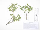 Coll. No. 3103, Salix glauca. Coll. No. 3103, Salix glauca.
|
3103
|
Salix sp.
|
Plants of Colorado
Salicaceae
Salix glauca L.
Gray Willow.
West Tennessee Creek, Lake County, Colorado.
Former meander of West Tennessee Creek, 578 m. (geodesic) southeast of Lily Lake, 12.3 km. (geodesic) north northwest of Leadville.
39.3469°N, 106.3636°W.
WGS 1984
Elev. 3164 m.
Low shrub on floor of meander, also collected here: Pseudocymopterus montanus, Potentilla gracilis var. fastigiata, Danthonia intermedia, and Phleum alpinum.
Variety villosa Andersson, if infraspecific names are to be applied.
Collected by permit: Pike San Isabel National Forest, 2023, issued: Jul 1, 2023, to: Tom Schweich.
|
Tom Schweich
3103. |
18-Jul-2023 |
|
|
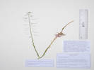 Coll. No. 3104, Boechera grahamii. Coll. No. 3104, Boechera grahamii.
|
3104
|
Boechera stricta ???
|
Plants of Colorado
Brassicaceae
Boechera grahamii (Lehm.) Windham & Al-Shehbaz.
Graham's Rockcress.
West Tennessee Creek, Lake County, Colorado.
Lowest terrace above West Tennessee Creek, 588 m. (geodesic) southeast of Lily Lake, 12.3 km. (geodesic) north northwest of Leadville.
39.3459°N, 106.3653°W.
WGS 1984
Elev. 3168 m.
First terrace above creek, sunny and dry, with Arenaria sp. and Erigeron sp.
Collected by permit: Pike San Isabel National Forest, 2023, issued: Jul 1, 2023, to: Tom Schweich.
|
Tom Schweich
3104. |
18-Jul-2023 |
|
|
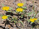 Coll. No. 3105, Heterotheca pumila Coll. No. 3105, Heterotheca pumila
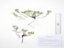 Coll. No. 3105, Heterotheca pumila. Coll. No. 3105, Heterotheca pumila.
|
3105
|
Heterotheca pumila.
|
Plants of Colorado
Asteraceae
Heterotheca pumila (Greene) Semple.
Alpine False Goldenaster.
West Tennessee Creek, Lake County, Colorado.
Lowest terrace above West Tennessee Creek, 588 m. (geodesic) southeast of Lily Lake, 12.3 km. (geodesic) north northwest of Leadville.
39.3458°N, 106.3656°W.
WGS 1984
Elev. 3171 m.
First terrace above creek, sunny and dry, with Arenaria sp. and Erigeron sp.
Collected by permit: Pike San Isabel National Forest, 2023, issued: Jul 1, 2023, to: Tom Schweich.
|
Tom Schweich
3105. |
18-Jul-2023 |
|
|
|
Other articles:
• Field Notes:
Coll. No. 2894, 20 Jul 2022;
|
3106
|
Caltha chionophila.
|
Plants of Colorado
Ranunculaceae
Caltha chionophila Greene.
Marsh Marigold.
West Tennessee Creek, Lake County, Colorado.
In a meadow just north of West Tennessee Creek, 580 m. southwest of Lily Lake, 12.6 km. northwest of the GNIS location of Leadville.
39.3462°N, 106.3715°W.
WGS 1984
Elev. 3205 m.
Collected by permit: Pike San Isabel National Forest, 2023, issued: Jul 1, 2023, to: Tom Schweich.
|
Tom Schweich
3106. |
18-Jul-2023 |
|
See notes for Coll. No. 2894 regarding Caltha chionophila and C. leptosepala.
|
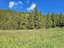 Meadow above West Tennessee Creek with Pedicularis groenlancica and Packera sp. Meadow above West Tennessee Creek with Pedicularis groenlancica and Packera sp.
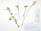 Coll. No. 3107, Packera crocata. Coll. No. 3107, Packera crocata.
|
3107
|
Packera dimorphophylla.
|
Plants of Colorado
Asteraceae
Packera crocata (Rydb.) W. A. Weber & A. Love.
Saffron Ragwort.
(Syn: Packera dimorphophylla (Greene) W.A. Weber & Á. Löve)
West Tennessee Creek, Lake County, Colorado.
In a meadow just north of West Tennessee Creek, 580 m. southwest of Lily Lake, 12.6 km. northwest of the GNIS location of Leadville.
39.3466°N, 106.3723°W.
WGS 1984
Elev. 3210 m.
Basal leaves mostly withered, bases chordate to cuneate.
Also collected here: Caltha chionophila.
Collected by permit: Pike San Isabel National Forest, 2023, issued: Jul 1, 2023, to: Tom Schweich.
|
Tom Schweich
3107. |
18-Jul-2023 |
|
|
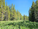 Habitat of Coll. No. 3108, Veratrum californicum. Habitat of Coll. No. 3108, Veratrum californicum.
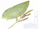 Coll. No. 3108, Veratrum californicum. Coll. No. 3108, Veratrum californicum.
|
3108
|
Veratrum californicum.
|
Plants of Colorado
Melanthiaceae
Veratrum californicum Durand.
Helleborine, Corn Lily.
West Tennessee Creek, Lake County, Colorado.
Meadow in a small valley between West Tennessee Creek and Lily Lake, 400 m. southwest of Lily Lake, 12.8 km. northwest of the GNIS location of Leadville.
39.3481°N, 106.3713°W.
WGS 1984
Elev. 3235 m.
Filling the floor of this little valley, also collected here: Senecio triangularis, Pedicularis racemosa, and Viola sp.
Collected by permit: Pike San Isabel National Forest, 2023, issued: Jul 1, 2023, to: Tom Schweich.
|
Tom Schweich
3108. |
18-Jul-2023 |
|
|
|
|
3109
|
Senecio triangularis.
|
Plants of Colorado
Asteraceae
Senecio triangularis Hook.
Arrowleaf Ragwort.
West Tennessee Creek, Lake County, Colorado.
Meadow in a small valley between West Tennessee Creek and Lily Lake, 400 m. southwest of Lily Lake, 12.8 km. northwest of the GNIS location of Leadville.
39.3481°N, 106.3713°W.
WGS 1984
Elev. 3235 m.
With Veratrum californicum, Pedicularis racemosa, and Viola sp.
Collected by permit: Pike San Isabel National Forest, 2023, issued: Jul 1, 2023, to: Tom Schweich.
|
Tom Schweich
3109. |
18-Jul-2023 |
|
|
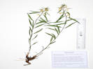 Coll. No. 3110, Pedicularis racemosa var. alba. Coll. No. 3110, Pedicularis racemosa var. alba.
|
3110
|
Pedicularis racemosa ssp. alba.
|
Plants of Colorado
Orobanchaceae
Pedicularis racemosa Douglas ex Benth. ssp. alba Pennell.
Sickletop Lousewort.
West Tennessee Creek, Lake County, Colorado.
Edge of lodgepole pine forest beside a meadow between West Tennessee Creek and Lily Lake, 400 m. southwest of Lily Lake, 12.8 km. northwest of the GNIS location of Leadville.
39.3479°N, 106.3713°W.
WGS 1984
Elev. 3243 m.
Leaves simple, serrate; flowers, white.
With Veratrum californicum, Senecio triangularis in the meadow, and Viola sp. in the forest.
Collected by permit: Pike San Isabel National Forest, 2023, issued: Jul 1, 2023, to: Tom Schweich.
|
Tom Schweich
3110. |
18-Jul-2023 |
|
|
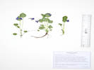 Coll. No. 3111, Viola adunca. Coll. No. 3111, Viola adunca.
|
3111
|
Viola sp.
|
Plants of Colorado
Violaceae
Viola adunca Sm.
Hooked Spur Violet.
West Tennessee Creek, Lake County, Colorado.
Edge of lodgepole pine forest beside a meadow between West Tennessee Creek and Lily Lake, 400 m. southwest of Lily Lake, 12.8 km. northwest of the GNIS location of Leadville.
39.348°N, 106.3712°W.
WGS 1984
Elev. 3244 m.
Purple flowers, long spurs.
With Veratrum californicum, Senecio triangularis in the meadow, and Pedicularis racemosa in the forest.
Collected by permit: Pike San Isabel National Forest, 2023, issued: Jul 1, 2023, to: Tom Schweich.
|
Tom Schweich
3111. |
18-Jul-2023 |
|
|
|
Other articles:
• Field Notes:
Coll. No. 3021, 3 Jul 2023;
Coll. No. 3139, 20 Jul 2023;
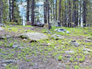 Habitat of Coll. No. 3112, Vaccinium scoparium. Habitat of Coll. No. 3112, Vaccinium scoparium.
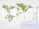 Coll. No. 3112, Vaccinium scoparium. Coll. No. 3112, Vaccinium scoparium.
|
3112
|
Vaccinium, probably V. myrtillus.
|
Plants of Colorado
Ericaceae
Vaccinium scoparium Leiberg ex Coville.
Grouse Whortleberry.
Lily Lake, Lake County, Colorado.
Ridge south of Lily Lake on Lily Lake Loop trail, 230 m. south of Lily Lake, 12.7 km (geodesic) northwest of Leadville.
39.3488°N, 106.3692°W.
WGS 1984
Elev. 3254 m.
Rocky top of hill between West Tennessee Creek and Lily Lake. Primary ground cover here in lodgepole pine forest with no middlestory.
Collected by permit: Pike San Isabel National Forest, 2023, issued: Jul 1, 2023, to: Tom Schweich.
|
Tom Schweich
3112. |
18-Jul-2023 |
|
Coll. No. 3112, 18 July 2023, characters observed:
Perennial, low-growing;
Stems,
numerous narrow ridged branches “broom-like,”
of current year, green,
sharply angled;
Leaves,
alternate,
lanceolate,
14 mm. × 6 mm. wide,
margins serrulate,
slightly revolute;
Petals,
united,
pink;
|
|
Locations:
Lily Lake.
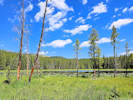 Lily Lake from the other side. Lily Lake from the other side.
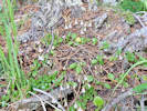 Coll. No. 3113, Linnaea borealis. Coll. No. 3113, Linnaea borealis.
|
3113
|
Undetermined.
|
Plants of Colorado
Caprifoliaceae
Linnaea borealis L.
Twinflower.
Lily Lake, Lake County, Colorado.
Western shore of Lily Lake, sprawling over forest floor at base of trees, 12.9 km. northwest of the GNIS location of Leadville.
39.3509°N, 106.3694°W.
WGS 1984
Elev. 3239 m.
Collected by permit: Pike San Isabel National Forest, 2023, issued: Jul 1, 2023, to: Tom Schweich.
|
Tom Schweich
3113. |
18-Jul-2023 |
|
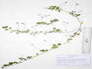
Coll. No. 3113, Linnaea borealis. |
|
|
Locations:
North Fork West Tennessee Creek.
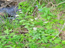 Coll. No. 3114, Cardamine cordifolia. Coll. No. 3114, Cardamine cordifolia.
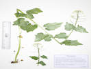 Coll. No. 3114. Cardamine cordifolia. Coll. No. 3114. Cardamine cordifolia.
|
3114
|
Brassicaceae.
|
Plants of Colorado
Brassicaceae
Cardamine cordifolia A. Gray.
Heartleaf Bittercress.
North Fork West Tennessee Creek, Lake County, Colorado.
Right bank of North Fork of West Tennessee Creek, 530 m. east northeast of Lily Lake, 12.7 km. north northwest of the GNIS location of Leadville.
39.352°N, 106.3622°W.
WGS 1984
Elev. 3205 m.
Growing on the bank of creek with Micranthes odontoloma.
Collected by permit: Pike San Isabel National Forest, 2023, issued: Jul 1, 2023, to: Tom Schweich.
|
Tom Schweich
3114. |
18-Jul-2023 |
|
|
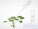 Coll. No. 3115, Micranthes odontoloma. Coll. No. 3115, Micranthes odontoloma.
|
3115
|
Saxifragaceae.
|
Plants of Colorado
Saxifragaceae
Micranthes odontoloma (Piper) A. Heller.
Brook Saxifrage.
North Fork West Tennessee Creek, Lake County, Colorado.
Right bank of North Fork of West Tennessee Creek, 530 m. east northeast of Lily Lake, 12.7 km. north northwest of the GNIS location of Leadville.
39.352°N, 106.3623°W.
WGS 1984
Elev. 3203 m.
In a damp ephemeral stream channel, collected with Cardamine cordifolia.
Collected by permit: Pike San Isabel National Forest, 2023, issued: Jul 1, 2023, to: Tom Schweich.
|
Tom Schweich
3115. |
18-Jul-2023 |
|
|
|
Locations:
Lily Lake.
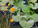 Obs. No. 3359, Nuphar polysepala Obs. No. 3359, Nuphar polysepala
|
|
Nuphar polysepala
|
|
Other articles:
• Forest Road 189:
upper meadow;
on the road;
Locations:
Unnamed Gulch.
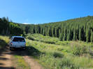 Uppermost meadow on Forest Road 189. Uppermost meadow on Forest Road 189.
|
|
Wednesday, 19 July 2023
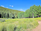
Uppermost meadow on Forest Road 189. |
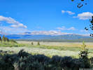
View of Mount Massive across Tennessee Park. |
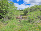
Little creek in the willow thicket. |
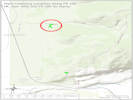
Location of Plant Collections on Forest Road 189. |
|
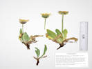 Coll. No. 3116, Agoseris glauca var. dasycephala. Coll. No. 3116, Agoseris glauca var. dasycephala.
|
3116
|
Agoseris, maybe A. glauca.
|
Plants of Colorado
Asteraceae
Agoseris glauca (Pursh) Raf. var. dasycephala (Torr. & A. Gray) Jeps.
Pale Goat-Chicory.
Unnamed Gulch, Lake County, Colorado.
Along Forest Road 189, about 1 km. east of County Road 18 “East Tennessee Road,” 5.69 km. (geodesic) north northwest of the GNIS location of Leadville.
39.2984°N, 106.31697°W.
WGS 1984
Elev. 3095 m.
Between the road and the creek to the south, open shrubland with Artemisia tridentata, Eriogonum umbellatum, and Dasophora fritucosa.
Collected by permit: Pike San Isabel National Forest, 2023, issued: Jul 1, 2023, to: Tom Schweich.
|
Tom Schweich
3116. |
19-Jul-2023 |
|
|
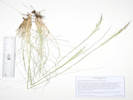 Coll. No. 3117, Eriocoma lettermanii. Coll. No. 3117, Eriocoma lettermanii.
|
3117
|
Eriocoma nelsonii lettermanii.
|
Plants of Colorado
Poaceae
Eriocoma lettermanii (Vasey) Romansch.
Unnamed Gulch, Lake County, Colorado.
Along Forest Road 189, about 1 km. east of County Road 18 “East Tennessee Road,” 5.69 km. (geodesic) north northwest of the GNIS location of Leadville.
39.2984°N, 106.31695°W.
WGS 1984
Elev. 3095 m.
Between the road and the creek to the south, open shrubland with Agoseris glauca var. dasycephala, Artemisia tridentata, Eriogonum umbellatum, and Dasiophora fruticosa.
Collected by permit: Pike San Isabel National Forest, 2023, issued: Jul 1, 2023, to: Tom Schweich.
|
Tom Schweich
3117. |
19-Jul-2023 |
|
|
|
|
3118
|
Salix sp., probably S. brachycarpa var. brachycarpa.
Placed in "deferred" pile.
|
 Coll. No. 3119, Linum perenne. Coll. No. 3119, Linum perenne.
|
3119
|
Linum, probably L. lewisii.
|
Plants of Colorado
Linaceae
Linum perenne L.
Blue Flax.
Unnamed Gulch, Lake County, Colorado.
Along Forest Road 189, about 1 km. east of County Road 18 “East Tennessee Road,” 5.69 km. (geodesic) north northwest of the GNIS location of Leadville.
39.29799°N, 106.31703°W.
WGS 1984
Elev. 3093 m.
Many stems, not particularly vasiform; a few short-styled flowers among almost all long-styled.
Openings in willow thicket near creek.
Collected by permit: Pike San Isabel National Forest, 2023, issued: Jul 1, 2023, to: Tom Schweich.
|
Tom Schweich
3119. |
19-Jul-2023 |
|
|
|
|
3120
|
Oxypolis fendleri.
|
Plants of Colorado
Apiaceae
Oxypolis fendleri (A. Gray) Heller.
Fendler's Cowbane.
Unnamed Gulch, Lake County, Colorado.
Along Forest Road 189, about 1 km. east of County Road 18 “East Tennessee Road,” 5.69 km. (geodesic) north northwest of the GNIS location of Leadville.
39.29797°N, 106.3171°W.
WGS 1984
Elev. 3091 m.
South of the road in willow thicket, on bank of creek.
Collected by permit: Pike San Isabel National Forest, 2023, issued: Jul 1, 2023, to: Tom Schweich.
|
Tom Schweich
3120. |
19-Jul-2023 |
|
|
 Coll. No. 3121, Lonicera involucrata. Coll. No. 3121, Lonicera involucrata.
|
3121
|
Lonicera involucrata
|
Plants of Colorado
Caprifoliaceae
Lonicera involucrata (Richardson) Banks ex Spreng.
Twinberry Honeysuckle.
Unnamed Gulch, Lake County, Colorado.
Along Forest Road 189, about 1 km. east of County Road 18 “East Tennessee Road,” 5.69 km. (geodesic) north northwest of the GNIS location of Leadville.
39.29794°N, 106.31707°W.
WGS 1984
Elev. 3094 m.
South of the road in willow thicket, streamside.
Collected by permit: Pike San Isabel National Forest, 2023, issued: Jul 1, 2023, to: Tom Schweich.
|
Tom Schweich
3121. |
19-Jul-2023 |
|
|
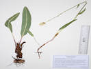 Coll. No. 3122, Bistorta bistortoides. Coll. No. 3122, Bistorta bistortoides.
|
3122
|
Bistorta bistortoides.
|
Plants of Colorado
Polygonaceae
Bistorta bistortoides (Pursh) Small.
Unnamed Gulch, Lake County, Colorado.
Along Forest Road 189, about 1 km. east of County Road 18 “East Tennessee Road,” 5.69 km. (geodesic) north northwest of the GNIS location of Leadville.
39.29752°N, 106.31733°W.
WGS 1984
Elev. 3091 m.
Muddy, wet place in willow thicket.
Collected by permit: Pike San Isabel National Forest, 2023, issued: Jul 1, 2023, to: Tom Schweich.
|
Tom Schweich
3122. |
19-Jul-2023 |
|
|
|
|
3123
|
Pedicularis groenlandica.
|
Plants of Colorado
Orobanchaceae
Pedicularis groenlandica Retz.
Elephanthead Lousewort.
Unnamed Gulch, Lake County, Colorado.
Along Forest Road 189, about 1 km. east of County Road 18 “East Tennessee Road,” 5.69 km. (geodesic) north northwest of the GNIS location of Leadville.
39.29755°N, 106.31738°W.
WGS 1984
Elev. 3090 m.
Muddy, wet places in willow thicket, south of the road and the creek.
Collected by permit: Pike San Isabel National Forest, 2023, issued: Jul 1, 2023, to: Tom Schweich.
|
Tom Schweich
3123. |
19-Jul-2023 |
|
|
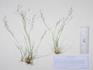 Coll. No. 3124, Agrostis scabra. Coll. No. 3124, Agrostis scabra.
|
3124
|
Tiny little grass.
|
Plants of Colorado
Poaceae
Agrostis scabra Willd.
Rough Bentgrass.
Unnamed Gulch, Lake County, Colorado.
Along Forest Road 189, about 1 km. east of County Road 18 “East Tennessee Road,” 5.69 km. (geodesic) north northwest of the GNIS location of Leadville.
39.29759°N, 106.31735°W.
WGS 1984
Elev. 3088 m.
Tiny little grass.
Damp openings in willow thicket, south of the road and the creek.
Collected by permit: Pike San Isabel National Forest, 2023, issued: Jul 1, 2023, to: Tom Schweich.
|
Tom Schweich
3124. |
19-Jul-2023 |
|
|
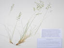 Coll. No. 3125, Coll. No. 3125, Festuca trachyphylla Festuca cf. calligera.
|
3125
|
Mid-size grass.
|
Plants of Colorado
Poaceae
Festuca trachyphylla (Hack.) Krajina.
Hard Fescue.
Festuca cf. calligera (Piper) Rydb., Jan Wingate, 4/23/2024.
Unnamed Gulch, Lake County, Colorado.
Along Forest Road 189, about 1 km. east of County Road 18 “East Tennessee Road,” 5.69 km. (geodesic) north northwest of the GNIS location of Leadville.
39.29737°N, 106.31657°W.
WGS 1984
Elev. 3093 m.
Mid-size grass.
South side of the gulch on the edges of an open aspen forest.
Collected by permit: Pike San Isabel National Forest, 2023, issued: Jul 1, 2023, to: Tom Schweich.
|
Tom Schweich
3125. |
19-Jul-2023 |
|
Coll. No. 3125, 19 July 2023, characters observed:
Perennial grass, to 35 cm.,
not rhizomatous;
Stem,
ascending at base,
glabrous below inflorescence;
Leaves,
sheath,
open,
ligule,
membranous ears with cilia [see Shaw (2008) fig. 242],
blade,
≤0.5 mm. wide,
revolute,
hairy inside;
Inflorescence,
1 per culm,
>leaves,
panicle,
spreading, ascending,
90 mm. × 30 mm. wide;
Spikelets,
many,
7 mm. × 2 mm. wide,
similar,
borne singly;
Glumes,
lower,
3.3 mm.,
veins, 1(3?)
[except for mid-veins, all veins on glumes and lemmas are obscure]
upper,
4.0 mm.,
<lowest floret,
veins, 1(3?),
awns, 0;
Florets,
4 per spikelet;
Lemma,
4.5 mm.,
>glumes,
membranous,
rolled,
proximally short hairy,
distally scabrous,
veins, #5???, glabrous,
awns, #1, 2.5-4.0 mm., straight, attached end;
Palea,
±=lemma,
membranous;
Anthers,
2.1-2.7 mm.;
Ovary,
apex with a couple hair-like things.
|
|
|
3126
|
Pseudocymopterus montanus.
|
Plants of Colorado
Apiaceae
Pseudocymopterus montanus (A. Gray) J. M. Coult. & Rose.
Alpine False Springparsley.
Unnamed Gulch, Lake County, Colorado.
Along Forest Road 189, about 1 km. east of County Road 18 “East Tennessee Road,” 5.69 km. (geodesic) north northwest of the GNIS location of Leadville.
39.2974°N, 106.31664°W.
WGS 1984
Elev. 3093 m.
South side of the gulch on the edges of an open aspen forest.
Collected by permit: Pike San Isabel National Forest, 2023, issued: Jul 1, 2023, to: Tom Schweich.
|
Tom Schweich
3126. |
19-Jul-2023 |
|
|
|
|
3127
|
Aquilegia coerulea.
|
Plants of Colorado
Ranunculaceae
Aquilegia coerulea E. James.
Colorado Blue Columbine.
Unnamed Gulch, Lake County, Colorado.
Along Forest Road 189, about 1 km. east of County Road 18 “East Tennessee Road,” 5.69 km. (geodesic) north northwest of the GNIS location of Leadville.
39.2974°N, 106.31658°W.
WGS 1984
Elev. 3094 m.
South side of the gulch on the edges of an open aspen forest.
Collected by permit: Pike San Isabel National Forest, 2023, issued: Jul 1, 2023, to: Tom Schweich.
|
Tom Schweich
3127. |
19-Jul-2023 |
|
|
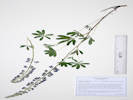 Coll. No. 3128, Lupinus argenteus var. rubricaulis. Coll. No. 3128, Lupinus argenteus var. rubricaulis.
|
3128
|
Lupinus argenteus var. ?.
|
Plants of Colorado
Fabaceae
Lupinus argenteus Pursh var. rubricaulis (Greene) S.L. Welsh.
Silvery Lupine.
Unnamed Gulch, Lake County, Colorado.
Along Forest Road 189, about 1 km. east of County Road 18 “East Tennessee Road,” 5.69 km. (geodesic) north northwest of the GNIS location of Leadville.
39.29742°N, 106.31655°W.
WGS 1984
Elev. 3097 m.
South side of the gulch on the edges of an open aspen forest.
Collected by permit: Pike San Isabel National Forest, 2023, issued: Jul 1, 2023, to: Tom Schweich.
|
Tom Schweich
3128. |
19-Jul-2023 |
|
|
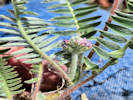 Coll. No. 3129, Oxytropis sp., maybe. Coll. No. 3129, Oxytropis sp., maybe.
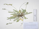 Coll. No. 3129, Oxytropis deflexa var. sericea. Coll. No. 3129, Oxytropis deflexa var. sericea.
|
3129
|
Oxytropis ?
|
Plants of Colorado
Fabaceae
Oxytropis deflexa (Pall.) DC. var. sericea Torr. & A. Gray.
Nodding Locoweed.
Unnamed Gulch, Lake County, Colorado.
Along Forest Road 189, about 1 km. east of County Road 18 “East Tennessee Road,” 5.69 km. (geodesic) north northwest of the GNIS location of Leadville.
39.29775°N, 106.3168°W.
WGS 1984
Elev. 3094 m.
Plants shortly caulescent, 1-3 nodes; tiny magenta flowers; peduncle elongating in fruit; mature fruit pendulous.
Full sun, openings in willow thicket just south of the creek.
Collected by permit: Pike San Isabel National Forest, 2023, issued: Jul 1, 2023, to: Tom Schweich.
|
Tom Schweich
3129. |
19-Jul-2023 |
|
|
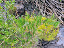 Coll. No. 3130, Bistorta vivipara. Coll. No. 3130, Bistorta vivipara.
|
3130
|
Bistorta vivipara.
|
Plants of Colorado
Polygonaceae
Bistorta vivipara (L.) Delarbre.
Alpine Bistort.
Unnamed Gulch, Lake County, Colorado.
Along Forest Road 189, about 1 km. east of County Road 18 “East Tennessee Road,” 5.69 km. (geodesic) north northwest of the GNIS location of Leadville.
39.29789°N, 106.31684°W.
WGS 1984
Elev. 3093 m.
Growing in moss on bank of creek in a willow thicket south of the road.
Collected by permit: Pike San Isabel National Forest, 2023, issued: Jul 1, 2023, to: Tom Schweich.
|
Tom Schweich
3130. |
19-Jul-2023 |
|
|
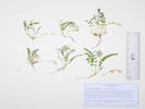 Coll. No. 3131, Astragalus alpinus. Coll. No. 3131, Astragalus alpinus.
|
3131
|
Astragalus sp.
|
Plants of Colorado
Fabaceae
Astragalus alpinus L.
Alpine Milkvetch.
Unnamed Gulch, Lake County, Colorado.
Along Forest Road 189, about 1 km. east of County Road 18 “East Tennessee Road,” 5.69 km. (geodesic) north northwest of the GNIS location of Leadville.
39.2981°N, 106.31693°W.
WGS 1984
Elev. 3093 m.
Tiny little Astragalus in sunny opening of willow thicket, beside game trail; between the road and the creek to the south.
Collected by permit: Pike San Isabel National Forest, 2023, issued: Jul 1, 2023, to: Tom Schweich.
|
Tom Schweich
3131. |
19-Jul-2023 |
|
|
|
|
|
Thursday, 20 July 2023
Evans Gulch
|
|
|
3132
|
Castilleja sulphurea.
|
Plants of Colorado
Orobanchaceae
Castilleja sulphurea Rydb.
Sulphur Indian Paintbrush.
Evans Gulch, Lake County, Colorado.
Middle section of Evans Gulch, near Conley Lakes and the Diamond Mine, 4.6 mi. by road east of the GNIS location of Leadville.
39.2606°N, 106.22036°W.
WGS 1984
Elev. 3450 m.
Sunny open southeast-facing slope.
Collected by permit: Pike San Isabel National Forest, 2023, issued: Jul 1, 2023, to: Tom Schweich.
|
Tom Schweich
3132. |
20-Jul-2023 |
|
|
|
|
3133
|
Eremogone fendleri.
|
Plants of Colorado
Caryophyllaceae
Eremogone fendleri (A. Gray) Ikonnikov.
Fendler's Sandwort.
Evans Gulch, Lake County, Colorado.
Middle section of Evans Gulch, near Conley Lakes and the Diamond Mine, 4.6 mi. by road east of the GNIS location of Leadville.
39.26062°N, 106.22032°W.
WGS 1984
Elev. 3447 m.
Sunny open southeast-facing slope.
Collected by permit: Pike San Isabel National Forest, 2023, issued: Jul 1, 2023, to: Tom Schweich.
|
Tom Schweich
3133. |
20-Jul-2023 |
|
|
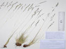 Coll. No. 3134, Coll. No. 3134, Festuca trachyphylla Festuca cf. calligera.
|
3134
|
Poa sp.
|
Plants of Colorado
Poaceae
Festuca trachyphylla (Hack.) Krajina.
Hard Fescue.
Evans Gulch, Lake County, Colorado.
Middle section of Evans Gulch, near Conley Lakes and the Diamond Mine, 4.6 mi. by road east of the GNIS location of Leadville.
39.26062°N, 106.22031°W.
WGS 1984
Elev. 3450 m.
Sunny open southeast-facing slope.
Collected by permit: Pike San Isabel National Forest, 2023, issued: Jul 1, 2023, to: Tom Schweich.
|
Tom Schweich
3134. |
20-Jul-2023 |
| Coll. No. 3134, 20 July 2023, characters observed:
Perennial grass, 30-35 cm., forming dense clumps;
Stem,
glabrous;
Leaves,
most basal,
on flowering culm:
sheath,
80 mm., open >½,
ligule,
membranous,
u-shaped [as illustrated in Shaw (2008) and FNANM],
<1 mm.;
blade,
40-60 mm. × 0.4 mm. dia.,
revolute,
adaxial (inside) hairy,
abaxial scabrous;
Inflorescence,
1 per culm,
>leaves,
panicle,
70 mm. × 10-15 mm. wide;
Spikelets,
many,
6 mm. (plus awns) × 2.2 mm. wide,
similar,
borne singly;
Glumes,
lower,
2.5 mm.,
veins, #1,
upper,
4.0 mm.,
<lowest floret,
veins, #3
awns, 0;
Florets,
4 per spikelet;
Lemma,
4.5 mm.,
glabrous, distally scabrous,
veins, #5,
awns, #1, 2.5 mm., straight
attached end;
Palea,
4.6 mm.,
±=lemma;
Anthers,
2.6 mm.;
Ovary,
glabrous.
|
|
|
3135
|
Pseudocymopterus montanus.
|
Plants of Colorado
Apiaceae
Pseudocymopterus montanus (A. Gray) J. M. Coult. & Rose.
Alpine False Springparsley.
Evans Gulch, Lake County, Colorado.
Middle section of Evans Gulch, near Conley Lakes and the Diamond Mine, 4.6 mi. by road east of the GNIS location of Leadville.
39.26055°N, 106.22033°W.
WGS 1984
Elev. 3450 m.
Sunny open southeast-facing slope.
Collected by permit: Pike San Isabel National Forest, 2023, issued: Jul 1, 2023, to: Tom Schweich.
|
Tom Schweich
3135. |
20-Jul-2023 |
|
|
|
|
3136
|
Penstemon whippleanus.
|
Plants of Colorado
Plantaginaceae
Penstemon whippleanus A. Gray.
Whipples Penstemon.
Evans Gulch, Lake County, Colorado.
Middle section of Evans Gulch, near Conley Lakes and the Diamond Mine, 4.6 mi. by road east of the GNIS location of Leadville.
39.26062°N, 106.22036°W.
WGS 1984
Elev. 3450 m.
Sunny open southeast-facing slope. One of the specimens has several insect galls.
Collected by permit: Pike San Isabel National Forest, 2023, issued: Jul 1, 2023, to: Tom Schweich.
|
Tom Schweich
3136. |
20-Jul-2023 |
|
|
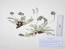 Coll. No. 3137, Oxytropis splendens. Coll. No. 3137, Oxytropis splendens.
|
3137
|
Maybe some sort of Oxytropis (?).
|
Plants of Colorado
Fabaceae
Oxytropis splendens Douglas ex Hook.
Showy Locoweed.
Evans Gulch, Lake County, Colorado.
Middle section of Evans Gulch, near Conley Lakes and the Diamond Mine, 4.6 mi. by road east of the GNIS location of Leadville.
39.26067°N, 106.22028°W.
WGS 1984
Elev. 3450 m.
Sunny open southeast-facing slope.
Collected by permit: Pike San Isabel National Forest, 2023, issued: Jul 1, 2023, to: Tom Schweich.
|
Tom Schweich
3137. |
20-Jul-2023 |
|
|
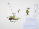 Coll. No. 3138, Symphyotrichum foliaceum var. apricum. Coll. No. 3138, Symphyotrichum foliaceum var. apricum.
|
3138
|
Erigeron sp.
|
Plants of Colorado
Asteraceae
Symphyotrichum foliaceum (DC.) G. L. Nesom var. apricum (A. Gray) G. L. Nesom.
Parry's Aster.
Evans Gulch, Lake County, Colorado.
Middle section of Evans Gulch, near Conley Lakes and the Diamond Mine, 4.6 mi. by road east of the GNIS location of Leadville.
39.2607°N, 106.22029°W.
WGS 1984
Elev. 3450 m.
Quite glandular-hairy.
Sunny open southeast-facing slope.
Collected by permit: Pike San Isabel National Forest, 2023, issued: Jul 1, 2023, to: Tom Schweich.
|
Tom Schweich
3138. |
20-Jul-2023 |
|
Coll. No. 3138, 20 July 2023, characters observed:
Perennial, to 7 cm. (one previous year scape to 20 cm.);
Stem,
hairy, not in distinct lines, becoming glandular above;
Leaves,
basal,
petiole 9 mm. + blade 20 mm. × 7 mm. wide,
oblanceolate,
ciliate, less so above;
cauline,
24 mm. × 6 mm.,
sessile,
neither auriculate nor clasping,
narrowly lanceolate;
Phyllaries,
3 series,
outer > inner,
green, purple-tipped,
inner becoming scarious on margins,
glandular-hairy;
Receptacle,
epaleate;
Ray flowers,
blue,
tube 2.5 mm. + blade 7 mm. × 1.2 mm. wide,
fertile;
Disk flowers,
yellow,
tube 3 mm. gradually expandin, + lobes, 0.3 mm.;
Pappus,
capillary bristles,
one series.
|
|
Other articles:
• Field Notes:
Coll. No. 3021, 3 Jul 2023;
Coll. No. 3112, 18 Jul 2023;
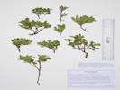 Coll. No, 3139, Vaccinium cespitosum. Coll. No, 3139, Vaccinium cespitosum.
|
3139
|
Vaccinium, maybe V. myrtillis.
|
Plants of Colorado
Ericaceae
Vaccinium cespitosum Michx.
Dwarf Blueberry.
Evans Gulch, Lake County, Colorado.
South-facing slope in full sun, above Evans Gulch, at the end of County Road 3, 6.33 km.(geodesic) east northeast of the GNIS location of Leadville.
39.2607°N, 106.2203°W.
WGS 1984
Elev. 3450 m.
Collected by permit: Pike San Isabel National Forest, 2023, issued: Jul 1, 2023, to: Tom Schweich.
|
Tom Schweich
3139. |
20-Jul-2023 |
| Coll. No. 3139, 20 July 2023, characters observed:
Perennial, low-growing;
Stems,
of current year,
terete,
yellow-green,
finely puberulent in patches (not in lines);
Leaves,
alternate,
oblanceolate,
20 mm. × 5.5 mm. wide,
margin serrulate;
No flowers or fruit.
|
|
|
3140
|
Calochortus gunnisonii.
|
Plants of Colorado
Liliaceae
Calochortus gunnisonii S. Watson.
Gunnison's Mariposa Lily.
Evans Gulch, Lake County, Colorado.
Middle section of Evans Gulch, near Conley Lakes and the Diamond Mine, 4.6 mi. by road east of the GNIS location of Leadville.
39.26068°N, 106.2204°W.
WGS 1984
Elev. 3450 m.
Sunny open southeast-facing slope.
Collected by permit: Pike San Isabel National Forest, 2023, issued: Jul 1, 2023, to: Tom Schweich.
|
Tom Schweich
3140. |
20-Jul-2023 |
|
|
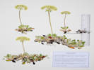 Coll. No. 3141, Eriogonum umbellatum var. majus. Coll. No. 3141, Eriogonum umbellatum var. majus.
|
3141
|
Eriogonum unbellatum.
|
Plants of Colorado
Polygonaceae
Eriogonum umbellatum Torrey, Ann. Lyceum Nat. Hist. New York. 2: 241. 1827. var. majus Hook.
Subalpine Sulphur-Flower Buckwheat.
Evans Gulch, Lake County, Colorado.
Middle section of Evans Gulch, near Conley Lakes and the Diamond Mine, 4.6 mi. by road east of the GNIS location of Leadville.
39.26066°N, 106.22032°W.
WGS 1984
Elev. 3450 m.
Perianth light yellow.
Sunny open southeast-facing slope.
Collected by permit: Pike San Isabel National Forest, 2023, issued: Jul 1, 2023, to: Tom Schweich.
|
Tom Schweich
3141. |
20-Jul-2023 |
|
|
|
Locations:
DeLong Park (City of Golden).
|
|
Saturday, 22 July 2023
Weeding at DeLong Park.
|
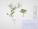 Coll. No. 3142, Cycloloma atriplicifolium. Coll. No. 3142, Cycloloma atriplicifolium.
|
3142
|
Cycloloma atriplicifolium.
|
Native and Naturalized Flora of the Golden Area, Jefferson County, Colorado
Chenopodiaceae
Cycloloma atriplicifolium (Spreng.) J. M. Coult.
Winged-Pigweed.
DeLong Park (City of Golden), Jefferson County, Colorado.
On the edge of a mowed area, in the hydroseeded native area, north corner of park on 23rd Street opposite Table Drive, 1.74 km. southeast of the GNIS location of Golden
39.74902°N, 105.20804°W.
WGS 1984
Elev. 1765 m.
DeLong Park was a private residence that was left fallow for a number of years, then converted to a city park in 2021-2022. This 2023 collection was made, therefore, in the second growing season after park construction.
Not previously collected in Golden; unclear whether this plant was previously here, brought in with the soil amendment, or was a contaminant in the seed mix.
Collected by permit: City of Golden, 2023, issued: Mar 13, 2023, to: Tom Schweich.
|
Tom Schweich
3142. |
22-Jul-2023 |
|
|
|
Locations:
Guy Gulch.
|
|
Wednesday, 26 July 2023
|
|
|
3143
|
Veronica peregrina, white flowers.
Plants of the Douglas Mountain Study Area
Jefferson County Open Space, Colorado, USA
Plantaginaceae
Veronica peregrina L. var. xalapensis (Kunth) H.St.John.
Neckweed.
Guy Gulch, Jefferson County, Colorado.
Muddy stream bed of upper meadow accessed by way of Pyrenees Lane, 40 m. northeast of line shack, 13.8 km. (geodesic) northwest of the GNISlocation of Golden.
39.81316°N, 105.36334°W.
WGS 1984
Elev. 2605 m.
White flowers.
Sunny steam bed, with Stellaria longipes and Montia chamissoi.
Collected by permit: Jefferson County Open Space, 2023, issued: Apr 10, 2023, to: Tom Schweich.
|
Tom Schweich, with John Vicjery
3143. |
26-Jul-2023 |
|
|
|
|
3144
|
Montia chammisoi.
Plants of the Douglas Mountain Study Area
Jefferson County Open Space, Colorado, USA
Montiaceae
Montia chamissoi (Spreng.) Greene.
Toad Lily.
Guy Gulch, Jefferson County, Colorado.
Meadow north of Guy Gulch, accessed by a ranch road off of Pyrenees Lane, 40 m. northeast of the line shack, 1.09 km. west southwest of Mt. Tom, 13.8 km. (geodesic) northwest of the GNIS location of Golden.
39.8132°N, 105.36339°W.
WGS 1984
Elev. 2604 m.
Muddy, wet but not flowing creek bed.
Collected by permit: Jefferson County Open Space, 2023, issued: Apr 10, 2023, to: Tom Schweich.
|
Tom Schweich, with John Vickery
3144. |
26-Jul-2023 |
|
|
|
|
3145
|
Stellaria, probably S. longipes.
Plants of the Douglas Mountain Study Area
Jefferson County Open Space, Colorado, USA
Caryophyllaceae
Stellaria longipes Goldie ssp. longipes.
Longstalk Starwort.
Guy Gulch, Jefferson County, Colorado.
North of Guy Gulch, accessed by a ranch road off of Pyrenees Lane, meadow 40 m. northeast of the line shack, 1.09 km. west southwest of Mt. Tom, 13.8 km. (geodesic) northwest of the GNIS location of Golden.
39.81319°N, 105.3634°W.
WGS 1984
Elev. 2605 m.
In the muddy, wet, but not flowing, creek bed; also here: Montia chamissoi, Veronica peregrina, and Potentilla norvegica.
Same as Coll. No. 3006.
Collected by permit: Jefferson County Open Space, 2023, issued: Apr 10, 2023, to: Tom Schweich.
|
Tom Schweich, with John Vickery
3145. |
26-Jul-2023 |
|
Subject to label mixup with #3018, per Jan Wingate, 4/23/2024.
|
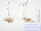 Coll. No. 3146, Bouteloua gracilis. Coll. No. 3146, Bouteloua gracilis.
|
3146
|
Bouteloua gracilis.
Plants of the Douglas Mountain Study Area
Jefferson County Open Space, Colorado, USA
Poaceae
Bouteloua gracilis (Kunth) Lag. ex Griffiths.
Blue Grama.
Guy Gulch, Jefferson County, Colorado.
North of Guy Gulch, accessed by a ranch road off of Pyrenees Lane, meadow 40 m. northeast of the line shack, 1.08 km. west southwest of Mt. Tom, 13.8 km. (geodesic) northwest of the GNIS location of Golden.
39.8132°N, 105.36337°W.
WGS 1984
Elev. 2607 m.
Comparatively short stature for this grass.
Collected by permit: Jefferson County Open Space, 2023, issued: Apr 10, 2023, to: Tom Schweich.
|
Tom Schweich
3146. |
26-Jul-2023 |
|
|
|
|
3147
|
Oenothera, maybe O. villosa.
|
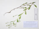 Coll. No. 3148, Rorippa palustris. Coll. No. 3148, Rorippa palustris.
|
3148
|
Rorippa, maybe R. teres, check for vesicular trichomes.
Plants of the Douglas Mountain Study Area
Jefferson County Open Space, Colorado, USA
Brassicaceae
Rorippa palustris (L.) Besser.
Bog Yellow-Cress.
Guy Gulch, Jefferson County, Colorado.
North of Guy Gulch, accessed by a ranch road off of Pyrenees Lane, meadow 27 m. northeast of the line shack, 1.08 km. west southwest of Mt. Tom, 13.8 km. (geodesic) northwest of the GNIS location of Golden.
39.813°N, 105.36333°W.
WGS 1984
Elev. 2606 m.
Streambed, waterlogged but not flowing.
Collected by permit: Jefferson County Open Space, 2023, issued: Apr 10, 2023, to: Tom Schweich.
|
Tom Schweich, with John Vickery
3148. |
26-Jul-2023 |
|
|
|
|
3149
|
Hesperostipa comata.
Plants of the Douglas Mountain Study Area
Jefferson County Open Space, Colorado, USA
Poaceae
Hesperostipa comata (Trin. & Rupr.) Barkworth.
Needle and Thread.
Guy Gulch, Jefferson County, Colorado.
North of Guy Gulch, accessed by a ranch road off of Pyrenees Lane, meadow 45 m. northeast of the line shack, 1.08 km. west southwest of Mt. Tom, 13.8 km. (geodesic) northwest of the GNIS location of Golden.
39.81319°N, 105.36329°W.
WGS 1984
Elev. 2609 m.
Sunny meadow, also collected here: Oenothera villosa, Veronica peregrina var. xalapensis, and Bouteloua gracilis.
Collected by permit: Jefferson County Open Space, 2023, issued: Apr 10, 2023, to: Tom Schweich.
|
Tom Schweich, with John Vickery
3149. |
26-Jul-2023 |
|
|
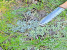 Coll. No. 3150, Antennaria microphylla Coll. No. 3150, Antennaria microphylla
|
3150
|
Antennaria microphylla.
Plants of the Douglas Mountain Study Area
Jefferson County Open Space, Colorado, USA
Asteraceae
Antennaria microphylla Rydb.
Littleleaf Pussytoes.
Guy Gulch, Jefferson County, Colorado.
North of Guy Gulch, accessed by a ranch road off of Pyrenees Lane, meadow 35 m. east northeast of the line shack, 1.08 km. west southwest of Mt. Tom, 13.7 km. (geodesic) northwest of the GNIS location of Golden.
39.81297°N, 105.36321°W.
WGS 1984
Elev. 2610 m.
East side of meadow, edge of forest with aspen, spruce and ponderosa pine, growing with Antennaria parviflora.
Collected by permit: Jefferson County Open Space, 2023, issued: Apr 10, 2023, to: Tom Schweich.
|
Tom Schweich, with John Vickery
3150. |
26-Jul-2023 |
|
|
|
|
3151
|
Astragalus miser
Plants of the Douglas Mountain Study Area
Jefferson County Open Space, Colorado, USA
Fabaceae
Astragalus alpinus L.
Alpine Milkvetch.
Guy Gulch, Jefferson County, Colorado.
North of Guy Gulch, accessed by a ranch road off of Pyrenees Lane, meadow 53 m. east northeast of the line shack, 1.06 km. west southwest of Mt. Tom, 13.7 km. (geodesic) northwest of the GNIS location of Golden.
39.81304°N, 105.36302°W.
WGS 1984
Elev. 2610 m.
East side of meadow, edge of forest af aspen, spruce and ponderosa pine. Circumboreal.
Collected by permit: Jefferson County Open Space, 2023, issued: Apr 10, 2023, to: Tom Schweich.
|
Tom Schweich, with John Vickery
3151. |
26-Jul-2023 |
|
Coll. No. 3151, 26 July 2023, characters observed:
Perennial herb, to 25 cm.,
sprawling, ascending,
hairs basifixed, white and black;
Leaves,
compound,
69 mm. × 23 mm. wide,
leaflets, #21, 11 mm. × 4 mm. wide, ovate,
stipules, connate into a sheath;
Calyx,
tube 2 mm. + lobes 2 mm.,
not inflated,
hairs black;
Flowers,
#10-12,
8 mm.,
close raceme but not crowded like A. agrestis,
banner, flexed at 4 mm.,
keel, 9 mm., >wings;
Fruit,
stipe, 1.5 mm.,
legume, 10.5 mm. × 3 mm. wide,
pendulous,
hairs black.
|
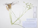 Coll. No. 3152, Danthonia parryi. Coll. No. 3152, Danthonia parryi.
|
3152
|
Danthonia, probably D. parryi.
Plants of the Douglas Mountain Study Area
Jefferson County Open Space, Colorado, USA
Poaceae
Danthonia parryi Scribn.
Parry's Oatgrass.
Guy Gulch, Jefferson County, Colorado.
North of Guy Gulch, accessed by a ranch road off of Pyrenees Lane, meadow 53 m. east northeast of the line shack, 1.06 km. west southwest of Mt. Tom, 13.7 km. (geodesic) northwest of the GNIS location of Golden.
39.81304°N, 105.36304°W.
WGS 1984
Elev. 2610 m.
East side of meadow, edge of forest of aspen, spruce and ponderosa pine.
Collected by permit: Jefferson County Open Space, 2023, issued: Apr 10, 2023, to: Tom Schweich.
|
Tom Schweich, with John Vickery
3152. |
26-Jul-2023 |
| Coll. No. 3152, 26 July 2023, characters observed:
Panicle erect to ascending (spreading);
Spikelets,
14-16 mm.,
5+ florets;
Glumes,
16 mm., ±equal,
>lemma;
Lemma,
13 mm.,
tip, deeply bifid,
awn, #1, 13 mm., attached back,
hairy on margins, veins, and some areas of back,
but most of back is glabrous;
Anthers,
3.2 mm.
|
|
|
|
There is no Coll. No. 3153
|
|
|
3154
|
Campanula rotundifolia.
Plants of the Douglas Mountain Study Area
Jefferson County Open Space, Colorado, USA
Campanulaceae
Campanula rotundifolia L.
Harebell.
Guy Gulch, Jefferson County, Colorado.
North of Guy Gulch, accessed by a ranch road off of Pyrenees Lane, meadow 53 m. east northeast of the line shack, 1.06 km. west southwest of Mt. Tom, 13.7 km. (geodesic) northwest of the GNIS location of Golden.
39.81307°N, 105.36302°W.
WGS 1984
Elev. 2615 m.
East side of meadow, edge of forest of aspen, spruce and ponderosa pine.
Collected by permit: Jefferson County Open Space, 2023, issued: Apr 10, 2023, to: Tom Schweich.
|
Tom Schweich, with John Vickery
3154. |
26-Jul-2023 |
|
|
|
Locations:
Guy Gulch.
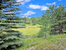 Old road, location of Coll. Nos. 3155-3162. Old road, location of Coll. Nos. 3155-3162.
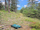 Old road, location of Coll. Nos. 3155-3162. Old road, location of Coll. Nos. 3155-3162.
|
3155
|
Astragalus miser.
Plants of the Douglas Mountain Study Area
Jefferson County Open Space, Colorado, USA
Fabaceae
Astragalus miser Douglas ex. Hook. var. oblongifolius (Rydb.) Cronquist.
Timber Milkvetch.
Guy Gulch, Jefferson County, Colorado.
North of Guy Gulch, accessed by a ranch road off of Pyrenees Lane, 61 m. east northeast of the line shack, 1.05 km. west southwest of Mt. Tom, 13.7 km. (geodesic) northwest of the GNIS location of Golden.
39.81308°N, 105.36293°W.
WGS 1984
Elev. 2619 m.
On an old road through forest of aspen, spruce and ponderosa pine, with Oxytropis lambertii and Packera fendleri.
Collected by permit: Jefferson County Open Space, 2023, issued: Apr 10, 2023, to: Tom Schweich.
|
Tom Schweich, with John Vickery
3155. |
26-Jul-2023 |
|
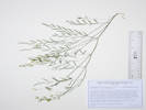
Coll. No. 3155, Astragalus miser var. oblongifolius. |
|
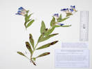 Coll. No. 3156, Penstemon glaber var. alpinus. Coll. No. 3156, Penstemon glaber var. alpinus.
|
3156
|
Penstemon, neither P. virens nor P. secundiflorus.
Plants of the Douglas Mountain Study Area
Jefferson County Open Space, Colorado, USA
Plantaginaceae
Penstemon glaber Pursh var. alpinus (Torr.) A. Gray.
Sawsepal Penstemon.
Guy Gulch, Jefferson County, Colorado.
North of Guy Gulch, accessed by a ranch road off of Pyrenees Lane, 71 m. east northeast of the line shack, 1.05 km. west southwest of Mt. Tom, 13.7 km. (geodesic) northwest of the GNIS location of Golden.
39.81309°N, 105.36281°W.
WGS 1984
Elev. 2623 m.
On the edge of an old road through forest of aspen, spruce and ponderosa pine, with Oxytropis lambertii and Packera fendleri.
Collected by permit: Jefferson County Open Space, 2023, issued: Apr 10, 2023, to: Tom Schweich.
|
Tom Schweich, with John Vickery
3156. |
26-Jul-2023 |
|
Coll. No. 3156, 26 July 2023, characters observed:
Perennial herb, to 30 cm.,
not mat-forming;
Leaves,
opposite,
sessile,
lanceolate to oblanceolate,
90 mm. × 14 mm. wide,
glabrous,
entire (not undulate or crisped);
Inflorescence,
axis, glabrous;
Flowers,
30 mm.,
blue;
Stamens,
included;
Staminode,
slightly notched at tip;
Anthers,
3.7 mm.,
sacs, short hairy opposite dehiscence.
|
|
|
3157
|
Sedum lanceolatum.
Plants of the Douglas Mountain Study Area
Jefferson County Open Space, Colorado, USA
Crassulaceae
Sedum lanceolatum Torr.
Spearleaf Stonecrop.
Guy Gulch, Jefferson County, Colorado.
North of Guy Gulch, accessed by a ranch road off of Pyrenees Lane, 79 m. east northeast of the line shack, 1.04 km. west southwest of Mt. Tom, 13.7 km. (geodesic) northwest of the GNIS location of Golden.
39.81298°N, 105.36267°W.
WGS 1984
Elev. 2621 m.
On the edge of an old road through forest of aspen, spruce and ponderosa pine, with Packera fendleri, Oxytropis lambertii, and Penstemon glaber var. alpinus.
Collected by permit: Jefferson County Open Space, 2023, issued: Apr 10, 2023, to: Tom Schweich.
|
Tom Schweich, with John Vickery
3157. |
26-Jul-2023 |
|
|
|
|
3158
|
Grass, large ovate inflorescence.
Plants of the Douglas Mountain Study Area
Jefferson County Open Space, Colorado, USA
Poaceae
Koeleria macrantha (Ledeb.) Schult.
Prairie Junegrass.
Guy Gulch, Jefferson County, Colorado.
North of Guy Gulch, accessed by a ranch road off of Pyrenees Lane, 70 m. east northeast of the line shack, 1.04 km. west southwest of Mt. Tom, 13.7 km. (geodesic) northwest of the GNIS location of Golden.
39.81298°N, 105.3628°W.
WGS 1984
Elev. 2621 m.
In the middle of an old road through forest of aspen, spruce and ponderosa pine, with Packera fendleri, Sedum lanceolatum, Oxytropis lambertii, and Penstemon glaber var. alpinus.
Collected by permit: Jefferson County Open Space, 2023, issued: Apr 10, 2023, to: Tom Schweich.
|
Tom Schweich, with John Vickery
3158. |
26-Jul-2023 |
|
|
|
|
3159
|
Oxytropis lambertii.
Plants of the Douglas Mountain Study Area
Jefferson County Open Space, Colorado, USA
Fabaceae
Oxytropis lambertii Pursh.
Purple Locoweed.
Guy Gulch, Jefferson County, Colorado.
North of Guy Gulch, accessed by a ranch road off of Pyrenees Lane, 70 m. east northeast of the line shack, 1.04 km. west southwest of Mt. Tom, 13.7 km. (geodesic) northwest of the GNIS location of Golden.
39.81311°N, 105.36284°W.
WGS 1984
Elev. 2622 m.
Beside an old road through forest of aspen, spruce and ponderosa pine, with Packera fendleri, Sedum lanceolatum, Penstemon glaber var. alpinus, and Koeleria macrantha.
Collected by permit: Jefferson County Open Space, 2023, issued: Apr 10, 2023, to: Tom Schweich.
|
Tom Schweich, with John Vickery
3159. |
26-Jul-2023 |
|
|
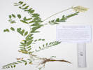 Coll. No. 3160, Astragalus laxmannii var. robustior. Coll. No. 3160, Astragalus laxmannii var. robustior.
|
3160
|
Astragalus, large sprawling plant, white flowers, not shrubby like A. drummondii.
Plants of the Douglas Mountain Study Area
Jefferson County Open Space, Colorado, USA
Fabaceae
Astragalus laxmannii Jacq. var. robustior (Hook.) Barneby & S. L. Welsh.
Prairie Milkvetch.
Guy Gulch, Jefferson County, Colorado.
North of Guy Gulch, accessed by a ranch road off of Pyrenees Lane, 80 m. east northeast of the line shack, 1.04 km. west southwest of Mt. Tom, 13.7 km. (geodesic) northwest of the GNIS location of Golden.
39.81298°N, 105.36265°W.
WGS 1984
Elev. 2623 m.
Woody taproot, caulescent, sprawling, dolabriform hairs, large leaves and ochroleucous flowers.
Beside an old road through forest of aspen, spruce and ponderosa pine, with Packera fendleri, Sedum lanceolatum, Oxytropis lambertii, Penstemon glaber var. alpinus, and Koeleria macrantha.
Collected by permit: Jefferson County Open Space, 2023, issued: Apr 10, 2023, to: Tom Schweich.
|
Tom Schweich
3160. |
26-Jul-2023 |
|
|
|
|
3161
|
Calochortus gunnisonii.
Plants of the Douglas Mountain Study Area
Jefferson County Open Space, Colorado, USA
Liliaceae
Calochortus gunnisonii S. Watson.
Gunnison's Mariposa Lily.
Guy Gulch, Jefferson County, Colorado.
North of Guy Gulch, accessed by a ranch road off of Pyrenees Lane, 110 m. southeast of the line shack, 1.05 km. west southwest of Mt. Tom, 13.65 km. (geodesic) northwest of the GNIS location of Golden.
39.81236°N, 105.36249°W.
WGS 1984
Elev. 2624 m.
Small patch at the end of an old road. Sunny opening in forest of aspen, spruce, and ponderosa pine.
Collected by permit: Jefferson County Open Space, 2023, issued: Apr 10, 2023, to: Tom Schweich.
|
Tom Schweich, with John Vickery
3161. |
26-Jul-2023 |
|
|
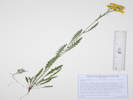 Coll. No. 3162, Packera fendleri. Coll. No. 3162, Packera fendleri.
|
3162
|
Packera fendleri.
Plants of the Douglas Mountain Study Area
Jefferson County Open Space, Colorado, USA
Asteraceae
Packera fendleri (A. Gray) W.A. Weber & Á. Löve.
Fendler’s Ragwort.
Guy Gulch, Jefferson County, Colorado.
North of Guy Gulch, accessed by a ranch road off of Pyrenees Lane, 63 m. southeast of the line shack, 1.05 km. west southwest of Mt. Tom, 13.65 km. (geodesic) northwest of the GNIS location of Golden.
39.81292°N, 105.36285°W.
WGS 1984
Elev. 2621 m.
On an old road through forest of aspen, spruce and ponderosa pine, with Sedum lanceolatum, Oxytropis lambertii, Penstemon glaber var. alpinus, and Koeleria macrantha.
Collected by permit: Jefferson County Open Space, 2023, issued: Apr 10, 2023, to: Tom Schweich.
|
Tom Schweich, with John Vickery
3162. |
26-Jul-2023 |
|
|
|
Literature Cited:
- Rose, Jeffrey P., 2021.
- Rose, Jeffrey P., Cassio A. P. Toledo, Emily Moriarty Lemmon, Alan R, Lemmon, and Kenneth J. Sytsma, 2021.
|
3163
|
Polemonium foliosissimum.
Plants of the Douglas Mountain Study Area
Jefferson County Open Space, Colorado, USA
Polemoniaceae
Polemonium foliosissimum A. Gray.
Towering Jacob's Ladder.
Guy Gulch, Jefferson County, Colorado.
North of Guy Gulch, accessed by a ranch road off of Pyrenees Lane, in front of the line shack, 1.07 km. west southwest of Mt. Tom, 13.7 km. (geodesic) northwest of the GNIS location of Golden.
39.81288°N, 105.3635°W.
WGS 1984
Elev. 2607 m.
Sunny spot, with grasses and small shrubs.
Collected by permit: Jefferson County Open Space, 2023, issued: Apr 10, 2023, to: Tom Schweich.
|
Tom Schweich, with John Vickery
3163. |
26-Jul-2023 |
|
Sounds like P. foliosissimum is about to undergo a revision.
Unfortunately, the relevant article (Rose, 2021) is behind a paywall that not even Sci-Hub could break through.
|
|
|
3164
|
Solidago nana, may be mixed collection with S. missouriensis.
Plants of the Douglas Mountain Study Area
Jefferson County Open Space, Colorado, USA
Asteraceae
Solidago missouriensis Nutt.
Missouri Goldenrod.
Guy Gulch, Jefferson County, Colorado.
North of Guy Gulch, accessed by a ranch road off of Pyrenees Lane, 72 m. north of the line shack, 1.07 km. west southwest of Mt. Tom, 13.8 km. (geodesic) northwest of the GNIS location of Golden.
39.81349°N, 105.36337°W.
WGS 1984
Elev. 2615 m.
Sunny openings in grass.
Collected by permit: Jefferson County Open Space, 2023, issued: Apr 10, 2023, to: Tom Schweich.
|
Tom Schweich, with John Vickery
3164. |
26-Jul-2023 |
|
|
|
|
3165
|
Eriogonum alatum.
Plants of the Douglas Mountain Study Area
Jefferson County Open Space, Colorado, USA
Polygonaceae
Eriogonum alatum Torrey in L. Sitgreaves, Rep. Exped. Zuni Colorado Rivers. 168, plate 8. 1853.
Winged Buckwheat.
Guy Gulch, Jefferson County, Colorado.
North of Guy Gulch, accessed by a ranch road off of Pyrenees Lane, 73 m. north of the line shack, 1.07 km. west southwest of Mt. Tom, 13.8 km. (geodesic) northwest of the GNIS location of Golden.
39.8135°N, 105.36337°W.
WGS 1984
Elev. 2615 m.
Open, sunny, meadow with Solidago missouriensis and Elymus elymoides.
Collected by permit: Jefferson County Open Space, 2023, issued: Apr 10, 2023, to: Tom Schweich.
|
Tom Schweich, with John Vickery
3165. |
26-Jul-2023 |
|
|
|
|
3166
|
Elymus elymoides.
Plants of the Douglas Mountain Study Area
Jefferson County Open Space, Colorado, USA
Poaceae
Elymus elymoides (Raf.) Swezey.
Squirreltail Grass.
Guy Gulch, Jefferson County, Colorado.
North of Guy Gulch, accessed by a ranch road off of Pyrenees Lane, 73 m. north of the line shack, 1.07 km. west southwest of Mt. Tom, 13.8 km. (geodesic) northwest of the GNIS location of Golden.
39.81348°N, 105.36336°W.
WGS 1984
Elev. 2613 m.
Open, sunny, meadow with Solidago missouriensis and Eriogonum alatum.
Collected by permit: Jefferson County Open Space, 2023, issued: Apr 10, 2023, to: Tom Schweich.
|
Tom Schweich, with John Vickery
3166. |
26-Jul-2023 |
|
|
|
|
3167
|
Monarda fistulosa.
Plants of the Douglas Mountain Study Area
Jefferson County Open Space, Colorado, USA
Lamiaceae
Monarda fistulosa L.
Wild Bergamot.
Guy Gulch, Jefferson County, Colorado.
North of Guy Gulch, accessed by a ranch road off of Pyrenees Lane, 128 m. north of the line shack, 1.07 km. west southwest of Mt. Tom, 13.8 km. (geodesic) northwest of the GNIS location of Golden.
39.81401°N, 105.36347°W.
WGS 1984
Elev. 2621 m.
Sunny meadow, also collected here, Oreocarya virgata and Astragalus alpinus.
Collected by permit: Jefferson County Open Space, 2023, issued: Apr 10, 2023, to: Tom Schweich.
|
Tom Schweich, with John Vickery
3167. |
26-Jul-2023 |
|
|
|
|
3168
|
Astragalus alpinus.
Plants of the Douglas Mountain Study Area
Jefferson County Open Space, Colorado, USA
Fabaceae
Astragalus alpinus L.
Alpine Milkvetch.
Guy Gulch, Jefferson County, Colorado.
North of Guy Gulch, accessed by a ranch road off of Pyrenees Lane, 128 m. north of the line shack, 1.07 km. west southwest of Mt. Tom, 13.8 km. (geodesic) northwest of the GNIS location of Golden.
39.81399°N, 105.36339°W.
WGS 1984
Elev. 2621 m.
Sunny meadow, also collected here, Oreocarya virgata and Monarda fistulosa.
Collected by permit: Jefferson County Open Space, 2023, issued: Apr 10, 2023, to: Tom Schweich.
|
Tom Schweich, with John Vickery
3168. |
26-Jul-2023 |
|
|
|
|
3169
|
Galium boreale.
Plants of the Douglas Mountain Study Area
Jefferson County Open Space, Colorado, USA
Rubiaceae
Galium boreale L.
Bedstraw.
Guy Gulch, Jefferson County, Colorado.
North of Guy Gulch, accessed by a ranch road off of Pyrenees Lane, 260 m. north of the line shack, 1.11 km. west southwest of Mt. Tom, 13.9 km. (geodesic) northwest of the GNIS location of Golden.
39.81513°N, 105.36428°W.
WGS 1984
Elev. 2642 m.
Bank of stream with aspen, Douglas fir, and ponderosa pine, also collected here: Nassella viridula.
Collected by permit: Jefferson County Open Space, 2023, issued: Apr 10, 2023, to: Tom Schweich.
|
Tom Schweich, with John Vickery
3169. |
26-Jul-2023 |
|
|
|
|
|
with Galium boreale.
Plants of the Douglas Mountain Study Area
Jefferson County Open Space, Colorado, USA
Caryophyllaceae
Cerastium arvense L. ssp. strictum Gaudin.
Field Chickweed.
Guy Gulch, Jefferson County, Colorado.
North of Guy Gulch, accessed by a ranch road off of Pyrenees Lane, 260 m. north of the line shack, 1.11 km. west southwest of Mt. Tom, 13.9 km. (geodesic) northwest of the GNIS location of Golden.
39.81513°N, 105.36428°W.
WGS 1984
Elev. 2642 m.
Bank of stream with aspen, Douglas fir, and ponderosa pine, also collected here: Nassella viridula.
Collected by permit: Jefferson County Open Space, 2023, issued: Apr 10, 2023, to: Tom Schweich.
|
Tom Schweich, with John Vickery
3169.1 |
26-Jul-2023 |
|
|
|
|
3170
|
Nassella viridula.
Plants of the Douglas Mountain Study Area
Jefferson County Open Space, Colorado, USA
Poaceae
Nassella viridula (Trin.) Barkworth.
Green Needlegrass.
Guy Gulch, Jefferson County, Colorado.
North of Guy Gulch, accessed by a ranch road off of Pyrenees Lane, 260 m. north of the line shack, 1.11 km. west southwest of Mt. Tom, 13.9 km. (geodesic) northwest of the GNIS location of Golden.
39.81518°N, 105.36423°W.
WGS 1984
Elev. 2643 m.
Bank of stream with aspen, Douglas fir, and ponderosa pine, also collected here: Galium boreale.
Collected by permit: Jefferson County Open Space, 2023, issued: Apr 10, 2023, to: Tom Schweich.
|
Tom Schweich, with John Vickery
3170. |
26-Jul-2023 |
|
|
|
|
3171
|
Oreocarya virgata.
Plants of the Douglas Mountain Study Area
Jefferson County Open Space, Colorado, USA
Boraginaceae
Oreocarya virgata (Porter) Greene.
Miner"s Candle.
Guy Gulch, Jefferson County, Colorado.
North of Guy Gulch, accessed by a ranch road off of Pyrenees Lane, 140 m. north northeast of the line shack, 1.04 km. west southwest of Mt. Tom, 13.9 km. (geodesic) northwest of the GNIS location of Golden.
39.81407°N, 105.36314°W.
WGS 1984
Elev. 2628 m.
Partially eaten.
On a small berm from some long-ago disturbance.
Collected by permit: Jefferson County Open Space, 2023, issued: Apr 10, 2023, to: Tom Schweich.
|
Tom Schweich, with John Vickery
3171. |
26-Jul-2023 |
|
|
|
|
3171.1
|
Penstemon, lance-linear leaves, flowers blue-purple, neither P. secundiflorus nor P. virens, nor the sam as Coll. No. 3156.
Plants of the Douglas Mountain Study Area
Jefferson County Open Space, Colorado, USA
Plantaginaceae
Penstemon virgatus A. Gray var. asa-grayi (Crosswh.) Dorn.
Upright Blue Beardtongue.
Guy Gulch, Jefferson County, Colorado.
North of Guy Gulch, accessed by a ranch road off of Pyrenees Lane, 140 m. north northeast of the line shack, 1.04 km. west southwest of Mt. Tom, 13.9 km. (geodesic) northwest of the GNIS location of Golden.
39.81408°N, 105.36314°W.
WGS 1984
Elev. 2628 m.
Leaves lance-linear, flowers just starting to open,
On a small berm from some long-ago disturbance, with Oreocarya virgata.
Collected by permit: Jefferson County Open Space, 2023, issued: Apr 10, 2023, to: Tom Schweich.
|
Tom Schweich, with John Vickery
3171.1 |
26-Jul-2023 |
|
|
|
|
3172
|
Potentilla, maybe P. norvegica.
Plants of the Douglas Mountain Study Area
Jefferson County Open Space, Colorado, USA
Rosaceae
Potentilla norvegica L.
Norwegian Cinquefoil.
Guy Gulch, Jefferson County, Colorado.
North of Guy Gulch, accessed by a ranch road off of Pyrenees Lane, 30 m. north northeast of the line shack, 1.09 km. west southwest of Mt. Tom, 13.8 km. (geodesic) northwest of the GNIS location of Golden.
39.81307°N, 105.36338°W.
WGS 1984
Elev. 2616 m.
Beside stream near line shack, collected nearby: Rorippa palustris, Stellaria longipes ssp. longipes, and Veronica peregrina var. xalapensis.
Circumpolar.
Collected by permit: Jefferson County Open Space, 2023, issued: Apr 10, 2023, to: Tom Schweich.
|
Tom Schweich, with John Vickery
3172. |
26-Jul-2023 |
|
|
|
|
|
Friday, 28 July 2023
Schweich Hill, weeding.
|
|
Locations:
Schweich Hill.
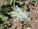 Euphorbia marginata seen on edge of social trail. Euphorbia marginata seen on edge of social trail.
|
|
Observation No. 3359, Euphorbia marginata.
|
|
Other articles:
• Golden Gate Canyon Road:
along the road;
Locations:
Guy Gulch.
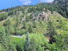 Where we parked on July 31st. Where we parked on July 31st.
|
|
Monday, 31 July 2023
Guy Gulch, with John Vickery
|
|
|
3173
|
Equisetum arvense.
Plants of the Douglas Mountain Study Area
Jefferson County Open Space, Colorado, USA
Equisetaceae
Equisetum arvense L.
Field Horsetail.
Guy Gulch, Jefferson County, Colorado.
Southwest side of the gulch, 680 m. northwest of Centennial Ranch, 12.8 km. northwest of the GNIS location of Golden.
39.7983°N, 105.36056°W.
WGS 1984
Elev. 2376 m.
In shaded seep beside creek, with Betula occidentalis, willows , and cottonwoods.
Collected by permit: Jefferson County Open Space, 2023, issued: Apr 10, 2023, to: Tom Schweich.
|
Tom Schweich, with John Vickery
3173. |
31-Jul-2023 |
|
|
|
|
3174
|
Betula occidentalis.
Plants of the Douglas Mountain Study Area
Jefferson County Open Space, Colorado, USA
Betulaceae
Betula occidentalis Hook.
Water Birch.
Guy Gulch, Jefferson County, Colorado.
Southwest side of the gulch, 680 m. northwest of Centennial Ranch, 12.8 km. northwest of the GNIS location of Golden.
39.79829°N, 105.36056°W.
WGS 1984
Elev. 2376 m.
Shaded lower terrace just above creek, with Equisteum arvense, willows , and cottonwoods.
Collected by permit: Jefferson County Open Space, 2023, issued: Apr 10, 2023, to: Tom Schweich.
|
Tom Schweich, with John Vickery
3174. |
31-Jul-2023 |
|
|
|
|
3175
|
Erigeron speciosus.
Plants of the Douglas Mountain Study Area
Jefferson County Open Space, Colorado, USA
Asteraceae
Erigeron speciosus (Lindl.) DC.
Aspen Fleabane.
Guy Gulch, Jefferson County, Colorado.
Southwest side of the gulch, 690 m. northwest of Centennial Ranch, 12.9 km. northwest of the GNIS location of Golden.
39.79827°N, 105.36074°W.
WGS 1984
Elev. 2386 m.
Steep slope below rock outcrop, with Senecio pudicus.
Collected by permit: Jefferson County Open Space, 2023, issued: Apr 10, 2023, to: Tom Schweich.
|
Tom Schweich, with John Vickery
3175. |
31-Jul-2023 |
|
|
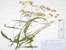 Coll. No. 3176, Senecio pudicus. Coll. No. 3176, Senecio pudicus.
|
3176
|
Senecio pudicus.
Plants of the Douglas Mountain Study Area
Jefferson County Open Space, Colorado, USA
Asteraceae
Senecio pudicus Greene.
Bashful Ragwort.
Guy Gulch, Jefferson County, Colorado.
Southwest side of the gulch, 690 m. northwest of Centennial Ranch, 12.9 km. northwest of the GNIS location of Golden.
39.79827°N, 105.36073°W.
WGS 1984
Elev. 2386 m.
Composite. with nodding flowers.
Steep slope above creek, twining through Symphoricarpos sp., with Erigeron speciosus.
Collected by permit: Jefferson County Open Space, 2023, issued: Apr 10, 2023, to: Tom Schweich.
|
Tom Schweich, with John Vickery
3176. |
31-Jul-2023 |
|
|
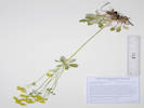 Coll. No. 3177, Eriogonum umbellatum var. ramulosum. Coll. No. 3177, Eriogonum umbellatum var. ramulosum.
|
3177
|
Eriogonum umbellatum var. ramulosum.
Plants of the Douglas Mountain Study Area
Jefferson County Open Space, Colorado, USA
Polygonaceae
Eriogonum umbellatum Torr. var. ramulosum Reveal.
Buffalo Bill's Sulphur Flower.
Guy Gulch, Jefferson County, Colorado.
Southwest side of County Road 70 and the gulch, 600 m. northwest of Centennial Ranch, 12.8 km. northwest of the GNIS location of Golden, and 12.7 km. northwest of Buffalo Bill's grave.
39.79777°N, 105.35992°W.
WGS 1984
Elev. 2379 m.
Outwash delta of small watercourse with smooth brome, snowberry, aspen, and water birch.
This collection fits the description of var. ramulosum with the branched inflorescence and bracted branches, whereas other parts of same plant do not. Coll. No. 3078 made nearby was similarly ambiguous as to variety.
Collected by permit: Jefferson County Open Space, 2023, issued: Apr 10, 2023, to: Tom Schweich.
|
Tom Schweich, with John Vickery
3177. |
31-Jul-2023 |
|
|
|
|
3178
|
Heterotheca villosa.
Plants of the Douglas Mountain Study Area
Jefferson County Open Space, Colorado, USA
Asteraceae
Heterotheca villosa (Pursh) Shinners var. nana (A. Gray) Semple.
Hairy False Golden Aster.
Guy Gulch, Jefferson County, Colorado.
Southwest side of County Road 70 and the gulch, 618 m. northwest of Centennial Ranch, 12.8 km. northwest of the GNIS location of Golden.
39.79766°N, 105.36023°W.
WGS 1984
Elev. 2392 m.
Open southeast-facing slope above small gulch tributary to Guy Gulch.
Collected by permit: Jefferson County Open Space, 2023, issued: Apr 10, 2023, to: Tom Schweich.
|
Tom Schweich, with John Vickery
3178. |
31-Jul-2023 |
|
|
|
|
3179
|
Helianthis pumilis.
Plants of the Douglas Mountain Study Area
Jefferson County Open Space, Colorado, USA
Asteraceae
Helianthus pumilus Nutt.
Little Sunflower.
Guy Gulch, Jefferson County, Colorado.
Southwest side of County Road 70 and the gulch, 615 m. northwest of Centennial Ranch, 12.8 km. northwest of the GNIS location of Golden.
39.79764°N, 105.3602°W.
WGS 1984
Elev. 2390 m.
Open southeast-facing slope of ridge above small gulch tributary to Guy Gulch.
Collected by permit: Jefferson County Open Space, 2023, issued: Apr 10, 2023, to: Tom Schweich.
|
Tom Schweich, with John Vickery
3179. |
31-Jul-2023 |
|
|
|
|
3180
|
Dieteria sp.
Plants of the Douglas Mountain Study Area
Jefferson County Open Space, Colorado, USA
Asteraceae
Dieteria bigelovii (A. Gray) D. R. Morgan & R. L. Hartman var. bigelovii.
Bigelow's Tansy Aster.
Guy Gulch, Jefferson County, Colorado.
Southwest side of County Road 70 and the gulch, 615 m. northwest of Centennial Ranch, 12.8 km. northwest of the GNIS location of Golden.
39.79762°N, 105.36024°W.
WGS 1984
Elev. 2389 m.
Open southeast-facing slope of ridge above small gulch tributary to Guy Gulch, also here: Helianthus pumilis and Heterotheca villosa.
Collected by permit: Jefferson County Open Space, 2023, issued: Apr 10, 2023, to: Tom Schweich.
|
Tom Schweich, with John Vickery
3180. |
31-Jul-2023 |
|
|
|
|
3181
|
Bromus, probably B. lanatipes.
Plants of the Douglas Mountain Study Area
Jefferson County Open Space, Colorado, USA
Poaceae
Bromus lanatipes (Shear) Rydb.
Wooly Brome.
Guy Gulch, Jefferson County, Colorado.
Southwest side of County Road 70 and the gulch, 615 m. northwest of Centennial Ranch, 12.8 km. northwest of the GNIS location of Golden.
39.79764°N, 105.36021°W.
WGS 1984
Elev. 2378 m.
Spikelets pendant, lemmas soft hairy.
Sunny southeast-facing rocky slope, north ridge above small gulch tributary to Guy Gulch, with: Dieteria bigelovii, Helianthus pumilis, and Heterotheca villosa.
Collected by permit: Jefferson County Open Space, 2023, issued: Apr 10, 2023, to: Tom Schweich.
|
Tom Schweich, with John Vickery
3181. |
31-Jul-2023 |
|
|
|
|
3182
|
Euphorbia brachycera.
Plants of the Douglas Mountain Study Area
Jefferson County Open Space, Colorado, USA
Euphorbiaceae
Euphorbia brachycera Engelm.
Horned Spurge.
Guy Gulch, Jefferson County, Colorado.
Southwest side of County Road 70 and the gulch, 620 m. northwest of Centennial Ranch, 12.8 km. northwest of the GNIS location of Golden.
39.79777°N, 105.3602°W.
WGS 1984
Elev. 2390 m.
Sunny southeast-facing rocky slope, north ridge above small gulch tributary to Guy Gulch, with: Dieteria bigelovii, Helianthus pumilis, Heterotheca villosa, and Bromus lanatipes.
Collected by permit: Jefferson County Open Space, 2023, issued: Apr 10, 2023, to: Tom Schweich.
|
Tom Schweich, with John Vickery
3182. |
31-Jul-2023 |
|
|
|
|
3183
|
Muhlenbergia montana.
Plants of the Douglas Mountain Study Area
Jefferson County Open Space, Colorado, USA
Poaceae
Muhlenbergia montana (Nutt.) Hitchc.
Mountain Muhly.
Guy Gulch, Jefferson County, Colorado.
Southwest side of County Road 70 and the gulch, 620 m. northwest of Centennial Ranch, 12.8 km. northwest of the GNIS location of Golden.
39.79765°N, 105.36036°W.
WGS 1984
Elev. 2386 m.
Sunny southeast-facing rocky slope, north ridge above small gulch tributary to Guy Gulch, with: Dieteria bigelovii, Helianthus pumilis, Heterotheca villosa, Euphorbia brachycera, and Bromus lanatipes.
Collected by permit: Jefferson County Open Space, 2023, issued: Apr 10, 2023, to: Tom Schweich.
|
Tom Schweich, with John Vickery
3183. |
31-Jul-2023 |
|
|
|
|
3183.1
|
Polygonum sp.
Plants of the Douglas Mountain Study Area
Jefferson County Open Space, Colorado, USA
Polygonaceae
Polygonum douglasii Greene.
Douglas Knotweed.
Guy Gulch, Jefferson County, Colorado.
Southwest side of County Road 70 and the gulch, 620 m. northwest of Centennial Ranch, 12.8 km. northwest of the GNIS location of Golden.
39.79765°N, 105.36036°W.
WGS 1984
Elev. 2386 m.
Sunny southeast-facing rocky slope, north ridge above small gulch tributary to Guy Gulch, with: Dieteria bigelovii, Helianthus pumilis, Heterotheca villosa, Euphorbia brachycera, and Bromus lanatipes.
Collected by permit: Jefferson County Open Space, 2023, issued: Apr 10, 2023, to: Tom Schweich.
|
Tom Schweich, with John Vickery
3183.1 |
31-Jul-2023 |
|
|
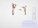 Coll. No. 3184, Orobanche fasciculata. Coll. No. 3184, Orobanche fasciculata.
|
3184
|
Orobanche fasciculata.
Plants of the Douglas Mountain Study Area
Jefferson County Open Space, Colorado, USA
Orobanchaceae
Orobanche fasciculata Nutt.
Clustered Broomrape.
Guy Gulch, Jefferson County, Colorado.
Southwest side of County Road 70 and the gulch, 635 m. northwest of Centennial Ranch, 12.8 km. northwest of the GNIS location of Golden.
39.79771°N, 105.36041°W.
WGS 1984
Elev. 2394 m.
Several plants between two Cercocarpus montanus, with a few Eriogonum umbellatum, no Artemisia sp. nearby.
Collected by permit: Jefferson County Open Space, 2023, issued: Apr 10, 2023, to: Tom Schweich.
|
Tom Schweich, with John Vickery
3184. |
31-Jul-2023 |
|
|
|
|
3185
|
Polygonum douglasii.
Plants of the Douglas Mountain Study Area
Jefferson County Open Space, Colorado, USA
Polygonaceae
Polygonum douglasii Greene.
Douglas Knotweed.
Guy Gulch, Jefferson County, Colorado.
Southwest side of County Road 70 and the gulch, 635 m. northwest of Centennial Ranch, 12.8 km. northwest of the GNIS location of Golden.
39.79764°N, 105.36041°W.
WGS 1984
Elev. 2398 m.
Sunny southeast-facing rocky slope, north ridge above small gulch tributary to Guy Gulch.
Collected by permit: Jefferson County Open Space, 2023, issued: Apr 10, 2023, to: Tom Schweich.
|
Tom Schweich, with John Vickery
3185. |
31-Jul-2023 |
|
|
|
|
3186
|
Mirabilis nyctaginea.
Plants of the Douglas Mountain Study Area
Jefferson County Open Space, Colorado, USA
Nyctaginaceae
Mirabilis nyctaginea (Michx.) MacMill.
Heartleaf Four O'Clock.
Guy Gulch, Jefferson County, Colorado.
Southwest side of County Road 70 and the gulch, 635 m. northwest of Centennial Ranch, 12.8 km. northwest of the GNIS location of Golden.
39.79757°N, 105.36048°W.
WGS 1984
Elev. 2401 m.
Infested with aphids, as usual with this plant.
Sunny southeast-facing rocky slope, north ridge above small gulch tributary to Guy Gulch, also collected here: Dieteria bigelovii, Orobanche fasciculata, Polygonum douglasii, and Muhlenbergia montana.
Collected by permit: Jefferson County Open Space, 2023, issued: Apr 10, 2023, to: Tom Schweich.
|
Tom Schweich, with John Vickery
3186. |
31-Jul-2023 |
|
|
|
|
3187
|
Symphyotrichum porteri.
Plants of the Douglas Mountain Study Area
Jefferson County Open Space, Colorado, USA
Asteraceae
Symphyotrichum porteri (A. Gray) G.L. Nesom.
Smooth White Aster.
Guy Gulch, Jefferson County, Colorado.
Southwest side of County Road 70 and the gulch, 640 m. northwest of Centennial Ranch, 12.8 km. northwest of the GNIS location of Golden.
39.79732°N, 105.36071°W.
WGS 1984
Elev. 2417 m.
Few plants, flowers beginning to open.
Lightly shaded floor of gulch.
Collected by permit: Jefferson County Open Space, 2023, issued: Apr 10, 2023, to: Tom Schweich.
|
Tom Schweich, with John Vickery
3187. |
31-Jul-2023 |
|
|
|
|
3188
|
Thinopyrum intermedium Elymus lanceolatus.
Plants of the Douglas Mountain Study Area
Jefferson County Open Space, Colorado, USA
Poaceae
Thinopyrum intermedium (Host) Barkworth & D.R. Dewey.
Intermediate Wheatgrass.
Guy Gulch, Jefferson County, Colorado.
Southwest side of County Road 70 and the gulch, 660 m. northwest of Centennial Ranch, 12.8 km. northwest of the GNIS location of Golden.
39.79748°N, 105.36092°W.
WGS 1984
Elev. 2422 m.
Strongly rhizomatous, glumes tough, tip small offset mucro.
Sunny southeast-facing rocky slope, north ridge above small gulch tributary to Guy Gulch, also collected here: Artemisia ludoviciana, Symphyotrichum porteri, Allium cernuum and Muhlenbergia montana.
Collected by permit: Jefferson County Open Space, 2023, issued: Apr 10, 2023, to: Tom Schweich.
|
Tom Schweich, with John Vickery
3188. |
31-Jul-2023 |
|
Coll. No. 3188, characters observed:
Perennial grass, 110 cm., strongly rhizomatous;
Leaves,
sheath,
open,
one side ciliate,
other side chartaceous;
ligule,
membraneous,
<1 mm.,
auricles,
1.3 mm.,
longer on one side,
blade,
200 mm. × 4.5 mm. wide,
±flat, somewhat scabrous;
Inflorescence,
1 per culm,
>leaves,
2-sided spike,
190 mm. × 10 mm. wide;
Spikelets,
many,
19 mm. × 7 mm. wide,
similar,
borne singly,
sessile;
Glumes,
lower,
8 mm.,
veins, #5,
upper,
8.5 mm.,
<lowest floret,
veins, #6,
rounded,
tough,
veins scabrous + a few longer hairs,
awns, 0,
tip, offset;
Florets,
#6 (+1);
Lemma,
11.2 mm.,
>glumes,
indurate,
tan center,
green edges,
veins, 5,
hairy on right margin,
awn, tip 0.2 mm,
attached, end;
Palea,
10 mm.,
<lemma (but not by much),
membraneous,
keel, ciliate,
veins, green,
tip, blunt;
Anthers,
4.3 mm.
|
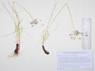 Coll. No. 3189, Allium cernuum. Coll. No. 3189, Allium cernuum.
|
3189
|
Allium cernuum.
Plants of the Douglas Mountain Study Area
Jefferson County Open Space, Colorado, USA
Alliaceae
Allium cernuum Roth.
Nodding Onion.
Guy Gulch, Jefferson County, Colorado.
Southwest side of County Road 70 and the gulch, 660 m. northwest of Centennial Ranch, 12.8 km. northwest of the GNIS location of Golden.
39.79749°N, 105.36094°W.
WGS 1984
Elev. 2423 m.
Flowers just beginning to open.
Sunny southeast-facing rocky slope, north ridge above small gulch tributary to Guy Gulch, also collected here: Artemisia ludoviciana, Symphyotrichum porteri, Muhlenbergia montana, and Thinopyrum intermedium.
Collected by permit: Jefferson County Open Space, 2023, issued: Apr 10, 2023, to: Tom Schweich.
|
Tom Schweich, with John Vickery
3189. |
31-Jul-2023 |
|
|
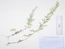 Coll. No. 3190, Artemisia ludoviciana ssp. incompta. Coll. No. 3190, Artemisia ludoviciana ssp. incompta.
|
3190
|
Artemisia ludoviciana.
Plants of the Douglas Mountain Study Area
Jefferson County Open Space, Colorado, USA
Asteraceae
Artemisia ludoviciana Nutt. ssp. incompta (Nutt.) D. D. Keck.
White Sagebrush.
Guy Gulch, Jefferson County, Colorado.
Southwest side of County Road 70 and the gulch, 660 m. northwest of Centennial Ranch, 12.8 km. northwest of the GNIS location of Golden.
39.79756°N, 105.36092°W.
WGS 1984
Elev. 2422 m.
Small plants, leaves deeply lobed, involucres small, in flower.
Sunny southeast-facing rocky slope, north ridge above small gulch tributary to Guy Gulch, also collected here: Symphyotrichum porteri, Allium cernuum, Muhlenbergia montana, and Thinopyrum intermedium.
Collected by permit: Jefferson County Open Space, 2023, issued: Apr 10, 2023, to: Tom Schweich.
|
Tom Schweich, with John Vickery
3190. |
31-Jul-2023 |
|
|
|
Locations:
Munich.
 Marienplatz, Munich Marienplatz, Munich
 Rathaus-Glockenspiel in Marienplatz, Munich. Rathaus-Glockenspiel in Marienplatz, Munich.
|
|
Saturday, 5 August 2023
Munich

Hofbrauhaus in Munich |

Brunch in the Hofbrauhaus, Munich. |
|
|
 Train to Fussen from Munich, via Buchloe. Train to Fussen from Munich, via Buchloe.
|
|
Sunday, 6 August 2023
Munich to Fussen
|
|
Locations:
Fussen.
Lech River.
Neuschwanstein Castle.
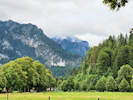 Our first view of the Neuschwanstein from near our apartment in Horn. Our first view of the Neuschwanstein from near our apartment in Horn.
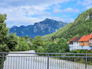 View down river from the bridge over the Lech River. View down river from the bridge over the Lech River.
|
|
Monday, 7 August 2023
Horn, Fussen
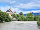
View down river from the bridge over the Lech River. |
Commemoration of French attack on Fussen. |

Frische Waffeln in Fussen, one cinnamon, the other powdered sugar. |
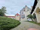
High castle in Fussen. |
|
|
Locations:
Neuschwanstein Castle.
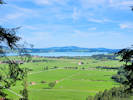 View from near the castle. View from near the castle.
 Ian, Nacho, Nico, Rachel Cheryl, and Sofia. Ian, Nacho, Nico, Rachel Cheryl, and Sofia.
|
|
Tuesday, 8 August 2023
Neuschwanstein Castle
Tom and Cheryl |
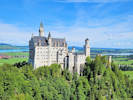
Neuschwanstein Castle from the Marienbrucke. |
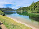
The Alpsee |
|
|
Locations:
Neuschwanstein Castle.
Schwangau.
 The Schloss Neuschwanstein seen from Schwangau. The Schloss Neuschwanstein seen from Schwangau.
 Tom, Cheryl, Nacho, Rachel, Ian, Nico, and Sofia. Tom, Cheryl, Nacho, Rachel, Ian, Nico, and Sofia.
|
|
Schwangau
Felix Mezei with his Lego model of Neuschwanstein castle. |
|
|
Locations:
Fussen.
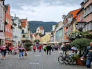 Reichenstrasse, the main street of Fussen. Reichenstrasse, the main street of Fussen.
|
|
Wednesday, 9 August 2023
Fussen
|
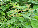 Urtica dioica ssp. pubescens does not sting. Urtica dioica ssp. pubescens does not sting.
|
|
|
|
Locations:
Schwangau.
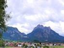 View across Schwangau from Kurpark. View across Schwangau from Kurpark.
|
|
Returned bikes to Schwangau.
|
|
Locations:
Gunzburg.
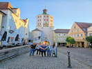 After dinner photo. We ate at the Kebab place on the left. After dinner photo. We ate at the Kebab place on the left.
|
|
Thursday, 10 August 2023
Fussen to Gunzburg
|
|
Locations:
Gunzburg.
 Nico at the entrance to Legoland. Nico at the entrance to Legoland.
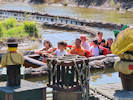 End of the Jungle Adventure ride. End of the Jungle Adventure ride.
|
|
Friday, 11 August 2023
Legoland

Ice cream break. |
|
|
Locations:
Gunzburg.
Ulm.
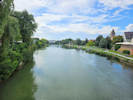 Danube River in Ulm. Danube River in Ulm.
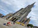 Plaza and cathedral with tallest steeple. Plaza and cathedral with tallest steeple.
|
|
Saturday, 12 August 2023
To Ulm to do laundry.
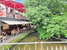
Restaurants in the former fishermans' quarters. |
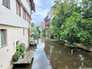
Former fishermans' quarters. |

Sofia, Rachel, Nacho, and Nico. |
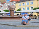
Cheryl in the main plaza of Gunzburg. |
|
|
 Roter Flitzer, historic rail bus in Stuttgart Roter Flitzer, historic rail bus in Stuttgart
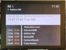 Train sign announcing Trier
and Schweich Train sign announcing Trier
and Schweich
|
|
Sunday, 13 August 2023
Gunzburg to Pfalzel
|
|
Locations:
Pfalzel.
 Interior of our house in Pfalzel. Interior of our house in Pfalzel.
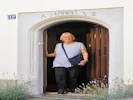 Cheryl in the doorway of our house. Cheryl in the doorway of our house.
|
|
Pfalzel
Cheryl and Nico in the window. |
|
|
Locations:
Schweich.
 The Stefan Andres fountain. The Stefan Andres fountain.
 Rachel and family at the Schweich city sign. Rachel and family at the Schweich city sign.
|
|
Monday, 14 August 2023
A visit to Schweich.
Entrance to Schweich. |
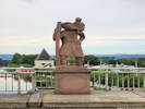
St. Christopher on the Moselle River bridge "Carry us on the stream of life." |
Tom and Cheryl at the Schweich city sign. |
|
|
Locations:
Schweich.
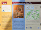 Interpretive panel about St. Martin Holy Way. Interpretive panel about St. Martin Holy Way.
 450 Years, Parish St. Martin Schweich 450 Years, Parish St. Martin Schweich
|
|
Inside St. Martin church. |
St. Martin Church in Schweich. |
Flags for Schweich, the European Union, and Germany. |
|
|
Locations:
Pfalzel.
 Narrow street in Pfalzel. Narrow street in Pfalzel.
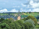 View from bridge over Moselle River. View from bridge over Moselle River.
|
|
Tuesday, 15 August 2023
Down day arounf Pfalzel.
Carex in a window box. |
|
|
Locations:
Trier.
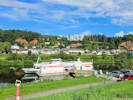 Our boat for the river cruise. Our boat for the river cruise.
|
|
Wednesday, 16 August 2023
Boat trip up the Moselle and Saar River.
|
|
Locations:
Moselle River.
Saar River.
 Passing a scrap barge. Passing a scrap barge.
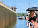 The scrap boat enters the lock behind us. The scrap boat enters the lock behind us.
|
|
Trier to Saarburg
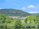
Village along the Moselle River. |
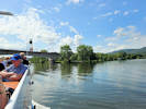
Entering the mouth of the Saar River. |
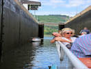
Entering the lock on the Saar River. |
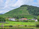
Vinyards along the Saar River. |
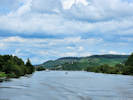
Looking downstream, Saarkanal on left, Saar River on the right. |

Cheryl and Ian. |
|
|
Locations:
Saarburg.
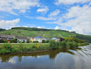 Vinyards on the outskirts of Saarburg. Vinyards on the outskirts of Saarburg.
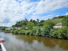 Coming into Saarburg. Coming into Saarburg.
|
|
Saarburg
Saarburg Castle. |
Narrow street in Saarburg. |
Waterfall and water-powered wheels in Saarburg. |
Restaurants along the stream. |
|
|
|
|
Saarburg to Trier
|
|
Locations:
Trier.
 Dreikonigenhaus. Dreikonigenhaus.
 Porta Negra Porta Negra
|
|
Thursday, 17 August 2023
Pfalzel to Frankfurt.
|
|
Locations:
Frankfurt.
 Wedding party in old town hall. Wedding party in old town hall.
 Lunch in the Apple Wine district. Lunch in the Apple Wine district.
|
|
Friday, 18 August 2023
Day in Frankfurt.
Lunch in the Apple Wine district. |
|
|
|
|
Saturday, 19 August 2023
Frankfurt to Golden
|
|
Locations:
Colorado School of Mines Survey Field.
|
|
Sunday, 27 August 2023
|
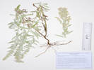 Coll. No. 3191, Artemisia ludoviciana ssp. ludoviciana. Coll. No. 3191, Artemisia ludoviciana ssp. ludoviciana.
|
3191
|
Pseudognaphalium, maybe P. macounii.
|
Native and Naturalized Flora of the Golden Area, Jefferson County, Colorado
Asteraceae
Artemisia ludoviciana Nutt. ssp. ludoviciana.
White Sagebrush.
Colorado School of Mines Survey Field, Jefferson County, Colorado.
Southeast corner of Survey Field, 2.45 km. (geodesic) south of the GNIS location of Golden
39.73354°N, 105.21837°W.
WGS 1984
Elev. 1819 m.
Perennial herb, rhizomatous, not woody, infl. a narrow panicle, leaves entire.
Highest mixed grass prairie near Rocky Mountain Front Range scarp, also nearby: Asclepias pumila, Ambrosia psilostachya, Artemisia dracunculus, Liatris punctata, and Evolvulus nuttallianus.
Collected by permit: Colorado School of Mines, 2023, issued: May 9, 2023, to: Tom Schweich.
|
Tom Schweich
3191. |
27-Aug-2023 |
|
|
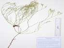 Coll. No. 3192, Eriogonum effusum. Coll. No. 3192, Eriogonum effusum.
|
3192
|
Eriogonum effusum.
|
Native and Naturalized Flora of the Golden Area, Jefferson County, Colorado
Polygonaceae
Eriogonum effusum Nuttall, Proc. Acad. Nat. Sci. Philadelphia. 4: 15. 1848.
Spreading Buckwheat.
Colorado School of Mines Survey Field, Jefferson County, Colorado.
Top of slope overlooking an unnamed stream to the northwest, southeast quadrant of the Survey Field, 2.36 km. (geodesic) south of the GNIS location of Golden.
39.73432°N, 105.21896°W.
WGS 1984
Elev. 1826 m.
Leaves withered.
Highest mixed grass prairie near Rocky Mountain Front Range scarp, also nearby: Gutierrezia sarothrae, Senecio spartioides, and Cercocarpus montanus.
Collected by permit: Colorado School of Mines, Edgar Mine 2022, issued: May 31, 2022, to: Tom Schweich.
|
Tom Schweich
3192. |
27-Aug-2023 |
|
|
|
|
3193
|
Gutierrezia sarothrae.
|
Native and Naturalized Flora of the Golden Area, Jefferson County, Colorado
Asteraceae
Gutierrezia sarothrae (Pursh) Britton & Rusby.
Broom Snakeweed.
Colorado School of Mines Survey Field, Jefferson County, Colorado.
Top of northwest-facing slope overlooking an unnamed stream to the northwest, southeast quadrant of the Survey Field, 2.36 km. (geodesic) south of the GNIS location of Golden.
39.73434°N, 105.21897°W.
WGS 1984
Elev. 1820 m.
Flowers just beginning to open.
Highest Great Plains mixed grass near Rocky Mountain Front Range scarp, also nearby: Senecio spartioides, Eriogonum effusum, and Cercocarpus montanus.
Collected by permit: Colorado School of Mines, 2023, issued: May 9, 2023, to: Tom Schweich.
|
Tom Schweich
3193. |
27-Aug-2023 |
|
|
|
|
3194
|
Saponaria officinalis.
|
Native and Naturalized Flora of the Golden Area, Jefferson County, Colorado
Caryophyllaceae
Saponaria officinalis L.
Bouncingbet.
Colorado School of Mines Survey Field, Jefferson County, Colorado.
In a former oxbow of an unnamed creek in the southeast quadrant of the Survey Field, 2.28 km. (geodesic) south of the GNIS location of Golden.
39.73499°N, 105.21948°W.
WGS 1984
Elev. 1806 m.
Large patch in a larger patch of Bromus inermis.
Colorado Noxious Weed List B.
Collected by permit: Colorado School of Mines, Edgar Mine 2022, issued: May 31, 2022, to: Tom Schweich.
|
Tom Schweich
3194. |
27-Aug-2023 |
|
|
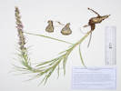 Coll. No. 3195, Liatris punctata. Coll. No. 3195, Liatris punctata.
|
3195
|
Liatris punctata.
|
Native and Naturalized Flora of the Golden Area, Jefferson County, Colorado
Asteraceae
Liatris punctata Hook.
Dotted Blazing Star.
Colorado School of Mines Survey Field, Jefferson County, Colorado.
Small divide between two unnamed streams, southeast quadrant of Survey Field, 2.23 km. (geodesic) south of the GNIS location of Golden.
39.73546°N, 105.2205°W.
WGS 1984
Elev. 1810 m.
Highest Great Plains at Rocky Mountain Front Range scarp, more or less disturbed mixed grass, where some quarrying has occurred, also collected here: Cleomella serrulata, Salsola tragus and Eriocoma hymenoides.
Collected by permit: Colorado School of Mines, Edgar Mine 2022, issued: May 31, 2022, to: Tom Schweich.
|
Tom Schweich
3195. |
27-Aug-2023 |
|
|
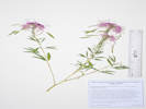 Coll. No. 3196, Cleomella serrulata. Coll. No. 3196, Cleomella serrulata.
|
3196
|
Cleomella serrulata.
|
Native and Naturalized Flora of the Golden Area, Jefferson County, Colorado
Cleomaceae
Cleomella serrulata (Pursh) Roalson & J. C. Hall.
Rocky Mountain Bee Plant.
Colorado School of Mines Survey Field, Jefferson County, Colorado.
Small divide between two unnamed streams, southeast quadrant of Survey Field, 2.23 km. (geodesic) south of the GNIS location of Golden.
39.73543°N, 105.22054°W.
WGS 1984
Elev. 1812 m.
Highest Great Plains at Rocky Mountain Front Range scarp, edge of disturbed area, where some quarrying has occurred, also collected here: Liatris punctata, Salsola tragus and Eriocoma hymenoides.
Collected by permit: Colorado School of Mines, 2023, issued: May 9, 2023, to: Tom Schweich.
|
Tom Schweich
3196. |
27-Aug-2023 |
|
|
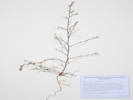 Coll. No. 3197, Salsola tragus. Coll. No. 3197, Salsola tragus.
|
3197
|
Salsola, maybe S. tragus?
|
Native and Naturalized Flora of the Golden Area, Jefferson County, Colorado
Chenopodiaceae
Salsola tragus L.
Tumbleweed.
Colorado School of Mines Survey Field, Jefferson County, Colorado.
Small divide between two unnamed streams, southeast quadrant of Survey Field, 2.23 km. (geodesic) south of the GNIS location of Golden.
39.73542°N, 105.22058°W.
WGS 1984
Elev. 1813 m.
Highest Great Plains at Rocky Mountain Front Range scarp, disturbed area of limestone mining, also collected here: Liatris punctata, Cleomella serrulata and Eriocoma hymenoides.
Collected by permit: Colorado School of Mines, 2023, issued: May 9, 2023, to: Tom Schweich.
|
Tom Schweich
3197. |
27-Aug-2023 |
|
|
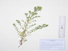 Coll. No. 3198, Symphyotrichum ericoides. Coll. No. 3198, Symphyotrichum ericoides.
|
3198
|
Symphyotrichum ericoides.
|
Native and Naturalized Flora of the Golden Area, Jefferson County, Colorado
Asteraceae
Symphyotrichum ericoides (Linnaeus) G. L. Nesom.
White Heath Aster.
Colorado School of Mines Survey Field, Jefferson County, Colorado.
Bank of unnamed creek, near southern boundary of the southeast quadrant of Survey Field, 2.49 km. (geodesic) south of the GNIS location of Golden.
39.73319°N, 105.22078°W.
WGS 1984
Elev. 1822 m.
Collected by permit: Colorado School of Mines, 2023, issued: May 9, 2023, to: Tom Schweich.
|
Tom Schweich
3198. |
27-Aug-2023 |
|
|
|
Locations:
Clear Creek Canyon Park.
Welch Ditch.
|
|
Tuesday, 29 August 2023
Looking for hops along the Welch Ditch.
|
|
Other articles:
• Welch Ditch:
12985;
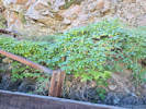 Coll. No. 3199, Humulus neomexicanus Coll. No. 3199, Humulus neomexicanus
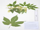 Coll. No. 3199, Humulus neomexicanus. Coll. No. 3199, Humulus neomexicanus.
|
3199
|
Humulus sp.
Plants of Jefferson County Open Space
Jefferson County, Colorado
Cannabaceae
Humulus neomexicanus (A. Nelson & Cockerell) Rydb.
New Mexican Hops.
Welch Ditch, Jefferson County, Colorado.
Mouth of Clear Creek Canyon, hill side of Welch Ditch, near junction of climbing access trail and at a gate formerly used to close access to the trail, 3.39 km. (geodesic) west of the GNIS location of Golden.
39.74937°N, 105.25052°W.
WGS 1984
Elev. 1717 m.
Nearly all above the flume, small amount below, with Clematis ligusticifolia, Ribes cereum, Holodiscus dumosus, and Brickellia californica.
GPS coordinates place collection on the Peaks to Plains Trail about 25 m. southwest of actual location, perhaps because of the steepness of the cliffs here. One of three collections made along the Welch Ditch on this date.
Collected by permit: Jefferson County Open Space, 2023, issued: Apr 10, 2023, to: Tom Schweich.
|
Tom Schweich
3199. |
29-Aug-2023 |
|
|
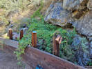 Coll. No. 3200, Humulus neomexicanus Coll. No. 3200, Humulus neomexicanus
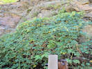 Coll. No. 3200, Humulus neomexicanus Coll. No. 3200, Humulus neomexicanus
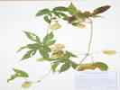 Coll. No. 3200, Humulus neomexicanus. Coll. No. 3200, Humulus neomexicanus.
|
3200
|
Humulus sp.
Plants of Jefferson County Open Space
Jefferson County, Colorado
Cannabaceae
Humulus neomexicanus (A. Nelson & Cockerell) Rydb.
New Mexican Hops.
Welch Ditch, Jefferson County, Colorado.
Mouth of Clear Creek Canyon, beside the flume of the Welch Ditch, 2.53 km. (geodesic) west southwest of the GNIS location of Golden.
39.74679°N, 105.24832°W.
WGS 1984
Elev. 1717 m.
Sunny southwest-facing site, upper side of the flume, in a small steep gulch, with Holodiscus dumosus, and Cercocarpus montanus.
Collected by permit: Jefferson County Open Space, 2023, issued: Apr 10, 2023, to: Tom Schweich.
|
Tom Schweich
3200. |
29-Aug-2023 |
|
|
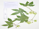 Coll. No. 3201, Humulus neomexicanus. Coll. No. 3201, Humulus neomexicanus.
|
3201
|
Humulus sp.
Plants of Jefferson County Open Space
Jefferson County, Colorado
Cannabaceae
Humulus neomexicanus (A. Nelson & Cockerell) Rydb.
New Mexican Hops.
Welch Ditch, Jefferson County, Colorado.
Mouth of Clear Creek Canyon, along the Welch Ditch in a small steep gulch, 2.55 km. (geodesic) west southwest of the GNIS location of Golden.
39.74466°N, 105.2486°W.
WGS 1984
Elev. 1725 m.
Upper side of flume, wetter site, edge of Douglas fir and water birch.
GPS coordinates inaccurate due to cliffs in the canyon; actual location about 80 meters to the northeast. One of three collections of hops made along the ditch this day.
Collected by permit: Jefferson County Open Space, 2023, issued: Apr 10, 2023, to: Tom Schweich.
|
Tom Schweich
3201. |
29-Aug-2023 |
|
|
|
Locations:
Golden History Park.
|
|
Golden History Park
|
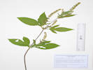 Coll. No. 3202, Ambrosia trifida. Coll. No. 3202, Ambrosia trifida.
|
3202
|
Ambrosia trifida
|
Native and Naturalized Flora of the Golden Area, Jefferson County, Colorado
Asteraceae
Ambrosia trifida L.
Giant Ragweed.
Golden History Park, Jefferson County, Colorado.
West end of Golden History Park, at the western entrance gate, 395 m. west of the GNIS location of Golden.
39.75469°N, 105.22556°W.
WGS 1984
Elev. 1733 m.
Most likely native to Golden, but found in an area of planted, non-native, vegetation.
Collected by permit: City of Golden, 2023, issued: Mar 13, 2023, to: Tom Schweich.
|
Tom Schweich
3202. |
29-Aug-2023 |
|
|
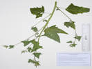 Coll. No. 3203, Chenopodium album. Coll. No. 3203, Chenopodium album.
|
3203
|
Atriplex hortensis
|
Native and Naturalized Flora of the Golden Area, Jefferson County, Colorado
Chenopodiaceae
Chenopodium album L.
Lambsquarters.
Golden History Park, Jefferson County, Colorado.
West end of Golden History Park, at the western entrance gate, 395 m. west of the GNIS location of Golden.
39.75466°N, 105.22554°W.
WGS 1984
Elev. 1733 m.
Apparently naturalized, found in an area of native and non-native vegetation.
Collected by permit: City of Golden, 2023, issued: Mar 13, 2023, to: Tom Schweich.
|
Tom Schweich
3203. |
29-Aug-2023 |
|
|
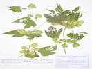 Coll. No. 3204, Humulus lupulus. Coll. No. 3204, Humulus lupulus.
|
3204
|
Humulus sp.
|
Native and Naturalized Flora of the Golden Area, Jefferson County, Colorado
Cannabaceae
Humulus lupulus L.
Common Hops.
Golden History Park, Jefferson County, Colorado.
Escaping the cultivated demonstration garden at the Golden History Park, adjacent to 11th Street, about 290 m. west of the GNIS location of Golden.
39.75507°N, 105.22446°W.
WGS 1984
Elev. 1733 m.
Collected by permit: City of Golden, 2023, issued: Mar 13, 2023, to: Tom Schweich.
|
Tom Schweich
3204. |
29-Aug-2023 |
|
|
|
Locations:
Welch Ditch.
|
|
Wednesday, 30 August 2023
Welch Ditch
|
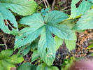 Coll. No. 3205, Humulus neomexicanus Coll. No. 3205, Humulus neomexicanus
|
3205
|
Humulus lupulus ssp. neomexicana.
Combined with Coll. No. 3199.
|
|
Other articles:
• Golden Checklist Flora:
Froelichia gracilis;
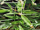 Coll No. 3206, Froelichia gracilis. Coll No. 3206, Froelichia gracilis.
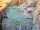 Coll No. 3206, Froelichia gracilis. Coll No. 3206, Froelichia gracilis.
|
3206
|
Froelichia gracilis.
Plants of Jefferson County Open Space
Jefferson County, Colorado
Amaranthaceae
Froelichia gracilis (Hook.) Moq.
Slender Snakecotton.
Welch Ditch, Jefferson County, Colorado.
Mouth of Clear Creek Canyon, in loose gravel and rocks between cliff and the flume of Welch Ditch, 2.60 km. (geodesic) west southwest of the GNIS location of Golden.
39.74753°N, 105.24967°W.
WGS 1984
Elev. 1784 m.
Upper side of flume only, not seen below. Only plant growing here.
Collected by permit: Jefferson County Open Space, 2023, issued: Apr 10, 2023, to: Tom Schweich.
|
Tom Schweich
3206. |
30-Aug-2023 |
|
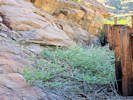
Coll No. 3206, Froelichia gracilis. |
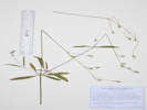
Coll. No. 3206, Froelichia gracilis. |
|
|
Other articles:
• (New) Social Trail:
at the bottom;
Locations:
Schweich Hill.
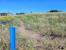 Lower end of new social trail. Lower end of new social trail.
|
|
Tuesday, 5 September 2023
Schweich Hill
|
|
Literature Cited:
- Primack, Richard B., and Carina Terry, 2021.
Other articles:
• Social Trail (Arapahoe to N. Rubey):
at drain;
• (New) Social Trail:
near middle;
near middle;
Locations:
Schweich Hill.
|
|
Wednesday, 6 September 2023
Schweich Hill, and review of Ailanthus altissima and Elaeagnus angustifolium.
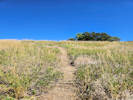
Middle of new social trail, looking uphill. |
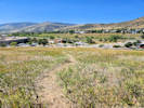
Middle of new social trail, looking downhill. |
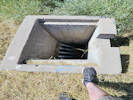
Grate off. |
|
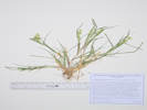 Coll. No. 3206.5, Cenchrus longispinus. Coll. No. 3206.5, Cenchrus longispinus.
|
3206.5
|
Cenchrus longispinus.
|
Native and Naturalized Flora of the Golden Area, Jefferson County, Colorado
Poaceae
Cenchrus longispinus (Hack.) Fern.
Longspine Sandbur.
DeLong Park (City of Golden), Jefferson County, Colorado.
In planted native grass beds, along 23rd Street, opposite Vernon Drive, 1.72 km. southeast of the GNIS location of Golden.
39.74893°N, 105.20797°W.
WGS 1984
Elev. 1765 m.
Annual grass, collected in its second growing season at this site, suggesting it is naturalized here.
Native to Colorado, but usually found in sandy habitats. Not previously collected at any other location in or near Golden; unclear whether this grass was previously here, brought in with the soil amendment, or was a contaminant in the seed mix.
DeLong Park was a private residence that was left fallow for a number of years, then converted to a city park in 2021-2022.
Collected by permit: City of Golden, 2023, issued: Mar 13, 2023, to: Tom Schweich.
|
Tom Schweich
3206.5 |
7-Sep-2023 |
|
|
|
Locations:
Guy Gulch.
|
|
Friday, 8 September 2023
Guy Gulch.
|
|
|
3207
|
Symphyotrichum porteri.
Plants of the Douglas Mountain Study Area
Jefferson County Open Space, Colorado, USA
Asteraceae
Symphyotrichum porteri (A. Gray) G.L. Nesom.
Smooth White Aster.
Guy Gulch, Jefferson County, Colorado.
Work or parking area in front of ranch sheds, 40 m. southeast of the Centennial Ranch house, 15.8 km. (geodesic) northwest of Golden.
39.79451°N, 105.35384°W.
WGS 1984
Elev. 2350 m.
With Dieteria bigelovii.
Collected by permit: Jefferson County Open Space, 2023, issued: Apr 10, 2023, to: Tom Schweich.
|
Tom Schweich, with John Vickery
3207. |
8-Sep-2023 |
|
|
|
|
3208
|
Dieteria bigelovii.
Plants of the Douglas Mountain Study Area
Jefferson County Open Space, Colorado, USA
Asteraceae
Dieteria bigelovii (A. Gray) D. R. Morgan & R. L. Hartman.
Bigelow's Tansy Aster.
Guy Gulch, Jefferson County, Colorado.
Work or parking area in front of ranch sheds, 40 m. southeast of the Centennial Ranch house, 15.8 km. (geodesic) northwest of Golden.
39.79451°N, 105.35384°W.
WGS 1984
Elev. 2350 m.
With Symphyotrichum porteri.
Collected by permit: Jefferson County Open Space, 2023, issued: Apr 10, 2023, to: Tom Schweich.
|
Tom Schweich, with John Vickery
3208. |
8-Sep-2023 |
|
|
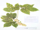 Coll. No. 3209, Humulus lupulus. Coll. No. 3209, Humulus lupulus.
|
3209
|
Humulus neomexicanus.
Plants of the Douglas Mountain Study Area
Jefferson County Open Space, Colorado, USA
Cannabaceae
Humulus lupulus L.
Common Hops.
Guy Gulch, Jefferson County, Colorado.
In a culvert with flowing water on the northeast side of County Road 70, 35 m. south of the Centennial Ranch house, 12.2 km. (geodesic) west northwest of the GNIS location of Golden.
39.79445°N, 105.35403°W.
WGS 1984
Elev. 2351 m.
Collected by permit: Jefferson County Open Space, 2023, issued: Apr 10, 2023, to: Tom Schweich.
|
Tom Schweich, with John Vickery
3209. |
8-Sep-2023 |
|
|
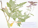 Coll. No. 3210, Cirsium arvense. Coll. No. 3210, Cirsium arvense.
|
3210
|
Cirsium arvense.
Plants of the Douglas Mountain Study Area
Jefferson County Open Space, Colorado, USA
Asteraceae
Cirsium arvense (L.) Scop.
Canada Thistle.
Guy Gulch, Jefferson County, Colorado.
Broken shade up a small gulch 30 m. northeast of the Centennial Ranch house, 12.2 km. (geodesic) northwest of the GNIS location of Golden.
39.79491°N, 105.35385°W.
WGS 1984
Elev. 2357 m.
Colorado Noxious Weed List B. EDDMapS Record ID 11926494.
Collected by permit: Jefferson County Open Space, 2023, issued: Apr 10, 2023, to: Tom Schweich.
|
Tom Schweich, with John Vickery
3210. |
8-Sep-2023 |
|
|
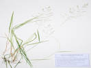 Coll. No. 3211, Coll. No. 3211, Agrostis stolonifera Agrostis gigantea.
|
3211
|
Fine, rhizomatous grass.
Plants of the Douglas Mountain Study Area
Jefferson County Open Space, Colorado, USA
Poaceae
Agrostis stolonifera L.
Creeping Bentgrass.
Guy Gulch, Jefferson County, Colorado.
Shaded streamside 35 m. behind and northeast of the Centennial Ranch house, 12.2 km. (geodesic) northwest of the GNIS location of Golden.
39.79494°N, 105.3538°W.
WGS 1984
Elev. 2362 m.
Fine grass, rhizomatous stoloniferous.
Collected by permit: Jefferson County Open Space, 2023, issued: Apr 10, 2023, to: Tom Schweich.
|
Tom Schweich, with John Vickery
3211. |
8-Sep-2023 |
|
Agrostis gigantea, Jan Wingate, 4/24/2024.
|
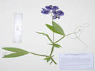 Coll. No. 3212, Lathyrus latifolia. Coll. No. 3212, Lathyrus latifolia.
|
3212
|
Lathyrus latifolius.
Plants of the Douglas Mountain Study Area
Jefferson County Open Space, Colorado, USA
Fabaceae
Lathyrus latifolius L.
Perennial Pea Vine.
Guy Gulch, Jefferson County, Colorado.
In the gulch about 45 m. behind and northwest of the Centennial Ranch house, 12.2 km. (geodesic) northwest of the GNIS location of Golden.
39.79512°N, 105.35383°W.
WGS 1984
Elev. 2364 m.
In the open beside stream, also here: Cirsium arvense, Campanula rapunculoides, Arctostaphylos uva-ursi, and Agrostis stolonifera.
Collected by permit: Jefferson County Open Space, 2023, issued: Apr 10, 2023, to: Tom Schweich.
|
Tom Schweich, with John Vickery
3212. |
8-Sep-2023 |
|
|
|
|
3213
|
Arctostaphylos uva-ursi.
Plants of the Douglas Mountain Study Area
Jefferson County Open Space, Colorado, USA
Ericaceae
Arctostaphylos uva-ursi (L.) Sprengel.
Bearberry.
Guy Gulch, Jefferson County, Colorado.
In the gulch about 45 m. behind and northeast of the Centennial Ranch house, 12.2 km. (geodesic) northwest of the GNIS location of Golden.
39.79503°N, 105.35387°W.
WGS 1984
Elev. 2366 m.
Base of small Ponderosa pine, also here: Cirsium arvense, Campanula rapunculoides, Lathyrus latifolia, and Agrostis stolonifera.
Collected by permit: Jefferson County Open Space, 2023, issued: Apr 10, 2023, to: Tom Schweich.
|
Tom Schweich, with John Vickery
3213. |
8-Sep-2023 |
|
|
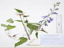 Coll. No. 3214, Campanula rapunculoides. Coll. No. 3214, Campanula rapunculoides.
|
3214
|
Campanula rapunculoides.
Plants of the Douglas Mountain Study Area
Jefferson County Open Space, Colorado, USA
Campanulaceae
Campanula rapunculoides L.
Rampion Bellflower.
Guy Gulch, Jefferson County, Colorado.
In the gulch about 55 m. behind and northeast of the Centennial Ranch house, 12.2 km. (geodesic) northwest of the GNIS location of Golden.
39.79517°N, 105.35368°W.
WGS 1984
Elev. 2369 m.
Nearly all vegetative, beside stream, rooted in moss.
EDDMapS Record ID 11942190.
Collected by permit: Jefferson County Open Space, 2023, issued: Apr 10, 2023, to: Tom Schweich.
|
Tom Schweich, with John Vickery
3214. |
8-Sep-2023 |
|
|
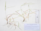 Coll. No. 3215, Carex aurea. Coll. No. 3215, Carex aurea.
|
3215
|
Carex aurea.
Plants of the Douglas Mountain Study Area
Jefferson County Open Space, Colorado, USA
Cyperaceae
Carex aurea Nutt.
Golden Sedge.
Guy Gulch, Jefferson County, Colorado.
In the gulch about 75 m. behind and northeast of the Centennial Ranch house, 12.2 km. (geodesic) northwest of the GNIS location of Golden.
39.79538°N, 105.35361°W.
WGS 1984
Elev. 2373 m.
In ponderosa pine duff beside creek.
Collected by permit: Jefferson County Open Space, 2023, issued: Apr 10, 2023, to: Tom Schweich.
|
Tom Schweich, with John Vickery
3215. |
8-Sep-2023 |
|
|
|
|
3216
|
Epilobium ciliatum.
Plants of the Douglas Mountain Study Area
Jefferson County Open Space, Colorado, USA
Onagraceae
Epilobium ciliatum Raf.
Fringed Willowherb.
Guy Gulch, Jefferson County, Colorado.
In the gulch about 140 m. behind and northeast of the Centennial Ranch house, 12.2 km. (geodesic) northwest of the GNIS location of Golden.
39.79589°N, 105.35334°W.
WGS 1984
Elev. 2386 m.
Rooted in stream.
Collected by permit: Jefferson County Open Space, 2023, issued: Apr 10, 2023, to: Tom Schweich.
|
Tom Schweich, with John Vickery
3216. |
8-Sep-2023 |
|
|
|
|
3217
|
Heliomeris multiflora.
Plants of the Douglas Mountain Study Area
Jefferson County Open Space, Colorado, USA
Asteraceae
Heliomeris multiflora Nutt. var. multiflora.
Showy Golden Eye.
Guy Gulch, Jefferson County, Colorado.
Southeast-facing hill slope abobe the gulch about 285 m. behind and northeast of the Centennial Ranch house, 12.2 km. (geodesic) northwest of the GNIS location of Golden.
39.79714°N, 105.35275°W.
WGS 1984
Elev. 2427 m.
Collected by permit: Jefferson County Open Space, 2023, issued: Apr 10, 2023, to: Tom Schweich.
|
Tom Schweich, with John Vickery
3217. |
8-Sep-2023 |
|
|
|
Other articles:
• Magpie Gulch Trail:
social train down;
Locations:
New Loveland Mine Park.
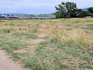 Upper end of the shortcut social trail. Upper end of the shortcut social trail.
|
|
Sunday, 10 September 2023
|
|
Other articles:
• Social Trail (N. Wash. OS):
at new social trail;
• (New) Social Trail:
at top;
Locations:
Schweich Hill.
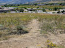 Upper end of the new social trail. Upper end of the new social trail.
|
|
Tuesday, 12 September 2023
Schweich Hill, mostly to see the Brickellia eupatorioides.
|
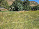 General location of Coll. No. 3218, Brickellia eupatorioides. General location of Coll. No. 3218, Brickellia eupatorioides.
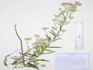 Coll. No. 3218, Brickellia eupatorioides. Coll. No. 3218, Brickellia eupatorioides.
|
3218
|
Brickellia eupatorioides.
|
Native and Naturalized Flora of the Golden Area, Jefferson County, Colorado
Asteraceae
Brickellia eupatorioides (L.) Shinners.
False Boneset.
Schweich Hill, Jefferson County, Colorado.
Near the northern border of Schweich Hill, in the eastern section that was mowed by neighbors for about twenty years, 1.75 km. (geodesic) north northwest of the GNIS location of Golden.
39.76885°N, 105.23204°W.
WGS 1984
Elev. 1798 m.
20-30 plants mostly concentrated in a 10 m x 10 m patch, scattered in Bromus inermis with Artemisia dracunculus, Ericameria nauseosa var. graveolens, and Liatris punctata.
Mowing occurred from approximately 2007 to 2018. Other collections may identify this location as “North Washington Open Space.”
Collected by permit: City of Golden, 2023, issued: Mar 13, 2023, to: Tom Schweich.
|
Tom Schweich
3218. |
12-Sep-2023 |
|
|
|
|
|
Since the adjoining neighbors have stopped mowing this area, the Bromus inermis “smooth brome” has gotten larger.
There are also several native subshrubs that are competing with the smooth brome, including:
Ambrosia psilostachya,
Artemisia dracunculus,
Artemisia ludoviciana,
Heterotheca villosa,
Liatris punctata,
Symphyotrichum ericoides,
Pediomelum tenuiflorum,
and, of course, the shrub Ericameria nauseosa var. graveolens.
|
|
|
3219
|
Artemisia ludoviciana.
|
Native and Naturalized Flora of the Golden Area, Jefferson County, Colorado
Asteraceae
Artemisia ludoviciana Nutt. ssp. ludoviciana.
White Sagebrush.
Schweich Hill, Jefferson County, Colorado.
Near the western border of Schweich Hill, about mid-way up the slope, 1.81 km. (geodesic) north northwest of the GNIS location of Golden.
39.76851°N, 105.23388°W.
WGS 1984
Elev. 1819 m.
This area was graded then revegetated circa 2006, though this taxon is more likely adventive rather than revegetated. Other collections may identify this location as “North Washington Open Space.”
Collected by permit: City of Golden, 2023, issued: Mar 13, 2023, to: Tom Schweich.
|
Tom Schweich
3219. |
12-Sep-2023 |
|
|
|
|
3220
|
Ambrosia acanthocarpa
|
Native and Naturalized Flora of the Golden Area, Jefferson County, Colorado
Asteraceae
Ambrosia psilostachya DC.
Western Ragweed.
Schweich Hill, Jefferson County, Colorado.
Top of hill, center of parcel, 1.77 km. (geodesic) north northwest of the GNIS location of Golden.
39.76853°N, 105.23302°W.
WGS 1984
Elev. 1821 m.
Plants of short stature.
Southwest aspect, top of hill, gravel-covered upturned Laramie and Arapahoe Formations.
Other collections identify this location as “North Washington Open Space.”
Collected by permit: City of Golden, 2023, issued: Mar 13, 2023, to: Tom Schweich.
|
Tom Schweich
3220. |
12-Sep-2023 |
|
|
|
Other articles:
• Eagle Ridge Drive:
at park;
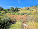 Epilobium hirsutum in fall after being sprayed. Epilobium hirsutum in fall after being sprayed.
|
|
Wednesday, 13 September 2023
|
|
Locations:
Colorado School of Mines Survey Field.
|
|
Sunday, 17 September 2023
Colorado School of Mines Survey Field
|
|
|
3221
|
Gutierrezia sarothrae.
|
Native and Naturalized Flora of the Golden Area, Jefferson County, Colorado
Asteraceae
Gutierrezia sarothrae (Pursh) Britton & Rusby.
Broom Snakeweed.
Colorado School of Mines Survey Field, Jefferson County, Colorado.
Northwest corner of the Survey Field, highest Great Plains at base of Rocky Mountain Front Range scarp, 1.92 km. southwest of the GNIS location of Golden
39.73965°N, 105.22997°W.
WGS 1984
Elev. 1863 m.
With Bouteloua gracilis, Bromus inermis, Ambrosia psilostachya, and Helianthus pumilus.
Collected by permit: Colorado School of Mines, Edgar Mine 2022, issued: May 31, 2022, to: Tom Schweich.
|
Tom Schweich
3221. |
17-Sep-2023 |
|
|
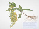 Coll. No. 3222, Solidago nemoralis ssp. decemflora. Coll. No. 3222, Solidago nemoralis ssp. decemflora.
|
3222
|
Solidago sp.
|
Native and Naturalized Flora of the Golden Area, Jefferson County, Colorado
Asteraceae
Solidago nemoralis Aiton ssp. decemflora (de Candolle) Brammall ex Semple.
Gray Goldenrod.
Colorado School of Mines Survey Field, Jefferson County, Colorado.
Northwest corner of Survey Field, north-facing slope of small gulch, 1.97 km. southwest of the GNIS location of Golden.
39.73902°N, 105.22941°W.
WGS 1984
Elev. 1873 m.
Highest Great Plains at base of Rocky Mountain Front Range scarp, with Juniperus scopulorum and Pinus ponderosa.
Collected by permit: Colorado School of Mines, Edgar Mine 2022, issued: May 31, 2022, to: Tom Schweich.
|
Tom Schweich
3222. |
17-Sep-2023 |
|
|
|
|
3223
|
Ambrosia psilostachya.
|
Native and Naturalized Flora of the Golden Area, Jefferson County, Colorado
Asteraceae
Ambrosia psilostachya DC.
Western Ragweed.
Colorado School of Mines Survey Field, Jefferson County, Colorado.
Mixed grass prairie, highest Great Plains at the Rocky Mountain Front Range scarp, northwest corner of the Survey Field, 2.02 km. southwest of the GNIS location of Golden.
39.73856°N, 105.22933°W.
WGS 1984
Elev. 1873 m.
Very similar to Coll. No. 3224, but much more tall.
Common plant of the plains of Colorado, especially up against the Front Range, also found at lower elevations on the west slope.
Collected by permit: Colorado School of Mines, 2023, issued: May 9, 2023, to: Tom Schweich.
|
Tom Schweich
3223. |
17-Sep-2023 |
|
|
|
|
3224
|
Ambrosia, more compact than the previous, A. acanthicarpa?
|
Native and Naturalized Flora of the Golden Area, Jefferson County, Colorado
Asteraceae
Ambrosia acanthicarpa Hook.
Flat-Spine Burr-Ragweed.
Colorado School of Mines Survey Field, Jefferson County, Colorado.
Mixed grass prairie, highest Great Plains at the Rocky Mountain Front Range scarp, northwest corner of the Survey Field, 2.02 km. southwest of the GNIS location of Golden.
39.73854°N, 105.22936°W.
WGS 1984
Elev. 1883 M.
Very similar to Coll. No. 3223, but more compact plant.
Common plant of the plains of Colorado, especially up against the Front Range, also found at lower elevations on the west slope.
Collected by permit: Colorado School of Mines, 2023, issued: May 9, 2023, to: Tom Schweich.
|
Tom Schweich
3224. |
17-Sep-2023 |
|
|
|
|
3225
|
Andropogon gerardii.
|
Native and Naturalized Flora of the Golden Area, Jefferson County, Colorado
Poaceae
Andropogon gerardii Vitman.
Big Bluestem.
Colorado School of Mines Survey Field, Jefferson County, Colorado.
Northwest corner of the Survey Field, mixed grass prairie, highest Great Plains at the Rocky Mountain Front Range scarp, 2.04 km. southwest of the GNIS location of Golden.
39.73829°N, 105.22939°W.
WGS 1984
Elev. 1885 m.
Collected by permit: Colorado School of Mines, 2023, issued: May 9, 2023, to: Tom Schweich.
|
Tom Schweich
3225. |
17-Sep-2023 |
|
|
|
|
3226
|
Ericameria nauseosa var. graveolens.
|
Native and Naturalized Flora of the Golden Area, Jefferson County, Colorado
Asteraceae
Ericameria nauseosa (Pall. ex Pursh) G.L.Nesom & G.I.Baird var. graveolens (Nutt.) Reveal & Schuyler.
Goldy-Locks.
Colorado School of Mines Survey Field, Jefferson County, Colorado.
Northwest corner of the Survey Field, mixed grass prairie, highest Great Plains at the Rocky Mountain Front Range scarp,2.09 km. (geodesic) south southwest of the GNIS location of Golden.
39.7379°N, 105.22917°W.
WGS 1984
Elev. 1884 m.
Gravelly open fields with Rhus trilobata, Artemisia dracunculus, Prunus virginiana, and Thinopyrum intermedium, but beside a small perennial stream that is probably overflow from a nearby city water tank.
Collected by permit: Colorado School of Mines, 2023, issued: May 9, 2023, to: Tom Schweich.
|
Tom Schweich
3226. |
17-Sep-2023 |
|
|
|
|
3227
|
Large needle-grass, maybe Achnatherum robustum.
|
Native and Naturalized Flora of the Golden Area, Jefferson County, Colorado
Poaceae
Eriocoma robusta (Vasey) Romasch.
Colorado School of Mines Survey Field, Jefferson County, Colorado.
Northwest corner of the Survey Field, mixed grass prairie, highest Great Plains at the Rocky Mountain Front Range scarp,2.09 km. (geodesic) south southwest of the GNIS location of Golden.
39.73734°N, 105.22887°W.
WGS 1984
Elev. 1884 m.
Gravelly open fields with Rhus trilobata, Artemisia dracunculus, A. ludoviciana, Ericameria nauseosa var. graveolens, Prunus virginiana, and Thinopyrum intermedium.
iNaturalist Observation 183708052.
Collected by permit: Colorado School of Mines, 2023, issued: May 9, 2023, to: Tom Schweich.
|
Tom Schweich
3227. |
17-Sep-2023 |
|
|
|
Locations:
Magpie Gulch.
|
|
Tuesday, 19 September 2023
Magpie Gulch
|
|
|
3228
|
Heliomeris multiflora.
Plants of Jefferson County Open Space
Jefferson County, Colorado
Asteraceae
Heliomeris multiflora Nutt.
Showy Golden Eye.
Magpie Gulch, Jefferson County, Colorado.
Mouth of Magpie Gulch on the southeast flank of Mount Galbraith, 1.72 km. (geodesic) west northwest of the GNIS location of Golden.
39.75947°N, 105.24053°W.
WGS 1984
Elev. 1829 m.
Floor of gulch, full sun and high shade, with Symphyotrichum porteri, Cynoglossum officinale, Hypericum perforatum, Mentha spicata, Monarda fistulosa, and Rubus deliciosus.
Collected by permit: Jefferson County Open Space, 2023, issued: Apr 10, 2023, to: Tom Schweich.
|
Tom Schweich
3228. |
19-Sep-2023 |
|
|
|
|
3229
|
Symphyotrichum porteri.
Plants of Jefferson County Open Space
Jefferson County, Colorado
Asteraceae
Symphyotrichum porteri (A. Gray) G.L. Nesom.
Smooth White Aster.
Magpie Gulch, Jefferson County, Colorado.
Mouth of Magpie Gulch on the southeast flank of Mount Galbraith, 1.72 km. (geodesic) west northwest of the GNIS location of Golden.
39.75942°N, 105.24058°W.
WGS 1984
Elev. 1831 m.
Floor of gulch, full sun and high shade, with Heliomeris multiflora, Cynoglossum officinale, Hypericum perforatum, Mentha spicata, Monarda fistulosa, and Rubus deliciosus.
Collected by permit: Jefferson County Open Space, 2023, issued: Apr 10, 2023, to: Tom Schweich.
|
Tom Schweich
3229. |
19-Sep-2023 |
|
|
|
Locations:
North Table Mountain.
|
|
Tuesday, 26 September 2023
|
|
Other articles:
• North Table Mountain Trail:
at social trail;
at section line;
• Climbing Access Trail:
in climbing area;
• Spur Social Trail:
top of mesa;
at juniper;
along the trail;
at N Table Mtn Trl;
Locations:
Golden.
North Table Mountain.
Schweich Hill.
 Social trail that follows section line. Social trail that follows section line.
|
|
Social trail down to Ridge Road, follows the section line in part.
Condition of social trail to rim in 2023. |
View of Schweich Hill in September 2023. |
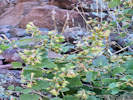
Brickellia californica im bloom. |
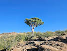
Rocky Mountain juniper on the rim of North Table Mountain. |
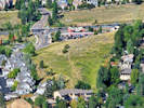
View of Schweich Hill from the rim of North Table Mountain in September 2023. |
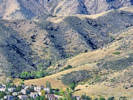
View of Magpie Gulch from the rim of North Table Mountain. |
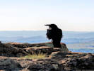
Raven on top of North Table Mountain. |
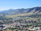
Downtown Golden from the top of North Table Mountain, September 2023. |
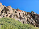
Climbing hardware left on cliffs. |
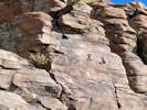
Climbing hardware left on cliffs. |
|
|
|
|
Friday, 29 September 2023
Tucker Gulch and Schweich Hill.
|
|
Other articles:
• Golden Checklist Flora:
Fallopia baldschuanica;
• Tucker Gulch Trail:
just above bridge;
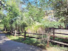 View of Coll. No. 3230, Fallopia baldschuanica, from south. View of Coll. No. 3230, Fallopia baldschuanica, from south.
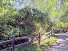 View of Coll. No. 3230, Fallopia baldschuanica, from north.. View of Coll. No. 3230, Fallopia baldschuanica, from north..
|
3230
|
Showy vine climbing into the Tucker Gulch Trail from adjacent private residence.
|
Native and Naturalized Flora of the Golden Area, Jefferson County, Colorado
Polygonaceae
Fallopia baldschuanica (Regel) Holub.
Bukhara Fleeceflower.
Tucker Gulch (lower), Jefferson County, Colorado.
Side yard of 405 Garden Glen Ct., Colden, CO.
39.7651°N, 105.2249°W.
WGS 1984
Elev. 1765 m.
Sprawling over a green ash (Fraxinus pennsylvanica Marshall) and fence for about 10 m., coming across onto the City of Golden Tucker Gulch Trail, no sign of rooting away from fence line.
Also seen on top of Cemetery Hill (Gregory Drive), and 1000 19th Street. EDDMapS No. 11556331.
iNaturalist Observation 185490713.
Collected by permit: City of Golden, 2023, issued: Mar 13, 2023, to: Tom Schweich.
|
Tom Schweich
3230. |
29-Sep-2023 |
|
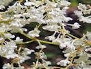
Coll. No. 3230, Fallopia baldschuanica. |
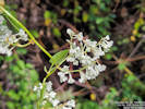
Coll. No. 3230, Fallopia baldschuanica. |
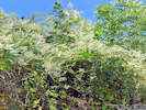
Coll. No. 3230, Fallopia baldschuanica. |
|
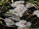 Brickellia eupatorioides in fruit. Brickellia eupatorioides in fruit.
|
|
Collected seed from Brickellia eupatorioides
|
|
Other articles:
• Social Trail (Arapahoe to N. Rubey):
at drain;
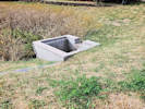 Grate off. Grate off.
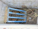 Location of the missing grate; down in the drain. Location of the missing grate; down in the drain.
|
|
Monday, 2 October 2023
|
|
Other articles:
• Social Trail (Arapahoe to N. Rubey):
at drain;
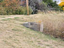 Grate off. Grate off.
|
|
Wednesday, 11 October 2023
Grate off of surge pond drain.
|
|
Other articles:
• Trail to Parkview Court:
at uphill;
at drain;
Locations:
New Loveland Mine Park.
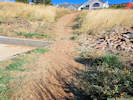 Sedimented drain from surge pond. Sedimented drain from surge pond.
|
|
Tuesday, 10 October 2023
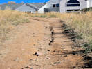
Trail widening caused by erosion. |
|
|
Other articles:
• East Street:
at home made park;
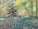 “Home Made Park” in Tucker Gulch. “Home Made Park” in Tucker Gulch.
|
|
Saturday, 21 October 2023
Bicycle ride to North Table Mountain Trailhead.
|
|
Other articles:
• Clear Creek Trail:
at Magpie Gl;
near entrance 9-N;
• Magpie Gulch Trail:
at junction;
Locations:
Magpie Gulch.
New Loveland Mine Park.
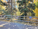 Picnic in the Sensitive Area. Picnic in the Sensitive Area.
|
|
Sunday, 22 October 2023
Walk downtown and up Clear Creek.
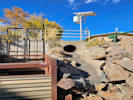
The ignominious end of Magpie Gulch at Clear Creek. |
The new Coors mural and Castle Rock from New Loveland Mine Park. |
|
|
Other articles:
• Social Trail (Arapahoe to N. Rubey):
at drain;
 The surge pond grate is not bolted down. The surge pond grate is not bolted down.
|
|
Wednesday, 15 November 2023
Grate on surge pond is not bolted down.
|
|
|
|
[Previous Page]
[Next Page]
Go to page: [1800s] [1900s] [1910s] [1920s] [1930s] [1940s] [1950s] [1960s] [1970s] [1980s] [1990] [1991] [1992] [1993] [1994] [1995] [1996] [1997] [1998] [1999] [2000] [2001] [2002] [2003] [2004] [2005] [2006] [2007] [2008] [2009] [2010] [2011] [2012] [2013] [2014] [2015] [2016] [2017] [2018] [2019] [2020] [2021] [2022] [2023] [2024] [A]
|
|
If you have a question or a comment you may write to me at:
tas4@schweich.com
I sometimes post interesting questions in my FAQ, but I never disclose your full name or address.
|
[Home Page] [Site Map]
Date and time this article was prepared:
4/27/2024 3:27:50 PM
|
 Eastern Mojave Vegetation