Eastern Mojave Vegetation
Tom Schweich
|
Eastern Mojave Vegetation
| Field Notes (Continued) |
|
Tom Schweich |

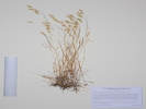
Topics in this Article: 1800s 1900s 1910s 1920s 1930s 1940s 1950s 1960s 1970s 1980s 1990 1991 1992 1993 1995 1996 1997 1998 1999 2000 2001 2002 2003 2004 2005 2006 2007 2008 2008 Tour de Swertia albomarginata Mono Lake, August 2008 2009 2010 2011 2012 2013 2014 2015 2016 2017 2018 2019 2020 2021 2022 2023 2024 Contents Literature Cited |
When I first read the field notes of Annie Alexander and Louise Kellogg, I was fascinated by the descriptions they wrote about the places they went and the plants and animals they found there. By publishing my field notes on the Internet I hope to follow a little bit in their tradition. | |||||||||||||||||||||
|
|
2016 | |||||||||||||||||||||
|
Other articles:
|
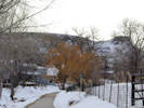
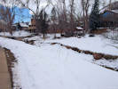
Saturday, February 6th
| |||||||||||||||||||||
|
Literature Cited:
Other articles:
|
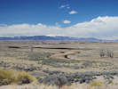
From the Nevada Appeal, 10 February 2016:
Completion of 17 1/2 miles of new highway which connects by a more direct route the county seats of Bridgeport in Mono County and Markleeville in Alpine County will be celebrated by the boards of supervisors of the two counties with a dedication ceremony Sunday, when the new road will be opened formally to traffic. | |||||||||||||||||||||
|
Other articles:
|
Thursday, February 18th
| |||||||||||||||||||||
|
Other articles:
|
Saturday, February 28th
| |||||||||||||||||||||
|
Other articles:
|
Thursday, March 3rd
| |||||||||||||||||||||
|
|
Monday, April 4th | |||||||||||||||||||||
|
Other articles:
Locations:
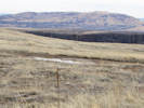
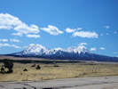
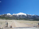
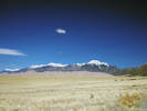
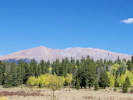
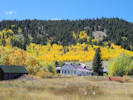
Sierra Blanca.
Spanish Peaks.
|
| |||||||||||||||||||||
|
Other articles:
Locations:
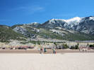
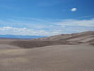
Great Sand Dunes National Park.
|
| |||||||||||||||||||||
|
|
Tuesday, April 5th | |||||||||||||||||||||
|
Other articles:
Locations:
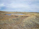
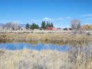
Monte Vista National Wildlife Refuge.
|
Monte Vista National Wildlife Refuge | |||||||||||||||||||||
|
Other articles:
Locations:
Rio Grande.
Rio Grande.
Rio Grande State Wildlife Area.
|
| |||||||||||||||||||||
|
Other articles:
Locations:
Alamosa National Wildlife Refuge.
Rio Grande.
|
| |||||||||||||||||||||
|
Other articles:
Locations:
Hansen Bluff.
Sierra Blanca.
|
| |||||||||||||||||||||
|
Other articles:
Locations:
Alamosa.
|
| |||||||||||||||||||||
|
Other articles:
Locations:
Russell Lakes State Wildlife Area.
|
| |||||||||||||||||||||
|
Other articles:
Locations:
Villa Grove.
|
||||||||||||||||||||||
|
Locations: Colorado School of Mines Survey Field. |
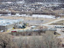
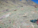
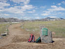
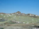
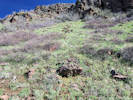
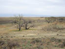
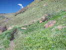
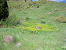
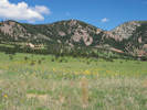
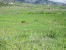
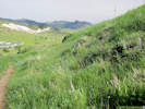
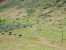
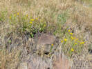
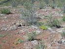
Saturday, April 9thColorado School of Mines, Survey Field, early spring, looking primarily for the Townsendia. | |||||||||||||||||||||
|
Other articles:
|
1301 |
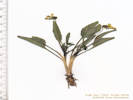
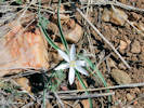
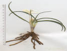
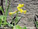
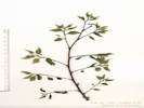
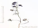
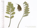
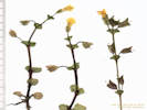
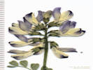
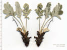
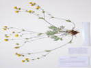
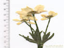
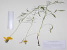
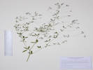
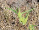
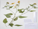
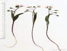
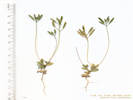
Viola nuttallii Pursh. Nuttall's Violet.
Colorado School of Mines Survey Field, Jefferson County, Colorado. Along the access road to the City of Golden water tank, 210 m from Lookout Mountain Road, 2 km south southwest of the GNIS location of Golden. 39.7387°N, 105.2284°W. WGS 1984. Elev. 1870 m. South-facing slope of ditch, early-blooming perennial, grass is still very short. | ||||||||||||||||||||
| 1302 |
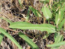
Alyssum simplex Rudolphi. European Madwort.
Colorado School of Mines Survey Field, Jefferson County, Colorado. Along the access road to the City of Golden water tank, 210 m from Lookout Mountain Road, 2 km south southwest of the GNIS location of Golden. 39.7387°N, 39.7387°E. WGS 1984 Elev. 1865 m. Small plants, on south-facing bank, early spring, grass still very short, with Viola nuttallii. | |||||||||||||||||||||
|
Other articles:
|
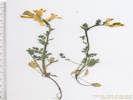
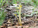
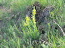
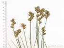
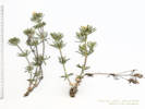
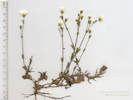
1303 |
Colorado School of Mines Survey Field, Jefferson County, Colorado. Center of Survey Field, 525 m south of Beverly Heights Park, 2.2 km south southwest of the GNIS location of Golden 39.7365°N, 105.2261°W. WGS 1984 Elev. 1873 m. South-facing slope of rocky older alluvium. | ||||||||||||||||||||
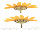
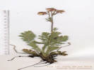
| 1304 |
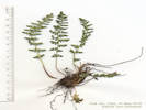
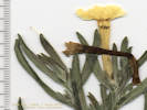
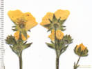
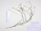
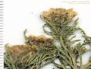
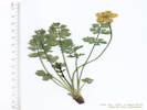
Field determination: Townsendia hookeri
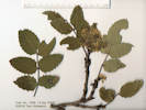
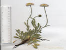
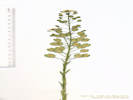
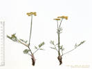
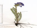
Townsendia hookeri Beaman. Hooker's Townsend Daisy. Colorado School of Mines Survey Field, Jefferson County, Colorado. Center of Survey Field, 525 m south of Beverly Heights Park, 2.2 km south southwest of the GNIS location of Golden. 39.7366°N, 105.2262°W. WGS 1984 Elev. 1879 m. Scattered, uncommon at this location. South-facing slope of rocky older alluvium. Coll. No. 1304, 9 April 2016, characters observed: Perennial, acaulescent, Leaves, narrowly oblanceolate, strigose; Head, sessile (or apparently so), 12 mm. × 10-12 mm. wide; Phyllaries, many series, 8 mm., outer hairy, tipped by a tuft of tangled cilia, inner, margins and tip ciliate, but not tangled; Rays, #25-30, corolla 10 mm., white, pappus bristles, 5 mm.; Disc flowers, corolla 4.5 mm., yellow, pappus, 6 mm., bristles. | |||||||||||||||||||||
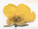
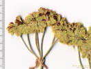
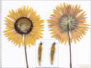
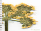
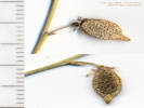
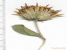
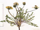
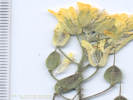
 Head of Coll. No. 1305, Taraxacum, but T. officinale? Head of Coll. No. 1305, Taraxacum, but T. officinale?
 Coll. No. 1305, Taraxacum, but T. officinale? Coll. No. 1305, Taraxacum, but T. officinale?
|
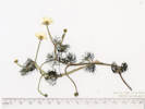
1305 |
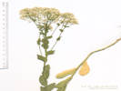
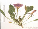
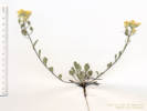
Dandelion, large round head.
Taraxacum officinale F. H. Wigg. Common Dandelion. Colorado School of Mines Survey Field, Jefferson County, Colorado. Center of Survey Field, 525 m south of Beverly Heights Park, 2.2 km south southwest of the GNIS location of Golden. 39.7366°N, 105.2262°W. WGS 1984 Elev. 1870 m. One plant, selected because of very large, globose inflorescence. | ||||||||||||||||||||
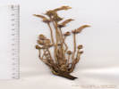
 Head of Coll. No. 1306, Taraxacum officinale Head of Coll. No. 1306, Taraxacum officinale
 Coll. No. 1306, Taraxacum officinale Coll. No. 1306, Taraxacum officinale
|
1306 |
Field identification: Dandelion.
Taraxacum officinale F. H. Wigg. Common Dandelion. Colorado School of Mines Survey Field, Jefferson County, Colorado. Northern portion of Survey Field, 2 km south southwest of the GNIS location of Golden. 39.7379°N, 105.2277°W. WGS 1984 Elev. 1862 m. Numerous plants beside an ephemeral stream. | ||||||||||||||||||||
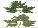
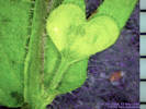
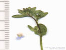
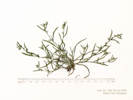
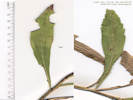
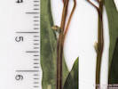 Bract(s) at base of inflorescence of Coll. No. 1307, Claytonia rosea Bract(s) at base of inflorescence of Coll. No. 1307, Claytonia rosea
 Coll. No. 1307, Claytonia rosea Coll. No. 1307, Claytonia rosea
|
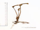
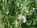
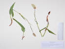
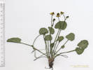
1307 |
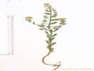
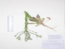
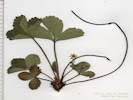
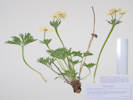
Field determination: Claytonia lanceolata Pursh. Lanceleaf Springbeauty.
Windy Saddle Park, Jefferson County, Colorado. Lower slopes of Lookout Mountain, 2.23 km southwest of the GNIS location of Golden. 39.7371°N, 105.2322°W. WGS 1984 Elev. 1944 m. Numerous plants around edges of Rhus shrubs. Hillside above Colorado School of Mines Survey Field. | ||||||||||||||||||||
|
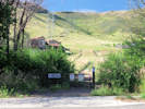
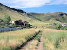
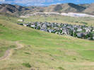
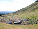
Locations: North Table Mountain Park. |
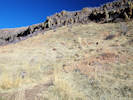
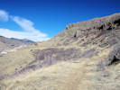
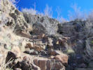
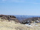
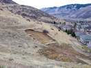
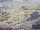
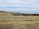
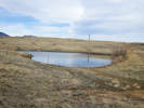
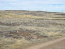
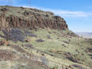
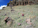
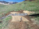
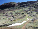
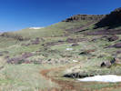
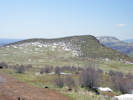
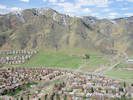
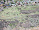
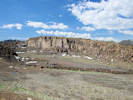
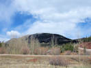
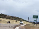
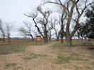
Tuesday, April 12thNorth Table Mountain, Cottonwood Canyon to basalt quarry. | |||||||||||||||||||||
|
Other articles:
|
1308 |
Chorispora tenella (Pall.) DC. Crossflower. North Table Mountain Park, Jefferson County, Colorado. Just inside North Table Mountain Park, southeast side of North Table Mountain, about 150 m, northwest of the trailhead for the Neighborhood Access Trail at the corner of Ridge Road and Ulysses Avenue, 2.9 km northeast of the GNIS location of Golden. 39.7736°N, 105.1974°W. WGS 1984 Elev. 1728 m. Possibly at a former home site. | ||||||||||||||||||||
|
Other articles:
|
1309 |
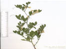
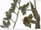
Field determination: Berberis repens
Berberis repens Lindl. Creeping Barberry. North Table Mountain Park, Jefferson County, Colorado. Just inside North Table Mountain Park, southeast side of North Table Mountain, about 150 m, northwest of the trailhead for the Neighborhood Access Trail at the corner of Ridge Road and Ulysses Avenue, 2.9 km northeast of the GNIS location of Golden. 39.774°N, 105.1977°W. WGS 1984 Elev. 1751 m. Few plants on strath above creek; many more plants at higher and drier locations. | ||||||||||||||||||||
 Coll. No. 1310, Muscari botryoides Coll. No. 1310, Muscari botryoides
|
1310 |
Field determination: Muscari botryoides, naturalized.
Muscari botryoides (L.) Mill. Common Grape Hyacinth. North Table Mountain Park, Jefferson County, Colorado. Just inside North Table Mountain Park, southeast side of North Table Mountain, about 150 m, northwest of the trailhead for the Neighborhood Access Trail at the corner of Ridge Road and Ulysses Avenue, 2.9 km northeast of the GNIS location of Golden. 39.774°N, 105.1977°W. WGS 1984 Elev. 1748 m. Near a former home site, probably naturalized. | ||||||||||||||||||||
|
Literature Cited:
Other articles:
|
| |||||||||||||||||||||
|
Other articles:
|
1311 |
Field determination: Leucocrinum montanum
Leucocrinum montanum Nutt. ex A. Gray. Star Lily. North Table Mountain Park, Jefferson County, Colorado. Just inside North Table Mountain Park, southeast side of North Table Mountain, about 200 m, northwest of the trailhead for the Neighborhood Access Trail at the corner of Ridge Road and Ulysses Avenue, 2.9 km northeast of the GNIS location of Golden. 39.7745°N, 105.1972°W. WGS 1984 Elev. 1766 m. Grassy slopes above the trail, but the grass is very short because it is still very early spring here; more common on slopes above. | ||||||||||||||||||||
|
Other articles:
Locations:
North Table Mountain Park.
|
| |||||||||||||||||||||
|
Other articles:
|
Two small Corydalis aurea along the North Table Loop. | |||||||||||||||||||||
|
Other articles:
|
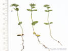
1312 |
Field determination: Claytonia rosea, basal leaves present at flowering.
Claytonia rosea Rydb. Rocky Mountain Springbeauty. North Table Mountain Park, Jefferson County, Colorado. Along the North Table Loop, southeast side of North Table Mountain, approximately 1/2 km west of the Neighborhood Access Trail trailhead at Ridge Road and Ulysses Avenue, 2.6 km northeast of the GNIS location of Golden. 39.7738°N, 105.2019°W. WGS 1984 Elev. 1876 m. Basal leaves present at flowering. East to northeast-facing grassy slope. | ||||||||||||||||||||
|
Other articles:
Locations:
Ranson/Edwards Homestead Open Space Park.
|
Thursday, April 14th.
| |||||||||||||||||||||
|
Other articles:
|
1313 |
Field determination: Viola nuttallii
Viola nuttallii Pursh. Nuttall's Violet. Ranson/Edwards Homestead Open Space Park, Jefferson County, Colorado. Southern section of park, 115 m north of the Plainview Road bridge over Coal Creek, 14.5 km north northwest of the GNIS location of Golden. 39.8796°N, 105.2701°W. WGS 1984 Elev. 1994 m. One of the earliest flowers in bloom here. | ||||||||||||||||||||
|
Other articles:
|
1314 |
Field determination: Taraxacum officinale
Taraxacum officinale F. H. Wigg. Common Dandelion. Ranson/Edwards Homestead Open Space Park, Jefferson County, Colorado. Southern section of park, 115 m north of the Plainview Road bridge over Coal Creek, 14.5 km north northwest of the GNIS location of Golden. 39.8796°N, 105.2701°W. WGS 1984 Elev. 1992 m. One of the earliest flowers in bloom, collected with Viola nuttallii. | ||||||||||||||||||||
|
Other articles:
|
1315 |
Field determination: Townsendia hookeri
Townsendia hookeri Beaman. Hooker's Townsend Daisy. Ranson/Edwards Homestead Open Space Park, Jefferson County, Colorado. Southern section of park, 360 m northwest of the Plainview Road bridge over Coal Creek, 14.5 km north northwest of the GNIS location of Golden. 39.8806°N, 105.2731°W. WGS 1984 Elev. 2016 m. Rocky alluvial terrace. | ||||||||||||||||||||
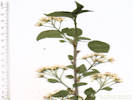
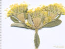
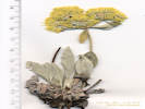
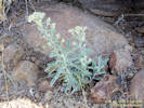
 Frasera speciosa beginning to bloom. Frasera speciosa beginning to bloom.
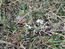 Unknown Brassicaceae. Unknown Brassicaceae.
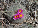 Pediocactus simpsonii in bloom at Ranson Edwards Homestead OSP. Pediocactus simpsonii in bloom at Ranson Edwards Homestead OSP.
|
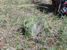
Frasera speciosa beginning to send up a flowering stalk, and an unknown Brassicaceae. | |||||||||||||||||||||
|
Other articles:
|
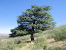
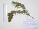
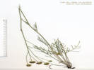
1316 |
Field determination: Pinus ponderosa.
Pinus ponderosa Laws. Ponderosa Pine. Ranson/Edwards Homestead Open Space Park, Jefferson County, Colorado. Southern section of park, 400 m west northwest of the Plainview Road bridge over Coal Creek, 14.5 km north northwest of the GNIS location of Golden. 39.8804°N, 105.2738°W. WGS 1984 Elev. 2044 m. Upper slopes just below the railroad tracks. | ||||||||||||||||||||
|
Other articles:
|
Friday, April 22nd
| |||||||||||||||||||||
|
Other articles:
|
1317 |
Field identification: Taraxacum officinale.
Taraxacum officinale F. H. Wigg. Common Dandelion. North Table Mountain, Jefferson County, Colorado. On the City of Golden North Table Mountain trail, just below the southwest rim of North Table Mountain, 1.9 km north of the GNIS location of Golden. 39.7727°N, 105.224°W. WGS 1984 Elev. 1906 m. Flat area beside the trail. | ||||||||||||||||||||
|
Other articles:
|
1318 |
Field identification: Corydalis aurea.
Corydalis aurea Willd. Scrambled Eggs. North Table Mountain, Jefferson County, Colorado. On the City of Golden North Table Mountain trail, just below the southwest rim of North Table Mountain, 1.9 km north of the GNIS location of Golden. 39.7727°N, 105.2239°W. WGS 1984 Elev. 1926 m. Rocky open slopes above the trail. Small plants here, one larger plant in the basalt rim of the mesa. | ||||||||||||||||||||
|
Other articles:
Locations:
Cucharas Pass.
La Veta.
North Lake.
Pikes Peak.
South Fork Purgatoire River.
|
Tuesday, April 26th
| |||||||||||||||||||||
|
|
Wednesday, April 27th | |||||||||||||||||||||
|
Other articles:
|
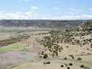
Near the former town of Thatcher on US Highway 50 to La Junta from Trinidad. | |||||||||||||||||||||
|
Other articles:
|
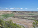
| |||||||||||||||||||||
|
Other articles:
Locations:
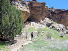
Purgatoire Canyon.
|
| |||||||||||||||||||||
|
Other articles:
Locations:
Vogel Canyon.
|
| |||||||||||||||||||||
|
Other articles:
Locations:
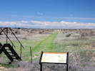
Bent's Old Fort National Historic Site.
|
| |||||||||||||||||||||
|
|
Thursday, April 28th | |||||||||||||||||||||
|
Other articles:
Locations:
Sand Creek Massacre National Historic Site.
|
| |||||||||||||||||||||
|
Other articles:
Locations:
Cheyenne Wells.
|
| |||||||||||||||||||||
|
Other articles:
|
||||||||||||||||||||||
|
|
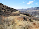
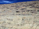
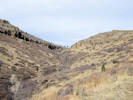
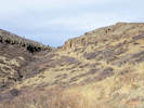
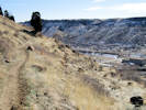
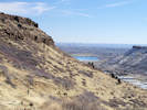
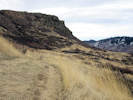
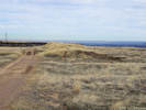
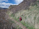
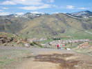
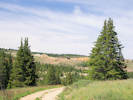
Wednesday, May 4thNorth Table Mountain, by way of the Golden Cliffs Trail to the Climbing Access Trail, then over the rim on an social trail route. From the top, used the social trail to the North Table Mountain Trail, then a social trail to the Golden Cliff Preserve parking lot. | |||||||||||||||||||||
|
Other articles:
|
1319 |
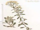
Field identification: Ribes aureum.
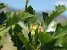
Ribes aureum Pursh. Golden Currant. North Table Mountain Park, Jefferson County, Colorado. Along the lower portion of the Golden Cliffs Trail, about 150 m. from the parking lot and trailhead,1.4 km. northeast of the GNIS location of Golden. 39.7668°N, 105.2136°W. WGS 1984 Elev. 1787 m. In a protected little rock enclosure, southeast aspect, more along the trail above. Coll. No. 1319, 4 May 2016: Perennial shrub, to 1 m.; Stem, unarmed; Leaves, fascicled, broadly ovate, 29 mm. × 22 mm. wide, lobes 3, obtuse; Hypanthium, 9 mm., bright yellow; Sepals, petaloid, 5 mm.; Petals, 2.5 mm.; Ovary, 2 mm. | ||||||||||||||||||||
|
Other articles:
|
1320 |
Field identification: Mertensia lanceolata
Mertensia lanceolata (Pursh) DC. Prairie Bluebells. North Table Mountain Park, Jefferson County, Colorado. Along the lower portion of the Golden Cliffs Trail, about 200 m. from the parking lot and trailhead,1.5 km. northeast of the GNIS location of Golden. 39.767°N, 105.2131°W. WGS 1984 Elev. 1822 m. Growing in afternoon shade of a small point of rocks, southeast exposure, more along the trail above. | ||||||||||||||||||||
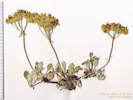
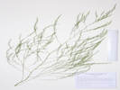
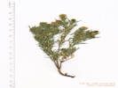
 Apiaceae Aletes acaulis Apiaceae Aletes acaulis
 Coll. No. 1321, Aletes acaulis Coll. No. 1321, Aletes acaulis
|
1321 |
Field identification: Musineon divaricatum
North Table Mountain Park, Jefferson County, Colorado. Southwest rim of North Table Mountain, 1.55 km north of the GNIS location of Golden. 39.7695°N, 105.2198°W. WGS 1984 Elev. 1973 m. Edges of cliffs. | ||||||||||||||||||||
| 1322 |
Field identification: Lomatium orientale
Lomatium orientale J.M. Coult. & Rose. Northern Idaho Biscuitroot. North Table Mountain Park, Jefferson County, Colorado. Top of mesa, near southwest edge, 1.55 km north of the GNIS location of Golden. 39.7696°N, 105.2197°W. WGS 1984 Elev. 1975 m. Widespread on mesa-top lava flow derived soils and colluvial soils of upper and lower slopes. | |||||||||||||||||||||
 Euphorbiaceae Euphorbia myrsinites Euphorbiaceae Euphorbia myrsinites
|
1323 |
Field identification: Euphorbia myrsinites
Lomatium orientale J.M. Coult. & Rose. Northern Idaho Biscuitroot. North Table Mountain Park, Jefferson County, Colorado. Top of mesa, near southwest edge, 1.55 km north of the GNIS location of Golden. 39.7696°N, 105.2197°W. WGS 1984 Elev. 1975 m. Widespread on mesa-top lava flow derived soils and colluvial soils of upper and lower slopes. | ||||||||||||||||||||
|
Other articles:
|
1324 |
Field identification: Thlaspi arvense
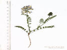
Thlaspi arvense L. Field Penny Cress. North Table Mountain Park, Jefferson County, Colorado. Along a social trail above Peery Parkway, adjacent to running water from spring above on upper slopes of North Table Mountain, 1.26 km north northeast of the GNIS location of Golden. 39.7669°N, 105.22°W. WGS 1984 Elev. 1829 m. Coll. No. 1324, 4 May 2016, characters observed: Annual, tap-rooted, to 50 cm., generally glabrous throughout; Stem, single, or few-branched proximally; Leaves, basal and cauline, basal, withered at flowering, cauline, sessile, auriculate, oblong, 30 mm. × 5 mm. wide, reduced distally, toothed; Sepals, 2 mm.; Petals, 3 mm., white; Fruit, petiole 10 mm., ascending, fruit obovate, 10 mm. × 8 mm., wide, margin winged, tip deeply notched. | ||||||||||||||||||||
|
Locations: Ranson/Edwards Homestead Open Space Park. |
Thursday, May 5thRanson/Edwards Homestead Open Space Park, at the small segment toward the south end of the park. | |||||||||||||||||||||
|
Literature Cited:
|
1325 |
Field identification: Mertensia lanceolata.
Mertensia lanceolata (Pursh) DC. Prairie Bluebells. Ranson/Edwards Homestead Open Space Park, Jefferson County, Colorado. Wet alluvial slope above Coal Creek, Stevens parcel immediately south of Ranson/Edwards parcel, 3.55 km west southwest of the GNIS location of Rocky Flats 39.8789°N, 105.2703°W. WGS 1984 Elev. 1959 m. | ||||||||||||||||||||
| 1326 |
Field identification: Lomatium orientale
Lomatium orientale J.M. Coult. & Rose. Northern Idaho Biscuitroot. Ranson/Edwards Homestead Open Space Park, Jefferson County, Colorado. Stevens parcel just south of Ranson/Edwards parcel, about 180 m. northwest of the Plainview Road bridge over Coal Creek, 3.65 km west southwest of the GNIS location of Rocky Flats, 39.8792°N, 105.2717°W. WGS 1984 Elev. 1990 m. Gentle east-facing grassy slopes. | |||||||||||||||||||||
| 1327 |
Field identification: Cerastium arvense L. ssp. strictum Gaudin. Field Chickweed. Ranson/Edwards Homestead Open Space Park, Jefferson County, Colorado. Stevens parcel immediately south of Ranson/Edwards parcel, 1.5 km south of the GNIS location of Plainvew, and 3.65 km south southwest of Rocky Flats. 39.8805°N, 105.2723°W. WGS 1984 Elev. 2013 m. East-facing grassy slopes. Common early-flowering perennial, to 20 cm.; Leaves, opposite, broadly linear, 15 mm. × 3 mm. wide, stipules absent, tufts of leaves in lower axils; Sepals free; Petals >>sepals, white, notched; Styles (4)5. | |||||||||||||||||||||
| 1328 |
Field identification: Noccaea fendleri (A. Gray) Holub ssp. glauca (A. Nelson) Al-Shehbaz & M. Koch. Ranson/Edwards Homestead Open Space Park, Jefferson County, Colorado. Stevens parcel immediately south of Ranson/Edwards parcel, 1.5 km south of the GNIS location of Plainvew, 3.71 km west southwest of the GNIS location of Rocky Flats. 39.8806°N, 105.2731°W. WGS 1984. Elev. 2021 m. East-facing gentle slope. Few plants in the shade of ponderosa pine. | |||||||||||||||||||||
 Habitat of Coll. No. 1329, Noccaea fendleri var. glauca Habitat of Coll. No. 1329, Noccaea fendleri var. glauca
|
1329 |
Field identification: Noccaea fendleri (A. Gray) Holub ssp. glauca (A. Nelson) Al-Shehbaz & M. Koch. Ranson/Edwards Homestead Open Space Park, Jefferson County, Colorado. Stevens parcel immediately south of Ranson/Edwards parcel, 1.64 km south southeast of the GNIS location of Plainview, 3.48 km west southwest of the GNIS location of Rocky Flats. 39.8797°N, 105.2699°W. WGS 1984. Elev. 1991 m. Common in shade of ponderosa pines among rocks; flat, disturbed area above Coal Creek, with much broken glass. | ||||||||||||||||||||
|
Locations: Tucker Gulch (lower). |
Wednesday, May 11thTucker Gulch in Golden, along the trail from First Street northward. There were a couple of things in the mustard family that were not ready to collect. | |||||||||||||||||||||
|
Other articles:
|
1330 |
Field identification: Chorispora tenella
Chorispora tenella (Pall.) DC. Crossflower. Tucker Gulch (lower), Jefferson County, Colorado. Disturbed area between paths, 1.33 km north northwest of the GNIS location of Golden 39.7667°N, 105.227°W. WGS 1984 Elev. 1753 m. Small colony of this common early spring weed. | ||||||||||||||||||||
|
Other articles:
|
1331 |
Field identification: Euphorbia, not E. myrsinites
Euphorbia esula L. Leafy Spurge. Tucker Gulch (lower), Jefferson County, Colorado. Disturbed area between paths, 1.33 km north northwest of the GNIS location of Golden 39.7666°N, 105.2272°W. WGS 1984 Elev. 1776 m. Weed: CO DofA, List: B. | ||||||||||||||||||||
| 1332 |
Field identification: Muscari botryoides
Muscari botryoides (L.) Mill. Common Grape Hyacinth. Tucker Gulch (lower), Jefferson County, Colorado. Beside Tucker Gulch Trail, about 100 m. north of the First Street bridge, 1.42 km north northwest of the GNIS location of Golden 39.7674°N, 105.2273°W. WGS 1984 Elev. 1773 m. Naturalized. | |||||||||||||||||||||
|
Other articles:
|
1333 |
Field identification: Ranunculus sp.
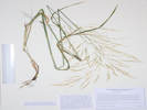
Ranunculus repens L. Creeping Buttercup. Tucker Gulch (lower), Jefferson County, Colorado. 135 m. north of First Street bridge, 1.46 km north northwest of the GNIS location of Golden 39.7677°N, 105.2275°W. WGS 1984 Elev. 1767 m. In a small slump beside creek. Coll. No. 1333, 11 May 2016, characters observed: Perennial herb, terrestrial of wet habitat, not alpine, appressed to spreading hairy throughout; Leaves, basal, petiole to 26 cm., 8 cm. × 10 cm. wide, ternately compound, divided once again, then lobed, cauline, distributed along stem, alternate, compound; Flowers, radially symmetric, Sepals, spreading (not reflexed), 9 mm., long straight hairy; Petals, #5, 16 mm. × 12 mm. wide, yellow, not spurred, nectary scale free ≥½ length; Pistils many; Style absent; Achenes, (immature) 1.5 mm., beak straight to slightly curved. | ||||||||||||||||||||
|
Other articles:
|
1334 |
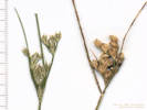
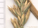
Field identification: Alopecurus arundinaceus Poir. Creeping Meadow Foxtail. Tucker Gulch (lower), Jefferson County, Colorado. 135 m. north of First Street bridge, 1.46 km north northwest of the GNIS location of Golden 39.7677°N, 105.2274°W. WGS 1984 Elev. 1766 m. Growing adjacent to running water in creek. Coll. No. 1334, 11 May 2016, characters observed: Perennial, to 90 cm., rhizomatous; Leaves, Sheath, open, 10 cm.; Ligule, membraneous, 2 mm.; Auricles, 0; Blade, flat, 10 cm., glabrous, finely scabrous on margins; Inflorescence, spike-like, 80 mm. × 12 mm. wide, contracted panicle of up to 4 branches, spikelets many; Rachis, glabrous; Compression, lateral; Spikelets, similar, 1 per node, 1-flowered; Florets, 1 per spikelet; Glumes, #2, 4.5 mm., ±equal, keeled ciliate, veins 3, awns 0, apex acute, apices divergent; Lemma, 4 mm., < glumes, membraneous, keeled, glabrous, veins parallel, apex truncate to obtuse, awns #1, 1-2 mm., straight, attached middle; Palea, absent; Stamens, #3. | ||||||||||||||||||||
| 1335 |
Field identification: Brassicaceae. Not collected, no fruit. | |||||||||||||||||||||
|
Other articles:
|
1336 |
Field identification: Brassicaceae, Shepherd's Purse shaped fruit. Well, by golly
it's ...
Capsella bursa-pastoris (L.) Medik. Shepherd's Purse. Tucker Gulch (lower), Jefferson County, Colorado. 230 m. north of the First Street bridge, 1.55 km north northwest of the GNIS location of Golden 39.7685°N, 105.228°W. WGS 1984 Elev. 1779 m. Common weed beside Tucker Gulch Trail. Coll. No. 1336, 11 May 2016, characters observed: Annual, scapose, to 27 cm., hairs, sessile, stellate, 3-4 points, throughout; Leaves, basal, oblanceolate, 55 mm. × 16 mm. wide, deeply lobed, but not all the way to mid-rib; cauline, 4-5 stem leaves, lanceolate, 25 mm. × 10 mm. wide, base sagittate; Flowers, small, petals white; Fruit, obcordate, 4 mm. × 3.5 mm. wide. The single species in this genus; described by some as the second-most common weed on Earth. | ||||||||||||||||||||
|
Other articles:
|
1337 |
Erigeron tracyi Greene. Running Fleabane. North Table Mountain Park, Jefferson County, Colorado. Lower south slopes of North Table Mountain, 100 m. east of the end of Peery Parkway, 1.2 km. north northeast of the GNIS location of Golden. 39.7659°N, 105.2179°W. WGS 1984 Elev. 1808 m. Signed as Jefferson County Open Space, parcel owned by City of Golden. Coll. No. 1337, 11 May 2016, characters observed: Perennial, caudex simple (not stout), Stem, some with prior year's branches assumed to have been stoloniferous; Leaves, petioles, to 26 mm., oblanceolate, 8-12 mm. × 2-5.5 mm. wide, margin entire, short hairy and glandular (especially visible at high magnification), stem leaves not well-developed; Peduncle, spreading to descending multicellular hairs with clear crosswalls, slightly pustular (maybe) or glandular at high magnification; Phyllaries, in 2+ series, 4.5 mm. × 0.7 mm wide, spreading hairy, inner, margin, chartaceous; Receptacle, epaleate; Flowers, of two kinds; Rays, numerous, 7 mm., ligule, 4 mm. × 0.3-0.6 mm. wide, white-pink fading purple; Disk flowers, yellow; Pappus, ray and disk alike, inner, few capillary bristles, 4 mm., outer, short crown of scales, double pappus not particularly disgnostic in Erigeron. | ||||||||||||||||||||
| 1338 |
Field identification: Populus deltoides.
Populus deltoides Marshall ssp. monilifera (Aiton) Eckenw. Plains Cottonwood. North Table Mountain, Jefferson County, Colorado. South slopes of North Table Mountain, along the road to the Golden Cliffs overflow parking, 1.20 km north northeast of the GNIS location of Golden 39.7659°N, 105.2167°W. WGS 1984 Elev. 1802 m. Entrance to Jefferson County Open Space, parcel owned by City of Golden. | |||||||||||||||||||||
|
|
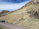
Thursday, May 12thCollected at North Table Mountain today. Went up by way of the social trail from Easley Road and the on-ramp to Colorado Highway 58. At the first stream, I turned north and went cross-country north towards Cottonwood Canyon. Followed an old road with a social or game trail down to the junction of North Table Loop and Neighborhood Access Trail. | |||||||||||||||||||||
| 1339 |
Field identification: Tragopogon dubius
Tragopogon dubius Scop. Yellow Salsify. North Table Mountain Park, Jefferson County, Colorado. On a social trail from the intersection of Easley Road and CO Highway 58, west and upslope to North Table Loop, 1.9 km. northeast of the GNIS location of Golden. 39.7692°N, 105.2077°W. WGS 1984 Elev. 1800 m. Scattered widely along trail and grassy slopes above and below. | |||||||||||||||||||||
|
Other articles:
|
1340 |
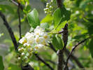
Prunus virginiana L. Chokecherry. North Table Mountain Park, Jefferson County, Colorado. Southeast-draining canyon on the south side of North Table Mountain, 1.85 km. northeast of the GNIS location of Golden 39.7701°N, 105.2106°W. WGS 1984 Elev. 1841 m. Mixed shrubs and grass. FNANM distinguishes two varieties, an eastern var. virginia and a Rocky Mountains and west var. demissa (syn: var. melanocarpa) with plants of the high plains showing intergradation between those of the Rockies and those of the East. Based on measured characters used by FNANM of raceme length, petal length, and leaf shape and dimensions, this specimen is closer to var. virginiana, i. e., the eastern variety than it is to the western variety, i. e., var. demissa (syn: var. melanocarpa). | ||||||||||||||||||||
|
Other articles:
|
1341 |
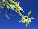
Prunus domestica L. European Plum. North Table Mountain Park, Jefferson County, Colorado. Southeast-draining canyon on the south side of North Table Mountain, near intersection of social trail and North Table Loop, 1.85 km. northeast of the GNIS location of Golden 39.7701°N, 105.2106°W. WGS 1984 Elev. 1844 m. Mixed shrubs and grass in a ±flat area. Coll. No. 1341, 12 May 2016, characters observed; Small tree, to 3 m.; Stem, unarmed; Leaves, alternate, petiole, 3 mm., hairy, 2 glands at base, blade, likely immature, 20 mm. × 8 mm. wide, rhomboid / oblong / lanceolate, simple, bases equal, pinnately veined, margin toothed, hairy, but less on top than bottom; Pedicels, 8-10 mm., hairy below, thining above; Flowers, solitary in axils, perfect; Petals, free, white; Hypanthium, hairy inside; Ovary, superior; Style, 1; Stigma, 2; Fruit, unknown (not an acorn). | ||||||||||||||||||||
| 1342 |
Field identification: Erodium cicutarium
Erodium cicutarium (L.) L'Her. ex Aiton. Redstem Stork's Bill. North Table Mountain Park, Jefferson County, Colorado. Southeast-draining canyon on the south side of North Table Mountain, near intersection of social trail and North Table Loop, 1.85 km. northeast of the GNIS location of Golden. 39.7702°N, 105.2104°W. WGS 1984 Elev. 1849 m. Colorado Noxious Weed List C. | |||||||||||||||||||||
|
Other articles:
|
1343 |
Field identification: a fern, maybe Woodsia oregana D.C. Eaton. subsp. cathcartiana (B. L. Robinson) Windham North Table Mountain Park, Jefferson County, Colorado. Southeastern portion of North Table Mountain, near the North Table Loop, where it passes through the top basalt rim of the mountain, 1.8 km. north northeast of the GNIS location of Golden. 39.7713°N, 105.215°W. WGS 1984 Elev. 1928 m. Under an east-facing rock overhang. Of the three characters that distinguish subsp. cathcartiana from subsp. oregana, two, spore size and adaxial epidermal cell size, require measuring in units of µm, something outside the usual abilities of the field botanist. The third character, regarding the cells on pinnule margins being irregular in shape making the margins appear ragged, can be seen with a good microscope. | ||||||||||||||||||||
|
Other articles:
|
1344 |
Veronica arvensis L. Corn Speedwell. North Table Mountain Park, Jefferson County, Colorado. Southeast edge of North Table Mountain where a small stream cuts through the uppermost basalt rim, beside North Table Loop, 1.85 km. north northeast of the GNIS location of Golden. 39.7715°N, 105.2149°W. WGS 1984 Elev. 1922 m. Small wet area at base of rocks. Coll. No, 1344, 12 May 2016, characters observed: Annual, to 6 cm., lightly glandular hairy throughout; Stem erect; Leaves, opposite, ±sessile, 6 mm. × 4.5 mm. wide, oval; Pedicel, in flower, 0.8 mm., in fruit, 1.5 mm.; Bracts, 4 mm × 1.3 mm. wide, lanceolate; Flower, appear solitary in upper leaf axils, limb 4.5 mm.; Corolla, blue; Style, in flower, 0.6 mm., in fruit, 0.5 mm.; Fruit, 2 mm. × 2.5 mm., notched 0.4 mm., flattened. Differentiated from Veronica persica, V. biloba, and V. polita by: short pedicels, short styles, and reduced depth of the notch in the capsule. Differentiated from V. peregrina var. xalapensis (which has also been collected on top of North Table Mountain) by the relatively short inflorescence, blue color of the flowers, and broadness of the leaves. | ||||||||||||||||||||
|
Other articles:
|
1345 |
Field identification: Physaria, Physaria vitulifera Rydb. Roundtip Twinpod. North Table Mountain Park, Jefferson County, Colorado. Southeast base of North Table Mountain, along the neighborhood access trail, 195 m. northwest of the trailhead at the corner of Ridge Road and Ulysses Way, 2.9 km. northeast of the GNIS location of Golden 39.7744°N, 105.1975°W. WGS 1984 Elev. 1767 m. Open grassland on south-facing slope. Coll. No. 1345, 12 May 2016, characters observed: Perennial, caespitose, stellate hairy throughout, flowering branches to 15 cm.; Leaves, basal, petiole 10 mm. + blade 23 mm. × 8 mm. wide, elliptic, weakly pinnately lobed, otherwise entire, cauline, alternate, 13 mm. × 4 mm. wide, oblancelate, entire; Pedicel, 5 mm., ascending, becoming s-shaped in fruit; Sepals, #4, 5 mm. × 1.5 mm. wide, lanceolate; Flowers, Petals, #4, 10 mm. × 2.5 mm. wide, color yellow; Stamens, #6; Style, #1, 4 mm., persistent; Fruit, didymous, 4.5 mm., round, hairy; Ovules, 4 per ovary. | ||||||||||||||||||||
|
Literature Cited:
|
1346 |
Field identification: was hoping it was a Plagiobothrys but looks like it's Lappula redowski.
Lappula occidentalis (S. Watson) Greene var. cupulata (A. Gray) Higgins. (Syn: L. redowskii (Hornem.) Greene var. cupulata (A. Gray) M. E. Jones) Crowned Stickseed. North Table Mountain Park, Jefferson County, Colorado. Southeast base of North Table Mountain, along the neighborhood access trail, 195 m. northwest of the trailhead at the corner of Ridge Road and Ulysses Way, 2.9 km. northeast of the GNIS location of Golden 39.7744°N, 105.1975°W. WGS 1984 Elev. 1758 m. Open grassland on south-facing slope. I am familiar with naming this plant L. redowskii (Hornem.) Greene var. cupulata (A. Gray) M. E. Jones, having collected it just south of Coyote Summit in the Silver Peak Range, of Esmeralda County, Nevada (26 May 2004, UCR248660). The Jepson Manual of California (Baldwin, et al., 2012) uses this name as well. However, I was surprised to see L. occidentalis (S. Watson) Greene var. cupulata (A. Gray) Higgins applied to this plant in Ackerfield (2015). Weber & Wittmann (2012) do not list varieties of L. redowskii. This name was proposed by Larry Higgins in his (1972) “The Boraginaceae of Utah.” Higgins made no comment his separation of the taxon from L. redowskii, stating only that L. occidentalis is not the L. redowskii of European authors. Welsh, et al., 1993 in their Flora of Utah explained their reasoning:
Rolfsmeier (2013) proposed Lappula occidentalis var. stricta (S. Watson) Rolfsmeier comb. nov. and placed var. cupulata (A. Gray) Higgins in synonomy with it.
| ||||||||||||||||||||
|
|
Friday, May 20th | |||||||||||||||||||||
|
Literature Cited:
Other articles:
|
1347 |
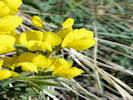
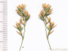
Field identification: Thermopsis rhombifolia
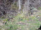
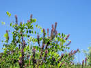
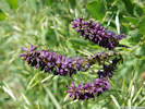
Thermopsis rhombifolia (Nutt. ex Pursh) Nutt. ex Richardson var. divaricarpa (A. Nelson) Isely. Prairie Thermopsis. North Table Mountain Park, Jefferson County, Colorado. Lower part of Cottonwood Canyon, 285 m. northwest of Neighborhood Access trailhead at Ridge Road and Ulysses Way, 2.89 km. northeast of the GNIS location of Golden. 39.775°N, 105.1987°W. WGS 1984 Elev. 1773 m. Fruit ascending to spreading. Large patch in meadow, visited by large bumblebees. | ||||||||||||||||||||
|
Literature Cited:
|
1348 |
Field identification: Thermopsis rhombifolia, on the other side of the creek.
Thermopsis rhombifolia (Nutt. ex Pursh) Nutt. ex Richardson var. divaricarpa (A. Nelson) Isely. Prairie Thermopsis. North Table Mountain Park, Jefferson County, Colorado. Lower part of Cottonwood Canyon, 285 m. northwest of Neighborhood Access trailhead at Ridge Road and Ulysses Way, 2.89 km. northeast of the GNIS location of Golden. 39.7747°N, 105.199°W. WGS 1984 Elev. 1764 m. Fruit ascending to spreading. Large patch in meadow, visited by large bumblebees. On the other side of the creek from my Coll. No. 1347 of the same taxon. | ||||||||||||||||||||
| 1349 |
Field identification: Cercocarpus montanus
Cercocarpus montanus Raf. Alder-Leaf Mountain Mahogany. North Table Mountain Park, Jefferson County, Colorado. Lower Cottonwood Canyon on southeast side of North Table Mountain, about 295 m. northwest of the Neighborhood Access trailhead at the corner of Ridge Road and Ulysses Way, 2.9 km. northeast of the GNIS location of Golden. 39.775°N, 105.1989°W. WGS 1984 Elev. 1776 m. | |||||||||||||||||||||
| 1350 |
Field identification: Rubus deliciousus
Rubus deliciosus Torr. Delicious raspberry. North Table Mountain Park, Jefferson County, Colorado. Lower Cottonwood Canyon on southeast side of North Table Mountain, about 310 m. northwest of the Neighborhood Access trailhead at the corner of Ridge Road and Ulysses Way, 2.9 km. northeast of the GNIS location of Golden. 39.7751°N, 105.1988°W. WGS 1984 Elev. 1773 m. | |||||||||||||||||||||
| 1351 |
Field identification: Populus deltoides
Populus deltoides Marshall ssp. monilifera (Aiton) Eckenw. Plains Cottonwood. North Table Mountain Park, Jefferson County, Colorado. Lower Cottonwood Canyon on southeast side of North Table Mountain, about 400 m. northwest of the Neighborhood Access trailhead at the corner of Ridge Road and Ulysses Way, 2.9 km. northeast of the GNIS location of Golden. 39.7759°N, 105.1994°W. WGS 1984 Elev. 1782 m. Group of 8-10 trees together on both sides of creek. | |||||||||||||||||||||
|
Other articles:
|
1352 |
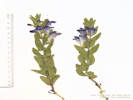
Field identification: Scutellaria brittonii
Scutellaria brittonii Porter. Britton's Skullcap. North Table Mountain Park, Jefferson County, Colorado. Lower Cottonwood Canyon on southeast side of North Table Mountain, about 260 m. northwest of the Neighborhood Access trailhead at the corner of Ridge Road and Ulysses Way, 2.9 km. northeast of the GNIS location of Golden. 39.7748°N, 105.1981°W. WGS 1984 Elev. 1773 m. Moderate slope above rock outcrop. | ||||||||||||||||||||
| 1353 |
Field identification: Allium textile
Allium textile A. Nelson & J.F. Macbr. Textile Onion. North Table Mountain Park, Jefferson County, Colorado. Lower Cottonwood Canyon on southeast side of North Table Mountain, about 250 m. northwest of the Neighborhood Access trailhead at the corner of Ridge Road and Ulysses Way, 2.9 km. northeast of the GNIS location of Golden. 39.7747°N, 105.1979°W. WGS 1984 Elev. 1775 m. Moderate slope above rock outcrop. | |||||||||||||||||||||
|
Other articles:
|
1354 |
Field identification: domestic apple?
Nope, another Prunus
Prunus pensylvanica L. f. Pin Cherry. North Table Mountain Park, Jefferson County, Colorado. Lower Cottonwood Canyon on southeast side of North Table Mountain, about 130 m. northwest of the Neighborhood Access trailhead at the corner of Ridge Road and Ulysses Way, 2.9 km. northeast of the GNIS location of Golden. 39.7739°N, 105.1974°W. WGS 1984 Elev. 1755 m. Trail-side, in an area with old concrete foundations, as though planted. Coll. No. 1354, 20 May 2016, characters observed: Small tree, to 3 m., branches unarmed; Leaves, petiole, 12 mm., very short hairy, blade, elliptic, 25 mm. × 20 mm. wide, margin, toothed, gland-tipped, veins of young leaves hairy abaxially; Flowers, clusters of 7-8 on pedicels to 14 mm.; Sepals, glabrous, few (2) glands on margins; Hypanthium, glabrous inside; Petals, 5-7 mm., white; Stamens, #12-15; Ovary, superior, glabrous; Style, #1, 4 mm., emerges from top of ovary; Fruit, unknown. | ||||||||||||||||||||
|
Locations: Tin Cup Ridge. |
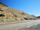
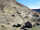
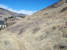
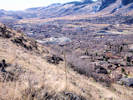
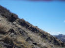
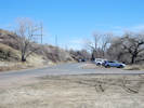
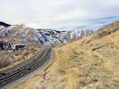
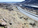
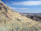
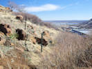
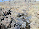
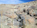
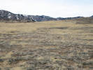
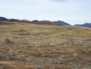
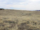
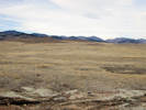
Saturday, May 21st“Tin Cup Ridge,” from the Rooney Road Sports Complex to the power lines at the south end. | |||||||||||||||||||||
|
Other articles:
|
1355 |
Field identification: Arctostaphylos uva-ursi
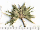
Arctostaphylos uva-ursi (L.) Sprengel. Bearberry. Tin Cup Ridge, Jefferson County, Colorado. Along the top of Tin Cup Ridge, the northward extension of Dinosaur Ridge into Golden, 5.5 km. south of the GNIS location of Golden 39.708°N, 105.2027°W. WGS 1984 Elev. 1963 m. Sterile. Small patch growing in and around rocks. | ||||||||||||||||||||
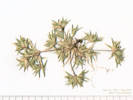
| 1356 |
Field identification: Lomatium orientale
Lomatium orientale J.M. Coult. & Rose. Northern Idaho Biscuitroot. Tin Cup Ridge, Jefferson County, Colorado. Along the top of Tin Cup Ridge, the northward extension of Dinosaur Ridge into Golden, 5.5 km. south of the GNIS location of Golden 39.708°N, 105.2027°W. WGS 1984 Elev. 1963 m. Thin soils between layers of upturned strata. | |||||||||||||||||||||
|
Other articles:
|
1357 |
Field identification: Harbouria trachypleura
Harbouria trachypleura (A. Gray) J.M. Coult. & Rose. Whiskbroom Parsley. Tin Cup Ridge, Jefferson County, Colorado. Along the top of Tin Cup Ridge, the northward extension of Dinosaur Ridge into Golden, 5.5 km. south of the GNIS location of Golden 39.7079°N, 105.2028°W. WGS 1984 Elev. 1964 m. Open, rocky ridge with Cercocarpus and ponderosa pine. | ||||||||||||||||||||
|
Literature Cited:
|
1358 |
Field identification: Mertensia lanceolata
Mertensia lanceolata (Pursh) DC. Prairie Bluebells. Tin Cup Ridge, Jefferson County, Colorado. Along the top of Tin Cup Ridge, the northward extension of Dinosaur Ridge into Golden, 5.5 km. south of the GNIS location of Golden. 39.7079°N, 105.2027°W. WGS 1984 Elev. 1968 m. Mostly around base of juniper and mountain mahogany at this location. | ||||||||||||||||||||
| 1358 |
Field identification: Cercocarpus montana
Cercocarpus montanus Raf. Alder-Leaf Mountain Mahogany. Tin Cup Ridge, Jefferson County, Colorado. Along the top of Tin Cup Ridge, the northward extension of Dinosaur Ridge into Golden, 5.5 km. south of the GNIS location of Golden. 39.7079°N, 105.2027°W. WGS 1984 Elev. 1968 m. | |||||||||||||||||||||
|
Literature Cited:
Other articles:
|
1360 |
Field identification: Thermopsis rhombifolia, likely var. divaricarpa based on leaflet size, per Chen et al., 1994:
Thermopsis rhombifolia (Nutt. ex Pursh) Nutt. ex Richardson var. divaricarpa (A. Nelson) Isely. Prairie Thermopsis. Tin Cup Ridge, Jefferson County, Colorado. Along the top of Tin Cup Ridge, the northward extension of Dinosaur Ridge into Golden, 5.4 km. south of the GNIS location of Golden. 39.7085°N, 105.2028°W. WGS 1984 Elev. 1959 m. No fruit, large leaflets. | ||||||||||||||||||||
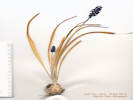
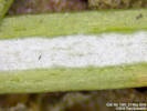 Glaucous stomatal band on leaf of Coll. No. 1361, Juniperus communis var. depressa Glaucous stomatal band on leaf of Coll. No. 1361, Juniperus communis var. depressa
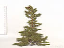 Coll. No. 1361, Juniperus communis var. depressa Coll. No. 1361, Juniperus communis var. depressa
|
1361 |
Field identification: Juniperus communis
Juniperus communis L. var. depressa. Common Juniper. Tin Cup Ridge, Jefferson County, Colorado. Along the top of Tin Cup Ridge, the northward extension of Dinosaur Ridge into Golden, 5.4 km. south of the GNIS location of Golden. 39.7085°N, 105.2029°W. WGS 1984 Elev. 1956 m. | ||||||||||||||||||||
|
Other articles:
|
1362 |
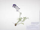
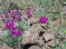
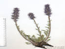
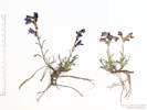
Field identification: Delphinium, maybe D. nuttallianum
Delphinium nuttallianum Pritz. Twolobe Larkspur. Tin Cup Ridge, Jefferson County, Colorado. Along the top of Tin Cup Ridge, the northward extension of Dinosaur Ridge into Golden, 5.3 km. south of the GNIS location of Golden. 39.7095°N, 105.2031°W. WGS 1984 Elev. 1950 M. Scattered between and inside shrubs. | ||||||||||||||||||||
| 1363 |
Field identification: Rubus deliciosus
Rubus deliciosus Torr. Delicious raspberry. Tin Cup Ridge, Jefferson County, Colorado. Along the top of Tin Cup Ridge, the northward extension of Dinosaur Ridge into Golden, 5.3 km. south of the GNIS location of Golden. 39.7095°N, 105.2031°W. WGS 1984 Elev. 1952 m. | |||||||||||||||||||||
|
Other articles:
|
1364 |
Field identification: Potentilla fissa
Potentilla fissa Nutt. ex Torr. & A.Gray. Bigflower Cinquefoil. Tin Cup Ridge, Jefferson County, Colorado. Along the top of Tin Cup Ridge, the northward extension of Dinosaur Ridge into Golden, 5.2 km. south of the GNIS location of Golden. 39.711°N, 105.2038°W. WGS 1984 Elev. 1935 m. Just beginning to bloom. West-facing grassy slopes. Coll. No. 1364, 21 May 2016, characters observed: Perennial, herb, caespitose, to 20 cm., terrestrial, not stoloniferous, glandular-hairy throughout; Leaves, basal, 12.5 cm. × 2.6 cm. wide, pinnately compound, leaflets, #11; cauline, reduced in size and number of leaflets, 4 cm. × 2 cm. wide, leaflets, #7; Inflorescence, congested cyme, with 5-7 flowers; Flowers, calyx, lobes, #5, 11 mm. × 4.5 mm. wide, fused at base, bractlets, 5 mm. × 1.3 mm. wide; Receptacle, hairy, <1 mm., Petals, 9 mm. × 7.5 mm. wide, color yellow; Stamens, many; Ovaries, many; Styles, widest at middle, attached laterally below top of ovary. | ||||||||||||||||||||
|
|
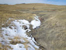
Tuesday, May 24thAttempted to collect on the west side of North Table Mountain, taking the North Table Loop north from the trailhead off Hwy 93. Trip was cut short by thunderstorm and hail. | |||||||||||||||||||||
|
Other articles:
|
1365 |
Field identification: Thlaspi arvense
Thlaspi arvense L. Field Penny Cress. North Table Mountain Park, Jefferson County, Colorado. Lower west-facing slopes of North Table Mountain, off the North Table Loop, 500 m. north of the trailhead off CO Highway 93, 3.5 km. north of the GNIS location of Golden. 39.787°N, 105.2275°W. WGS 1984 Elev. 1833 m. Gentle grassy slope. | ||||||||||||||||||||
|
Other articles:
|
1366 |
Field identification: Lepidium draba
Lepidium draba L. White Top. North Table Mountain Park, Jefferson County, Colorado. Lower west-facing slopes of North Table Mountain, off the North Table Loop, 500 m. north of the trailhead off CO Highway 93, 3.5 km. north of the GNIS location of Golden. 39.7869°N, 105.2275°W. WGS 1984 Elev. 1833 m. Multiple colonies spread around gentle grassy slopes. Weed: CO DofA, List: B. Coll. No. 1366, 24 May 2016, characters observed: Perennial, herb, to 45 cm., spreading by rhizomes, hairs simple; Leaves, basal, not seen, cauline, sessile, base auriculate, 36 mm. × 12 mm. wide, oblanceolate, margin irregularly toothed, reduced above; Flowers, petals, white; Style, immature, 1 mm.; Fruit, silicle, immature, 1.3-1.5 mm. × 0.5-1.0 mm. wide, flattened, wings 0, glabrous, reticulate-veined. | ||||||||||||||||||||
|
Other articles:
|
1367 |
Field identification: Alyssum Alyssum simplex Rudolphi. European Madwort. North Table Mountain Park, Jefferson County, Colorado. Lower west-facing slopes of North Table Mountain, off the North Table Loop, 500 m. north of the trailhead off CO Highway 93, 3.5 km. north of the GNIS location of Golden. 39.787°N, 105.2274°W. WGS 1984 Elev. 1834 m. Larger plants here amidst grasses, mostly smooth brome. Coll. No. 1367, 24 May 2016, characters observed: Annual, to 30 cm., stellate hairs throughout; Leaves, basal, withered at flowering, appear compound, cauline, alternate, oblanceolate, 17 mm. × 4 mm. wide, margin entire, tip acute; Pedicels, in fruit, 4.5 mm.; Sepals, 2 mm. × 0.7 mm. wide, deciduous in fruit; Flowers, petals, yellow; Stamens, 2.5 mm.; Filaments, 2.0 mm., winged, 1.5 mm.; Fruit, silique, 5 mm. × 5.6 mm. wide, orbicular, flattened. | ||||||||||||||||||||
| 1368 |
Field identification: Androsace occidentalis
Androsace occidentalis Pursh. Western Rockjasmine. North Table Mountain Park, Jefferson County, Colorado. Lower west-facing slopes of North Table Mountain, off the North Table Loop, 500 m. north of the trailhead off CO Highway 93, 3.5 km. north of the GNIS location of Golden. 39.787°N, 105.2274°W. WGS 1984 Elev. 1836 m. Tiny annual, hidden in the grass. | |||||||||||||||||||||
|
Literature Cited:
|
1369 |
Field identification: Rhus aromatica var. trilobata
Rhus trilobata Nutt. var. trilobata. Skunkbush Sumac. North Table Mountain Park, Jefferson County, Colorado. Lower west-facing slopes of North Table Mountain, off the North Table Loop, 500 m. north of the trailhead off CO Highway 93, 3.5 km. north of the GNIS location of Golden. 39.787°N, 105.2272°W. WGS 1984 Elev. 1838 m. Shrub on small ridge.
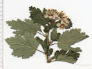
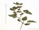
Nomenclature of RhusWelsh, et al. (1993) used Rhus aromatica Aiton var. trilobata (Nutt.) A. Gray (Syn: Rhus trilobata Nutt. ex T. & G.). An early study of the Rhus complex phylogeny and biogeography by Miller, et al. (2001) showed that the Madro-Tertiary floristic element (subgenus Lobadium) had a single origin within the Arcto-Tertiary floristic element (subgenus Rhus). Yi, et al. (2004) reported phylogenetic and biogeographis diversication of Rhus in the Northern Hemisphere .. Anderson (2006) used Rhus aromatica Aiton var. trilobata (Nutt.) A. Gray (Syn: Rhus trilobata Nutt.). SEINet (accessed 22 Nov 2016) cites this article and the SEINet taxon tree follow this nomenclature. Yi, et al. (2007 published a phylogeny of Rhus based on sequences of Nuclear nia-i3 intron and Chloroplast TrnC-trnD finding that Rhus is monophyletic and that incongruence among nuclear and chloroplast datasets, together with the phylogenetic positions, sympatric distributions, and morphological intermediacy of discordant taxa, suggest possible reticulate evolution among members of Rhus. Baldwin, et al. (2012) propose Rhus aromatica Aiton (Syn: R. trilobata Nutt.), without infraspecific taxa. Weber & Wittmann (2012) used Rhus aromatica Aiton subsp. trilobata (Nuttall) W. A. Weber (Syn: Rhus trilobata.) Ackerfield (2015) uses Rhus trilobata Nutt. (Syn: Rhus aromatica Aiton) var. trilobata. Andres-Hernandez, et al. (2014) combined structural and trnL-F and internal transcribed spacer sequences this one is $38. The Plant List (accessed 22 Nov 2016) states that Rhus aromatica Aiton is an accepted name with publication details Hort. Kew. [W. Aiton] 1: 367. 1789 [7 Aug-1 Oct 1789] (as "aromaticum") The Plant List (accessed 22 Nov 2016) also states that Rhus trilobata Nuttall is an accepted name with publication details Fl. N. Amer. (Torr. & A. Gray) 1(2): 219. 1838 [Oct 1838] . In that publication Torrey & Gray (1838) recognize Rhus aromatica Aiton as a separate taxon in the same section. | ||||||||||||||||||||
|
Other articles:
Locations:
Ranson/Edwards Homestead Open Space Park.
|
Sunday, May 29th
| |||||||||||||||||||||
|
Other articles:
|
1370 |
Field identification: Iris missouriensis
Iris missouriensis Nutt. Western Blue Flag. Ranson/Edwards Homestead Open Space Park, Jefferson County, Colorado. High plains above Rocky Flats, 1.7 mi. west on CO Hwy 72 from CO Hwy 93, then 1.4 mi. north on Plainview Road. 39.894°N, 105.2628°W. WGS 1984 Elev. 1934 m. Moist east-facing slope with deep grass. | ||||||||||||||||||||
|
Other articles:
|
1371 |
Field identification: Arnica fulgens
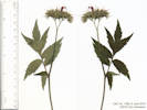
Arnica fulgens Pursh. Foothill Arnica. Ranson/Edwards Homestead Open Space Park, Jefferson County, Colorado. High plains above Rocky Flats, 1.7 mi. west on CO Hwy 72 from CO Hwy 93, then 1.4 mi. north on Plainview Road. 15.8 km. north northwest of the GNIS location of Golden. 39.8941°N, 105.2629°W. WGS 1984 Elev. 1941 m. Cauline leaves opposite. Moist east-facing slope with deep grass. Perennial herb of wetlands or moist areas, to 35 cm., glandular hairy throughout; Leaves, mostly basal and few cauline, basal, axils with 5 mm. brown wavy hair, petiole 70 mm. + blade 60 mm. × 12 mm. wide, 5 × longer than wide, cauline, opposite, sessile, ±2 pair, much reduced; Inflorescence, single heads on peduncle to 80 mm., flowers of two kinds; Involucre, 13 mm. × 22 mm. wide; Phyllaries, 2 ±equal series, 11-12 mm.× 3 mm. wide, green with dark tips; Receptacle epaleate; Rays, #12, fertile, tube 3 mm. + blade 16 mm. × 7 mm. wide = 19 mm., corolla yellow; Disc flowers, tube 7 mm. + lobes ≤1 mm. = 8 mm.; Pappus, bristles, 9 mm., white; Anther, yellow; Achene, 5 mm., short hairy. Described from Coll. No. 1119, 28 May 2015, and Coll. No. 1371, 29 May 2016. Subtribe Arnicinae is a sister subtribe to Madiinae (tarweeds) and Hulseinae, which contains both Hulsea and Eatonella, both common in the Mono Lake basin. Described by Pursh in Fl. Am. Sept. 2: 527 “On the banks of the Missouri,” but this is not a Lewis & Clark collection. Perhaps it is a Nuttall collection from 1811. | ||||||||||||||||||||
|
Other articles:
|
1372 |
Field identification: Orobanche uniflora
Orobanche uniflora L. Naked Broomrape. Ranson/Edwards Homestead Open Space Park, Jefferson County, Colorado. High plains above Rocky Flats, 1.7 mi. west on CO Hwy 72 from CO Hwy 93, then 1.4 mi. north on Plainview Road. 15.8 km. north northwest of the GNIS location of Golden. 39.8947°N, 105.2627°W. WGS 1984 Elev. 1939 m. Calyx lobes ±= tube when fresh, lobes > tube when dry, corolla white with bluish-purple. | ||||||||||||||||||||
|
Other articles:
|
1373 |
Field identification: Comandra umbellata ssp. pallida
Comandra umbellata (L.) Nutt. ssp. pallida (A. DC.) Piehl. Pale Bastard Toadflax. Ranson/Edwards Homestead Open Space Park, Jefferson County, Colorado. High plains above Rocky Flats, 1.7 mi. west on CO Hwy 72 from CO Hwy 93, then 1.4 mi. north on Plainview Road. 15.8 km. north northwest of the GNIS location of Golden. 39.8947°N, 105.2627°W. WGS 1984 Elev. 1939 m. | ||||||||||||||||||||
| 1374 |
Field identification: Eremogone fendleri (A. Gray) Ikonnikov. Fendler's Sandwort. Ranson/Edwards Homestead Open Space Park, Jefferson County, Colorado. High plains above Rocky Flats, 15.8 km. north northwest of the GNIS location of Golden, 1.7 mi. west on CO Hwy 72 from CO Hwy 93, 1.4 mi. north on Plainview Road, then 310 m. north of Plainview Road. 39.895°N, 105.2628°W. WGS 1984 Elev. 1941 m. | |||||||||||||||||||||
|
Literature Cited:
|
1375 |
Field identification: Thermopsis rhombifolia
Thermopsis rhombifolia (Nutt. ex Pursh) Nutt. ex Richardson var. divaricarpa (A. Nelson) Isely. Prairie Thermopsis. Ranson/Edwards Homestead Open Space Park, Jefferson County, Colorado. High plains above Rocky Flats, 15.8 km. north northwest of the GNIS location of Golden, 1.7 mi. west on CO Hwy 72 from CO Hwy 93, 1.4 mi. north on Plainview Road, then 335 m. north of Plainview Road. 39.8951°N, 105.263°W. WGS 1984 Elev. 1940 m. Small ridge between two watercourses. | ||||||||||||||||||||
|
Other articles:
|
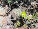
Field observation of Echinocereus viridiflorus in bloom. | |||||||||||||||||||||
 Coll. No. 1376, Draba reptans Coll. No. 1376, Draba reptans
|
1376 |
Field identification: Draba, probably D. reptans
Draba reptans (Lam.) Fernald. Carolina Whitlow Grass. Ranson/Edwards Homestead Open Space Park, Jefferson County, Colorado. High plains above Rocky Flats, 15.8 km. north northwest of the GNIS location of Golden, 1.7 mi. west on CO Hwy 72 from CO Hwy 93, 1.4 mi. north on Plainview Road, then 340 m. north of Plainview Road. 39.8953°N, 105.2628°W. WGS 1984 Elev. 1939 m. Growing among short grasses and forbs. Coll. No. 1376, 29 May 2016, characters observed: Annual, from slender taproot, to 10 cm.; Leaves, basal, withered in fruit, entire, cauline, 0-1 pair per stem, 6 mm. × 2 mm. wide, entire, hairs branched; Pedicels, glabrous; Flowers, petals, color unknown; Fruit, distributed in upper ⅕-⅓ of rachis. | ||||||||||||||||||||
 Inflorescence of Coll. No. 1377, Physaria montana Inflorescence of Coll. No. 1377, Physaria montana
 Coll. No. 1377, Physaria montana Coll. No. 1377, Physaria montana
|
1377 |
Field identification: Physaria, probably P. montana.
Physaria montana (A. Gray) Greene. Mountain Bladderpod. Ranson/Edwards Homestead Open Space Park, Jefferson County, Colorado. High plains above Rocky Flats, 15.8 km. north northwest of the GNIS location of Golden, 1.7 mi. west on CO Hwy 72 from CO Hwy 93, 1.4 mi. north on Plainview Road, then 340 m. north of Plainview Road. 39.8953°N, 105.2627°W. WGS 1984 Elev. 1941 m. Among short grasses and forbs on a drier, gravelly alluvial ridge. | ||||||||||||||||||||
| 1378 |
Field identification: Boraginaceae, probably Lappula redowski.
Lappula occidentalis (S. Watson) Greene var. cupulata (A. Gray) Higgins. Crowned Stickseed. Ranson/Edwards Homestead Open Space Park, Jefferson County, Colorado. High plains above Rocky Flats, 15.8 km. north northwest of the GNIS location of Golden, 1.7 mi. west on CO Hwy 72 from CO Hwy 93, 1.4 mi. north on Plainview Road, then 340 m. north of Plainview Road. 39.8953°N, 105.2627°W. WGS 1984 Elev. 1940 m. Short stature compared to those typically seen. Among short grasses and forbs on a drier, gravelly alluvial ridge. | |||||||||||||||||||||
|
Other articles:
|
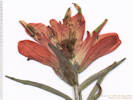
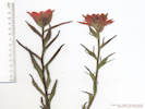
1379 |
Field identificaton: Castilleja integra.
Castilleja integra A. Gray. Wholeleaf Indian Paintbrush. Ranson/Edwards Homestead Open Space Park, Jefferson County, Colorado. High plains above Rocky Flats, 15.8 km. north northwest of the GNIS location of Golden, 1.7 mi. west on CO Hwy 72 from CO Hwy 93, 1.4 mi. north on Plainview Road, then 410 m. north of Plainview Road. 39.896°N, 105.2627°W. WGS 1984 Elev. 1937 m. | ||||||||||||||||||||
| 1380 |
Field identification: Harbouria trachypleura
Harbouria trachypleura (A. Gray) J.M. Coult. & Rose. Whiskbroom Parsley. Ranson/Edwards Homestead Open Space Park, Jefferson County, Colorado. High plains above Rocky Flats, 15.8 km. north northwest of the GNIS location of Golden, 1.7 mi. west on CO Hwy 72 from CO Hwy 93, 1.4 mi. north on Plainview Road, then 620 m. north of Plainview Road. 39.898°N, 105.2612°W. WGS 1984 Elev. 1927 m. On break in slope above reservoir. | |||||||||||||||||||||
| 1381 |
Field identification: Delphinium nuttallianum.
Delphinium nuttallianum Pritz. Twolobe Larkspur. Ranson/Edwards Homestead Open Space Park, Jefferson County, Colorado. High plains above Rocky Flats, 15.8 km. north northwest of the GNIS location of Golden, 1.7 mi. west on CO Hwy 72 from CO Hwy 93, 1.4 mi. north on Plainview Road, then 620 m. north of Plainview Road. 39.898°N, 105.2611°W. WGS 1984 Elev. 1924 m. Upper northwest-facing slope above reservoir. | |||||||||||||||||||||
|
Other articles:
|
Wednesday, June 1st | |||||||||||||||||||||
|
Other articles:
|
1382 |
Field identification: Lithospermum incisum Lehm. Narrowleaf Stoneseed. North Table Mountain Park, Jefferson County, Colorado. Northwest base of North Table Mountain, about 150 m. upslope of the North Table Loop, 3.5 km north of the GNIS location of Golden. 39.7871°N, 105.2261°W. WGS 1984 Elev. 1811 m. Uncommon; widely distributed but not often seen. Northwest-facing slope, a little drier than surrounding area. | ||||||||||||||||||||
|
Other articles:
|
1383 |
Field identification: Linum lewisii.
Linum perenne L. Blue Flax. North Table Mountain Park, Jefferson County, Colorado. Northwest base of North Table Mountain, about 110 m. upslope of the North Table Loop, 3.5 km north of the GNIS location of Golden. 39.787°N, 105.2259°W. WGS 1984 Elev. 1845 m. Flowers consistently heterostylous, styles > stamens. On the edge of a small hill.
Definitely Linum, maybe L. perenne because the styles are consistently longer than the stamens, which, in Weber & Wittmann (2012), would put us in L. perenne rather than L. lewisii. The key in Ackerfield (2015) does not discriminate between the two taxa based upon characters that can be observed with this collection. | ||||||||||||||||||||
| 1384 |
Field identification: Astragalus sp., small purple flowers, growing on pedicels arising from axils.
Astragalus flexuosus G. Don. Flexible Milkvetch. North Table Mountain Park, Jefferson County, Colorado. Northwest base of North Table Mountain, about 120 m. upslope of the North Table Loop, 3.5 km north of the GNIS location of Golden. 39.787°N, 105.2259°W. WGS 1984 Elev. 1850 m. Small purple flowers, on pedicels arising from axils. In grass and forbs on a small ridge. | |||||||||||||||||||||
|
Other articles:
|
1385 |
Field identification: Oxytropis lambertii sp., large magenta flowers, on basal scape.
Oxytropis lambertii Pursh. Purple Locoweed. North Table Mountain Park, Jefferson County, Colorado. Northwest base of North Table Mountain, about 120 m. upslope of the North Table Loop, 3.5 km north of the GNIS location of Golden. 39.7869°N, 105.2261°W. WGS 1984 Elev. 1849 m. Large magenta flowers, on peduncle arising from base. Coll. No. 1385, 1 June 2016, characters observed: Perennial herb, acaulescent, mostly dolabriform hairs (one arm much shorter than the other); Leaves, basal, pinnately compound, leaflets #17, terminal leaflet present; Inflorescence, raceme, peduncle 30 cm., pedicels very short; Bracts, 7 mm. × 1.6 mm. wide, green, lanceolate; Calyx, tube 7 mm. + lobes 4 mm. = 11 mm.; Flower, zygomorphic, various shades of magenta to purple, banner, 17 mm., wings, 16 mm., keel, 13 mm., blades united enclosing stamens, recurved beak; Stamens, #10, diadelphous. | ||||||||||||||||||||
 Coll. No. 1386, Orobanche fasciculata Coll. No. 1386, Orobanche fasciculata
|
1386 |
Field identification: Orobanche fasciculata Nutt. Clustered Broomrape. North Table Mountain Park, Jefferson County, Colorado. Small canyon draining the northwest side of North Table Mountain, about 160 m. upslope of the North Table Loop, 3.5 km north of the GNIS location of Golden. 39.787°N, 105.2244°W. WGS 1984 Elev. 1864 m. 19 flowers in 3 clusters, calyx lobes = tube, tan color. Rare, southwest facing slope. In O. fasciculata the calyx has a slightly reddish tint to it, something not noticed in O. uniflora. | ||||||||||||||||||||
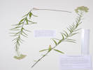
| 1387 |
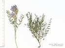
Field identification: Vicia americana
Vicia americana Willd. var. americana. American Vetch. North Table Mountain Park, Jefferson County, Colorado. Small canyon draining the northwest side of North Table Mountain, about 160 m. upslope of the North Table Loop, 3.5 km north of the GNIS location of Golden. 39.787°N, 105.2244°W. WGS 1984 Elev. 1863 m. Vetch, leaves with forked terminal tendril. Coll. No. 1387, 1 June 2016, characters observed: Perennial herb, to 30 cm.; Stem, not winged; Leaves, stipules, 3 mm. × 10 mm. wide, lobed, not connate, nectary 0; cauline, compound, odd-pinnate, leaflets #8, + forked tendril; Inflorescence, raceme, 4-5 flowered, pedicel 17 mm.; Flowers, zygomorphic, 20 mm.; Style, round, ring of hairs below stigma; Legume, stipe 5 mm. + body 20 mm. × 3 mm. wide + persistent style 2 mm. Key characters:
| |||||||||||||||||||||
 Inflorescence of Coll. No. 1388, Euphorbia spathulata Inflorescence of Coll. No. 1388, Euphorbia spathulata
 Coll. No. 1388, Euphorbia spathulata Coll. No. 1388, Euphorbia spathulata
|
1388 |
Field identification: Euphorbia spathulata.
Euphorbia spathulata Lam. Warty Spurge, Spoonleaf Spurge. North Table Mountain Park, Jefferson County, Colorado. Northwest side of North Table Mountain, southwest-facing slope above canyon, about 75 m. west of the underground water tank and 160 m. west of the Mesa Top Trail, 3.5 km north of the GNIS location of Golden. 39.787°N, 105.223°W. WGS 1984 Elev. 1893 m. Not listed as a noxious weed. Coll. No. 1388, 1 June 2016, characters observed: Annual, tap-rooted, to 25 cm., glabrous throughout; Leaves, cauline alternate, 26 mm. × 9 mm. wide, spatulate, toothed; Inflorescence, umbellate, flower a cyathium; Capsules, 2.5 mm. × 2.8 mm. wide, warty-tuberculate. | ||||||||||||||||||||
|
Other articles:
|
1389 |
Field identification: Dactylis glomerata, “Orchard Grass.”
Dactylis glomerata L. Orchard Grass. North Table Mountain Park, Jefferson County, Colorado. Northwest side of North Table Mountain, southwest-facing slope above canyon, on the edge of the disturbed construction area for the underground water tank and 120 m. west of the Mesa Top Trail, 3.5 km north of the GNIS location of Golden. 39.7869°N, 105.2225°W. WGS 1984 Elev. 1890 m. | ||||||||||||||||||||
| 1390 |
Field identification: Vicia americana, same as Coll. No. 1387.
Vicia americana Willd. var. americana. American Vetch. North Table Mountain Park, Jefferson County, Colorado. Northwest side of North Table Mountain, southwest-facing slope above canyon, on the edge of the disturbed construction area for the underground water tank and 80 m. west of the Mesa Top Trail, 3.5 km north of the GNIS location of Golden. 39.7868°N, 105.222°W. WGS 1984 Elev. 1882 m. Same as Coll. No. 1387. | |||||||||||||||||||||
 Coll. No. 1391, Ellisia nyctelea Coll. No. 1391, Ellisia nyctelea
|
1391 |
Field identification: Ellisia nyctelea, “Aunt Lucy”
Ellisia nyctelea (L.) L. Aunt Lucy. North Table Mountain Park, Jefferson County, Colorado. Northwest side of North Table Mountain, in the road to the underground water tank 30 m. northeast of the tank and 60 m. west of the Mesa Top Trail, 3.5 km north of the GNIS location of Golden. 39.7869°N, 105.2218°W. WGS 1984 Elev. 1875 m. Hidden in short mown grasses. | ||||||||||||||||||||
|
Other articles:
Locations:
North Table Mountain Park.
|
Thursday, June 2nd
| |||||||||||||||||||||
|
Locations: North Table Mountain Park. |
Sunday, June 5thColorado Native Plant Society field trip to North Table Mountain. | |||||||||||||||||||||
|
Locations: North Table Mountain. North Table Mountain Park. |
Wednesday, June 9th | |||||||||||||||||||||
|
Other articles:
|
1392 |
Field identification: Penstemon secundiflorus.
Penstemon secundiflorus Benth. Sidebells Penstemon. North Table Mountain, Jefferson County, Colorado. Southwest side of North Table Mountain, along City of Golden North Table Mountain Trail, 2.6 km. north of the GNIS location of Golden. 39.7785°N, 105.2271°W. WGS 1984 Elev. 1866 m. West-facing slope with mixed grasses and forbs. | ||||||||||||||||||||
|
Other articles:
|
1393 |
Field identification: Linaria dalmatica.
Linaria dalmatica (L.) Mill. Dalmatian ToadFlax. North Table Mountain, Jefferson County, Colorado. Southwest side of North Table Mountain, along City of Golden North Table Mountain Trail, 2.6 km. north of the GNIS location of Golden. 39.7785°N, 105.2271°W. WGS 1984 Elev. 1870 m. West-facing slope with mixed grasses and forbs. Colorado Noxious Weed List B. | ||||||||||||||||||||
|
Other articles:
|
1394 |
Field identification: Vicia sp.
Vicia americana Willd. var. minor Hook. American Vetch. North Table Mountain, Jefferson County, Colorado. Southwest side of North Table Mountain, along City of Golden North Table Mountain Trail, 2.5 km. north of the GNIS location of Golden. 39.7776°N, 105.2262°W. WGS 1984 Elev. 1883 m. In grass and small shrubs below the trail. Coll. No. 1394, 1 June 2016, characters observed: Perennial herb, to 30 cm.; Stem, not winged; Leaves, stipules, 4 mm. × 15 mm. wide, reduced above, lobed, not connate, nectary 0; cauline, compound, odd-pinnate, leaflets #6-8, + simple tendril; Inflorescence, raceme, 4-5 flowered, pedicel 17 mm.; Flowers, zygomorphic, 14 mm., smaller than var. americana; petals, ±white, banner pink at point of inflection; Style, round, abaxially hairy below stigma; Legume, stipe ? mm. (indistinct) + body 32 mm. × 4 mm. wide + persistent style 2 mm. | ||||||||||||||||||||
 Coll. No. 1395 Galium aparine Coll. No. 1395 Galium aparine
|
1395 |
Field identification: Galium aparine.
Galium aparine L. Sticky Willy, Cleavers. North Table Mountain, Jefferson County, Colorado. Southwest side of North Table Mountain, along City of Golden North Table Mountain Trail, 2.5 km. north of the GNIS location of Golden. 39.7774°N, 105.2259°W. WGS 1984 Elev. 1890 m. Shade of large shrubs in ravine. Coll. No. 1395, 8 June 2016, characters observed: Annual/perennial unknown, weak-stemmed and scrambling through shrubs and grass; Stem, retrorsely scabrous on angles (but not densely so); Leaves, whorls of 6-8 (more leaves above, fewer below), 46 mm. × 4 mm. wide, oblanceolate, margins retrorsely scabrous, tips with a short spine; Flowers, corolla, greenish-white, lobes 1 mm.; Fruit, 1.3 mm., covered with hooked hairs. | ||||||||||||||||||||
|
Other articles:
|
1396 |
Field identification: Hydrophyllum fendleri.
Physocarpus monogynus (Torr.) J.M. Coult. Mountain Ninebark. North Table Mountain, Jefferson County, Colorado. Southwest side of North Table Mountain, along City of Golden North Table Mountain Trail, 2.5 km. north of the GNIS location of Golden. 39.7773°N, 105.226°W. WGS 1984 Elev. 1889 m. Moist shady west-facing ravine. | ||||||||||||||||||||
|
Other articles:
|
1397 |
Field identification: Physocarpus monogynus.
Physocarpus monogynus (Torr.) J.M. Coult. Mountain Ninebark. North Table Mountain, Jefferson County, Colorado. Southwest side of North Table Mountain, along City of Golden North Table Mountain Trail, 2.5 km. north of the GNIS location of Golden. 39.7773°N, 105.226°W. WGS 1984 Elev. 1889 m. Moist shady west-facing ravine. Coll. No. 1397, 8 June 2016, characters observed: Shrub, height unknown (growing in ravine); Leaves, alternate, simple, hairs stellate, petiole, 10 mm., blade, 30 mm. × 33 mm. wide, ovate, palmate-veined, doubly crenate; Inflorescence, umbellate corymb, ±20-flowered; Pedicels, 8-12 mm.; Flowers, limb, 12 mm., petals, 4.5 mm., color cream; Styles, 2. | ||||||||||||||||||||
|
Other articles:
|
1398 |
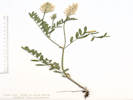
Field identification: Astragalus, maybe Astragalus agrestis Douglas ex G. Don. Purple Milkvetch. North Table Mountain, Jefferson County, Colorado. Southwest side of North Table Mountain, along City of Golden North Table Mountain Trail, 2.3 km. north of the GNIS location of Golden. 39.7758°N, 105.2261°W. WGS 1984 Elev. 1906 m. Trailside, in grasses, in flat area likely created by a landslide. Coll. No. 1398, 8 June 2016, characters observed: Perennial herb, to 15 cm., caulescent, basifixed straight appressed hairy throughout; Leaves, cauline, alternate, stipules, 5 mm., connate opposite petiole, compound, odd-pinnate, leaflets, #13, 8 mm. × 2 mm. wide, straight hairy, tip round; Inflorescence, upright ovoid cluster; Calyx, tube 4.5 mm. + lobes 3.5 mm. = 8 mm., mix of white and black hairs; Flowers, zygomorphic, 11 mm., blue-purple; Style, 7 mm., persistent; Legume, immature, 5 mm. × 1.7 mm. wide, stipe very short (0.4 mm.?), dense long straight soft hairy. | ||||||||||||||||||||
|
Other articles:
|
1399 |
Field identification: Scozonera laciniata.
Scorzonera laciniata L. Cutleaf Vipergrass. North Table Mountain, Jefferson County, Colorado. Southwest side of North Table Mountain, along City of Golden North Table Mountain Trail, 2.2 km. north of the GNIS location of Golden. 39.7749°N, 105.2262°W. WGS 1984 Elev. 1902 m. Disturbed trailside with grasses and Tragopogon dubius. Coll. No. 1399, 8 June 2016, characters observed: Perennial herb, to 40 cm., Leaves, basal and cauline, 7-20 cm., pinnately dissected into near-linear lobes, reduced but still well-developed above; Inflorescence, few heads on long stems; Phyllaries, in ±3 series, graduated, 4-13 mm. × 1.5-9 mm. wide, margins chartaceous, tips dark; Receptacle, epaleate; Flowers, ligulate (1 kind, 5-lobed), corolla yellow; Pappus of plumose bristles. | ||||||||||||||||||||
|
Other articles:
|
1400 |
Field identification: Astragalus, maybe A. laxmannii var. robustior.
Astragalus laxmannii Jacq. var. robustior (Hook.) Barneby & S. L. Welsh. Prairie Milkvetch. North Table Mountain, Jefferson County, Colorado. Southwest side of North Table Mountain, along City of Golden North Table Mountain Trail, 1.9 km. north of the GNIS location of Golden. 39.7727°N, 105.225°W. WGS 1984 Elev. 1912 m. In grasses and forbs trailside. Coll. No. 1400, 8 June 2016, characters observed: Perennial herb, to 40 cm., caulescent, hairs dolabriform; Leaves, cauline, compound, leaflets, #17, 17 mm. × 5 mm. wide, elliptic, tip cuspidate, terminal leaflet jointed to rachis; Calyx, tube 6 mm. + lobes 5 mm. = 11 mm.; Flowers, 14 mm., whitish; Legume, more erect than flower. | ||||||||||||||||||||
|
Other articles:
|
1401 |
Field identification: Eriogonum umbellatum, possibly two varieties.
This is a mixed collection of E. umbellatum and E. flavum. See also Coll. No. 1445. | ||||||||||||||||||||
|
Other articles:
|
1401.1 |
Field identification: Eriogonum sp.
Eriogonum arcuatum Greene. North Table Mountain Park, Jefferson County, Colorado. Top of North Table Mountain, southwest edge, within a few meters of the rim of the mesa, 1.7 km. north of the GNIS location of Golden. 39.7706°N, 105.2213°W. WGS 1984 Elev. 1962 m. Growing in thin soils and cracks on top of the uppermost basalt flow. Compare this collection to Coll. No. 1401.2, 1445.1, and 1445.2. Coll. No. 1401.1, 8 Jun 2015, characters observed: Perennial, caespitose, to 10 cm.; Leaves, basal, elliptic, petiole 10 mm. + blade 30 mm. × 12 mm. wide, adaxial greenish floccose, abaxial tomentose; Flowering stems, without a whorl of bracts mid-stem; Inflorescence, umbellate (simple, not compound); Involucre, sessile (not peduncled), 4.5 mm., hairy, teeth, very short; Flowers, (obscurely) attenuate at base; Perianth, 4.5-6.0 mm., bright yellow, hairy. | ||||||||||||||||||||
| 1401.2 |
Eriogonum umbellatum Torr. var. umbellatum. Sulphur-Flower Buckwheat.
North Table Mountain Park, Jefferson County, Colorado. Top of North Table Mountain, southwest edge, within a few meters of the rim of the mesa, 1.7 km. north of the GNIS location of Golden. 39.7706°N, 105.2213°W. WGS 1984 Elev. 1962 m. Growing in thin soils and cracks on top of the uppermost basalt flow. Compare this collection to Coll. No. 1401.1, 1445.1, and 1445.2. | |||||||||||||||||||||
|
Other articles:
|
1402 |
Field identification: Astragalus agrestis.
Astragalus agrestis Douglas ex G. Don. Purple Milkvetch. North Table Mountain Park, Jefferson County, Colorado. Top of North Table Mountain, southwest sector, 1.75 km. north of the GNIS location of Golden. 39.7713°N, 105.2211°W. WGS 1984 Elev. 1962 m. Growing in short grasses, near head of drainage where a little more soil has developed. Between North Table Loop and Golden Cliffs Trail, near their intersection. | ||||||||||||||||||||
| 1403 |
Field identification: Cryptantha virgata.
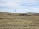
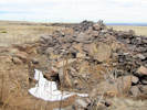
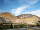
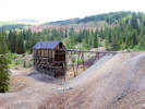
Cryptantha virgata (Porter) Payson. Miner"s Candle. North Table Mountain Park, Jefferson County, Colorado. Southwest portion of the top of North Table Mountain, across the North Table Loop from a large basalt quarry, 2.2 km. north of the GNIS location of Golden 39.7751°N, 105.222°W. WGS 1984 Elev. 1978 m. On top of the flat surface of a spoils pile from the basalt quarry to the west. | |||||||||||||||||||||
|
Other articles:
|
1404 |
Field identification: Townsendia grandflora.
Townsendia grandiflora Nutt. Largeflower Townsend Daisy. North Table Mountain Park, Jefferson County, Colorado. Southwest portion of the top of North Table Mountain, across the North Table Loop from a large basalt quarry, 2.2 km. north of the GNIS location of Golden. 39.7752°N, 105.2223°W. WGS 1984 Elev. 1979 m. On top of the flat surface of a spoils pile from the basalt quarry to the west. | ||||||||||||||||||||
|
Other articles:
|
1405 |
Field identification: Astragalus shortianus, only one plant seen on top of the mesa, no flowers, collected 2 leaves and 2 pods. Another plant seen on the City of Golden North Table Mountain Trail.
Astragalus shortianus Torr. & A.Gray. Short's Milkvetch. North Table Mountain Park, Jefferson County, Colorado. Southwest portion of the top of North Table Mountain, across the North Table Loop from a large basalt quarry, 2.2 km. north of the GNIS location of Golden. 39.7752°N, 105.2223°W. WGS 1984 Elev. 1976 m. Only plant seen, no flowers, collected two leaves and two pods. On top of the flat surface of a spoils pile from the basalt quarry to the west. Plant fragments which are consistent with A. shortianus. | ||||||||||||||||||||
| 1406 |
Field identification: Lithospermum incisum.
Lithospermum incisum Lehm. Narrowleaf Stoneseed. North Table Mountain Park, Jefferson County, Colorado. Southwest portion of the top of North Table Mountain, across the North Table Loop from a large basalt quarry, 2.2 km. north of the GNIS location of Golden. 39.7753°N, 105.2222°W. WGS 1984 Elev. 1978 m. On top of the flat surface of a spoils pile from the basalt quarry to the west. Uncommon, very widespread, but seldom seen, and never in large numbers. | |||||||||||||||||||||
|
Other articles:
|
1407 |
Field identification: Oenothera cespitosa.
Oenothera cespitosa Nutt. ssp. macroglottis (Rydb.) W.L. Wagner. Tufted Evening Primrose. North Table Mountain Park, Jefferson County, Colorado. Southwest portion of the top of North Table Mountain, across the North Table Loop from a large basalt quarry, 2.2 km. north of the GNIS location of Golden. 39.7755°N, 105.2223°W. WGS 1984 Elev. 1981 m. On the bank of a spoils pile from the basalt quarry, west-facing slopes. Most petals dried pink, a few remained yellowish. Coll. No. 1407, 8 Jun 2016, characters observed: Perennial herb, to 20 cm., glabrous, except as noted; Stem, short, to 4 cm., but definitely there; Leaves, petiole, 90 mm., blade, 90 mm. × 28 mm. wide, oblanceolate, margin toothed, straight hairy; Buds, sparsely hairy on veins; Flowers, solitary in axils, floral tube 100 mm., petals, 37 mm., yellowish, most drying purplish; Stigma, 4-lobed; Capsule, 27 mm. × 5 mm. wide, valve ridges not tuberculate. The leaves are toothed and not deeply lobed or deeply toothed, and there are no tubercules on the valve ridges of the capsules. Therefore, I am using var. macroglottis rather than var. marginata. | ||||||||||||||||||||
|
Locations: Ranson/Edwards Homestead Open Space Park. |
Friday, June 10thRanson/Edwards Homestead Open Space Park | |||||||||||||||||||||
| 1408 |
Field identification: Harbouria trachypleura.
Harbouria trachypleura (A. Gray) J.M. Coult. & Rose. Whiskbroom Parsley. Ranson/Edwards Homestead Open Space Park, Jefferson County, Colorado. 1.6 mi. west on CO Hwy 72 from CO Hwy 93, then 2.4 mi. northerly on Plainview Road, then 40 m. or so south of the road. 16 km. north northwest of the GNIS location of Golden. 39.8943°N, 105.2737°W. WGS 1984 Elev. 2009 m. Among grasses and ponderosa pines, near top of south-facing slope. | |||||||||||||||||||||
| 1409 |
Field identification: Eriogonum umbellatum.
Eriogonum umbellatum Torr. var. umbellatum. Sulphur-Flower Buckwheat. Ranson/Edwards Homestead Open Space Park, Jefferson County, Colorado. 1.6 mi. west on CO Hwy 72 from CO Hwy 93, then 2.4 mi. northerly on Plainview Road, then 40 m. or so south of the road. 16 km. north northwest of the GNIS location of Golden. 39.8943°N, 105.2737°W. WGS 1984 Elev. 2036 m. Among grasses and ponderosa pines, near top of south-facing slope. | |||||||||||||||||||||
| 1410 |
Field identification: Galium, maybe G. triflorum
Galium aparine L. Sticky Willy, Cleavers. Ranson/Edwards Homestead Open Space Park, Jefferson County, Colorado. 1.6 mi. west on CO Hwy 72 from CO Hwy 93, then 2.4 mi. northerly on Plainview Road, then 100 m. south of the road to the other side of the drainage. 16 km. north northwest of the GNIS location of Golden. 39.8937°N, 105.2734°W. WGS 1984 Elev. 2032 m. North-facing grassy slope with ponderosa pines. | |||||||||||||||||||||
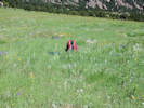 Habitat of Coll. No. 1411, Stellaria longifolia Habitat of Coll. No. 1411, Stellaria longifolia
|
1411 |
Field identification: Eremogone fendleri (A. Gray) Ikonnikov. Fendler's Sandwort. Ranson/Edwards Homestead Open Space Park, Jefferson County, Colorado. 1.6 mi. west on CO Hwy 72 from CO Hwy 93, 1.6 mi. northerly on Plainview Road, then 470 m. southwest of the road upslope. 16 km. north northwest of the GNIS location of Golden. 39.8897°N, 105.2693°W. WGS 1984 Elev. 2020 m. Mixed short grasses and forbs. | ||||||||||||||||||||
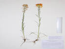 Coll. No. 1412, Erysimum capitatum Coll. No. 1412, Erysimum capitatum
|
1412 |
Field identification: Erysimum capitatum.
Erysimum capitatum (Hook.) Greene. Sanddune Wallflower. Ranson/Edwards Homestead Open Space Park, Jefferson County, Colorado. 1.6 mi. west on CO 72 from CO Hwy 93, 1.6 mi. north on Plainview Road, then 470 m. southwest upslope.15.3 km. north northeast of the GNIS location of Golden. 39.8896°N, 105.2692°W. WGS 1984 Elev. 2016 m. Uncommon. Open gentle slope with grasses and forbs, lightly grazed in 2016. Coll. No. 1412, 10 Jun 2016, characters observed: Biennial or short-lived perennial, to 33 cm., proximal hairs 2-rayed; Sepals, 9 mm.; Petals, 16-19 mm., orange; Anthers, 3.5-4.0 mm., Fruit, 34 mm. × 0.7 mm., ascending; Seed, unknown. Weak evidence that this might be var. purshii were infraspecific taxa to be recognized in Colorado (Ackerman, 2015). | ||||||||||||||||||||
|
Other articles:
|
1413 |
Field identification: Lepidium ?
Lepidium campestre (L.) W. T. Aiton. Field Pepperweed. Ranson/Edwards Homestead Open Space Park, Jefferson County, Colorado. 1.6 mi. west on CO 72 from CO Hwy 93, 1.6 mi. north on Plainview Road, then 470 m. southwest upslope.15.3 km. north northeast of the GNIS location of Golden. 39.8897°N, 105.2694°W. WGS 1984 Elev. 2021 m. Open gentle slope with grasses and forbs, lightly grazed in 2016. Coll. No. 1413, 10 Jun 2016, characters observed: Annual, tap-rooted, to 35 cm., hairs simple throughout; Leaves, basal, petiole 10 mm. + blade 40 mm. × 12 mm. wide, oblanceolate, margin wavy, tip rounded, cauline, 21 mm. × 7 mm. wide, lanceolate, base auriculate, margin dentate (scalloped, though the term is rarely used); Inflorescence, terminal raceme, 72 mm. × 21 mm. plus several axillary racemes; Sepals, 1.2 mm. × 0.8 mm. wide, green, purple distally, margin chartaceous; Petals, 1.3 mm., white; Style, 1, 0.5 mm., persistent; Fruit, pedicel, horizontal, 5 mm., silicle, 4.5 mm. × 3 mm. wide, margin, winged, 0.2 mm. at middle, 1 mm. at apex. | ||||||||||||||||||||
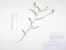 Coll. No. 1415, Astragalus eucosmus Coll. No. 1415, Astragalus eucosmus
|
1415 |
Field identification: Vicia sp.?
Astragalus eucosmus B. L. Rob. Elegant Milkvetch. Ranson/Edwards Homestead Open Space Park, Jefferson County, Colorado. 1.6 mi. west on CO Hwy 72 from CO Hwy 93, 1.6 mi. north on Plainview Road, then 455 m. southwest upslope.15.3 km. north northeast of the GNIS location of Golden. 39.8903°N, 105.2699°W. WGS 1984 Elev. 2023 m. Open gentle slope with grasses and forbs, lightly grazed in 2016. Coll. No. 1415, 10 June 2016, characters observed: Perennial, caulescent, to 40 cm., hairs basifixed throughout; Stem, not flexuous or zigzag distally, light brown above, purplish at base; Stipules, 6 mm., connate opposite petiole proximally; Leaves, cauline, alternate, compound, leaflets, #15, 15 mm. × 3.3 mm. wide, glabrous adaxially, hairy abaxially; Inflorescence, axillary racemes, flowers, #21; Calyx, tubes 3 mm. + lobes 1 mm. = 4 mm.; Flowers, spreading, 10 mm., ochroleucous proximally, blue distally, banner, 9.5 mm., wings, 8 mm., keel, 6 mm.; Fruit, unknown, immature, developing short stipitate and hairy. I'm not so sure about my determination on this one. If it holds, it will be the first collection of this taxon from Jefferson County. I have distributed to JCOS, KHD, CS, and COLO, with a note requesting advice if the determination is changed. | ||||||||||||||||||||
| 1416 |
Field identification: Oxytropis lambertii.
Oxytropis lambertii Pursh. Purple Locoweed. Ranson/Edwards Homestead Open Space Park, Jefferson County, Colorado. 1.6 mi. west on CO Hwy 72 from CO Hwy 93, 1.6 mi. north on Plainview Road, then 450 m. southwest upslope.15.3 km. north northeast of the GNIS location of Golden. 39.8904°N, 105.2698°W. WGS 1984 Elev. 2023 m. Open gentle slope with grasses and forbs, lightly grazed in 2016. | |||||||||||||||||||||
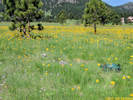 Habitat of Coll. No. 1417, Allium, perhaps A. geyeri Habitat of Coll. No. 1417, Allium, perhaps A. geyeri
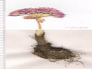 Coll. No. 1417, Allium geyeri Coll. No. 1417, Allium geyeri
|
1417 |
Field identification: Allium, perhaps A. geyeri.
Allium geyeri S. Watson. Geyer's Onion. Ranson/Edwards Homestead Open Space Park, Jefferson County, Colorado. 1.6 mi. west on CO Hwy 72 from CO Hwy 93, 1.7 mi. north on Plainview Road, then 375 m. southwest upslope.15.7 km. north northeast of the GNIS location of Golden. 39.8918°N, 105.2709°W. WGS 1984 Elev. 2019 m. Open gentle slope with grasses, Arnica fulgens, and a few small ponderosa pines. Coll. No. 1417, 10 June 2016, characters observed: Perennial herb, geophyte, to 40 cm.; Bulb, 20 mm. × 20 mm. wide, ovoid, outer coat with coarse fibers; Leaves, #2-3, 24 cm. × 1.5 mm. wide, somewhat withered at anthesis; Inflorescence, umbel; Bracts, #3, 14 mm., prominently 1-veined; Flowers, #29, tepals, 7 mm., pink; Seed, unknown. | ||||||||||||||||||||
 One-sided inflorescence of Coll. No. 1418, Dactylis glomerata One-sided inflorescence of Coll. No. 1418, Dactylis glomerata
|
1418 |
Field identification: Dactylis glomerata.
Dactylis glomerata L. Orchard Grass. Ranson/Edwards Homestead Open Space Park, Jefferson County, Colorado. 1.6 mi. west on CO Hwy 72 from CO Hwy 93, 1.8 mi. north on Plainview Road, then 350 m. southwest upslope.15.8 km. north northeast of the GNIS location of Golden. 39.8922°N, 105.2711°W. WGS 1984 Elev. 2026 m. In and around a small group of ponderosa pines. | ||||||||||||||||||||
 Inflorescence of Coll. No. 1419, Koeleria macrantha Inflorescence of Coll. No. 1419, Koeleria macrantha
|
1419 |
Field identification: Koeleria macrantha, determination tentative.
Koeleria macrantha (Ledeb.) Schult. Prairie Junegrass. Ranson/Edwards Homestead Open Space Park, Jefferson County, Colorado. 1.6 mi. west on CO Hwy 72 from CO Hwy 93, 1.8 mi. north on Plainview Road, then 350 m. southwest upslope.15.8 km. north northeast of the GNIS location of Golden. 39.8922°N, 105.2711°W. WGS 1984 Elev. 2025 m. In and around a small group of ponderosa pines. | ||||||||||||||||||||
 Inflorescence of Coll. No. 1420, Poa pratensis Inflorescence of Coll. No. 1420, Poa pratensis
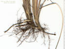 Roots of Coll. No. 1420, Poa pratensis Roots of Coll. No. 1420, Poa pratensis
|
1420 |
Field identification: Agrostis, weakly rhizomatous.
Poa pratensis L. Kentucky Bluegrass. Ranson/Edwards Homestead Open Space Park, Jefferson County, Colorado. 1.6 mi. west on CO Hwy 72 from CO Hwy 93, 1.8 mi. north on Plainview Road, then 350 m. southwest upslope.15.8 km. north northeast of the GNIS location of Golden. 39.8922°N, 105.2711°W. WGS 1984 Elev. 2029 m. In and around a small group of ponderosa pines. Collected with Dactylis glomerata and Koeleria macrantha. Coll. No. 1420, 10 June 2016, characters observed: Perennial grass, rhizomatous (although of material collected for three vouchers, only one has rhizomes), not strongly flattened, to 75 cm.; Sheath, open about ½; Ligule, membraneous, 0.7 mm.; Auricles, 0; Inflorescence, much-branched open panicle, branches scabrous; Spikelets, one per node, 4 mm., awns 0; Florets, 3 per spikelet, reduced florets above fertile floret, #1 ♀, #2-3 ♂, Rachilla, extends 1 mm. above upper floret, not hairy; Glumes, #2, keeled, scabrous, lower, 2.0-2.3 mm., veins 1, upper, 2.5-3.0 mm., veins 3, prominent; Lemma, 3 mm., veins 5, keeled, tuft of hairs at base, >⅓ lemma; Palea, 2.3 mm., veins 2, green, otherwise translucent. | ||||||||||||||||||||
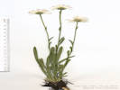 Coll. No. 1421, Erigeron vetensis Coll. No. 1421, Erigeron vetensis
|
1421 |
Field identification: Erigeron, not E. flagellaris, and maybe not E. divergens or E. tracyi.
Erigeron vetensis Rydb. Early Bluetop Fleabane. Ranson/Edwards Homestead Open Space Park, Jefferson County, Colorado. High plains above Rocky Flats, 1.6 mi. west on CO Hwy 72 from CO Hwy 93, 1.8 mi. north on Plainview Road, then 300 m. southwest upslope.15.8 km. north northeast of the GNIS location of Golden. 39.8934°N, 105.2715°W. WGS 1984 Elev. 2033 m. Small ridge between two drainages, grasses and a few ponderosa pines. Coll. No. 1421, 10 Jun 2016, characters observed: Perennial, to 12 cm., sparse multicellular hairs with clear crosswalls to 0.8 mm., plus very small (<0.1 mm.) peg-like glands, throughout; Leaves, basal, petiole 45 mm. + blade 65 mm. × 5 mm. wide, narrowly oblanceolate, cauline, reduced in size, #4-5, sessile, 15 mm. × 2.1 mm. wide, oblanceolate; Inflorescence, scapose, 21 cm.; Heads, mostly borne singly; Involucre, 5 mm. × 11 mm. wide; Phyllaries, subequal, in 2 rows, 5 mm. × 0.7 mm. wide, margins not ciliate, tip acuminate; Flowers of 2 kinds, Ray flowers, fertile, corolla, 11 mm. × 1.6 mm. wide, ±white, fading blue; Disk flowers, corolla, 4.0 mm., yellow, lobes triangular, style branch appendages triangular; Pappus, short (0.3 mm.) and long (2.2 mm.) capillary bristles; Cypsela, 1.5-1.6 mm. | ||||||||||||||||||||
| 1422 |
Field identification: Astragalus agrestis.
Astragalus agrestis Douglas ex G. Don. Purple Milkvetch. Ranson/Edwards Homestead Open Space Park, Jefferson County, Colorado. High plains above Rocky Flats, 1.6 mi. west on CO Hwy 72 from CO Hwy 93, 2.4 mi. generally north on Plainview Road, then 130 m. southeast across a small drainage, 15.95 km. north northwest of the GNIS location of Golden. 39.8938°N, 105.2718°W. WGS 1984 Elev. 2016 m. North-facing slope with grasses and ponderosa pines. | |||||||||||||||||||||
|
Locations: Colorado School of Mines Survey Field. Deadman Gulch. |
Wednesday, June 15thDeadman Gulch and Survey Field. | |||||||||||||||||||||
| 1423 |
Field identification: Astragalus drummondii.
Astragalus drummondii Dougl. ex Hook. Drummond's Milkvetch. Deadman Gulch, Jefferson County, Colorado. High plains between US Hwy 6 and Lookout Mountain, about 140 m. west of the Deadman Gulch undercrossing of US Hwy 6, 2.3 km. south of the GNIS location of Golden. 39.735°N, 105.2165°W. WGS 1983 Elev. 1774 m. Open east-facing grassy slopes. Deadman Gulch is locally euphemistically known as Kinney Run. | |||||||||||||||||||||
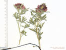 Coll. No. 1423, Sphaeralcea coccinea Coll. No. 1423, Sphaeralcea coccinea
|
1424 |
Field identification: Sphaeralcea coccinea.
Sphaeralcea coccinea (Nutt.) Rydb. Scarlet Globemallow. Deadman Gulch, Jefferson County, Colorado. High plains between US Hwy 6 and Lookout Mountain, about 140 m. west of the Deadman Gulch undercrossing of US Hwy 6, 2.3 km. south of the GNIS location of Golden. 39.735°N, 105.2164°W. WGS 1984 Elev. 1494 m. Open east-facing grassy slopes. Uncommon, only one seen here, two more 165 m. northwest (Coll. No. 1433). | ||||||||||||||||||||
| 1425 |
Field identification: Gaillardia aristata.
Gaillardia aristata Pursh. Blanketflower. Deadman Gulch, Jefferson County, Colorado. High plains between US Hwy 6 and Lookout Mountain, about 150 m. northwest of the Deadman Gulch undercrossing of US Hwy 6, 2.3 km. south of the GNIS location of Golden. 39.7352°N, 105.2165°W. WGS 1984 Elev. 1799 m. East-facing grassy slope. Deadman Gulch is often referred to by the locally euphemistic name of Kinney Run. | |||||||||||||||||||||
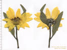 Coll. No. 1426, Helianthus pumilis Coll. No. 1426, Helianthus pumilis
|
1426 |
Field identification: Helianthus pumilis.
Helianthus pumilus Nutt. Little Sunflower. Deadman Gulch, Jefferson County, Colorado. High plains between US Hwy 6 and Lookout Mountain, about 145 m. northwest of the Deadman Gulch undercrossing of US Hwy 6, 2.3 km. south of the GNIS location of Golden. 39.7354°N, 105.2163°W. WGS 1984 Elev. 1797 m. Northeast-facing grassy slope. Coll. No. 1426, 15 June 2016, characters observed: Perennial herb, to 40 cm.; Leaves, cauline, alternate, simple, petiole 7 mm. + blade 86 mm. × 30 mm. wide, adaxial, pustular hairy, hairs multicellular, crosswalls clear, abaxial, glandular and hairy; Inflorescence, few heads borne singly on peduncles to 8 cm., hairy, glandular; Phyllaries, 2+ series, similar, 10-8 mm. × 2-3 mm. wide; Receptacle, slightly convex, paleate, Palea, 9 mm., tip, glandular, hairy; Flowers, 2 kinds; Disk, 17 mm. wide; Ray flowers, sterile, 25 mm. × 9 mm. wide, yellow; Disk flowers, 6 mm., not laterally compressed, anther appendages reddish-brown; Pappus, 2 aristate scales. | ||||||||||||||||||||
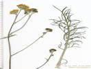 Flower heads and basal leaf of Coll. No. 1427, Hymenopappus filifolius var. polycephalus Flower heads and basal leaf of Coll. No. 1427, Hymenopappus filifolius var. polycephalus
|
1427 |
Field identification: Hymenopappus filifolius.
Hymenopappus filifolius Hook. var. polycephalus (Osterh.) B.L. Turner. Many-Headed Fine-Leaved Wooly-White. Deadman Gulch, Jefferson County, Colorado. High plains between US Hwy 6 and Lookout Mountain, about 145 m. northwest of the Deadman Gulch undercrossing of US Hwy 6, 2.3 km. south of the GNIS location of Golden. 39.7355°N, 105.2164°W. WGS 1984 Elev. 1796 m. East-facing grassy slope. Deadman Gulch is often referred to by the locally euphemistic name of Kinney Run. Coll. No. 1427, 15 June 2016, characters observed: Perennial herb, to 60 cm.; Leaves, basal, to 140 mm. × 50 mm., oblanceolate in shape, base conspicuously tomentose, bipinnately dissected to filiform segments, ultimate leaf divisions 12-19 mm., cauline, reduced above, #7-8; Heads, 10-16 per stem; Phyllaries, in 1 series, 6 mm. × 2.8-4.0 mm. wide, green, tomentose, margins chartaceous; Flowers, 1 kind; Disk flowers, corollas, 3.5 mm., yellow; Pappus, crown of scales, 0.8-1.2 mm.; Cypsela, 3 mm., hairy all over to just on margins. | ||||||||||||||||||||
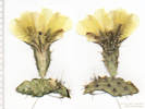 Flower and fruit of Coll. No. 1428, Opuntia polyacantha Flower and fruit of Coll. No. 1428, Opuntia polyacantha
|
1428 |
Field identification: Opuntia polyacantha.
Opuntia polyacantha Haw. Plains Pricklypear. Deadman Gulch, Jefferson County, Colorado. High plains between US Hwy 6 and Lookout Mountain, about 220 m. northwest of the Deadman Gulch undercrossing of US Hwy 6, 2.3 km. south of the GNIS location of Golden. 39.7358°N, 105.2171°W. WGS 1984 Elev. 1809 m. East-facing grassy slope. Deadman Gulch is often referred to by the locally euphemistic name of Kinney Run. | ||||||||||||||||||||
| 1429 |
Field identification: Oxytropis lambertii.
Oxytropis lambertii Pursh. Purple Locoweed. Colorado School of Mines Survey Field, Jefferson County, Colorado. Lower, eastern edge of the Survey field, 250 m. northwest of the Deadman Gulch undercrossing of US Hwy 6, 2.2 km. south of the GNIS location of Golden. 39.7358°N, 105.2174°W. WGS 1984 Elev. 1808 m. Grassy, northwest-facing slope. | |||||||||||||||||||||
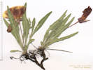 Coll. No. 1430, Oenothera howardii Coll. No. 1430, Oenothera howardii
|
1430 |
Field identification: Oenothera howardii.
Oenothera howardii (A. Nels.) W. L. Wagner. Howard's Evening Primrose. Colorado School of Mines Survey Field, Jefferson County, Colorado. Lower, eastern edge of the Survey field, 250 m. northwest of the Deadman Gulch undercrossing of US Hwy 6, 2.2 km. south of the GNIS location of Golden. 39.7358°N, 105.2174°W. WGS 1984 Elev. 1812 m. Leaves basal, large yellow flowers, winged capsule. Grassy, northwest-facing slope. | ||||||||||||||||||||
| 1431 |
Field identification: Astragalus agrestis.
Astragalus agrestis Douglas ex G. Don. Purple Milkvetch. Colorado School of Mines Survey Field, Jefferson County, Colorado. Lower, eastern edge of the Survey field, 250 m. northwest of the Deadman Gulch undercrossing of US Hwy 6, 2.2 km. south of the GNIS location of Golden. 39.7358°N, 105.2176°W. WGS 1984 Elev. 1809 m. Gentle northwest-facing grassy slope. | |||||||||||||||||||||
| 1432 |
Field identification: Oenothera suffrutescens.
Oenothera suffrutescens (Ser.) W. L. Wagner & Hoch. Linda Tarde. Colorado School of Mines Survey Field, Jefferson County, Colorado. Lower, eastern edge of the Survey field, 250 m. northwest of the Deadman Gulch undercrossing of US Hwy 6, 2.2 km. south of the GNIS location of Golden. 39.7358°N, 105.2175°W. WGS 1984 Elev. 1811 m. Northwest-facing grassy slope. Generally described as common, but not often seen in this area; hence the small size of the collection. | |||||||||||||||||||||
|
Coll. No. 1423, Sphaeralcea coccinea
|
1433 |
Field identification: Sphaeralcea coccinea.
Sphaeralcea coccinea (Nutt.) Rydb. Scarlet Globemallow. Colorado School of Mines Survey Field, Jefferson County, Colorado. High plains between US Hwy 6 and Lookout Mountain, about 290 m. west of the Deadman Gulch undercrossing of US Hwy 6, 2.3 km. south of the GNIS location of Golden. 39.7358°N, 105.218°W. WGS 1984 Elev. 1806 m. North-facing grassy slope. Uncommon, rarely seen, and solitary. | ||||||||||||||||||||
|
Other articles:
|
1434 |
Field identification: Cynoglossum officinale.
Cynoglossum officinale L. Gypsyflower. Colorado School of Mines Survey Field, Jefferson County, Colorado. Eastern, lower section of the Survey Field, 2.2 km. south of the GNIS location of Golden. 39.7359°N, 105.2188°W. WGS 1984 Elev. 1801 m. High plains at the base of the Front Range, growing in dense vegetation along banks of a small creek. Colorado Noxious Weed List B. | ||||||||||||||||||||
| 1435 |
Field identification: Equisteum hyemale.
Equisetum laevigatum A. Braun. Smooth Horsetail. Colorado School of Mines Survey Field, Jefferson County, Colorado. Eastern, lower section of the Survey Field, 2.2 km. south of the GNIS location of Golden. 39.736°N, 105.2188°W. WGS 1984 Elev. 1799 m. High plains at the base of the Front Range, growing in dense vegetation along banks of a small creek. | |||||||||||||||||||||
|
Other articles:
|
1436 |
Field identification: Conium maculatum.
Conium maculatum L. Common Poison Hemlock. Colorado School of Mines Survey Field, Jefferson County, Colorado. Eastern, lower section of the Survey Field, between US Highway 6 and Lookout Mountain, 2.2 km. south of the GNIS location of Golden. 39.7359°N, 105.2189°W. WGS 1984 Elev. 1801 m. High plains at the base of the Front Range, growing in dense vegetation along banks of a small creek. | ||||||||||||||||||||
|
Other articles:
|
1437 |
Field identification: Elaeagnus angustifolia.
Elaeagnus angustifolia L. Russian Olive. Colorado School of Mines Survey Field, Jefferson County, Colorado. Eastern, lower section of the Survey Field, between US Highway 6 and Lookout Mountain, 2.2 km. south of the GNIS location of Golden. 39.7358°N, 105.2191°W. WGS 1984 Elev. 1801 m. Several trees beside ephemeral creek in a distal part of the Survey Field. Colorado Noxious Weed List B. | ||||||||||||||||||||
|
Literature Cited:
|
1438 |
Field identification: Onosmodium bejarense var. occidentale.
Onosmodium bejariense DC. ex A. DC. var. occidentale (Mack.) B. L. Turner. Western Marbleseed. Colorado School of Mines Survey Field, Jefferson County, Colorado. Eastern, lower section of the Survey Field, between US Highway 6 and Lookout Mountain, 2.2 km. south of the GNIS location of Golden. 39.7359°N, 105.2194°W. WGS 1984 Elev. 1803 m. On a small terrace beside an ephemeral creek. Probably should be determined Lithospermum occidentale (Mack.) Weakley, Witsell & D. Estes, per Weakley, et al., 2011. | ||||||||||||||||||||
| 1439 |
Field identification: Harbouria trachypleura.
Harbouria trachypleura (A. Gray) J.M. Coult. & Rose. Whiskbroom Parsley. Colorado School of Mines Survey Field, Jefferson County, Colorado. Eastern, lower section of the Survey Field, between US Highway 6 and Lookout Mountain, 2.35 km. south of the GNIS location of Golden. 39.7344°N, 105.2192°W. WGS 1984 Elev. 1819 m. Uncommon. Steep northwest facing slope above ephemeral creek from Lookout Mountain. | |||||||||||||||||||||
|
Other articles:
|
1440 |
Field identification: Delphinium virescens.
Delphinium virescens Nutt. Carolina Larkspur. = Delphinium carolinianum Walter ssp. virescens (Nutt.) R.E. Brooks Colorado School of Mines Survey Field, Jefferson County, Colorado. Extreme southeastern corner of the Survey Field, between US Highway 6 and Lookout Mountain, 2.35 km. south of the GNIS location of Golden. 39.7331°N, 105.2175°W. WGS 1984 Elev. 1815 m. Very red fine-grained soil, south-facing slope. Uncommon, only plant seen. | ||||||||||||||||||||
|
Other articles:
|
1441 |
Field identification: Hesperis matronalis L. Dame's Rocket. Deadman Gulch, Jefferson County, Colorado. Adjacent to a small artificial pond in Deadman Gulch, about 150 m. upstream of the gulch undercrossing of US Highway 6, 2.5 km. south of the GNIS location of Golden. 39.7336°N, 105.2158°W. WGS 1984 Elev. 1794 m. Purple wall flower. The pond was reconstructed by the City of Golden late in 2016. Deadman Gulch is locally euphemistically referred to as Kinney Run. Colorado Noxious Weed List B. Coll. No. 1441, 15 June 2016, characters observed: Perennial herb, to 50 cm., hairs, forked on stem, leaf, and sepal, but not fruit; Leaves, basal, withered at flowering, cauline, petiole 3-5 mm. + blade 100 mm. × 35 mm. wide, lanceolate, margin, small-toothed; Inflorescence, raceme; Sepals, #4, 5-6 mm., green, margins purple; Petals, #4, 13 mm. × 4 mm. wide, clawed, purple; Fruit, silique, 40 mm. × 0.6 mm. wide; Seed, 1.7 mm., brown, glabrous. | ||||||||||||||||||||
|
Other articles:
Locations: Taos. |
Saturday, June 18th | |||||||||||||||||||||
|
Other articles:
Locations:
Taos Pueblo.
|
| |||||||||||||||||||||
|
Other articles:
Locations:
Rio Grande Gorge Bridge.
|
| |||||||||||||||||||||
|
Other articles:
Locations:
San Francisco de Asissi Church.
|
| |||||||||||||||||||||
|
|
Sunday, June 19th | |||||||||||||||||||||
|
Other articles:
Locations:
Ghost Ranch.
|
| |||||||||||||||||||||
|
Other articles:
Locations:
El Santuario de Chimayo Historic Site.
|
| |||||||||||||||||||||
|
Locations: North Table Mountain Park. |
Wednesday, June 22ndNorth Table Mountain, with Greg McKittrick, JCOS. | |||||||||||||||||||||
|
Other articles:
|
1442 |
Field identification: Apocynum cannabinum.
Apocynum ×floribundum Greene. Dogbane. North Table Mountain Park, Jefferson County, Colorado. Western side of North Table Mountain, in roadside ditch along road to City of Golden water tank, 2.8 km. north of the GNIS location of Golden. 39.7798°N, 105.228°W. WGS 1984 Elev. 1853 m. Coll. No. 1442, 22 June 2016, characters observed: Perennial herb, to 35 cm.; Leaves, cauline, opposite, spreading horizontal, petiole 2 mm. + blade 50 mm. × 24 mm. wide, ovate, margin revolute; Sepals, 2.5 mm.; Flowers, bell-shaped, 6 mm. × 5 mm. wide, >2× calyx; Petals, fused at base, tube mm. + lobes 2 mm., pink, drying purple, lobes erect to spreading, none reflexed; Stamens, 5. Filaments, distinct; More like A. androsaemifolium than A. cannabinum, but it seems to best fit the description of the hybrid A. ×floribundum. | ||||||||||||||||||||
| 1443 |
Field identification: Astragalus laxmannii var. robustior.
Astragalus laxmannii Jacq. var. robustior (Hook.) Barneby & S. L. Welsh. Prairie Milkvetch. North Table Mountain, Jefferson County, Colorado. Southwest slopes of North Table Mountain, 2 km. north of the GNIS location of Golden. 39.7731°N, 105.2254°W. WGS 1984 Elev. 1905 m. Grassy slopes with Prinus americana and Rhus trilobata. | |||||||||||||||||||||
| 1444 |
Field identification: Calochortus gunnisonii.
Calochortus gunnisonii S. Watson. Gunnison's Mariposa Lily. North Table Mountain, Jefferson County, Colorado. Southwest slope of North Table Mountain, just below the basalt rim, where a social trail climbs through the rim from the City of Golden North Table Mountain trail, 1.7 km. north of the GNIS location of Golden. 39.7708°N, 105.2225°W. WGS 1984 Elev. 1922 m. Mixed grasses and forbs. | |||||||||||||||||||||
|
Other articles:
|
1445 |
Field identification: This is a mixed collection of E. umbellatum and E. flavum. See also Coll. No. 1401. | ||||||||||||||||||||
| 1445.1 |
Eriogonum arcuatum Greene. Baker's Buckwheat.
North Table Mountain Park, Jefferson County, Colorado. Top of North Table Mountain, southwest edge, within a few meters of the rim of the mesa, 1.7 km. north of the GNIS location of Golden. 39.7706°N, 105.2213°W. WGS 1984 Elev. 1967 m. Growing in thin soils and cracks on top of the uppermost basalt flow, with E. umbellatum var. umbellatum. | |||||||||||||||||||||
|
Other articles:
|
1445.2 |
Eriogonum umbellatum Torr. var. umbellatum. Sulphur-Flower Buckwheat.
North Table Mountain Park, Jefferson County, Colorado. Top of North Table Mountain, southwest edge, within a few meters of the rim of the mesa, 1.7 km. north of the GNIS location of Golden. 39.7706°N, 105.2213°W. WGS 1984 Elev. 1967 m. Growing in thin soils and cracks on top of the uppermost basalt flow, with E. arcuatum. | ||||||||||||||||||||
 Coll. No. 1446, Glyceria striata Coll. No. 1446, Glyceria striata
|
1446 |
Field identification: Glyceria striata.
Glyceria striata (Lam.) Hitchc. Striate Manna Grass. North Table Mountain Park, Jefferson County, Colorado. Southern part of the mesa where several watercourses join to enter an unnamed canyon draining southeast to Clear Creek, 1.8 km. north of the GNIS location of Golden. 39.7717°N, 105.2163°W. WGS 1984 Elev. 1936 m. Very small perennial wetland, grass forming tussocks in an area several meters across. Coll. No. 1446, 22 Jun 2016, characters observed: Perennial grass, to 1 m.; Leaf, sheath closed, ligule membraneous, blade, 3 mm. wide; Inflorescence, loose panicle; Spikelets, one per node on short pedicels, laterally compressed, 2+ fertile florets, all similar; Glumes, #2, lower < upper, lower 1-nerved; Disarticulation, above the glumes; Lemma, 7-nerved, well-developed, evenly spaced, apices prow-shaped, awns, 0. | ||||||||||||||||||||
| 1447 |
Field identification: 2 different ferns, soriae present on one.
Woodsia oregana D.C. Eaton ssp. cathcartiana (B.L. Rob.) Windham. Rocky Mountain Woodsia. North Table Mountain Park, Jefferson County, Colorado. Rim of mesa, head of unnamed canyon draining southeast to Clear Creek, 1.8 km. north northeast of the GNIS location of Golden. 39.7712°N, 105.2148°W. WGS 1984 Elev. 1926 m. East-facing rock crevices. | |||||||||||||||||||||
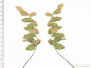 Coll. No. 1447.1, Fern, perhaps Cystopteris fragilis Coll. No. 1447.1, Fern, perhaps Cystopteris fragilis
|
1447.1 |
Fern, maybe Cystopteris fragilis (L.) Bernh. Brittle Bladderfern.
North Table Mountain Park, Jefferson County, Colorado. Rim of mesa, head of unnamed canyon draining southeast to Clear Creek, 1.8 km. north northeast of the GNIS location of Golden. 39.7712°N, 105.2148°W. WGS 1984 Elev. 1926 m. East-facing rock crevices. | ||||||||||||||||||||
|
Other articles:
|
1448 |
Field identification: Mimulus floribundus.
Mimulus floribundus Lindl. Many Flowered Monkey Flower. North Table Mountain Park, Jefferson County, Colorado. Southern rim of North Table Mountain, adjacent to North Table Loop, head of unnamed canyon draining southeast to Clear Creek, 1.84 km. north northeast of the GNIS location of Golden. 39.7714°N, 105.215°W. WGS 1984 Elev. 1924 m. Growing in running water at the junction of two small ephemeral streams. Coll. No. 1448, 22 June 2016, characters observed: Annual, of wet places, 10-30 cm.; Leaves, opposite, cauline, lower, petiole 8 mm. + blade 9 mm. × 8 mm. wide, orbicular-ovate; upper, nearly sessile; Calyx, upper lobe 4.7-8.0 mm., lower lobe 3.7-6.4 mm.; Corolla, 10 mm., yellow; Fruit, pedicel, 8 mm. | ||||||||||||||||||||
| 1449 |
Field identification: Prunella vulgaris.
Prunella vulgaris L. Common Selfheal. North Table Mountain Park, Jefferson County, Colorado. Southern rim of North Table Mountain, adjacent to North Table Loop, head of unnamed canyon draining southeast to Clear Creek, 1.84 km. north northeast of the GNIS location of Golden. 39.7715°N, 105.215°W. WGS 1984 Elev. 1924 m. Growing in running water at the junction of two small ephemeral streams. | |||||||||||||||||||||
|
Other articles:
|
1450 |
Field identification: Carex, maybe C. brevior, but my collection included no roots, so it wasn't good to deposit at a herbarium.
Carex breweri Boott. Brewer's Sedge. North Table Mountain Park, Jefferson County, Colorado. Southern rim of North Table Mountain, adjacent to North Table Loop, head of unnamed canyon draining southeast to Clear Creek, 1.84 km. north northeast of the GNIS location of Golden. 39.7715°N, 105.215°W. WGS 1984 Elev. 1924 m. Growing in running water at the junction of two small ephemeral streams. | ||||||||||||||||||||
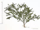 Coll. No. 1451, Rorippa tenerrima Coll. No. 1451, Rorippa tenerrima
|
1451 |
Field identification: Rorippa sinuata.
Rorippa tenerrima Greene. Modoc Yellowcress. North Table Mountain Park, Jefferson County, Colorado. 2.4 km. north northeast of the GNIS location of Golden. 39.776°N, 105.2133°W. WGS 1984 Elev. 1965 m. Ephemeral pond indicated on Golden 7.5' quadrangle may have been natural, but has also been enhanced with a low dam on the southwest side. Coll. No. 1451, 22 Jun 2016, characters observed: Annual, to 15 cm., generally glabrous throughout; Leaves, basal unknown, cauline, largest, petiole 26 mm + blade 60 mm. × 24 mm. wide, oblanceolate in shape, deeply pinnately lobed, reduced above; Inflorescence, raceme, ebractwate; Sepal, 0.7 mm.; Petals, 0.8 mm., color unknown, drying purple; Stamens, #6; Fruit, 7 mm. × 1.3 mm. wide, terete, ascending, not constricted, papillate; Ovules, #21 | ||||||||||||||||||||
|
Literature Cited:
|
1452 |
Field identification: Plagiobothrys scouleri (Hook. & Arn.) I.M. Johnst. Var. hispidulus (Greene) Dorn.
Plagiobothrys scouleri (Hook. & Arn.) I.M. Johnst. var. hispidulus (Greene) Dorn. Scouler's popcornflower. North Table Mountain Park, Jefferson County, Colorado. Top of North Table Mountain, at the northeast edge of a small ephemeral pond, 2.4 km. north northeast of the GNIS location of Golden. 39.776°N, 105.2132°W. WGS 1984 Elev. 1961 m. Ephemeral pond indicated on Golden 7.5' quadrangle may have been natural, but has also been enhanced with a low dam on the southwest side. Coll. No. 1452, 22 June 2016, characters observed: Annual, to 10 cm., ±appressed hairy throughout; Stem, decumbent to ascending, not winged; Leaves, basal, unknown, cauline, alternate, 35 mm. × 2.5 mm. wide, linear; Calyx, lobes #4, in fruit, 3 mm.; Corolla, very small, white; Style, 0.4 mm., entire; Nutlets, #4, 1.8 mm., attachment baso-lateral, tuberculed abaxially (not hooked or barbed). Treated as ssp. penicillata in Weber&Wittmann (2012), at rank of species in California (Baldwin, et al., 2012). | ||||||||||||||||||||
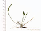 Coll. No. 1452.1, Myosurus minimus Coll. No. 1452.1, Myosurus minimus
|
1452.1 |
Myosurus minimus L. Tiny Mousetail.
North Table Mountain Park, Jefferson County, Colorado. Top of North Table Mountain, at the northeast edge of a small ephemeral pond, 2.4 km. north northeast of the GNIS location of Golden. 39.776°N, 105.2132°W. WGS 1984 Elev. 1961 m. Accidental collection. Ephemeral pond indicated on Golden 7.5' quadrangle may have been natural, but has also been enhanced with a low dam on the southwest side. | ||||||||||||||||||||
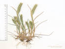 Coll. No. 1453, Hordeum pusillum Coll. No. 1453, Hordeum pusillum
|
1453 |
Field identification: grass.
Hordeum pusillum Nutt. Little Barley. North Table Mountain Park, Jefferson County, Colorado. Top of North Table Mountain, in the lower, southeast corner of an area disturbed by removal of soil that straddles the Tilting Mesa Trail, 2.4 km. north northeast of the GNIS location of Golden. 39.777°N, 105.2151°W. WGS 1984 Elev. 1975 m. Coll. No. 1453, 22 June 2016, characters observed: Annual, to 15 cm.; Leaves, sheath, open, 31 mm., ligule, membraneous, 0.7 mm., auricles, ±0; blade, 51 mm.; Inflorescence, dense 2-sided spike, 46 mm. × 5 mm. wide, base inserted in upper leaf sheath; Spikelets, 3 per node, central spikelet, sessile, fertile, 1 floret, lateral spikelets, pedicelled, sterile; Glumes, #2, body 5 mm. + awn 7 mm. = 12 mm., straight. Native. Type collected by Nuttall in 1811 “on the arid and saline plains of the Missouri” (Nuttall, 1818, p. 87-88). | ||||||||||||||||||||
|
Locations: Ranson/Edwards Homestead Open Space Park. |
Monday, June 27thRanson/Edwards Homestead Open Space Park. | |||||||||||||||||||||
|
Other articles:
|
1454 |
Field identification: Gaillardia aristata.
Gaillardia aristata Pursh. Blanketflower. Ranson/Edwards Homestead Open Space Park, Jefferson County, Colorado. High plains above Rocky Flats, 1.6 mi. west on CO Hwy 72 from CO Hwy 93, 1.2 mi. north on Plainview Road, then 200 m. east along the south side of an ephemeral stream; 15.2 km. north northwest of the GNIS location of Golden. 39.8896°N, 105.2594°W. WGS 1984 Elev. 1899 m. Mostly grasses and forbs; collected with Rosa arkansana and Crataegus succulenta. | ||||||||||||||||||||
|
Other articles:
|
1455 |
Field identification: Crataegus, likely C. succulenta per synonomy in Ackerfield (2015).
Crataegus succulenta Schrad. ex Link. Fleshy Hawthorn. Ranson/Edwards Homestead Open Space Park, Jefferson County, Colorado. High plains above Rocky Flats, 1.6 mi. west on CO Hwy 72 from CO Hwy 93, 1.2 mi. north on Plainview Road, then 200 m. east along the south side of an ephemeral stream; 15.2 km. north northwest of the GNIS location of Golden. 39.8896°N, 105.2594°W. WGS 1984 Elev. 1928 m. Discarded, sterile. See Coll. No. 1462 for material with fruit. | ||||||||||||||||||||
|
Other articles:
|
1456 |
Field identification: Rosa arkansana.
Rosa arkansana Porter. Prairie Rose. Ranson/Edwards Homestead Open Space Park, Jefferson County, Colorado. High plains above Rocky Flats, 1.6 mi. west on CO Hwy 72 from CO Hwy 93, 1.2 mi. north on Plainview Road, then 200 m. east along the south side of an ephemeral stream; 15.2 km. north northwest of the GNIS location of Golden. 39.8895°N, 105.2593°W. WGS 1984 Elev. 1933 m. Petal attachment tenuous making good flower collections difficult. Coll. No. 1456, 27 June 2016, characters observed: Low-growing perennial, to 20 cm.; Stem, straight slender unequal prickles, present on new growth; Leaves, alternate, compound, leaflets (7-8) 9, 20 mm. × 9 mm. wide, serrate, teeth dark-tipped, unclear whether there is glandular exudate, sparsely villous on both sides; Flowers, in clusters of 2-5; Sepals, 16 mm. × 3 mm. wide, abaxial, stalked glandular, adaxial, glandular hairy; Petals, 28 mm. × 21 mm. wide, color pink. | ||||||||||||||||||||
| 1457 |
Field identification: Prunella vulgaris.
Prunella vulgaris L. Common Selfheal. Ranson/Edwards Homestead Open Space Park, Jefferson County, Colorado. High plains above Rocky Flats, 1.6 mi. west on CO Hwy 72 from CO Hwy 93, 1.2 mi. north on Plainview Road, then 200 m. east along the north side of an ephemeral stream; 15.2 km. north northwest of the GNIS location of Golden. 39.8899°N, 105.2594°W. WGS 1984 Elev. 1932 m. On the edge of a spring-fed swale close to an ephemeral stream. | |||||||||||||||||||||
|
Other articles:
|
1458 |
Field identification: Trifolium pratense.
Trifolium pratense L. Red Clover. Ranson/Edwards Homestead Open Space Park, Jefferson County, Colorado. High plains above Rocky Flats, 1.6 mi. west on CO Hwy 72 from CO Hwy 93, 1.2 mi. north on Plainview Road, then 200 m. east along the north side of an ephemeral stream; 15.2 km. north northwest of the GNIS location of Golden. 39.8899°N, 105.2593°W. WGS 1984 Elev. 1928 m. On the edge of a spring-fed swale close to an ephemeral stream. Coll. No. 1458, 27 June 2016, characters observed: Perennial herb, erect, to 50 cm., hairs not hooked at tips; Stem, spreading hairy; Stipules, 21 mm. × 5 mm. wide, connate, scarious with several green nerves; Leaves, ternately compound, leaflets, 38 mm. × 20 mm. wide, margins slightly wavy tip short mucronate (easier to see on young leaves), both sides long wavy hairy; Heads, sessile, subtended by stipules and a pair of leaves, many flowers; Fruit, unknown. Introduced. | ||||||||||||||||||||
|
Literature Cited:
|
1459 |
Field identification: Pediomelum tenuiflorum.
Psoralidium tenuiflorum (Pursh) Rydb. Slimflower Scurfpea. Ranson/Edwards Homestead Open Space Park, Jefferson County, Colorado. High plains above Rocky Flats, 1.6 mi. west on CO Hwy 72 from CO Hwy 93, 1.2 mi. north on Plainview Road, then 215 m. east along the north side of an ephemeral stream; 15.2 km. north northwest of the GNIS location of Golden. 39.8901°N, 105.2592°W. WGS 1984 Elev. 1938 m. Dry alluvial terrace above watercourse. Coll. No. 1459, 27 June 2016, characters observed: Perennial herb, erect, to 50 cm., orange punctate glands throughout; Stipules, 4 mm. × 0.7 mm. wide; Leaves, ternately compound, leaflet, 35 mm. × 7 mm. wide, margins, entire, reduced above; Calyx, 3 mm., in fruit, 4 mm.; Flowers, 5 mm., blue; Fruit, legume, immature, 4 mm. × 1 mm. wide. Determined Psoralidium tenuiflorum (Pursh) Rydb. per Ackerfield (2015). | ||||||||||||||||||||
|
Other articles:
|
1460 |
Field identification: Cirsium undulatum.
Cirsium undulatum (Nutt.) Spreng. Wavy Leaved Thistle. Ranson/Edwards Homestead Open Space Park, Jefferson County, Colorado. High plains above Rocky Flats, 1.6 mi. west on CO Hwy 72 from CO Hwy 93, 1.3 mi. north on Plainview Road, then 195 m. east along the north side of an ephemeral stream; 15.2 km. north northwest of the GNIS location of Golden. 39.8901°N, 105.2595°W. WGS 1984 Elev. 1937 m. Mixed grasses and forbs on a dry alluvial terrace. Coll. No. 1460, 27 June 2016, characters observed: Perennial thistle, to 30 cm., stout tap root; Stem, leafy, 20 cm.; Leaves, basal and cauline, basal, petiole 25 mm. + blade 180 mm. × 55 mm. wide, oblanceolate, pinnately lobed more than half-way to mid-rib, cauline, reduced above, decurrent 5 mm., 45 mm. × 14 mm. wide, lanceolate, surface, adaxial, thinly tomentose, abaxial, tomentose, margins, spiny; Head, 35 mm. × 40 mm. wide, indented around top of peduncle; Phyllaries, many (7?) series, 13 mm. × 3.5 mm. wide, + robust spine 5-6 mm., body dark dorsal ridge, outer and middle reflexed; Flowers, 1 kind; Disk flowers, 25-36 mm., corolla pink-purple; Pappus, plumose bristles; Cypsela, 5 mm., apical collar unremarkable. | ||||||||||||||||||||
|
Other articles:
|
1461 |
Field identification: Bromus japonicus.
Bromus japonicus Thunb. Japanese Cheat Grass. Ranson/Edwards Homestead Open Space Park, Jefferson County, Colorado. High plains above Rocky Flats, 1.6 mi. west on CO Hwy 72 from CO Hwy 93, 1.3 mi. north on Plainview Road, then 170 m. east along the north side of an ephemeral stream; 15.2 km. north northwest of the GNIS location of Golden. 39.89°N, 105.2597°W. WGS 1984 Elev. 1937 m. Mixed grasses and forbs on a dry alluvial terrace. | ||||||||||||||||||||
|
Other articles:
|
1462 |
Field identification: Crataegus succulenta
Crataegus succulenta Schrad. ex Link. Fleshy Hawthorn. Ranson/Edwards Homestead Open Space Park, Jefferson County, Colorado. High plains above Rocky Flats, 1.6 mi. west on CO Hwy 72 from CO Hwy 93, 1.2 mi. north on Plainview Road; 15.2 km. north northwest of the GNIS location of Golden. 39.8893°N, 105.2616°W. WGS 1984 Elev. 1944 m. Same as Coll. No. 1455; this collection has fruit. Scattered along ephemeral steam. | ||||||||||||||||||||
|
Other articles:
|
1463 |
Field identification: Silene vulgaris (Moench) Garcke. Maidens Tears. Ranson/Edwards Homestead Open Space Park, Jefferson County, Colorado. High plains above Rocky Flats, 1.6 mi. west on CO Hwy 72 from CO Hwy 93, 0.9 mi. north on Plainview Road, then 250 m. east on old ranch road; 15.2 km. north northwest of the GNIS location of Golden. 39.884°N, 105.2595°W. WGS 1984 Elev. 1936 m. Mixed grasses and forbs beside the old road, on the accessible side of a gate that prevents cows from going down to Coal Creek. Coll. No. 1463, 27 June 2016, characters observed: Perennial herb, erect, to 55 cm., generally glabrous throughout; Stem, lacking dark sticky band, most, i.e., 7/8 stems, simple unbranched; Stipules, 0; Leaves, basal, unknown, cauline, opposite, 44 mm. × 6-7 mm. wide, sessile, bases connate; Calyx, tube 8 mm. × 5.5 mm. wide + lobes 2 mm. somewhat inflated, many green veins, not particularly prominent; indented around peduncle (when pressed and dry); Corolla, 13 mm., limb 6 mm., white; Stamens, #10, exserted; Filaments, white (definitely not purple); Seeds, 1 mm., brown, papillate. | ||||||||||||||||||||
|
Other articles:
|
1464 |
Amorpha fruticosa L. False Indigo. Ranson/Edwards Homestead Open Space Park, Jefferson County, Colorado. Flood plain of Coal Creek, 1.6 mi. west on CO Hwy 72 from CO Hwy 93, 0.9 mi. generally north on Plainview Road, then 390 m. generally east on an old road leading to Coal Creek; 14.7 km. north northwest of the GNIS location of Golden. 39.8845°N, 105.2584°W. WGS 1984 Elev. 1922 m. In dense vegetation of mostly willows on the edge of an abandoned channel of Coal Creek. Coll. No. 1464, 27 June 2016, characters observed: Woody shrub, to 2 m.; Leaves, alternate, compound, leaflets, #13, 26 mm. × 16 mm. wide, elliptic-ovate, mid-rib extended as a short slender mucro, eglandular, short soft hairy, sparse adaxially, less sparse abaxially; Inflorescence, racemes, Calyx, 3 mm., minutely hairy, few gland-dotted distally; Flowers, purple; Banner, 6 mm. | ||||||||||||||||||||
|
Other articles:
|
1465 |
Field identification: Silene . Catchfly. Ranson/Edwards Homestead Open Space Park, Jefferson County, Colorado. Flood plain of Coal Creek, 1.6 mi. west on CO Hwy 72 from CO Hwy 93, 0.9 mi. generally north on Plainview Road, then 345 m. generally east on an old road leading to Coal Creek; 14.7 km. north northwest of the GNIS location of Golden. 39.8841°N, 105.2585°W. WGS 1984 Elev. 1923 m. In dense vegetation at edge of old road. | ||||||||||||||||||||
| 1466 |
Field identification: Apocynum ×floribundum Greene. Dogbane. Ranson/Edwards Homestead Open Space Park, Jefferson County, Colorado. Flood plain of Coal Creek, 1.6 mi. west on CO Hwy 72 from CO Hwy 93, 0.9 mi. generally north on Plainview Road, then 340 m. generally east on an old road leading to Coal Creek; 14.7 km. north northwest of the GNIS location of Golden. 39.884°N, 105.2586°W. WGS 1984 Elev. 1929 m. Leaves spreading, not drooping; corolla lobes erect to spreading, not reflexed. In dense vegetation at edge of old road. | |||||||||||||||||||||
|
Other articles:
Locations:
Fremont Pass.
|
Tuesday, June 28thEnroute to Leadville. | |||||||||||||||||||||
|
Other articles:
Locations:
Diamond Mine.
Evans Gulch.
Monarch Mine.
Turquoise Lake.
|
Wednesday, June 29th
| |||||||||||||||||||||
|
Other articles:
|
1467 |
Field identification: Castilleja, probably C. integra
Castilleja miniata Hook. Giant Red Indian Paintbrush. Evans Gulch, Lake County, Colorado. Mosquito Range, middle section of Evans Gulch, near Conley Lakes and the Diamond Mine, 4.6 mi. by road east of the GNIS location of Leadville. 39.2603°N, 106.2198°W. WGS 1984 Elev. 3415 m. Southeast-facing open slope with mostly forbs. Coll. No. 1467, 29 June 2016, characters observed: Perennial herb, to 30 cm., glandular hairy, sometimes tangled, more dense distally; Leaves, cauline, alternate, sessile, 35 mm. × 4.7 mm. wide, some entire, some with pair of lateral lobes; Bract, subtending flower, 26 mm. × 11 mm. wide, ovate, entire, or 1 pair lateral lobes, green becoming reddish-orange distally; Calyx, 22 mm. × 6.5 mm. wide, tube 12 mm. + lobes 10 mm., upper and lower lobes ±equal, color unremarkable, except reddish at tip; Corolla, 30 mm. upper lip(s) 9 mm., lower lip, 3 short teeth, 3 mm. Does not fit easily into any Castilleja recognized in Colorado. Most like C. miniata or perhaps C. miniata × rhexifolia. | ||||||||||||||||||||
|
Other articles:
|
1468 |
Field identification: Androsace, probably A. occidentalis.
Androsace septentrionalis L. Pygmyflower Rockjasmine. Evans Gulch, Lake County, Colorado. Mosquito Range, middle section of Evans Gulch, near Conley Lakes and the Diamond Mine, 4.6 mi. by road east of the GNIS location of Leadville. 39.2604°N, 106.2199°W. WGS 1984 Elev. 3436 m. Southeast-facing open slope with mostly forbs. | ||||||||||||||||||||
|
Other articles:
|
1469 |
Field identification: Cymopterus lemmonii (J. M. Coult. & Rose) Dorn. Alpine False Springparsley. Evans Gulch, Lake County, Colorado. Mosquito Range, middle section of Evans Gulch, near Conley Lakes and the Diamond Mine, 4.6 mi. by road east of the GNIS location of Leadville. 39.2603°N, 106.2199°W. WGS 1984 Elev. 3445 m. Southeast-facing open slope with mostly forbs. Coll. No. 1469, 29 June 2016, characters observed: Perennial herb, to 15 cm., glabrous throughout, except very slightly scabrous at top of peduncle and on ribs of some rays; Pseudoscape, absent; Leaves, basal and cauline, 40 mm. × 25 mm. wide, obovate, compound, leaflets, #7, ultimate divisions narrowly lanceolate; Inflorescence, compound umbel; Involucre, bracts, 1.7 mm., linear (but not pinnafitid); Rays, ascending-spreading, ±equal; Involucel, bractlets green, inconspicuous, 1 mm.; Corolla, petals, #5, 1 mm. × 0.6 mm. wide, yellow; Stamens, #5; Filaments, recurved; Ovary, glabrous; Stylopodium, absent (?); Fruit, unknown. | ||||||||||||||||||||
|
Other articles:
|
1470 |
Field identification: Geum triflorum Pursh. Old Man's Whiskers. Evans Gulch, Lake County, Colorado. Mosquito Range, middle section of Evans Gulch, near Conley Lakes and the Diamond Mine, 4.6 mi. by road east of the GNIS location of Leadville. 39.2604°N, 106.2198°W. WGS 1984 Elev. 3447 m. Southeast-facing open slope with mostly forbs. Unclear as to variety if infraspecific taxa are to be recognized. Clump contains accidental collections of Astragalus alpinus and Leptosiphon nuttallii. Coll. No 1470, 29 June 2016, characters observed: Perennial herb, to 20 cm., pilose; Leaves, basal, petiole 20 mm. + blade 70 mm. × 25 mm. wide, pinnately compound, leaflets, 15 mm. × 9 mm. wide, deeply lobed, terminal leaflet 3-lobed at tip; flowering stem, opposite; Sepals, #5, 7 mm. × 2.5 mm. wide; Flowers, nodding; Petals, 6 mm. × 3.7 mm. wide, white; Stamens, many; Styles, many, (in fruit) unknown; Fruit, unknown. | ||||||||||||||||||||
|
Other articles:
|
1470.1 |
Leptosiphon nuttallii (Gray) J. M. Porter & L. A. Johnson ssp. nuttallii. Nuttall's Linanthus.
Evans Gulch, Lake County, Colorado. Mosquito Range, middle section of Evans Gulch, near Conley Lakes and the Diamond Mine, 4.6 mi. by road east of the GNIS location of Leadville. 39.2604°N, 106.2198°W. WGS 1984 Elev. 3447 m. Southeast-facing open slope with mostly forbs. Coll. No. 1470.1, 29 June 2016, characters observed: Perennial herb, to 15 cm., woody at base; Leaves, well-developed, cauline, opposite, 3-lobed, lobes 12 mm. × 0.8 mm. wide, soft, tip acute, some appearing spinulose; Inflorescence, head-like, not tomentose; Calyx, lobes, 8 mm. × 1.2 mm. wide; Corolla, white, tube 7 mm. + lobes 5 mm. × 3 mm. wide, limb 11 mm. wide. | ||||||||||||||||||||
|
Other articles:
|
1471 |
Field identification: Astragalus
Astragalus alpinus L. Alpine Milkvetch. Evans Gulch, Lake County, Colorado. Mosquito Range, middle section of Evans Gulch, near Conley Lakes and the Diamond Mine, 4.6 mi. by road east of the GNIS location of Leadville. 39.2603°N, 106.2198°W. WGS 1984 Elev. 3446 m. Southeast-facing open slope with mostly forbs. Coll. No 1471, 29 June 2016, characters observed: Perennial herb, to 12 cm., caulescent, hairs basifixed; Leaves, cauline, stipules, 5 mm., connate opposite petiole, alternate, to 80 mm., compound, leaflets, #21, 5 mm. × 3 mm. wide, ovate; Calyx, tube 2 mm. + lobes 1 mm. mostly black hairy, few white hairs; Flowers, spreading to deflexed; Banner, 5 mm + 4 mm. reflexed, blue; Wings, 8 mm. yellowish-white, apex obtuse; Keel, 8.5 mm., > wings, blue distally; Fruit, unknown. | ||||||||||||||||||||
|
Other articles:
|
1472 |
Field identification: Polemoniaceae.
Polemonium viscosum Nuttall. Sky Pilot. Evans Gulch, Lake County, Colorado. Mosquito Range, middle section of Evans Gulch, near Conley Lakes and the Diamond Mine, 4.6 mi. by road east of the GNIS location of Leadville. 39.2604°N, 106.2198°W. WGS 1984 Elev. 3444 m. Southeast-facing open slope with mostly forbs. | ||||||||||||||||||||
|
Other articles:
|
1473 |
Field identification: Fragaria virginiana Mill. Virginia Strawberry. Evans Gulch, Lake County, Colorado. Mosquito Range, middle section of Evans Gulch, near Conley Lakes and the Diamond Mine, 4.6 mi. by road east of the GNIS location of Leadville. 39.2603°N, 106.2197°W. WGS 1984 Elev. 3442 m. Southeast-facing open slope with mostly forbs. | ||||||||||||||||||||
|
Other articles:
|
1473.1 |
Accidental collection of something that looks like a Potentilla.
Potentilla L. Cinquefoil. Evans Gulch, Lake County, Colorado. Mosquito Range, middle section of Evans Gulch, near Conley Lakes and the Diamond Mine, 4.6 mi. by road east of the GNIS location of Leadville. 39.2603°N, 106.2197°W. WGS 1984 Elev. 3442 m. Southeast-facing open slope with mostly forbs. Accidental collection. | ||||||||||||||||||||
|
Other articles:
|
1474 |
Field identification: Valeriana ?
Valeriana edulis Nuttall. [var. edulis, if infraspecific taxa are recognized] Tobacco Root. Evans Gulch, Lake County, Colorado. Mosquito Range, mid-section of Evans Gulch, near Conley Lakes and the Diamond Mine, 4.6 mi. by road east of the GNIS location of Leadville. 39.2602°N, 106.22°W. WGS 1984 Elev. 3440 m. Southeast-facing open slope with mostly forbs. Variety edulis if infraspecific taxa are recognized. Coll. No. 1474, 29 Jun 2016, characters observed: Perennial herb, to 60 cm.; Stem, glabrous; Leaves, basal, petiole 11 cm. + blade 15 cm. × 2.6 cm. wide, narrowly obovate, cauline, in 2 pairs, pinnafitid, segments narrow; Inflorescence, panicle (definitely not a corymb); Flowers, perfect; Corolla, tube 2 mm. + lobes 1.2 mm., white, somewhat hairy proximal outside; Stamens, ±exserted; Fruit, unknown. | ||||||||||||||||||||
|
Other articles:
|
1475 |
Field identification: Ranunculaceae.
Anemone multifida Poir. Pacific Anemone. Evans Gulch, Lake County, Colorado. Mid-section of Evans Gulch, near Conley Lakes and the Diamond Mine, 4.6 mi. by road east of the GNIS location of Leadville. 39.2604°N, 106.2199°W. WGS 1984 Elev. 3441 m. Southeast-facing open slope with mostly forbs. Var. multifida if infraspecific taxa are to be recognized. | ||||||||||||||||||||
|
Other articles:
|
1476 |
Field identification: Packera sp.
Senecio integerrimus Nutt. [var. exaltatus (Nutt.) Cronquist if infraspecific taxa are to be recognized]. Columbia Ragwort. Evans Gulch, Lake County, Colorado. Mid-section of Evans Gulch, near Conley Lakes and the Diamond Mine, 4.6 mi. by road east of the GNIS location of Leadville. 39.2604°N, 106.22°W. WGS 1984 Elev. 3443 m. Southeast-facing open slope with mostly forbs. Var. exaltatus (Nutt.) Cronquist if infraspecific taxa are to be recognized. Coll. No. 1476, 29 Jun 2016, characters observed: Short-lived perennial, 25-35 cm., roots, unbranched, fibrous, pubescence floccose or arachnose, appearing to thin with age; Leaves, basal, petiole 15 mm., + blade 50 mm. × 25 mm. wide, margin entire or slightly wavy, with reddish spots every 2-5 mm. (is this the callous denticle?), cauline, reduced above to sessile, narrowly lanceolate, 40 mm. × 5 mm. wide; Inflorescence, terminal corymb; Peduncles, to 18 mm., black exudate; Heads, #7-8, radiate; Involucre, 9 mm. × 10 mm. wide; Phyllaries, in 1 series, 9 mm. × 1.2-2.2 wide, tip black; Flowers, 2 kinds Rays, #9, fertile; Corolla, yellow, tube 3.5 mm. + blade 5 mm. = 8.5 mm.; Disk, corolla yellow, lobes dark; Anther, base, rounded (not tailed); Pappus, capillary bristles, 4 mm. | ||||||||||||||||||||
|
Other articles:
|
1477 |
Field identification: Potentilla sp.
Potentilla glaucophylla Lehm. var. glaucophylla. Blue Leaf Cinquefoil. Breece Hill, Lake County, Colorado. Near the top of Breece Hill, just west of the intersection of Lake County Roads 1A and 1B, 4.2 mi. by road from the GNIS location of Leadville. 39.2413°N, 106.2365°W. WGS 1984 Elev. 3576 m. Relatively less-disturbed full-sun meadow. Coll. No. 1477, 29 Jun 2016, characters observed: Perennial herb, to 25 cm.; Flowering stems, ascending, reddish; Leaves, basal, petiole, 50 mm., sparsely hairy, blade, palmate, 25 mm. × 35 mm. wide, 5-7 leaflets, leaflets, incised, distal ½, about half-way to mid-vein, adaxial, very sparse hairy, abaxial, hairy mostly on veins, margins hairy, cauline, much reduced to sessile, ternately lobed, 17 mm.; Sepals, 5 mm. × 3 mm. wide, green, purplish on veins or at tips; Petals, 7 mm. × 8 mm. wide, bright yellow; Stamens, #20; Anthers, 0.7 mm.; Style, 2 mm., slender throughout, attached mid-achene. | ||||||||||||||||||||
|
Other articles:
Locations:
Breece Hill.
|
1478 |
Anemone narcissiflora L. var. zephyra (A. Nelson) B. E. Dutton & Keener. Narcissis Anemone. Breece Hill, Lake County, Colorado. Roadside of Lake County Road 1A, near the top of Breece Hill, about 4.1 mi. by road from the GNIS location of Leadville. 39.2417°N, 106.2345°W. WGS 1984 Elev. 3565 m. Rocky forest floor. Coll. No. 1478, 29 Jun 2016, characters observed: Perennial herb, to 35 cm.; Stem, thick, 4 mm.; Leaves, basal, petiole, 150 mm. × 3 mm. wide + blade 60 mm. × 75 mm. wide, (ternately?) divided, margins incised, involucre, single series of stem leaves whorled around inflorescence, sessile; Flowers, actinomorphic, 1-4 per stem; Sepals, petaloid, 12-17 mm., not spurred, white, drying light yellow; Fruit, unknown. | ||||||||||||||||||||
|
Other articles:
|
1479 |
Field identification: Stellaria sp.
Cerastium arvense L. ssp. strictum Gaudin. Field Chickweed. Adelaide, Lake County, Colorado. Roadside in Stray Horse Gulch, along County Road 2A, just south of County Road 1, 3 km. east southeast of the GNIS location of Leadville. 39.2465°N, 106.2583°W. WGS 1984 Elev. 3328 m. | ||||||||||||||||||||
|
Other articles:
|
1480 |
Field identification: Bistorta bistortoides.
Bistorta bistortoides (Pursh) Small. Adelaide, Lake County, Colorado. Roadside in Stray Horse Gulch, along County Road 2A, just south of County Road 1, 3 km. east southeast of the GNIS location of Leadville. 39.2465°N, 106.2582°W. WGS 1984 Elev. 3327 m. | ||||||||||||||||||||
|
Other articles:
|
1481 |
Phacelia sericea (Graham ex Hook.) A. Gray. Silky Phacelia. Evans Gulch, Lake County, Colorado. Junction of County Road 3 and 3B, 2.8 mi. east of Leadville on County Road 3. 39.256°N, 106.2448°W. WGS 1984 Elev. 3307 m. In gravel of valley bottom land. Also collected here: Penstemon hallii A. Gray. Probably var. sericea if infraspecific taxa are recognized. Coll. No. 1481, 29 June 2016, characters observed: Perennial herb, to 25 cm., from tap root, ±spreading hairy and lightly glandular throughout; Leaves, basal and cauline, basal, petiole 25 mm. + blade 30 mm. × 10 mm. wide, lanceolate, deeply pinnafitid, margins toothed, cauline, alternate, similar but reduced above; Inflorescence, panicle or thryse, not coiled; Calyx, 4 mm., lobes #5, 3.5 mm. × 0.5 mm. wide, Flowers, actinomorphic; Corolla, tube 3 mm. + lobes 1.5 mm. × 2 mm. wide, spreading, tip round, purple; Stamens, #5, alternate, exserted 5 mm.; Ovary, superior, 1.8 mm. × 1.3 mm. wide, hairy distally; Styles, #1, 8.5 mm., forked, hairy proximally; Stigma, thread-like; Seed, unknown. | ||||||||||||||||||||
|
Other articles:
|
1482 |
Field identification: Penstemon.
Penstemon hallii A. Gray. Hall's Beardtongue. Evans Gulch, Lake County, Colorado. Junction of County Road 3 and 3B, 2.8 mi. east of Leadville on County Road 3. 39.2559°N, 106.2447°W. WGS 1984 Elev. 3302 m. In gravel of valley bottom land. Coll. No. 1482, 29 June 2016, characters observed: Perennial herb, caulescent, 8 to 15 cm., glabrous below, becoming glandular in inflorescence, but not hairy; Leaves, opposite, 20 mm. × 1.8 mm. wide, narrowly oblanceolate, reduced above; Inflorescence, 6-8 flowers per stem, somewhat one-sided; Pedicel, leafy, 4-9 mm.; Calyx, tube 1.0-1.5 mm. + lobes 4.0-5.5 mm., green to dark green with tinges of purple, chartaceous scalloped margins; Flowers, tube, 12 mm. + lobes 5-6 mm. × 8-9 mm., blue throughout, or yellow tube with blue lobes; Staminode, hairy at tip; Stamens, just reaching orifice of corolla, Anther, sacs, 1.6 mm. glabrous. | ||||||||||||||||||||
|
Other articles:
Locations:
Colorado School of Mines Survey Field.
|
Wednesday, July 6th
| |||||||||||||||||||||
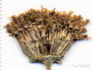 Coll. No. 1483, Thelesperma megapotamicum Coll. No. 1483, Thelesperma megapotamicum
|
1483 |
Field identification: Thelesperma megapotamicum.
Thelesperma megapotamicum (Spreng.) Kuntze. Hopi Tea Greenthread. Colorado School of Mines Survey Field, Jefferson County, Colorado. Northern part of the Survey Field, above the access road, about 90 m. south of Lookout Mountain Road, 1.9 km. south southwest of the GNIS location of Golden. 39.7392°N, 105.2278°W. WGS 1984 Elev. 1844 m. Yellow comp., perennial, woody at base, finely divided leaves, outer phyllaries short, inner phyllaries appearing fused. Mixed prairie near the base of Lookout Mountain. Coll. No. 1483, 6 Jul 2016, characters observed: Perennial herb, to 55 cm., woody at base, glabrous, eglandular; Leaves, opposite, pinnately lobed, lobes filiform, 30-35 mm.; Inflorescence, 1-3 heads per stem on 10 cm. peduncles; Phyllaries, 2 dimorphic series, without bristles or spines, outer, 2 mm. × 1.3 mm. wide, spreading, inner, 8 mm. × 3 mm. wide, connate 4.7 mm, tips erect; Receptacle, paleate, flat; Paleae, 7 mm. × 2 mm. wide, mid-vein greenish-brown, otherwise chartaceous; Flowers of 1 kind; Disc flowers, corolla, tube 3 mm. + throat 1 mm. + lobes 2 mm., color yellow with red-brown veins; Pappus, 2 retrorsely barbed awns; Cypsela, 3.8 mm. | ||||||||||||||||||||
|
Other articles:
|
1484 |
Argemone polyanthemos (Fedde) G.B. Ownbey. Crested Prickly Poppy. Colorado School of Mines Survey Field, Jefferson County, Colorado. High plains at the base of the Rocky Mountain Front Range, 2.2 km. south southwest of the GNIS location of Golden 39.7366°N, 105.2292°W. WGS 1984 Elev. 1896 m. Stems dripping orange sap when cut. | ||||||||||||||||||||
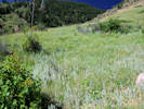 Habitat of Coll. No. 1485, Achillea millefolium Habitat of Coll. No. 1485, Achillea millefolium
|
1485 |
Field identification: Achillea millefolium.
Achillea millefolium L. Common Yarrow. Colorado School of Mines Survey Field, Jefferson County, Colorado. High plains at the base of the Rocky Mountain Front Range, 2.4 km. south southwest of the GNIS location of Golden 39.7347°N, 105.2296°W. WGS 1984 Elev. 1921 m. Mixed shrubs and grasses on lower slopes of Lookout Mountain. | ||||||||||||||||||||
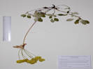 Coll. No. 1486, Eriogonum umbellatum var. umbellatum Coll. No. 1486, Eriogonum umbellatum var. umbellatum
|
1486 |
Field identification: Eriogonum umbellatum.
Eriogonum umbellatum Torr. var. umbellatum. Sulphur-Flower Buckwheat. Colorado School of Mines Survey Field, Jefferson County, Colorado. Rocky lower slopes of Lookout Mountain, southwest corner of the Survey Field, 2.5 km. south southwest of the GNIS location of Golden 39.7335°N, 105.2287°W. WGS 1984 Elev. 1972 m. Steep slope, large plants. | ||||||||||||||||||||
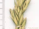 Coll. No. 1487, Leymus triticoides Coll. No. 1487, Leymus triticoides
|
1487 |
Field identification: grass.
Leymus triticoides (Buckley) Pilg. Beardless Wildrye. Colorado School of Mines Survey Field, Jefferson County, Colorado. Steep rocky lower slopes of Lookout Mountain, southwest corner of the Survey Field, 2.5 km. south southwest of the GNIS location of Golden 39.7334°N, 105.2287°W. WGS 1984 Elev. 1974 m. Coll. No. 1487, 6 Jul 2016, characters observed: Perennial, to 90 cm., long scaly rhizomes not found, culms, 1.5 mm. dia., generally glabrous, except lemma minutely scabrous; Leaves, sheath, open, glabrous, ligule, membraneous, 0.8 mm., auricles, very small, blade, involute; Inflorescence, spike-like, 2-sided, 115 mm. × 8 mm. wide; Spikelets, in pairs, sessile; Glumes, #2, awl-like, lower, 8 mm., upper, 10 mm.; Disarticulation, above the glumes, between florets unclear; Florets, #5, + 1 rudimentary at top of rachilla; Lemma (largest), body 14 mm. + awn 2 mm., reduced above, veins 5, minutely scabrous; Palea, 11 mm., enclosing embryo, tip bifid. | ||||||||||||||||||||
|
Other articles:
|
1488 |
Field identification: Scirpus, maybe S. pallidus or S. maritimus ssp. paludosus.
Scirpus pallidus (Britt.) Fern. Cloaked Bulrush. Colorado School of Mines Survey Field, Jefferson County, Colorado. Northern part of the Survey Field at the base of Lookout Mountain, beside access road to central part of the field, 2.1 km. south southwest of the GNIS location of Golden. 39.738°N, 105.2292°W. WGS 1984 Elev. 1886 m. In a watercourse below a small spring, possibly natural, or possibly overflow from a city water tank. | ||||||||||||||||||||
|
|
Wednesday, July 13thNorth Table Mountain, by way of North Table Loop, Tilting Mesa, Mesa Top, and North Table Loop trails. | |||||||||||||||||||||
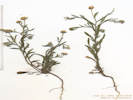 Coll. No. 1489, Erigeron divergens Coll. No. 1489, Erigeron divergens
|
1489 |
Field identification: Erigeron sp.
Erigeron divergens Torr. & A. Gray. Spreading Fleabane. North Table Mountain Park, Jefferson County, Colorado. Top of North Table Mountain, along an old road and former powerline headed in the general direction of the radio station, 2.6 km. north of the GNIS location of Golden 39.7792°N, 105.2173°W. WGS 1984 Elev. 1945 m. In thin soils or cracks of basalt caprock, near the edge of prairie dog town. Coll. No. 1489. 13 July 2016, characters observed: Annual or short-lived perennial, to 15 cm., tap-rooted, ±spreading hairy throughout, becoming minutely glandular above, hairs multicellular with clear crosswalls; Leaves, basal, absent or withered; cauline, alternate, petiole ±10 mm. + blade ±12 mm. × 2.4 mm. wide, uniformly hairy, somewhat reduced above; Inflorescence, heads borne singly on leafy stems, peduncles spreading or decurved, but cannot be described as “heads nodding;” Involucre, 3 mm. × limb 12 mm.; Receptacle, epaleate; Flowers, 2 kinds; Rays, corolla, 3.5 mm., white fading blue; Disk flowers, corolla, 1.7 mm., yellow; Pappus, short scales and longer capillary bristles, similar on ray and disk flowers; Cypsela, 0.8 mm. | ||||||||||||||||||||
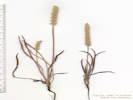 Coll. No. 1490, Plantago patagonica Coll. No. 1490, Plantago patagonica
|
1490 |
Field identification: Plantago patagonica.
Plantago patagonica Jacq. Woolly Plantain. North Table Mountain Park, Jefferson County, Colorado. Top of North Table Mountain, along an old road and former powerline headed about 600 m. north to a radio tower, 2.6 km. north of the GNIS location of Golden 39.7792°N, 105.2172°W. WGS 1984 Elev. 1972 m. In thin soils or cracks of basalt caprock, near the edge of prairie dog town. | ||||||||||||||||||||
|
Other articles:
|
Ponderosa Pine to the west. | |||||||||||||||||||||
 Old road to radio tower. Old road to radio tower.
 Old road and power line to radio tower. Old road and power line to radio tower.
|
1491 |
Field identification: Paronychia jamesii.
Paronychia jamesii Torr. & A. Gray. Jame's Nailwort. North Table Mountain Park, Jefferson County, Colorado. Top of North Table Mountain, along an old road and former powerline headed about 290 m. north to a radio tower, 2.6 km. north of the GNIS location of Golden 39.7821°N, 105.2168°W. WGS 1984 Elev. 1981 m. Thin soils on top of the mesa. | ||||||||||||||||||||
| 1492 |
Field identification: Eriogonum alatum.
Eriogonum alatum Torr. Winged Buckwheat. North Table Mountain Park, Jefferson County, Colorado. Top of North Table Mountain, about mid-way between the radio tower and the large pond to the east, about 3.25 km. north of the GNIS location of Golden. 39.7843°N, 105.2145°W. WGS 1984 Elev. 1986 m. Uncommon, perennial, to 1.5 m., leaves mostly basal, inflorescence a panicle. Thin, dry soil, on top of basalt flow capping North Table Mountain. | |||||||||||||||||||||
|
Other articles:
|
1493 |
Field identification: grass.
Achnatherum robustum (Vasey) Barkworth. Sleepygrass. North Table Mountain Park, Jefferson County, Colorado. Top of North Table Mountain, base of north-facing rocky slope (fault scarp?) above pond, 3.3 km. north northeast of the GNIS location of Golden. 39.7849°N, 105.2135°W. WGS 1984 Elev. 1979 m. Tall bunch grass, perennial, non-rhizomatous. Coll. No. 1493, 13 Jul 2016, characters observed: Perennial grass, to 1.3 m., non-rhizomatous bunch grass; Leaves, sheath open, ligule membraneous, tuft of hairs abaxially, blade flat, upper 15 cm.; Inflorescence, panicle, 30 cm. × 2.5 cm.; Spikelets, 1 per node; Florets, 1 per spikelet, bisexual; Glumes, #2, lower, 8 mm. + awn 2.5 mm., veins, #3, thin, upper, ±similar; Disarticulation, above the glumes; Callus, sharp, 0.2 mm.; Lemma, enclosing grain, 6 mm. + awn 26 mm., twisted, short (0.1 mm.) hairy, color tan, tuft of hairs at base, middle sparse hairy, tuft of hairs at tip, lengths ±similar; Palea, 4 mm., hairy; Anthers, #3. | ||||||||||||||||||||
| 1494 |
Field identification: Achillea millefolia.
Achillea millefolium L. Common Yarrow. North Table Mountain Park, Jefferson County, Colorado. Top of North Table Mountain, base of north-facing rocky slope (fault scarp?) above pond, 3.3 km. north northeast of the GNIS location of Golden. 39.7849°N, 105.2135°W. WGS 1984 Elev. 1978 m. | |||||||||||||||||||||
| 1495 |
Field identification: Scrophularia lanceolata.
Scrophularia lanceolata Pursh. Lanceleaf Figwort. North Table Mountain Park, Jefferson County, Colorado. Top of North Table Mountain, base of north-facing rocky slope (fault scarp?) above pond, 3.3 km. north northeast of the GNIS location of Golden. 39.7849°N, 105.2136°W. WGS 1984 Elev. 1978 m. Fruit only, past flowering. Numerous plants here, many trampled by deer (?) or weed sprayers (?) | |||||||||||||||||||||
|
Other articles:
|
1496 |
Field identification: Ratibida columnifera.
Ratibida columnifera (Nutt.) Woot. & Standl. Upright Prairie Coneflower. North Table Mountain Park, Jefferson County, Colorado. Top of North Table Mountain, base of north-facing rocky slope (fault scarp?) above pond, 3.3 km. north northeast of the GNIS location of Golden. 39.7849°N, 105.2134°W. WGS 1984 Elev. 1976 m. | ||||||||||||||||||||
|
Other articles:
|
1497 |
Field identification: Ranunculus aquatilis.
Ranunculus aquatilis L. var. diffusus With. Threadleaf Crowfoot. North Table Mountain Park, Jefferson County, Colorado. Top of North Table Mountain, south edge of pond at base of north-facing rocky slope (fault scarp?), 3.3 km. north northeast of the GNIS location of Golden. 39.785°N, 105.2136°W. WGS 1984 Elev. 1975 m. | ||||||||||||||||||||
|
Other articles:
|
1498 |
Field identification: Ranunculus cymbalaria.
Ranunculus cymbalaria Pursh. Alkali Buttercup. North Table Mountain Park, Jefferson County, Colorado. Top of North Table Mountain, on the west side of an ephemeral pond in the northern part of the mesa, near the radio tower, 3.4 km. north of the GNIS location of Golden. 39.7853°N, 105.2142°W. WGS 1984 Elev. 1976 m. In very wet soil at the edge of the pond. | ||||||||||||||||||||
|
Other articles:
|
1499 |
Field identification: grass.
Elymus trachycaulus (Link) Shinners. Slender Wheatgrass. North Table Mountain Park, Jefferson County, Colorado. Top of North Table Mountain, on the west side of an ephemeral pond in the northern part of the mesa, near the radio tower, 3.4 km. north of the GNIS location of Golden. 39.7853°N, 105.2142°W. WGS 1984 Elev. 1973 m. In very wet soil at the edge of the pond. Coll. No 1499, 13 Jul 2016, characters observed: Perennial grass, to 80 cm., tufted, not strongly rhizomatous; Leaves, sheath, open, ligule, membraneous, 0.5 mm., auricles, 1 mm., thin, blade, 12-15 cm., flat to involute; Inflorescence, 2-sided spike Rachis, internodes, 6 mm., scabrous on margins; Spikelets, 1 per node, 17 mm. × 3.5 mm. wide, laterally compressed, appear to be positioned edge-wise to rachis, but this may be a feature of pressing/drying; Florets, 7+ per spikelet; Glumes, #2, ±equal, 8 mm. × 1.2 mm. wide, rounded, veins, #5; Lemma, 9 mm., rounded, veins, #7, glabrous; Palea, ±=lemma; Anthers, 4 mm. Ackerfield (2015) and Baldwin (2012) lead equivocally to E. trachycaulus, whereas Shaw (2008) and Weber & Wittmann (2012) are more suggestive of E. lanceolatus. | ||||||||||||||||||||
|
Other articles:
|
1500 |
Field identification: Potentilla norvegica.
Potentilla norvegica L. Norwegian Cinquefoil. North Table Mountain Park, Jefferson County, Colorado. Top of North Table Mountain, on the west side of an ephemeral pond in the northern part of the mesa, beside Mesa Top Trail, near the radio tower, 3.4 km. north of the GNIS location of Golden. 39.7855°N, 105.2142°W. WGS 1984 Elev. 1968 m. Coll. No. 1500, 13 July 2016, characters observed: Perennial herb, to 25 cm., erect, ±spreading stiff hairy throughout, 1.5 mm., glands, sparse, obscure; Leaves, cauline, stipules, large, 8 mm. × 4 mm. wide, lanceolate, petiole 19 mm. + blade 22 mm. × 24 mm. wide, ternately compound, leaflets, 3(4); Calyx, sepals, 3.5-4.0 mm. × 2 mm. wide, fused >½; Corolla, petals, free, yellow; 1.5 mm. × 1 mm. wide; Stamens, most seen, #8; Style, 0.7 mm., thickest at base; Achenes, 0.6 mm., tan, minutely papillate. | ||||||||||||||||||||
|
Other articles:
|
1500.1 |
Field identification: grass.
Hordeum pusillum Nutt. Little Barley. North Table Mountain Park, Jefferson County, Colorado. Top of North Table Mountain, on the west side of an ephemeral pond in the northern part of the mesa, beside Mesa Top Trail, near the radio tower, 3.4 km. north of the GNIS location of Golden. 39.7855°N, 105.2142°W. WGS 1984 Elev. 1968 m. | ||||||||||||||||||||
|
Other articles:
|
1500.2 |
Field identification: Mint or verbena.
Verbena bracteata Lag. & Rodr. Large Bract Vervain. North Table Mountain Park, Jefferson County, Colorado. Top of North Table Mountain, on the west side of an ephemeral pond in the northern part of the mesa, beside Mesa Top Trail, near the radio tower, 3.4 km. north of the GNIS location of Golden. 39.7855°N, 105.2142°W. WGS 1984 Elev. 1968 m. Erect, perennial, damp soil near pond. Coll. No. 1500.2, 13 July 2016, characters observed: Perennial herb, to 15 cm., erect; Leaves, cauline, opposite, petiole 5 mm. + blade 20 mm. × 10 mm. wide, pinnafitid, toothed; Bract, 11 mm. × 2.2 mm. wide, entire; Calyx, 4 mm. × 1.5 mm. wide; Corolla, lobes, #5 tube 4 mm. + throat 1 mm. + lobes 2 mm., limb, 2.5 mm., color blue; Introduced. Usually seen as a prostrate trailside herb. However, this one was growing in grasses and herbs, and forced to adopt an erect habit. | ||||||||||||||||||||
| 1501 |
Field identification: Dalea purpurea.
Dalea purpurea Vent. Purple Prairie Clover. North Table Mountain Park, Jefferson County, Colorado. Along the Mesa Top Trail (radio tower access road), 135 m. northwest of the tower, 3.3 km. north of the GNIS location of Golden. 39.7851°N, 105.2175°W. WGS 1984 Elev. 1949 m. Edge of brush across roadside gulley. Accidental collections with this one: Aegilops cylindrica and Alyssum simplex. | |||||||||||||||||||||
|
Other articles:
|
1502 |
Field identification: Pseudotsuga menziesii.
Pseudotsuga menziesii (Mirb.) Franco var. glauca (Beissn.) Franco. Douglas Fir. North Table Mountain Park, Jefferson County, Colorado. North slope of North Table Mountain, 30 m. east of and above the Mesa Top Trail (radio tower access road), 3.4 km. north of the GNIS location of Golden. 39.7864°N, 105.2208°W. WGS 1984 Elev. 1916 m. In brush on moderate northwest slope, only such tree seen. | ||||||||||||||||||||
|
Other articles:
|
1503 |
Field identification: Thelesperma megapotamicum “Hopi Tea Greenthread.”
Thelesperma megapotamicum (Spreng.) Kuntze. Hopi Tea Greenthread. North Table Mountain Park, Jefferson County, Colorado. Northwest slope of North Table Mountain, near the intersection of the North Table Loop and the Mesa Top Trail, 3.7 km. north of the GNIS location of Golden. 39.7887°N, 105.2216°W. WGS 1984 Elev. 1854 m. Mixed grasses and forbs on the nose of a small ridge. | ||||||||||||||||||||
|
Other articles:
|
1504 |
Field identification: looks like a Chaenactis, but not C. douglasii the only representative in Jefferson County.
Hymenopappus filifolius Hook. var. polycephalus (Osterh.) B.L. Turner. Many-Headed Fine-Leaved Wooly-White. North Table Mountain Park, Jefferson County, Colorado. Lower slopes on the west side of North Table Mountain, along side of North Table Loop, just a few meters north of the access road to the trailhead, 3.2 km. north northwest of the GNIS location of Golden. 39.7833°N, 105.2298°W. WGS 1984 Elev. 1835 m. Coll. No. 1504, 13 July 2016, characters observed: Perennial herb, to 60 cm., ±tomentose throughout; Leaves, basal, petiole 35 mm. + blade 75 mm. × 30 mm. wide, very deeply pinnafitid, segments filiform, ultimate divisions 8-18 mm., cauline, #4-5, similar, reduced above, bases conspicuously tomentose; Inflorescence, heads borne singly on peduncles, 22-45 mm., #(5) 7 (15); Involucre, 8 mm. × 15 mm. wide; Receptacle, epaleate, flat; Phyllaries, 2 series, 7 mm. × 2.5 mm. wide; inner > outer, margins chartaceous, tips broad scarious; Flowers, 1 kind; Disk flowers, corolla, yellow; Pappus, scales, 1.2 mm.; Achenes, 5 mm., hairy all over, more so on the angles. Ackerfield (2015) leads to Hymenopappus when the involucre bracts (phyllaries) have broad, scarious tips, whereas involucre bracts in Chaenactis are green and narrow, without scarious tips. Weber & Wittmann (2012) use the same characters. FNANM also uses the shape of the cypselae. Baldwin (2012) also uses the shape and margin of the phyllaries and, in addition, the corollas of Hymenopappus are yellow, whereas those of Chaenactis are white. | ||||||||||||||||||||
|
Other articles:
Locations:
North Table Mountain.
North Table Mountain Park.
|
Friday, July 22nd
| |||||||||||||||||||||
|
Other articles:
|
1505 |
Field identification: Oenothera curtiflora.
Oenothera curtiflora W.L. Wagner & Hoch. Velvet Butterfly-Weed. North Table Mountain Park, Jefferson County, Colorado. Lowest north slopes of North Tab;e Mountain, along the Mesa Spur Trail, 0.6 km. south of 58th Avenue, 4.7 km. north northeast of the GNIS location of Golden. 39.7971°N, 105.2113°W. WGS 1984 Elev. 1798 m. Very tall, single stem branched at the inflorescence, small-flowered, soft-hairy. | ||||||||||||||||||||
| 1506 |
Field identification: Symphoricarpos occidentalis
Symphoricarpos occidentalis Hook. Western Snowberry. North Table Mountain Park, Jefferson County, Colorado. Lowest north slopes of North Table Mountain, along the Mesa Spur Trail, 0.6 km. south of 58th Avenue, 4.6 km. north northeast of the GNIS location of Golden. 39.7967°N, 105.2112°W. WGS 1984 Elev. 1807 m. | |||||||||||||||||||||
| 1507 |
Field identification: Helianthus Helianthus pauciflorus Nutt. ssp. subrhomboideus (Rydb.) O. Spring & E. Schilling. Stiff Sunflower. North Table Mountain Park, Jefferson County, Colorado. Near the top of several small hills (toe of landslide?) on the lower north slope of North Table Mountain, 0.7 km. southeast of the Mesa Spur Trailhead on 58th Avenue, 4.8 km. north northeast of the GNIS location of Golden. 39.7972°N, 105.2071°W. WGS 1984 Elev. 1851 m. Also at this location: Thelesperma megapotamicum, Eriogonum alatum, and E. effusum. | |||||||||||||||||||||
| 1507.1 |
Field identification: Eriogonum effusum, immature.
Included with Coll. No. 1541 and sent to KHD to demonstrate characters of leaves. | |||||||||||||||||||||
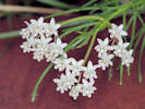 Asclepias pumila growing in my parkway. Asclepias pumila growing in my parkway.
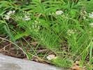 Asclepias pumila growing in my parkway. Asclepias pumila growing in my parkway.
|
1508 |
Field identification: Asclepias pumila.
Asclepias pumila (A. Gray) Vail. Plains Milkweed. North Table Mountain Park, Jefferson County, Colorado. Lower north slopes of North Table Mountain, 0.79 km southeast of the Mesa Spur Trailhead in 58th Avenue, 4.65 km. north northeast of the GNIS location of Golden. 39.796°N, 105.207°W. WGS 1984 Elev. 1845 m. Growing in low grasses and forbs. | ||||||||||||||||||||
|
Other articles:
|
1509 |
Field identification: Psoralidium Psoralidium tenuiflorum (Pursh) Rydb. Slimflower Scurfpea. North Table Mountain Park, Jefferson County, Colorado. Lower north slopes of North Table Mountain, 0.76 km southeast of the Mesa Spur Trailhead in 58th Avenue, 4.58 km. north northeast of the GNIS location of Golden. 39.7956°N, 105.2086°W. WGS 1984 Elev. 1840 m. | ||||||||||||||||||||
|
Other articles:
|
1510 |
Field identification: Asparagus officinalis.
Asparagus officinalis L. Asparagus. North Table Mountain Park, Jefferson County, Colorado. Lower north slopes of North Table Mountain, 0.76 km southeast of the Mesa Spur Trailhead in 58th Avenue, 4.58 km. north northeast of the GNIS location of Golden. 39.7955°N, 105.2086°W. WGS 1984 Elev. 1843 m. Sterile. | ||||||||||||||||||||
|
Other articles:
|
1511 |
Field identification: Physalis hederifolia.
Physalis hederifolia A. Gray var. comata (Rydb.) Waterfall. Ivy-Leaved Ground Cherry. North Table Mountain Park, Jefferson County, Colorado. Lower north slopes of North Table Mountain,500 m. south southeast of the Mesa Spur Trailhead on 58th Avenue, 4.74 km. north northeast of the GNIS location of Golden. 39.7976°N, 105.2115°W. WGS 1984 Elev. 1797 m. Trailside, in grasses. | ||||||||||||||||||||
|
Locations:
Ranson/Edwards Homestead Open Space Park.
|
Sunday, July 24th
| |||||||||||||||||||||
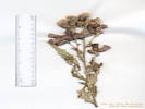 Coll. No. 1512, Cirsium arvense Coll. No. 1512, Cirsium arvense
|
1512 |
Field identification: Cirsium arvense.
Cirsium arvense (L.) Scop. Canada Thistle. Ranson/Edwards Homestead Open Space Park, Jefferson County, Colorado. Northern part of open space, 1.6 mi. west on CO Highway 72 from CO Highway 93, north 1.9 mi. on Plainview Road, then 80 m. northwest; 16.3 km. north northwest of the GNIS location of Golden. 39.8977°N, 105.2687°W. WGS 1984 Elev. 1935 m. Mixed grasses and forbs, just below the ponderosa pine zone. Lightly grazed in 2016. Colorado Noxious Weed List B. Coll. No. 1512, 24 July 2016, characters observed: Annual, to 70 cm., tap-rooted; Leaves, cauline, alternate, sessile but not obviously decurrent, 85 mm. × 20 mm. wide, margin sinuate, spiny, adaxial thinly tomentose, abaxial tomentose; Inflorescence, panicle(?); Heads, many, 30±, 15 mm. × 8 mm. dia., disk flowers only, dioecious, staminate heads, pappus < corolla, pistillate heads, pappus > corolla; Phyllaries, many (6-7) series, outer 3 mm. × 1.5 mm. wide, inner 15 mm. × 1 mm. wide, dark dorsal ridge, tips, spinulose, reflexed; Receptacle, soft bristles, 10 mm.; Pappus, plumose bristles. | ||||||||||||||||||||
| 1513 | Field identification: Amorpha nana | |||||||||||||||||||||
| 1514 | Field identification: Ratibida columnifera | |||||||||||||||||||||
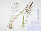 Coll. No. 1515, Agrostis stolonifera Coll. No. 1515, Agrostis stolonifera
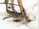 Roots of Coll. No. 1515, Agrostis stolonifera Roots of Coll. No. 1515, Agrostis stolonifera
|
1515 |
Field identification: Agrostis?, maybe A. gigantea.
Agrostis stolonifera L. Creeping Bentgrass. Ranson/Edwards Homestead Open Space Park, Jefferson County, Colorado. Northern part of open space, 1.6 mi. west on CO Highway 72 from CO Highway 93, north 1.9 mi. on Plainview Road, then 300 m. northeast, almost to the boundary fence; 16.3 km. north northwest of the GNIS location of Golden. 39.8991°N, 105.2668°W. WGS 1984 Elev. 1937 m. Weakly stoloniferous, growing in and beside ephemeral stream. Introduced. Coll. No. 1515, 24 July 2016, characters observed: Perennial grass, to 85 cm., decumbent at base, weakly rhizomatous, 1 of 3 collections has a 2.5 cm. scaly rhizome; Leaves, sheath, open, ligule 4 mm., chartaceous tissue extending down sheath 20 mm., auricles, 1 mm., blade, 80 mm. × 3.2 mm. wide, flat, scabrous adaxially; Inflorescence, panicle, branches not bearing spikelets to base; Spikelets, 1 floret; Glumes, ±equal, 2.3 mm., purplish, keeled scabrous; Lemma, 1.8 mm. + awn 0.3 mm., thin, translucent, veins, 3(5?); Palea, 1.3 mm. Introduced. | ||||||||||||||||||||
| 1516 |
Field identification: Oenothera villosa.
Oenothera villosa Thunb. Hairy Evening Primrose. Ranson/Edwards Homestead Open Space Park, Jefferson County, Colorado. Northern part of open space, 1.6 mi. west on CO Highway 72 from CO Highway 93, north 1.9 mi. on Plainview Road, then 700 m. downhill to northeast to a small reservoir; 16.3 km. north northwest of the GNIS location of Golden. 39.8989°N, 105.2609°W. WGS 1984 Elev. 1905 m. High plains above Rocky Flats, single plant growing in delatic gravels of small ephemeral stream entering pond. | |||||||||||||||||||||
| 1517 |
Field identification: Carduus nutans.
Carduus nutans L. Nodding Plumeless Thistle. Ranson/Edwards Homestead Open Space Park, Jefferson County, Colorado. Northern part of open space, 1.6 mi. west on CO Highway 72 from CO Highway 93, north 1.9 mi. on Plainview Road, then 560 m. downhill to northeast; 16.3 km. north northwest of the GNIS location of Golden. 39.8974°N, 105.262°W. WGS 1984 Elev. 1916 m. Northwest-facing slope above ephemeral stream. Introduced. Colorado Noxious Weed List B. Coll. No. 1517, 24 July 2016, characters observed: Annual, to 55 cm., tap-rooted, branched at base; Leaves, basal, withered at flowering, cauline, alternate, decurrent 40 mm. + blade 75 mm. × 25 mm. wide, pinnately lobed, margins spiny; Inflorescence, single heads on spiny tomentose peduncles 2.5-15 cm.; Phyllaries, many graduated series, 9-20 mm. × 1-3 mm. wide, thick at base, mostly green, purplish at margins, mid-vein prominent, tip spiny; Receptacle, alveolate (honeycombed), flat, bristly; Disk flowers, 25 mm., color purple; Pappus, capillary bristles, 18 mm. | |||||||||||||||||||||
|
Other articles:
Locations:
North Table Mountain Park.
|
Friday, July 29th
| |||||||||||||||||||||
|
Other articles:
|
1518 |
Field identification: Stephanomeria pauciflora (Torr.) A. Nelson. Brownplume Wirelettuce. North Table Mountain Park, Jefferson County, Colorado. Lower east slopes of North Table Mountain, between North Table Loop and Mesa Top Trail, 0.7 km. northwest of the Easley Road trailhead; 3.9 km. northeast of the GNIS location of Golden. 39.7841°N, 105.1952°W. WGS 1984 Elev. 1798 m. Grassy southeast-facing slope. Coll. No. 1518, 29 July 2016, characters observed: Perennial, shrub-like, to 30 cm.; Leaves, alternate, sessile, 80 mm. × 15 mm. wide, lanceolate, deeply toothed (runcinate); Heads, many; Phyllaries, 3 graduated series, 4-9 mm. × 1.3-1.5 mm. wide; Flowers, 1 kind; Rays, #5, 12 mm. × 2.5 mm. wide, white, fading tan; Pappus, bristles, connate into 5 groups corresponding to ribs of cypsela, 7 mm., plumose upper 3/4; Cypsela, 4 mm., beak, 0, rugose-tuberculate, 5 broad ribs. | ||||||||||||||||||||
|
Other articles:
|
1519 |
Field identification: Solidago, Solidago missouriensis Nutt. Missouri Goldenrod. North Table Mountain Park, Jefferson County, Colorado. Lower east slopes of North Table Mountain, along the North Table Loop north of the Mesa Top Trail, 1.2 km. northwest of the Easley Road trailhead; 4.32 km. northeast of the GNIS location of Golden. 39.789°N, 105.1953°W. WGS 1984 Elev. 1829 m. Trailside in small outcrop of rocks. Coll. No. 1519, 29 Jul 2016, characters observed: Perennial herb, to 35 cm.; Leaves, basal, unknown, cauline, alternate, petiole 10 mm. + blade 100 mm. × 22 mm. wide, oblanceolate, glabrous, margin, sparsely scabrous proximally, serrate distally, prominently 3(5)-nerved, reduced above; Heads, 3-4 mm. × 3-4 mm. wide; Phyllaries, 3+ series, 3.5 mm. × 1 mm. wide, green, margin chartaceous, veins, 1; Receptacle, epaleate, conic, Flowers, 2 kinds; Ray flowers, #12, yellow; Disk flowers, #12, yellow; Pappus, capillary bristles. | ||||||||||||||||||||
|
Other articles:
|
1520 |
Field identification: unknown tree, maybe Corylus cornuta Marshall. Beaked Hazelnut. North Table Mountain Park, Jefferson County, Colorado. Lower east slopes of North Table Mountain, along the North Table Loop north of the Mesa Top Trail, 1.57 km. northwest of the Easley Road trailhead; 4.56 km. northeast of the GNIS location of Golden. 39.7923°N, 105.1973°W. WGS 1984 Elev. 1830 m. Sterile collection, no reproductive parts found. Determination tentative. Coll. No. 1520, 29 July 2016, characters observed: Tree, Twigs, brown, sparsely (hairy to arachnose); Leaves, alternate, petiole, 6 mm., blade, 130 mm. × 75 mm. wide, base, oblique, tip, acuminate, margin, doubly-serrate, prominently pinnately veined, glabrous. | ||||||||||||||||||||
|
Other articles:
|
1521 |
Field identification: D. Y. C.
Heterotheca villosa (Pursh) Shinners var. villosa. Hairy False Goldenaster. North Table Mountain Park, Jefferson County, Colorado. Lower north slopes of North Table Mountain, 1.02 km. southwest of the Mesa Spur trailhead on 58th Avenue, 4.66 km. north northeast of the GNIS location of Golden. 39.7953°N, 105.2039°W. WGS 1984 Elev. 1848 m. Mixed grasses and forbs upslope of North Table Loop. Coll. No. 1521, 29 July 2016, characters observed: Perennial herb, to 35 cm., eglandular and hispid throughout; Leaves, cauline, alternate, sessile, 35 mm. × 18 mm. wide, ovate, entire, not contorted after drying; Heads, borne singly on leafy peduncles to 50 mm., subtended by a pair of bracts, sometimes equalling but not exceeding the head, with cilia to 1.2 mm. proximally; Phyllaries, 3+graduated series, 3-8 mm. × 1 mm. wide, more toward strigose than hispid, tips, dark brown; Receptacle, epaleate, hemispheric; Flowers, 2 kinds; Rays, corolla, 9 mm., yellow; Disk flowers, corolla, 6.5 mm., yellow; Pappus, short (1 mm.) and long (5-6 mm.) capillary bristles; Cypsela, 3 mm., hairy. Perhaps an intermediate between Heterotheca villosa and H. foliosa. See discussion in Ackerfield (2015) Flora of Colorado. | ||||||||||||||||||||
|
|
Friday, August 8th | |||||||||||||||||||||
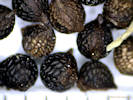 Seed of Coll. No. 1522, Argemone polyanthemos Seed of Coll. No. 1522, Argemone polyanthemos
|
1522 |
Field identification: Argemone polyanthemos.
Argemone polyanthemos (Fedde) G.B. Ownbey. Crested Prickly Poppy. North Table Mountain Park, Jefferson County, Colorado. South side of North Table Mountain, along the Climbing Access Trail just below the uppermost basalt flow; 224 m. southeast of the USBR monument designated North Table, 1.44 km. north northeast of the GNIS location of Golden. 39.7681°N, 105.2169°W. WGS 1984 Elev. 1905 m. | ||||||||||||||||||||
| 1523 |
Field identification: Helianthus pumilus.
Helianthus pumilus Nutt. Little Sunflower. North Table Mountain Park, Jefferson County, Colorado. South side of North Table Mountain, along the Climbing Access Trail just below the uppermost basalt flow; 224 m. southeast of the USBR monument designated North Table, 1.44 km. north northeast of the GNIS location of Golden. 39.7681°N, 105.2169°W. WGS 1984 Elev. 1918 m. | |||||||||||||||||||||
| 1524 |
Field identification: Andropogon gerardii.
Andropogon gerardii Vitman. Big Bluestem. North Table Mountain, Jefferson County, Colorado. South side of North Table Mountain, below Climbing Access Trail near the top of the slope; 260 m. southeast of the USBR monument designated North Table, 1.38 km. north northeast of the GNIS location of Golden. 39.7675°N, 105.217°W. WGS 1984 Elev. 1891 m. Collected with Mirabilis linearis. | |||||||||||||||||||||
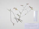 Coll. No. 1525, Mirabilis linearis Coll. No. 1525, Mirabilis linearis
|
1525 |
Field identification: Mirabilis linearis.
Mirabilis linearis (Pursh) Heimerl. Narrowleaf Four O'Clock. North Table Mountain, Jefferson County, Colorado. South side of North Table Mountain, below Climbing Access Trail near the top of the slope; 260 m. southeast of the USBR monument designated North Table, 1.38 km. north northeast of the GNIS location of Golden. 39.7675°N, 105.217°W. WGS 1984 Elev. 1890 m. Widely scattered; collected with Andropogon gerardii. | ||||||||||||||||||||
 Location of Coll. No. 1526, Securigera varia Location of Coll. No. 1526, Securigera varia
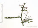 Coll. No. 1526, Securigera varia Coll. No. 1526, Securigera varia
|
1526 |
Field identification: Securigera varia.
Securigera varia (L.) Lassen. Purple Crownvetch. North Table Mountain, Jefferson County, Colorado. Lower slopes on the south side of North Table Mountain, 330 m. south southeast of the USBR monument designated North Table, 1.22 km. north northeast of the GNIS location of Golden. 39.7663°N, 105.2181°W. WGS 1984 Elev. 1819 m. Barely identifiable fragments from a very heavily browsed patch approximately 3 m. × 5 m. in size. Aerial photography shows multiple game trails oriented toward this patch. Introduced. Coll. No. 1526, 5 August 2016, characters observed: Perennial shrub, to 1 m. × 3 m. dia.; Leaves, cauline, alternate, stipules, 3 mm. × 0.6 mm., strap-shaped, sessile or nearly so, compound, leaflets, #21, 9 mm. × 2.7 mm. wide, oblong, tip mucronate; Inflorescence, axillary umbellate clusters, peduncles, 25 mm., Pedicels, 2.5 mm., Calyx, conical, tube 2.5 mm. + lobes 0.5 mm.; Flowers, white to pink, banner 4 mm. + 2 mm., wings, 6 mm., keel, 9 mm.; Fruit, erect, 19 mm. × 1.5 mm. wide, ridged. | ||||||||||||||||||||
|
Other articles:
|
1527 |
Field identification: Juncus sp.
Juncus interior Wiegand. Inland Rush. North Table Mountain, Jefferson County, Colorado. Lower south slopes of North Table Mountain, above Peery Parkway, 250 m. south of the USBR monument North Table,1.25 km. north of the GNIS location of Golden. 39.767°N, 105.2201°W. WGS 1984 Elev. 1831 m. Small wetland where the North Table Mountain Trail crosses a watercourse below a near-perennial spring that is higher on the south slope of the mesa. Coll. No. 1527, 5 August 2014, characters observed: Perennial graminoid, to 45 cm., Culm, 40 cm, round, 1 mm. dia.; Leaves, basal, outer, 7 mm., sheath-like, inner, sheath, 80 mm., open, ligule, 0.5 mm., membraneous, blade, 225 mm., rolled; Bracts, #2, 85 mm., 46 mm.; Pedicel, 3 mm., bract, 2 mm.; Flowers, #17, closely subtended by a pair of scarious bracteoles; Tepals, 3.2 mm. lanceolate, tip acuminate, green center, then light brown strips, then scarious margin; Capsule, 3.5 mm., rounded at summit, placenta extends nearly to tip; Seeds, 0.5 mm., oblong, not tailed, annular grooves; | ||||||||||||||||||||
|
Other articles:
|
1528 |
Field identification: some kind of wheat grass, Elymus trachycaulus (Link) Shinners. Slender Wheatgrass. North Table Mountain, Jefferson County, Colorado. Lower south slopes of North Table Mountain, above Peery Parkway, 250 m. south of the USBR monument North Table,1.25 km. north of the GNIS location of Golden. 39.7669°N, 105.22°W. WGS 1984 Elev. 1835 m. Small wetland where the North Table Mountain Trail crosses a watercourse below a near-perennial spring that is higher on the south slope of the mesa. Coll. No. 1528, 5 August 2016, characters observed: Perennial grass, to 1 m., generally glabrous except as noted; Leaves, sheath, open, ligule, membraneous, auricles, small, 1 mm., blade, 25 mm. Inflorescence, bi-lateral spike; Spikelets, mostly 1 per node, about 1/3 have 2 per node, 21 mm. × 3.5 mm. wide, compression, lateral; Disarticulation, between the florets; Glumes, #2, ±equal, 11 mm. + awns 2 mm., not quite straight, thick, tough, not keeled, veins, 5, prominent, margins, widest at middle, Florets, #8, Lemma, 9 mm. + awn 3 mm, longitudinally symetric; Palea, 9 mm., tip, bifid, veins, ciliate; Anthers, 3 mm. | ||||||||||||||||||||
|
Other articles:
|
1529 |
Field identification: some kind of grass, maybe Poa palustris L. Fowl Bluegrass. North Table Mountain, Jefferson County, Colorado. Lower south slopes of North Table Mountain, above Peery Parkway, 250 m. south of the USBR monument North Table,1.25 km. north of the GNIS location of Golden. 39.767°N, 105.22°W. WGS 1984 Elev. 1833 m. Small wetland where the North Table Mountain Trail crosses a watercourse below a near-perennial spring that is higher on the south slope of the mesa. Coll. No. 1529, 5 August 2016, characters observed: Perennial grass, to 1 m., growing in running water; rhizomes, unknown (none seen); Leaves, sheath open, ligule, membraneous, 4 mm., blade, flat, scabrous, tip, narrow, not broadly prow-shaped; Inflorescence, open panicle, 28 cm. × 20 cm. wide, lower branches 4-5 per node; Pedicels, 0.3-3.0 mm.; Spikelets, 1 per node, 4 mm. × 1 mm., compression lateral, glumes, lemma, and paleae very fragile; Glumes, #2, lower, 2.6 mm., veins 3, upper, 2.8 mm., veins 3 (5?); Disarticulation, above the glumes; Florets, 3 fertile, + uppermost rudimentary; Lemma, 2.6 mm., veins, at least 3, maybe 5, basal hairs sparse, but length 1/2 the lemma, keeled, hairy proximally, margin, hairy proximally, glabrous between the veins; Palea, 2.3 mm. | ||||||||||||||||||||
| 1530 |
Field identification: some kind of grass, maybe same as previous, Poa palustris L. Fowl Bluegrass. North Table Mountain, Jefferson County, Colorado. Lower south slopes of North Table Mountain, above Peery Parkway, 250 m. south of the USBR monument North Table,1.25 km. north of the GNIS location of Golden. 39.7669°N, 105.22°W. WGS 1984 Elev. 1830 m. Small wetland where the North Table Mountain Trail crosses a watercourse below a near-perennial spring that is higher on the south slope of the mesa. Same as Coll. No. 1529, but this one shows the decumbent culms that are purplish at the base. | |||||||||||||||||||||
| 1531 |
Field identification: definitely Rumex, probably R. crispus.
Rumex crispus L. Curley Dock. North Table Mountain, Jefferson County, Colorado. Lower south slopes of North Table Mountain, above Peery Parkway, 250 m. south of the USBR monument North Table,1.25 km. north of the GNIS location of Golden. 39.767°N, 105.22°W. WGS 1984 Elev. 1822 m. Basal leaves absent. Small wetland where the North Table Mountain Trail crosses a watercourse below a near-perennial spring that is higher on the south slope of the mesa. Introduced. | |||||||||||||||||||||
| 1532 |
Field identification: Epilobium ciliatum.
Epilobium ciliatum Raf. Fringed Willowherb. North Table Mountain, Jefferson County, Colorado. Lower south slopes of North Table Mountain, above Peery Parkway, 250 m. south of the USBR monument North Table,1.25 km. north of the GNIS location of Golden. 39.767°N, 105.2201°W. WGS 1984 Elev. 1826 m. Small wetland where the North Table Mountain Trail crosses a watercourse below a near-perennial spring that is higher on the south slope of the mesa. | |||||||||||||||||||||
|
|
Tuesday, August 16thSome of the unwanted stuff that came up in the parkway. | |||||||||||||||||||||
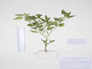 Coll. No. 1533, Solanum physalifolium Coll. No. 1533, Solanum physalifolium
|
1533 |
Solanum physalifolium Rusby. Hoe Nightshade.
Golden, Jefferson County, Colorado. Landscaped parkway near the intersection of 5th Street and Arapahoe Street, Golden, CO, 0.9 km. northwest of the GNIS location of Golden. 39.7613°N, 105.2286°W. WGS 1984 Elev. 1755 m. Adventive weed. Introduced. Coll. No. 1533, 16 August 2016, characters observed: Annual, to 25 cm., hairy throughout, hairs gland-tipped, some multicellular, without spines or prickles; Leaves, alternate, simple, 35 mm. × 19 mm. wide, ovate, margins entire to wavy; Inflorescence, racemes, 2-5 flowers, between nodes or sometimes at nodes opposite leaves; Calyx, tube 1.5 mm. + lobes 1.0 mm., without downward pointing lobes; Corolla, rotate, white, limb, 8 mm.; Stamens, upright around the style, touching it without being fused (connivent); Fruit, unknown. Introduced. | ||||||||||||||||||||
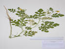 Coll. No. 1534, Solanum rostratum Coll. No. 1534, Solanum rostratum
|
1534 |
Solanum rostratum Dunal. Buffalo Bur Nightshade.
Golden, Jefferson County, Colorado. Landscaped parkway near the intersection of 5th Street and Arapahoe Street, Golden, CO, 0.9 km. northwest of the GNIS location of Golden. 39.7613°N, 105.2286°W. WGS 1984 Elev. 1755 m. Adventive weed. | ||||||||||||||||||||
| 1535 | Persicaria sp. | |||||||||||||||||||||
|
Locations: North Table Mountain Park. |
Thursday, August 18thNorth side of North Table Mountain. | |||||||||||||||||||||
| 1536 |
Field identification: Liatris punctata.
Liatris punctata Hook. Dotted Blazing Star. North Table Mountain Park, Jefferson County, Colorado. Lower north slopes of North Table Mountain, along the Tablerock Trail, 1.0 km. south of the Mesa Spur trailhead on W. 58th Avenue, 4.2 km. north northwest of the GNIS location of Golden. 39.7926°N, 105.2127°W. WGS 1984 Elev. 1811 m. Phyllaries erect, acuminate; flowers few (e.g., 5), pappus plumose bristles. Mixed grasses and forbs. | |||||||||||||||||||||
| 1537 |
Field identification: Eriogonum effusum.
Eriogonum effusum Nutt. Spreading Buckwheat. North Table Mountain Park, Jefferson County, Colorado. Lower north slopes of North Table Mountain, along the Tablerock Trail, 1.0 km. south of the Mesa Spur trailhead on W. 58th Avenue, 4.2 km. north northwest of the GNIS location of Golden. 39.7927°N, 105.2127°W. WGS 1984. Elev. 1830 m. Many here, very few in bloom. Coll. No. 1507.1, 22 Jul 2016, Coll. Nos. 1537 & 1541, 18 Aug 2016, characters observed: Perennial herb, woody at base, to 30 cm., Stem, floccose; Leaves, cauline, petiole 5 mm. + blade 20-25 mm. × 2-6 mm. wide, generally tomentose, except less so adaxially, ±flat, margin entire, , withered at flowering; Inflorescence, open cyme; Involucre, 1 per node, 2 mm., tomentose; Perianth, without stipe; Tepals, 1.8 mm., white to pink, described as yellow in Ackerfield (2015) and FNAMN; Achene, unknown. | |||||||||||||||||||||
| 1538 |
Field identification: Senecio sp.
Senecio spartioides Torr. & A. Gray. Broomlike Ragwort. North Table Mountain Park, Jefferson County, Colorado. lower north slopes of North Table Mountain, 0.73 km. south southeast of the Mesa Spur trailhead on W. 58th Avenue, 4.5 km. north northeast of the GNIS location of Golden. 39.7954°N, 105.2104°W. WGS 1984 Elev. 1837 m. Mixed grasses, forbs and small shrubs. | |||||||||||||||||||||
|
Other articles:
|
1539 |
Field identification: Asteraceae.
Verbesina encelioides (Cav.) Benth. & Hook. f. ex A. Gray. Golden Crownbeard. Cowpen Daisy.. North Table Mountain Park, Jefferson County, Colorado. Lower north slopes of North Table Mountain at the fenceline of the Williams parcel, 0.88 km. southeast of the Mesa Spur trailhead on W. 58th Avenue, 4.7 km. north northeast of the GNIS location of Golden. 39.796°N, 105.2054°W. WGS 1984. Elev. 1840 m. On edge of private horse pasture. Coll. No. 1539, 18 August 2016, characters observed: Annual/perennial not observed, but described as annual; Stem, densely strigose; Leaves, cauline, alternate, petiole 48 mm. + blade 80 mm. × 40 mm. wide, reduced above, lanceolate, margin coarsely toothed, adaxial sparsely strigose, abaxial densely strigose; Heads, 7 mm. × 13 mm. wide, borne singly, on peduncles 6-43 mm.; Phyllaries, 1 series, 7 mm. × 1.5 mm. wide, strigose abaxially; Receptacle, conical, paleate; Flowers, 2 kinds, Rays, #12, tube 2 mm. + laminae 15 mm. × 4.5 mm. wide, yellow, sterile; Disk flowers, corolla, 3.5 mm., yellow; Pappus, [2 awns,] 1 mm.; Cypsela, 3.5 mm., strigose. | ||||||||||||||||||||
|
Other articles:
|
1540 |
Field identification: Dyssodia papposa (Vent.) Hitchc. Fetid Marigold. North Table Mountain Park, Jefferson County, Colorado. Lower north slopes of North Table Mountain, on North Table Loop trail, at the fenceline of the Williams parcel, 0.88 km. southeast of the Mesa Spur trailhead on W. 58th Avenue, 4.7 km. north northeast of the GNIS location of Golden. 39.796°N, 105.2055°W. WGS 1984 Elev. 1840 m. On edge of private horse pasture. Coll. No. 1540, 18 August 2016, characters observed: Annual, to 15 cm., tap-rooted, most surfaces with scattered 0.4 mm. elliptical brown oil glands; Leaves, cauline, 28 mm. × 12 mm. wide, reduced above, pinnafitid, ±sessile; Heads, borne singly on leafy stems; Phyllaries, 2+ graduated series, 3 mm. × 1 mm. wide, lanceolate, to 6 mm. × 2.7 mm. wide, elliptic, 5-9 brown oil glands; Receptacle, epaleate; Flowers, 1 kind; Disk flowers, 2.8 mm., yellow; Pappus, scales, dissected to appear to be bristles, 3 mm.; Cypsela, 4 mm., black. Native roadside weed. | ||||||||||||||||||||
| 1541 |
Field identification: Eriogonum effusum
Eriogonum effusum Nutt. Spreading Buckwheat. North Table Mountain Park, Jefferson County, Colorado. Lower north slopes of North Table Mountain, in an area of small knolls that may be the toe of a large lansdlide, 0.74 km. southeast of the Mesa Spur trailhead on W. 58th Avenue, 4.8 km. north northeast of the GNIS location of Golden. 39.797°N, 105.2064°W. WGS 1984 Elev. 1842 m. Mixed grasses, shrubs, and forbs. Sterile material from Coll. No. 1507.1 was included with the materials sent to KHD to demonstrate the cheracters of the leaves. Coll. No. 1507.1, 22 Jul 2016, Coll. Nos. 1537 & 1541, 18 Aug 2016, characters observed: Perennial herb, woody at base, to 30 cm., Stem, floccose; Leaves, cauline, petiole 5 mm. + blade 20-25 mm. × 2-6 mm. wide, generally tomentose, except less so adaxially, ±flat, margin entire, , withered at flowering; Inflorescence, open cyme; Involucre, 1 per node, 2 mm., tomentose; Perianth, without stipe; Tepals, 1.8 mm., white to pink, described as yellow in Ackerfield (2015) and FNAMN; Achene, unknown. | |||||||||||||||||||||
| 1542 |
Field identification: Melilotus Melilotus albus Medik. North Table Mountain Park, Jefferson County, Colorado. Lower north slopes of North Table Mountain, beside the North Table Loop, 0.72 km. south of the Mesa Spur trailhead on W. 58th Avenue, 4.5 km. north northwest of the GNIS location of Golden. 39.7953°N, 105.2118°W. WGS 1984, Elev. 1821 m. Mixed grasses and forbs. Introduced. Not considered a noxious weed in Colorado. | |||||||||||||||||||||
| 1543 |
Field identification: Gutierrezia sarothrae.
Gutierrezia sarothrae (Pursh) Britton & Rusby. Broom Snakeweed. North Table Mountain Park, Jefferson County, Colorado. West-facing slope on the north side of North Table Mountain, 0.92 km. south of the Mesa Spur trailhead on W. 58th Avenue, 4.3 km. north northeast of the GNIS location of Golden. 39.7935°N, 105.212°W. WGS 1984 Elev. 1842 m. Mixed grasses, subshrubs, and forbs. | |||||||||||||||||||||
|
|
Wednesday, August 31st | |||||||||||||||||||||
| 1544 |
Field identification: Tribulus terrestris.
Tribulus terrestris L. Puncture Vine. Golden, Jefferson County, Colorado. Parkway of 404 Arapahoe Street, near the intersection of 4th Street and Arapahoe Street. 0.95km. northwest of the GNIS location of Golden. 39.7616°N, 105.2289°W. WGS 1984 Elev. 1762 m. Colorado Noxious Weed List C. | |||||||||||||||||||||
|
Locations: North Table Mountain. North Table Mountain Park. |
Thursday, September 1stNorth Table Mountain, by way of Golden Cliffs Trail, the social trail down the rim, and then North Table Mountain Trail. | |||||||||||||||||||||
| 1545 |
Field identification: Senecio spartiodes.
Senecio spartioides Torr. & A. Gray. Broomlike Ragwort. North Table Mountain Park, Jefferson County, Colorado. Middle elevation south slopes of North Table Mountain, along Golden Cliffs trail, 84 m. northeast of the Golden Cliffs trailhead, 1.4 km. northeast of the GNIS location of Golden. 39.7668°N, 105.2135°W. WGS 1984 Elev. 1767 m. Perennial with large woody caudex. Growing next to Coll. No. 1319, Ribes aureum, 4 May 2016. | |||||||||||||||||||||
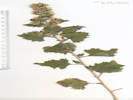 Coll. No. 1546, Brickellia californica Coll. No. 1546, Brickellia californica
|
1546 |
Field identification: Brickellia californica.
Brickellia californica (Torrey & A. Gray) A. Gray. California Brickelbush. North Table Mountain Park, Jefferson County, Colorado. Near top of south side of North Table Mountain, at the base of the lower set of basalt cliffs, 220 m. north of the Golden Cliffs trailhead, 1.5 km. north northeast of the GNIS location of Golden. 39.7682°N, 105.2145°W. WGS 1984 Elev. 1908 m. Growing in rock fractures, flowers just starting to open. | ||||||||||||||||||||
| 1547 |
Field identification: Tribulus terrestris.
Tribulus terrestris L. Puncture Vine. North Table Mountain Park, Jefferson County, Colorado. Beside the Golden Cliffs trail, at the base of the lower basalt flow, 210 m. north of the Golden Cliffs trailhead, 1.5 km. northeast of the GNIS location of Golden. 39.7681°N, 105.2148°W. WGS 1984 Elev. 1906 m. All visible plants uprooted and removed. Colorado Noxious Weed List C. | |||||||||||||||||||||
| 1548 |
Field identification: Lactuca, most likely L. serriola.
Lactuca serriola L. Prickly Lettuce. North Table Mountain Park, Jefferson County, Colorado. South rim of North Table Mountain, in the Golden Cliffs Trail where it passes through the uppermost basalt flow, 260 m. north of the Golden Cliffs trailhead, 1.5 km. north northeast of the GNIS location of Golden. 39.7685°N, 105.2151°W. WGS 1984 Elev. 1936 m. Growing in cracks in the basalt of the upper flow, plentiful in rocks and in soil below. Introduced. | |||||||||||||||||||||
|
Other articles:
|
1549 |
Field identification: Pseudognaphalium canescens.
Pseudognaphalium canescens (DC.) Anderberg. Wright's Rabbit-Tobacco.. North Table Mountain Park, Jefferson County, Colorado. South rim of North Table Mountain, in the Golden Cliffs Trail where it passes through the uppermost basalt flow, 260 m. north of the Golden Cliffs trailhead, 1.5 km. north northeast of the GNIS location of Golden. 39.7686°N, 105.2151°W. WGS 1984 Elev. 1951 m. Growing in cracks in the basalt of the upper flow, very few seen. Coll. No. 1549, 1 Sep 2016, characters observed: Perennial, to 25 cm.; Leaves, alternate, petiole 16 mm. + blade 30 mm. × 10 mm. wide, tomentose (slightly less so adaxially), sessile glandular beneath the tomentum; Inflorescence, terminal and axial on leafy stems; Phyllaries, 3 series, 3.7 mm. × 1 mm. wide, green center, mostly scarious, innermost glabrous; Receptacle, epaleate, flat; Flowers, 2 kinds (heads disciform); Rays, small, inconspicuous, sterile; Disk flowers, corolla, 2 mm., yellow; Pappus, capillary bristles, >corollas. | ||||||||||||||||||||
| 1550 |
Field identification: Gutierrezia sarothrae.
Gutierrezia sarothrae (Pursh) Britton & Rusby. Broom Snakeweed. North Table Mountain Park, Jefferson County, Colorado. Top of North Table Mountain, near southern edge, 360 m. east of the USBR monument designated North Table, 1.6 km. north northeast of the GNIS location of Golden. 39.7691°N, 105.215°W. WGS 1984 Elev. 1957 m. Small stature, growing in cracks of basalt flow. | |||||||||||||||||||||
| 1550.5 |
Field identification: Chamaesyce, sp., either C. glyptosperma or C. serpyyllifolia.
Chamaesyce glyptosperma (Engelm.) Small. Ribseed Sand Mat. North Table Mountain Park, Jefferson County, Colorado. Top of North Table Mountain, near southern edge, 330 m. east of the USBR monument designated North Table, 1.64 km. north northeast of the GNIS location of Golden. 39.7696°N, 105.2153°W. WGS 1984 Elev. 1954 m. | |||||||||||||||||||||
|
Other articles:
|
1551 |
Field identification: Spiny little annual, maybe a Chorizanthe, which, of course, does not occur in Jefferson County.
Munroa squarrosa (Nutt.) Torr. False Buffalograss. North Table Mountain Park, Jefferson County, Colorado. Top of North Table Mountain, near southern edge, 1.64 km. north northeast of the GNIS location of Golden. 39.7696°N, 105.2154°W. WGS 1984 Elev. 1953 m. | ||||||||||||||||||||
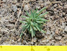 Small plant seen on top of North Table Mountain Small plant seen on top of North Table Mountain
|
Small plant seen on top of North Table Mountain. Undetermined; my first thought was Lewisia, which, of course, does not occur in Jefferson County.
6/16/2017: I now believe this is Phemeranthis parviflorus, as seen on CoNPS field trips, 6/10/2017 and 6/12/2017. | |||||||||||||||||||||
 Habitat of Coll. No. 1553, Muhlenbergia wrightii Habitat of Coll. No. 1553, Muhlenbergia wrightii
|
1552 |
Field identificaton: Muhlenbergia wrightii.
Muhlenbergia wrightii Vasey ex J.M. Coult. Spike muhly. North Table Mountain Park, Jefferson County, Colorado. Top of North Table Mountain, adjacent to the North Table Loop, in an upper portion of a watercourse draining to the southeast through an unamed canyon, 1.8 km. north of the GNIS location of Golden. 39.7716°N, 105.2179°W. WGS 1984 Elev. 1953 m. Common in bed of ephemeral stream and nearby gentle slopes to the south. | ||||||||||||||||||||
|
Other articles:
|
1553 |
Field identification: Asteraceae, disciform heads.
Brickellia eupatorioides (L.) Shinners. False Boneset. North Table Mountain Park, Jefferson County, Colorado. Top of North Table Mountain, adjacent to the North Table Loop, 285 m. north of the USBR monument designated North Table, 1.8 km. north of the GNIS location of Golden. 39.7716°N, 105.2182°W. WGS 1984 Elev. 1953 m. Common in bed of ephemeral stream, in an upper portion of a watercourse draining southeast to Clear Creek through an unamed canyon. Many Eriogonum alatum at this location.
Coll. No. 1553, 1 Sep 2016, characters observed:
Perennial herb,
to 40 cm.;
Leaves,
alternate,
short-petioled (2 mm.),
48 mm. × 7 mm. wide,
lanceolate,
tip obtuse,
margin entire,
glandular-punctate, sparsely strigose;
Inflorescence,
corymbiform,
heads in groups of 4-5;
Involucre,
8.5 mm. × 6 mm. wide;
Phyllaries,
3+ series,
graduated,
2-8.5 mm. × 0.5 mm. wide,
prominently | ||||||||||||||||||||
| 1554 |
Field identification: Artemisia dracunculus.
Artemisia dracunculus L. Tarragon, Dragon Wort. North Table Mountain, Jefferson County, Colorado. Uppermost southwest slopes of North Table Mountain, just below the basalt flow capping the mesa, 1.7 km. north of the GNIS location of Golden. 39.7711°N, 105.2225°W. WGS 1984 Elev. 1935 m. | |||||||||||||||||||||
|
Locations:
Ranson/Edwards Homestead Open Space Park.
|
Saturday, September 3rdRanson/Edwards Homestead Open Space, planning for CoNPS field trip. | |||||||||||||||||||||
| 1555 |
Field identification: Sporobolus heterolepis.
Sporobolus heterolepis (A. Gray) A. Gray. Prairie Drop-seed. Ranson/Edwards Homestead Open Space Park, Jefferson County, Colorado. 1.7 mi. west on CO Highway 72 Coal Creek Canyon Road, from CO Highway 93, 1.2 mi. north on Plainview Road, then 45 m. west of Plainview road, 15.3 km. north northwest of the GNIS location of Golden. 39.8896°N, 105.2624°W. WGS 1984 Elev. 1937 m. On a small terrace on the north side of intermittent creek. | |||||||||||||||||||||
| 1556 |
Field identification: Solidago, probably S. missouriensis.
Solidago rigida L. var. humilis Porter. Stiff Goldenrod. Ranson/Edwards Homestead Open Space Park, Jefferson County, Colorado. 1.7 mi. west on CO Highway 72 Coal Creek Canyon Road, from CO Highway 93, 1.2 mi. north on Plainview Road, then 400 m. east of Plainview road, 15.3 km. north northwest of the GNIS location of Golden. 39.8898°N, 105.2571°W. WGS 1984 Elev. 1922 m. Wet, almost swampy, area on the south side of an intermittent stream. | |||||||||||||||||||||
| 1557 |
Field identification: Helianthus, probably H. pumila.
Helianthus pauciflorus Nutt. ssp. subrhomboideus (Rydb.) O. Spring & E. Schilling. Stiff Sunflower. Ranson/Edwards Homestead Open Space Park, Jefferson County, Colorado. 1.7 mi. west on CO Highway 72 Coal Creek Canyon Road, from CO Highway 93, 1.2 mi. north on Plainview Road, then 400 m. east of Plainview road, 15.3 km. north northwest of the GNIS location of Golden. 39.8898°N, 105.2571°W. WGS 1984 Elev. 1922 m. Wet, almost swampy, area on the south side of an intermittent stream. | |||||||||||||||||||||
| 1558 |
Field identificaton: an “Aster,” maybe Symphyotricum falcatum.
Symphyotrichum ericoides (Linnaeus) G. L. Nesom. White Heath Aster. Ranson/Edwards Homestead Open Space Park, Jefferson County, Colorado. 1.1 miles north on Plainview Road from CO State Highway 72, then 400 m. east, to a damp area where an old ranch road first crosses an ephemeral stream. 39.8898°N, 105.257°W. WGS 1984 Elev. 1922 m. Coll. No. 1558, 3 September 2016, characters observed: Perennial, woody at base, stems ascending, to 40 cm., eglandular throughout; Leaves, alternate, sessile, narrowly lanceolate, 9 mm. × 1.5 mm. wide, entire, strigose, tip, small white spine; Heads, borne singly along stem, on leafy pedicels; Flowers, of 2 kinds; Involucre, 4 mm.; Phyllaries, 2+ series, 3 mm. × 0.7 mm. wide, white below with 1 brown vein, rhomboid green above, tip with very small spine; Receptacle, epaleate; Rays, corolla, white, 6.0-6.5 mm.; Disc flowers, corolla, yellow, 4 mm.; Pappus, bristles, fine, barbelate, 4 mm. | |||||||||||||||||||||
| Following collections made in my garden for use as examples in an upcoming field trip. | ||||||||||||||||||||||
| 1559 | Single inflorescence from Sporobolus heterolepis. | |||||||||||||||||||||
| 1560 |
p>
Two example inflorescences from garden-grown Sorghastrum nutans for use as examples in an upcoming field trip. | |||||||||||||||||||||
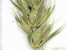 Coll. No. 1561, Elymus virginicus Coll. No. 1561, Elymus virginicus
|
1561 |
Adventive grass, distinctive, should be easy to determine.
Elymus virginicus L. Virginia Wildrye. Golden, Jefferson County, Colorado. Parkway at 420 Arapahoe Street. 39.7613°N, 105.2286°W. WGS 1984 Elev. 1755 m. Adventive grass in garden; perhaps introduced with seed of Sorghastrum nutans. Coll. No. 1561, 4 Sep 2016, characters observed: Annual or perennial unknown (s/b perennial); Rhizomes unknown (s/b absent); Culm, erect, dark purple below; Inflorescence, terminal, spike, bilateral, exserted above leafy portion of plant; Disarticulation unknown (s/b rachis not disarticulating, in Elymus the rachis generally remains articulate); Spikelets, in pairs at each node; Glumes, #2, held away from florets, body 10 mm. + awn 4-5 mm. = 14-15 mm., veins 5 (2 ±obscure) at midlength, awn single (not split); Florets, #4-5, fertile; Lemma, lowest (adjacent to glume), body 7 mm. + awn 7 mm. = 14 mm., body, veins, 5 (2 ±obscure), awn straight; | ||||||||||||||||||||
|
Other articles:
Locations:
Ranson/Edwards Homestead Open Space Park.
|
Thursday, September 8th
| |||||||||||||||||||||
| 1562 |
Field identification: Sorghastrum nutans.
Sorghastrum nutans (L.) Nash. Yellow Indian Grass. Ranson/Edwards Homestead Open Space Park, Jefferson County, Colorado. Northwest corner of the Ranson/Edwards parcel, 1.7 mi. west on CO Highway 72 Coal Creek Canyon Road from CO Highway 93, 2.2 mi. north on Plainview Road, then 360 m. west northwest, nearly to the parcel boundary at the base of a hogback. 39.898°N, 105.276°W. WGS 1984 Elev. 2022 m. 16.5 km. north northwest of the GNIS location of Golden. | |||||||||||||||||||||
| 1563 |
Field identification: Muhlenbergia wrightii.
Muhlenbergia wrightii Vasey ex J.M. Coult. Spike muhly. Ranson/Edwards Homestead Open Space Park, Jefferson County, Colorado. Northwest corner of the Ranson/Edwards parcel, 1.7 mi. west on CO Highway 72 Coal Creek Canyon Road from CO Highway 93, 2.2 mi. north on Plainview Road, then 350 m. west northwest, nearly to the parcel boundary at the base of a hogback. 39.8979°N, 105.2752°W. WGS 1984 Elev. 2022 m. 16.5 km. north northwest of the GNIS location of Golden. | |||||||||||||||||||||
| 1564 |
Field identification: Senecio spartioides.
Senecio spartioides Torr. & A. Gray. Broomlike Ragwort. Ranson/Edwards Homestead Open Space Park, Jefferson County, Colorado. Northwest corner of the Ranson/Edwards parcel, 1.7 mi. west on CO Highway 72 Coal Creek Canyon Road from CO Highway 93, 2.3 mi. north on Plainview Road, then 40 m. west, 16.3 km. north northwest of the GNIS location of Golden. 39.8962°N, 105.2731°W. WGS 1984 Elev. 2022 m. Not often seen at Ranson/Edwards; these growing among grasses and fallen, burned ponderosa pines. | |||||||||||||||||||||
|
|
Monday, September 19th | |||||||||||||||||||||
|
Other articles:
Locations:
Guanella Pass.
|
| |||||||||||||||||||||
|
Other articles:
Locations:
Kenosha Pass.
Mount Evans.
|
| |||||||||||||||||||||
|
Other articles:
Locations:
Como.
|
| |||||||||||||||||||||
|
Other articles:
Locations:
Peabodys.
|
| |||||||||||||||||||||
|
Other articles:
Locations:
South Park.
|
| |||||||||||||||||||||
|
Other articles:
Locations:
Boreas Pass.
|
| |||||||||||||||||||||
|
Other articles:
|
Bakers Tank.
| |||||||||||||||||||||
|
Locations: Ranson/Edwards Homestead Open Space Park. |
Field trip to Ranson/Edwards after the 2016 Colorado Native Plant Society Annual Meeting. | |||||||||||||||||||||
|
Locations: Ranson/Edwards Homestead Open Space Park. |
Wednesday, September 28thReturn to Ranson/Edwards Homestead Open Space to look for Salvia reflexa. | |||||||||||||||||||||
| 1565 |
Field identification: Dieteria bigelovii.
Dieteria bigelovii (A. Gray) D. R. Morgan & R. L. Hartman. Bigelow's Tansy Aster. Ranson/Edwards Homestead Open Space Park, Jefferson County, Colorado. Bank below Plainview Road, 1.7 mi. west on CO Highway 72 Coal Creek Canyon Road from CO Highway 93, 1.8 mi. north on Plainview Road; 16.0 km. north northwest of the GNIS location of Golden. 39.8949°N, 105.2682°W. WGS 1984 Elev. 1927 m. Resprouting laterally after having been eaten. | |||||||||||||||||||||
| 1566 |
Field identification: Salvia reflexa.
Salvia reflexa Hornemann. Lanceleaf Sage. Ranson/Edwards Homestead Open Space Park, Jefferson County, Colorado. Outside edge of a small outwash gravel bar, a few meters west of Plainview Road; 1.7 mi. west on CO Highway 72 Coal Creek Canyon Road from CO Highway 93, 1.2 mi. north on Plainview Road; 15.3 km. north northwest of the GNIS location of Golden. 39.8895°N, 105.2621°W. WGS 1984 Elev. 1938 m. Annual, corolla light blue, falling easily. Plants branching laterally after being eaten. There is a certain amount of confusion about the names for this taxon. For my notes on the subject, see my page on Names in Salvia reflexa and S. lanceolata. | |||||||||||||||||||||
|
|
Thursday, November 10th | |||||||||||||||||||||
|
Other articles:
Locations:
Fort Saint Vrain.
|
Fort Saint Vrain | |||||||||||||||||||||
 Poudre River Education Center Poudre River Education Center
|
Poudre River Education Center | |||||||||||||||||||||
|
Other articles:
Locations:
Greeley.
|
GreeleyAn interpretive panel outside the depot says this:
| |||||||||||||||||||||
|
[Previous Page]
[Next Page]
Go to page: [1800s] [1900s] [1910s] [1920s] [1930s] [1940s] [1950s] [1960s] [1970s] [1980s] [1990] [1991] [1992] [1993] [1994] [1995] [1996] [1997] [1998] [1999] [2000] [2001] [2002] [2003] [2004] [2005] [2006] [2007] [2008] [2009] [2010] [2011] [2012] [2013] [2014] [2015] [2016] [2017] [2018] [2019] [2020] [2021] [2022] [2023] [2024] [A] | ||||||||||||||||||||||
| If you have a question or a comment you may write to me at: tas4@schweich.com I sometimes post interesting questions in my FAQ, but I never disclose your full name or address. |
Date and time this article was prepared: 4/27/2024 3:25:50 PM |
|||||||||||||||||||||