Eastern Mojave Vegetation
Tom Schweich
|
Eastern Mojave Vegetation
| Field Notes (Continued) |
|
Tom Schweich |

Topics in this Article: 1800s 1900s 1910s 1920s 1930s 1940s 1950s 1960s 1970s 1980s 1990 1991 1992 1993 1995 1996 1997 1998 1999 2000 2001 2002 2003 2004 2005 2006 2007 2008 2008 Tour de Swertia albomarginata Mono Lake, August 2008 2009 2010 2011 2012 2013 2014 2015 2016 2017 2018 2019 2020 2021 2022 2023 2024 Contents Literature Cited |
When I first read the field notes of Annie Alexander and Louise Kellogg, I was fascinated by the descriptions they wrote about the places they went and the plants and animals they found there. By publishing my field notes on the Internet I hope to follow a little bit in their tradition. | |||
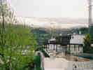
| Glacier Point | ||||
|
|
2003 | |||
|
|
Saturday, March 22 | |||
|
Other articles:
|
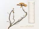
322 |
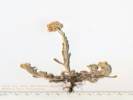
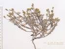
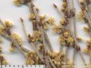
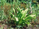
Pseudognaphalium luteoalbum (L.) Hilliard & B. L. Burtt. Jersey Cudweed.
Towata Park, City of Alameda, Alameda County, California. In the vacant lot across Bridgeview Isle from Towata Park, near Bay Farm Bridge abutment on Otis Drive (California Highway 61). 37.7501°N, 122.2369°W. WGS 1984. Elev. 3 m. Coll. No. 322, 22 March 2003, characters observed while keying: Annual, to 25 cm., tap-rooted; Stem, branched at base, ascending, tomentose, without embedded translucent oil glands; Leaves, alternate, sessile to ±clasping, to 35 mm., not spiny, entire, leaves just below cluster of flowers shorter than cluster; Inflorescence, without strap-shaped corollas, flowers of 1 kind; Heads, many per flower stem; Involucre 3 mm.; Phyllaries in 2+ series, unequal in size and appearance, outermost transparent, inner have some green near base, not spiny; Receptacle epaleate; Pappus of fine bristles, 8-12+, shed in rings; Corollas, white to pink, radial (not bilateral). | ||
My 2003 Trip To Spain | ||||
|
|
Monday, April 14th | |||
| Our flight left San Francisco on time and we landed in Toronto a few minutes early. No one was wearing masks in San Francisco, so we did not put ours on either. The same in Toronto, no masks. | ||||
| Our plane landed in Madrid a few minutes early. I slept maybe 20 minutes on the flight. On the flight into Madrid we were handed a questionnaire about asking whether we had any fever or cough, where we were coming from, and where we were staying in Spain. These were collected in Madrid, but not reviewed at the collection point. The only mask we saw was in Madrid, worn by the medical person who was handing out a SARS information sheet. | ||||
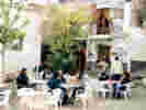
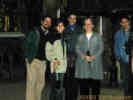
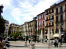
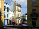
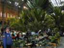 First morning in Spain at Atocha. First morning in Spain at Atocha.
|
We cleared customs and headed for the Metro station. After realizing that the walk was substantial, plus we carrying lots of baggage, and the knowledge that we would have to climb up and down stairs while we transferred twice in the Metro, we decided to take a taxi. The taxi fare from Barajas to Atocha was 18, including some additional charges for four pieces of luggage the driver had to handle. | |||
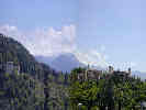
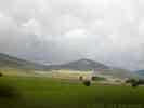 Countryside as seen from the Ave. Countryside as seen from the Ave.
 Spanish countryside in the foothills of the Sierra Morena. Spanish countryside in the foothills of the Sierra Morena.
|
At Atocha we had a light breakfast and then waited a few minutes for our train. We were a little late getting on the train as the baggage shelves were quite full, and another person was in our seat. After a little ticket-showing and gesturing, she agreed to change. The ride from Madrid to Sevilla was very pretty, the hills were quite green as Spain has been getting some rain lately. I tried to take some photos from the train, but all the fore- and middle-grounds were blurred by the high speed of the train. | |||
| Our daughter, Rachel, met us at Estacion Santa Justa, and we took a taxi to our house. I took a shower and a short (2 hour) nap. A pair of leg cramps, both legs, cramped up solid, rudely awakened me. Maybe it would have been good to walk a little more when we arrived at Seville, rather than just crash for a nap. | ||||
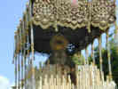
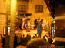
 Beso de Judo: Four Guys and an Olive Tree Lurch Around the Corner Beso de Judo: Four Guys and an Olive Tree Lurch Around the Corner
|
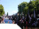
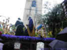
Having been so rudely awakened, I dressed and then went out. Rachel and Nacho live in a courtyard, so you have to have keys for the courtyard, the building and the apartment. I could hear some music and when I got to the street, it seemed like everyone was going one direction, toward the city center. So I followed them. There was a large crowd in Plaza Ponce de Leon, and I could see some purple "capirotes" crossing the plaza. After waiting a short time, music started to play and people would applaud. Then it got loud and from around a corner these four guys and an olive tree lurched around the corner and across the plaza disappearing into a small side street. I hope that doesn't sound horrible or like I'm some sort of cultural illiterate, because it was pretty impressive. I just had no idea what to expect. Loud music, incense, and these very imposing statues, moving in strange way. People were clapping in a very sharp, distinct way. It had a different qualify than the polite applause you might expect at a parade. It reminded me of the very sharp clapping we've heard at flamenco programs. Later, over coffee and the Semana Santa program, we figured out this was Beso de Judas, and they were off their normal route because they were returning to the church due to the threat of rain. | |||
| In the evening, we thought we would catch some Salidas ("exits") from the churches. We went to Las Penas, Las Aguas, and El Museo. Each, however, had been cancelled because of the threat of rain. | ||||
| We had tapas at La Gigantica, and then turned in for the night. | ||||
|
|
Tuesday April 15th. | |||
| We got up this morning and went down to La Gigantica on Plaza Ponce de Leon for coffee and tostada ("toast"). | ||||
 Virgin Paso in Iglesia de la Anunciacion Virgin Paso in Iglesia de la Anunciacion
|
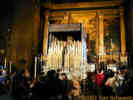
Down a little further we came to what looked like a church with the door open. People were going in and out, so we joined them. Inside were about 6 "pasos" (floats), and people were going in to see them. Later, outside, we learned this was the Iglesia de la Anunciacion, which is adjacent to the University of Seville School of Fine Arts. We don't know whether these pasos went out, but looking at the Practical Guide to Semana Santa from El Pais, it doesn't seem like they do. I took several photos, as it seemed to OK to do so. Later on TV we saw film of the same church. The candles had been lit for the filming. | |||
| We walked down toward El Corte Ingles, a big Spanish department store, to buy Cheryl some socks. Then, we sat in the cafe under Hotel Americana until Rachel came to join us for lunch. It rained during and after lunch, sometimes hard, so we're thinking there won't be any pasos this afternoon. We came back to Rachel's apartment and are watching last year's Semana Santa on TV. The weather is breaking up a little bit, but not clearing. Some of the pasos have already been cancelled, but others are saying they may come out if the weather clears. | ||||
|
|
Tuesday April 15th Afternoon | |||
| In the afternoon, we walked by two nearby churches to see if they were open. Sometimes if the pasos don't go out from the church because of rain, then the church will be open so people can come in and see them. However, the two nearby churches were not open. Since Rachel's friend Amalia was coming by, Rachel and Cheryl went back to the apartment, while Nacho and I went to the supermarket. | ||||
 Waiting to enter a church to see the pasos Waiting to enter a church to see the pasos
|
At the supermarket, we got some fruit. The routine is to get a plastic bag and a plastic hand mitt to pick up the fruit and put it in the bag. Then you weigh the fruit on a nearby scale and push the button that corresponds to the number of the item you got. The scale prints a label that you stick on the bag. Then you twist up the open end of the bag and push it through a little slot that neatly ties a tape around the bag. No twist ties here. | |||
 The Virgin paso in Candelaria The Virgin paso in Candelaria
|
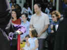
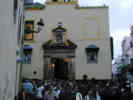
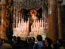
Amalia was at the apartment when Nacho and I returned. So we headed out and went to the three churches: San Esteban, Candelaria and Santa Cruz that Amalia knew were open. All three churches were scheduled to send out pasos today, but they cancelled because of rain. People were going to the churches, instead. | |||
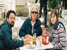
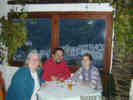
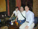
 Nacho, Rachel, Amalia, and Cheryl at Candelaria. Nacho, Rachel, Amalia, and Cheryl at Candelaria.
|
After visiting the churches, we went to a Gallego (Galician) tapas place. The tapas were quite a bit different. We had a Galician white wine called Ribeiro that was very mild. We also had pulpo (octopus), Patatas Brava (potatoes in a tomato sauce that Spaniards would consider to be spicy), Gambas Alioli (shrimp served in boiling olive oil with garlic), and something else I can't remember at the time. | |||
 La Bofeta "The Slap" La Bofeta "The Slap"
|
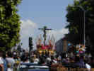
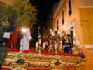
By this time we learned that one paso had gone out, so we found a place at the end of Sierpes (main shopping street in Seville) to wait for the paso. It was very crowded, but we finally got to see one complete paso go by. This one was La Bofeta ("The Slap"). This paso depicts Christ before the High Priest Anas where the guy in the purple robe slaps him. The Nazarenos were all dressed in white. The comparison to Ku Klux Klan robes is very strong, but also unfortunate. The book says 650 total people. It didn't seem like that many to me. The Christ paso comes by first followed about 30 minutes later by the Virgin, each accompanied by their own band. | |||
| After this paso went by, we walked Amalia home and then walked back to Rachel and Nacho's apartment getting home a little after midnight. | ||||
|
|
Wednesday, April 16th. | |||
| This morning the sky is blue with not a cloud in the sky. We're going to try to see two pasos coming in from the city this afternoon: La Sed and San Bernardo. They are large pasos, one with 1300 people and the other with 1900 people. | ||||
| We went out, walking down to a neighborhood known as Alfalfa. We got cafe con leche in one place, and then had lunch at another. We ordered a 1/2 ration of Ensalada Mixta (Mixed Salad: lettuce, onion, tomato, and tuna), and a 1/2 ration of Chicken Breast. The salad was quite large, and the chicken breast was 3 breasts, so we should have ordered chicken breast as a tapas, i.e., much smaller portions. | ||||
|
Other articles:
|
| |||
| After the virgin went by, we left to go find another paso: La Sed ("The Thirst"). We wound through the passages of old Seville following other people who seemed to know where they were going, and in a hurry. We arrived at La Sed, just as the Cristo was going by. Since they stop and rest every 100 yards or so, we were able to get ahead of the paso, and then stop to watch it go by. This Cristo apparently refers to Jesus' words, "I thirst." After a while the Virgin went by. It seems like many of the parishioners follow along behind the virgin. After they went by, we made our way back to Rachel and Nacho's apartment. | ||||
| Cheryl and I went back to Rachel's apartment to meet her after work. But she was late and rushed, so Cheryl and I went to Christo de Burgos to watch a salida. The street in front of the church was packed. Then an ambulance went by and we had to pack in tighter to make room for it. There were people trying to walk right behind the ambulance to get through the crowd, but after the ambulance the crowd surged back into the ambulance's wake. Then we watched salida of the Cristo and then the Virgin. | ||||
 Garden of Gethsemene Garden of Gethsemene
|
At Rachel's apartment we determined to watch one more paso, down in the center of Sevilla. The streets were extremely crowded and we couldn't move. The paso depicted Jesus in the Garden of Gethsemane, but they set it down around the corner from our location, and then moved quickly across the intersection where we were standing. Our view was very short, but we waited until the virgin passed. | |||
| After the paso, we tried to eat at a bar near my Rachel and Nacho's apartment, but the restaurant was very busy and got the orders mixed up, so we had to wait a long time, and it was late when we got back to the apartment. | ||||
|
|
Thursday April 17th | |||
| This morning we got up late and took a while getting ready to go. Nacho and I walked over to get the car at the Hertz office at Estacion Santa Justa. The car was an Opel ____, a small mini-van. It was a little bigger than Ford Focus Wagon I had in mind, but it is OK. | ||||
| Nacho drove the car back to the apartment. It was a good thing because the police stopped us. They were not letting cars into the neighborhood, in preparation for the day's pasos. Nacho explained that he lived in the neighborhood, and waved a piece of paper that had his address, and the police let us through. We parked for a few minutes in the basement garage. Nacho went up and got Rachel, Cheryl, and they brought the luggage. | ||||
| I was happy to let Nacho drive out of town. At one point the street was so narrow, Rachel had to fold back the mirror. We went north out of town to A-92, the highway to Granada. | ||||
|
Locations:
Osuna.
|
We drove to Osuna in about an hour. At the Plaza Mayor, we parked and had lunch in a small cafe bar. We had Boccarones in Vinegar, Gambas ____(Deep-fired shrimp), Chicken in a sauce from the Azores (adobo ?), and Ensalada Rusa, a kind of Potato Salad. | |||
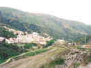
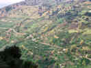
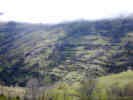
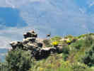
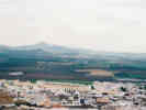 View of countryside south of Osuna View of countryside south of Osuna
|
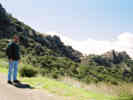
After eating lunch, we walked up to the top of the town. There was a old building there, not really a castle, and a fine view of the surrounding countryside. | |||
|
Locations: Puerto del Suspiro de Moro. Valle de Lecrín. |
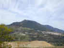
Leaving Osuna, I took over driving, and after a false start, we got off in good shape. Drove past Granada, getting a glimpse of the Alhambra at one point. Very quickly we were over the Puerto del Suspiro de Moro and in Valle de Lecrín and the Mediterranean watershed. | |||
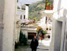
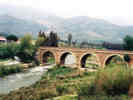
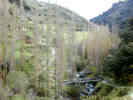
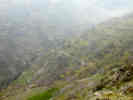
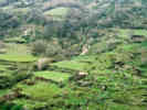
 The road between Orgiva and Pampaneira The road between Orgiva and Pampaneira
|
Very soon, we exited the freeway and drove a few miles to Lanjaron. Here we got gas and continued to Orgiva, then turned off for Pampaneira, Bubion and Capileira. The roads are a bit narrow, and the drop off is steep but the drive is easy. | |||
|
Locations: Capileira. |
In Capileira, we drove up through the town to Finca Las Llanos at the top of Capileira. We checked in and then walked down into the town, in search of tourist information. The tourist place was closed. Opens at 9:00 AM tomorrow morning. The we walked to the Church, to see if there was going to be a paso in Capileira tonight. There was no notice on the door, but we asked a man standing outside the church. He said there would be a small paso after Mass. | |||
| We were a bit hungry, so we went to a local market and bought some food. Back at Finca Los Llanos we had a small snack and them walked down into town. At the church, we waited until Mass was over but there was no paso. | ||||
|
Literature Cited:
|
At Cafe Europa, which we learned specialized in ice cream, we had ice cream and coffee. We also bought the recreation map of Las Alpujarras and a book about the region. The Alpujarra book is: Pascual, Jose Pascual Real. n.d. La Alpujarra. Barcelona Spain: Editorial Escudo de Oro S.A. ISBN: 84-378-1614-9. The map does not have copyright information but includes a booklet about the region and the bibliographic reference is: Anonymous. n.d. Sierra Nevada National Park: Alpujarras, Marquesado del Zenete. Granada, Spain: Editorial Penibetica. ISBN: 84-931217-8-9. | |||
| We are now back at Finca Los Llanos, and watching the news. | ||||
|
|
Friday, April 18th | |||
|
Locations:
Pampaneira.
|
This morning we had a brief snack, and headed down to Pampaneira, because that is where the local information center is. Tried to arrive in the Aparcamiento, but it was quite full so we returned to a spot just above town. | |||
|
Locations:
Pampaneira.
|
We arrived a little early, so had breakfast of café con leche and tostada with aciete and tomate in the plaza outside. The tostada was a sliced bun that was lightly toasted. On this we drizzled olive oil, and then spooned pureed tomato. A little salt helped it immensely. Accustomed as I am to my oatmeal or eggs for breakfast, I was a little dubious. But it was quite good (a little salt helps), and carried us through until lunch. | |||
|
Locations:
Pampaneira.
|
The information center opened at 11:00 AM. It was primarily for Parque Nacional Sierra Nevada, with some very nice interpretive displays, but they also had other local information as well. I saw one very tempting book, a flora of endemic plants to Parque Nacional, published by the Junta de Andalucia for 36. There are three Gentians found in the park, but no Frasera. | |||
|
Locations:
Orgiva.
|
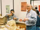
Then we drove further down to Orgiva to see their Feria (Fair) of local foods and crafts. This was primarily for promotion of local producers and vendors. Featured were jamon (ham), wine, and confections. There was one blacksmith making furniture and one potter who was turning a pot. A local tile maker was exhibiting their tiles that I wish were available in the United States. When we were redoing our bathroom, we had lots of choice of Italian tile, but no Spanish tile was available in the Bay Area. There were also a couple of weavers. My favorite was the turron, a confection of almonds, sugar and honey, and Rachel took a photograph of me trying to buy some. The seller kept wanting to give us samples, I guess not realizing that we wanted to buy some turron as well. | |||
| From there we walked into the town a little bit, as Rachel wanted to buy some cough medicine. It took a bit of walking to find an open Pharmacy, but eventually they did. At the church, we learned that Orgiva has a paso tonight. They are taking Cristo out in the sepulcher followed by the virgin. We watched the pasos being prepared, with white chrysanthemums at the feet of the virgin, and a few more in the ferns decorating the Cristo paso. Rachel and Nacho may want to drive down to see it but I think Cheryl and I might pass on the opportunity. | ||||
|
Locations:
Rio Guadalfeo.
|
Walked back to the Feria and got our car, heading south and east looking for a place to have lunch. The highway south from Orgiva crosses over the Guadalfeo, where it joins another large highway connecting Motril to Torvizcón and on to Cadiar and Ugijar. | |||
|
Other articles:
Locations:
Torvizcón.
|
| |||
|
Locations:
Orgiva.
Rio Guadalfeo.
|
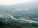
On our return we stopped for a photo of the Guadalfeo valley, and then again at an overlook between Pampaneira and Bubion. The views were almost opposite each other, as the dam across the Guadalfeo could be seen from both sides. I remember reading about this dam. Apparently it has rarely gotten full, because there just isn't enough sustained runoff, and it has nearly filled with sediment because of the occasional floods with huge sediment loads. Even the bed of the Guadalfeo is braided in places, an indication that the sediment load is far greater than the capacity of the river. | |||
| Back at Finca Los Llanos, we have had a Siesta and now, at least, I am stirring. | ||||
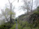
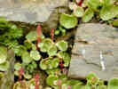 Succulent in a terrace wall near Capileira Succulent in a terrace wall near Capileira
 Capileira from above on a cool hazy afternoon. Capileira from above on a cool hazy afternoon.
 The beginnings of the middle trail "sendero" from Capileira The beginnings of the middle trail "sendero" from Capileira
|
After bringing my journal up to date, I went out briefly. Walked to the edge of town and then out on a little trail. It began to climb quickly. Below I could see a good wide trail that left from a lower parking lot of Capileira. This must be the trail up the canyon. | |||
| Tonight we sampled the buffet at Finca Los Llanos. They served a limited salad, with chicken, fish, potatoes and swiss chard as the main course. Not quite a Hometown Buffet, but enough to each. Quality: OK; price: a little steep at 9 a plate. | ||||
|
|
Saturday April 19th. | |||
 Rain and snow in the morning. Rain and snow in the morning.
|
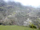
Today was to be our walking day, but I woke up early in the morning to the sound of rain. As the clouds lifted in the valley we could see snow across the canyon, just a few meters above the level of our hotel. As the morning progressed the rain stopped, so after breakfast at Cafe Europa, we went to the little store, bought some supplies and set off for our day's walk. | |||
|
Locations: Barranco del Poqueira. |
From the lower parking lots of Capileira that I saw yesterday, we took a broad path that headed up the canyon (Barranco del Poqueira) to the bridge called Puente Buchite. | |||
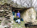
 Stable beside the trail. Stable beside the trail.
|
We passed by a grove of almond trees in bloom, and numerous small outbuildings. | |||
| Just before Puente Buchite, I slipped and in the process of catching myself shredded the skin on the side of my thumb. I was, of course, fully equipped for this accident, and staunched the flow of blood with an old, used Kleenex. | ||||
|
Locations:
Puente Buchite.
|
At Puente Buchite, we sampled the water of Rio Poqueira. It was very cold, having come directly from the snow, and a little milky, perhaps with rock flour from the high mountains. | |||
| Immediately after crossing Puente Buchite, the trail climbs away from Rio Poqueira, and travels up the canyon, climbing from terrace to terrace. | ||||
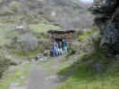
 Shelter from the light rain. Shelter from the light rain.
|
The weather continued to be sun and clouds with wind and occasional light rain. We stood under a little shelter to get a break from wind, then pressed on. | |||
 Threshing floor to right of trail. Threshing floor to right of trail.
|
We saw many rock lined circular platforms along the way. I thought maybe they were to catch the rain, but Rachel and Nacho got it right, that they are for threshing of grain. Every little ranch or finca had one. Later a man would confirm this for us, and point out that they are built at an exposed location to catch the wind to blow away the chaff. | |||
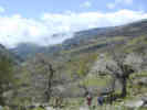
 Walking in the fog. Walking in the fog.
|
We were passed by one hiking group, most of whom were speaking German. Some of them were equipped for some serious hiking, with poles and boots and daypacks with rain covers. | |||
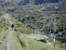
 Looking across Barranco del Poqueira. Looking across Barranco del Poqueira.
|
The fog would come and go, sometimes the sun would tantalize us a bit and the fog would lift enough for a view of the other side of the canyon. At this place we could hear some bells for a flock of sheep, but we never saw them until we were on the opposite side of the canyon. | |||
 Final climb to Haza Llana. Final climb to Haza Llana.
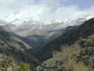 La Cebadilla with Mulhacen in background. La Cebadilla with Mulhacen in background.
|
Finally we made a descent from Haza Llana to Puente Naute at La Cebadilla. Rachel pointed out the black sand beach along side the river, being the dark minerals from the schist. At some old buildings above the river, we had our lunch of bread, cheese, salami, and oranges. | |||
| Thoroughly chilled from sitting still while we ate our lunch, we started our return along the road to La Cebadlla. | ||||
 Sun on opposite bank, under a bank of fog. Sun on opposite bank, under a bank of fog.
|
From the road we could look back across the canyon and see the sheep that we heard on the ranch below. They were a small flock, maybe 30 sheep, and were moving from terrace to terrace. | |||
 View across the Barranco View across the Barranco
 House above the road. House above the road.
|
About half way back to Capileira, we crossed Acequia de los Lugares. Here a path aptly named "Camino Capileira" left the main road. It generally followed the aqueduct across the side of the canyon. | |||
 House above the road. House above the road.
|
We came upon a man and his sheep (mixed with a few goats) at his house. We asked about the threshing floors and he told us about them. He also said that each ranch had their own threshing floor to minimize conflict with neighbors. | |||
| Soon the trail dropped right down into Capileira, at the point I explored last night. | ||||
| We stopped at Cafe Europa for a little refreshment, then returned to Finca Los Llanos for a short nap. | ||||
| Now, at 7:00 PM, it is clear outside, with just a few clouds around the mountain peaks. It is also quite breezy, so there isn't any haze built up in the canyon. | ||||
 Dinner at Restaurante Alpuxarra. Dinner at Restaurante Alpuxarra.
|
For dinner we went to Restaurante Alpuxarra, just across the road from Finca los Llanos. Nacho and I had the Plato Alpuxarreño, which was a blood sausage, another sausage something chorizo, patatas pobres, and a fried egg. I tasted the blood sausage and decided it wasn't for me. The papas a la pobres were fried with onion and pepper and of course lots of olive oil, so while burned in some places they were not crisp. | |||
| Yesterday, today's forecast for this region was mixed clouds and sun, but no rain. I'm thinking that today we saw some local weather effects from the Sierra Nevada. While other areas may have had just a few clouds, perhaps the clouds along moisture from the Mediterranean, only 20 km away, rising and cooling, produced the rain and snow. This morning as soon as the sun hit the canyon, a fog formed in the lower part of the canyon, blowing upward and obscuring the sun for us. Sometimes the sun could burn through the fog and clouds, other times to orographic effect was just too strong. | ||||
| It was an interesting day. I wish it were just a little bit warmer, but I certainly can't complain. | ||||
| Not sure what tomorrow will bring. I'm hoping it will be another walking day, maybe Capileira to Bubion to Pitres and return, but we'll see what the group wants to do. Then Monday, we are off for a brief visit to Granada before returning to Sevilla. | ||||
|
|
Sunday, April 20th | |||
| Raining again this morning and, as the clouds lift, we can see snow down lower than yesterday. At about 10:00, blue sky breaks overhead. | ||||
| We tried to go to the museum in Capileira. The sign said it opened at 1130 am on Sundays. But, this Sunday, probably because it was Easter Sunday, the museum wasn't open. | ||||
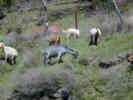 Goats grazing along the road above Capileira Goats grazing along the road above Capileira
 Walking toward Loma de las Palominicas Walking toward Loma de las Palominicas
 Cistus albidus on Loma de las Palominicas Cistus albidus on Loma de las Palominicas
|
| |||
| Out near the end of the ridge, we saw a mountain sheep, or an ibex. I got one photograph of it before it bounded away, so maybe when I get my photographs developed, we can identify it. | ||||
|
Locations: Torvizcón. |
Heard some percussion, and looked to the south. It looked like fireworks and, while we could not see the town, it seemed like it was likely Torvizcón. The time was 13:20, so we think the fireworks were preparatory to the burning of Judas at 13:30, followed by the paella at 14:30. | |||
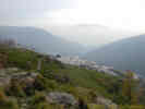
 Bubion and Capileira with Veleta in background. Bubion and Capileira with Veleta in background.
|
We had very good views of Bubion and Capileira from the ridge. | |||
 East end of the Valle de Lecrin. East end of the Valle de Lecrin.
|
Looking the other way, we could see all the way to the Mediterranean. | |||
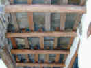 Ceiling construction with chestnut beams and slate. Ceiling construction with chestnut beams and slate.
 Cabin on the ridge above Capileira. Cabin on the ridge above Capileira.
 Ibex? Mountain Goat? Ibex? Mountain Goat?
|
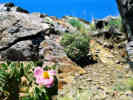
Among the plants we saw were Rock Rose (Cistus sp.) and Lavender (Lavandula sp.). It is interesting to see these common garden plants growing in the wild state. On the way back to town, we noticed three species of broom growing together, co-existing with each other and the other plants. | |||
| I also saw a little white flower, with the buds recurved, | ||||
| This afternoon we had lunch at the Pizza place just below the church. I had the Alpujarreña Pizza. It was a basic cheese pizza with pieces of the chorizo-like sausage that came with my dinner last night. | ||||
| After lunch, Cheryl and I shopped a bit in Capileira. We bought a woven purse for Cheryl and a similar purse for Tamara. In another store we bought a little shrine for Shi, and Cheryl picked out a plate she liked that depicts Capileira. | ||||
| Then we went back to the hotel and rested a bit. For dinner we finished the leftover pizza and had some other snacks. | ||||
|
|
Monday, April 21st. | |||
|
Locations:
Pampaneira.
|
This morning we packed and drove to Pampaneira for breakfast. Again we had aceite and tomate on toast. We shopped a bit in Pampaneira. I got a rug for the bathroom. | |||
 Pinos del Valle and the Sierra de las Guajaras Pinos del Valle and the Sierra de las Guajaras
|
We drove from Pampaneira, stopping once to buy oranges, and another time to look over the Lecrin Valley and the town of Pinos del Valle on the other side. | |||
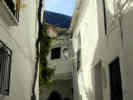
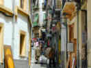 Small street in the Albaicin. Small street in the Albaicin.
 Plaza Nueva with the Alcazaba of La Alhambra above. Plaza Nueva with the Alcazaba of La Alhambra above.
 Looking the other way, we liked the yellow color of the building on the right. Looking the other way, we liked the yellow color of the building on the right.
|
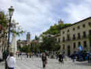
We drove into Granada through very traffic in what now seemed like a very big city. Parked underneath Plaza Real, and walked up toward El Albaicin. We got Falafel for lunch at the Falafel shop and ate it on a pack bench in Plaza Nueva. I took a photo of a building that Cheryl liked the color of. | |||
 La Alhambra from Mirador de Nicolas. La Alhambra from Mirador de Nicolas.
 View south from Mirador de San Nicolas. View south from Mirador de San Nicolas.
 Cheryl's camera view from the Mirador de San Nicolas. Cheryl's camera view from the Mirador de San Nicolas.
|
Then we walked up to Mirador de San Nicolas for a view of La Alhambra. It was a bit of a climb, as it is just as high as the Alhambra, but a nice view as well. | |||
 At a tea shop in the Albaicin. At a tea shop in the Albaicin.
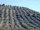 Olive trees on a hillside between Sevilla and Granada. Olive trees on a hillside between Sevilla and Granada.
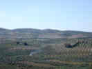 Fields between Granada and Sevilla. Fields between Granada and Sevilla.
|
After the view we walked down into the Albaicin. I guess I'm just not very impressed by the shops and what they have to sell. But, anyway, we took a little break at a tea shop (I had fresh-squeezed orange juice), and then we walked back to get the car. Traffic was pretty heavy on the highway until we left Granada. Driving time from the outskirts of Granada to Sevilla was just over two hours. | |||
| Cheryl made a salad and fried some chicken in olive oil. That and a little bread made a fine dinner. We also started a load of clothes in the washer. | ||||
|
|
Tuesday, April 22nd. | |||
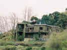
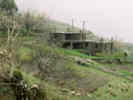
| This morning it is raining. The clothes we washed last night are hanging on the inside clothes line. A few of them are dry this morning, but most are a bit damp. Cheryl has been snoozing while I e-mail. I think after she gets dressed, we're going to the market to get some food for lunch and dinner. Then maybe tonite, we will go look at the house that Rachel and Nacho are interested in. | ||||
| Cheryl and I walked to the supermarket in the rain. Along the way we had a cafe con leche. In the supermarket, we couldn't find the spinach, and ultimately decided they didn't have any today. Also we bought the only package of broccoli. For the asparagus, we couldn't find the number, so I asked a man who was shopping himself. Turns out that Asparagus bought fresh in little bunches was "trigero" not "esparrago" maybe because they are thin little sprouts instead of the large thick spears. Otherwise I think we got every thing OK. | ||||
| However, after buying the groceries, we looked outside and it was just pouring rain. The streets were water from curb to curb. After watching and waiting for a while, we decided to make a run for it. Since I had my Gortex shell, I put up the parka and carried two bags and two water jugs without the umbrella. Cheryl took two bags with her umbrella. Well, we were pretty soaked when we got back to Rachel and Nacho's apartment. | ||||
| For lunch, Cheryl fixed the broccoli and ravioli, with a little leftover salad from last night. | ||||
 Duplex in housing development. Duplex in housing development.
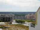 Looking west, highway to Huelva. Looking west, highway to Huelva.
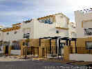
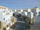 Housing development in Bormujos. Housing development in Bormujos.
|
| |||
| After looking at the house, we went to La Taberna El Potro in Gines for dinner. We got there a little early, so we sat in a coffee shop across the street and nursed our cafe con leche until the tavern opened about 8:45 PM. For dinner, we had deep-fried zucchini, pescado adobo (fried fish in a slightly spicy batter), a very thin piece of pork loin with some french fries that was very tasty, and an artichole scramble (revuelto). El Potro had a nice atmosphere, and was decorated with historic artifacts, farm implements, and the like. | ||||
|
|
Wednesday, April 23rd | |||
| This morning the sky was blue, with a few clouds coming in from the southwest. We organized ourselves and walked down to the Alcazar. | ||||
| On the way, we stopped at a convent and bought a dozen magdalenas for a snack. | ||||
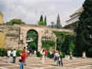 Rachel and Cheryl at the entrance to the Alcazar. Rachel and Cheryl at the entrance to the Alcazar.
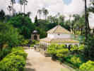 Standard view inside the Alcazar. Standard view inside the Alcazar.
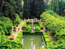 Gardens of the Alcazar. Gardens of the Alcazar.
|
We had visited the Alcazar once during our first visit in 1999. I mistakenly took my analog camera, so I didn't have a flash, therefore no photos inside the building. Also my film is ASA 200, because the store in Capileira did not have ASA 400 film. I took a few photos of the inside courtyards, but the light was very low because of the clouds, so we'll see what the results are. | |||
| We ate some of the magdalenas in the gardens of the Alcazar. A pair of mallard ducks waddled over to beg for a handout. After the snack we walked through the gardens and the grotesque wall. | ||||
| Rachel took us up through the Barrio de Santa Cruz on our way back to her apartment, including along the street called "Agua." A section of the old city wall is on one side of the street and the wall includes a segment of the original aqueduct that brought water to Sevilla. Hence the name Agua. I guess this is also the street where Rachel, Matt and Becci have a photo of them in the pouring rain, during their visit a couple of years ago. | ||||
| I think this afternoon we will have a little rest, and then maybe do some shopping downtown. | ||||
| After Siesta, we walked down to Sierpes, Campana, and El Corte Ingles. My destination was Sevilla Rock, a music store. In the basement we found a CD that I have been looking for. It is produced by a group called "Acetre" from Oliviendo in Extremadura. I have heard them on the Internet, but their CD isn't imported into the United States. This was a good find. It was the only CD by Acetre in the store. I also found a CD by a group called "Luar Na Lubre" who play music from Portugal and Galicia. Cheryl found a two CD set of Semana Santa music that we can regale our friends with upon our return. | ||||
| We also shopped Sierpes and another street a little closer to the river. After walking home we had a light dinner and went to bed. | ||||
|
|
Thursday April 24th. | |||
|
Locations: Carmona. |
This morning we determined to go to Carmona. We took the bus to the San Sebastian bus station, where we thought we could catch the bus to Carmona. When we didnt see any ticket sellers for Carmona, we asked the information guy. He gave us the schedule and told us to wait at the end of the platform for the bus to Carmona, and that we would have to pay the driver. | |||
| The bus pretty much left on time, but for the first half hour, it would its way through city streets picking people up. Some pickup points were clearly bus stops. Other pickup points just seemed to be people standing in the oleanders by the side of the road. | ||||
| It took about an hour to get to Carmona, with the bus stop conveniently just outside the Sevilla gate of the old city. We went to the tourist information center strategically located inside the Sevilla gate and got a map. Asking about bathrooms, we were told to go to the Market Plaza (Plaza de Mercado). On the way we came to the Casa Palacio de Los Dominguez, which we discovered was now a library. We found bathrooms inside the library. We walked through the Plaza de Mercado on the way to the Parador, but didn't really stop to look or buy anything. | ||||
| We went to be Parador to see the view from the terrace. We thought we might also relax and have something to drink. Unfortunately, the terrace was closed for construction, so we couldn't do that. we did walk along the road to the north of the Parador to see the view. Today was a pleasantly warm day, with a few clouds coming in from the Gulf of Cadiz, and a few light breezes. From this overlook, we could see a long way in the Guadalquivir Valley. | ||||
| From there, we went to the Museum of Carmona. The 2 entrance price is well worth it. This is a nice interpretive museum of the prehistory and current history of Carmona. There is also a nice exhibition of paintings by Carmen Diaz, who must have been a local painter. She painted portraits, landscapes, and city scenes. | ||||
| We had lunch at a Cafe Bar in Plaza de San Fernando, perhaps the main plaza of the old city. We had Ensalada Mixta, Espinaca con Garbanzos, and I added a Mortadilo de filete lomo de puerco (a small sandwich of fried fileted pork loin). We also tried to order Setas a la plancha, but they were out of setas. | ||||
| From there we walked down to the Cordoba gate, looked around, and then headed for the Hotel Casa de Corboda. This is a very fancy hotel, four stars, and might be worth a visit. | ||||
| Now we walked through the city en route to the Sevilla Gate. I took a couple of photographs of the snapdragon that grows in the rain gutters here. | ||||
| We were a little early for the next bus, so we sat for a time in the shade in a park below the Sevilla gate. | ||||
| Our bus left right at Five, and we got off near the shopping center Nervion. We waited while Rachel did a little bit of business. Then we took a bus to Plaza Encarnacion, and walked a short block home. | ||||
|
|
Friday April 25th | |||
 Street Sign Street Sign
|
Today we did not do much, because we were recovering from colds. However, in the afternoon we went to Bormujos again with Rachel and Nacho to look at the house. | |||
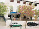
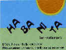 Habanita Restaurant Habanita Restaurant
|
We had dinner at Habanita, C/ Golfo 3 in Alfalfa. This is a Cuban / Vegetarian restaurant with a little of something for everyone. Very popular, though, there was no seating left after 9:30 PM. We had fried banana balls; chicken in curry with pineapple, salmorejo, and some other things I can't remember. | |||
|
|
Saturday April 26th | |||
| Walked down to the book store on Sierpes and Rachel and Nacho bought a couple of books for home owners in Spain. Then we went over to El Corte Ingles, where we bought some things to bring home. This included some supreme quality turron for Cheryl and I to take to work. | ||||
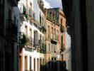 Small street near Puerto Osario Small street near Puerto Osario
 Intersection of puerto del Osario and Escuelas Pias. Intersection of puerto del Osario and Escuelas Pias.
|
On the way back we had lunch in the Plaza Santa Marta. We had acetunas, paella, and patatas alioli. Nacho and I walked home to start our siesta, while Cheryl and Rachel stayed behind in the plaza to watch a wedding. | |||
| After a long nap, we went out for coffee in the Plaza Los Terceros, and then to the supermarket. We had a relaxing afternoon, and then Rachel and Nacho made dinner. | ||||
|
|
Sunday, April 27th. | |||
| This morning, or the Spanish equivalent of morning, meaning before 3:00 PM, we set forth for Rio Tinto. we drove north from Sevilla on N-630 to Las Nieves. Cheryl and I had been that far in 1999, when we drove as far north as Monesterio. However, at Los Nieves we turned on C-421 to Nerva and Minas de Riotinto. | ||||
|
Literature Cited:
Locations: Rio Guadiamar. |
| |||
|
Locations:
Rio Tinto.
|
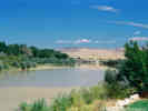
Leaving the Rio Guadimar we drove to Minas de Riotinto and to the museum. It was open when we arrived, but was closing for an hour at 3:00 PM. We had a quick look around. This museum is a worthwhile stop, if you are interested in mining, the Romans in Spain, or Spanish archeology of any age. | |||
| One thing we learned is that an extra-charge guided tour is required to look into the Corta Atalaya (the Big Hole). | ||||
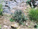
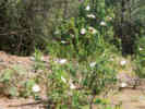 Cistus sp. common in the understory. Cistus sp. common in the understory.
|
The museum also has a replica of the Roman mine workings. It also requires a guided tour, that I believe is conducted once an hours. Inside the replica is a working pair of the water wheels that the Romans used to de-water the mines. We learned that the Roman mine workings were about 100 meters deep, that the Romans did not recognize the gold in the Gossan deposit, but were after the silver under the gold. Of course, the Romans did not work in the mines themselves. They used slaves to work the mines. Once in the mines, the slaves never left. They also used the children of the slaves to work in the small ore shoots. | |||
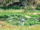
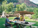
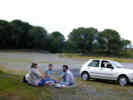 Los Domingueros have a picnic at Rio Tinto Los Domingueros have a picnic at Rio Tinto
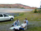 Los Domingueros have a picnic at Rio Tinto Los Domingueros have a picnic at Rio Tinto
|
When the museum closed we set about looking for a place to have lunch. We drove close to the Corta Atalaya, but were stopped by a large gate. We tried a little side road that took us to a large open area. Here we had lunch, in the shade of the Pine Trees, surrounded by Rock Roses. | |||
|
Locations:
Rio Tinto.
|
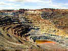
After lunch we walked down the bank and over to the Mirador (the looking place) to look into the pit. It was a short walk, and fairly easy. The Corta Atalaya is 1220 meters in length and 335 meters deep. There was a locomotive still in the pit, about 2/3 down. From the Mirador, the locomotive is a pretty small dot. | |||
| We went back to the museum, where Cheryl, Rachel, and Nacho had coffee, while I walked back through the entire museum. One thing I learned is that the oldest Bronze Age artifact has been dated at 800 B.C. That means that the mines have been active for at least 2,800 years, and probably longer. There were Paleolithic artifacts, Bronze age, Roman, and Celtic artifacts, including dolmens. | ||||
| They made me buy some souvenirs, so I bought a tee shirt and a hat. | ||||
| Leaving Minas de Riotinto we drove south through El Madroño and Berrocal. Just before entering Berrocal, we stopped to take some photos, and discovered some local pigs behind the stone wall. They came over to see us, presumably in hopes of a handout. | ||||
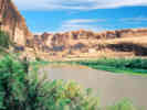
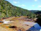 Rio Tinto from the H 5137 highway bridge near Berrocal. Rio Tinto from the H 5137 highway bridge near Berrocal.
|
Below Berrocal, we came to a bridge over Rio Tinto. Here we stopped for photographs. The yellow color of the river seems mostly to be an iron sediment at this point. Then we drove east on the small road from Berrocal, then south on N 435 and A 493. At one point we crossed the Rio Tinto again. It was still quite tinted at this point. Near La Palma de Condado, we joined A 49, the main highway between Sevilla and Huelva, where we turned west to Sevilla. | |||
| Nacho did a good job of driving, and Rachel navigated, to help me get the Triple Crown of Rio Tinto: the Museum, the Big Hole, and the River, while earning the hat and t-shirt! | ||||
|
|
Monday April 28th | |||
| Today we said goodbye to Rachel and Nacho and took the Ave to Madrid. I was a little concerned about getting a taxi, but it worked out OK. We walked down to the Plaza Ponce de Leon (where I saw the four guys and the olive tree lurch around the corner) and watched for a taxi. An available taxi has a green light on the top, and a "Libre" sign in the window. Anyway, one came pretty quickly, and we got in for the ride to Estacion Santa Justa. | ||||
| When we arrived at Santa Justa, the platform for our train was not announced yet, so Cheryl had Cafe con Leche and a croissant, while I had some fresh-squeezed Orange Juice. | ||||
| For the ride from Sevilla to Madrid, we had window seats, on the single seat side of the train. We tried to see Carmona from the train but could not. While the sky was overcast in Sevilla, it cleared progressively as we rode north. The countryside was still quite green, as the rain has continued over the two weeks of our vacation. | ||||
| In Madrid, we took a taxi from Atocha to Hotel Mora at Paseo del Prado, 32. Well, had we known, we would have walked, as the hotel was quite close to the train station. In fact, the hotel was across the street and up about half a block. | ||||
| When we went by the Prado, Cheryl noticed the banners for the Vermeer exhibit, something she would very much like to see. | ||||
| Upon check-in to the hotel, the clerk gave me a long speech in Spanish about "muchos robos," many robbers that we took as advice to be careful. After checking in to the hotel, we walked across the street to the entrance of the Botanical Garden to check its opening hours. It was open until 8:00 PM, so we determined to see the Vermeer exhibit. Unfortunately, today is a Monday, a day on which all the museums are closed. So we walked down to the Botanical Garden. | ||||
| The Garden is quite large and we walked its length several times. It was also quite winday, so the dust and pollen were swirling about. The tulips were done, and the iris winding down. The Buckeye and a K_______ were at the height of their bloom. We also saw a Ceanothus thrysiflorus in bloom. | ||||
| Leaving the garden, we thought of going to the Parque del Retiro. We walked up through a construction zone to the park and entered the nearest gate. It wasn't very nice in there, with some rough-looking characters, so we left and walked north to the next gate. This seemed to be a main gate. | ||||
| There were lots of people sitting on benches and sunbathing on the grass. Walking in a little further, we came to a lake. People were out on the lake in little row boats, and there is a cafe, as well as a couple of food stands. Here we got an ice cream -- a Magnum Almendra -- vanilla ice cream covered with chocolate with almonds, all on a stick. | ||||
| There was a guy reciting poetry to recorded music, some of the poetry he recited from memory and some he read. | ||||
| On the way back to the hotel, we looked in the Starbucks. It looked very much like a Starbucks at home. Didn't have Sulawesi, and in addition to the traditional Starbucks coffee drinks, they had added Cafe Mista that we decided was the Starbucks equivalent of Cafe con Leche. | ||||
| We walked back down to the hotel, and took a little rest before dinner. I think it was about 8:45 PM that we went down for dinner. | ||||
|
|
Tuesday April 29th. | |||
| This morning we got up pretty early, because we wanted to be at the Prado when it opened at 9:00 PM. | ||||
| After the typical breakfast of Cafe con Leche, Zumo de Naranja, and Tostada, we walked over to the Prado and waited in a short line to enter. | ||||
| We walked through the Vermeer exhibit. There were about 12 paintings by Vermeer and about 20-24 paintings by his contemporaries. But "The Girl with the Pearl Earring" wasn't there. We walked through a couple of other galleries, and then left, returning to our hotel to check out. We took a taxi to Barajas, 17 this time. | ||||
| The flight to Toronto is about 80% full. Took off on time, and now we are over Labrador or Newfoundland. | ||||
|
|
Sunday 25-May | |||
| This morning I left home and drove through the fog and drizzle through Salinas. | ||||
| Exited US Hwy 101 at Arroyo Seco Road, thinking I would stop by Mission Soledad. Unfortunately I made a wrong turn (or didnt see the sign), and remained on Arroyo Seco Road until it entered the canyon. Here I turned back on County Route G16 to Greenfield. | ||||
| South of King City I left US Hwy 101 at Wildhorse Road and then followed the old highway, now known as Cattlemen Road, through San Lucas and San Ardo, back to US Hwy 101. | ||||
| Exited briefly at Alvarado Road for a photo of the San Ardo oil fields. | ||||
| In the afternoon, we decided to visit Cuesta Ridge. The fog was pouring over the ridge, but we found a sunny spot in the Botanic Area where the Sergeant Cypress is. As the fog cleared a little more, we climbed a ridge to check the view. | ||||
| The fog came back in quickly and swirled around us as we picked our way back to the car. | ||||
|
|
Monday 26-May | |||
| Left Atascadero about 8:15 AM and drove to Bakersfield for supplies. Next Stop was Riotinto Borax visitor center. Very nice display and video. Unfortunately, the viewpoint doesnt permit a view all the way to the bottom of the pit. | ||||
| Got gas at Baker 99° -- and then drove to Pinto Mountain. Calochortus kennedyi out in force. A couple of other little things in bloom, but otherwise not much to see. | ||||
|
Other articles:
|
Only one rosette of Frasera albomarginata and that one was in my plot. No other rosettes seen around the plot. Collected a few things to verify determinations. | |||
| Colected four plants at Pinto Mountain, one is Calochortus kennedyi. The other three remain to be determined. See my Eastern Mojave field notes for details. | ||||
 Collection No. 308, Calochortus kennedyi Collection No. 308, Calochortus kennedyi
 Collection No. 308, Calochortus kennedyi Collection No. 308, Calochortus kennedyi
|
308 |
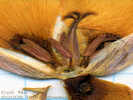
Calochortus kennedyi Porter. Desert Mariposa Lily.
Pinto Mountain, San Bernardino County, California. 14.5 km north of Hole-in-the-Wall. 35.1755°N, 115.3866°W. WGS 1984. Elev. 1650 m. | ||
|
Other articles:
|
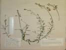
309 |
Syntrichopappus fremontii A. Gray. Yellow-Ray Fremont's-Gold.
Pinto Mountain, San Bernardino County, California. South side of Pinto Mountain. 35.1754°N, 115.3862°W. WGS 1984. Elev. 1658 m. Collected under Permit#: MOJA-2001-SCI-0015, Vegetation of Lobo Point and North Wild Horse Mesa. Coll. No. 309, 25 May 2003, characters observed while keying: Annual, tap-rooted, to 15 cm., generally tomentose throughout; Stem, decumbent to ascending; Leaves, alternate, 16 mm. × 3 mm. wide, tip 3-lobed; Inflorescence, solitary heads on peduncles (10 mm.), flowers of two kinds, radiate; Phyllaries, 5, in one series, free at base, 7.5 mm. × 2.5 mm. wide, margins slightly scarious, tip acuminate without tack-shaped gland; Receptacle, flat, epaleate; Ray flowers, 5, 5 mm., yellow; Pappus of bristles on both ray and disc flowers, single row, short plumose; cypsela, black, short plumose. | ||
|
Other articles:
|
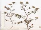
310 |
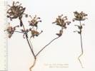
Cryptantha gracilis Osterh. Narrow-Stem Cryptantha. Pinto Mountain, San Bernardino County, California. South face of Pinto Mountain, 12.5 km southeast of Cima, 14.5 km north of Hole-in-the-Wall, growing in Winkler Formation, a Tertiary lacustrine limestone. 35.1752°N, 115.386°W. WGS 1984. Elev. 1639 m. | ||
 Coll. No. 311, Phacelia fremontii Coll. No. 311, Phacelia fremontii
|
311 |
Phacelia fremontii Torr. Fremont's Phacelia.
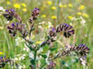
Pinto Mountain, San Bernardino County, California. 35.1732°N, 115.3844°W. WGS 1984. Elev. 1613 m. Coll. No. 311, keyed 10 Jan 2013, characters observed: Annual, from taproot, 10 to 20 cm., green, glandular, staining newsprint, Leaves, alternate, deeply pinnately lobed; Inflorescence coiled; Sepals, 5, 5 mm x 1 mm wide, tip rounded, sinus appendages 0; Corolla funnelform, radial, tube 6.5 mm + lobes 2.5 mm = 9 mm x 6 mm wide, blue/purple, deciduous; Ovary, 1, entire; Style, attached to tip of ovary, forked; Stigma, 2; Stamens, 5, included, different lengths (2,2,1), filaments all attached at same level, free glabrous; Seeds 8, 1.2 mm, dark brown or nearly black, cross-furrowed. | ||
| Cloudy but not too humid, beautiful at sunset when the clouds were lit from below. | ||||
|
|
Tuesday 27-May | |||
| Sun up about 5:40 AM. Low maybe 60°. Few high cirrus clouds, light breeze from the east. | ||||
| Checked my plot of Salvia dorrii near Lobo Point. This might have been a good year for annuals, but not perennials. Many Salvia dorrii have died or remained dormant. | ||||
| Even the junipers have some die back. | ||||
| Collected three plants, including a Phacelia that was growing in the Coleogyne, a Cryptantha and a Stylocline. | ||||
| Phacelia ramosissima Douglas ex Lehm. Branching Phacelia. Poorly preserved, no good leaf material, destroyed. | ||||
|
Other articles:
|
313 |
Cryptantha circumscissa (Hook. & Arn.) I. M. Johnst. Cushion Cryptantha. Lobo Point, San Bernardino County, California. Experimental plots in Salvia dorrii. 3.6 km northwest of Hole in the Wall visitor center, 20.7 km south southeast of Cima, San Bernardino County, California. 35.0571°N, 115.4321°W. WGS 1984. Elev. 1425 m. Collected under Permit#: MOJA-2001-SCI-0015, Vegetation of Lobo Point and North Wild Horse Mesa. | ||
| 314 |
Eriophyllum pringeli A. Gray. Pringle's Woolly Sunflower. Lobo Point, San Bernardino County, California. Experimental plots in Salvia dorrii, bajada just north of Lobo point, about 2½ miles northwest of Hole-in-the-Wall, 9 miles northeast of Mitchell Caverns. 35.0571°N, 115.432°W. WGS 1984. Elev. 1425 m. | |||
| Had lunch at Lobo Point, and then drove up the cherry-stem road into the north face of Wild Horse Mesa. Most of my Frasera albomarginata have died. There are two new rosettes in the experimental plot. One of the new rosettes is in a cluster of four new rosettes. The other three are just outside my plot. | ||||
 Coll. No. 315, Phacelia ramosissima Coll. No. 315, Phacelia ramosissima
|
315 |
Collected a Phacelia on the north face of Wild Horse Mesa that was growing under pinyons. This collection had UTM coordinates of the access road to the Mid Hills Campground. So, it's not clear where the collection was actually made.
Phacelia ramosissima Douglas ex Lehm. Branching Phacelia. Mid Hills Campground, San Bernardino County, California. 35.1274°N, 115.4351°W. WGS 1984. | ||
 Dead or dying Junipers on north face of Wild Horse Mesa Dead or dying Junipers on north face of Wild Horse Mesa
|
Noticed that many of the junipers near Winklers cabin have died, or at least turned brown. | |||
| Went to Winklers Cabin and signed guest register. Looked like someone was staying there. | ||||
| The Salvia dorrii along the road near Mid Hills campground had some heavy bloom, perhaps 6 or 7 whorls. | ||||
| Plants that looked good: Annuals, especially several different Phacelias, Calochortus, Ephedra, and Ledipium. | ||||
| Plants that looked OK: Coleogyne, Mirabilis (both M. multiflora and M. bigelovii[= M. laevis var. villosa] TAS 19-Feb-05), Yucca baccata, and the single-leaved ash (Fraxinus anomala) on the north face of Wild Horse Mesa. | ||||
| Plants that looked bad: Junipers, some Pinyons, Salvia dorrii, and Frasera albomarginata. | ||||
|
|
Wednesday 28-May | |||
| 07:45 74515 mi., lv. Mid Hills, bound for Goodsprings, Potosi Mountain, and the Mesquite Mountains. | ||||
| 08:53 74575 mi., lv. Jean, having filled up with gas. | ||||
| 09:00 74584 mi., lv. Goodsprings, thinking we would like to drive to the top of Potosi Mtn. We take a major-looking road off of Wilson Pass Road. It turns out this road doesnt go to the top of Potosi Mountain, but to a nearby hill with lots of radio towers. | ||||
|
Locations:
Mesquite Mountains.
|
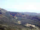
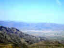
09:45 74589 mi., lv. Radio towers, nice view of Sandy Valley, Goodsprings, the Bird Spring Mountains, and Potosi Mountain. | |||
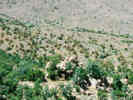
| Not too much to collect on the top, but the undisturbed slopes below the top were pretty interesting. | ||||
 Coll. No. 316, Caulanthus crassicaulis Coll. No. 316, Caulanthus crassicaulis
|
316 |
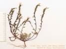
Caulanthus crassicaulis (Torr.) Wats. Spindlestem.
Spring Mountains, Clark County, Nevada. On a ridge south of an unnamed small peak with many radio towers, southern Spring Mountains, 5.3 air miles northwest of Goodsprings, Clark County, Nevada, and 5.1 air miles south of Potosi Mountain, Clark County Nevada. 35.8909°N, 115.4955°W. WGS 1984. Elev. 1859 m. Coll. No. 316, 10 Nov 2012, characters observed while keying: Perennial, terrestrial, caudex woody; Stem erect 7 dm., inflated, glabrous; Leaves basal glabrous, cauline leaves few, bases not lobed of sagittate; Pedicel 2 mm.; Calyx many straight hairs; Stamens 6, mostly included; Stigma lobes opposite valves; Fruit cylindric; Seed wings 0. | ||
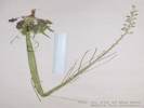
 Coll. No. 317, Oenothera suffrutescens Coll. No. 317, Oenothera suffrutescens
|
317 |
Oenothera suffrutescens (Ser.) W. L. Wagner & Hoch. Linda Tarde. (Syn: Gaura coccinea Pursh)
Spring Mountains, Clark County, Nevada. On a ridge south of an unnamed small peak with many radio towers, southern Spring Mountains, 5.3 air miles northwest of Goodsprings, Clark County, Nevada, and 5.1 air miles south of Potosi Mountain, Clark County Nevada. 35.8909°N, 115.4955°W. WGS 1984. Elev. 1859 m. Coll. No. 317, keyed 15 Dec 2012, characters observed: Herbaceous perennial, to 60 cm.; Stipules absent; Leaves alternate, 25 mm. x 5 mm., lanceolate, few toothed; Inflorescence straight, open; Bracts 2-3 mm.; Buds erect; Sepals fused to tip in bud, all coming free, reflexed, 6 mm., not persistent after flowering; Hypanthium 6 mm.; Petals entire; Stamens 8, < stigma; Anthers maturing in unison with stigma; Ovary at flowering > distal internode (ergo infl. "open"); Stigma 4-lobed; Fruit 7 mm., stalk-like base 0, erect, fusiform, gradually wider at middle, puberulent, indehiscent; Seeds few, 2 mm., glabrous, not winged. | ||
 Coll. No. 318, Calochortus kennedyi var. kennedyi Coll. No. 318, Calochortus kennedyi var. kennedyi
|
318 |
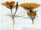
Calochortus kennedyi Porter var. kennedyi. Desert Mariposa Lily.
Potosi Mountain, Clark County, Nevada. Rocky ground just below unnamed peak with radio towers, 5.0 air miles south of Potosi Mountain, and 5.5 air miles northwest of Goodsprings, Nevada. 35.8909°N, 115.4955°W. Elev. 1859 m. Coll. No. 318, 10 June 2012, characters observed while keying: Leaf basal withered at flowering; Perianth outer parts (bracts) differentiated from inner parts (petals); Flower erect; Petals 20 mm., wide, orange (faded to yellow brown); Nectary round, hairy; Fruit erect. | ||
|
Locations:
Mesquite Mountains.
|
From the radio towers we drove back through Goodsprings, and then over Columbia Pass on Nevada Highway 161. Did not stop in Sandy Valley, and then into the Mesquite Mountains on a very good dirt Kingston Road. | |||
| We turned up the cherry-stem road into the North Mesquite Mountains, and drove 1.6 miles to the end. Here we had lunch. 11S 0615381 3952371 1220 m. | ||||
|
Other articles:
|
319 |
Mimulus bigelovii (A. Gray) A. Gray var. bigelovii. Bigelow's Monkeyflower.
Mesquite Mountains, San Bernardino County, California. About 1.75 mi northwest of Winters Pass, reached by going 1.2 mi north of Winters Pass on Kingston Road, then 1.5 mi west on cherry-stem road into North Mesquite Mountains Wilderness. 35.7085°N, 115.7245°W. WGS 1984. Elev. 1220 m. Coll. No. 319, 27 May 2003, characters observed while keying: Annual, 10-15 cm., tap-rooted, branched at base or not, terrestrial; Leaves, opposite, lower, sessile, 11 mm. × 3 mm., oblanceolate, upper, petioled 1.5 mm. + blade 8 mm. × 2.8 mm., elliptic, tip acuminate; Inflorescence axillary, flowering nodes with 2 flowers; Pedicel 1.5 mm.; Calyx, tube 4 mm. + lobes 1.5-2.0 mm., cleft <½length, hairy; Corolla, lobes similar, spur absent, magenta; Stamens, 4, in 2 pairs of unequal length, staminode 0; Stigma, broad, ±2-lobed. | ||
|
Other articles:
|
320 |
Eriogonum nidularium Coville. Birdnest Buckwheat.
Mesquite Mountains, San Bernardino County, California. About 1.75 mi northwest of Winters Pass, reached by going 1.2 mi north of Winters Pass on Kingston Road, then 1.5 mi west on cherry-stem road into North Mesquite Mountains Wilderness. 35.7085°N, 115.7245°W. WGS 1984. Elev. 1220 m. Coll. No. 320, 27 May 2003, characters observed while keying: Annual; Stem densely branched, some incurved, tomentose (not glabrous or glandular); Leaves basal, blades round-ovate; Involucre 1.5-2.0 mm., angled (a little), not solely at tips of slender branches, sessile, sparsely tomentose; Peduncles glabrous; Flowers 1.8-1.9 mm., yellow, glabrous, outer perianth lobes fan-shaped (fiddle-shaped?), obtuse basally, all lobes ± alike. | ||
|
Other articles:
|
321 |
Mesquite Mountains, San Bernardino County, California. At the end of a cherry-stem road into the North Mesquite Mountains Wilderness, 1.4 miles by road north of Winters Pass, then 1.6 miles by road west to end of road; about 21 miles by road north of the Cima Road exit on US Interstate 15. 35.7085°N, 115.7245°W. WGS 1984. Elev. 1220 m. Coll. No. 321, keyed 19 Jan 2013, characters observed: Perennial, sprawling in shade, to 60 cm.; Stem decumbent, sparse short and long hairs; Leaves, alternate, to 7 cm., compound, 5 or 7 lobes, terminal lobes larger than lateral lobes, sparsely short hairy and glandular; Inflorescence coiled loosely, 12-15 flowers; Pedicels, 1-3 mm, elongating as fruit matures; Calyx, lobes 5, long (7.5 mm) and narrow, glandular hairy; Corolla blue, tube 4 mm + lobes 3.5 mm = 7.5 mm x 8 mm wide; Ovary, 1 mm., entire, straight hairy distally; Style, arising from top of ovary, 7 mm., hairy proximally, forked at approximate middle; Stigma, 2; Stamens exserted; Fruit, 3 mm., ovoid; Seeds, 4, 2.5 mm, light brown, pitted. | ||
| 12:50 74620 mi., return to Kingston Rd. Turn right, west to Winters Pass. | ||||
| 12:55 74621 Winters Pass, 1169 m by GPS, lots of Eriogonum in bloom, one Eschscholzia, perhaps E. minutiflora, lots of Winter Fat, some Salvia dorrii that had finished blooming and set seed. | ||||
| Once we left Winters Pass, we watched for the other cherry-stem road going into the North Mesquite Mountains Wilderness. We did not find it. | ||||
| Since the hour was early we resolved to drive through the Piute Valley south of Mountain Pass. | ||||
 View of Mountain Pass Rare Earth Mine from the east slope of Kokoweef Peak. View of Mountain Pass Rare Earth Mine from the east slope of Kokoweef Peak.
|
We started by visiting the mine on the north face of Kokoweef Peak, that I believe is the Carbonate King Mine. | |||
| Then we swung through Kokoweef Caverns. Its occupied and we turned around and left. | ||||
|
Locations:
Blue Buzzard Mine.
Iron Horse Mine.
Rogers Camp.
|
Navigated our way through the maze of roads in Piute Valley past the dinosaur foot prints. Then past the turn off to the Iron Horse Mine and the Blue Buzzard Mine to Rogers Camp. Here a check of our GPS receivers indicated an anomaly of about 160 m north and south. The GPS receivers were correct east and west. | |||
| We returned back up the road into Piute Valley, drove around the north side of Striped Mountain, and then exited Piute Valley through a small pass. | ||||
| Did a drive through of the Standard No. 1 Mine and then took a relatively short dirt road down to Cima Road. | ||||
| 16:26 74695 mi., ar. Mid Hills, total 180 miles. | ||||
|
|
Wednesday 29-May | |||
| This morning I drove out through Macedonia Canyon, Kelso and Granite Pass. Its clearly the fastest way in and out of the Mid Hills area. | ||||
|
|
Saturday, 16-August | |||
| Alameda to Elko | ||||
|
|
Sunday, 17-August | |||
| Elko | ||||
|
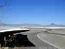
Other articles:
Locations:
Bonneville Salt Flats.
|
||||
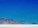
|
Other articles:
Locations:
Bonneville Salt Flats.
|
||||
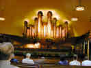
| Salt Lake City | ||||
|
Locations:
Salt Lake City.
|
We got to Temple Square in Salt Lake City just in time for the daily organ concert, a brief tour of Temple Square, and then went to the food court in the mall across the street for lunch. | |||
|
|
Park CityIn Park City, we stopped to get gas, and then drove through the town on our way to Heber City. | |||
|
Other articles:
Locations: Vernal. |
Vernal | |||
| We checked in to the Best Western Dinosaur in Vernal. I wanted to stay here because they had high-speed wireless Internet access. This is a community service as an alternative to wiring the community for DSL or for cable modems. The wireless LAN adapter was an Orinoco card, and the software client was a very well locked down client loaded from a CD. It worked very well. | ||||
|
|
Monday, 18-August | |||
| This morning in Vernal, we visited the Utah Field House Museum, next to the motel, and then headed out for Dinosaur National Monument. | ||||
|
|
Dinosaur National Monument | |||
|
Literature Cited:
Locations: Dinosaur National Monument. |
Geology and paleontology of Dinosaur National Monument, Utah-Colorado is discussed in Gregson and Chure (2003). | |||
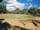
 The quarry building at Dinosaur National Monument. The quarry building at Dinosaur National Monument.
|
We rode the shuttle bus up to the quarry building. | |||
 The quarry at Dinosaur National Monument. The quarry at Dinosaur National Monument.
|
The bones inside the quarry are very impressive. | |||
|
Locations:
Green River.
|
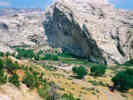
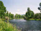
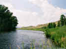
For lunch, we went to a place called Split Mountain where the Green River exits a canyon. | |||
|
Other articles:
Locations:
Colorado River.
|
| |||
| Hot Sulphur Springs | ||||
| Steamboat Springs | ||||
|
|
Tuesday, 19-August | |||
| Steamboat Springs | ||||
|
Other articles:
Locations:
Steamboat Springs.
|
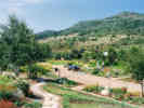
Yampa River Botanic Park | |||
|
Other articles:
|
Berthoud Pass is the highest pass on the route of US Highway 40. | |||
| Denver | ||||
|
|
Wednesday, 20-August | |||
| Denver | ||||
| FlatIron Crossing | ||||
| Denver | ||||
|
|
Thursday, 21-August | |||
| Denver | ||||
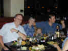 Dinner with my cousin Sydney and her husband Dave. Dinner with my cousin Sydney and her husband Dave.
|
On Thursday evening we had dinner with my cousin Sydney and her husband Dave. | |||
|
|
Friday, 22-August | |||
| Denver | ||||
| Glenwood Springs | ||||
| Carbondale | ||||
|
Locations:
Redstone.
|
| |||
| Lost Lake | ||||
|
Locations:
Lost Lake Campground.
|
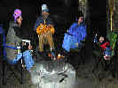
Sitting around the campfire, Simone tried everyone else's chair. | |||
|
|
Saturday, 23-August | |||
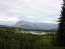 View of Lost Lake Slough from the trail to Dollar Lake. View of Lost Lake Slough from the trail to Dollar Lake.
|
On Saturday morning we took a little hike to Dollar Lake from the campground. From we trail we had this view of Lost Lake Slough. | |||
|
Locations:
Dollar Lake.
|
Dollar Lake | |||
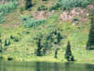 Many Frasera speciosa at Dollar Lake. Many Frasera speciosa at Dollar Lake.
|
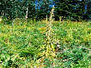
Across Dollar Lake we could see many Frasera speciosa (Kellogg) Kuntze, or perhaps Frasera speciosa Griesb., depending on your point of view. The common names for this plant are either Monument Plant or Elkweed. | |||
 Frasera speciosa that has finished blooming. Frasera speciosa that has finished blooming.
|
Generally, we found this plant in open areas, rarely in shade, and never under trees. The habit of growing in the open has apparently carried over to other Frasera, including the desert species. | |||
 Rosette of Frasera speciosa at Dollar Lake, CO. Rosette of Frasera speciosa at Dollar Lake, CO.
|
The life history of Frasera speciosa was studied by Taylor and Inouye (1985) at the Rocky Mountain Biological Laboratory, in nearby Gothic (Crested Butte), Colorado. S. radiata blloms once then dies. The expected age at flowering is 37 years. | |||
| Lost Lake | ||||
 Coll. No. 323, Gentiana parryi Coll. No. 323, Gentiana parryi
 Coll. No. 323, Gentiana parryi Coll. No. 323, Gentiana parryi
 Lost Lake Slough Lost Lake Slough
|
323 |
Gentiana parryi Engelm. Parry's Gentian.
Lost Lake Slough, Gunnison County, Colorado. 12 mi (19.2 km) west of Crested Butte, Colorado. 38.8693°N, 107.2091°W. WGS 1984. Elev. 2933 m. Coll. No. 323, keyed 1 Jan 2013, characters observed: Perennial herb to 35 cm.; Leaves cauline; Bracts 25 mm x 10-12 mm wide; Corolla blue, 35 mm., distinctly tubular, tube broad, plicate; Anthers not spirally twisted. | ||
|
|
Sunday, 24-August | |||
| Lost Lake Campground | ||||
| Crested Butte | ||||
| Gunnison | ||||
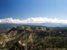
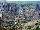 Looking into Black Canyon of the Gunnison. Looking into Black Canyon of the Gunnison.
|
Black Canyon of the Gunnison | |||
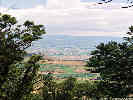 Looking toward Montrose, CO from Black Canyon of the Gunnison National Park. Looking toward Montrose, CO from Black Canyon of the Gunnison National Park.
|
Montrose | |||
| Ouray | ||||
| Silverton | ||||
| Durango | ||||
|
|
Monday, 25-August | |||
|
Locations:
Durango.
|
Durango | |||
|
|
Tuesday, 26-August | |||
| Durango | ||||
| Mesa Verde National Park | ||||
|
Locations:
Mesa Verde National Park.
|
This is the north and highest end of Mesa Verde. Somewhat like Wild Horse Mesa, Mesa Verde is much higher at one end and sloping at a pretty high angle, and then becomes nearly flat at the lower and southern end. | |||
|
Locations:
Mesa Verde National Park.
|
We took the tour of Cliff Palace. | |||
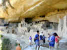 Cheryl talks with two young people from the Bay Area at the Cliff Palace. Cheryl talks with two young people from the Bay Area at the Cliff Palace.
|
As if to underscore what a small world this is, we learned that these young people were also from the Bay Area. They are brother and sister; she just graduated from Stanford, he from UC Berkeley. | |||
|
Locations:
Mesa Verde National Park.
|
On our way back up the mesa, and out of the park, we stopped at Far View. There were four or five little villages here, and this apparent reservoir. It was 90 feet in diameter and 12 feet deep. | |||
| Monticello | ||||
|
Literature Cited:
Locations: Canyon Lands National Park. |
Canyonlands National Park. We didn't have time to stop this year. However, I would like to visit and see the grabens, as described in Baars (2003), and Walsh and Shultz-Ela (2003). | |||
|
Locations: Moab. |
Moab | |||
| We arrived in Moab in the early evening, checked in to a motel and walked down to the Slickrock Café for dinner. Then we got a really good ice cream cone at the Restoration Creamery run by Living Rivers Network. | ||||
|
|
Wednesday, 27-August | |||
| Moab | ||||
|
Locations: Arches National Park. |
Arches National Park | |||
|
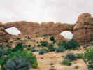
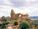
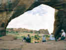
Locations:
Arches National Park.
|
Our first major stop was at the Windows, an area of many arches. We walked around the "primitive" trail that leads behind the arches. Here we caught up with a Ranger giving a desert survival talk. We stayed with her for a bit and then sat inside one of the arches. | |||
|
Locations:
Arches National Park.
|
From the perspective of one of the Spectacles Arches, we looked over Turret Arch. | |||
|
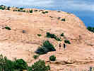
Locations:
Arches National Park.
|
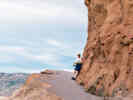
The trail sign says it's 1.5 miles from the trail head to Delicate Arch. The first half of this trail climbs across this bare sandstone outcrop. | |||
|
Locations:
Arches National Park.
|
The last portion of the trail to Delicate Arch traverses a ledge with a drop-off of 30 to 50 feet. | |||
|
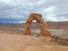
Locations:
Arches National Park.
|
Delicate Arch is across a small bowl. You have to skirt around the bowl to the left to stand under the arch. Behind the arch the sandstone drops off quickly to a creek. | |||
|
Locations:
Arches National Park.
|
At the end of the day, we took a plant walk with Lee. It turns out Lee and I had previously corresponded about Blackbrush. One of the plants we saw on this walk was Lomatium latilobum (Rydb.) Mathias, common name: Canyonlands biscuitroot. | |||
|
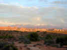
Locations:
La Sal Mountains.
|
As we were leaving Arches National Park in the late afternoon, we were treated to some beautiful views, lit by the setting sun. | |||
|
Literature Cited:
Locations: Arches National Park. |
References about geology are Doelling (2003) and Cruikshank and Ayden (1994). | |||
|
|
Thursday, 28-August | |||
|
Locations:
Colorado River.
|
Moab | |||
| Arches National Park | ||||
|
Locations:
Green River.
|
Green River | |||
|
Other articles:
Locations:
San Rafael Swell.
|
San Rafael Swell | |||
| Eureka | ||||
|
|
Friday, 29-August | |||
| Eureka | ||||
| Alameda | ||||
|
|
October 3, 2003 | |||
|
|
October 4, 2003 | |||
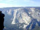
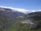
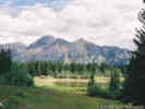
| Drive to Glacier point Merced River valley hazy. | ||||
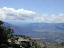
| Taft Point, Sentinel Dome trail head. | ||||
|
Locations:
El Capitan.
Yosemite National Park.
|
Taft Point, Sentinel Dome trial head. | |||
|
Locations:
Yosemite National Park.
|
Taft Point | |||
| Yosemite West | ||||
| Wawona | ||||
|
|
October 5, 2003 | |||
| power out | ||||
| Library | ||||
| Crossed Merced River | ||||
| to 7th Day Adventist camp .. Couldn't find suspension bridge | ||||
| back to the Redwoods. | ||||
|
[Previous Page]
[Next Page]
Go to page: [1800s] [1900s] [1910s] [1920s] [1930s] [1940s] [1950s] [1960s] [1970s] [1980s] [1990] [1991] [1992] [1993] [1994] [1995] [1996] [1997] [1998] [1999] [2000] [2001] [2002] [2003] [2004] [2005] [2006] [2007] [2008] [2009] [2010] [2011] [2012] [2013] [2014] [2015] [2016] [2017] [2018] [2019] [2020] [2021] [2022] [2023] [2024] [A] | ||||
| If you have a question or a comment you may write to me at: tas4@schweich.com I sometimes post interesting questions in my FAQ, but I never disclose your full name or address. |
Date and time this article was prepared: 5/10/2024 11:04:30 AM |
|||