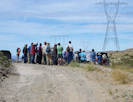
“In 1967, workers with the Forest Service and the Department of Defense stacked 342 piles of juniper and piñon logs in this place 20 tons of wood per pile, spaced 25 feet apart. Then, at 8 a.m. on Sept. 29, they set fire to them.
“Project Flambeau comprised some two-dozen experiments like this one, meant to simulate an American suburb under nuclear attack
(Fox, 2017)”
|
Literature Cited:
- Baldwin, Bruce G., Donald W. Kyhos, Scott N. Martins, Frank C. Vasek, and Bridget L. Wessa, 1996.
Other articles:
• Field Notes:
20 Apr 2004;
|
1576
|
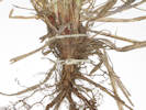
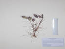
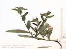
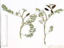
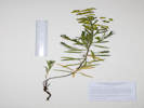
Field identification: Hymenoclea salsola.
Ambrosia salsola (A. Gray) Strother & B. G. Baldwin. Cheesebush.
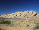
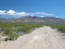
Shadow Valley, San Bernardino County, California. Along Kingston Road, 13.4 miles north of US Interstate 15 on Kingston Road, and 0.9 miles northeast of the intersection of Kingston Road and Excelsior Mine Road. 35.6217°N, 115.7269°W. WGS 1984 Elev. 980 m. Also collected here, Coll. No. 1575, Yucca schidigera salsola.
|
Species Lists:
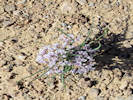
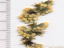
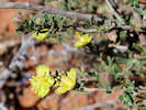
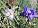
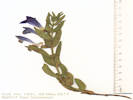
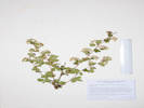
Salvia dorrii
|
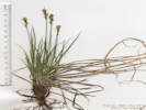
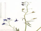
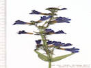
1577
|
Field identification: Salvia dorrii.
Salvia dorrii (Kellogg) Abrams var. pilosa (A. Gray) J. L. Strachan & Rev. Purple Sage.
Shadow Valley, San Bernardino County, California. Along Kingston Road, 17.2 miles north of US Interstate 15 on Kingston Road, and 4.6 miles northeast of the intersection of Kingston Road and Excelsior Mine Road. 35.6736°N, 115.7081°W. WGS 1984 Elev. 1123 m. Collected with Coll. No. 1578, Sphaeralcea ambigua.
| |
Other articles:
• Kingston Road:
s. of Winters Pass;
 Coll. No. 1578, Sphaeralcea ambigua Coll. No. 1578, Sphaeralcea ambigua
|
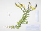
1578
|
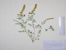
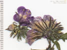
Field identification: Sphaeralcea ambigua.
Sphaeralcea ambigua A. Gray var. ambigua. Apricot Mallow.
Shadow Valley, San Bernardino County, California. Along Kingston Road, 17.2 miles north of US Interstate 15 on Kingston Road, and 4.6 miles northeast of the intersection of Kingston Road and Excelsior Mine Road. 35.6738°N, 115.7079°W. WGS 1984 Elev. 1127 m. Collected with Coll. No. 1577, Salvia dorrii.
Coll. No. 1578, 18 April 2017, characters observed:
Perennial herb, to 50 cm.;
Hairs, stellate;
Bractlets, #2-3;
Calyx, 10 mm., fused at base;
Flower,
17 mm. × 28 mm wide,
showy,
orange, fading pink;
Anthers, near top of filament tube,
not organized in concentric series, i.e., not Sidalcea
Stigmas, head-like;
Fruit, separate segments;
Seeds, seeds per segment unknown.
Fruit needed to key to genus from family, not available in this collection.
Also with stellate hairs: some Brassicaceae, and Elaeagnus angustifolia “Russian Olive.”
| |
|
1579
|
Field identification: unknown, white flower.
Lepidium fremontii S. Watson. Desert Pepperweed.
Mesquite Mountains, San Bernardino County, California. 19.6 miles north of US Interstate 15 on Kingston Road, then 1.1 miles west on an unnamed cherry stem road into the North Mesquite Mountains Wilderness (road is 1.3 miles north of Wilson Pass). 35.7087°N, 115.716°W. WGS 1984 Elev. 1162 m. Location of my collections Coll. No. 1579 to 1590.
| |
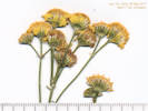
|
1580
|
Field identification: little yellow composite.
Eriophyllum wallacei (A. Gray) A. Gray. Woolly Easter Bonnets.
Mesquite Mountains, San Bernardino County, California. 19.6 miles north of US Interstate 15 on Kingston Road, then 1.1 miles west on an unnamed cherry stem road into the North Mesquite Mountains Wilderness (road is 1.3 miles north of Wilson Pass). 35.7088°N, 115.716°W. WGS 1984 Elev. 1157 m. Location of my collections Coll. No. 1579 to 1590.
| |
Other articles:
• Kingston Road:
at cherry stem;
 Coll. No. 1581, Ericameria linearifolia Coll. No. 1581, Ericameria linearifolia
|
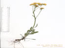
1581
|
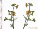
Field identification: Ericameria sp.
Ericameria linearifolia (DC.) Urb. & J. Wussow. Narrowleaf Goldenbush.
Mesquite Mountains, San Bernardino County, California. 19.6 miles north of US Interstate 15 on Kingston Road, then 1.1 miles west on an unnamed cherry stem road into the North Mesquite Mountains Wilderness (road is 1.3 miles north of Wilson Pass). 35.7087°N, 115.716°W. WGS 1984 Elev. 1155 m. Location of my collections Coll. No. 1579 to 1590.
Coll. No. 1581, 18 April 2017, characters observed:
Low-growing perennial subshrub, to 15 cm.,
woody at base;
Twigs, green-striate, glandular-punctate,
becoming white-scaly with age;
Leaves,
alternate,
subsessile,
20 mm. × 2 mm. wide,
margins rolled,
glandular punctate, few white hairs,
becoming white-scaly in age;
Inflorescence, heads borne singly;
Involucre, 10 mm. × 15 mm wide;
Phyllaries, 2+ series, graduated,
6-10 mm. × 1.5-1.8 mm wide,
base thick,
center green, mid-vein prominent,
short-stalked glandular,
margin variously chartaceous entire to irregularly small-toothed;
Receptacle, epaleate;
Pappus, 1 series of bristles, 6 mm.;
Rays,
fertile,
#6-8,
tube 5 mm. + blade 12 mm. × 3.6 mm. wide, yellow;
Disc flowers, #18-20, yellow;
Style, stigma 0.7 mm., appendage 1.0 mm.;
Cypsela, 4 mm., hairy.
The phyllaries of this collection vary from the Jepson (2012) key and description by virtue of being graduated in size and much variation in the phyllary margins.
I don't see any reason to think this might be a hybrid with E. cooperi.
| |
Other articles:
• Kingston Road:
at cherry stem;
 Coll. No. 1582, Eremogone macradenia var. macradenia Coll. No. 1582, Eremogone macradenia var. macradenia
|
1582
|
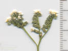
Field identification: Arenaria sp.
Eremogone macradenia (S. Watson) Ikonn. var. macradenia. Desert Sandwort.
Mesquite Mountains, San Bernardino County, California. 19.6 miles north of US Interstate 15 on Kingston Road, then 1.1 miles west on an unnamed cherry stem road into the North Mesquite Mountains Wilderness (road is 1.3 miles north of Wilson Pass). 35.7087°N, 115.7161°W. WGS 1984 Elev. 1163 m. Location of my collections Coll. No. 1579 to 1590.
Coll. No. 1582, 18 April 2017, characters observed:
Perennial herb, to 22 cm.;
Leaves,
opposite,
ascending,
12 mm. × 1 mm. wide,
widest at base, tapered throughout length,
tip sharp-pointed;
Inflorescence, open cyme;
Sepals, acute (barely acuminate),
6 mm. × 2 mm. wide.
Stem and leaves short relative to
typical descriptions, but not likely to
be E. kingii var. glabrescens.
| |
Other articles:
• Kingston Road:
at cherry stem;
 Coll. No. 1583, Xylorhiza tortifolia Coll. No. 1583, Xylorhiza tortifolia
|
1583
|
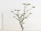
Field identification: Xylorhiza tortifolia
Xylorhiza tortifolia (Torr. & A. Gray) Greene var. tortifolia. Mojave Woody Aster.
Mesquite Mountains, San Bernardino County, California. 19.6 miles north of US Interstate 15 on Kingston Road, then 1.1 miles west on an unnamed cherry stem road into the North Mesquite Mountains Wilderness (road is 1.3 miles north of Wilson Pass). 35.7086°N, 115.7161°W. WGS 1984 Elev. 1170 m. Location of my collections Coll. No. 1579 to 1590.
| |
Other articles:
• Kingston Road:
at cherry stem;
 Coll. No. 1584, Chylismia claviformis Coll. No. 1584, Chylismia claviformis
|
1584
|
Field identification: Camissonia sp.
Chylismia claviformis (Torr. & Frém.) A. A. Heller. Browneyes.
Mesquite Mountains, San Bernardino County, California. 19.6 miles north of US Interstate 15 on Kingston Road, then 1.1 miles west on an unnamed cherry stem road into the North Mesquite Mountains Wilderness (road is 1.3 miles north of Wilson Pass). 35.7086°N, 115.7163°W. WGS 1984 Elev. 1160 m. Location of my collections Coll. No. 1579 to 1590. Very similar to my Coll. No. 447 (UCR241432) which has been determined Chylismia claviformis × brevipes.
| |
Other articles:
• Kingston Road:
at cherry stem;
 Coll. No. 1585, Salazaria mexicana Coll. No. 1585, Salazaria mexicana
|
1585
|
Field identification: Salazaria mexicana
Salazaria mexicana Torrey. Mexican Bladder Sage.
Mesquite Mountains, San Bernardino County, California. 19.6 miles north of US Interstate 15 on Kingston Road, then 1.1 miles west on an unnamed cherry stem road into the North Mesquite Mountains Wilderness (road is 1.3 miles north of Wilson Pass). 35.7087°N, 115.7162°W. WGS 1984 Elev. 1157 m. Location of my collections Coll. No. 1579 to 1590.
| |
Other articles:
• Kingston Road:
at cherry stem;
 Leaf of Coll. No. 1586, Phacelia vallis-mortae Leaf of Coll. No. 1586, Phacelia vallis-mortae
 Inflorescence of Coll. No. 1586, Phacelia vallis-mortae Inflorescence of Coll. No. 1586, Phacelia vallis-mortae
|
1586
|
Field identification: Phacelia sp.
Phacelia vallis-mortae J. W. Voss. Death Valley Phacelia.
Mesquite Mountains, San Bernardino County, California. 19.6 miles north of US Interstate 15 on Kingston Road, then 1.1 miles west on an unnamed cherry stem road into the North Mesquite Mountains Wilderness (road is 1.3 miles north of Wilson Pass). 35.7087°N, 115.7159°W. WGS 1984 Elev. 1162 m. Location of my collections Coll. No. 1579 to 1590.
| |
Other articles:
• Kingston Road:
at cherry stem;
 Inflorescence of Coll. No. 1587, Pholistoma membranaceum Inflorescence of Coll. No. 1587, Pholistoma membranaceum
|
1587
|
Field identification: Other stuff, maybe a Galium sp.
Pholistoma membranaceum (Benth.) Constance. White Fiestaflower.
Mesquite Mountains, San Bernardino County, California. 19.6 miles north of US Interstate 15 on Kingston Road, then 1.1 miles west on an unnamed cherry stem road into the North Mesquite Mountains Wilderness (road is 1.3 miles north of Wilson Pass). 35.7087°N, 115.7159°W. WGS 1984 Elev. 1162 m. Location of my collections Coll. No. 1579 to 1590.
Coll. No. 1587, 18 April 2017, characters observed:
Annual,
to 40 cm.,
sparsely prickly throughout;
Stem, weak, tangled
(reminiscent of a Galium);
Leaf,
alternate,
petiole winged,
30 mm. × 30 mm. wide,
tip rounded,
most with 2 pinnate lobes ±= tip,
some with 2nd pair of pinnate lobes;
Inflorescence, open cyme;
Calyx,
lobes, #5,
1.5 mm. × 1 mm. wide;
Corolla,
petals #5,
united at base 1.5 mm. + lobes 1.5 mm.,
white;
Stamens, #5;
Style, #1, 2-lobed distally;
Fruit,
3 mm. × 3 mm. wide,
sparsely prickly.
| |
Other articles:
• Kingston Road:
at cherry stem;
 Inflorescence of Coll. No. 1588, Cryptantha utahensis Inflorescence of Coll. No. 1588, Cryptantha utahensis
 Coll. No. 1588, Cryptantha utahensis Coll. No. 1588, Cryptantha utahensis
|
1588
|
Field identification: Plagiobothrys sp.
Cryptantha utahensis (A. Gray) Greene. Fragrant Forget-Me-Not.
Mesquite Mountains, San Bernardino County, California. 19.6 miles north of US Interstate 15 on Kingston Road, then 1.1 miles west on an unnamed cherry stem road into the North Mesquite Mountains Wilderness (road is 1.3 miles north of Wilson Pass). 35.7089°N, 115.716°W. WGS 1984 Elev. 1160 m. Location of my collections Coll. No. 1579 to 1590.
Coll. No. 1588, 18 April 2017, characters observed:
Annual, 18-25 cm.,
taller than wide,
pustulate appressed hairy throughout;
Leaves,
cauline,
alternate,
sessile,
20 mm. × 3 mm. wide,
margin entire;
Inflorescence,
not bracteate;
Pedicel, 0 mm.;
Calyx,
rounded at base,
2.7 mm. × 1.7 mm. wide, 3 mm. in fruit,
hairs straight (not hooked) throughout;
Corolla,
limb 2.6 mm.,
white;
Nutlets,
generally #1,
ventral groove central,
margin sharp but not flattened or wing-like,
papillate with few small spines.
Keyed with Simpson & Hasenstab (2009).
| |
Other articles:
• Kingston Road:
at cherry stem;
 Coll. No. 1588.5, Cryptantha or Plagiobothrys Coll. No. 1588.5, Cryptantha or Plagiobothrys
|
1588.5
|
Field identification: Boraginaceae
Undetermined, Cryptantha or Plagiobothrys sp. Borage Family.
Mesquite Mountains, San Bernardino County, California. 19.6 miles north of US Interstate 15 on Kingston Road, then 1.1 miles west on an unnamed cherry stem road into the North Mesquite Mountains Wilderness (road is 1.3 miles north of Wilson Pass). 35.7089°N, 115.716°W. WGS 1984 Elev. 1160 m. Location of my collections Coll. No. 1579 to 1590.
Coll. No. 1588.5, 18 April 2017, characters observed:
Annual, to 20 cm.;
Stem,
decumbent to ascending,
stiff white hairy;
Leaves,
cauline,
alternate,
75 mm. × 17 mm. wide,
reduced above,
elliptical,
entire,
pustular white hairy;
Corolla,
tubular,
9 mm. × 5.5 mm. wide,
yellow;
Ovary,
deep-lobed, style base hidden within lobes;
Nutlets,
±erect,
but otherwise immature and characters indistinct.
| |
Other articles:
• Kingston Road:
at cherry stem;
 Coll. No. 1589, Bromus madritensis ssp. rubens Coll. No. 1589, Bromus madritensis ssp. rubens
|
1589
|
Field identification: Red brome.
Bromus madritensis L. ssp. rubens (L.) Husn. Red Brome.
Mesquite Mountains, San Bernardino County, California. 19.6 miles north of US Interstate 15 on Kingston Road, then 1.1 miles west on an unnamed cherry stem road into the North Mesquite Mountains Wilderness (road is 1.3 miles north of Wilson Pass). 35.7087°N, 115.7161°W. WGS 1984 Elev. 1163 m. Location of my collections Coll. No. 1579 to 1590.
Coll. No. 1589, 18 April 2017, characters observed:
Annual grass, to 25 cm.,
soft hairy throughout;
Sheath (... looks open to me ...)
Ligule,
membraneous, 4 mm., laciniate;
Inflorescence,
panicle;
Compression,
lateral;
Spikelets,
1 per node,
27 mm.,
axis mostly glabrous;
Glumes,
lower, 7 mm.,
upper, 9 mm., veins 5, keeled (IMHO);
Florets, #4-6;
Lemma,
13 mm., veins 3, tip bifid,
awn, #1, 9 mm., attached to back;
Palea,
9 mm., margin ciliate;
Grain, 8 mm., flattened, brown.
| |
|
1590
|
Field identification: Mentzelia, sprawling, weak stem.
Mentzelia cf. M. nitens Greene. Shining Blazing Star.
Mesquite Mountains, San Bernardino County, California. 19.6 miles north of US Interstate 15 on Kingston Road, then 1.1 miles west on an unnamed cherry stem road into the North Mesquite Mountains Wilderness (road is 1.3 miles north of Wilson Pass). 35.7088°N, 115.716°W. WGS 1984 Elev. 1160 m. Sprawling, weak stem. Location of my collections Coll. No. 1579 to 1590.
Coll. No. 1590, 18 April 2017, characters observed:
Annual, to 40 cm.;
Stem,
weak, sprawling;
Leaves,
95 mm. × 37 mm. wide, lanceolate, pinnately lobed below,
reduced, entire above;
Bracts, green, entire;
Sepals, 5 mm. × 1.5 mm., wide, green fading yellow;
Petals, 8.5-9.0 mm., obovate, yellow;
Style, 5 mm.;
Fruit,
25-29 mm. × 1.5-2.5 mm., obconic, immature;
Seed, immature.
Petals are larger than expected for M. albiaculis. Sepals, style small. Bract too wide for M. jonesii. Also considered and rejected: M. obscura, M. oreophila, and M. polita. Otherwise seed immature and unavailable for keying.
| |
Other articles:
• Kingston Road:
34000;
Locations:
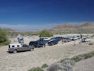
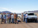
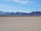
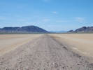
Mesquite Lake.
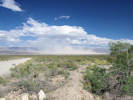 Dust blown off the surface of Mesquite Lake. Dust blown off the surface of Mesquite Lake.
|
|
Very windy today. Dust being blown off the surface of Mesquite Lake.
| |
|
|
Wednesday, April 19th
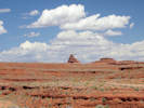
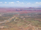
Las Vegas, Nevada to Monument Valley, Arizona.
| |
Other articles:
• US Highway Alternate 89:
at hiway pullout;
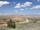 View of Shinarump Cliffs from US Highway 89A View of Shinarump Cliffs from US Highway 89A
 View of Shinarump Cliffs and Muggins Flat from US Highway 89A View of Shinarump Cliffs and Muggins Flat from US Highway 89A
|
|
Crowbar Point above Johnson Run.
| |
Other articles:
• US Highway Alternate 89:
at scenic view;
Locations:
House Rock.
House Rock Valley.
Vermilion Cliffs.
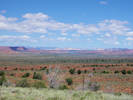
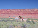
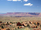
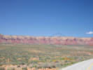
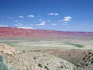 Vermilion Cliffs and House Rock Valley. Vermilion Cliffs and House Rock Valley.
|
|
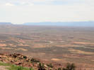
House Rock Valley Scenic View.
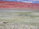
House Rock and ranch. |
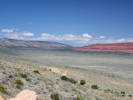
Coyote Valley between Buckskin Mountain on the left (west) and the Paria Plateau on the right (east). |
| |
Other articles:
• US Highway Alternate 89:
at House Rock;
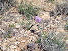 Calochortus flexuosus at House Rock Calochortus flexuosus at House Rock
|
|
House Rock. No sign of any rock that looks like a house, or could provide shelter.
We did find many of this pretty Calochortus, probably C. flexuosus along the road.
| |
Other articles:
• US Highway Alternate 89:
at Buffalo Rch Rd;
 Interpretive panel at Buffalo Ranch Road. Interpretive panel at Buffalo Ranch Road.
|
|
Wildlife Kiosk Interpretive Site.
| |
Other articles:
• US Highway Alternate 89:
near Marble Canyon;
Locations:
Vermilion Cliffs.
 Vermilion Cliffs beside US Highway 89A (Smart Phone). Vermilion Cliffs beside US Highway 89A (Smart Phone).
|
|
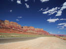
Vermilion Cliffs beside US Highway 89A (Digital SLR). |
| |
Other articles:
• US Highway Alternate 89:
Navajo Bridge;
Locations:
Navajo Bridge.
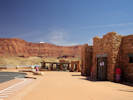 Visitor Center for Navajo Bridge. Visitor Center for Navajo Bridge.
|
|
Navajo Bridge
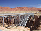
The old bridge (now pedestrian access only) at Navajo Bridge. |
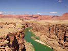
Colorado River upstream of the Navajo Bridge. |
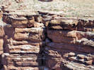
Male of condor pair incubates egg while mate is out hunting. |
| |
Other articles:
• U. S. Hwy 89:
at scenic view;
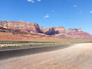
 Marble Canyon and Vermilion Cliffs. Marble Canyon and Vermilion Cliffs.
 Bitter Springs from the scenic viewpoint. Bitter Springs from the scenic viewpoint.
|
|
Scenic View of Marble Canyon and Vermilion Cliffs.
| |
|
|
Thursday, April 20th
| |
Other articles:
• US Highway 163:
in Monument Valley;
Locations:
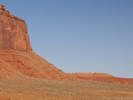
Monument Valley.
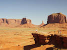 John Ford Point. John Ford Point.
|
|
Tour of Monument Valley.
The View Hotel at Monument Valley. |
Blackbrush (Coleogyne ramosissima) in bloom at Monument Valley. |
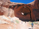
Egg Arch in Monument Valley |
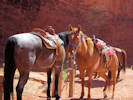
“Diablo,” the Navajo horse. |
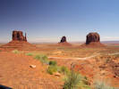
East and West Mitten, and Merrick Butte; the view from our hotel room. |
| |
Other articles:
• US Highway 163:
at the rock;
edge of town;
Locations:
Mexican Hat Rock.
 Mexican Hat Rock, from the edge of town. Mexican Hat Rock, from the edge of town.
|
|
Mexican Hat Rock.
Mexican Hat Rock, just north of the town of Mexican Hat. |
| |
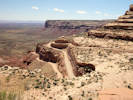
Other articles:
• Utah Highway 261:
near top;
about 2/3;
near US Hwy 163;
Locations:
Moki Dugway.
Valley of the Gods.
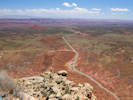
 Cedar Mesa above Valley of the Gods, Moki Dugway circled. Cedar Mesa above Valley of the Gods, Moki Dugway circled.
|
|
Ascent and descent of the Moki Dugway.
Valley of the Gods from Cedar Mesa at the top of the Moki Dugway |
Valley of the Gods from the Moki Dugway. |
About 2/3 of the way to the top. |
| |
Other articles:
• US Highway 163:
at San Juan R;
Locations:
San Juan River.
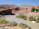 San Juan River in Mexican Hat. San Juan River in Mexican Hat.
|
|
| |
|
|
Friday, April 21st
| |
Other articles:
• Colorado State Highway 184:
Anasazi Heritage Center;
Locations:
Mesa Verde.
Sleeping Ute Mountain.
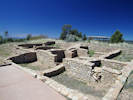
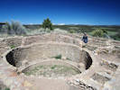 Anasazi pueblo. Anasazi pueblo.
|
|
Anasazi Heritage Center.
Anasazi pueblo. |
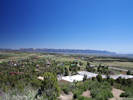
Mesa Verde from Anasazi Heritage Center. |
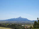
Sleeping Ute Mountain from the Anasazi Heritage Center. |
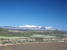
San Juan Mountains from Anasazi Heritage Center. |
| |
Other articles:
• US Highway 160:
Pagosa Springs;
Locations:
Pagosa Springs.
|
|
Spent this night in Pagosa Springs.
| |
|
|
Saturday, April 22nd
| |
|
|
May, 2017
| |
|
|
Tuesday, May 2nd
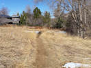
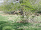
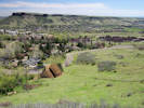
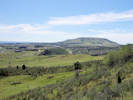
North Washington Open Space. Schweich Hill
| |
Locations:
Schweich Hill.
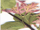
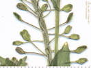
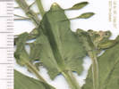
 Coll. No. 1591, Lonicera tatarica Coll. No. 1591, Lonicera tatarica
 Coll. No. 1591, Lonicera tatarica Coll. No. 1591, Lonicera tatarica
|
1591
|
Field Identification: unknown, woody perennial, garden escapee, maybe Caprifoliaceae, same as Coll. No. 1705.
Lonicera tatarica L. Tatarian Honeysuckle.
North Washington Open Space, Jefferson County, Colorado. Small (4 acre) fallow city-owned parcel in northern Golden, near the intersection of Colorado Hughway 93 and Washington Avenue. Several plants near the east end of the parcel, close to North Ford Street. 39.7688°N, 105.2313°W. Elev. 1795 m. Attractive upright shrub, pink flowers. Probable garden escapee.
Coll. No. 1591, 2 May 2017, characters observed:
Shrub to small tree, 2 m.;
Leaves,
opposite,
24 mm. × 17 mm. wide, simple, entire,
petiole, 1.5 mm.;
Peduncle,
10-13 mm.;
Flowers,
in pairs, subtended by bracts, bisexual;
Bracts,
small, at base of calyx;
Calyx,
tube 2.0 mm. + lobes 0.5-1.0 mm.;
Corolla,
tube 12.5 mm. + lobes 12 mm.,
pink, hairy inside;
Ovary,
inferior;
Stamens,
#5, exserted, versatile;
Style,
#1, exserted, hairy;
Stigma,
capitate.
Disturbed places,
native to Siberia,
sporadic escapee from cultivation,
berries possibly toxic.
| |
Locations:
Schweich Hill.
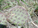 Obs. No. 1540, Opuntia macrorhiza Obs. No. 1540, Opuntia macrorhiza
|
|
Field identification: Lithospermum incisum.
| |
Locations:
Schweich Hill.
Obs. No. 1540, Opuntia macrorhiza
|
|
Field identification: Opuntia, probably O. macrorhiza.
| |
|
1592
|
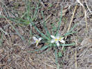
Field identification: Leucocrinum montanum.
Leucocrinum montanum Nutt. ex A. Gray. Star Lily.
North Washington Open Space, Jefferson County, Colorado. Small (4 acre) fallow city-owned parcel in northern Golden, near the intersection of Colorado Hughway 93 and Washington Avenue. At the top of the hill with Opuntia, Commandra, Castilleja, and Linaria. 39.7687°N, 105.2334°W. WGS 1984 Elev. 1810 m.
| |
Locations:
Schweich Hill.
 Habitat of Coll. No. 1593, Viola nuttallii Habitat of Coll. No. 1593, Viola nuttallii
|
1593
|
Field identification: Viola nuttallii.
Viola nuttallii Pursh. Nuttall's Violet.
North Washington Open Space, Jefferson County, Colorado. Small (4 acre) fallow city-owned parcel in northern Golden, near the intersection of Colorado Highway 93 and Washington Avenue. On the west slope, near top of hill. 39.7685°N, 105.2335°W. WGS 1984 Elev. 1819 m.
| |
|
1594
|
Field identification: Colutea arborescens
Colutea arborescens L. Bladder Senna.
North Washington Open Space, Jefferson County, Colorado. Small (4 acre) fallow city-owned parcel in northern Golden, near the intersection of Colorado Highway 93 and Washington Avenue. North-central area near fence with neighbor's discarded yard waste. 39.7688°N, 105.2327°W. WGS 1984 Elev. 1810 m.
| |
Literature Cited:
- Nazaire, Mare, and Larry Hufford, 2012.
 Interior of flower of Coll. No. 1595, Mertensia lanceolata Interior of flower of Coll. No. 1595, Mertensia lanceolata
|
1595
|
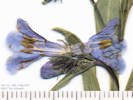
Field identification: Mertensia lanceolata.
Mertensia lanceolata (Pursh) DC. Prairie Bluebells.
North Washington Open Space, Jefferson County, Colorado. Small (4 acre) fallow city-owned parcel in northern Golden, near the intersection of Colorado Highway 93 and Washington Avenue. North-central portion of open space on northeast slopes. 39.7687°N, 105.2328°W. WGS 1984 Elev. 1812 m.
The associated image is intended to show that the filaments are as long as the anthers and attached near the throat of the corolla tube at the level of the fornices, and there is a ring of hairs at the base of the corolla tube.
| |
|
1596
|
Field identification: Muscari botryoides.
Muscari botryoides (L.) Mill. Common Grape Hyacinth.
North Washington Open Space, Jefferson County, Colorado. Small (4 acre) fallow city-owned parcel in northern Golden, near the intersection of Colorado Highway 93 and Washington Avenue. North-central area, near neighbor's fences. 39.7688°N, 105.2328°W. WGS 1984 Elev. 1811 m.
| |
|
|
Thursday, May 5th
Ranson/Edwards Homestead Open Space
| |
|
1597
|
Field identification: Alyssum simplex.
Alyssum simplex Rudolphi. European Madwort.
Ranson/Edwards Homestead Open Space Park, Jefferson County, Colorado. High plains above Rocky Flats, 1.7 miles west on Colorado Highway 72 from Colorado Highway 93, then 0.9 miles north on Plain View Road, to an old ranch road. Roadside and among short grasses, older terrace of Coal Creek. 39.8843°N, 105.2612°W. WGS 1984 Elev. 1910 m. Some sepals persistent and some filaments winged.
|
 Coll. No. 1598, Prunus americana Coll. No. 1598, Prunus americana
 Coll. No. 1598, Prunus americana Coll. No. 1598, Prunus americana
|
1598
|
Field identification: Prunus americana.
Prunus americana Marshall. American Plum.
Ranson/Edwards Homestead Open Space Park, Jefferson County, Colorado. High plains above Rocky Flats, 1.7 miles west on Colorado Highway 72 from Colorado Highway 93, 0.9 miles north on Plainview Road, then 300 meters east on an old ranch road to the lower terrace of Coal Creek. 39.8839°N, 105.2588°W. WGS 1984 Elev. 1925 m. Blooms first, then leafs out, white flowers.
| |
|
1599
|
Field identification: Brassicaceae, annual, glabrous.
| |
|
|
Monday, May 8th
| |
Other articles:
• Social Trail:
along trail;
Locations:
North Table Mountain Park.
 Coluber constrictor mormon “Western yellow-bellied racer” on North Table Mountain Coluber constrictor mormon “Western yellow-bellied racer” on North Table Mountain
|
|
North Table Mountain, by way of social trail at Easley Road and Hwy 58, to the top of the mesa on North Table Loop.
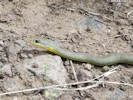
Coluber constrictor mormon “Western yellow-bellied racer” on North Table Mountain |
| |
|
|
Lithospermum incisum, one plant seen beside game trail.
| |
Other articles:
• Golden Checklist Flora:
Cynoglossum officinale;
 Obs. No. 1552, Cynoglossum officinale Obs. No. 1552, Cynoglossum officinale
 Obs. No. 1552, Cynoglossum officinale Obs. No. 1552, Cynoglossum officinale
|
|
Field identification: Cynoglossum officinale L. Gypsyflower.
| |
Other articles:
• North Table Loop:
below rim;
 Obs. No. 1553, Escobaria vivipara Obs. No. 1553, Escobaria vivipara
|
|
Field identification: Escobaria vivipara
| |
|
1600
|
Field identification: Parthenocissus quinquefolia, Virginia Creeper.
Parthenocissus quinquefolia (L.) Planch. Virginia Creeper.
North Table Mountain Park, Jefferson County, Colorado. Unnamed canyon on south side of North Table Mountain, 1.8 km. north northwest of the GNIS location of Golden. In the creek bed below North Table Loop trail. 39.7704°N, 105.2125°W. WGS 1984 Elev. 1844 m. Current year tendrils undeveloped, previous year tendrils appear to have adhesive pads.
| |
|
1601
|
Field identification: Galium aparine.
Galium aparine L. Sticky Willy, Cleavers.
North Table Mountain Park, Jefferson County, Colorado. Unnamed canyon on south side of North Table Mountain, 1.8 km. north northwest of the GNIS location of Golden. In the creek bed below North Table Loop trail. 39.7705°N, 105.2127°W. WGS 1984 Elev. 1859 m. Annual, cotyledons still attached. Four petals, white.
| |
Other articles:
• North Table Loop:
near creek;
|
1602
|
Field identification: Eleocharis, maybe E. palustris.
Eleocharis R. Br. Spikerush.
North Table Mountain Park, Jefferson County, Colorado. Southern portion of North Table Mountain just above a break in slope above an unnamed canyon draining into Clear Creek, 1.85 km. north northeast of the GNIS location of Golden. 39.7716°N, 105.215°W. WGS 1984 Elev. 1920 m. Running water.
| |
Other articles:
• North Table Loop:
near creek;
|
1602.1
|
Field identification: Veronica, maybe V. arvensis.
Veronica arvensis L. Corn Speedwell.
North Table Mountain Park, Jefferson County, Colorado. Southern portion of North Table Mountain just above a break in slope above an unnamed canyon draining into Clear Creek, 1.85 km. north northeast of the GNIS location of Golden. 39.7716°N, 105.215°W. WGS 1984 Elev. 1920 m. See also my collection 1344, 13 May 2016, at the same location.
Coll. No. 1602.1, 8 May 2017, characters observed:
Annual, 12 cm.,
growing in standing water;
Stem,
erect,
some branched at base and decumbent to ascending,
unevenly spreading multicellular hairy;
Leaves,
cauline,
opposite,
10 mm. × 7 mm. wide,
ovate,
margin serrate,
appressed hairy;
Inflorescence,
elongated terminal raceme;
Pedicels,
1.0-1.2 mm.;
Corolla,
limb 3 mm.;
Petals,
2 mm. × 1.5 mm. wide,
color blue;
Style,
0.5 mm., < notch;
Fruit,
3.5 mm. × 3.2 mm wide,
notch, 0.7 mm.,
margin glandular hairy.
| |
|
|
Saturday, May 13th
| |
Locations:
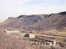
Colorado School of Mines Survey Field.
Windy Saddle Park.
 Colorado School of Mines Survey Field from the northwest corver. Colorado School of Mines Survey Field from the northwest corver.
 Colorado School of Mines Survey Field from the northwest corver. Colorado School of Mines Survey Field from the northwest corver.
|
|
Colorado School of Mines and lowest Windy Saddle Park.
| |
Letters:
Thursday, July 25, 2019.
|
1603
|
Field identification: Lithospermum incisum.
Mertensia lanceolata (Pursh) DC. Prairie Bluebells.
Colorado School of Mines Survey Field, Jefferson County, Colorado. High plains at the lowest slopes of Lookout Mountain, northwest corner of the Survey Field, near Lookout Mountain Road, 1.90 km. southwest of the GNIS location of Golden. 39.7396°N, 105.229°W. WGS 1984 Elev. 1873 m. Uncommon but widespread, many have broken stems from snow earlier in week. North bank of gulch.
Revised label sent to Tim Hogan at COLO.
|
Native and Naturalized Flora of the Golden Area, Jefferson County, Colorado
Boraginaceae
Lithospermum incisum Lehm.
Narrowleaf Stoneseed.
Colorado School of Mines Survey Field, Jefferson County, Colorado.
High plains at the lowest slopes of Lookout Mountain, northwest corner of the Survey Field, near Lookout Mountain Road, 1.90 km. southwest of the GNIS location of Golden.
39.7396°N, 105.229°W.
WGS 1984
Elev. 1873 m.
Uncommon but widespread, many have broken stems from snow earlier in week. North bank of gulch.
Collected by permit: Colorado School of Mines, 2017, issued: Apr 1, 2017, to: Tom Schweich.
|
Tom Schweich
1603. |
13-May-2017 |
|
| |
|
1604
|
Field identification: Rubus deliciousus.
Rubus deliciosus Torr. Delicious raspberry.
Colorado School of Mines Survey Field, Jefferson County, Colorado. Northwest corner of the Survey Field, near Lookout Mountain Road, 1.9 km. southwest of the GNIS location of Golden. 39.7397°N, 105.2296°W. WGS 1984 Elev. 1870 m. Growing with Ribes cereum.
| |
|
1605
|
Field identification: Ribes cereum.
Ribes cereum Douglas. Wax Currant.
Colorado School of Mines Survey Field, Jefferson County, Colorado. Northwest corner of the Survey Field, near Lookout Mountain Road, 1.9 km. southwest of the GNIS location of Golden. 39.7394°N, 105.2297°W. WGS 1984 Elev. 1874 m. Growing with Rubus deliciosus.
|
|
1606
|
Field identification:Juniperus communis.
Juniperus communis L. var. depressa. Common Juniper.
Colorado School of Mines Survey Field, Jefferson County, Colorado. High plains at the lowest slopes of Lookout Mountain, northwest corner of the Survey Field, near Lookout Mountain Road, 1.95 km. southwest of the GNIS location of Golden. 39.7392°N, 105.2297°W. WGS 1984 Elev. 1880 m. Shoulder of small gulch.
| |
Other articles:
• Golden Checklist Flora:
Lepidium campestre;
 Fruit of Coll. No. 1607, Lepidium campestre Fruit of Coll. No. 1607, Lepidium campestre
 Auriculate leaf of Coll. No. 1607, Lepidium campestre Auriculate leaf of Coll. No. 1607, Lepidium campestre
|
1607
|
Field identification: Brassicaceae.
Lepidium campestre (L.) W. T. Aiton. Field Pepperweed.
Colorado School of Mines Survey Field, Jefferson County, Colorado. High plains at the lowest slopes of Lookout Mountain, northwest corner of the Survey Field, near Lookout Mountain Road, 1.95 km. southwest of the GNIS location of Golden. 39.7392°N, 105.2296°W. WGS 1984 Elev. 1879 m. Annual, small white flowers.
Growing at edges of Juniperus communis.
| |
Literature Cited:
- Nazaire, Mare, and Larry Hufford, 2012.
|
1608
|
Field identification: Mertensia lanceolata.
Mertensia lanceolata (Pursh) DC. Prairie Bluebells.
Colorado School of Mines Survey Field, Jefferson County, Colorado. High plains at the lowest slopes of Lookout Mountain, northwest corner of the Survey Field, near Lookout Mountain Road, 1.95 km. southwest of the GNIS location of Golden. 39.7392°N, 105.2299°W. WGS 1984 Elev. 1877 m.
| |
|
1609
|
Field identification: Prunus virginiana.
Prunus virginiana L. Chokecherry.
Colorado School of Mines Survey Field, Jefferson County, Colorado. High plains at the lowest slopes of Lookout Mountain, northwest corner of the Survey Field, near Lookout Mountain Road, 1.95 km. southwest of the GNIS location of Golden. 39.7391°N, 105.2301°W. WGS 1984 Elev. 1887 m. Small, heavily browsed shrubs. North bank of gulch.
| |
|
1610
|
Field identification: Cerastium arvense L. ssp. strictum Gaudin
Cerastium arvense L. ssp. strictum Gaudin. Field Chickweed.
Windy Saddle Park, Jefferson County, Colorado. Lowest slopes of Lookout Mountain, just above highest plains, western edge of Windy Saddle Park, near Lookout Mountain Road, 1.95 km. southwest of the GNIS location of Golden. 39.7393°N, 105.2321°W. WGS 1984 Elev. 1917 m.
| |
|
|
Monday, May 15th
| |
Other articles:
• Social Trail (N. Ford to Jackson):
n. e. corner;
• Social Trail (N. Wash. OS):
near top;
Locations:
Schweich Hill.
 Area mowed by neighbors in the public open space. Area mowed by neighbors in the public open space.
|
|
North Washington Open Space Schweich Hill
High density of Echinocereus viridiflorus |
| |
Other articles:
• Social Trail (N. Wash. OS):
at tree;
 Coll. No. 1611, Prunus virginiana, below an, as yet, unidentified small tree. Coll. No. 1611, Prunus virginiana, below an, as yet, unidentified small tree.
|
1611
|
Field identification: Prunus virginiana.
Prunus virginiana L. Chokecherry.
North Washington Open Space, Jefferson County, Colorado. Small (4 acre) fallow city-owned parcel in northern Golden, near the intersection of Colorado Highway 93 and Washington Avenue, 1.75 km. northwest of the GNIS location of Golden. 39.7684°N, 105.2328°W. WGS 1984 Elev. 1816 m. Shrubs below an undetermined small tree, probably a hackberry, per the leaf galls.
| |
|
1612
|
Field identification: Erigeron, probably not E. flagillaris.
Erigeron tracyi Greene. Running Fleabane.
North Washington Open Space, Jefferson County, Colorado. Small (4 acre) fallow city-owned parcel in northern Golden, near the intersection of Colorado Highway 93 and Washington Avenue, 1.75 km. northwest of the GNIS location of Golden. 39.7684°N, 105.2328°W. WGS 1984 Elev. 1817 m. South side of hill, near the informal bench.
| |
|
1613
|
Field identification: Alyssum simplex.
Alyssum simplex Rudolphi. European Madwort.
North Washington Open Space, Jefferson County, Colorado. Small (4 acre) fallow city-owned parcel in northern Golden, near the intersection of Colorado Highway 93 and Washington Avenue, 1.75 km. northwest of the GNIS location of Golden. 39.7686°N, 105.2327°W. WGS 1984 Elev. 1818 m. East-facing slope.
| |
Other articles:
• Golden Checklist Flora:
251140;
Notes on Castilleja integra;
• Social Trail (N. Wash. OS):
near top;
 Coll. No. 1614, Castilleja integra, along the top of the North Washington Open Space. Coll. No. 1614, Castilleja integra, along the top of the North Washington Open Space.
|
1614
|
Field identification: Castilleja, likely C. integra.
Castilleja integra A. Gray. Wholeleaf Indian Paintbrush.
North Washington Open Space, Jefferson County, Colorado. Small (4 acre) fallow city-owned parcel in northern Golden, near the intersection of Colorado Highway 93 and Washington Avenue, 1.75 km. northwest of the GNIS location of Golden. 39.7686°N, 105.2328°W. WGS 1984 Elev. 1818 m. Top of hill in the remnant short-grass prairie found there.
Bracts, 31 mm. × 7 mm. wide, entire or lobed near tip, lowest green, becoming increasingly red-orange from distal end of bractm and toward the distal inflorescence.
| |
|
1615
|
Field identification: Oxytropis lambertii.
Oxytropis lambertii Pursh. Purple Locoweed.
North Washington Open Space, Jefferson County, Colorado. Small (4 acre) fallow city-owned parcel in northern Golden, near the intersection of Colorado Highway 93 and Washington Avenue, 1.75 km. northwest of the GNIS location of Golden. 39.7686°N, 105.2332°W. WGS 1984 Elev. 1820 m. Southwest slope near top of hill.
| |
|
1616
|
Field identification: Tragopogon dubius.
Tragopogon dubius Scop. Yellow Salsify.
North Washington Open Space, Jefferson County, Colorado. Small (4 acre) fallow city-owned parcel in northern Golden, near the intersection of Colorado Highway 93 and Washington Avenue, 1.75 km. northwest of the GNIS location of Golden. 39.7686°N, 105.2331°W. WGS 1984 Elev. 1817 m. Common, scattered throughout parcel; these from top of hill.
| |
|
1617
|
Field identification: Lithospermum incisum.
Lithospermum incisum Lehm. Narrowleaf Stoneseed.
North Washington Open Space, Jefferson County, Colorado. Small (4 acre) fallow city-owned parcel in northern Golden, near the intersection of Colorado Highway 93 and Washington Avenue, 1.75 km. northwest of the GNIS location of Golden. 39.7686°N, 105.233°W. WGS 1984 Elev. 1816 m. Uncommon, scattered throughout parcel; these from top of hill.
| |
|
1618
|
Field identification: Ribes cereum.
Ribes cereum Douglas. Wax Currant.
North Washington Open Space, Jefferson County, Colorado. Small (4 acre) fallow city-owned parcel in northern Golden, near the intersection of Colorado Highway 93 and Washington Avenue, 1.75 km. northwest of the GNIS location of Golden. 39.7689°N, 105.2332°W. WGS 1984 Elev. 1815 m. In a weedy area near the fence north-central portion of parcel.
| |
|
1619
|
Field identification: Prunus, maybe P. domestica.
Nope!
Prunus pensylvanica L. f. Pin Cherry.
North Washington Open Space, Jefferson County, Colorado. Small (4 acre) fallow city-owned parcel in northern Golden, near the intersection of Colorado Highway 93 and Washington Avenue, 1.75 km. northwest of the GNIS location of Golden. 39.7688°N, 105.233°W. WGS 1984 Elev. 1812 m. Near fence, north edge of parcel.
Coll. No. 1619, 15 May 2017, characters observed:
Small tree to 1.5 m.,
partially leafed out while in bloom;
Branches,
thorn-less,
peeling white, dotted;
Leaves,
simple,
25 mm. × 23 mm. wide,
ovate,
pinnately veined,
serrate,
small glands on distal edge of each tooth,
petioles, 7 mm.,
some have a pair of glands at base of leaf,
very sparse short hairs;
Inflorescence,
flowers in clusters of #5±;
Hypanthium,
3.5 mm × 3 mm. wide;
Sepals, 1.5 mm., glabrous;
Petals, 4.5 mm, white;
Stamens, many, #25±;
Styles, #1.
| |
|
1620
|
Field identification: Comandra umbellata.
Comandra umbellata (L.) Nutt. ssp. pallida (A. DC.) Piehl. Pale Bastard Toadflax.
North Washington Open Space, Jefferson County, Colorado. Small (4 acre) fallow city-owned parcel in northern Golden, near the intersection of Colorado Highway 93 and Washington Avenue, 1.75 km. northwest of the GNIS location of Golden. 39.7688°N, 105.2336°W. WGS 1984 Elev. 1816 m. Uncommon, but widespread where not crowded out by invasive exotics.
| |
|
1621
|
Field identification: Astragalus drummondii.
Astragalus drummondii Dougl. ex Hook. Drummond's Milkvetch.
North Washington Open Space, Jefferson County, Colorado. Small (4 acre) fallow city-owned parcel in northern Golden, near the intersection of Colorado Highway 93 and Washington Avenue, 1.75 km. northwest of the GNIS location of Golden. 39.7686°N, 105.2339°W. WGS 1984 Elev. 1811 m. Western portion, southwest slope. Expected because it is native to Golden, but collected in an area possibly revegetated following adjacent home construction 2006-2007.
| |
|
1622
|
Field identification: Erodium cicutarium.
Erodium cicutarium (L.) L'Her. ex Aiton. Redstem Stork's Bill.
North Washington Open Space, Jefferson County, Colorado. Small (4 acre) fallow city-owned parcel in northern Golden, near the intersection of Colorado Highway 93 and Washington Avenue, 1.75 km. northwest of the GNIS location of Golden. 39.7686°N, 105.2339°W. WGS 1984 Elev. 1811 m. Scattered around the parcel, in areas where the native or exotic vegetation is not too thick. Colorado Noxious Weed list C.
| |
|
1623
|
Field identification: Scorzonera laciniata.
Scorzonera laciniata L. Cutleaf Vipergrass.
North Washington Open Space, Jefferson County, Colorado. Small (4 acre) fallow city-owned parcel in northern Golden, near the intersection of Colorado Highway 93 and Washington Avenue, 1.75 km. northwest of the GNIS location of Golden. 39.7687°N, 105.2339°W. WGS 1984 Elev. 1813 m. Western section of parcel, which has possibly been revegetated after adjacent home construction.
| |
|
|
Monday, May 22nd
| |
Other articles:
• Mesa Top Trail:
below switchback;
Locations:
North Table Mountain Park.
 Color variation in Tradescantia occidentalis. Color variation in Tradescantia occidentalis.
|
|
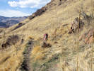
North Table Mountain, from Easley Road, Lithic Trail, North Table Loop, and old road to Mesa Top Trail.
Spray-painted graffiti on North Table Mountain. |
Small stream on east side of North Table Mountain. |
Mesa Top Trail, on east side of North Table Mountain. |
Old road on the side of North Table Mountain. |
North Table Loop from the Mesa Top Trail |
|
 Fruit of Astragalus crassicarpus Fruit of Astragalus crassicarpus
 Habitat of Astragalus crassicarpus on North Table Mountain. Habitat of Astragalus crassicarpus on North Table Mountain.
 Coll. No. 1624, Astragalus crassicarpus Coll. No. 1624, Astragalus crassicarpus
|
1624
|
Field identification: Astragalus, maybe A. crassicarpus.
Astragalus crassicarpus Nutt. Groundplum Milkvetch.
North Table Mountain Park, Jefferson County, Colorado. East side of North Table Mountain, near the Easley Road trailhead, on an old abanconed road just above North Table Loop. 39.7805°N, 105.1928°W. WGS 1984 Elev. 1787 m. In fruit, no flowers, glabrous pods, turning reddish-brown.
| |
|
1625
|
Field identification: Astragalus, flower only, no fruit.
Astragalus flexuosus G. Don. Flexible Milkvetch.
North Table Mountain Park, Jefferson County, Colorado. East side of North Table Mountain, near the Easley Road trailhead, on an old abanconed road just above North Table Loop, 3.7 km. northeast of the GNIS location of Golden. 39.7805°N, 105.1928°W. WGS 1984 Elev. 1787 m. Flower only, no fruit.
| |
|
1626
|
Field identification: grass, maybe Poa secunda.
Poa pratensis L. Kentucky Bluegrass.
North Table Mountain Park, Jefferson County, Colorado. East side of North Table Mountain, near the Easley Road trailhead, on an old abanconed road just above North Table Loop, 3.7 km. northeast of the GNIS location of Golden. 39.7805°N, 105.1927°W. WGS 1984 Elev. 1796 m. At base of southeast-facing boulder.
|
 Grassy habitat of Coll. No. 1627, Toxicoscordion paniculatum Grassy habitat of Coll. No. 1627, Toxicoscordion paniculatum
|
1627
|
Field identification: Zigadenus sp.
Zigadenus paniculatus (Nutt.) S. Watson var. gramineus (Rydb.) Ackerfield. Grassy Death Camas.
North Table Mountain Park, Jefferson County, Colorado. East side of North Table Mountain, near the Easley Road trailhead, on an old abandoned road above North Table Loop, 3.8 km. northeast of the GNIS location of Golden. 39.7834°N, 105.1961°W. WGS 1984 Elev. 1854 m. Steep, northeast slope.
|
 Coll. No. 1628, Delphinium nuttallianum Coll. No. 1628, Delphinium nuttallianum
|
1628
|
Field identification: Delphinium, likely D. nuttallianum.
Delphinium nuttallianum Pritz. Twolobe Larkspur.
North Table Mountain Park, Jefferson County, Colorado. East side of North Table Mountain, near the Easley Road trailhead, on an old abandoned road above North Table Loop, 3.8 km. northeast of the GNIS location of Golden. 39.7838°N, 105.1968°W. WGS 1984 Elev. 1852 m. One blue, one lavender, in a thicket of Prunus virginiana on a game trail.
| |
|
|
Thursday, May 25th
| |
Locations:
Colorado School of Mines Survey Field.
|
|
Southern end of Survey Field.
| |
|
1629
|
Field identification: Lithospermum incisum.
Lithospermum incisum Lehm. Narrowleaf Stoneseed.
Colorado School of Mines Survey Field, Jefferson County, Colorado. High plains below Lookout Mountain (Rocky Mountain Front Range), about 80 meters northwest of the intersection of Fox Hollow Lane with Eagle Ridge Drive, 2.5 km. south of the GNIS location of Golden. 39.733°N, 105.2184°W. WGS 1984 Elev. 1866 m. In short grass on alluvial mesa.
| |
|
1630
|
Field identification: definitely Poa, maybe P. pratensis.
Poa pratensis L. Kentucky Bluegrass.
Colorado School of Mines Survey Field, Jefferson County, Colorado. High plains below Lookout Mountain (Rocky Mountain Front Range), about 175 meters northwest of the intersection of Fox Hollow Lane with Eagle Ridge Drive, about 2.4 km. south of the GNIS location of Golden. 39.7339°N, 105.2189°W. WGS 1984 Elev. 1825 m. Among short grasses on alluvial mesa.
|
 Location of Coll. No. 1631, Scutellaria brittonii Location of Coll. No. 1631, Scutellaria brittonii
 Coll. No. 1631, Scutellaria brittonii Coll. No. 1631, Scutellaria brittonii
|
1631
|
Field identification: Scutellaria brittonii.
Scutellaria brittonii Porter. Britton's Skullcap.
Colorado School of Mines Survey Field, Jefferson County, Colorado. High plains below Lookout Mountain (Rocky Mountain Front Range), about 225 meters northwest of the intersection of Fox Hollow Lane with Eagle Ridge Drive, 2.38 km. south of the GNIS location of Golden. 39.7341°N, 105.2195°W. WGS 1984 Elev. 1818 m. Edge of borrow pit in reddish soil.
| |
|
1632
|
Field identification: Veronica, maybe V. serpyllifolia.
Veronica arvensis L. Corn Speedwell.
Colorado School of Mines Survey Field, Jefferson County, Colorado. High plains below Lookout Mountain (Rocky Mountain Front Range), about 265 meters northwest of the intersection of Fox Hollow Lane with Eagle Ridge Drive, 2.37 km. south of the GNIS location of Golden. Beside a small creek tributary to Deadman Gulch. 39.7342°N, 105.22°W. WGS 1984 Elev. 1813 m. Annual, flowers blue.
|
 Location of Coll. Nos. 1632-4. Location of Coll. Nos. 1632-4.
 Location of Coll. Nos. 1632-4. Location of Coll. Nos. 1632-4.
|
1633
|
Field identification: Brassicaceae, annual, white flowers.
Lepidium campestre (L.) W. T. Aiton. Field Pepperweed.
Colorado School of Mines Survey Field, Jefferson County, Colorado. High plains below Lookout Mountain (Rocky Mountain Front Range), about 265 meters northwest of the intersection of Fox Hollow Lane with Eagle Ridge Drive, 2.37 km. south of the GNIS location of Golden. Beside a small creek tributary to Deadman Gulch.. 39.7342°N, 105.22°W. WGS 1984 Elev. 1814 m. Annual, white flowers. Fruit winged apically.
| |
|
1634
|
Field identification: Brassicaceae, yellow flowers.
Barbarea vulgaris R. Br. Garden Yellowrocket.
Colorado School of Mines Survey Field, Jefferson County, Colorado. High plains below Lookout Mountain (Rocky Mountain Front Range), about 265 meters northwest of the intersection of Fox Hollow Lane with Eagle Ridge Drive, 2.37 km. south of the GNIS location of Golden. Beside a small creek tributary to Deadman Gulch.. 39.7341°N, 105.22°W. WGS 1984 Elev. 1815 m. Flowers yellow.
| |
|
|
Thlaspi arvense L. Field Penny Cress.
Colorado School of Mines Survey Field, Jefferson County, Colorado. High plains below Lookout Mountain (Rocky Mountain Front Range), about 265 meters northwest of the intersection of Fox Hollow Lane with Eagle Ridge Drive, 2.37 km. south of the GNIS location of Golden. Beside a small creek tributary to Deadman Gulch. 39.7341°N, 105.22°W. WGS 1984 Elev. 1815 m.
| |
|
1635
|
Field identification: Astragalus drummondii
Astragalus drummondii Dougl. ex Hook. Drummond's Milkvetch.
Colorado School of Mines Survey Field, Jefferson County, Colorado. High plains below Lookout Mountain (Rocky Mountain Front Range), 2.36 km. south south southwest of the GNIS location of Golden. 39.7343°N, 105.2229°W. WGS 1984 Elev. 1839 m. Grassy field. Large group of about 50 plants here.
| |
|
1636
|
Field identification: Lupinus argenteus.
Lupinus argenteus Pursh var. argenteus. Loosely Flowered Silver Lupine.
Colorado School of Mines Survey Field, Jefferson County, Colorado. Southern portion of Survey Field, highest plains at the base of the Rocky Mountain Front Range (lowest slopes of Lookout Mountain), 2.45 km. south southwest of the GNIS location of Golden. 39.7336°N, 105.2247°W. WGS 1984 Elev. 1870 m. Recovering from being browsed, i.e., early stems were bitten off.
| |
|
1637
|
Field identification: Packera, maybe P. plattensis.
Packera plattensis (Nuttall) W. A. Weber & Á. Löve. Prairie Groundsel.
Colorado School of Mines Survey Field, Jefferson County, Colorado. Southwestern part of Survey Field, lowest slopes of Lookout Mountain (Rocky Mountain Front Range), 2.56 km. south southwest of the GNIS location of Golden. 39.7327°N, 105.2253°W. WGS 1984 Elev. 1875 m. North-facing slope, above a small stream.
|
 Habitat of Coll. No. 1638, Erysimum capitatum Habitat of Coll. No. 1638, Erysimum capitatum
|
1638
|
Field identification: Erysimum capitatum.
Erysimum capitatum (Hook.) Greene. Sanddune Wallflower.
Colorado School of Mines Survey Field, Jefferson County, Colorado. Southwestern part of Survey Field, lowest slopes of Lookout Mountain (Rocky Mountain Front Range), 2.56 km. south southwest of the GNIS location of Golden. 39.7329°N, 105.2194°W. WGS 1984 Elev. 1841 m. Grassy alluvial terrace under power lines.
| |
|
|
Tuesday, May 30th
| |
Other articles:
• Social Trail (N. Wash. OS):
west of top;
Locations:
Schweich Hill.
 General view looking east across the top of the hill. General view looking east across the top of the hill.
|
|
Sprinkler and plastic landscape netting in the western section. |
One of two irrigation pipes on the west slope. |
North Washington Open Space.
|
 Coll. No. 1639, Penstemon secundiflorus Coll. No. 1639, Penstemon secundiflorus
 Inflorescence of Coll. No. 1639, Penstemon secundiflorus Inflorescence of Coll. No. 1639, Penstemon secundiflorus
|
1639
|
Field identification: Penstemon secundiflorus.
Penstemon secundiflorus Benth. Sidebells Penstemon.
North Washington Open Space, Jefferson County, Colorado. Small (4 acre) fallow city-owned parcel in northern Golden, near the intersection of Colorado Highway 93 and Washington Avenue, 1.75 km. northwest of the GNIS location of Golden. 39.7686°N, 105.2329°W. WGS 1984 Elev. 1811 m. Common in less-disturbed and less-invaded areas near the top of hill.
|
 Inflorescence of Coll. No. 1640, Penstemon virens Inflorescence of Coll. No. 1640, Penstemon virens
|
1640
|
Field identification: Penstemon virens
Penstemon virens Pennell ex Rydb. Front Range Beardtongue.
North Washington Open Space, Jefferson County, Colorado. Small (4 acre) fallow city-owned parcel in northern Golden, near the intersection of Colorado Highway 93 and Washington Avenue, 1.75 km. northwest of the GNIS location of Golden. 39.7685°N, 105.233°W. WGS 1984 Elev. 1811 m. Common in less-disturbed and less-invaded areas near the top of hill.
| |
Other articles:
• Golden Checklist Flora:
Linaria dalmatica;
 Coll. No. 1641, Linaria dalmatica Coll. No. 1641, Linaria dalmatica
|
1641
|
Field identification: Linaria dalmatica.
Linaria dalmatica (L.) Mill. Dalmatian ToadFlax.
North Washington Open Space, Jefferson County, Colorado. Small (4 acre) fallow city-owned parcel in northern Golden, near the intersection of Colorado Highway 93 and Washington Avenue, 1.75 km. northwest of the GNIS location of Golden. 39.7686°N, 105.2329°W. WGS 1984 Elev. 1821 m. Top of hill, among best area of native vegetation. Colorado Noxious Weed List B.
| |
|
1642
|
Field identification: Physaria montana.
Physaria montana (A. Gray) Greene. Mountain Bladderpod.
North Washington Open Space, Jefferson County, Colorado. Small (4 acre) fallow city-owned parcel in northern Golden, near the intersection of Colorado Highway 93 and Washington Avenue, 1.75 km. northwest of the GNIS location of Golden. 39.7686°N, 105.2329°W. WGS 1984 Elev. 1818 m. Top of hill, among most intact area of native vegetation.
|
 Inflorescence of Coll. No. 1643, Packera tridenticulata Inflorescence of Coll. No. 1643, Packera tridenticulata
 Coll. No. 1643, Packera tridenticulata Coll. No. 1643, Packera tridenticulata
|
1643
|
Field identification: Senecio or Solidago.
Packera tridenticulata (Rydb.) W.A. Weber & Á. Löve. Three-Tooth Ragwort.
North Washington Open Space, Jefferson County, Colorado. Small (4 acre) fallow city-owned parcel in northern Golden, near the intersection of Colorado Highway 93 and Washington Avenue, 1.75 km. northwest of the GNIS location of Golden. 39.7686°N, 105.2329°W. WGS 1984 Elev. 1817 m. Top of hill, among most intact area of native vegetation.
Coll. No. 1643, 30 May 2017, characters observed:
Perennial, to 25 cm.,
densely tomentose below, thinning above;
Leaves,
mostly basal,
petiole 40 mm. + blade 24 mm. × 7 mm. wide,
sparsely shallowly toothed,
few cauline,
tomentose in the axils,
petiole 20 mm. + blade 24 mm. × 4 mm. wide,
sparsely shallowly toothed,
a few are 3-lobed at tip;
Inflorescence,
corymbiform, heads #12±, flowers of 2 kinds;
Involucre,
6 mm. × 11 mm. wide, bowl-shaped;
Phyllaries,
1 series (with little overlap),
4 mm. × 1.2 mm. wide,
mostly green, 2+ veins, 1 margin chartaceous;
Receptacle, epaleate;
Rays,
#11±,
fertile,
tube 2.5 mm. + blade 5.5 mm. × 2 mm. wide,
yellow;
Disc flowers, yellow;
Pappus, capillary bristles, 4.5 mm.;
Cypsela, 2.5 mm., glabrous.
| |
|
1644
|
Field identification: Bromus tectorum.
Bromus tectorum L. Cheat Grass.
North Washington Open Space, Jefferson County, Colorado. Small (4 acre) fallow city-owned parcel in northern Golden, near the intersection of Colorado Highway 93 and Washington Avenue, 1.75 km. northwest of the GNIS location of Golden. 39.7686°N, 105.2329°W. WGS 1984 Elev. 1818 m. Top of hill. Colorado Noxious Weed List C.
| |
Other articles:
• Golden Checklist Flora:
Elaeagnus angustifolia;
 Coll. No. 1645, Elaeagnus angustifolia Coll. No. 1645, Elaeagnus angustifolia
|
1645
|
Field identification: Elaeagnus angustifolia.
Elaeagnus angustifolia L. Russian Olive.
North Washington Open Space, Jefferson County, Colorado. Small (4 acre) fallow city-owned parcel in northern Golden, near the intersection of Colorado Highway 93 and Washington Avenue, 1.75 km. northwest of the GNIS location of Golden. 39.7689°N, 105.2335°W. WGS 1984 Elev. 1816 m. Along the north fence. Spreading, one mature plant, one young plant to the west. Colorado Noxious Weed List B.
| |
|
1646
|
Field identification: Medicago sativa.
Medicago sativa L. Alfalfa.
North Washington Open Space, Jefferson County, Colorado. Small (4 acre) fallow city-owned parcel in northern Golden, near the intersection of Colorado Highway 93 and Washington Avenue, 1.75 km. northwest of the GNIS location of Golden. 39.7686°N, 105.2344°W. WGS 1984 Elev. 1805 m. Western section of parcel, which appears to have been revegetated following residential constriction in 2006-2007.
| |
|
|
June, 2017
| |
|
|
Thursday, June 1st
| |
Locations:
North Table Mountain Park.
|
|
North Table Mountain, from Mesa Spur trailhead on W. 58th Avenue, around the northeast side.
| |
|
|
Field identification: Campanula rotundifolia, many plants in bud, four open flowers, around the base of the boulder.
|
 Obs. No. 1564, Undetermined Obs. No. 1564, Undetermined
 Obs. No. 1564, Undetermined Obs. No. 1564, Undetermined
 Obs. No. 1564, Undetermined Obs. No. 1564, Undetermined
|
|
Obs. No. 1564, Field identification: Undetermined, Leaves basal, stipules 10 mm., 2×pinnate, margins revolute; few flowers on a bare scape.
| |
|
|
Field identification: Tall robust grass, not Big Blue Stem.
| |
|
1647
|
Field identification: Astragalus flexuousus.
Astragalus flexuosus G. Don. Flexible Milkvetch.
North Table Mountain Park, Jefferson County, Colorado. Lowest slopes of North Table Mountain, along the Mesa Spur Trail, below power line, 460 m. south of W. 58th Avenue, 4.77 km. north northeast of the GNIS location of Golden 39.7979°N, 105.2117°W. WGS 1984 Elev. 1788 m. Moderately disturbed mixed grass prairie.
| |
Other articles:
• North Table Loop:
along trail;
 Leaf of Coll. No. 1648, Ulmus americana (?). Leaf of Coll. No. 1648, Ulmus americana (?).
 Ulmus americana beside North Table Loop. Ulmus americana beside North Table Loop.
|
1648
|
Field identification: Unknown tree on northeast side of North Table Mountain, no reproductive structures visible, nothing that even looks like a bud. Last visited 29 Jul 2016.
Plants of Jefferson County Open Space
Jefferson County, Colorado
Betulaceae
Corylus cornuta Marshall. Determination tentative.
Beaked Hazelnut.
North Table Mountain Park, Jefferson County, Colorado.
Northeast slope of North Table Mountain. along the North Table Loop, almost directly downslope of the GNIS location of North Table Mountain, 4.56 km. northeast of the GNIS location of Golden
39.7923°N, 105.1973°W.
WGS 1984
Elev. 1829 m.
Tree, no reproductive structures, nothing that even looks like a bud.
Collected by permit: Jefferson County Open Space, 2017, issued: Mar 1, 2017, to: Tom Schweich.
|
Tom Schweich
1648. |
1-Jun-2017 |
|
| |
|
1649
|
Field identification: Sphaeralcea coccinea.
Sphaeralcea coccinea (Nutt.) Rydb. Scarlet Globemallow.
North Table Mountain Park, Jefferson County, Colorado. Lower northeast slopes of North Table Mountain, on North Table Loop, near the Neighborhood Access Trail on West 53rd Drive. 39.7937°N, 105.1984°W. WGS 1984 Elev. 1831 m.
| |
|
1650
|
Field identification: Potentilla fissa.
Potentilla fissa Nutt. ex Torr. & A.Gray. Bigflower Cinquefoil.
North Table Mountain Park, Jefferson County, Colorado. Lower northeast slopes of North Table Mountain, near North Table Loop and the Neighborhood Access Trail off West 53rd Drive, among rocks in a minor gulley. 39.7945°N, 105.1994°W. WGS 1984 Elev. 1832 m.
| |
Other articles:
• Golden Checklist Flora:
Poa bulbosa;
|
1651
|
Field identification: Poa bulbosa.
Poa bulbosa L. Bulbous Bluegrass.
North Table Mountain Park, Jefferson County, Colorado. Lower northeast slopes of North Table Mountain, near North Table Loop and the Neighborhood Access Trail off West 53rd Drive, among rocks in a minor gulley. 39.7945°N, 105.1994°W. WGS 1984 Elev. 1833 m. Also seen along the Mesa Spur Trail. Colorado Noxious Weed List C.
| |
Other articles:
• North Table Loop:
near W 53rd Dr;
 Inflorescence of Coll. No. 1652, Nassella viridula Inflorescence of Coll. No. 1652, Nassella viridula
|
1652
|
Field identification: Nasella viridula.
Nassella viridula (Trin.) Barkworth. Green Needlegrass.
North Table Mountain Park, Jefferson County, Colorado. Lower northeast slopes of North Table Mountain, near North Table Loop and the Neighborhood Access Trail off West 53rd Drive. 39.7951°N, 105.2008°W. WGS 1984 Elev. 1841 m.
| |
Other articles:
• North Table Loop:
near Metz parcel;
 Coll. No. 1653, Phlox multiflora Coll. No. 1653, Phlox multiflora
|
1653
|
Field identification:Phlox, maybe P. longifolia.
Phlox multiflora A. Nelson. Mountain Phlox.
North Table Mountain Park, Jefferson County, Colorado. North slopes of North Table Mountain, at the base of the steepest slopes, near North Table Loop trail, 4.7 km. north northeast of the GNIS location of Golden. 39.7954°N, 105.2022°W. WGS 1984 Elev. 1843 m. Trailing down a break in slope. In retrospect, this also appears to be at the mouth of a small watercourse.
Coll. No. 1653, 1 Jun 2011, characters observed:
Perennial, tufted,
decumbent to ascending, 7-10 cm.;
Internodes,
8-9 mm.;
Leaves,
cauline,
opposite,
23 mm. × 2 mm. wide,
±linear,
sharp-pointed;
Flowers,
solitary at ends of stems,
pedicels, 12 mm., hairy,
calyx,
tube 5 mm. + lobes 6 mm.,
sparsely hairy,
hyaline membranes flat;
corolla,
tube 14 mm + lobes 11 mm. × 7 mm. wide,
color (not recorded), fading blue.
| |
Other articles:
• North Table Loop:
s. of williams parcel;
 Coll. No. 1654, Symphoricarpos rotundifolius Coll. No. 1654, Symphoricarpos rotundifolius
|
1654
|
Field identification: Symphoricarpos sp.
Symphoricarpos rotundifolius A. Gray. Roundleaf Snowberry.
North Table Mountain Park, Jefferson County, Colorado. North slopes of North Table Mountain, at the base of the steepest slopes, near North Table Loop trail, 4.7 km. north northeast of the GNIS location of Golden. 39.7956°N, 105.2034°W. WGS 1984 Elev. 1844 m. Long floral tube, ochroleucus, among deep grasses in a small swale.
Coll. No. 1654, 1 Jun 2017, characters observed:
Shrub, to 70 cm.;
Leaves,
opposite,
12 mm. × 9 mm. wide,
ovate,
margin entire;
Inflorescence, terminal racemes on short branches;
Calyx, 1.5 mm.;
Corolla,
tube 10 mm. + lobes 1.7 mm.,
color ochroleucus,
few hairs near base of tube (around the style);
Stamens, #5;
Filaments, free 2 mm.;
Ovary, inferior;
Style, 3.5 mm., glabrous;
Fruit, berry, white.
| |
|
|
Monday, June 5th
|
 Some things that can be seen from North Table Mountain. Some things that can be seen from North Table Mountain.
|
|
Slopes on northwest side of North Table Mountain.
|
 Obs. No. 1567, Orobanche fasciculata Obs. No. 1567, Orobanche fasciculata
|
|
Obs. No. 1567, field identification: Orobanche fasciculata
|
 Coll. No. 1655, Heuchera parvifolia Coll. No. 1655, Heuchera parvifolia
|
1655
|
Field identification: Unknown forb, leaves basal, petioled, palmate veined, simple, Infl scapose panicle, calyx 5s, petals 5-6, small white, style 2; maybe Heuchera parvifolia.
Heuchera parvifolia Nutt. ex Torr. & A. Gray. Littleleaf Alumroot.
North Table Mountain Park, Jefferson County, Colorado. Western section of North Table Mountain, on a terrace beside a northward draining unnamed watercourse, 3.2 km. north of the GNIS location of Golden. 39.7845°N, 105.2226°W. WGS 1984 Elev. 1901 m. Forb, leaves basal, petioled, palmate veined, simple, Inflorescence scapose panicle, calyx 5s, petals 5-6, small white, style 2.
| |
|
1656
|
Field identification: Oenothera suffrutescens.
Oenothera suffrutescens (Ser.) W. L. Wagner & Hoch. Linda Tarde.
North Table Mountain Park, Jefferson County, Colorado. Northwest section of North Table Mountain, on a lobe of the mountain that is formed by the lowest lava flow embedded within the Denver Formation, 3.28 km. north of the GNIS location of Golden. 39.7849°N, 105.2246°W. WGS 1984 Elev. 1913 . Short grass with Cercocarpus montanus, Artemisia frigida, and A. ludoviciana.
| |
Other articles:
• Golden Checklist Flora:
Euphorbia esula;
 Coll. No. 1657, Euphorbia esula Coll. No. 1657, Euphorbia esula
|
1657
|
Field identification: Euphorbia esula.
Euphorbia esula L. Leafy Spurge.
North Table Mountain Park, Jefferson County, Colorado. Northwest section of North Table Mountain, on a lobe of the mountain that is formed by the lowest lava flow embedded within the Denver Formation, 3.25 km. north of the GNIS location of Golden. 39.7847°N, 105.2249°W. WGS 1984 Elev. 1911 m. Colorado Noxious Weed List B.
| |
Other articles:
• Golden Checklist Flora:
Physocarpus monogynus;
 Coll. No. 1658, Physocarpus monogynus Coll. No. 1658, Physocarpus monogynus
|
1658
|
Field identification: Physocarpus monogynus.
Physocarpus monogynus (Torr.) J.M. Coult. Mountain Ninebark.
North Table Mountain Park, Jefferson County, Colorado. Steep north slope, northwest section of North Table Mountain, just below a lobe of the mountain that is formed by the lowest lava flow embedded within the Denver Formation, 3.32 km. north of the GNIS location of Golden. 39.7852°N, 105.2261°W. WGS 1984 Elev. 1890 m.
| |
|
|
Thursday, June 8th
| |
Other articles:
• North Table Mountain Trail:
at social trail;
Locations:
Schweich Hill.
 North Washington Open Space as seen from North Table Mountain North Washington Open Space as seen from North Table Mountain
|
|
Open Space from North Table Mountain. |
Woodsia in a crevice on west side of North Table Mountain. |
North Table Mountain, west side, mostly a pre-walk of upcoming field trips.
| |
|
1659
|
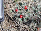
Field identification: Paronychia jamesii.
Paronychia jamesii Torr. & A. Gray. James' Nailwort.
North Table Mountain Park, Jefferson County, Colorado. Top of North Table Mountain, near Golden Cliffs Trail, 1.70 km. north of the GNIS location of Golden. 39.7709°N, 105.2199°W. WGS 1984 Elev. 1941 m. Very thin vegetation with patches of bare mesa caprock.
| |
|
|
Saturday, June 10
| |
Locations:
North Table Mountain Park.
 Phemeranthus parviflorus on top of North Table Mountain. Phemeranthus parviflorus on top of North Table Mountain.
|
|
North Table Mountain field trip for Colorado Native Plant Society.
| |
|
|
Friday, June 16th
| |
Locations:
Schweich Hill.
|
|
North Washington Open Space.
| |
Other articles:
• Golden Checklist Flora:
smooth brome;
 Coll. No. 1660, Bromus inermis Coll. No. 1660, Bromus inermis
|
1660
|
Field identification: Bromus inermis.
Bromus inermis Leyss. Smooth Brome.
North Washington Open Space, Jefferson County, Colorado. Small (4 acre) fallow city-owned parcel in northern Golden, near the intersection of Colorado Highway 93 and Washington Avenue, 1.75 km. northwest of the GNIS location of Golden. 39.7687°N, 105.2316°W. WGS 1984 Elev. 1792 m. Northeast corner of the parcel, where there is nearly a monoculture of smooth brome with a few Canada thistle. Some of the neighbors have taken to mowing this area.
|
 Coll. No. 1661, Delphinium carolinianum subsp. virescens Coll. No. 1661, Delphinium carolinianum subsp. virescens
|
1661
|
Field identification: Delphinium virescens.
Delphinium carolinianum Walter ssp. virescens (Nutt.) R.E. Brooks. Carolina Laskspur.
North Washington Open Space, Jefferson County, Colorado. Small (4 acre) fallow city-owned parcel in northern Golden, near the intersection of Colorado Highway 93 and Washington Avenue, 1.75 km. northwest of the GNIS location of Golden. 39.7686°N, 105.2331°W. WGS 1984 Elev. 1821 m. Top of hill where there is less disturbance and fewer invasive weeds.
| |
|
1662
|
Field identification: Tradescantia occidentalis.
Tradescantia occidentalis (Britton) Smyth. Prairie Spiderwort.
North Washington Open Space, Jefferson County, Colorado. Small (4 acre) fallow city-owned parcel in northern Golden, near the intersection of Colorado Highway 93 and Washington Avenue, 1.75 km. northwest of the GNIS location of Golden. 39.7685°N, 105.233°W. WGS 1984 Elev. 1827 m. In a slightly more exposed area on the south side of the hill.
|
 Coll. No. 1663, Hymenopappus filifolius var. polycephalus Coll. No. 1663, Hymenopappus filifolius var. polycephalus
|
1663
|
Field identification: looks familiar, maybe Hymenopappus filifolia
Hymenopappus filifolius Hook. var. polycephalus (Osterh.) B.L. Turner. Many-Headed Fine-Leaved Wooly-White.
North Washington Open Space, Jefferson County, Colorado. Small (4 acre) fallow city-owned parcel in northern Golden, near the intersection of Colorado Highway 93 and Washington Avenue, 1.75 km. northwest of the GNIS location of Golden. 39.7685°N, 105.2331°W. WGS 1984 Elev. 1817 m. Finely divided leaves. In a slightly more exposed area on the south side of the hill where there are fewer non-natives and less disturbance.
|
 Coll. No. 1664, Heterotheca villosa Coll. No. 1664, Heterotheca villosa
|
1664
|
Field identification: Heterotheca villosa.
Heterotheca villosa (Pursh) Shinners. Hairy False Goldenaster.
North Washington Open Space, Jefferson County, Colorado. Small (4 acre) fallow city-owned parcel in northern Golden, near the intersection of Colorado Highway 93 and Washington Avenue, 1.75 km. northwest of the GNIS location of Golden. 39.7686°N, 105.233°W. WGS 1984 Elev. 1818 m. Top of hill, center of parcel. Somewhat ambiguous as to var. minor vs. var. nana.
|
 Coll. No. 1665, Gaillardia aristata Coll. No. 1665, Gaillardia aristata
|
1665
|
Field identification: Gaillardia aristata.
Gaillardia aristata Pursh. Blanketflower.
North Washington Open Space, Jefferson County, Colorado. Small (4 acre) fallow city-owned parcel in northern Golden, near the intersection of Colorado Highway 93 and Washington Avenue, 1.75 km. northwest of the GNIS location of Golden. 39.7686°N, 105.2332°W. WGS 1984 Elev. 1819 m. Top of hill, center of parcel.
| |
Other articles:
• Field Notes:
Coll. No. 1710, 14 Jul 2017;
|
1666
|
Field identification: Total mystery at first, no flowers open, but now I think it is Gypsophila paniculata, Baby's Breath.
| |
Literature Cited:
- Barkworth, Mary E., Laurel K. Anderton, Kathleen M. Capels, Sandy Long, and Michael B. Piep, 2007.
 Coll. No. 1667, Festuca saximontana Coll. No. 1667, Festuca saximontana
 Inflorescence of Coll. No. 1667, Festuca saximontana Inflorescence of Coll. No. 1667, Festuca saximontana
|
1667
|
Field identification: Grass.
Festuca saximontana Rydb. Rocky Mountain Fescue.
North Washington Open Space, Jefferson County, Colorado. Small (4 acre) fallow city-owned parcel in northern Golden, near the intersection of Colorado Highway 93 and Washington Avenue, 1.75 km. northwest of the GNIS location of Golden. 39.7687°N, 105.2334°W. WGS 1984 Elev. 1819 m. Western edge of hill, adjacent to social trail.
Coll. No. 1667, 16 Jun 2017, characters observed:
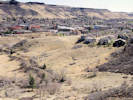
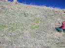
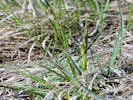
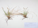
Perennial, to 30 cm.;
Rhizomes, 0;
Culm,
very sparse scabrous below inflorescence;
Leaves,
sheath, open,
ligule, membraneous, 0.2 mm.,
auricles, 0.5 mm., short hairy distally,
blades, revolute;
Inflorescence,
panicle,
50 mm. × 9 mm. wide;
Spikelets,
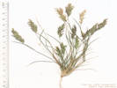
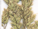
1 per node;
Disarticulation,
between florets;
Florets,
#6±,
9 mm. × 3.5 mm. wide;
Glumes, #2,
pubescent only on distal veins and margins,
lower, 2.5 mm., veins 1;
upper, 3.5 mm., veins 2, tip mucronate;
Lemma,
4 mm.,
veins 5, obscure but best seen at base,
awn, #1, 1.5 mm., from tip of lemma;
Palea,
≥lemma,
veins green,
tip bifid;
Anthers,
1.8-2.0 mm.
|
 Coll. No. 1668, Erigeron divergens Coll. No. 1668, Erigeron divergens
|
1668
|
Field identification: Erigeron with long trailing branches, maybe E. flagellaris.
Erigeron divergens Torr. & A. Gray. Spreading Fleabane.
North Washington Open Space, Jefferson County, Colorado. Small (4 acre) fallow city-owned parcel in northern Golden, near the intersection of Colorado Highway 93 and Washington Avenue, 1.75 km. northwest of the GNIS location of Golden. 39.7686°N, 105.2335°W. WGS 1984 Elev. 1816 m. West-central part of hill, southwest slope.
| |
|
1669
|
Field identification: Bromus japonicus.
Bromus japonicus Thunb. Japanese Cheat Grass.
North Washington Open Space, Jefferson County, Colorado. Small (4 acre) fallow city-owned parcel in northern Golden, near the intersection of Colorado Highway 93 and Washington Avenue, 1.75 km. northwest of the GNIS location of Golden. 39.7687°N, 105.2344°W. WGS 1984 Elev. 1799 m. Far western, revegetated, part of parcel.
|
 Coll. No. 1670, Rosa arkansana Coll. No. 1670, Rosa arkansana
 New growth of Coll. No. 1670, Rosa arkansana New growth of Coll. No. 1670, Rosa arkansana
|
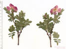
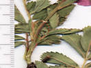
1670
|
Field identification: Rosa arkansana.
Rosa arkansana Porter. Prairie Rose.
North Washington Open Space, Jefferson County, Colorado. Small (4 acre) fallow city-owned parcel in northern Golden, near the intersection of Colorado Highway 93 and Washington Avenue, 1.75 km. northwest of the GNIS location of Golden. 39.7684°N, 105.2329°W. WGS 1984 Elev. 1813 m. Armament of new growth quite variable. South side, near top of hill, scattered among grasses.
| |
|
1671
|
Field identification: Oenothera suffrutescens.
Oenothera suffrutescens (Ser.) W. L. Wagner & Hoch. Linda Tarde.
North Washington Open Space, Jefferson County, Colorado. Small (4 acre) fallow city-owned parcel in northern Golden, near the intersection of Colorado Highway 93 and Washington Avenue, 1.75 km. northwest of the GNIS location of Golden. West side of hill, on the edge of a path that the neighbors have mowed into the smooth brome.
| |
|
1672
|
Field identification: Convolvulus arvensis -- Bind weed!!
Convolvulus arvensis L. Field Bindweed.
North Washington Open Space, Jefferson County, Colorado. Small (4 acre) fallow city-owned parcel in northern Golden, near the intersection of Colorado Highway 93 and Washington Avenue, 1.75 km. northwest of the GNIS location of Golden. 39.7688°N, 105.232°W. WGS 1984 Elev. 1806 m. Colorado Noxious Weed List C.
| |
Other articles:
• Golden Checklist Flora:
Buchloe dactyloides;
Notes on Buffalo Grass;
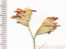 Staminate inflorescence of Coll. No. 1673, Buchloe dactyloides Staminate inflorescence of Coll. No. 1673, Buchloe dactyloides
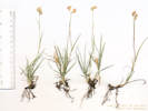 Coll. No. 1673, Buchloe dactyloides Coll. No. 1673, Buchloe dactyloides
|
1673
|
Field identification: Buchloë dactyloides.
Buchloe dactyloides (Nutt.) Engelm. Buffalo Grass.
North Washington Open Space, Jefferson County, Colorado. Small (4 acre) fallow city-owned parcel in northern Golden, near the intersection of Colorado Highway 93 and Washington Avenue, 1.75 km. northwest of the GNIS location of Golden. 39.7688°N, 105.232°W. WGS 1984 Elev. 1803 m. Pistillate plants only. Northeast section where the neighbors have mowed the smooth brome.
| |
|
|
Monday, June 19th
| |
Locations:
Ranson/Edwards Homestead Open Space Park.
|
|
Ranson/Edwards Homestead Open Space, with Anthony Massaro and Jerry Bader.
| |
Other articles:
• Golden Checklist Flora:
Notes on Buffalo Grass;
|
1674
|
Field identification: Buchloë dactyloides
Buchloe dactyloides (Nutt.) Engelm. Buffalo Grass.
Ranson/Edwards Homestead Open Space Park, Jefferson County, Colorado. High plains above Rocky Flats, 1.7 miles west on Colorado Highway 72 from Colorado Highway 93, 1.1 mile north on Plainview Road, then 120 m. northeast on an old ranch road now used as a service road. 39.8885°N, 105.2604°W. WGS 1984 Elev. 1916 m. In a somewhat elevated drier location between the tracks of an old road.
|
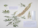 Coll. No. 1675, Lupinus caudatus var. argophyllus Coll. No. 1675, Lupinus caudatus var. argophyllus
|
1675
|
Field identification: Lupinus, whitish flowers, robust, and less hairy than the typical L. argentea.
Lupinus caudatus Kellogg var. argophyllus (A. Gray) S.L. Welsh. Kellogg's Spurred Lupine.
Ranson/Edwards Homestead Open Space Park, Jefferson County, Colorado. High plains above Rocky Flats, 1.7 miles west on Colorado Highway 72 from Colorado Highway 93, 1.1 mile north on Plainview Road, then 580 m. east northeast to the lowest terrace of Coal Creek. 39.8894°N, 105.2548°W. WGS 1984 Elev. 1907 m. Among deep grasses and near the mouth of a minor ephemeral creek.
Coll. No. 1675, 19 Jun 2018, characters observed:
Perennial, to 1 m.;
Leaves,
cauline,
petiole 35-40 mm.,
palmately compound, 44 mm. × 70 mm. wide,
leaflets, 7-9,
36 mm. × 9 mm. wide,
oblanceolate,
veins 1,
adaxial glabrate,
abaxial appressed hairy;
Inflorescence,
well above the leaves,
25 cm. × 3.5 mm. wide;
Pedicel,
3.5 mm., recurved, silky hairy;
Calyx, silky hairy,
lower lobe, 9 mm.,
upper lobe, 6 mm.,
spur, more a bump, ≤1 mm.;
Banner,
9 mm., reflexed 2.5 mm from tip,
folded tightly over wings,
back hairy inside folds;
Wing,
10 mm. × 5.5 mm. wide,
claw, 1.5 mm. × 1 mm. wide;
Keel,
10 mm.,
hairy on bottom,
tip dark,
recurved <3 mm. giving closed appearance;
Style, glabrous;
Stigma, small, 4-lobed.
|
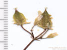 Inflorescence of Coll. No. 1676, Oxalis stricta Inflorescence of Coll. No. 1676, Oxalis stricta
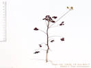 Coll. No. 1676, Oxalis stricta Coll. No. 1676, Oxalis stricta
|
1676
|
Field identification: Spurge???
Oxalis stricta L. Common Yellow Oxalis.
Ranson/Edwards Homestead Open Space Park, Jefferson County, Colorado. High plains above Rocky Flats, 1.7 miles west on Colorado Highway 72 from Colorado Highway 93, 1.1 mile north on Plainview Road, then 550 m. east northeast to Coal Creek. 39.8879°N, 105.255°W. WGS 1984 Elev. 1907 m. On a gravel and sand bar in Coal Creek.
| |
Literature Cited:
- Greene, Edward Lee, 1902a.
Other articles:
• Golden Checklist Flora:
Notes on Erigeron tracyi, Greene 1902;
|
|
?
|
ERIGERON COMMIXTUS. With the habit of E. flagellaris, smaller, less stoloniferous,
the leaves relatively broader, some entire, others with one or more conspicuous lobes at base of the blade,
the whole plant almost hoary with a stiffly hirsute pubescence, this spreading on the leaves and petioles,
retrorse on the stems and peduncles : heads, rays, achenes, etc., much as in E. flagellaris.
Canon of the Limpia, mountains of western Texas, 26 April, 1902, S. M. Tracy and F. S. Earle;
also collected by the present writer,
in the same general region, namely, in the mountains near Silver City, New Mexico, 18 May, 1880,
and distributed for E. flagellaris.
The species last named has a rather obscure, fine closely appressed hairiness.
That of the new one is so extremely different, that were the plants of the size of a Sunflower or Goldenrod,
no botanist would confuse them as one species, were the pubescence the only character.
I may remark that true E. flagellaris reaches the mountains of even southern New Mexico, where, however,
it occurs only in a more elevated biological zone.
|
We now treat E. commixtus as a synonym of E. tracyi.
|
ERIGERON TRACYI. Allied to the last but dwarf, only 2 or 3 inches high,
densely leafy at base and with no stolons (at least at flowering time):
petioles of the spatulate-lanceolate entire leaves shorter than the blade or obsolete;
the whole herbage silvery-hoary with a fine dense strigulose pubescence,
or this more sparse and spreading on the solitary scapiform peduncle:
involucre hispidulous:
outer pappus very conspicuous though consisting of only shorter and setiform hairs,
the inner of a few very delicate capillary ones.
Davis Mountains, western Texas, Tracy and Earle, 28 April, 1902.
|
| |
Literature Cited:
- Gray, Asa, 1849.
Other articles:
• Golden Checklist Flora:
Gray, 1849, publication details;
Notes on Erigeron flagellaris, Gray, 1849;
|
|
|
? 334. E. FLAGELLARE (sp. nov.): bienne ? striguloso-puberulum, pumilum;
caulibus gracillimis e basi ramosis, floriferis seu primariis simplicibus superne aphyllis monocephalis,
sterilibus patentibus flagelliformibus;
foliis spathulatis mucronulatis inferioribus in petiolum gracilem attenuatis integris
seu radicalibus parce inciso-lobatis, ramealibus parvulis sublinearibus sessilibus;
ligulis numerosis gracilibus (albis purpureo tinctis) involucrum hirsutum duplo superantibus;
pappo radii et disci conformi duplici, exteriore coroniformi-squamellato conspicuo,
interiore e setis sub-20 fragilibus.
Low, moist places, along Santa Fe Creek; May, June. (381.)
-- Root slender. Flowering stems 5 to 7 inches high, very slender, few-leaved below the middle,
naked and pedunculiform above;
the head rather smaller than in the preceding species; the involucre, &c., similar.
Lower leaves one to two inches long, including the slender petiole;
those of the runner-like sterile branches decreasing to 2 or 3 lines in length.
This species should rank next to the foregoing.
|
The “foregoing” was Erigeron cinereum (sp. nov.), now treated as a synonym of E. tracyi Greene. The head was described as “
as large as those on Bellis perennis
” and the involucre was described as “
hirsutum duplo superantibus
” [
coarse erect or ascending hairs doubly
??? ]
| |
Literature Cited:
- Torrey, John, and Asa Gray, 1841.
Other articles:
• Golden Checklist Flora:
Notes on Erigeron divergens, Torrey & Gray, 1841-3;
|
|
Torrey & Gray (1841, p. 175) in Flora of North America proposed Erigeron divergens for the small fleabane that was previously illegimately published by Nuttall as E. divaricatuum.
|
?26. E. divergens: somewhat hoary with a minute hirsute pubescence, diffusely branched from the base;
leaves small, entire, acute; the radical somewhat spatulate, narrowed into a short petiole;
the cauline scattered, sessile, linear, narrowed at the base;
heads (small) mostly solitary terminating the naked branchlets or peduncles;
rays very narrow and numerous, twice the length of the hirsute involucre;
inner pappus of few (8-12) very slender and deciduous bristles.
Erigeron (Oligotrichium) divaricatuum,
Nutt.! in trans. Amer. Phil. Soc. (n. ser.) 7. p. 311, not of Michx.
Rocky Mountains, and plains of the interior of Oregon, Nuttall !
(? Stems about a foot high, diffuse, ascending, slender, at length much branched.
Leaves half an inch to an inch long, 1 to 2 lines wide. mucronate-acute.
Heads rather smaller than in E. tenue; the rays (white, Nutt.) nearly similar; the exterior pappus shorter.
|
| |
|
|
Wednesday, June 28th
| |
Locations:
Ranson/Edwards Homestead Open Space Park.
|
|
Ranson/Edwards Homestead Open Space.
| |
Other articles:
• Golden Checklist Flora:
Poa compressa;
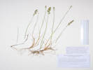 Coll. No. 1677, Poa compressa Coll. No. 1677, Poa compressa
|
1677
|
Field identification: Poa, rhizomatous.
Poa compressa L. Canada Bluegrass.
Ranson/Edwards Homestead Open Space Park, Jefferson County, Colorado. 1.7 miles west of Colorado Highway 93 on Colorado Highway 72 (Coal Creek Canyon Road), 1.2 miles north on Plainview Road, then 67 meters east into the open field. 39.889°N, 105.2608°W. WGS 1984 Elev. 1923 m. Relatively short stature, in drier areas.
Coll. No. 1677, 28 June 2017, characters observed:
Perennial grass, 35-40 cm.;
Rhizomes, numerous;
Culms, compressed;
Nodes, compressed;
Leaves,
sheath 40-55 mm., open top ¾,
ligule, membraneous, 1 mm.,
blade, 40-55 mm., folded;
Inflorescence,
panicle, contracted,
45 mm. × 12 mm. wide;
Spikelets,
4 mm. × 1.5 mm. wide;
Disarticulation,
above the glumes,
between the florets;
Glumes, #2,
lower, 2 mm., veins #3,
upper, 2.2 mm.;
Florets,
5 per spikelet,
at least some bisexual;
Lemma,
2 mm.,
keeled, few hairs near base,
veins, #5, neither equally spaced nor prominent,
tip, obtuse,
awns, 0;
Palea,
2 mm.,
veins, green, sparsely scabrous, purple between;
Anthers, 1.6 mm.
|
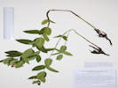 Coll. No. 1678, Apocynum x-floribundum Coll. No. 1678, Apocynum x-floribundum
|
1678
|
Field identification: Apocynum, likely the hybrid.
Apocynum ×floribundum Greene. Dogbane.
Ranson/Edwards Homestead Open Space Park, Jefferson County, Colorado. High plains above Rocky Flats, 1.7 miles west on CO Highway 72 from CO Highway 93, 1.3 miles north on Plainview Road, then 20 meters east into open prairie. 39.8904°N, 105.2616°W. WGS 1984 Elev. 1947 m. Along old road in the direction of the original homestead.
Coll. No. 1678, 28 Jun 2017, characters observed:
Perennial, 45-50 cm., in open prairie;
Leaves,
40-57 mm. × 15-25 mm. wide,
ovate, lanceolate, and oblong;
Calyx,
lobes, 1.4-1.6 mm.;
Corolla,
lobes,
2.5-3.0 mm.,
erect to spreading in distal ⅓,
faded to thin pink veins and various blotches of pinkish color;
Corolla lobes 1.56-2.14 times as long as the calyx lobes.
| |
|
1679
|
Field identification: Erigeron flagellaris, stem hairs antrorsely appressed.
Erigeron flagellaris A. Gray. Trailing Fleabane.
Ranson/Edwards Homestead Open Space Park, Jefferson County, Colorado. High plains above Rocky Flats, 1.7 miles west on CO Highway 72 from CO Highway 93, 1.3 miles north on Plainview Road, then 20 meters east into open prairie. 39.8904°N, 105.2616°W. WGS 1984 Elev. 1952 m. Stem hairs appressed antrorsely. Along old road in the direction of the original homestead.
| |
Other articles:
• Golden Checklist Flora:
Potentilla recta;
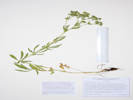 Coll. No. 1680, Potentilla recta Coll. No. 1680, Potentilla recta
|
1680
|
Field identification: Potentilla recta.
Potentilla recta L. Sulphur Cinquefoil.
Ranson/Edwards Homestead Open Space Park, Jefferson County, Colorado. High plains above Rocky Flats, 1.7 miles west on CO Highway 72 from CO Highway 93, 1.4 miles north on Plainview Road, then 210 meters east northeast into open prairie. 39.8923°N, 105.2597°W. WGS 1984 Elev. 1942 m. Along a faint old ranch road that goes in the general direction of the original homestead. Colorado Noxious Weed List B.
Coll. No. 1680, 28 June 2017, characters observed:
Perennial herb, to 50 cm.,
hairy throughout,
short (0.3 mm.) hairs glandular,
long (4 mm.) hairs straight spreading eglandular;
Leaves,
stem, 7-8 per stem,
alternate,
stipules, to 20 mm., lobed,
petioles, to 80 mm.,
blade, palmately compound,
leaflets, #5, 45 mm. × 14 mm. wide,
lobed ½ to mid-rib,
progressively reduced above;
Calyx,
9 mm. × 9 mm. wide,
flattened at base;
Petals,
8 mm., yellow;
Style,
1.3 mm.,
tapered throughout,
not appearing warty;
Achene,
1 mm., attached laterally,
reticulate in color, but not texture.
“The long, stiff, spreading, tubercle-based hairs on stems and petioles of P. recta, overtopping a layer of short hairs and glands, also serve to distinguish this aggressive species from native P. gracilis at any stage of the life cycle (FNANM).”
| |
Literature Cited:
- Barkworth, Mary, 1978.
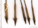 Coll. No. 1681, Hesperostipa spartea Coll. No. 1681, Hesperostipa spartea
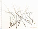 Coll. No. 1681, Hesperostipa spartea Coll. No. 1681, Hesperostipa spartea
|
1681
|
Field identification: Achnatherum sp.
Hesperostipa spartea (Trin.) Barkworth. Porcupine Grass.
Ranson/Edwards Homestead Open Space Park, Jefferson County, Colorado. High plains above Rocky Flats, 1.7 miles west on CO Highway 72 from CO Highway 93, 1.4 miles north on Plainview Road, then 205 meters east northeast into open prairie. 39.8923°N, 105.2598°W. WGS 1984 Elev. 1940 m. Along a faint old ranch road that goes in the general direction of the original homestead. "Rare and relictual in tall grass prairie along the base of the Front Range (Weber & Wittman, 2012)."
Coll. No. 1681, 28 June 2017;
Perennial, to 80 cm., clumped;
Stem, herbaceous;
Leaves,
blade and sheath differentiated, soft;
Sheath, open;
Ligule,
membraneous,
5 mm., forked,
auricles, 2.5, 5.0 mm.;
Blade, flat, glabrous, sparsely scabrous;
Inflorescence, 1 per culm,
25 cm.,
panicle, branching evident,
>leaves;
Rachis,
glabrous, not extended beyond upper spikelet;
Spikelets,
many, similar, 1 per node;
Compression, unremarkable;
Disarticulation, above the glumes;
Florets, 1 per spikelet, bisexual;
Glumes, both present, ±equal, 25 mm.,
rounded, veins #5,
awns 0, tip somewhat awn-like,
margins entire;
Callus, sharp, 2.5 mm.;
Lemma, 11-14 mm., < glumes, tough,
rolled,
color, medium brown, veins ≥5,
hairs, to 2 mm proximally to glabrous distally,
color dark brown,
awns, #1, 9.5 cm., twisted,
attached, end;
Palea, ±lemma, glabrous;
| |
Other articles:
• Glossary:
vestiture;
|
1682
|
Field identification: Potentilla norvegica.
This turned out to be a mixed collection of similar taxa in Potentilla Sect. Rivales. FNANM shed some light on this section:
The North American representatives of sect. Rivales are morphologically distinctive in being annuals, biennials, or short-lived perennials (especially in cold regions) with very short, conic-tapered styles. Plants grow primarily in wet habitats, especially where periodically inundated. These distinctions led E. L. Greene (1906c) to adopt Tridophyllum. However, the gross morphological cohesiveness is not matched by molecular monophyly. Instead, chloroplast data scatter Potentilla norvegica, P. rivalis, and P. supina among the core Potentilla, while P. biennis is sister species to the monophyletic Ivesia-Horkelia-Horkeliella clade (C. Dobe and J. Paule 2010; M. H. Töpel et al. 2011). Nuclear markers, on the other hand, place P. norvegica as sister to the Ivesia-Horkelia-Horkeliella clade (Töpel et al.), suggesting a possible hybrid origin and/or multiple origins of the biennial habit.
Existing herbarium annotations of Potentilla biennis, P. norvegica, and P. rivalis are not reliable, but the three species can be readily distinguished by vestiture of proximal petioles and stems. Only P. biennis has prominently septate gland-tipped trichomes; P. norvegica is characterized by relatively stiff, spreading, tubercle-based hairs to 3 mm, resembling those of P. recta. In addition, the tiny, smooth, pale achenes of P. biennis and P. rivalis contrast sharply with the larger, darker, strongly ridged ones of P. norvegica.
| |
Other articles:
• Glossary:
ternate;
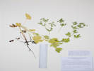 Coll. No. 1682.1, Potentilla rivalis Coll. No. 1682.1, Potentilla rivalis
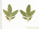 Ternate leaf of Coll. No. 1682.1, Potentilla rivalis Ternate leaf of Coll. No. 1682.1, Potentilla rivalis
|
1682.1
|
Potentilla rivalis Nutt. Brook Cinquefoil.
Ranson/Edwards Homestead Open Space Park, Jefferson County, Colorado. High plains above Rocky Flats, 1.7 miles west on CO Highway 72 from CO Highway 93, 1.4 miles north on Plainview Road, then 450 meters east northeast to the original homestead location. 39.8947°N, 105.2583°W. WGS 1984 Elev. 1915 m. Very wet, water from an open running well.
Coll. No. 1682.1, 28 June 2017, characters observed:
Perennial herb, to 60 cm., in very wet places;
Stem,
erect and branched at base decumbent to ascending,
proximal hairs weak, 1 mm.,
eglandular;
Leaves,
compound,
palmate and ternate,
petiole 0-62 mm. + blade 37 mm. × 40 mm. wide,
leaflets, 3-5,
both sides, green, sericeous,
hairs weak;
Sepals,
3 mm., green;
Petals,
4 mm. × 2.5 mm. wide, yellow;
Style,
0.7 mm.;
Achene,
0.9 mm., light greenish-brown,
smooth, maybe very minutely pappilate.
|
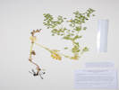 Coll. No. 1682.2, Potentilla supina ssp. paradoxa Coll. No. 1682.2, Potentilla supina ssp. paradoxa
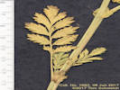 Pinnately compound leaf of Coll. No. 1682.2, Potentilla supina ssp. paradoxa Pinnately compound leaf of Coll. No. 1682.2, Potentilla supina ssp. paradoxa
|
1682.2
|
Potentilla supina L. ssp. paradoxa (Nuttall) Sojak. Bushy Cinquefoil.
Ranson/Edwards Homestead Open Space Park, Jefferson County, Colorado. High plains above Rocky Flats, 1.7 miles west on CO Highway 72 from CO Highway 93, 1.4 miles north on Plainview Road, then 450 meters east northeast to the original homestead location. 39.8947°N, 105.2583°W. WGS 1984 Elev. 1915 m. Very wet, water from an open running well.
Coll. No. 1682.2, 28 June 2017, characters observed:
Perennial herbs, to 50 cm.,
in very wet places,
not stoloniferous;
Leaves,
petiole 20 mm. + blade 42 mm. × 23 mm.,
pinnately compound,
leaflets, 9,
15 mm. × 6 mm. wide,
margins flat;
Sepals, 4 mm., green;
Petals, 4 mm. × 2.5 mm. wide,
±=sepals,
yellow;
Style, 0.6 mm., tapered,
Achene,
1 mm.,
brown, large white protuberance.
|
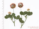 Coll. No. 1683, Trifolium hybridum Coll. No. 1683, Trifolium hybridum
|
1683
|
Field identification: Trifolium “Clover”
Trifolium hybridum L. Alsike Clover.
Ranson/Edwards Homestead Open Space Park, Jefferson County, Colorado. High plains above Rocky Flats, 1.7 miles west on CO Highway 72 from CO Highway 93, 1.4 miles north on Plainview Road, then 450 meters east northeast to the original homestead location. 39.8947°N, 105.2584°W. WGS 1984 Elev. 1908 m.
Coll. No. 1683, 28 Jun 2017, characters observed:
Perennial herb, to 50 cm.,
sprawling-ascending;
Leaves,
cauline,
petiole to 90+ mm.,
stipules, to 25 mm., entire, acute,
leaf compound, ternate,
leaflets, 3, 20 mm. × 16 mm. wide,
attached at a single point,
margin serrate,
generally glabrous, scant hairs along distal margins;
Inflorescence,
flowers in heads,
peduncles, 55-95 mm.,
heads 22 mm. diameter,
many flowers,
bracts inconspicuous (1 mm.);
Calyx, tube 1 mm. + lobes 2 mm.;
Corolla, 7 mm.
| |
|
1684
|
Field identification: Verbena bracteata.
Verbena bracteata Lag. & Rodr. Large Bract Vervain.
Ranson/Edwards Homestead Open Space Park, Jefferson County, Colorado. High plains above Rocky Flats, 1.7 miles west on CO Highway 72 from CO Highway 93, 1.4 miles north on Plainview Road, then 450 meters east northeast to the original homestead location. 39.8947°N, 105.2584°W. WGS 1984 Elev. 1908 m. Collected around a concrete foundation, perhaps of a former ranch house.
| |
|
1685
|
Field identification: Cirsium arvense.
Cirsium arvense (L.) Scop. Canada Thistle.
Ranson/Edwards Homestead Open Space Park, Jefferson County, Colorado. High plains above Rocky Flats, 1.7 miles west on CO Highway 72 from CO Highway 93, 1.4 miles north on Plainview Road, then 450 meters east northeast to the original homestead location. 39.8946°N, 105.2584°W. WGS 1984 Elev. 1916 m.
| |
|
1686
|
Field identification: Medicago sativa.
Medicago sativa L. Alfalfa.
Ranson/Edwards Homestead Open Space Park, Jefferson County, Colorado. High plains above Rocky Flats, 1.7 miles west on CO Highway 72 from CO Highway 93, 1.4 miles north on Plainview Road, then 450 meters east northeast to a location just southeast of the original homestead. 39.8944°N, 105.258°W. WGS 1984 Elev. 1915 m.
|
 Inflorescence of Coll. No. 1687, Melilotus officinalis Inflorescence of Coll. No. 1687, Melilotus officinalis
|
1687
|
Field identification: Melilotus officinalis.
Melilotus officinalis (L.) Lam. Yellow Sweet Clover.
Ranson/Edwards Homestead Open Space Park, Jefferson County, Colorado. High plains above Rocky Flats, 1.7 miles west on CO Highway 72 from CO Highway 93, 1.4 miles north on Plainview Road, then 450 meters east northeast to a location just southeast of the original homestead. 39.8943°N, 105.258°W. WGS 1984 Elev. 1916 m.
|
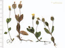 Coll. No. 1688, Erythranthe floribunda Coll. No. 1688, Erythranthe floribunda
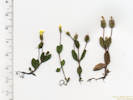 Coll. No. 1688, Erythranthe sp. Coll. No. 1688, Erythranthe sp.
|
1688
|
Field identification: Erythranthe sp.
Erythranthe floribunda (Douglas ex Lindl.) G. L. Nesom. Many Flowered Monkey Flower.
Ranson/Edwards Homestead Open Space Park, Jefferson County, Colorado. High plains above Rocky Flats, 1.7 miles west on Colorado Highway 72 from Colorado Highway 93, 1.0 mile north on Plainview Road, then 350 m. east to a terrace overlooking Coal Creek. 39.8872°N, 105.2572°W. WGS 1984 Elev. 1926 m. Margins of calyx teeth glandular-pubescent. Muddy flat with sheet flow water.
Coll. No. 1688, 28 June 2017, characters observed:
Annual, to 45 mm.;
Stems,
gland-tipped hairs;
Leaves,
cauline,
opposite,
petiole, an indistinct 0.4-0.7 mm. to a distinct 1.5 mm.,
blade,
8 mm. × 4.5 mm. wide,
palmately veined,
margin, entire to few-toothed;
Calyx,
tube 3.5 mm., + lobes 0.5 mm.,
uppermost lobe not longer, more like bottom two lobes are shorter,
margins sparsely ciliate;
Pedicels, 15-16 mm., glandular;
Corolla,
6 mm. × 2 mm. dia.,
throat open,
lobes, 1 mm., upper lobe ±=others,
limb 3.7 mm.,
yellow.
|
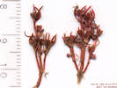 Coll. No. 1689, Crassula aquatica Coll. No. 1689, Crassula aquatica
|
1689
|
Field identification: Crassula, maybe C. aquatica.
Crassula aquatica (L.) Schoenl. Water Pygmy Weed.
Ranson/Edwards Homestead Open Space Park, Jefferson County, Colorado. High plains above Rocky Flats, 1.7 miles west on Colorado Highway 72 from Colorado Highway 93, 1.0 mile north on Plainview Road, then 350 m. east to a terrace overlooking Coal Creek. 39.8874°N, 105.2567°W. WGS 1984 Elev. 1926 m. Muddy flat with sheet flow water.
Coll. No. 1689, 28 June 2017, characters observed:
Annual,
to 22 mm.;
Stem,
rooting,
ascending;
Leaves,
cauline,
opposite,
bases conjoined,
4 mm. × 0.5 mm. wide;
Flowers,
borne singly in axils;
Petals,
#4, 1 mm. × 1.2 mm. wide;
Seeds,
#12,
0.4 mm.,
oblong,
lines longitudinal.
|
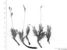 Coll. No. 1689.1, Phemeranthus parviflorus Coll. No. 1689.1, Phemeranthus parviflorus
|
1689.1
|
Field identification: Phemeranthus parviflorus.
Phemeranthus parviflorus (Nutt.) Kiger. Sunbright.
Ranson/Edwards Homestead Open Space Park, Jefferson County, Colorado. High plains above Rocky Flats, 1.7 miles west on Colorado Highway 72 from Colorado Highway 93, 1.0 mile north on Plainview Road, then 350 m. east to a terrace overlooking Coal Creek. 39.8874°N, 105.2567°W. WGS 1984 Elev. 1926 m. Muddy flat with sheet flow water.
| |
Literature Cited:
- Simpson, Michael G., C. Matt Guilliams, Kristin E. Hasenstab-Lehman, Makenzie E. Mabry, & Lee Ripma, 2017.
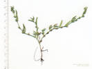 Coll. No. 1689.2, Plagiobothrys scouleri Coll. No. 1689.2, Plagiobothrys scouleri
|
1689.2
|
Field identification: Plagiobothrys scouleri.
Plagiobothrys scouleri (Hook. & Arn.) I.M. Johnst. var. hispidulus (Greene) Dorn. Scouler's Popcornflower.
Ranson/Edwards Homestead Open Space Park, Jefferson County, Colorado. High plains above Rocky Flats, 1.7 miles west on Colorado Highway 72 from Colorado Highway 93, 1.0 mile north on Plainview Road, then 350 m. east to a terrace overlooking Coal Creek. 39.8874°N, 105.2567°W. WGS 1984 Elev. 1926 m. Muddy flat with sheet flow water.
| |
Other articles:
• Field Notes:
Coll. No. 1917, 3 Jun 2018;
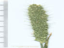 Inflorescence of Coll. No. 1689.3, Alopecurus carolinianus Inflorescence of Coll. No. 1689.3, Alopecurus carolinianus
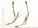 Coll. No. 1689.3, Alopecurus carolinianus Coll. No. 1689.3, Alopecurus carolinianus
|
1689.3
|
Coll. No. 1689.3, Alopecurus carolinianus |
Field identification: Alopecurus geniculatus.
Alopecurus carolinianus Walter. Carolina Foxtail.
Det. by Janet Wingate, 1/24/2018.
Ranson/Edwards Homestead Open Space Park, Jefferson County, Colorado. High plains above Rocky Flats, 1.7 miles west on Colorado Highway 72 from Colorado Highway 93, 1.0 mile north on Plainview Road, then 350 m. east to a terrace overlooking Coal Creek. 39.8874°N, 105.2567°W. WGS 1984 Elev. 1926 m. Muddy flat with sheet flow water.
|
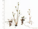 Coll. No. 1689.4, Juncus bufonius and Coll. No. 1689.6, Limosella aquatica. Coll. No. 1689.4, Juncus bufonius and Coll. No. 1689.6, Limosella aquatica.
|
1689.4
|
Field identification: Juncus bufonius.
Juncus bufonius L. Toad Rush.
Ranson/Edwards Homestead Open Space Park, Jefferson County, Colorado. High plains above Rocky Flats, 1.7 miles west on Colorado Highway 72 from Colorado Highway 93, 1.0 mile north on Plainview Road, then 350 m. east to a terrace overlooking Coal Creek. 39.8874°N, 105.2567°W. WGS 1984 Elev. 1926 m. Muddy flat with sheet flow water.
|
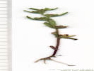 Coll. No. 1689.5, Veronica peregrina ssp. xalapensis Coll. No. 1689.5, Veronica peregrina ssp. xalapensis
|
1689.5
|
Field identification: Veronica peregrina.
Veronica peregrina L. ssp. xalapensis (Kunth) Pennell. Neckweed.
Ranson/Edwards Homestead Open Space Park, Jefferson County, Colorado. High plains above Rocky Flats, 1.7 miles west on Colorado Highway 72 from Colorado Highway 93, 1.0 mile north on Plainview Road, then 350 m. east to a terrace overlooking Coal Creek. 39.8874°N, 105.2567°W. WGS 1984 Elev. 1926 m. Muddy flat with sheet flow water.
|
Coll. No. 1689.4, Juncus bufonius and Coll. No. 1689.6, Limosella aquatica.
|
1689.6
|
Field identification: Limosella aquatica.
Limosella aquatica L. Water Mudwort.
Ranson/Edwards Homestead Open Space Park, Jefferson County, Colorado. High plains above Rocky Flats, 1.7 miles west on Colorado Highway 72 from Colorado Highway 93, 1.0 mile north on Plainview Road, then 350 m. east to a terrace overlooking Coal Creek. 39.8874°N, 105.2567°W. WGS 1984 Elev. 1926 m. Muddy flat with sheet flow water.
| |
|
|
Thursday, June 29th
| |
Locations:
North Table Mountain Park.
|
|
North Table Mountain, from Dunraven Circle, to the radio tower and pond, then down by bushwhacking.
| |
Other articles:
• Golden Checklist Flora:
Notes on Buffalo Grass;
|
1690
|
Field identification: Buchloë dactyloides.
Buchloe dactyloides (Nutt.) Engelm. Buffalo Grass.
North Table Mountain Park, Jefferson County, Colorado. North side of North Table Mountain, in short vegetation on road to Table Rock water tank, 3.6 km. north of the GNIS location of Golden. 39.7882°N, 105.2219°W. WGS 1984 Elev. 1836 m.
|
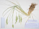 Coll. No. 1691, Pascopyrum smithii Coll. No. 1691, Pascopyrum smithii
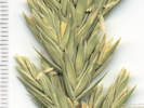 Inflorescence of Coll. No. 1691, Pascopyrum smithii Inflorescence of Coll. No. 1691, Pascopyrum smithii
|
1691
|
Field identification: Pascopyron smithii.
Pascopyrum smithii (Rydb.) Á. Löve. Western Wheatgrass.
North Table Mountain Park, Jefferson County, Colorado. North side of North Table Mountain, in short vegetation on road to Table Rock water tank, 3.6 km. north of the GNIS location of Golden. 39.7882°N, 105.2218°W. WGS 1984 Elev. 1850 m.
Coll. No. 1691, 28 Jun 2017, characters observed:
Perennial grass, to 75 cm.,
rhizomes, not seen;
Leaves,
ligule, short membraneous,
auricles, 0,
blade revolute;
Inflorescence,
bilateral spike;
Rachis, internodes 6 mm.;
Spikelets,
17 mm. × 10 mm. wide × 2 mm.,
not in capitate clusters,
1 per node,
not oriented edgewise to rachis;
Glumes, < lowest floret,
narrowly lanceolate,
slightly asymmetric,
lower, 9.5 mm.,
upper, 10.6 mm.;
Florets, #6±;
Lemma, 11 mm., awns, 0;
Palea, 9 mm.;
Anthers, 4.5 mm.
| |
|
1692
|
Field identification: Achnatherum sp.
Nassella viridula (Trin.) Barkworth. Green Needlegrass.
North Table Mountain Park, Jefferson County, Colorado. Northwest quadrant of North Table Mountain, interior canyon, below Mesa Top trail, 3.4 km. north of the GNIS location of Golden 39.786°N, 105.222°W. WGS 1984 Elev. 1894 m. West-facing hillslope, open grassy vegetation, non-rhizomatous.
| |
|
1693
|
Field identification: grass.
Pascopyrum smithii (Rydb.) Á. Löve. Western Wheatgrass.
North Table Mountain Park, Jefferson County, Colorado. Rocky Mountain Front Range, northwest quadrant of North Table Mountain, interior canyon, below Mesa Top trail, 3.4 km. north of the GNIS location of Golden 39.786°N, 105.222°W. WGS 1984 Elev. 1897 m. Tight, compact head, rhizomatous. Same as Coll. No. 1691, but this one is clearly rhizomatous.
| |
|
1694
|
Field identification: Melilotus officinalis.
Melilotus officinalis (L.) Lam. Yellow Sweet Clover.
North Table Mountain Park, Jefferson County, Colorado. Rocky Mountain Front Range, northwest quadrant of North Table Mountain, a lava-capped mesa of Denver Formation, along the side of Mesa Top Trail also the road to the radio towers, 3.3 km. north of the GNIS location of Golden. 39.7848°N, 105.2188°W. WGS 1984 Elev. 1933 m.
| |
Other articles:
• Golden Checklist Flora:
Eriogonum arcuatum;
Notes on Eriogonum arcuatum;
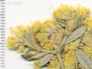 Inflorescence of Coll. No. 1695, Eriogonum arcuatum Inflorescence of Coll. No. 1695, Eriogonum arcuatum
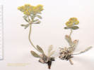 Coll. No. 1695, Eriogonum arcuatum Coll. No. 1695, Eriogonum arcuatum
|
1695
|
Field identification: Eriogonum, maybe E. flavum.
Eriogonum arcuatum Greene. Baker's Buckwheat.
North Table Mountain Park, Jefferson County, Colorado. Rocky Mountain Front Range, northwest quadrant of North Table Mountain, a lava-capped mesa of Denver Formation, 210 m. east of radio tower, 3.3 km. north northeast of the GNIS location of Golden. 39.7846°N, 105.2135°W. WGS 1984 Elev. 1974 m. Rooted in thin soils and fractures of exposed caprock of mesa.
|
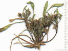 Coll. No. 1696, Limosella aquatica Coll. No. 1696, Limosella aquatica
|
1696
|
Field identification: Limosella aquatica.
Limosella aquatica L. Water Mudwort.
North Table Mountain Park, Jefferson County, Colorado. Rocky Mountain Front Range, center of North Table Mountain, a lava-capped mesa of Denver Formation, along Tilting Mesa Trail near Mesa Top Trail, 3.3 km. north northeast of the GNIS location of Golden. 39.7853°N, 105.2111°W. WGS 1984 Elev. 1969 m. Drying muddy watercourse with Erythranthe sp. and Plagiobothrys scouleri.
|
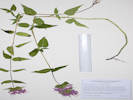 Coll. No. 1697, Monarda fistulosa Coll. No. 1697, Monarda fistulosa
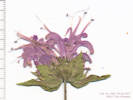 Coll. No. 1697, Monarda fistulosa Coll. No. 1697, Monarda fistulosa
|
1697
|
Field identification: Monarda fistulosa.
Monarda fistulosa L. Wild Bergamot.
North Table Mountain Park, Jefferson County, Colorado. Rocky Mountain Front Range, north slope of North Table Mountain, a lava-capped mesa of Denver Formation, just below the rim, 3.7 km north northeast of the GNIS location of Golden. 39.7878°N, 105.2111°W. WGS 1984 Elev. 1961 m.
| |
|
|
July, 2017
| |
|
|
Friday, July 7th
| |
|
|
Ranson/Edwards Homestead Open Space, as a pre-walk for my field trip tomorrow.
| |
|
1698
|
Field identification: Nassella viridula
Nassella viridula (Trin.) Barkworth. Green Needlegrass.
Ranson/Edwards Homestead Open Space Park, Jefferson County, Colorado. High plains above Rocky Flats, 1.7 miles west on Colorado Highway 72 from Colorado Highway 93, 1.3 miles north on Plainview Road, then 60 meters east. 39.8908°N, 105.2612°W. WGS 1984 Elev. 1900 m. On an old ranch road that heads in the direction of the original homestead.
Coll. No. 1698, 7 July 2017:
Perennial, to 70 cm., clumped, non-rhizomatous;
Stem, herbaceous;
Inflorescence,
25 cm., 1 per culm, panicle;
Rachis, lightly scabrous, not extended beyond upper spikelet;
Compression, unremarkable;
Spikelets, 1 per node;
Florets, 1 per spikelet, bisexual;
Glumes, both present, upper 8 mm., lower 9 mm.,
rounded, membraneous, veins, #3;
Callus, short;
Lemma, 5 mm., <glumes, tough, hairy, <1 mm.,
awns, #1, 25 mm., bent, short hairy (±0.2 mm.)
Palea, 1.5 mm., <lemma, membraneous, glabrous;
Stamens, #3.
| |
Other articles:
• Plainview Road:
near coll loc west;
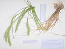 Coll. No. 1699, Elymus canadensis Coll. No. 1699, Elymus canadensis
|
1699
|
Field identification: Elymus canadensis.
Elymus canadensis L. Canadian Wildrye.
Ranson/Edwards Homestead Open Space Park, Jefferson County, Colorado. High plains above Rocky Flats, 1.7 miles west on Colorado Highway 72 from Colorado Highway 93, 1.2 miles north on Plainview Road, west side of road. 39.8897°N, 105.262°W. WGS 1984 Elev. 1935 m. Non-rhizomatous. Gravelly stream terrace.
Coll. No. 1699, 7 Jul 2017, characters observed:
Perennial grass, to 75 cm.,
non-rhizomatous;
Culm,
cauline nodes hidden by sheath;
Inflorescence,
200 mm. × 15 mm. wide,
±erect to curved;
Rachis,
mostly glabrous,
internodes, 5 mm.;
Spikelets,
2 per node,
sessile;
Glumes, #2,
21-24 mm.,
indistinct body 8 mm + awn 14 mm.,
nearly subulate,
flattened and slightly broadened above base;
Lemma,
body 10 mm. + awn 35 mm., curving.
|
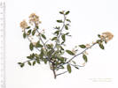 Coll. No. 1700, Ceanothus fendleri Coll. No. 1700, Ceanothus fendleri
|
1700
|
Field identification: Rhamnaceae, maybe Ceanothus fendleri.
Ceanothus fendleri A. Gray. Fendler's Ceanothus.
Ranson/Edwards Homestead Open Space Park, Jefferson County, Colorado. High plains above Rocky Flats, 1.7 miles west on Colorado Highway 72 from Colorado Highway 93, 2.2 miles north on Plainview Road, then 250 m. west northwest into the northwest corner of Ranson/Edwards Homestead OS. 39.8973°N, 105.2754°W. WGS 1984 Elev. 2024 m. Somewhat sheltered little draw near base of a hogback.
| |
|
|
Friday, July 14th
| |
Locations:
Schweich Hill.
|
|
North Washington Open Space.
| |
|
1701
|
Field identification: Cirsium arvense.
Cirsium arvense (L.) Scop. Canada Thistle.
North Washington Open Space, Jefferson County, Colorado. Small (4 acre) fallow city-owned parcel in northern Golden, near the intersection of Colorado Highway 93 and Washington Avenue, 1.75 km. northwest of the GNIS location of Golden. 39.7687°N, 105.2317°W. WGS 1984 Elev. 1766 m. East end of parcel amid a dense infestation of smooth brome.
| |
|
1702
|
Field identification: Ratibida columnifera.
Ratibida columnifera (Nutt.) Woot. & Standl. Upright Prairie Coneflower.
North Washington Open Space, Jefferson County, Colorado. Small (4 acre) fallow city-owned parcel in northern Golden, near the intersection of Colorado Highway 93 and Washington Avenue, 1.75 km. northwest of the GNIS location of Golden. 39.7686°N, 105.2317°W. WGS 1984 Elev. 1789 m. Base becoming woody. Southeast corner of parcel, between social trails.
| |
|
1703
|
Field identification: Pediomelum tenuiflorum.
Psoralidium tenuiflorum (Pursh) Rydb. Slimflower Scurfpea.
North Washington Open Space, Jefferson County, Colorado. Small (4 acre) fallow city-owned parcel in northern Golden, near the intersection of Colorado Highway 93 and Washington Avenue, 1.75 km. northwest of the GNIS location of Golden. 39.7684°N, 105.2322°W. WGS 1984 Elev. 1799 m. Southeast edge, in the approximate location of the city water line.
|
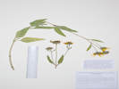 Coll. No. 1704, Helianthus pumilus Coll. No. 1704, Helianthus pumilus
|
1704
|
Field identification: Helianthus pumila.
Helianthus pumilus Nutt. Little Sunflower.
North Washington Open Space, Jefferson County, Colorado. Small (4 acre) fallow city-owned parcel in northern Golden, near the intersection of Colorado Highway 93 and Washington Avenue, 1.75 km. northwest of the GNIS location of Golden. 39.7686°N, 105.2326°W. WGS 1984 Elev. 1811 m. East-facing slope near center of parcel.
Coll. No. 1704, 14 Jul 2017, characters observed:
Perennial herb, to 40 cm.;
Leaves,
cauline,
alternate,
occasionally opposite, then bases conjoined,
petiole 10 mm. + blade 55 mm. × 22 mm. wide,
lanceolate,
flat (not folded),
margin, entire to lightly toothed,
pustular multicellular white strigose,
glandular;
Inflorescence,
single to few heads on peduncles to 100 mm.;
Involucre,
9 mm. × 16 mm. wide;
Phyllaries, in 2+ series,
8 mm. × 4 mm wide,
green,
abaxial strigose;
Receptacle,
paleate,
flat to hemispheric;
Rays,
20 mm. × 3.3 mm. wide,
yellow,
sterile;
Disk,
tube 4 mm. + lobes 1 mm., yellow;
Pappus,
scales,
to 4 mm.;
Cypsela,
3.5 mm. × 1.4 mm. wide,
quadrangular,
black.
|
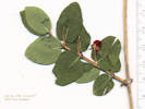 Coll. No. 1705, Lonicera tatarica Coll. No. 1705, Lonicera tatarica
|
1705
|
Field identification: Horticultural Caprifoliaceae, same as Coll. No. 1591.
|
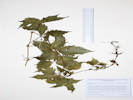 Coll. No. 1706, Parthenocissus vitacea Coll. No. 1706, Parthenocissus vitacea
|
1706
|
Field identification: Parthenocissus vitacea.
Parthenocissus vitacea (Knerr) Hitchcock. Woodbine, thicket creeper.
North Washington Open Space, Jefferson County, Colorado. Small (4 acre) fallow city-owned parcel in northern Golden, near the intersection of Colorado Hughway 93 and Washington Avenue. Several plants near the east end of the parcel, close to North Ford Street. 39.7688°N, 105.2326°W. WGS 1984 Elev. 1808 m. Tendrils without adhesive pads.
|
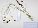 Coll. No. 1707, Thelesperma megapotamicum Coll. No. 1707, Thelesperma megapotamicum
|
1707
|
Field identification: Thelesperma megapotamicum.
Thelesperma megapotamicum (Spreng.) Kuntze. Hopi Tea Greenthread.
North Washington Open Space, Jefferson County, Colorado. Small (4 acre) fallow city-owned parcel in northern Golden, near the intersection of Colorado Highway 93 and Washington Avenue. Center of parcel, top of hill. 39.7685°N, 105.2326°W. WGS 1984 Elev. 1814 m.
| |
|
1708
|
Field identification: Eriogonum arcuatum.
Eriogonum arcuatum Greene. Baker's Buckwheat.
North Washington Open Space, Jefferson County, Colorado. Small (4 acre) fallow city-owned parcel in northern Golden, near the intersection of Colorado Highway 93 and Washington Avenue. Center of parcel, top of hill. 39.7686°N, 105.233°W. WGS 1984 Elev. 1818 m.
| |
Other articles:
• Golden Checklist Flora:
Thinopyrum intermedium;
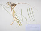 Coll. No. 1709, Thinopyrum intermedium Coll. No. 1709, Thinopyrum intermedium
|
1709
|
Field identification:Thinopyrum intermedium.
Thinopyrum intermedium (Host) Barkworth & D.R. Dewey. Intermediate Wheatgrass.
North Washington Open Space, Jefferson County, Colorado. Small (4 acre) fallow city-owned parcel in northern Golden, near the intersection of Colorado Highway 93 and Washington Avenue. North central part of parcel, just off the top of the hill. 39.7687°N, 105.233°W. WGS 1984 Elev. 1815 m. Rhizomatous.
| |
Other articles:
• Golden Checklist Flora:
Gypsophila paniculata;
• Field Notes:
Coll. No. 1666, 16 Jun 2017;
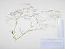 Coll. No. 1710, Gypsophila paniculata Coll. No. 1710, Gypsophila paniculata
|
1710
|
Field identification: Gypsophila paniculata.
Gypsophila paniculata L. Baby's Breath.
North Washington Open Space, Jefferson County, Colorado. Small (4 acre) fallow city-owned parcel in northern Golden, near the intersection of Colorado Highway 93 and Washington Avenue. Northwest central part of parcel, off the top of the hill, getting close to the neighbors' fences. 39.7688°N, 105.2334°W. WGS 1984 Elev. 1816 m. Colorado Noxious Weed Watch List.
| |
Other articles:
• Golden Checklist Flora:
Carduus nutans;
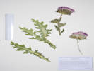 Coll. No. 1711, Carduus nutans Coll. No. 1711, Carduus nutans
|
1711
|
Field identification: Carduus nutans.
Carduus nutans L. Nodding Plumeless Thistle.
North Washington Open Space, Jefferson County, Colorado. Small (4 acre) fallow city-owned parcel in northern Golden, near the intersection of Colorado Highway 93 and Washington Avenue. Southwestern slope, probably in the revegetated zone. 39.7684°N, 105.2337°W. WGS 1984 Elev. 1811 m. Colorado Noxious Weed List B.
| |
|
1712
|
|
Native and Naturalized Flora of the Golden Area, Jefferson County, Colorado
Asteraceae
Symphyotrichum falcatum (Lindl.) G.L. Nesom.
White Prairie Aster.
North Washington Open Space, Jefferson County, Colorado.
Small (4 acre) fallow city-owned parcel in northern Golden, near the intersection of Colorado Highway 93 and Washington Avenue. Mid-slope in southwestern section, probably not in the revegetated zone.
39.7683°N, 105.2334°W.
WGS 1984
Elev. 1810 m.
See also my Coll. No. 1760.
Collected by permit: City of Golden, 2017, issued: Feb 6, 2017, to: Tom Schweich.
|
Tom Schweich
1712. |
14-Jul-2017 |
|
Field identification: Symphyotrichum sp.
| |
|
|
Friday, July 28th
| |
Other articles:
• Plainview Road:
at old ranch rd;
Locations:
Ranson/Edwards Homestead Open Space Park.
|
|
Ranson/Edwards Homestead Open Space.
| |
|
1713
|
Field identification: Grass, multiple infl. per culm, spikelets tightly appressed, Aegilops cylindrica ???
Schizachyrium scoparium (Michx.) Nash. Little Bluestem.
Ranson/Edwards Homestead Open Space Park, Jefferson County, Colorado. High plains above Rocky Flats, 1.7 miles west on Colorado Highway 72 from Colorado Highway 93, 0.8 miles north on Plainview Road, then 120 meters west into open prairie. 39.8847°N, 105.2638°W. WGS 1984 Elev. 1950 m. When immature, appressed spikelets of multiple inflorescenses per culm look similar to Aegilops cylindrica.
| |
Other articles:
• Plainview Road:
at old ranch rd;
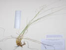 Coll. No. 1714, Sporobolus heterolepis Coll. No. 1714, Sporobolus heterolepis
|
1714
|
Field identification: Sporobolus heterolepis.
Sporobolus heterolepis (A. Gray) A. Gray. Prairie Drop-seed.
Ranson/Edwards Homestead Open Space Park, Jefferson County, Colorado. High plains above Rocky Flats, 1.7 miles west on Colorado Highway 72 from Colorado Highway 93, 0.8 miles north on Plainview Road, then 120 meters west into open prairie. 39.8847°N, 105.2638°W. WGS 1984 Elev. 1954 m. Within an arm's length of Coll. No. 1713, Schizachyrium scoparium. Collected a little early in the season for this C4, warm season grass.
Coll. No. 1714, 28 July 2017, characters observed:
Perennial grass, to 40 cm.,
caespitose;
Leaves,
mostly basal,
≥inflorescence;
Inflorescence,
(immature) 10 cm. × 2 cm. wide,
open panicle;
Spikelets,
1 per node,
4-5 mm.;
Florets,
1 per spikelet;
Glumes,
#2, awns 0,
lower, 4 mm., <lemma,
upper, 5 mm., ≥lemma;
Lemma,
4 mm., veins 1, awn 0.
| |
Other articles:
• Plainview Road:
at old ranch rd;
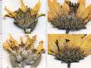 Comparison of involucres of two taxa of Helianthus Comparison of involucres of two taxa of Helianthus
|
1715
|
Field identification: Sunflower, Helianthus? long, stiff, coarse hairs.
Helianthus pumilus Nutt. Little Sunflower.
Ranson/Edwards Homestead Open Space Park, Jefferson County, Colorado. High plains above Rocky Flats, 1.7 miles west on Colorado Highway 72 from Colorado Highway 93, 0.8 miles north on Plainview Road, then 360 meters west into open prairie. 39.8854°N, 105.2664°W. WGS 1984 Elev. 1976 m. Sunflower, long coarse hairs, a few disc flowers have reddish lobes.
| |
|
1716
|
Field identification: Stiff Sunflower, Helianthus pauciflorus var. subrhiomboideus.
Helianthus pauciflorus Nutt. ssp. subrhomboideus (Rydb.) O. Spring & E. Schilling. Stiff Sunflower.
Ranson/Edwards Homestead Open Space Park, Jefferson County, Colorado. High plains above Rocky Flats, 1.7 miles west on Colorado Highway 72 from Colorado Highway 93, 0.8 miles north on Plainview Road, then 385 meters west into open prairie. 39.8853°N, 105.2667°W. WGS 1984 Elev. 1978 m.
| |
Other articles:
• Plainview Road:
at old ranch rd;
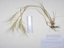 Coll. No. 1717, Elymus elymoides Coll. No. 1717, Elymus elymoides
|
1717
|
Field identification: Grass, Squirrel Tail(?)
Elymus elymoides (Raf.) Swezey. Squirreltail Grass.
Ranson/Edwards Homestead Open Space Park, Jefferson County, Colorado. High plains above Rocky Flats, 1.7 miles west on Colorado Highway 72 from Colorado Highway 93, 0.8 miles north on Plainview Road, then 395 meters west into open prairie. 39.8853°N, 105.2669°W. WGS 1984 Elev. 1984 m.
Coll. No. 1717, 28 July 2017, characters observed:
Perennial grass to 50 cm., clumped;
Inflorescence,
bilateral spike;
Rachis,
internodes, 6.4 mm.,
breaking apart when mature;
Spikelets,
2 per node;
Glumes,
#2,
subulate,
62-65 mm.;
Florets,
#3,
lowest 2 fertile, upper sterile;
Lemma,
10 mm. + awn 50 mm.,
veins, #5, converging;
Palea,
9 mm.,
1 of 2 veins slightly extended as bristle.
Variety brevifolius if infraspecific names are to be applied.
|
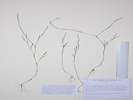 Coll. No. 1718, Polygonum douglasii Coll. No. 1718, Polygonum douglasii
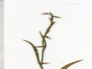 Coll. No. 1718, Polygonum douglasii Coll. No. 1718, Polygonum douglasii
|
1718
|
Field identification: Epilobium or Gayophytum --- Nope, definitely not those
Polygonum douglasii Greene. Douglas Knotweed.
Ranson/Edwards Homestead Open Space Park, Jefferson County, Colorado. High plains above Rocky Flats, 1.7 miles west on Colorado Highway 72 from Colorado Highway 93, 0.8 miles north on Plainview Road, then 500 meters west into open prairie. 39.8857°N, 105.268°W. WGS 1984 Elev. 1994 m. At base of Prunus virginiana with Symphoricarpos and Potentilla recta.
Coll. No. 1718, 28 Jul 2017, characters observed:
Annual, to 35-40 cm.,
generally glabrous;
Leaves,
cauline,
alternate,
some sort of papery tissue at base of leaf that could be an ocrea,
20 mm. × 1 mm. wide,
linear to narrowly lanceolate,
adaxial sparsely pitted,
margins revolute;
Inflorescence,
flowers borne singly in axils;
Flowers,
stipe-like base;
Perianth,
2 series of 3,
2.5 mm. × 1 mm. wide,
outer, greenish with pink margins,
inner, pink with green mid-vein;
Stamens,
#6,
1.4 mm.;
Filaments,
winged below;
Ovary,
superior,
1 mm. × 0.6 mm. wide;
Styles,
#3,
0.3 mm.;
Stigmas,
1 per style;
Fruit,
2.5 mm.,
black.
FNANM treat P. douglasii and P. majus as distinct while noting that P. majus is sometimes treated as a synonym of P. douglasii. Reading the descriptions of both, I lean toward P. majus for this collection. However, Ackerfield (2015) does not list P. majus for Colorado. Nearly all collections for Colorado are determined as P. douglasii, except for two Hall and Harbour collections at F. Weber & Wittmann (2012) explicitly list P. majus as a synonym for P. douglasii. For this collection, I will use P. douglasii, file it at JCOS and KHD, and then let the “Polygonistas” (or is it “Polygonarians?”) sort it out.
| |
|
1719
|
Field identification: Oenothera elata.
Oenothera villosa Thunb. Hairy Evening Primrose.
Ranson/Edwards Homestead Open Space Park, Jefferson County, Colorado. High plains above Rocky Flats, 1.7 miles west on Colorado Highway 72 from Colorado Highway 93, 0.8 miles north on Plainview Road, then 865 meters west into open prairie, nearly to the railroad tracks. 39.8869°N, 105.2719°W. WGS 1984 Elev. 2035 m. with Asclepias speciosa, Rosa arkansana, Solidago, and Phleum. Probably var. strigosa if infra-specific names are to be applied.
| |
|
1720
|
Field indentifcation: Eriogonum arcuatum.
Eriogonum arcuatum Greene. Baker's Buckwheat.
Ranson/Edwards Homestead Open Space Park, Jefferson County, Colorado. High plains above Rocky Flats, 1.7 miles west on Colorado Highway 72 from Colorado Highway 93, 0.8 miles north on Plainview Road, then 915 meters a little north of west into open prairie, nearly to the railroad tracks. 39.8877°N, 105.2723°W. WGS 1984 Elev. 2035 m. Rocky elevated bench.
| |
|
1721
|
Field identification: Lycopus americanus.
Lycopus americanus W. P. C. Barton. American Bugleweed.
Ranson/Edwards Homestead Open Space Park, Jefferson County, Colorado. High plains above Rocky Flats, 1.7 miles west on Colorado Highway 72 from Colorado Highway 93, 0.8 miles north on Plainview Road, then 655 meters a little north of west along a small ephemeral stream. 39.8869°N, 105.2694°W. WGS 1984 Elev. 2005 m. Streamside.
|
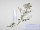 Coll. No 1721.1, Galium boreale Coll. No 1721.1, Galium boreale
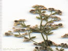 Mature Inflorescence of Coll. No 1721.1, Galium boreale Mature Inflorescence of Coll. No 1721.1, Galium boreale
|
1721.1
|
Mixed up my count. Wrote that Coll. No. 1723 was Galium boreale in my field notes, then discovered that Coll. No. 1723 was something else.
Galium boreale S. Watson. Bedstraw.
Ranson/Edwards Homestead Open Space Park, Jefferson County, Colorado. High plains above Rocky Flats, 1.7 miles west on Colorado Highway 72 from Colorado Highway 93, 0.8 miles north on Plainview Road, then 610 meters a little north of west along a small ephemeral stream. 39.8868°N, 105.2689°W. WGS 1984 Elev. 1997 m.
| |
|
1722
|
Field identification: Mentha arvensis.
Mentha arvensis L. Wild Mint.
Ranson/Edwards Homestead Open Space Park, Jefferson County, Colorado. High plains above Rocky Flats, 1.7 miles west on Colorado Highway 72 from Colorado Highway 93, 0.8 miles north on Plainview Road, then 610 meters a little north of west along a small ephemeral stream. 39.8867°N, 105.2688°W. WGS 1984 Elev. 1997 m.
|
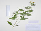 Coll. No. 1723, Lysimachia ciliata Coll. No. 1723, Lysimachia ciliata
|
1723
|
Field identification: Galium, with a stiff stem. -- Nope, the Galium turned out to be Coll. No. 1721.1.
Lysimachia ciliata L. Fringed Loosestrife.
Ranson/Edwards Homestead Open Space Park, Jefferson County, Colorado. High plains above Rocky Flats, 1.7 miles west on Colorado Highway 72 from Colorado Highway 93, 0.8 miles north on Plainview Road, then 610 meters a little north of west along a small ephemeral stream. 39.8868°N, 105.2689°W. WGS 1984 Elev. 2003 m. In the bank of a small stream.
Coll. No. 1723, 28 Jul 2018, characters observed:
Perennial herb, to 40 cm.;
Leaves,
cauline,
opposite,
petiole, 12 mm., sparsely long ciliate,
blade,
72 mm. × 26 mm. wide,
lanceolate,
glabrous,
margin minutely ciliate;
Inflorescence,
axillary,
flowers borne singly on long pedicels;
Pedicel,
30 mm.;
Sepals,
#5,
4 mm.;
Petals,
#5,
7 mm. × 6 mm. wide,
free ≥½length,
yellow;
Stamens,
#5,
alternate;
Filaments,
2 mm.,
attached near base;
Anthers,
2 mm.;
Ovary,
superior;
Style,
#1,
3 mm.,
lengthening to 4 mm. at maturity;
Fruit,
3 mm. × 3 mm. dia.,
globose,
bluish.
| |
|
1724
|
Field identification: Ranunculus, maybe R. macounii.
Ranunculus pensylvanicus L. f. Pennsylvania Buttercup.
Ranson/Edwards Homestead Open Space Park, Jefferson County, Colorado. High plains above Rocky Flats, 1.7 miles west on Colorado Highway 72 from Colorado Highway 93, 0.8 miles north on Plainview Road, then 555 meters a little north of west along a small ephemeral stream. 39.8867°N, 105.2682°W. WGS 1984 Elev. 1990 m. In the bottom on an ephemeral stream.
Coll. No. 1723, 28 Jul 2018, characters observed:
Perennial herb, to 40 cm.;
Leaves,
cauline,
opposite,
petiole, 12 mm., sparsely long ciliate,
blade,
72 mm. × 26 mm. wide,
lanceolate,
glabrous,
margin minutely ciliate;
Inflorescence,
axillary,
flowers borne singly on long pedicels;
Pedicel,
30 mm.;
Sepals,
#5,
4 mm.;
Petals,
#5,
7 mm. × 6 mm. wide,
free ≥½length,
yellow;
Stamens,
#5,
alternate;
Filaments,
2 mm.,
attached near base;
Anthers,
2 mm.;
Ovary,
superior;
Style,
#1,
3 mm.,
lengthening to 4 mm. at maturity;
Fruit,
3 mm. × 3 mm. dia.,
globose,
bluish.
| |
|
1725
|
Field identification: Geranium caespitosum.
Geranium caespitosum James. Pineywoods Geranium.
Ranson/Edwards Homestead Open Space Park, Jefferson County, Colorado. High plains above Rocky Flats, 1.7 miles west on Colorado Highway 72 from Colorado Highway 93, 0.8 miles north on Plainview Road, then 555 meters a little north of west along a small ephemeral stream. 39.8867°N, 105.2682°W. WGS 1984 Elev. 1993 m. Basal leaves withered, very red stem. On the bank of a small ephemeral stream (that was running on this particular day).
| |
|
1726
|
Field identification: Schoenoplectus, maybe S. acutus.
Scirpus pallidus (Britt.) Fern. Cloaked Bulrush.
Ranson/Edwards Homestead Open Space Park, Jefferson County, Colorado. High plains above Rocky Flats, 1.7 miles west on Colorado Highway 72 from Colorado Highway 93, 0.8 miles north on Plainview Road, then 360 meters northwest to a small ephemeral stream. 39.8866°N, 105.2655°W. WGS 1984 Elev. 1868 m.
|
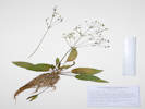 Coll. No. 1727, Alisma trivale Coll. No. 1727, Alisma trivale
|
1727
|
Field identification: Alisma triviale, based upon a similar collection across the highway at Rocky Flats.
Alisma triviale Pursh. Northern Water Plantain.
Ranson/Edwards Homestead Open Space Park, Jefferson County, Colorado. High plains above Rocky Flats, 1.7 miles west on Colorado Highway 72 from Colorado Highway 93, 0.8 miles north on Plainview Road, then 280 meters northwest to a small reservoir on an ephemeral stream. 39.8865°N, 105.2644°W. WGS 1984 Elev. 1958 m.
|
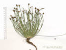 Coll. No. 1728, Eleocharis palustris Coll. No. 1728, Eleocharis palustris
|
1728
|
Field identification: Eleocharis sp.
Eleocharis palustris (L.) Roem. & Schult. Common Spikerush.
Ranson/Edwards Homestead Open Space Park, Jefferson County, Colorado. High plains above Rocky Flats, 1.7 miles west on Colorado Highway 72 from Colorado Highway 93, 0.8 miles north on Plainview Road, then 280 meters northwest to a small reservoir on an ephemeral stream. 39.8865°N, 105.2644°W. WGS 1984 Elev. 1958 m.
|
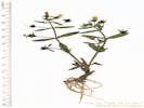 Coll. No. 1729, Gratiola neglecta Coll. No. 1729, Gratiola neglecta
|
1729
|
Field identification: Some kind of Scroph, maybe Gratiola neglecta.
Gratiola neglecta Torr. Clammy Hedge Hyssop.
Ranson/Edwards Homestead Open Space Park, Jefferson County, Colorado. High plains above Rocky Flats, 1.7 miles west on Colorado Highway 72 from Colorado Highway 93, 0.8 miles north on Plainview Road, then 280 meters northwest to a small reservoir on an ephemeral stream. 39.8865°N, 105.2644°W. WGS 1984 Elev. 1950 m.
|
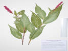 Coll. No. 1730, Persicaria pensylvanicum Coll. No. 1730, Persicaria pensylvanicum
|
1730
|
Field identification: Some kind of knotweed, quickly settling on Polygonum pennsylvanicum while looking at photos.
Persicaria pensylvanicum (L.) M. Gómez. Pennsylvania smartweed.
Ranson/Edwards Homestead Open Space Park, Jefferson County, Colorado. High plains above Rocky Flats, 1.7 miles west on Colorado Highway 72 from Colorado Highway 93, 0.8 miles north on Plainview Road, then 265 meters northwest to a small ephemeral stream below a reservoir. 39.8864°N, 105.2642°W. WGS 1984 Elev. 1955 m.
| |
|
1731
|
Field identification: definitely Mentzelia, maybe M. nuda.
Mentzelia nuda (Pursh) Torr. & A. Gray. Bractless Blazing Star.
North Washington Open Space, Jefferson County, Colorado. Small (4 acre) fallow city-owned parcel in northern Golden, near the intersection of Colorado Highway 93 and Washington Avenue. Top of Hill, center of parcel. 39.7685°N, 105.233°W. WGS 1984 Elev. 1810 m. Flowers mostly closed at 6:30 AM. Few plants here.
| |
|
|
August, 2017
| |
|
|
Tuesday, August 15th
| |
Locations:
North Table Mountain Park.
|
|
North Table Mountain, northwest side, off trail.
|
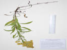 Coll. No. 1732, Solidago missouriensis at North Table Mountain. Coll. No. 1732, Solidago missouriensis at North Table Mountain.
|
1732
|
Field identification: Solidago, probably S. missouriensis.
Solidago missouriensis Nutt. Missouri Goldenrod.
North Table Mountain Park, Jefferson County, Colorado. Westernmost slope of North Table Mountain, near North Table Loop, just north of parking lot and trailhead, 3.2 km. north of the GNIS location of Golden. 39.7834°N, 105.2295°W. WGS 1984 Elev. 1835 m. With Bromus inermis, Andropogon gerardii, Liatris punctata in bud, Linum lewisii in seed.
|
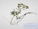 Coll. No. 1733, Euphorbia esula Coll. No. 1733, Euphorbia esula
|
1733
|
Field identification: Euphorbia, past flowering, probably E. esula.
Euphorbia esula L. Leafy Spurge.
North Table Mountain Park, Jefferson County, Colorado. Western slope of North Table Mountain, just below a break in slope formed by the lowest basalt flow embedded in the Denver Formation, 3.1 km. north of the GNIS location of Golden. 39.7833°N, 105.2273°W. WGS 1984 Elev. 1883 m.
|
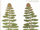 Coll. No. 1734, Woodsia oregana ssp. cathcartiana Coll. No. 1734, Woodsia oregana ssp. cathcartiana
|
1734
|
Field identification: Fern, maybe Woodsia oregana.
Woodsia oregana D.C. Eaton ssp. cathcartiana (B.L. Rob.) Windham. Rocky Mountain Woodsia.
North Table Mountain Park, Jefferson County, Colorado. Western slope of North Table Mountain, in boulders of the break in slope formed by the lowest basalt flow embedded in the Denver Formation, 3.1 km. north of the GNIS location of Golden. 39.7833°N, 105.2272°W. WGS 1984 Elev. 1889 m.
|
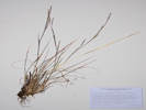 Coll. No. 1735, Schizachyrium scoparium Coll. No. 1735, Schizachyrium scoparium
|
1735
|
Field identification: Grass, maybe Schizachyrium scoparium.
Schizachyrium scoparium (Michx.) Nash. Little Bluestem.
North Table Mountain Park, Jefferson County, Colorado. About half way up the western slope of North Table Mountain, in rim rocks of oldest basalt flow embedded in the Denver Formation, 3.1 km. north of the GNIS location of Golden. 39.7833°N, 105.2269°W. WGS 1984 Elev. 1905 m. Plants smaller than those typically seen.
|
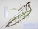 Coll. No. 1736, Liatris punctata Coll. No. 1736, Liatris punctata
|
1736
|
Field identification: Liatris punctata.
Liatris punctata Hook. Dotted Blazing Star.
North Table Mountain Park, Jefferson County, Colorado. Northwest corner of North Table Mountain, lower elevation lobe of the mesa, formed on top of the oldest basalt flow embedded in the Denver Formation, 3.1 km. north of the GNIS location of Golden. 39.7832°N, 105.2257°W. WGS 1984 Elev. 1916 m. Grassy gentle slope, this plant is an early bloomer among its species here.
| |
|
1737
|
Field identification: Grindelia squarrosa.
Grindelia squarrosa (Pursh) Dunal. Curlycup Gumweed.
North Table Mountain Park, Jefferson County, Colorado. Northwest corner of North Table Mountain, lower elevation lobe of the mesa, formed on top of the oldest basalt flow embedded in the Denver Formation, 3.1 km. north of the GNIS location of Golden. 39.7831°N, 105.2253°W. WGS 1984 Elev. 1923 m. Gentle grassy slope above oldest lava flow.
| |
Other articles:
• Golden Checklist Flora:
Acer glabrum;
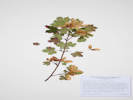 Coll. No. 1738, Acer glabrum Coll. No. 1738, Acer glabrum
|
1738
|
Field identification: Rocky Mountain Maple, Acer glabrum.
Acer glabrum Torr. Rocky Mountain Maple.
North Table Mountain Park, Jefferson County, Colorado. Northwest side of North Table Mountain, in a small gulch just below the rim of the mesa formed by the highest lava flow in the Denver Formation. 39.7824°N, 105.222°W. WGS 1984 Elev. 1954 m. One of several quintessential Jefferson County taxa, as the type was collected in Platte Canyon by Dr. Edwin James of the Major Stephen H. Long expedition of 1820.
|
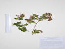 Coll. No. 1739, Physocarpus monogynus Coll. No. 1739, Physocarpus monogynus
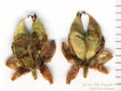 Fruit of Coll. No. 1739, Physocarpus monogynus Fruit of Coll. No. 1739, Physocarpus monogynus
|
1739
|
Field identification: Physocarpus monogynus, in fruit.
Physocarpus monogynus (Torr.) J.M. Coult. Mountain Ninebark.
North Table Mountain Park, Jefferson County, Colorado. Northwest side of North Table Mountain, in a small gulch just below the rim of the mesa formed by the highest lava flow in the Denver Formation. 39.7822°N, 105.222°W. wgs 1984 Elev. 1956 m. Collected for fruit, most often of 2 follicles. One of several quintessential Jefferson County taxa, as the type was collected in Platte Canyon by Dr. Edwin James of the Major Stephen H. Long expedition of 1820.
| |
Other articles:
• Golden Checklist Flora:
Eriocoma robusta;
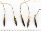 Coll. No. 1740, Coll. No. 1740, Achnatherum Eriocoma robustum
|
1740
|
Field identification: First thought was an unusual Stipae, but probably Nassella viridula.
Achnatherum robustum (Vasey) Barkworth. Sleepygrass.
North Table Mountain Park, Jefferson County, Colorado. Top of North Table Mountain, in mixed grasses near areas of bare basalt, 150 m. northwest of Lichen Peak, 2.7 km. north of the GNIS location of Golden. 39.7798°N, 105.2218°W. WGS 1984 Elev. 1993 m.
|
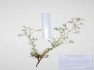 Coll. No. 1741, Aliciella pinnatifida Coll. No. 1741, Aliciella pinnatifida
|
1741
|
Field identification: Some sort of Gilia s. l.
Aliciella pinnatifida (Nutt. ex A.Gray) J.M.Porter. Sticky Gilia.
North Table Mountain Park, Jefferson County, Colorado. Top of North Table Mountain, on volcanic gravel plain near areas of bare basalt, 150 m. northwest of Lichen Peak, 2.6 km. north of the GNIS location of Golden. 39.7794°N, 105.2223°W. WGS 1984 Elev. 1993 m. Volcanic gravel plain, also seen on floor of basalt quarry.
| |
|
1742
|
Field identification: Mentzelia sp.
Mentzelia. Blazing Star.
North Table Mountain Park, Jefferson County, Colorado. Top of North Table Mountain, in basalt quary on west side, 2.1 km. north of the GNIS location of Golden. 39.7747°N, 105.2232°W. WGS 1984 Elev. 1980 m. On an artificial slope inside the basalt quarry.
| |
|
1743
|
Field identification: Bouncingbet.
Saponaria officinalis L. Bouncingbet.
North Table Mountain Park, Jefferson County, Colorado. West side of North Table Mountain, beside the former quarry road now forming a part of North Table Loop, 2.8 km. north of the GNIS location of Golden. 39.7802°N, 105.2281°W. WGS 1984 Elev. 1871 m.
Colorado Noxious Weed List B.
| |
|
|
Wednesday, August 23rd
| |
Other articles:
• Cheyenne Street:
near 4th;
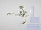 Coll. No. 1743.5, Symphyotrichum ericoides Coll. No. 1743.5, Symphyotrichum ericoides
|
1743.5
|
Field identification: Symphyotrichum sp.
Symphyotrichum ericoides (Linnaeus) G. L. Nesom. White Heath Aster.
Golden, Jefferson County, Colorado. Edge of the yard on Cheyenne Street at 908 4th Street, 1 km northwest of the GNIS location of Golden. 39.7614°N, 105.2301°W. WGS 1984 Elev. 5785 ft. Native to the area, but ruderal in this location, as sometimes also observed with Ericameria nauseosa var. graveolens and Senecio spartioides.
Perennial,
woody at base, stems ascending, to 40 cm.,
spreading vegetatively,
short hairy and minutely glandular throughout;
Leaves,
alternate,
sessile,
narrowly lanceolate or oblong, 7-9 mm. × 1.5 mm. wide,
entire,
strigose,
tip, small white spine;
Heads,
borne singly along stem, occasionally 2 per stem, on leafy pedicels;
Flowers, of 2 kinds;
Involucre, 4 mm. × 5 mm. wide, bell-shaped;
Phyllaries,
2+ series,
3-4 mm. × 0.7-0.8 mm. wide,
white below with 1 brown or green vein,
rhomboid green above,
tip with very small spine;
Receptacle, epaleate;
Rays, corolla, white,
tube 2 mm + ligule 5.0-6.5 mm.,
fertile;
Disc flowers, corolla, yellow,
tube 3.5 mm. + lobes 0.5 mm.,
(some?) lobes reddish;
Pappus, bristles, fine, barbelate, 4 mm.;
Cypsela, 1 mm.
(Described from Coll. No. 1558, 3 September 2016
and Coll. No. 1743.5, 23 August 2017).
| |
|
|
Thursday, August 31st
| |
Locations:
Schweich Hill.
|
|
North Washington Open Space.
| |
|
1744
|
Field identification: Bouteloua gracilis.
Bouteloua gracilis (Kunth) Lag. ex Griffiths. Blue Grama.
North Washington Open Space, Jefferson County, Colorado. Northeast corner of parcels, in an area of much smooth brome that has been mowed by neighbors to the north. 39.7688°N, 105.2321°W. WGS 1984 Elev. 1800 m. In bloom in mowed area.
| |
|
1745
|
Field identification: Euphorbia myrsinites.
Euphorbia myrsinites L. Myrtle Spurge.
North Washington Open Space, Jefferson County, Colorado. Northeast corner of parcels, in an area of much smooth brome that has been mowed by neighbors to the north. 39.7688°N, 105.2321°W. WGS 1984 Elev. 1804 m. In mowed area of smooth brome.
| |
|
1746
|
Field identification: Malva neglecta.
Malva neglecta Wallr. Common Mallow.
North Washington Open Space, Jefferson County, Colorado. Small (4 acre) fallow city-owned parcel in northern Golden, near the intersection of Colorado Highway 93 and Washington Avenue, 1.75 km. northwest of the GNIS location of Golden. Northeast corner of parcels. 39.7688°N, 105.2322°W. WGS 1984 Elev. 1804 m. Large plant at the edge of the area mowed by neighbors.
| |
|
1747
|
Field identification: Liatris punctata.
Liatris punctata Hook. Dotted Blazing Star.
North Washington Open Space, Jefferson County, Colorado. Small (4 acre) fallow city-owned parcel in northern Golden, near the intersection of Colorado Highway 93 and Washington Avenue, 1.75 km. northwest of the GNIS location of Golden. 39.7688°N, 105.2323°W. WGS 1984 Elev. 1806 m. Northeast section, in deep grasses (mostly smooth brome) and other weeds.
|
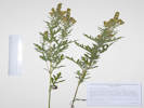 Coll. No. 1748, Ambrosia psilostachya Coll. No. 1748, Ambrosia psilostachya
|
1748
|
Field identification: Ambrosia psilostachya.
Ambrosia psilostachya DC. Western Ragweed.
North Washington Open Space, Jefferson County, Colorado. Small (4 acre) fallow city-owned parcel in northern Golden, near the intersection of Colorado Highway 93 and Washington Avenue, 1.75 km. northwest of the GNIS location of Golden. 39.7689°N, 105.2322°W. WGS 1984 Elev. 1807 m. Northeast sector, just west of the mowed area, among smooth brome.
| |
Other articles:
• Golden Checklist Flora:
Lactuca serriola;
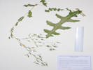 Coll. No. 1749, Lactuca serriola Coll. No. 1749, Lactuca serriola
|
1749
|
Field identification: Lactuca, probably L. serriola.
Lactuca serriola L. Prickly Lettuce.
North Washington Open Space, Jefferson County, Colorado. Small (4 acre) fallow city-owned parcel in northern Golden, near the intersection of Colorado Highway 93 and Washington Avenue, 1.75 km. northwest of the GNIS location of Golden. 39.7689°N, 105.2322°W. WGS 1984 Elev. 1809 m. Large, against neighbor's fence, maybe getting watered with neighbor's landscaping.
|
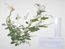 Coll. No. 1750, Chenopodium album Coll. No. 1750, Chenopodium album
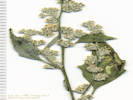 Coll. No. 1750, Chenopodium album Coll. No. 1750, Chenopodium album
|
1750
|
Field identification: Chenopodium album.
Chenopodium album L. Lambsquarters.
North Washington Open Space, Jefferson County, Colorado. Small (4 acre) fallow city-owned parcel in northern Golden, near the intersection of Colorado Highway 93 and Washington Avenue, 1.75 km. northwest of the GNIS location of Golden. 39.7686°N, 105.2319°W. WGS 1984 Elev. 1807 m. East end of parcels, adjacent to social trail over top of hill. Var. album if infraspecific names are to be applied.
| |
|
1751
|
Field identification: Gutierrezia sarothrae.
Gutierrezia sarothrae (Pursh) Britton & Rusby. Broom Snakeweed.
North Washington Open Space, Jefferson County, Colorado. Small (4 acre) fallow city-owned parcel in northern Golden, near the intersection of Colorado Highway 93 and Washington Avenue, 1.75 km. northwest of the GNIS location of Golden. 39.7686°N, 105.2325°W. WGS 1984 Elev. 1811 m. Eastern half of parcel, east slope at edge of smooth brome infestation.
| |
Other articles:
• Field Notes:
Coll. No. 1759, 31 Aug 2017;
|
1752
|
Field identification: Solidago, maybe S. missouriensis.
Solidago missouriensis Nutt. Missouri Goldenrod.
North Washington Open Space, Jefferson County, Colorado. Small (4 acre) fallow city-owned parcel in northern Golden, near the intersection of Colorado Highway 93 and Washington Avenue, 1.75 km. northwest of the GNIS location of Golden. 39.7686°N, 105.2325°W. WGS 1984 Eastern half of parcel, east slope at edge of smooth brome infestation.
| |
|
1753
|
Field identification: Artemisia ludoviciana.
Artemisia ludoviciana Nutt. Silver Wormwood.
North Washington Open Space, Jefferson County, Colorado.
Small (4 acre) fallow city-owned parcel in northern Golden, near the intersection of Colorado Highway 93 and Washington Avenue, 1.75 km. northwest of the GNIS location of Golden.
39.7685°N, 105.2325°W. WGS 1984 Elev. 1809 m.
Var. ludoviciana if infraspecific names are to be applied.
|
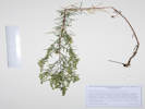 Coll. No. 1754, Artemisia dracunculus Coll. No. 1754, Artemisia dracunculus
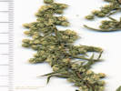 Coll. No. 1754, Artemisia dracunculus Coll. No. 1754, Artemisia dracunculus
|
1754
|
Field identification: Artemisia dracunculus.
Artemisia dracunculus L. Tarragon, Dragon Wort.
North Washington Open Space, Jefferson County, Colorado. Small (4 acre) fallow city-owned parcel in northern Golden, near the intersection of Colorado Highway 93 and Washington Avenue, 1.75 km. northwest of the GNIS location of Golden. 39.7685°N, 105.2324°W. WGS 1984 Elev. 1807 m. Eastern slope adjacent to social trail over the top of the hill.
| |
|
1755
|
Field identification: Senecio spartioides.
Senecio spartioides Torr. & A. Gray. Broomlike Ragwort.
North Washington Open Space, Jefferson County, Colorado. Small (4 acre) fallow city-owned parcel in northern Golden, near the intersection of Colorado Highway 93 and Washington Avenue, 1.75 km. northwest of the GNIS location of Golden. 39.7685°N, 105.2328°W. WGS 1984 Elev. 1812 m. Near top of hill, in some of the least-disturbed native vegetation.
| |
|
1756
|
Field identification: Eriogonum effusum.
Eriogonum effusum Nutt. Spreading Buckwheat.
North Washington Open Space, Jefferson County, Colorado. Small (4 acre) fallow city-owned parcel in northern Golden, near the intersection of Colorado Highway 93 and Washington Avenue, 1.75 km. northwest of the GNIS location of Golden. 39.7685°N, 105.2331°W. WGS 1984 Elev. 1816 m. Center of parcel, slight southwest slope. (Most of the flowers will be found in the fragment packets.)
| |
Other articles:
• Golden Checklist Flora:
Sporobolus cryptandrus;
 Coll. No. 1757, Sporobolus cryptandrus Coll. No. 1757, Sporobolus cryptandrus
 Leaf collar of Coll. No. 1757, Sporobolus cryptandrus Leaf collar of Coll. No. 1757, Sporobolus cryptandrus
|
1757
|
Field identification: grass.
Sporobolus cryptandrus (Torr.) A. Gray. Sand Drop-seed.
North Washington Open Space, Jefferson County, Colorado. Small (4 acre) fallow city-owned parcel in northern Golden, near the intersection of Colorado Highway 93 and Washington Avenue, 1.75 km. northwest of the GNIS location of Golden. 39.7686°N, 105.2331°W. WGS 1984 Elev. 1816 m. Top of hill, adjacent to social trail. Native to Colorado, but also commonly used in revegetation projects.
Described by Torrey from a collection by Dr. Edwin James, botanist on the Long Expedition of 1820.
Coll. No. 1757, 31 Aug 2017, characters observed:
Perennial grass, to 50 cm., caespitose;
Leaves,
cauline,
sheath,
45 mm.,
overlapping about ½,
open,
ciliate distally;
ligule, hairy, 0.5 mm.,
collar of hairs to 3 mm.,
blade,
150 mm. × 3.5 mm. wide,
rolled to flat;
Inflorescence,
open panicle,
120 mm, × 45 mm. wide,
lower branches included in sheath;
Spikelets,
2 mm. × 0.5 mm. wide,
crowded on panicle branches,
glabrous throughout;
Florets,
1 per spikelet,
bisexual;
Glumes,
#2, awns 0,
lower, 0.7 mm.,
upper, 1.8 mm.;
Lemma,
2.0 mm.,
veins, 1, prominent green,
awns, 0;
Palea,
1.9 mm.
|
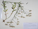 Coll. No. 1758, Brickellia eupatorioides Coll. No. 1758, Brickellia eupatorioides
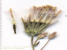 Flower head of Coll. No. 1758, Brickellia eupatorioides Flower head of Coll. No. 1758, Brickellia eupatorioides
|
1758
|
Field identification: Brickellia eupatorioides.
Brickellia eupatorioides (L.) Shinners. False Boneset.
North Washington Open Space, Jefferson County, Colorado. Small (4 acre) fallow city-owned parcel in northern Golden, near the intersection of Colorado Highway 93 and Washington Avenue, 1.75 km. northwest of the GNIS location of Golden. 39.7681°N, 105.2336°W. WGS 1984 Elev. 1802 m. On a bank that was formerly cut, unknown whether it was intentionally regevetated or not.
| |
Other articles:
• Field Notes:
Coll. No. 1752, 31 Aug 2017;
 Coll. No. 1759, Solidago nana Coll. No. 1759, Solidago nana
|
1759
|
Field identification: Solidago, maybe S. nana, compare to Coll. No. 1752.
Solidago nana Nutt. Baby Goldenrod.
North Washington Open Space, Jefferson County, Colorado. Small (4 acre) fallow city-owned parcel in northern Golden, near the intersection of Colorado Highway 93 and Washington Avenue, 1.75 km. northwest of the GNIS location of Golden. 39.7682°N, 105.2337°W. WGS 1984 Elev. 1805 m. On a bank that was formerly cut, unknown whether it was intentionally regevetated or not.
| |
|
1760
|
Field identification: Erigeron, maybe Symphyotrichum falcatum like found at Tin Cup Ridge.
Symphyotrichum falcatum (Lindl.) G.L. Nesom. White Prairie Aster.
North Washington Open Space, Jefferson County, Colorado. Small (4 acre) fallow city-owned parcel in northern Golden, near the intersection of Colorado Highway 93 and Washington Avenue, 1.75 km. northwest of the GNIS location of Golden. 39.7681°N, 105.2333°W. WGS 1984 Elev. 1806 m. South-central portion of parcel, but still above the most disturbed areas.
| |
|
|
September, 2017
| |
|
|
Friday, September 1st
| |
|
|
Ranson/Edwards Homestead Open Space
| |
|
1761
|
Field identification: Gentiana affinis.
Gentiana affinis Griseb. Pleated or Rocky Mountain Gentian..
Ranson/Edwards Homestead Open Space Park, Jefferson County, Colorado. High plains above Rocky Flats, 1.7 mi. west on Colorado Highway 72 from Colorado Highway 93, 1.6 mi. north on Plainview Road, then 35 meters southwest on the slope above the road. 39.8928°N, 105.2662°W. WGS 1984 Elev. 1953 m. Flowers just beginning to open.
| |
|
1762
|
Field identification: Sorghastrum nutans.
Sorghastrum nutans (L.) Nash. Yellow Indian Grass.
Ranson/Edwards Homestead Open Space Park, Jefferson County, Colorado. High plains above Rocky Flats, 1.7 mi. west on Colorado Highway 72 from Colorado Highway 93, 1.6 mi. north on Plainview Road, then 35 meters southwest on the slope above the road. 39.8928°N, 105.2662°W. WGS 1984 Elev. 1971 m.
|
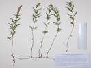 Coll. No. 1763, Ambrosia psilostachya Coll. No. 1763, Ambrosia psilostachya
|
1763
|
Field identification: Ambrosia psilostachya.
Ambrosia psilostachya DC. Western Ragweed.
Ranson/Edwards Homestead Open Space Park, Jefferson County, Colorado. High plains above Rocky Flats, 1.7 mi. west on Colorado Highway 72 from Colorado Highway 93, 1.6 mi. north on Plainview Road, then 35 meters southwest on the slope above the road. 39.8928°N, 105.2662°W. WGS 1984 Elev. 1972 m.
| |
|
1764
|
Field identification: Schizachyrium scoparium.
Schizachyrium scoparium (Michx.) Nash. Little Bluestem.
Ranson/Edwards Homestead Open Space Park, Jefferson County, Colorado. High plains above Rocky Flats, 1.7 mi. west on Colorado Highway 72 from Colorado Highway 93, 1.6 mi. north on Plainview Road, then 35 meters southwest on the slope above the road. 39.8928°N, 105.2662°W. WGS 1984 Elev. 1972 m. Smallish plants.
| |
|
1765
|
Field identification: Grindelia squarrosa.
Grindelia squarrosa (Pursh) Dunal. Curlycup Gumweed.
Ranson/Edwards Homestead Open Space Park, Jefferson County, Colorado. High plains above Rocky Flats, 1.7 mi. west on Colorado Highway 72 from Colorado Highway 93, 1.6 mi. north on Plainview Road, then 35 meters southwest on the slope above the road. 39.8927°N, 105.2661°W. WGS 1984 Elev. 1970 m.
| |
|
1766
|
Field identification: Bouteloua curtipendula.
Bouteloua curtipendula (Michx.) Torr. Sideoats Grama.
Ranson/Edwards Homestead Open Space Park, Jefferson County, Colorado. High plains above Rocky Flats, 1.7 mi. west on Colorado Highway 72 from Colorado Highway 93, 1.6 mi. north on Plainview Road, then 100 meters southwest on the slope above the road. 39.8923°N, 105.2668°W. WGS 1984 Elev. 1979 m. Few plants in a small area.
|
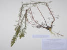 Coll. No. 1767, Artemisia campestris Coll. No. 1767, Artemisia campestris
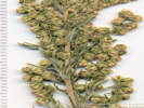 Inflorescence of Coll. No. 1767, Artemisia campestris Inflorescence of Coll. No. 1767, Artemisia campestris
|
1767
|
Field identification: Artemisia campestris.
Artemisia campestris L. Field Sagewort.
Ranson/Edwards Homestead Open Space Park, Jefferson County, Colorado. High plains above Rocky Flats, 1.7 mi. west on Colorado Highway 72 from Colorado Highway 93, 1.6 mi. north on Plainview Road, then 250 meters southwest on the slope above the road. 39.8911°N, 105.2674°W. WGS 1984 Elev. 1994 m. Rocky alluvial ridge. Somewhat ambiguous as to variety, but most like var. pacifica if infraspecific names are to be applied.
Coll. No. 1767, 1 Sep 2017, characters observed:
Perennial herb, to 60 cm.,
longer lived than biennial;
Stem,
4± per caudex,
reddish;
Leaves,
basal mostly withered,
cauline,
8 mm. × 0.6 mm. wide,
narrowly oblanceolate,
tomentose;
Inflorescence,
130 mm. × 20 mm. wide;
Heads,
many,
2 mm. × 2 mm. wide;
Phyllaries,
2+ series,
1.5 mm. × 1 mm. wide,
green to scarious;
Receptacle,
naked.
|
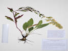 Coll. No. 1768, Solidago speciosa var. pallida Coll. No. 1768, Solidago speciosa var. pallida
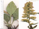 Basal leaf and inflorescence of Coll. No. 1768, Solidago speciosa var. pallida Basal leaf and inflorescence of Coll. No. 1768, Solidago speciosa var. pallida
|
1768
|
Field identification: Solidago, elongated inflorescence, rosettes of leaves growing from caudex, likely S. missouriensis.
Solidago speciosa Nutt. var. pallida Porter. Pale Showy Goldenrod.
Ranson/Edwards Homestead Open Space Park, Jefferson County, Colorado. High plains above Rocky Flats, 1.7 mi. west on Colorado Highway 72 from Colorado Highway 93, 1.6 mi. north on Plainview Road, then 260 meters southwest on the slope above the road. 39.891°N, 105.2674°W. WGS 1984 Elev. 1993 m. Elongated inflorescence, new rosettes growing from caudex while in flower.
Coll. No. 1768, 1 Sep 2017, characters observed:
Perennial herb,
50-55 cm.,
new rosette growing from caudex while flowering from adjacent stem;
Stem,
glabrous,
reddish;
Leaves,
new rosette of basal leaves,
petiole 38-55 mm.,
blade 80 mm. × 25 mm. wide,
pinnately veined,
glabrous,
margin minutely ciliate,
basal leaves of flowering stem, withered,
cauline leaves,
reduced,
not clasping,
short petioled 18-0 mm. distally,
glabrate,
turning reddish,
margin ciliate;
Inflorescence,
panicle-like (only 1° and 2° branches),
minutely glandular among heads;
Heads,
many,
6 mm. × 2.3 mm. wide;
Peduncles,
2 mm.;
Involucre,
3.5 mm. × 2.5 mm. wide;
Phyllaries,
3+ graduated series,
1.7-3.0 mm. × 0.7 mm. wide,
vein, 1,
tip, obtuse, ciliate;
Receptacle,
epaleate;
Flowers,
2 kinds;
Rays,
few (#2),
tube 2 mm. + blade 2 mm.,
yellow,
fertile;
Disc flowers,
#10-12,
tube 3 mm. + lobes 1 mm.,
yellow;
Pappus,
bristles,
3 mm.;
Cypsela,
1 mm.,
glabrous (sparse small hairs).
| |
Other articles:
• Glossary:
corymbiform;
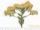 Corymbiform inflorescence of Coll. No. 1769, Solidago rigida var. humilis Corymbiform inflorescence of Coll. No. 1769, Solidago rigida var. humilis
|
1769
|
Field identification: Solidago, maybe S. rigida var. humilis.
Solidago rigida L. var. humilis Porter. Stiff Goldenrod.
Ranson/Edwards Homestead Open Space Park, Jefferson County, Colorado. High plains above Rocky Flats, 1.7 mi. west on Colorado Highway 72 from Colorado Highway 93, 1.6 mi. north on Plainview Road, then 270 meters southwest on the slope above the road. 39.8909°N, 105.2675°W. WGS 1984 Elev. 1993 m.
| |
|
1770
|
Field identification: Symphyotrichum porteri.
Symphyotrichum porteri (A. Gray) G.L. Nesom. Smooth White Aster.
Ranson/Edwards Homestead Open Space Park, Jefferson County, Colorado. High plains above Rocky Flats, 1.7 mi. west on Colorado Highway 72 from Colorado Highway 93, 1.6 mi. north on Plainview Road, then 210 meters southwest on the slope above the road and near a small group of Ponderosa pines. 39.8918°N, 105.2679°W. WGS 1984 Elev. 1997 m. Glabrous throughout, leaves and phyllaries with a white spinulose tip, ray flowers white. Growing with Coll. No. 1771, Symphyotrichum ericoides.
| |
|
1771
|
Field identification: Symphyotrichum, either S. ericoides or S. falcatum.
Symphyotrichum ericoides (Linnaeus) G. L. Nesom. White Heath Aster.
Ranson/Edwards Homestead Open Space Park, Jefferson County, Colorado. High plains above Rocky Flats, 1.7 mi. west on Colorado Highway 72 from Colorado Highway 93, 1.6 mi. north on Plainview Road, then 210 meters southwest on the slope above the road and near a small group of Ponderosa pines. 39.8919°N, 105.2679°W. WGS 1984 Elev. 1997 m. Short hairy throughout, leaves with spinulose tip, heads secund, ray flowers white.
| |
|
1772
|
Field identification: Epilobium brachycarpum.
Epilobium brachycarpum C. Presl. Autumn Willow Herb.
Ranson/Edwards Homestead Open Space Park, Jefferson County, Colorado. High plains above Rocky Flats, 1.7 mi. west on Colorado Highway 72 from Colorado Highway 93, 1.6 mi. north on Plainview Road, then 100 meters west in a small watercourse above the road. 39.8931°N, 105.2673°W. WGS 1984 Elev. 1980 m.
| |
|
|
Saturday, September 9th
| |
|
|
Sunday, September 10th
| |
Other articles:
• Colorado State Highway 115:
Cheyenne Mountain State Park;
Locations:
Cheyenne Mountain State Park.
 Cheyenne Montain from the state park. Cheyenne Montain from the state park.
|
|
| |
Other articles:
• Colorado State Highway 105:
72000;
Locations:
Palmer Lake.
 Palmer Lake Palmer Lake
|
|
Palmer Lake
| |
|
|
Sunday, September 17th
Golden to Buena Vista
| |
Other articles:
• U. S. Highway 50:
Cañon City;
Locations:
Cañon City.
 A former railroad depot in Canon City A former railroad depot in Canon City
|
|
Cañon City
Fremont Cattlemen's Association Brand Board |
Two old buildings on Main Street, Canon City |
| |
Other articles:
• County Road 3A:
Royal Gorge Bridge and Park;
Royal Gorge;
Locations:
Royal Gorge.
Royal Gorge Bridge.
 DRGW 499 on display at Royal Gorge. DRGW 499 on display at Royal Gorge.
|
|
Royal Gorge Bridge
Royal Gorge Bridge |
Interpretive panel for Royal Gorge Bridge |
Looking down into the gorge from the bridge |
|
Royal Gorge
Lt. Zebulon Pike and his men, who traveled through this area in November and December 1806, were the first American explorers to view the Arkansas River canyon now known as the Royal Gorge. A small party from the Maj. Stephen H. Long expedition visited the mouth of the canyon in 1820, as did members of Lt. John C. Fremont's expedition in 1845.
In 1878 a right of way through the Royal Gorge became the focal point of a bitter struggle between the Denver and Rio Grande and the Atchison, Topeka and Santa Fe Railroads, with the D and RG eventually winning the route through court action. Congress ceded the land comprising the Royal Gorge Park to Cañon City in 1906, and the world's highest suspension bridge spanning the Arkansas River 1053 feet below was built in 1929.
Elevation 6,626 feet.
Erected by the State Historical Society of Colorado
|
| |
|
|
Monday, September 18th
Salida to Creede
| |
Locations:
Methodist Mountain.
 Methodist Mountain from Salida in the early morning Methodist Mountain from Salida in the early morning
|
|
Methodist Mountain from our hotel room.
| |
Other articles:
• U. S. Highway 50:
91960;
Locations:
Maysville.
 Maysville School Maysville School
|
|
Maysville
| |
Other articles:
• U. S. Highway 50:
91920;
Locations:
Monarch (historical).
 Mining area at Monarch Mining area at Monarch
|
|
Monarch
Turning aspens at Monarch. |
| |
Other articles:
• U. S. Highway 50:
at Monarch Pass;
Locations:
Monarch Pass.
 Monarch Pass, 11,306 ft. Monarch Pass, 11,306 ft.
|
|
Monarch Pass
| |
Other articles:
• Colorado State Highway 149:
near Powderhorn;
Locations:
Powderhorn.
 Interpretive panel for Powderhorn Valley. Interpretive panel for Powderhorn Valley.
|
|
Powderhorn
View southwest to the populated place of Powderhorn |
Horses grazing in Powderhorn Valley |
|
Powderhorn Valley
Powderhorn Valley was named by mountain men and fur trappers because the shape of the valley resembles a bison horn that would have been used to keep gunpowder dry.
The Post Office in Powderhorn Valley was established in 1876 when the valley was settled by ranch families looking for lush grassland to support cattle. In the early years, Powderhorn Valley supplied beef and potatoes that fed the hungry miners and most of the hay for the horses, mules, and burros that worked in the mines in the mountains above Lake City.
For years, families shopped at Youman's store. Everything in the store was behind the counter and customers had to ask for needed items. Household goods, including fabric, nails, flour, and seed were available only in bulk and needed to tbe measured or weighed at the time goods were sold.
|
| |
Other articles:
• Colorado State Highway 149:
Gateview;
Locations:
Gateview.
 Interpretive panel for the Old Spanish Trail Interpretive panel for the Old Spanish Trail
|
|
Gateview
Interpretive panel “Lost in a Blizzard” |
Looking downstream on the Lake Fork of the Gunnison River |
|
The Old Spanish Trail 1829-1848
Between 1829 and 1848 woolen goods were transported by mule caravans from the Mexican outpost of Santa Fe to the Missions of Southern California on the Old Spanish Trail.
Annual mule pack caravans traveled the historic Old Spanish Trail between Santa Fe, New Mexico and Los Angeles, California. Traders from Santa Fe headed to San Gabriel Mission as a welcome destination. They brought woolen goods from New Mexico and returned with highly prized California mules and horses. Following ancient Native American trails, the trade route went into central Utah during Spanish Colonial days and continued as an emigrant trail during the Mexican period. Anglo trappers and military expeditions, including John Fremont, Kit Carson, and John Gunnison used various routes of what is now recognized as the Old Spanish National Historic Trail.
In June 1853, Lieutenant Edward Beale, accompanied by Gwinn Harris Heap detailed their travel route through this area. Head wrote “
we crossed the two forks of the Jaroso (Cebolla Creek and Powderhorn Creek)
we rested for the night by a small shallow brook, very marshy, and swarming with mosquitos
Numbers of deer and antelopes were seen; indeed, these sheltered calleys seem expressly intended as coverts for those gentle animals
Traders from Abiquiu come by it into these mountains to barter for peltries with the Utahs (Ute Indians).”
|
|
Lost in a Blizzard
“In the Colorado Rockies where the snow is deep and cold
a man afoot can starve to death unless he's brave and bold.” -- Ballad of Alferd Packer
What is now recognized as one of the most notorious events in Colorado's history -- cannibalism by Alferd Packer -- unfolded in the valley below you. If was here that Alferd Packer and his men made a most disastrous mistake, then missed a turn in the trail and became hopelessly lost in the San Juan Mountains.
On that fateful day in February 1874, Alferd Packer became lost in a severe snow storm while guiding five men from Salt Lake City ti the Los Piños Indian Agency, located south of what is now Gunnison. At the time, the Old Spanish Trail was a well worn trail that continued on to Taos and Santa Fe. Unfortunately, snow covered the trail in the valley below and the hapless men continued to the south instead of remaining in the trail to the east.
Cannibalism in the high country could have been averted had they remained on the correct trail towards Cohetopa Pass.
|
| |
Other articles:
• Colorado State Highway 149:
at The Gate;
Locations:
The Gate.
 Interpretive panel at The Gate Interpretive panel at The Gate
|
|
The Gate
The walls of The Gate |
|
Keeping the Peace
“The trail is well worn, and the peeled trees show that the valley has been much frequented by (Ute) Indians.”
Gold was discovered in the San Juan Mountains in the late 1860s leading to a rush of miners. Tension rose between the miners seeking gold and the Ute Indians who lived and hunted in the mountains. As a result, the U. S. Government negotiated the Brunot Treaty in 1873 with Chief Ouray and the Weminuche Ute.
“At this point we passed the Great Gate, a rift in a spar sweeping around from range to range across the calley.” -- Lt. E. H. Ruffner, Corps of Engineers, Reconnaissance in the Ute Country, 1873
That same year, the military sent Lt. E. H. Ruffner into the San Juan Mountains to document mining operations in Southern Colorado and evaluate the effectiveness of the Brunot Treaty. Ruffner noted, “While at Camp 47 we were visited by many western Utes, mostly well armed, well mounted, and well dressed; uncommonly clean, smiling and civil; short men, with broad muscular shoulders.”
|
| |
Literature Cited:
- Pitblado, Bonnie L., 2015.
Other articles:
• Colorado State Highway 149:
at interp. stop;
Locations:
Lake City.
|
|
Roadside interpretive stop.
Hazy view of turning aspens |
Interpretive panel for Early Holocene Encampment |
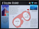
Interpretive panel for Lake City Caldera |
|
A Volcanic History
Twenty million years ago this entire region was geologically active as massive volcanoes changed the face of the landscape.
If you were here 23 million years ago, you would be standing on the northern edge of that is now called the Lake City Caldera. As the magma chamber emptied from this massive volcano it could no longer hold its shape. The volcano collapsed and fell into itself. This formed the landscape we see today. Most of the rocks surrounding the caldera including granite, obsidian, basalt, tuff and pumice are direct evidence of this region's violent volcanic past.
A caldera is a caldron-like feature formed by the collapse of land following a volcanic eruption. With the collapse of the Lake City and Silverton calderas, a volcanic soup of minerals was injected into the surrounding rock. This produced a rich intrusion of silver, gold, lead, copper, tellurium, and iron. For millions of years, these deposits remained untouched until discovered by prospectors in the 1860s and 1870s.
|
|
Early Holocene Encampment
Nearly 10,000 years ago, archaic hunters and gatherers camped along the Lake Fork of the Gunnison River. Here they hunted wild game such as bighorn sheep and elk in these alpine valleys.
At the end of the last Ice Age, Archaic big game hunters skillfully hunted animals such as elk, deer, bighorn sheep, and a now extinct variety of bison (Bison taylori). Archaeological evidence indicates that these hunters camped along the Lake Fork of the Gunnison River. Stone tools found in these emcampments include bifaces, drills, scrapers, projectile points, and point fragments.
Near the end of the Ice Age, during a colder and wetter period of time, Archaic hunters lived in small bands. Indications are that they did not stay in any one place very long, but moved often in search of game animals.
|
| |
Other articles:
• Colorado State Highway 149:
Lake City;
Locations:
Lake City.
 Hinsdale County Court House Hinsdale County Court House
|
|
Lake City
Turning aspens above Lake City |
| |
Literature Cited:
- Anonymous, 2015.
Other articles:
• Colorado State Highway 149:
at massacre site;
Locations:
Alferd Packer Massacre Site.
|
|
Alferd Packer Massacre Site
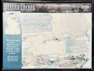
Interpretive panel at Alferd Packer massacre site. |
Plaque at Alferd Packer massacre site. |
|
Alferd Packer
“You man eating son of a
There was seven Democrats in Hinsdale County and you ate five of them.”
-- Quote attributed to saloon keeper Larry Dolan after Alferd Packer's first trial.
In February 1874, Alferd Packer became lost in a severe snow storm while guiding five men from Salt Lake City to the Los Piños Agency , (south of Gunnison).
In mid-April, Packer arrived at the Los Piños Agency -- alone. Upon interrogation, he claimed that as each person died the other men ate the flesh of the dead. Packer said he killed only one person, but only in self-defense. That summer, five bodies were discovered at this site. Each person's head had been crushed. Alferd Packer was arrested and accused of murder and cannabalism. Before his trial, however, he fled Colorado.
Nine years later, Packer was captured in Wyoming and was returned to Colorado. He was found guilty of manslaughter and sentenced to prison for forty years. After serving fifteen years he was paroled in 1901. Until his death in 1907, Packer maintained his innocence in one of the most notorious events in Colorado's history.
|
| |
Other articles:
• Colorado State Highway 149:
at overlook;
Locations:
Lake San Cristobal.
Slumgullion Earthflow.
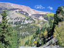 Slumgullion Earthflow from Lake San Cristobal Overlook Slumgullion Earthflow from Lake San Cristobal Overlook
|
|
Lake San Cristobal
This is the best place along Colorado Highway 149 to view the Slumgullion Earthflow.
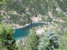
Lower end of Lake San Cristobal |
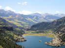
Upper end of Lake San Cristobal |
| |
Literature Cited:
- Varnes, D. J., and W. Z. Savage, eds.,, 1996.
Other articles:
• Colorado State Highway 149:
at overlook;
Locations:
Slumgullion Earthflow.
|
|
Slumgullion Earthflow Overlook
View of Slumgullion from the official viewpoint |
Interpretive panel for Slumgullion Earthflow |
|
Slumgullion Earthflow
The Slumgullion Earthflow was listed on the Natural Registry of Natural Landmarks in 1965 and designated a Colorado Natural Area in 1983.
Imagine what it must have looked like as a massive block of rock, dirt, and forest broke away from Mesa Seco and an enormous earthflow oozed into the valley below. About 850 years ago, during a very wet period of time, a series of slow-moving landslides occurred. the largest landslide dropped over 3,000 feet in elevation and extended downhill more than four miles. What is now called the Slumgullion Earth flow altered the landscape on over 1,000 acres and created Lake San Cristobal.
The story, however, is not over. About 350 years ago, the most recent earthflow began to descend. This flow covered half of the older flows and is still active today. Geologists estimate that in places it is still moving downhill about twenty feet per year.
Slumgullion is a mining word used to describe the muddy clay left in the bottom of a sluice box. However, miners often cooked a hearty and colorful stew that resembles the color of the Slumgullion Earthflow.
Slumgullion Stew
1½ lb. stew meat
1 sliced onion
1 bunch carrots
3 red potatoes
1 bell pepper
1 can black-eyed peas
4-6 cups water
Add leftover cabbage, corn, green beans, etc.
Add salt, pepper, and thyme to taste.
Thicken broth with flour.
Add ½ cup of macaroni in the last ½ hour of cooking.
|
| |
Other articles:
• Colorado State Highway 149:
at meadow;
at overlook;
Locations:
Slumgullion Earthflow.
Uncompahgre Peak.
Windy Point Overlook.
 Beetle-killed trees on Slumgullion Summit Beetle-killed trees on Slumgullion Summit
|
|
Windy Point Overlook
Head scarp of the Smulgullion Earthflow |
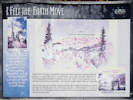
Interpretive panel at Windy Point Overlook |
Uncompahgre Peak in the San Juan Mountains |
Meadow below Windy Point Overlook |
|
I Felt the Earth Move
A massive portion of Mesa Seco gave way about 850 Years ago. This resulted in the Slumgullion Earthflow, one of the most visible examples of “mass wasting” in the United States.
About 850 years ago, thousands of tons of water-saturated, earthen material broke away from Mesa Seco and slid nearly four miles into the valley below. The Slumgullion Earthflow dammed the Lake Fork of the Gunnison River and formed Lake San Cristobal -- the second largest natural lake in Colorado.
About 350 years ago, another portion of Mesa Seco began to slowly ooze down the hillside. Riding above the older slide, this flow covered about 2.5 miles of the older flow. Geologists estimate that it is still moving downhill approximately twenty feet per year.
|
| |
Other articles:
• Colorado State Highway 149:
at Slumgullion Pass;
Locations:
Slumgullion Pass.
 Slumgullion Summit Slumgullion Summit
|
|
Slumgullion Summit
| |
Other articles:
• Colorado State Highway 149:
at Spring Creek Pass;
Locations:
Spring Creek Pass.
 Spring Creek Pass, Continental Divide, 10,898 ft. Spring Creek Pass, Continental Divide, 10,898 ft.
|
|
Spring Creek Pass
| |
Literature Cited:
- Lipman, Peter W., 2006.
Other articles:
• Colorado State Highway 149:
at FR 510;
Locations:
North Clear Creek Falls.
|
|
North Clear Creek Falls
North Clear Creek Falls |
View southwest from North Clear Creek Falls |
Clear Creek Graben |
| |
Other articles:
• Colorado State Highway 149:
at CR 18;
Locations:
Rio Grande.
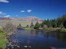 The Rio Grande River exits from the San Juan Mountains The Rio Grande River exits from the San Juan Mountains
|
|
Rio Grande River
Drove out on Forest Road 520.21 to the bridge over the Rio Grande River.
| |
|
|
Tuesday, September 19th
| |
Other articles:
• Colorado State Highway 149:
Creede;
Locations:
Creede.
 The Mac Mine, the only restaurant open for business on an off-season Tuesday morning The Mac Mine, the only restaurant open for business on an off-season Tuesday morning
|
|
Creede
Walked around Creede.
The former D&RGW depot, now the history museum |
| |
Literature Cited:
- Steven, Thomas A., and Peter W. Lipman, 1976.
Locations:
Creede.
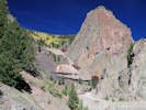 Creede Mining District Creede Mining District
|
|
Creede Mining District
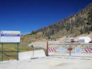
The Equity Mine |
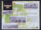
Bachelor City |
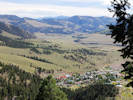
Town of Creede |
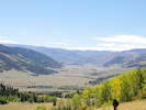
Looking upstream toward sources of the Rio Grande River |
|
Bachelor City
When gold and silver were discovered in the nearby mountains, these meadows at 10,500 feet in elevation became home to nearly 1,200 people. Between 1892 and 1896, this was the bustling community of Bachelor City. In January 1892, an eighty-acre town site was surveyed into twenty-four blocks with twelve streets. By March of 1892, nearly 100 ramshackle houses had been hastily constructed.
In its heyday, Bachelor City had a dozen saloons, four hotels, five grocery stores, a meat market, two barber shops, two bakeries, several restaurants, a school, a jail, city hall and a Catholic Church with a parsonage. Bachelor City had a doctor and a dentist and the town newspaper, the “Teller Topics.”
“The camp was a bustling one, and its citizens composed
of the rougher reckless types of Westerners, men who neither feared nor shunned danger, and to whom 'knockdown and dragout' fights were merely ordinary recreation. Brawls and pistol-play were a nightly occurrence in the numerous saloons and gambling dens that infested the place
the character of Bachelor remained tough.” -- Bachelor City - 1892
|
| |
|
|
Wednesday, September 20th
| |
Other articles:
• Colorado State Highway 149:
at Wagon Wheel Gap;
Locations:
Goose Creek.
Wagon Wheel Gap.
Wagon Wheel Gap Hot Springs.
 Looking upstream from Wagon Wheel Gap Looking upstream from Wagon Wheel Gap
|
|
Wagon Wheel Gap
Interpretive panel for Rio Grande Cutthroat Trout at Wagon Wheel Gap |
Interpretive panel at Wagon Wheel Gap |
Interpretive panel at Wagon Wheel Gap |
|
Wagon Wheel Gap -- The Early Years
In the early part of the twentieth century, railroad passengers, tourists, and health seekers boarded wagons at Wagon Wheel Gap and ventured to the Hot Springs Hotel to partake in the rejuvenating water.
The Denver and Rio Grande Railroad touted the healing qualities of the hot springs located near Wagon Wheel Gap. These springs soom became a destination for health seekers.
In December, 1848, John Fremont led an expedition into the San Juan Mountains to find a route for the transcontinental railroad. The ill-fated expedition may have traveled up Embargo Creek, (to the east of Wagon Wheel Gap), where they encountered a vicious winter storm. With ten feet of snow and deteriorating conditions, Fremont abandoned his expedition and each man fended for himself. All told, ten of Fremonts men died of cold or starvation in the San Juan Mountains.
In 1863, Charles Baker led a group of prospectors into the San Juan Mountains. While returning to New Mexico for the winter, then abandoned a damaged wagon near the “gap” where the Rio Grande carved a small canyon. In the 1870s, a wagon wheel was discovered in this area and it was believed to be a remnant from the Baker party. Miners referred to this area as “the gap where the wagon wheel was found.” Over time this area became known as Wagon Wheel Gap.
Wheeler Geologic Area was named in honor of George M. Wheeler, who surveyed much of Colorado in 1874. The area was designated a National Monument in 1908 by President Theodore Roosevelt in part to protect the highly erodible spires, hoodoos, and geologic formations. Due to its isolated location and diffifult access, the area was delisted as a National Monument in 1933. Wheeler Geologic Monument is now managed by the Rio Grande National Forest.
|
| |
Literature Cited:
- Jessen, Kenneth, 2012.
Other articles:
• Colorado State Highway 149:
in South Fork;
Locations:
South Fork.
|
|
South Fork
Saw some railroad equipment south of the highway while coming into town
Ex-Southern Pacific GE B30-7 7863 in South Fork, CO |
South Fork depot |
Locomotive No. 1 |
Ex-Utah Central GE 44-ton locomotive |
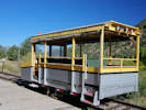
Denver and Rio Grande, something, not quite a goose, maybe a mudhen. |
| |
Other articles:
• County Road 38A:
at CR 40G;
• County Road 40G:
at end;
 Interpretive panel for Penitente Canyon Interpretive panel for Penitente Canyon
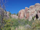 Virgin of Guadalupe in Penitente Canyon Virgin of Guadalupe in Penitente Canyon
|
|
Penitente Canyon
The BGN gives no name for this canyon, which seems to carry a local name of “Penitente Canyon.”
Virgin of Guadalupe in Penitente Canyon |
|
Penitente Canyon: Special Recreation Management Area
| |
A place of solitude ... a place of mystery .. a place with a spirit of its own ... Penitente Canyon
| |
In the mid-1980s, rock climbers discovered the Penitente canyonlands. Today the BLM manages the area primarily for climbing, though mountain bikers, hikers and people drawn to its sense of peace and history also make their way to the canyons.
| |
History
Ancestors of the Utes, Jicarilla Apaches and Puebloans have all left evidence of time spent hunting and camping here, along with explorers and trappers. The valley's first settlers were Hispanic farmers and sheepherders who migrated from northern New Mexico.
| |
Virgin of Guadalupe
It's said that in the mid-20th century a few men from the local community painted the image of the Virgin of Guadalupe that's still visible today. Local legend has it that they sat in tires and were lowered over the cliff on ropes to complete the painting. The words above the Virgin read “Consuelo y Spiritu” or “Comfort and Spirit.”
| |
Ecology
Penitente Canyon is home to many varieties of plants including chokecherry, wild rose, fringed sage and aspen; and wildlife including black bear, mountain lion, raptors, various lizards and prairie rattlesnakes.
| |
Snakes
Always watch where you are stepping or reaching; don't reach where you can't see. If you encounter a snake, leave it alone and back away.
Parents should always keep a close eye on their children in snake country.
| |
Stay Safe
Safety is your responsibility.
Know your limits and come prepared for the area's changing weather.
All recreational activity is at your own risk.
|
| |
|
|
October, 2017
| |
|
|
Saturday, October 7th
Golden, CO, to Green River, UT
| |
Other articles:
• Cisco Road:
at RR Xing;
• Utah Highway 128:
at Cisco Rd;
Locations:
Cisco.
 East end of Cisco siding, near Cisco, Grand County, Utah. East end of Cisco siding, near Cisco, Grand County, Utah.
|
|
Interpretive panel for the Dinosaur Diamond |
| |
Other articles:
• Utah Highway 128:
near Dewey Bridge;
Locations:
Dewey.
 Point of rocks along the Colorado River. Point of rocks along the Colorado River.
|
|
Highway 128 near Dewey, Colorado |
Near Dewey Bridge.
| |
Other articles:
• Utah Highway 128:
near Richardson Amphitheater;
near Fisher Towers;
at Rocky Rapid;
Locations:
Fisher Towers.
Rocky Rapids.
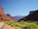 La Sal Mountains from the side of Highway 128 La Sal Mountains from the side of Highway 128
|
|
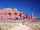
Fisher Towers from Utah Highway 128 |
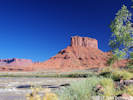
Unnamed butte near Rocky Rapids. |
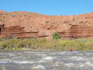
Stand Up Paddleboards in Rocky Rapids. |
Near and in the Richardson Amphitheater.
| |
Other articles:
• US Highway 191:
near Crescent Junction;
Locations:
Book Cliffs.
La Sal Mountains.
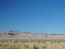 Book Cliffs near Crescent Junction. Book Cliffs near Crescent Junction.
|
|
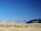
The La Sal Mountains south of Crescent Junction. |
Moab to Green River, Utah.
| |
|
|
Sunday, October 8th
Green River, Utah, to Saint George, Utah.
| |
Other articles:
• Utah Highway 24:
near The Notch;
• Utah Highway 95:
in Hanksville;
Locations:
Hanksville.
The Notch.
 Hollow Mountain Gas Station Hollow Mountain Gas Station
|
|
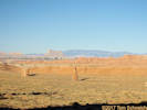
View across Well Draw in the direction of Capitol Reef and Boulder Mountain. |
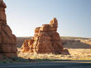
Rocks near The Notch |
Green River to Hanksville.
| |
Other articles:
• Utah Highway 24:
bet. Hanksville & Cainville;
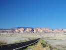 Capitol Reef with Boulder Mountain in the background Capitol Reef with Boulder Mountain in the background
|
|
Capitol Reef.
| |
Other articles:
• Utah Highway 24:
in Capitol Reef NP;
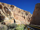 Canyon in Capitol Reef National Park along Utah Highway 24 Canyon in Capitol Reef National Park along Utah Highway 24
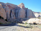 Canyon in Capitol Reef National Park along Utah Highway 24 Canyon in Capitol Reef National Park along Utah Highway 24
|
|
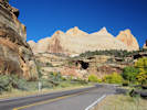
Canyon in Capitol Reef National Park along Utah Highway 24 |
in Capitol Reef National Park
| |
Other articles:
• Utah Highway 24:
at Capitol Reef Nat'l Pk;
Locations:
Capitol Reef National Park.
 Near Park Headquarters. Near Park Headquarters.
|
|
Capitol Reef National Park Headquarters.
| |
Other articles:
• Utah Highway 24:
at Capitol Reef Nat'l Pk;
 Cliffs at Panorama Point Cliffs at Panorama Point
 Small mesa near Panorama point. Small mesa near Panorama point.
|
|
Small mesa near Panorama point. |
At Panorama Point.
| |
Literature Cited:
- Smith, Beatrice Scheer, 1994.
Other articles:
• Utah Highway 12:
at Larb Hollow Olook;
 Interpretive panel at Larb Hollow Overlook. Interpretive panel at Larb Hollow Overlook.
|
|
Larb Hollow Overlook
Turning aspens at Larb Hollow Overlook |
View across Waterpocket Fold to San Rafael Desert |
Early Explorers: Filling in the Blanks
|
Ellen Thompson, Expedition Botanist
Ellen Thompson, wife of A. H. Thompson and sister of John Wesley Powell,
served as botanist on the sedond Powell Expedition.
She collected hundreds of plants,
many of them new to science.
Several were named in her honor,
including Thompson's Penstemon (Penstemon thompsoniae)
and Thompson's Woolly Locoweed (Astragalus mollissimum var. thompsoniae).
Mount Ellen, in the Henry Mountains, is also named for her.
“I never felt more exultant in my life ...
I was looking on the most wonderful scenery I ever beheld.”
|
Andrus Expedition, 1866
“... as far as the Eye can see a naked barren plain
of red and white Sandstone crossed in all directions by
innumerable gorges ...”
-- Franklin B. Woolley, Andrus Expedition, 1866.
Several years before the Powell Expedition,
the Andrus military expedition patrolled the Aquarius Plateau region,
providing the first written descriptions of this area.
|
Mapping the Last Uncharted Lands
By 1870, the continental United States had been mapped and surveyed,
except for one area -- the vast region that surrounds you.
From the Colorado River to the Aquarius Plateau,
and from the Virgin River to the Green, this rugged landscape was
uncharted territory.
Though the Fremont Expedition passed through Capitol Reef during the
winter of 1853-54,
they were desperately low on provisions and did not linger to survey the region.
In 1872, John Wesley Powell launched his second expedition down thw
Green and Colorado Rivers to chart the Rivers and surrounding lands.
Over the next four years, his brother-in-law, Almon H. Thompson,
led the land survey of southern Utah,
during which he explored and charted Boulder Mountain
and the rest of the Aquarius Plateau.
The expedition also named and mapped the Escalante River and the Henry Mountains,
respectively the last-mapped river and mountain range in the lower 48 states.
|
| |
Other articles:
• Utah Highway 12:
along highway;
 Turning aspens on Boulder Mountain Turning aspens on Boulder Mountain
|
|
Wide spot in road
| |
Other articles:
• Utah Highway 12:
along highway;
Locations:
Point Lookout.
 View south from Boulder Mountain View south from Boulder Mountain
|
|
Interpretive panel |
Viewpoint, south slope of Boulder Mountain.
Lay of the Land: Across a Vast Horizon
“To a life that accepts Nature's hand in sculpting an
individual expression – Nothing is exempt.
From the mellifluous rhythm and tome of the wid chime,
to the transitional form of the cloud –
Nothing exists alone.
All things thrive and whither in confluence with one another.
So it is; the paradox of our divinity.”
– Dave Buschow
Waterpocket Fold
The 100-mile-long Waterpocket Fold forms the backbone of Capitol Reef National Park.
Here, geologic rock layers drape over a steeply dipping fault plane.
Over millennia, water and wind have eroded the soft layers,
sculpting the Waterpocket Fold's intricate contours.
Along the Fold, water collects in sandstone basins,
forming “waterpockets.”
Circle Cliffs
Within this section of Grand Staircase - Escalante National Monument
lie huge petrified wood logs, some nearly 90 feet long.
These rocks formed from trees that grew some 210 million years ago.
The logs were buried in river sediments and became “petrified”
as silica from volcanic ash gradually replaced organic cell tissue.
The Heart of the Escalante
“The Aquarius should be described in blank verse and illustrated upon canvas.
The explorer who sits upon the brink of its parapet looking off into the southern and eastern haze,
who skirts its lava cap or clambers up and down its vast ravines,
who builds his camp fire by the borders of its snow-fed lakes
or stretches himself beneath its giant pines and spruces,
forgets that he is a geologist and feels himself a poet.”
– Clarence Dutton, 1880
The wild heart of the Escalante River drainage spreads before you
– a labyrinth of canyons, mesas, and rolling slickrock.
Remote peaks grace the horizon.
On the far left lie the Henry Mountains,
the last-named mountain range in the continental United States
and home to one of the country's few free-roaming bison herds.
Follow the horizon south, and you'll reach the rounded dome of Navajo Mountain on the Utah-Arizona border.
|
| |
Other articles:
• Utah Highway 12:
near Calf Creek;
Locations:
The Hogback.
 Boulder Creek below Utah Highway 12 Boulder Creek below Utah Highway 12
|
|
Utah Highway 12 traverses the New Home Bench and then the Hogback on the way to crossing Calf Creek.
| |
Other articles:
• Utah Highway 12:
in Escalante;
 Escalante Outfitters, supplies and food Escalante Outfitters, supplies and food
 Western end of Escalante Western end of Escalante
|
|
Lunch in Escalante at the Outfitters.
| |
Other articles:
• Utah Highway 12:
on UT Hwy12;
Locations:
Powell Point.
 Powell Point from Utah Highway 12 (2017) Powell Point from Utah Highway 12 (2017)
|
|
Interpretive plaque on the Second Powell Expedition |
Interpretive plaque about the Kaiparowits Formation |
Powell Point.
Second Powell Expedition: Charting New Territory
Powell Point Recollections
“We still keep Table Mountain (Pink Point) to our left
this singular mountain suggests a monster melon, sliced and standing on end.
It is exactly the color of a ripe, red core;
the pines that grow on ledges and benches, black specks at this distance,
look like weeds.”
– Walter Clement Powell, member of the Second Powell Expedition of 1871,
describing their ascent of the Blues Formation to the base of Powell Point.
The Topmost Stair
Powell Point reveals the topmost layer of the Colorado Plateau's
Grand Staircase.
This brilliantly colored layer, known as the Pink Cliffs or Claron Formation,
is the same geologic layer that forms the spectacular,
pinnacled landscape of Bryce Canyon National Park and Red Canyon,
farther west on Highway 12.
Last Blank Spot on the Map
In 1871, this region was part of the last uncharted territory in the
continental United States.
That year, Major John Wesley Powell launched the Second Powell Expedition
to explore and map this frontier,
continuing the work he had begun three years earlier.
Powell led the expedition safely through the wild waters of the
Green and Colorado Rivers to the Paria River.
He then instructed his brother-in-law Almon H. Thompson
to lead the expedition overland to map what they called
“the unknown country.”
In 1872, expedition members climbed the slippery slopes of
the badlands on which you now stand.
Thompson then scaled the brilliant pink formation
above you to view the surrounding country.
Over the next four years, Thompson's explorations
filled in this last blank spot on the U. S. map.
In 1879, surveyor Clarence Dutton named this spectacular landmark
“Powell Point,” in honor of Major Powell.
Highway 12 now follows the 2nd Powell Expedition's exact route
from Henrieville all the way to Head of the Rocks, east of Escalante.
|
Digging for Dinosaurs: Treasure in These Hills
Why Here?
The Kaiparowits Formation's stunning fossil record results from
a perfect combination of circumstances.
First, during the Late Cretaceous, this region was a lush,
subtropical, coastal plain where an enormous number and variety of
animals lived.
Second, abundant rivers and coastal storms moved great volumes of sand and mud,
so animals that died were sometimes buried quickly, preserving their remains.
Lastly, uplifting of the Colorado Plateau over the past
60 million years has brought this deeply buried treasure to the surface.
Scientific Frontier
In a region famed for once being the last unmapped frontier
in the continental United States,
the Kaiparowits Formation remains a largely unexplored frontier.
By protecting the fossils of this formation
through proper collection and study,
Grand Staircase - Escalante National Monument
conserves a vast storehouse of knowledge available nowhere else on earth.
Kaiparowits Fossil Bonanza
There's treasure beneath your feet.
Not of the gold-and-rubies variety,
but rather a treasure of fossilized bones, eggshells,
and other paleontological gems,
buried in these gray rock formations
some 73-77 million years ago.
Known as the Kaiparowits Formation,
these sedimentary rock layers lie at the top of what is perhaps the
best and most continuous record of Late Cretaceous terrestrial life in the world.
Forty-foot long crocodiles,
rhinoceros-like horned dinosaurs.
tyrannosaurs, and velociraptors – all lived here.
Scientists have surveyed only a small fraction of the Kaiparowits Formation,
and have unearthed more than one hundred species of vertebrates.
Excavations are revealing a long-lost ecosystem inhabited by a
fantastic array of animals,
including some of the earliest marsupial and placental mammals ever found.
These disoveries are helping to explain the origins of our present world.
|
| |
Other articles:
• Utah Highway 12:
in Tropic;
 Powell Point from the roadside near Tropic Powell Point from the roadside near Tropic
|
|
Stop near Tropic for a photo of Powell Point.
| |
|
|
Monday, October 9th. Saint George, Utah, to Laguna Hills, California
| |
|
|
Tuesday, October 10th. Laguna Hills, California
| |
|
|
Wednesday, October 11th
Laguna Hills, California.
| |
Other articles:
• Alta Laguna Boulevard:
Alta Laguna Park;
Locations:
Alta Laguna Park.
 View from Alta Laguna Park View from Alta Laguna Park
|
|
Laguna Canyon, Laguna Beach, and the Pacific Ocean |
We're the Heckawii! |
Drive to Laguna Beach, Alta Laguna Park, and Niks for dinner.
| |
|
|
Thursday, October 12th
Laguna Hills to San Luis Obispo.
| |
Other articles:
• U. S. Highway 101:
at rest stop;
 Gaviota Rest Stop Gaviota Rest Stop
|
|
Drive to San Luis Obispo from Laguna Hills. Stopped for coffee in Oxnard, and at the rest stop in Gaviota Pass.
| |
Locations:
San Luis Obispo.
 House I lived in while attending Cal Poly House I lived in while attending Cal Poly
 Market where I worked, formerly called the New Park Grocery Market where I worked, formerly called the New Park Grocery
|
|
Places in San Luis Obispo.
| |
Locations:
San Luis Obispo.
 Line for F. McLintocks barbeque at the Farmer's Market Line for F. McLintocks barbeque at the Farmer's Market
 One reason the SLO Farmer's Market was so pleasant One reason the SLO Farmer's Market was so pleasant
|
|
San Luis Obispo Farmer's Market
| |
|
|
Friday, October 13th. San Luis Obispo.
| |
|
|
Saturday, October 14th
San Luis Obispo and San Luis Obispo High School 55th Year Reunion.
| |
Locations:
Port San Luis.
 Port San Luis after lunch Port San Luis after lunch
|
|
Lunch in Port San Luis
| |
Locations:
San Luis Obispo.
 Still functional 50+ years later Still functional 50+ years later
|
|
Dinner at the Madonna Inn.
| |
|
|
Sunday, October 15th
San Luis Obispo, Atascadero, Paso Robles, and Duckies in Cayucos for late lunch/early dinner.
| |
Other articles:
• California Highway 41:
83900;
Locations:
Atascadero Pine Mountain Cemetery.
 Grave marker of Paul Schweich Grave marker of Paul Schweich
|
|
View from Atascadero Cemetery |
Atascadero Cemetery
| |
Other articles:
• Adelaida Road:
at cemetery;
Locations:
Adelaida Cemetery.
 Grave marker in Adelaida Cemetery Grave marker in Adelaida Cemetery
|
|
Adelaida Cemetery |
Grave marker in Adelaida Cemetery |
Adelaida Cemetery to find grave of Kathy Thompson.
| |
|
|
Monday, October 16th
San Luis Obispo to Gualala, by way of Hayward and Alameda.
|
 Grave of Jacob Schweich Grave of Jacob Schweich
|
|
Lone Tree Cemetery in Hayward.
| |
Other articles:
• Fairview Avenue:
near Southwood;
 The Old House The Old House
|
|
Drove by the ol' house and got a burrito at Taqueria Ramiro & Sons.
| |
Other articles:
• California Highway 1:
in Gualala;
Locations:
Gualala.
 Estuary of the Gualala River in Gualala Estuary of the Gualala River in Gualala
|
|
Schoenoplectus, perhaps S. californicus in the estuary of the Gualala River |
A sunset I was forced to watch in Gualala |
Stayed the night in Gualala. The SurfsInn was a little disappointing.
| |
|
|
Tuesday, October 17th
Gualala, California, to Gold Beach, Oregon.
| |
Other articles:
• California Highway 1:
in Fort Bragg;
Locations:
Fort Bragg.
 The Emerald City out back of Egghead Omelettes Restaurant The Emerald City out back of Egghead Omelettes Restaurant
|
|
Breakfast at Egghead Omelettes Restaurant in Fort Bragg.
| |
Other articles:
• Bald Hills Road:
at Lady Bird Johnson Grove;
Locations:
Lady Bird Johnson Grove.
 Looking up through the trees Looking up through the trees
|
|
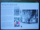
Interpretive panel for “Saving the Redwoods” |
Backlit view of redwood forest. |
Visit to Lady Bird Johnson Grove of redwoods.
Saving the Redwoods
As spectacular as these redwood forests are,
their protection was slow to gain broader support.
One of the earliest organized efforts to save the
redwoods was led by the Sempervirens Club.
In 1902, they convinced the California legislature
to appropriate funds for the purchase of the
first state redwood park.
Congressman William
Kent also joined the effort.
He personally bought
and donated 295 acres of redwoods outside
San Francisco to the federal government.
His gift led to the creation of the Muir Woods
National Monument in 1908.
Save the Redwoods League was founded in 1918
to purchase redwoods and convert the land to public trust.
Numerous groves were protected and redwood state parks created through the
League's efforts, including Del Norte Coast Redwoods,
Jedediah Smith Redwoods, and Prairie Creek Redwoods State Parks.
A renewed effort to establish a national redwood park
began in the early 1960s.
These efforts were augmented in 1963 when a National Geographic
survey team discovered several trees along Redwood Creek
that were taller than any previously known.
This discovery helped lead to the establishment of
Redwood National Park in October of 1968.
|
| |
Other articles:
• U. S. Highway 101:
at Bandon;
Locations:
Bandon.
 Tsunami Evacuation Map for Bandon, Oregon Tsunami Evacuation Map for Bandon, Oregon
|
|
Face Rock |
Location code for use in case of emergency |
Face Rock State Park in Bandon, Oregon
| |
|
|
Wednesday, October 18th. Gold Beach to Albany.
| |
|
|
Thursday, October 19th. Albany, Oregon
| |
|
|
Friday, October 20th. Albany, Oregon, to Boise, Idaho.
| |
Other articles:
• US I-84:
at Rooster Rock;
Locations:
Rooster Rock (historical).
 Interpretive panel at Rooster Rock State Park Interpretive panel at Rooster Rock State Park
|
|
Rooster Rock |
Rooster Rock and State Park.
Lewis and Clark Expedition
Rooster Rock
Meriwether Lewis and William Clark,
the two great American explorers who made secure the claim of the
United States for the Oregon country,
passed along this stretch of the Columbia River with their
Corps of Discovery on their way to the Pacific Ocean on
October 31 -- November 2, 1805.
They brought their boats through the “Great Shute”
(now covered by the waters of Bonneville Dam)
and recorded
“a remarkable high detached rock stands in a bottom on the
stard side ... [it is] 800 feet high and
400 paces around, we call [it] the beaten rock.”
A later journal entry called it Beacon Rock.
The captains described
“great numbers of sea otters” and
“a high clift of black rocks” (Cape Horn) on the north shore.
Clark wrote “here the river widens to near a mile,
and the bottoms are more extensive and thickly timbered,
as also the high mountains on each side ...
passed a rock near the middle of the river,
about 100 feet high and 80 feet diameter [Phoca Rock] ...
we encamped under a high projecting rock on the lard [Rooster Rock].”
The expedition camped in this area April 6-9, 1806, on their return journey.
They noted that Beacon Rock “may be esteemed the head of tidewater.”
|
| |
|
|
Saturday, October 21st
Boise, Idaho, to Rock Creek, Wyoming.
| |
Other articles:
• U. S. Highway 91:
bet. Zenda and Red Rock Pass;
 View south to Red Rock Pass View south to Red Rock Pass
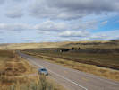 Looking north towards Zenda (in the trees) Looking north towards Zenda (in the trees)
|
|
Between Zenda and Red Rock Pass.
| |
Other articles:
• U. S. Highway 91:
Red Rock Pass;
Locations:
Red Rock Pass.
 Hill with monument Hill with monument
|
|
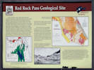
Interpretive Panel for Red Rock Pass |
Interpretive Panel for Red Rock Pass |
Memorial plaque to Captain Jefferson Hunt |
View from top of hill |
Red Rock Pass Geological Site
About 14,500 years ago, ancient Lake Bonneville overflowed at this site.
A dam of alluvial fans between Oxford Mountain to the west
and the Portneuf Range to the east
suddenly eroded releasing Lake Bonneville from the Great Basin
into the Snake River system.
The Peak flow was about one million cubic meters per second at the pass,
or about 500 times the maximum discharge on the Snake River at Idaho Falls, Idaho.
Ancient “bathtub ring” shorelines up to 1,000 feet above the valley
floor are readily visible in the Salt Lake Valley.
Evidence of the flood is visible thoughout southern Idaho with
areas of scoured bare bedrock (“scabland”)
and deposits of boulders (“melon gravel”) marking the flood path.
After about 11,000 years, Lake Bonneville receded to become the Great Salt Lake.
Highly saline and only 40 feet deep, it is but a shadow of
giant fresh-water Lake Bonneville.
Red Rock Pass is the geographic northern extremity of the Bonneville drainage
basin, and was also designated by the early Latter-day Saint leaders as
the northern edge of the proposed State of Deseret.
North of here, water flows to the Snake, Salmon, and Columbia rivers,
on the way to the Pacific Ocean, but south of here it flows into the Great Basin and the Great Salt Lake.
South of the monument in Red Rock Pass, the house-sized limestone blocks
were jostled during the breakout of the Bonneville flood.
The uneven topography northwest of the monument is a landslide which flowed
into Red Rock Pass after it was deepened about 400 feet during the flood.
Ancient cave formations are found in the flat-lying limestone of
Red Rock Butte immediately north of the monument.
|
Red Rock Pass
You are standing in the outlet of ancient Lake Bonneville.
A vast prehistoric inland sea,
of which Salt Lake is a modern remnant.
Covering over 20,000 square miles when it overflowed
here about 14,500 years ago,
its winding shoreline would have stretched from
here to New Orleans if it were straightened out.
This pass was deepened considerably when Lake Bonneville
began to slow into Snake River.
For a time, a torrent several times larger than
the Amazon was discharged here.
Finally, with a hotter, drier climate that slowly emerged about 8,000 years ago,
Lake Bonneville gradually disappeared.
|
No 119
Erected October 2, 1950
Captain Jefferson Hunt, Soldier, Pioneer, Churchman
Charles Jefferson Hunt served in the Mormon Battalion as
captain of Company “A” and as assistant executive officer, in
its historic march from Council Bluffs, Iowa to San Diego, California, 1846-47.
His service won the commendation of all who served with him.
Under appointment by President Brigham Young in 1851,
Captain Hunt was guide for the pioneers to San Bernardino, California.
His pioneering service included also Provo, Parowan,
and Huntsville (which bears hus name), in Utah, and Oxford, Idaho.
A convert to the church of Jesus Christ of Latter-Day Saints
he was loyal, obedient, and faithful to the end.
Erected by descendents of Captain Hunt and the
Utah Pioneer Trails and Landmarks Association.
|
| |
Other articles:
• UT Hwy 30:
90000;
 Welcome to Wyoming! Welcome to Wyoming!
|
|
Into Wyoming; only one state away from home!
| |
|
|
Sunday, October 22nd. Rock Creek, Wyoming, to Golden, Colorado.
| |
|
|
November, 2017
| |
Other articles:
• Nightbird Gulch Trail:
at switch back;
Locations:
Schweich Hill.
 Upper Washington Open Space as seen from lower slopes of Mount Galbraith Upper Washington Open Space as seen from lower slopes of Mount Galbraith
|
|
Friday, November 11th
Short hike up Nightbird Gulch Trail for photo of North Washington Open Space.
| |
Other articles:
• Nightbird Gulch Trail:
at point;
above reveg.;
at point;
just east of switch back;
at Cyn Pt Cir;
Locations:
Mount Galbraith.
Nightbird Gulch.
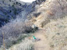 Yay! Dog poop in a bag! Yay! Dog poop in a bag!
|
|
Friday, November 24th
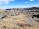
Revegetation area on southeast slope of Mt. Galbraith |
Map of Nightbird Gulch Trail. |
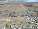
North Washington Open Space from lower slopes of Mount Galbraith |
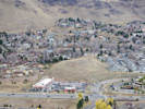
View of North Washington Open Space from Mount Galbraith |
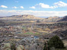
Colorado School of Mines with Green Mountain in the background |
Downtown Denver from Mt. Galbraith. |
Nightbird Gulch Trail, Mount Galbraith Park, for #OptOutside Friday.
| |
|
|
December, 2017
| |
|
|
Summary of Collections Made in 2017
| Year
| Agency
| Number of
Collections
| Number of
Vouchers
| KHD
| JCOS
| UCR
| UC
| CAS
| CS
| OBI
| EIU
| CDA
| COLO
| RENO
| Not Dist.
| | |
| 2014 | | 15 | 32 | | 1 | 9 | 10 | 7 | | 3 | | | | | 2
| | |
| 2015 | | 1 | 3 | | | 1 | | 1 | | | | | | 1 |
|
| 2015
| City of Golden, Department of
Parks, Recreation, and Golf
| 22
| 65
| 13
|
| 15
| 11
| 12
| 1
| 8
|
|
|
|
| 5
|
| 2015
| Colorado School of Mines | 25 | 82 | 20 | 6 | 15 | 14 | 13 | 3 | 9 | | | | | 2
|
| 2015
| Inyo National Forest | 42 | 108 | | | 29
| 15 | 9 | 20 | 23 | | 1 |
| 11 |
|
| 2015
| Jefferson County Open Space | 136 | 421 | 121 | 114 | 66 | 57 | 28 | 1 | 17 | 4 | 2 | | | 11
|
|
| Subtotal for 2015 | 226 | 679 | 154 | 120 | 126
| 97 | 63 | 25 | 57 | 4 | 3 | 0
| 12 | 18
| | |
| 2016
|
| 18 | 52 | | | 1 | 4 | 14
| | 17 | 15 | | | | 1
|
| 2016
| City of Golden, Department of
Parks, Recreation, and Golf
| 44 | 126 | 36 | 24 | 16 | 9 | 9
| 9 | 9 | 5 | 3 | 1 | | 5
|
| 2016
| Colorado School of Mines | 24 | 77 | 21 | 1 | 15 | 5 | 11 | 9 | 5 | 5 | 3 | 2 | |
|
| 2016
| Jefferson County Open Space | 191 | 643 | 153 | 156 | 41 | 47 | 35 | 61 | 53 | 44 | 4 | 34 | | 15
|
|
| Subtotal for 2016 | 277 | 898 | 210 | 181 | 73 | 65 | 69 | 79 | 84 | 69 | 10 | 37 | 0 | 21
| | |
| 2017
| Bureau of Land Management,
Needles, California | 25 | 88 |
| | | 15 | | 22 | 1 | 19
| 2 | 22 | | 7
|
| 2017
| City of Golden, Department of
Parks, Recreation, and Golf | 72 | 164 | 68 | 2 | 15 | 3 | 6 | 17 | 3 | 12 | 28 | 7 | | 3
|
| 2017
| Colorado School of Mines | 19 | 52 | 17 | 1 | 1 | 1 | 1 | 5 | 2 | 5 | 12 | 7 | |
|
| 2017
| Jefferson County Open Space | 105 | 282 | 80 | 82 | 30 | 5 | 18 | 9 | 5 | 16 | 28 | 7 | | 2
|
|
| Subtotal for 2017 | 221 | 586 | 165 | 85 | 46 | 24 | 25 | 53 | 11 | 52 | 70 | 43 | 0 | 12
| | |
| All
| Total | 739 | 2195 | 529 | 387 | 254 | 196 | 164 | 157 | 155 | 125 | 83 | 80 | 12 | 53
|
| |
|
|
[Previous Page]
[Next Page]
Go to page: [1800s] [1900s] [1910s] [1920s] [1930s] [1940s] [1950s] [1960s] [1970s] [1980s] [1990] [1991] [1992] [1993] [1994] [1995] [1996] [1997] [1998] [1999] [2000] [2001] [2002] [2003] [2004] [2005] [2006] [2007] [2008] [2009] [2010] [2011] [2012] [2013] [2014] [2015] [2016] [2017] [2018] [2019] [2020] [2021] [2022] [2023] [2024] [A]
|
|
If you have a question or a comment you may write to me at:
tas4@schweich.com
I sometimes post interesting questions in my FAQ, but I never disclose your full name or address.
|
[Home Page] [Site Map]
Date and time this article was prepared:
4/27/2024 3:26:08 PM
|
| |
 Eastern Mojave Vegetation

 Little unknown grass.
 Another little unknown grass.