Eastern Mojave Vegetation
Tom Schweich
|
Eastern Mojave Vegetation
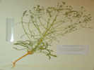
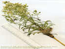
| Autecology of Desert Elkweed Frasera albomarginata S. Watson (Syn: Swertia a.) Gentianaceae in the American Southwest (Continued) |
|
Tom Schweich |

Topics in this Article: Introduction Literature Review Field Work and Methods Results Taxonomy Distribution Growth Habits Relationships to Soils and Other Plants Life History Discussion Summary Literature Cited Appendix A -- Field Data Communications Received. |
|
||||
|
|
Distribution | ||||
|
Literature Cited:
|
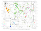
The published literature I used was primarily Post's (1956) dissertation on Swertia of the western United States, and Kartesz' (1988) flora of Nevada. The herbarium specimens I have examined were at UC/JEPS, CAS/DS, RSA/POM, and a few smaller local herbaria. Online collection was obtained from the Consortium of California Herbaria and the Southwest Environmental Information Network. These two virtual herbaria have been accessed many times over a period of years, often late at night while wearing my robe and bunny slippers. As of this writing, 25 Feb 2012, I am aware of 1178 vouchers of Frasera from the following herbaria: RM (216), NY (125), UTC (112), UC+JEPS (111), CAS+DS (101), RSA+POM (96), ASC (58), UCR (41), CS (31), ARIZ (23), GH (12), ASU (11) and others (103). I keep this data in a Microsoft Access data base and an ArcGIS feature class. Specimen records that include geographic coordinates, or enough information to estimate geographic coordinates, are plotted on the distribution maps. About 65% of collections have usable geographic coordinates, 22% do not have coordinates and have been located at the nearest named location, 9% are re-located by me because of obvious errors in the geographic coordinates, and the remainder of 4% are GPS locations of observations without a collection. In addition to the map and summaries that follow, the source data used to prepare the map and summaries is available at "Distribution of Frasera albomarginata." If you are interested in current distribution maps, I would recommend starting with fresh data from CoCH and SEINet, so that your maps will include recent collections. | ||||
|
Literature Cited:
Other articles:
Locations: Benson. Johnson. Little Dragoon Mountains. |
Southeastern Arizona
Two of the three collections appear to have been made close-by to each other, at locations described as "near Johnson," and "in the foothills of the Little Dragoon Mountains." Both of these locations are on the southeast side of the Little Dragoon Mountains. R. A. Darrow collected Frasera albomarginata (#3451, 3 May 1946, ARIZ) 3 miles north of Johnson, on alluvial soil from limestone ridge, with associated mesquite and Flourensia, a tarwort. Post (1956) saw this collection at a time when it was the only collection from this area. R. K. Van Devender and W. D. Peachey collected (#93-618, 5 May 1993, ARIZ) in the foothills of Little Dragoon Mountains, about 3.2 mi from pavement at Johnson Road exit of I-10, beyond Arimetco mine pit, where it was described as abundant along disturbed roadside in overgrazed grassland. I attempted to visit this locality on 1-Jun-2008, leaving Benson early on a Sunday morning, and heading east up I-10 for Dragoon Summit, and the former town of Johnson. I ran into locked gates at all three roads north from I-10. The Johnson Mine, which appeared to be in the middle of my route to the Little Dragoon Mountains, was locked up tight, and not a soul in sight. Maybe on a weekday I could have obtained permission to pass through, but not today. The mountains above the mine appeared to be Pinyons and Junipers on limestone, the right environment for Frasera albomarginata. | ||||
|
Other articles:
Locations:
Hookers Hot Springs.
Tres Alamos Wash.
|
On 1-Jun-08, I searched the area 10 miles south-southeast of Hookers Hot Springs fairly carefully. This would be on 3 Links Road, in the pass between Tres Alamos Wash, and the San Pedro River. There is some limestone here. However, the vegetation is ocotillo, prickly pear, agave, and mesquite. It's just not quite high enough for Frasera albomarginata. I now think it likely that the described location of 7 miles southwest of Hookers Hot Springs is correct, and the geographic coordinates and PLSS description given by the collectors is wrong. That location would be along the spine of this same ridge, but at a higher elevation, and may be a more likely habitat for Frasera albomarginata. | ||||
|
Locations:
Johnson.
|
On 26 April 2011, with the permission of Nord Resources, Inc., I once again visited the Johnson site, traveling past the mine to a location near the northern boundary of the mine. I made two collections of F. albomarginata, and nine collections of associated species. All these collections were deposited at UC. John L. Anderson (#2012-15) made an additional collection north of the Johnson Camp Mine in June, 2012. | ||||
|
Locations: Petrified Forest National Park. |
Regardless of the proximity of the three collections, the group is separated by quite a distance from any other collections of Frasera albomarginata. The nearest other collections were made about 220 miles (335 km) north at Petrified Forest National Park. | ||||
|
Other articles:
|
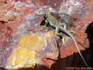
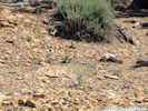
Petrified Forest National Park
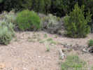
The third collection, by R. H. Peebles and E. Q. Smith (#13965, 15 Jun 1938, US, GH, NY, ARIZ) was made at the south entrance of the park. On 2-Jun-08, I drove through Petrified Forest National Park. Again I did the Figure 8 Snipe Hunt Routine every half mile, from the south entrance to about the mid-point of the park. No Snipe, or Frasera albomarginata, for that matter. Asked a Ranger, but learned that they have Law Enforcement Rangers here, not Interpretive Rangers or (heaven forbid!) a biologist on staff. Their volunteer "wildflower lady" had a nice poster in the Museum, but not with my little plant. This Collared lizard was the prettiest thing I found. He was clearly waiting for someone to take a photo. | ||||
|
Other articles:
Locations: Witch Well Trading Post. |
Also in Apache County, there is a Ripley and Barneby collection of Frasera albomarginata from sandy bluffs about nine miles south of Witch Well. There is a Witch Well Trading Post at the junction of US Hwy 191 and Arizona Highway 61. About nine miles south are some light-colored bluffs on the north side of the Zuni River. | ||||
|
|
Oak Creek Canyon | ||||
| There are three collections of Frasera albomarginata from the Oak Creek Canyon area of Arizona. | |||||
| A collection in 1883 by Henry Rusby(#725, 22 June 1883, NY, UC), for which there is a voucher at UC and three vouchers at NY, does not have location information any more specific than Oak Creek Canyon. The label on the UC voucher suggests that Rusby collected in New Mexico and Arizona Territory for Parke, Davis and Company. | |||||
|
Literature Cited:
Locations: Oak Creek Canyon. |
Post (1956) refers to a collection by Deaver (#76) that is at NA, which will require a visit to determine if there is better location information. | ||||
|
Other articles:
|
The third collection (David R. Goddard, #608, 14 June 1927, UC) gives a location 8 miles south of Oak Creek Lodge, which would be in the Wilson Canyon or Casner Canyon area, about 2 miles north of Sedona. At this location, Frasera albomarginata was growing on exposed slopes and abundant.
On 31-May-08 I thought to stop at Casner Canyon and hike a bit. However, the miniscule lot was full of two tourist busses with tourists. So I went on to the next canyon south. Hiked around here for a half-hour or so, but saw no Frasera albomarginata. | ||||
|
Other articles:
Locations: McCracken Mesa. |
Four Corners | ||||
| In the Four Corners area, there are collections of Frasera albomarginata from Colorado, New Mexico, and Utah. There are no collections from the Four Corners area of Arizona. | |||||
|
Literature Cited:
Other articles:
Locations: Mesa Verde. Mesa Verde National Park. Wetherill Mesa. |
The Colorado collections are primarily from Mesa Verde, where the taxon was collected by Alice Eastwood and Townsend Brandegee. Townsend Brandegee was at Mesa Verde in 1875 (#1249, MO, PH, MICH, UC). The collection(s) by Alice Eastwood may be one or more collections and are found at CAN, COLO, UC, and US. At least one collection was made 1 July 1889.
A brief discussion with the park biological staff revealed that the taxon was found on Weatherill Mesa, and on the lower mesas of the Ute Mountain Indian Reservation. | ||||
|
Literature Cited:
Locations: Soda Canyon Tip-off Trail. |
One collection (E. Anderson and R. S. Woodson, #29006, MO) is from a location described as the Soda Canyon Tip-Off Trail, which I believe is at the south end of Mesa Verde.
During my 2008 visit to Mesa Verde National Park, I was unable to find anyone who knew of this location. | ||||
|
Literature Cited:
Other articles:
Locations: Ackmen. Pleasant View. Letters: Monday, August 4, 2014. |
| ||||
|
Other articles:
|
533 | On June 3, 2008, I found Frasera albomarginata growing on the south slope cut bank of Montezuma County Road CC, just west of the Lowry Ruin, where the road descends into Cow Canyon. This is about 9 miles west of Pleasant View, Colorado. A brief search of natural slopes above and below the road was not successful in finding any other of the taxon. | |||
|
Literature Cited:
|
Sustainable Ecosystems Institute's 2002 report on the the San Miguel River headwaters states that Frasera albomarginata occurs in meadows and forests, in montane, subalpine areas. Sounds a little doubtful to me. | ||||
|
Literature Cited:
Other articles:
Locations: Beclabito. |
Martin and Hutchins (1980) stated that Frasera albomarginata is expected but not found in New Mexico. Since that time there was at least three collections of the taxon. The first was made by Mary Blankenhorn in 1975. The San Juan College herbarium has a collection made by Arnold Clifford, made in 1993 near Beclabito in the Navajo Nation. The collection was made in a Pinyon-Juniper community on silty-clay soils on Dakota Sandstone. | ||||
|
Literature Cited:
Other articles:
Locations: Bluff. White Mesa. |
Two of the three collections of Frasera albomarginata in the Four Corners area of Utah were made 11 miles north of Bluff, which would be at the south edge of White Mesa. Presumably these are roadside collections. The third collection merely states "vicinity" of Bluff. | ||||
|
Other articles:
Locations:
Squaw and Papoose Rock.
|
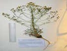
There is a collection from the Canyon Rims Recreation Area between the Colorado River and the Manti - La Sal National Forest. This collection by W. C. Hodgson with Ron Hill (#9235, 18 Jun 1995, NY188580) was made at the Sundance Trailhead into Dark Canyon Wilderness, end of Road 208A (37°50'49'N, 110°12'48"W), which I believe to be near Squaw and Papoose Rock, the nearest landmark with an accepted name in GNIS. Frasera albomarginata was found with Ephedra, Atriplex canescens, A. confertifolia, Cowania, Yucca angustissima, Gilia gunnisonii, Sclerocactus parviflora, Hymenoxys argentea, Pinus edulis, Juniperis, Bromus rubens, Calochortus, Coleogyne ramosissima, etc.
This area is accessed from Utah Highway 95 several miles southeast of its crossing of the Colorado River near Hite, Utah. My experience in travelling in this area is that most maps are accurate as to the placement of roads, but quite inaccurate with regard to the names of those roads. The Streets data set from the Utah State Geographic Information Database (SGID), however, appears quite accurate with regard to names and route numbers. | ||||
|
Other articles:
|
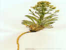
532 | Frasera albomarginata is also found on Squaw Rock Road on the way to the Sundance Trailhead (Tom Schweich, #532, 4-June-2008), in stiff, red sand with Junipers and an Opuntia. | |||
|
|
Grand Canyon | ||||
|
Other articles:
|
The oldest collection of Frasera albomarginata from the Grand Canyon that I have found was made by Alice Eastwood in 1913. This collection was made "... near El Tovar
" a large hotel, at the south rim.
Now the El Tovar Hotel is surrounded by grass, concrete sidewalks, and tourists. No Frasera albomarginata left. | ||||
|
Literature Cited:
Other articles:
Locations: Grand Canyon. |
There are nine collections described simply as Grand Canyon. Among them are collections by Henry H. Rusby in 1915, and Marcus E. Jones, who collected the species at the Grand Canyon twice: in 1920 and 1929. | ||||
|
Other articles:
Locations:
Rowes Well.
|
There is a collection by Rose E. Collom made 5-August-1939 (ARIZ 369229) at Rowes Well with no county name given. There is a Rowe Well, Rowes Tank, and Rowe Well Picnic Area all in the same vicinity about two miles south of the south rim of Grand Canyon and west of Arizona Highway 64. It seems reasonable to assume this is the location named "Rowes Well."
I attempted to visit this site on 30-May-08. From Arizona Highway 64, I drove west on what appears to be Forest Road 328 "Rowes Well Road" as far as the railroad and what looks like someone's private ranch. I wandered around here for the better part of an hour, but did not find Rowe Well, or Frasera albomarginata. In retrospect I was always south of Rowe Well. Next time, I'll take a map with me. | ||||
|
Also, there are two collections that were made south of the park entrance, at two different locations in 1946.
K. F. Parker, E. McClintock, and G. T. Robbins collected four miles south of south entrance to Grand Canyon National Park, finding Frasera albomarginata common in yellow pine openings (#6181, 14 August 1946, UC737082 , ARIZ). A little further south, ten miles south of South entrance to Grand Canyon National Park, K. F. Parker also found the species to be common along roadside in yellow pine forest (#6023, 15 Jul 1946, ARIZ). | |||||
|
|
EscalanteIn the Escalante area, there are four collections of Frasera albomarginata that can be approximately located. | ||||
|
Literature Cited:
Other articles:
Locations: Capitol Reef National Park. |
Post (1956) states there is one collection by McVaugh (#14450, RM) made near Capitol Reef National Monument. A plant list for the park attributed to Dr. Susan E. Meyer ( http://www.nps.gov/archive/care/plantchk.htm ) also lists the species.
The Visitor Center at Capitol Reef has a pretty good collection of plant cards available for public access. The card with Frasera albomarginata showed the taxon has been collected at Pleasant Creek and the Burr Trail. | ||||
|
Other articles:
|
546 |
| |||
|
Other articles:
Locations:
Left Hand Collet Canyon.
|
On the northeast border of the Kaiparowits Plateau, there is one collection by N. H. Holmgren with James L. Reveal and Charles LaFrance (#2063, 27 Jun 1965, NY188647) where Left Hand Collet Canyon pierces the Straight Cliffs. The collectors state Frasera albomarginata is common in pinyon-juniper woodland in sandy soil.
The road up Left Hand Collet Canyon is washed out (7-June-2008). I have been unable to find find Frasera albomarginata in the lower portions of the canyon that are accessible by road. | ||||
|
Other articles:
Locations:
Escalante.
|
About five miles east of Escalante, near the intersection of Hole-in-the-Rock Road with Utah Highway 12, there is a light colored calcareous sandstone. There were many Frasera albomarginata here in the openings between Pinyons and Junipers. I was told the next day that this was probably the Carmel Formation. | ||||
|
|
Central UtahThere are four collections of Frasera albomarginata from widely scattered locations in Central Utah. | ||||
|
Literature Cited:
Other articles:
Locations: Miller Canyon. Miller Canyon. |
However, I found a voucher of this same collection from the Dudley Herbarium (DS) now integrated with California Academy of Sciences (CAS). Being able to read the label directly, I learned that Jones had written "Millers Canyon, south of Price." This lead me on a fresh search, through which I located a Millers Canyon south of Emery. For now, I am using this as the location of Jones' collection from "Millers Canyon." | ||||
|
Other articles:
Locations:
Mounds.
|
The other Marcus E. Jones' collection was made near the former location of Mounds, Utah, on the Denver and Rio Grande Western Railroad in the Lower Temperate Life Zone (9 Jun 1910, NY188556 , PH, UC372786 , GH, POM).
On 5-June-2008, I looked unsuccessfully in the vicinity of Mounds for Frasera albomarginata. Given another opportunity, I would concentrate an additional search in the small hills north of Mounds, between the railroad and US Highway 6. | ||||
|
Literature Cited:
Other articles:
Locations: Beckwith Plateau. Summerville Point. |
There is a single collection from on or near Beckwith Plateau, along US Highway 6, north of Green River, Utah. S. L. Welsh with K. Taylor (#15226, 29 Jun 1977, NY188642) collected 3 miles north-northwest from Green River, Beckwith Plateau, lightly grazed, Mesa Verde Group Formation, pinyon-juniper community, sandy soil. The collection was made on top of the plateau, accessed by an oil exploration road. The undulating top of the plateau was clothed with a low, scattered forest of pinyon and juniper. The notation "CC" on the voucher indicates that the collection was made as part of a study of the central coal region of Utah (S. L. Welsh, pers. comm.). The notation of "Summerville" indicates the collection was made on the Summerville geologic formation. | ||||
|
Other articles:
|
Prior to my search, there was only one collection from the entire San Rafael Swell. It was made on the western portion of the swell, at the Ghost Rock Rest Stop along US Interstate 70.
B. Albee (#5084, 11 Jun 1981, NY188641) states Frasera albomarginata occurs in Pinyon-Juniper area disturbed by man, and gives the location as the rest stop along I-70 in San Rafael Swell at approximately Page (sic) Flat. The described location of Page Flat I assumed to be Paige Flat. The rest stop nearest to Paige Flat on US I-70 is the Ghost Rock Rest Stop. Therefore, the geographic coordinates used for this collection are those of the Ghost Rock Rest Stop. | ||||
|
Other articles:
Locations:
Ghost Rock.
|
545 |
I have been unable to find Frasera albomarginata at the westbound Ghost Rock rest stop. | |||
|
Other articles:
Locations:
Cedar Mountain.
Wimmer Flat.
|
534 |
| |||
|
|
Western ArizonaThere are very few collections of Frasera albomarginata from western Arizona, that portion of the state west of the Grand Canyon and south of the Colorado River. | ||||
|
Other articles:
Locations:
Music Mountains.
|
There is one collection made by F. W. Reichenbacher (#1642) on 7/24/1984 in the Music Mountains of the Hualapai Indian Reservation. The collection data reported by ARIZ has what I believe are incorrect geographic coordinates, but I have estimated the location to be the head of Milkweed Canyon based upon the written location description.
This area can be accessed by way of Buck and Doe Road just west of Peach Springs, Arizona. | ||||
|
Literature Cited:
Other articles:
Locations: Hualapai Mountains. |
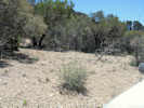
On May 29, 2008 I visited Hualapai Mountain, and stayed the night at Hualapai Mountain Park. The north side of the mountain, and the peak itself, is granitic. Hualapai Mountain Road also crosses a basaltic flow. I did not see either Frasera albomarginata or any likely-looking habitat. A checklist of species (Anonymous, n.d.) found in Hualapai Mountain Park lists "Elkweed/Green Gentian" as being found in the park. Review of Hualapai Mountain geology does not show any limestone or other carbonate outcrops on the mountain, at least at the 1:1,000,000 scale (Hirschberg and Pitts, 2000) . | ||||
|
Literature Cited:
Other articles:
Locations: Bucksin Mountain. Buckskin Mountain. Buckskin Mountains. Flagstaff. Panguitch. |
Finally, Post (1956) reports a collection of Frasera albomarginata by Marcus E. Jones (19-June-1890, POM) from "Bucksin Mountain, near Parker." Bucksin Mountain is listed as a synonym for Buckskin Mountain that is northwest of Parker. However, the elevation of Buckskin Mountain, and the vegetation that I can see in aerial and satellite photographs does not appear conducive to the presence of F. albomarginata. There are, however, two other locations in Arizona known as Buckskin Mountain. I think it's possible that Jones collected this specimen at one of the other Buckskin Mountains in Arizona.
Supporting this idea, Lenz (1986, p. 82) contains a long quote from Jones' biographical notes that places Jones on the road from Flagstaff, Arizona to Panguitch, Utah, in June 1890, crossing the Buckskin Mountains of Coconino County, Arizona and Kane County, Utah. I think it far more likely that Jones made his collection of Frasera albomarginata in the Buckskin Mountains of Cononino County, rather than that Buckskin Mountains of La Paz County, Arizona. Therfore, my map of the distribution of Frasera albomarginata shows this collection in the Buckskin Mountains of Coconino County, Arizona. | ||||
|
|
Arizona Strip and Utah's Dixie | ||||
| One of Edward Palmer's collections of Frasera albomarginata is described as "near Saint George" with no further location information. | |||||
| I have found four collections of the species from the Beaverdam Mountains to the southwest of Saint George. | |||||
|
Other articles:
|
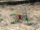
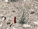
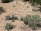
185 | One of them is my collection #185 made 27-May-1998 on the road to Hell Hole Pass on the northwest side of Old US Highway 91. | |||
|
Other articles:
Locations: Curly Hollow Wash. |
Barbara Ertter collected the species near the Apex Mine on the Mojave Desert Joshua Tree Scenic Backway. If my understanding of her location is correct she was on Curly Hollow Wash. | ||||
|
Other articles:
Locations:
Mine Valley.
|
I have also seen the plant near the Apex Mine, growing in red sandy wash that appear to also contain a lot of carbonates because the sand in the wash would "crunch" under my boots. | ||||
| There is also a Frank W. Pennell and R. L. Schaeffer (#21719, PH) collection of Frasera albomarginata from an undifferentiated location of "Beaver Dam Mountains." | |||||
| There are three collections from the southeastern slopes of the Pine Valley Mountains along US Interstate 15 north of Saint George. | |||||
|
Literature Cited:
Other articles:
Locations: Oak Grove Campground. |
The Oak Grove Campground location looks doubtful to me. It is too high, and the vegetation too lush, when compared to the typical habitat for Frasera albomarginata. I think it is possible, though, that the collection was made on the road to the Oak Grove Campground at a lower elevation, closer to Silver Reef or to Italian Spring. | ||||
|
Literature Cited:
Other articles:
Locations: Italian Spring. |
There is a R. K. Gierisch collection from Italian Spring (#381: RM, CAN, UTC, WS), above Silver Reef and below the campground. | ||||
|
Other articles:
Locations: Silver Reef. |
The third collection of Frasera albomarginata in the Pine Valley Mountains is a Marcus A. Jones collection (#5176a, POM) near the former mining town of Silver Reef. | ||||
|
Other articles:
Locations: Leeds. |
|||||
|
Other articles:
Locations: Zion National Park. |
There are two collections from the mesas north of the Virgin River. One was made on Smith Mesa
(Hurricane Mesa) just outside Zion National Park, and the other on Kolob Mesa inside the park.
The Smith Mesa collection was made by K. Moor (#213, 11 June 1970, NY) on Smith Mesa Road, 0.3 mile northwest of Zion National Park boundary in Pinyon-Juniper community, another one of those collections made just outside the park. The other was made by G. T. Crocket (s.n., 17 June 1937, UC) on a dry slope at North Creek in the Kolob National Monument portion of Zion National Park. | ||||
|
Other articles:
|
Along the Virgin River and the south border of Zion National Park, Coalpits Wash is popular collecting locality for Frasera albomarginata where the intrepid collector can capture the species sneaking through the fence at the park border. | ||||
| Harold E. Bailey collected at Coalpits Wash in 1936 (s.n., 12 June 1936, UC), and returned with his wife in 1949 (Harold & Virginia Bailey, #3433, 10 July 1949, UC). | |||||
|
Other articles:
Locations:
Coalpits Wash.
|
184 | My collection (#184, 27 May 1998, UC) was made there as well. | |||
|
Other articles:
Locations: Wire Mesa. |
There is also a Holmgren collection from Wire Mesa on the south side of the Virgin River, not far from Coalpits Wash (N. H. Holmgren with Patricia K. Holmgren, #8469, 21 June 1977, NY). | ||||
|
Other articles:
Locations: Kanab. |
In the vicinity of Kanab, Utah, there are three collections whose location data is no more specific. | ||||
| A collection of Frasera albomarginata was made 6 miles east of Kanab in dry sand and Juniper (L. C. Anderson< #1193, 22 June 1958, NY) . | |||||
|
Literature Cited:
Other articles:
Locations: Buckskin Mountain. |
Further east of Kanab are the Buckskin Mountains of Kane County, Utah, and Cononino County, Arizona.
There is a Marcus E. Jones collection of Frasera albomarginata (19-June-1890, POM) from the Buckskin Mountains that others have located in La Paz County near Parker, Arizona.
Lenz' 1986 biography of Jones, however, places him in northern Arizona and southern Utah, specifically crossing the Buckskin Mountains enroute to Panguitch, Utah from Flagstaff, Arizona. Placing this collection in northern Arizona, rather than southwest Arizona, solves a problem of explaining presence of the taxon in a very different habitat and location from the usual habitat. | ||||
| An additional collection was made near Kanab, although the location information conflicts with itself, and the collection may have been made in either Red Canyon, about 10 miles north, or Tom's Canyon, about 2 miles northeast. | |||||
|
Literature Cited:
Other articles:
Locations: Canaan Mountain. Kaibab Paiute Reservation. Pipe Spring. Vermilion Cliffs. |
Along Arizona Highway 389 and the Vermilion Cliffs, collections have been made at Pipe Spring, the
Kaibab Piute Reservation, and Canaan Mountain.
In June 2008, I stopped at Pipe Spring National Monument and talked to a couple of rangers, and showed them my photographs. No one recognized the plant as being found in the monument. | ||||
|
Locations: Short Creek. |
An additional collection made 5-6 miles southeast of Short Creek is given. However, since Short Creek runs east-west for about 15 miles, the location of this collection is difficult to estimate. | ||||
|
Literature Cited:
Other articles:
Locations: Cane Springs. Cottonwood Spring. Maple Canyon. Virgin Mountains. |
The Virgin Mountains south of Saint George have
been good places to scout for Frasera
albomarginata with seven collections in a relatively
small area.
I frequently have to remind myself that this is the Arizona Strip of Mohave County Arizona, and we have come south of the Utah state border. | ||||
|
Literature Cited:
Other articles:
Locations: Mokaac Pass. Mokiak Pass. |
The area around Quail Hill and Seegmiller Mountain with its variant spellings is a common area for collections, including
an early Edward Palmer collection.
This is also the location known as Mokiak Pass or Mokaac Pass. However, that location is not recognized by the Geographic Names Information System (GNIS). I don't really know which feature might be the Mokaac Pass of others. It could be the dramatic top of the hill at Quail Hill, or it could be the more subtle feature about 2 miles to the southwest where the road begins its descent towards Wolf Hole. | ||||
|
Other articles:
|
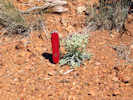
I found one Frasera albomarginata on Quail Hill. It happened to be growing in the tire tread of a long disused road. The seed is small and round and, maybe, it rolls to low places. And, maybe, the compaction of the soil excludes other species, thus allowing Frasera albomarginata to grow. Since there was only one rosette, I photographed it, and did not collect. | ||||
|
Locations: Seegmiller Mountain. |
Holmgren made a collection (#3357, 26 May 1969, NY) at the south end of Sigmiller (sic) Mountain, Sullivan Draw, 22 airline miles south of St. George, and 27 road miles (36°46'52"N, 113°32'09"W) in Pinyon-Juniper woodland, mostly under the trees. | ||||
|
Other articles:
|
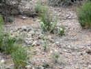
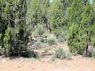
547 | Frasera albomarginata (S. Watson) Kuntze, about one one-half mile north of summit of Mokaac Pass and one mile southeast of Quail Hill in the road cut through reddish calcareous material, no Frasera albomarginata were found on hill slope above the road, my images IMG_0947.img, IMG_0948.jpg, and IMG_0950.jpg, 9 June 2008, Mokaac Pass, Mohave County, Arizona (UC). | |||
|
Other articles:
|
There are also several more collections deeper into the Virgin Mountains southwest of Wolf Hole at places like Cottonwood Spring, and Cane Springs. | ||||
|
Other articles:
Locations: Mount Trumbull. Potato Valley. Uinkaret Plateau. |
Further south, near Mount Trumbull, collections have been made on Mount Trumbull itself, in the adjacent Potato Valley and on the Uinkaret Plateau on the north side of Mount Trumbull. | ||||
|
Other articles:
Locations: Agway Valley. |
At the extreme southern end of the Arizona Strip, there are two collections in the vicinity of the Shivwitz, one that I believe to be in McDonald Flat on top of the plateau, and another that I believe to be near Andrus Canyon on the northeast edge. | ||||
|
Other articles:
Locations: South Big Saddle Point. |
Closer to the North Rim of the Grand Canyon, there is one observation of Frasera albomarginata just south of South Big Saddle Point (Jim Boone, Pers. Comm., 2009). | ||||
|
|
East-Central Nevada / Central Great Basin | ||||
Fish Creek RangeThe Fish Creek Range is centered near Eureka, Nevada, and includes an extension of the Diamond Mountains to the north. | |||||
|
Literature Cited:
Other articles:
Locations: Adams Hill. |
In the immediate vicinity of Eureka, there is a Percy Train collection of Frasera albomarginata from Adams Hill about 2 miles west of town (Percy Train, #251, n.d., US, ARIZ). | ||||
|
Literature Cited:
Other articles:
Locations: Pinto Canyon. Pinto Summit. |
There is an Alice Eastwood (#7348, CAS) collection of the species from Pinto Summit on US Highway 50 south of Eureka. In addition, Kartesz (1988) notes that the species occurs in Pinto Canyon, south of the summit. | ||||
|
Literature Cited:
Other articles:
Locations: Secret Canyon. |
| ||||
|
Other articles:
|
552 |
| |||
|
Other articles:
Locations: Pinto Creek Ranch. |
Around the east side of the Fish Creek Range in White Pine County near the mouth of Pinto Creek, there is one 1994 collection of Frasera albomarginata by A. P. Pinzl (#11188, 21 July 1994, NY). | ||||
White Pine Range | |||||
|
Literature Cited:
Locations: White Pine Range. |
While the White Pine Range measures about 55 miles from north to south, collections of Frasera albomarginata have been made in only a few miles of the northern end, around US Highway 50, and a few miles in the southern end, around US Highway 6. I would assume that the species is found throughout the range, but further exploration is required to confirm or deny that presumption. | ||||
|
Other articles:
Locations: Antelope Mountain. Antelope Spring. |
The Holmgren's made a collection at Antelope Mountain, at the extreme north end of the White Pine Range (N. H. Holmgren with Patricia K. Holmgren, #9374, 20 June 1979, NY). | ||||
|
Other articles:
Locations: Little Antelope Summit. |
H. D. Ripley (#3593, CAS) made a collection at Little Antelope Summit, presumably along US Highway 50. | ||||
|
Other articles:
|
551 |
| |||
|
Other articles:
|
On the west side of the White Pine Range, just south of US Highway 50, Jerry Tiehm collected Frasera albomarginata along the road to the Belmont Mill (A. Tiehm with Margaret Williams, #6486, 22 May 1981, NY). | ||||
|
Other articles:
Locations:
Moorman Ridge.
|
Jerry Tiehm also collected the species on the east side of the White Pine Range, just south of Illipah Creek reservoir (Arnold Tiehm with Maragaret Williams, #6185, 21 July 1980, NY). | ||||
|
Other articles:
|
Near the headwaters of the White River, where crossed by US Highway 6, Jerry Tiehm collected the species on barren-looking white clay hills (#13283, 20 June 2000, NY). | ||||
|
Other articles:
|
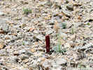
553 | Frasera albomarginata (S. Watson) Kuntze, purple stems, southwest of Currant Summit along US Highway 6, in caliche-covered volcanic sediments, my image IMG_1044.jpg. 11 June 2008 Currant Summit, Nye County, Nevada. (Alameda). | |||
|
Other articles:
Locations: Currant. |
In the southern part of the range, there are several collections giving Currant as the nearest location, including one collection about 3 miles southeast on the road to Wells Summit Station. | ||||
|
Locations: Butte Mountains. |
Butte MountainsNorth of US Highway 50, the Butte Mountains are inserted between the White Pine Range and the Egan Range. | ||||
|
Other articles:
|
There are two Holmgren collections of Frasera albomarginata from the Butte Mountains. One was made in Long Valley Canyon, an east-west canyon separating the Butte Mountains from the White Pine Range ( N. H. Holmgren with Patricia K. Holmgren, #14654, 8 June 2002, NY). | ||||
|
Other articles:
Locations: Long Valley Canyon. Middle Canyon. |
The other collection was made at the mouth of Middle Canyon on the east side of the Butte Mountains (N. H. Holmgren, #9325, 17 June 1979, NY). | ||||
|
Literature Cited:
Other articles:
Locations: Long Valley. |
Kartesz (1988) notes that the species occurs in Long Valley, on the west side of the Butte Mountains, but the location is not further differentiated. | ||||
|
Locations: Egan Range. |
Egan RangeThe Egan Range of east-central Nevada is 116 miles from North to South and about 14 miles from West to East. The range is mostly in White Pine County, but extends into Lincoln and Nye Counties in the south. | ||||
| I have found no collections of Frasera albomarginata from the Egan Range north of Ely or US Highway 50. | |||||
|
Other articles:
Locations: Ely. |
There is one collection from the "vicinity of Ely" with no further location details (B. S. Martineau, UTC). | ||||
|
Other articles:
Locations: Keystone. |
There are two collections of the species from near Keystone in the Robinson Mining District (Arnold Tiehm, #13242, 15 June 2000, NY) and (B. O. Moore and G. E. Franklin, #411, NA). | ||||
|
Other articles:
|
550 |
| |||
|
Other articles:
Locations: Lion Spring Wash. Murray Summit. |
Continuing further southwest of Ely, US Highway 6 crosses Murray Summit enroute to Tonopah. There is a collection of the species from Murray Summit (G. B. Van Schaack and G. F. Freytag, #2963, 27 July 1950, UC) and from Lion Spring Wash just south of the summit (N. H. Holmgren with Patricia K. Holmgren, #8240, 23 June 1976, NY). | ||||
|
Other articles:
Locations: Ward Mountain. |
There is an Edmund Jaeger collection of Frasera albomarginata from Ward Mountain (E. O. Jaeger, 4 July 1928, GH, POM), the highest peak in the Egan Range. However, there is no more definitive location data available for this collection. | ||||
|
Other articles:
Locations: Sunnyside. White River (historical location). |
At the southwestern end of the Egan Range is the oft-collected location of Sunnyside where Frasera gypsicola is found in addition to F. albomarginata. Collections by A. J. Cronquist (#11981, 2 June 1985, NY), M. D. Windham (#2441, 6 June 2001, NY), and N. H. Holmgren with Patricia K. Holmgren (#8225, 22 June 1976, NY). | ||||
|
Literature Cited:
Other articles:
Locations: Cave Valley. |
Cave Valley is between the Egan Range and the Schell Creek Range. Kartesz (1986) states that the species is found in Cave Valley. The valley stretches 42 miles from north to south, and from 6000 ft to 7200 ft in elevation. Probably, though, the species is found in the pinyon-juniper forests in the northern part of Cave Valley. | ||||
Schell Creek Range | |||||
|
Other articles:
Locations: Steptoe. |
There are two collections from the vicinity of Steptoe, behind and above the smelter at McGill (B. O. Moore and G. E. Franklin, #808, NA), and (F. W. Pennell and R. L. Schaeffer, #23073, PH). | ||||
|
Other articles:
Locations: Steptoe Creek. |
Nevada Highway 496, also known as Success Summit Drive, loops around from a point north of McGill, south through Duck Creek Valley, over Success Summit, and then down Steptoe Creek, past Cave Lake State Park.
There are two collections of Frasera albomarginata along this road, in addition to my own #549: (B. J. Cox with D. B. Dunn and W. Harmon, #486, 23 June 1968, NY) and (F. W. Pennell with R. L. Schaeffer, Jr., #23073, 15 July 1938, NY). Reading the location descriptions, I believe these collections were made along upper Steptoe Creek, between Cave Lake State Park and Success Summit. | ||||
|
Other articles:
|
549 |
| |||
|
Other articles:
|
In June 2008, I found Frasera albomarginata growing among Pinyons on a small hill south of Connors Pass, near the microwave station. None of the plants were in bloom, so I did not collect. | ||||
|
Other articles:
Locations: Connors Pass. |
There is one collection just east of Connors Pass along US Highway 50 (C. McMillan, #26, NA). | ||||
|
Other articles:
Locations:
Silver King Pass.
|
There are two collections, and one observation from Silver King Pass in the southern Schell Creek Range. | ||||
|
Other articles:
|
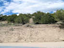
570 | Collection of Frasera albomarginata in Silver King Pass, in open places among Utah juniper, on the north side of the road in carbonate rocks. None seen in the volcanic rocks on the south side if the road. | |||
|
Other articles:
|
There was a large population blooming on the road berm in 2009. | ||||
|
Other articles:
|
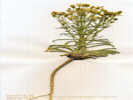
569 | Frasera albomarginata, in open places among sagebrush and Utah juniper. This location is about 2.3 miles (3.7 km) east of Silver King Pass, and at the lower edge of the juniper. Since I was traveling west, and up the slope, this location would place the lower elevation of F. albomarginata at 5745 ft (1751 m). | |||
| Kartesz (1988) states that Frasera albomarginata occurs in Cave Valley. This valley fills a long and narrow space between the Schell Creek Range and the Egan Range. I suspect that Kartesz was thinking of the northern end of Cave Valley as a plant location, and not the lower elevation valley floor to the south. | |||||
|
Locations: Grant Range. Quinn Canyon Range. |
Quinn Canyon and Grant RangesThe Grant Range and Quinn Canyon Range are southern extensions of the White Pine Range. | ||||
|
Other articles:
Locations: Burnt Canyon. Quinn Canyon Range. |
There is one collection of Frasera albomarginata from this area made by Basset Maguire and Noel Holmgren in 1945. Post (1956) referred to this collection and listed the location as Burut Creek, which I believe to be a transcription error. I found the collection online at NY. There, the location is listed as Burnt Creek.
There does not seem to be a Burnt Creek in either the Quinn Canyon Range or the Grant Range. However, there is a Burnt Canyon, and a Burnt Canyon Spring, just north of Humboldt-Toiyabe National Forest Road 410, on the west side of the ranges. Humboldt-Toiyabe National Forest Road 410 forms the boundary between the Quinn Canyon Range and the Grant Range. Since Burnt Canyon and the Grant Range are north of the road, this collection of Frasera albomarginata was collected in the Grant Range rather than the Quinn Canyon range as listed by the collectors. | ||||
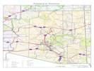
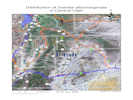
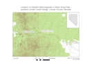
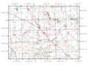
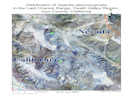
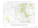
 Distribution of Frasera albomarginata in Lincoln County, Nevada Distribution of Frasera albomarginata in Lincoln County, Nevada
|
Bristol Range and Lake ValleyThere are eight collections of Frasera albomarginata in eastern Lincoln County, Nevada, spread from the Bristol Range, through Lake Valley near Pioche, to Beaverdam Wash near the Utah border. | ||||
|
Other articles:
Locations: Bristol Pass. |
There is one collection by Jean Langenheim (#3782, 7/1/1954) in Bristol Pass at the north end of the Bristol Range. The plants were found on a hillslope north of the summit, scattered in well-developed soil, and in close association with Artemisia tridentata. | ||||
|
Other articles:
Locations: Atlanta. |
Barbara Ertter collected the species at the railroad siding of Atlanta, about 2 miles northwest of Pioche. (This is a different location than the mining town of Atlanta in the Wilson Creek Range to the northeast.) Here, Frasera albomarginata was found in a wash with Peraphyllum and Purshia in an area of Pinyon-Juniper. | ||||
|
Other articles:
Locations: Pioche. |
In the vicinity of Pioche, there is a Marcus E. Jones collection from 1913. This was preceeded by a 1909 collection of Frasera albomarginata by Miss Maud Minthorn. Miss Minthorn was also a major collector in the Mono Lake basin. | ||||
|
Other articles:
Locations: Lake Valley. |
There is one collection from the south end of Lake Valley. I estimate this collection was made on a bluff overlooking Hamlight Canyon. Frasera albomarginata was found with scattered Juniper, Artemisia, Caulanthus, Chaenactis, Ipomopsis, and Stephanomeria. | ||||
|
Other articles:
Locations: Panaca. |
There are two collections from the vicinity of Panaca. Here the ecotype is described as high desert, with Artemisia sage, and Juniper. | ||||
|
Other articles:
|
Marie Gentry collected in June 1941 at "Panaca Valley and vicinity." This specimen was previously misidentified as F. paniculata and is probably the data point that results in mapping of that species in Lincoln County by the Global Biodiversity Information Facility and the Encyclopedia of Life. | ||||
|
Other articles:
|
The other is a collection by R. D. Hermansen which Post (1954) states is at NA. | ||||
|
Other articles:
Locations:
Miller Bench.
|
565 |
| |||
|
Other articles:
|
along Beaver Dam Road between Empy Mountain and Empy Wash. | ||||
|
Other articles:
Locations: Acoma. |
Where the road to Beaverdam State Park crosses Clover Creek, there is one collection of Frasera albomarginata made in sagebrush (Artemisia) and Juniper near the Acoma siding on the Union Pacific Railroad. | ||||
|
Other articles:
|
Frasera albomarginata was found at the base of the bluffs about 1/2 mile east of Acoma. | ||||
|
Other articles:
|
567 | ||||
|
Literature Cited:
Other articles:
Locations: Pine Mountain. |
Finally, just over the state line into Utah, in the extreme northwestern corner of Washington County, C. C. Parry made a collection of Frasera albomarginata at Pine Mountain. | ||||
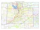
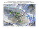
 Distribution of Frasera albomarginata in the Mt. Irish, Pahranagat, and Groom Ranges, Lincoln County, Nevada Distribution of Frasera albomarginata in the Mt. Irish, Pahranagat, and Groom Ranges, Lincoln County, Nevada
|
Mount Irish Range, Groom Range, and Pahranagat RangeIn western Lincoln County, Nevada, there are two collections of Frasera albomarginata from the Groom Range, and one collection each from the Mount Irish and Pahranagat Ranges. | ||||
|
Literature Cited:
Other articles:
Locations: Groom Range. |
The collections of Frasera albomarginata in the Groom Range were both made portions of range that are inside the Nellis Air Force Range and therefore not accessible to the public. Both collections appear to have been made in the same general area on the west side of the range among Pinyon, Juniper and Artemisia. Kartesz (1988) also notes that the species occurs in the Groom Range, without further differentiating the location. | ||||
|
Literature Cited:
Other articles:
Locations: Pahranagat Range. |
The collection in the Pahranagat Range was made by Searls and is deposited at F and GH as noted by
Post (1956). Beyond that, I have no other information specific to this collection. "Searls" is probably Fanny Searls (1851-1939). She graduated Laureate of Science in 1870 from Northwest Female College and studied for a year at Northwestern University, the first year women were admitted. In 1871 she travelled with her father, a lawyer, to the Pahranagat mines in Nevada. While there she collected 215 plant specimens, as well as minerals and fossils, which she gave to Professor Oliver Marcy at Northwestern University. In 1877 she received her M.D. from University of Michigan but couldn't get an internship. So she worked as a student nurse in New york until 1881 when she married a Chicago ophthalmologist: Henry Gradle. After her husband's death in 1911, she moved to Santa Barbara, California, where she lived until her death. Dalea searlsiae (A. Gray) Barneby is named for her. | ||||
|
Literature Cited:
Other articles:
Locations: Mount Irish. |
Edmund Jaeger made the collection of Frasera albomarginata in the Mount Irish Range. This voucher is at POM and I have not seen it. The Mount Irish Range should be fairly easy to access via Logan Canyon Road from Nevada State Route 318 near Hiko. | ||||
|
Locations: Snake Range. |
Snake RangeThe Snake Range is the easternmost range in the Great Basin of Nevada. Bisected in the middle where crossed by US Highway 50 and US Highway 6 at Sacramento Pass, the southern portion of the Snake Range is mostly occupied by Great Basin National Park. | ||||
|
Other articles:
Locations: Swallow Canyon. |
There is one collection of Frasera albomarginata at the herbaria that I have visited (JEPS, UC, ARIZ, and NY). This collection was made by Holmgren and Reveal in the foothills at the mouth of Swallow Canyon, on the southwest side of the range. The collection was made on a gravelly hillside with scattered Pinyon and Juniper. | ||||
|
Locations: Great Basin National Park. |
I would strongly suspect that Frasera albomarginata has been found or collected inside Great Basin National Park. I just have not yet found the collection. At my last visit to the park, I asked if they had a plant list, and was told that one was under development, but not yet ready to distribute. | ||||
|
Other articles:
Locations: Mountain Home Range. |
There are no collections from the Mountain Home Range south of Utah Highway 21. There is, however, a collection of Frasera speciosa. | ||||
|
Other articles:
Locations: Warm Cove Ridge. |
Basset Maguire (#20886, 6/19/1941) collected Frasera albomarginata in stony soil on "Warm Point Ridge," which I believe to be Warm Cove Ridge, 5 miles west of Headquarters of Desert Range Experiment Station. | ||||
| There are no collections from the Indian Peak Range, even though the species might be expected there. | |||||
|
Other articles:
Locations: Wah Wah Mountains. |
Wah Wah MountainsIn the Wah Wah Mountains and surrounding areas there have been five collections of Frasera albomarginata. | ||||
|
Literature Cited:
Locations: Crystal Peak. |
In the extreme north end of the Wah Wah Mountains at Crystal Peak, S. L. Welsh with K. Taylor and K. Thorne (#13589, 6/24/1976) collected Frasera albomarginata on what they described as a gray ignimbrite outcrop. However, the rock unit comprising Crystal Peak, the Tunnel Spring Tuff, is a crudely stratified, non-welded rhyolite ash-flow tuff with clasts of Palaeozoic dolomite, limestone and quartzite making up 10 per cent of the tuff (McBride and Picard, 2000). It's not unusual to find Frasera albomarginata on volcanic or plutonic rocks, when they contain a substantial portion of carbonates like the Tunnel Spring Tuff.
Tunnel Spring, by the way is on the west side of the Tunnel Spring Mountains, about 10 miles west southwest of Crystal Peak. | ||||
| Along Utah Highway 21, just west of Wah Wah Pass, Holmgren (#13816, 6/4/2000) collected the species in a Pinyon-Juniper woodland | |||||
|
Other articles:
|
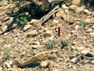
548 | Frasera albomarginata, about one-half mile east of Wah Wah Summit, in white limestone with Pinyons, Junipers, and Cliff Rose. | |||
|
Locations: Wah Wah Springs. |
H. D. Ripley and R. C. Barneby (#9258, n.d.) collected Frasera albomarginata at Wah Wah Springs, on the east flank of the mountains just south of Utah Highway 21. | ||||
| About 11 miles further south, the Holmgrens (3713,7/13/1969) collected the species in gravelly alluvial soil in Pinyon-Juniper woodland. I believe this would be on the Wah Wah Mines Road, just above Revenue Basin. | |||||
|
Other articles:
Locations: Red Hill. |
Near the south end of the Wah Wah Mountains, and close to the Iron County line, S. L. Welsh with K. Taylor and D. Atwood (#13985,7/27/1976) collected Frasera albomarginata in pinyon-juniper community on red-purple clay, probably adjacent to Jockey Road. | ||||
|
Other articles:
Locations: Currant Creek. Current Creek Mountains. Snake Mountains. |
Elko CountyPost (1956) states that there is a Marcus E. Jones collection of Frasera albomarginata made October 8, 1924 from the "Currant Creek Mountains" of Elko County. Vouchers are at POM and NY.The New York Botanical Garden online records (http://nybg.org) report three collections by Marcus E. Jones from Nevada with names including "Currant." On 31 July 1923, Jones collected Eriogonum microthecum Nutt. var. lapidicola Reveal at the Currant Creek Mountains (NY282222). On the same day, he also collected Ivesia sabulosa (M. E. Jones) D. D. Keck at Currant Creek (NY834049). There are no other collections in this location until 8 October 1924 when Jones collected Frasera albomarginata S. Watson at the Currant Creek Mountains (NY188578). Currant Creek drains the Snake Mountains to the east. It's possible that Jones thought the name for those mountains was "Currant Creek Mountains." I also noticed that Jones' collections occasionally mix county names. For example, Palisade is sometimes listed in Elko County and sometimes in Eureka County. The same for Ruby Hill, although, place names containing "ruby" are fairly common throughout Nevada. The collection of Frasera albomarginata in the Currant Creek Mountains is such as odd collection, it must remain suspect until more evidence can be obtained of Jones' collection localities in October of 1924. | ||||
|
Literature Cited:
Other articles:
Locations: Dry Mountain. Last Chance Mountain. Last Chance Range. |
Death Valley Region
| ||||
| I have found only one collection. There may be others, however, in the Death Valley herbarium, and in regional herbaria such as UNLV. | |||||
|
Other articles:
Locations:
Last Chance Mountain.
|
| ||||
|
|
Southern NevadaThe area that I have called "southern Nevada" includes the Sheep Range, and the Spring Mountains with their southern extension of Potosi Mountains. I have found twenty collections of Frasera albomarginata in this area. | ||||
|
Literature Cited:
Other articles:
Locations: Deadman Canyon. Deadman Spring. |
In the Sheep Range, Post (1956) notes presence of the species, perhaps on the basis of a single collection made by Annie M. Alexander and Louise Kellogg (1641, 1 Jun 1940) at Deadman Spring in Hidden Forest. | ||||
|
Other articles:
Locations: Cabin Spring. |
There is an observation of Frasera albomarginata at Cabin Spring on the west side of the Sheep Range (Jim Boone, Pers. Comm., 2009). | ||||
|
Other articles:
Locations: Mormon Pass. Mormon Well. |
There are observations of Frasera albomarginata at both Mormon Well and Mormon Pass (Jim Boone, Pers. Comm., 2009). | ||||
|
Other articles:
Locations: Clark Canyon. Wheeler Well. |
There are three vouchers made by I. W. Clokey in 1936 that may or may not represent the same collection (#7241a, 7241b, and 7241d) in the vicinity of Wheeler Well in Clark Canyon. These are described as found in a wooded wash, or a gravelly shrubby wash, in the Juniper belt. | ||||
|
Other articles:
Locations: Lee Canyon. |
There are four collections from Lee Canyon area, three of which were made by I. W. Clokey in 1936 in the Juniper belt. The other was made by A. A. Heller in 1913. | ||||
|
Other articles:
Locations: Deer Creek. |
In the Deer Creek area, between Lee Canyon and Kyle Canyon, there is a collection by I. W. Clokey (#7239, 6 Jun 1936) on a hillside with Pinus monophylla, and one by Robert T. Clausen and Harold Trapido (#5117, 20 Aug 1940) in open woods of Pseudotsuga on dry slope. | ||||
|
Other articles:
Locations: Kyle Canyon. |
In Kyle Canyon, there is a collection by I. W. Clokey (#7623, 30 Jun 1946) in the Yellow Pine Belt, and a collection by me (#257, 7 Jun 2000) on an old gravel road, near the intersection of NV Hwy 157 (Kyle Canyon Road) and NV Hwy 158 (Deer Creek Road), 42 km west of Las Vegas, Nevada. | ||||
|
Literature Cited:
Locations: Spring Mountains. |
There are two collections that cannot be located more specifically than just "Spring Mountains." one of them is the 1898 collection by Carl A. Purpus (#6083), that is the type for his Frasera induta. | ||||
|
Other articles:
Locations: Harris Springs. |
In the vicinity of Harris Springs, south of Kyle Canyon, there are two collections by I. W. Clokey (#7622, and the ubquitious collection #7241, 25 Jun 1937) and one by me (#258, 7 Jun 2000), described as being made on gravelly hills or gravelly ground in the Pinyon belt. | ||||
| There are numeerous observations of F. albomarginata from the ridge line of Red Rock Canyon Natural Conservation Area west of Blue Diamond (J. Boone, Pers. Comm., 2010) | |||||
| The Spring Mountains, and the Toiyabe National Forest, are generally considered to extend south past Mountain Springs to Potosi Mountain. | |||||
|
Other articles:
Locations: Potosi Mountain. |
Frank Pitelka (#120, 14 Jun 1940) collected Frasera albomarginata on the north side of Potosi Mountain on a dry south-facing slope, in coarse gravelly soil, associated with Pinyon, Juniper, and Manzanita. | ||||
| My collection (#260, 7 Jun 2000) was made on Potosi Mountain Road, just past the private campgrounds, about 3 km west of Nevada State Route 160 on loose limestone soil on moderate slopes. | |||||
|
Literature Cited:
Locations:
Yant Pit Canyon.
|
Philip A. Munz (#16736) made a collection at 4600 ft. in the east fork of Yant Pit Canyon. This location has been transcribed as "Yank Pit Canyon," but my review of the labels confirm that they are printed as "Yant Pit Canyon." I have also seen copies of Munz' field notes that are clearly written Yant with a "t." "Yant" is a Piute word for Agave. With the assistance of Lloyd Stark, Wes Niles, and others at UNLV, and David Charlet, it seems quite certain that Yant Pit Canyon is enters the Virgin Mountains from the south, and is the second canyon west of the main ridge. | ||||
|
|
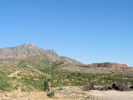
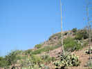
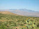
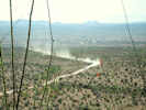
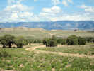
Eastern Mojave Desert | ||||
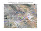
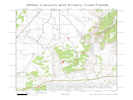
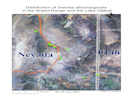
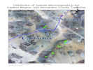 Distribution of Frasera albomarginata
in the eastern Mojave, San Bernardino County, California Distribution of Frasera albomarginata
in the eastern Mojave, San Bernardino County, California
|
In the eastern Mojave Desert of California, Frasera albomarginata has been collected on Clark Mountain, and on the New York to Providence Mountain Ranges. | ||||
| North of Clark Mountain is the Kingston Range. I've been told the species occurs there but, to date, I have not found a collection. | |||||
|
Locations: Clark Mountain. |
On Clark Mountain, Frasera albomarginata has been collected by Annie M. Alexander and Louise Kellogg (#841, 26 Jun 1939) on the north slope. I have also seen the species there, but did not collect because it was not in flower. | ||||
| To the south, across the Ivanpah Valley, are the Providence Mountains and the New York Mountains, that are joined by the Mid Hills. | |||||
|
Literature Cited:
Other articles:
Locations: Keystone Canyon. |
In the northern part of the New York
Mountains, at Keystone Canyon, there are two collections
by C. B. Wolf and P. C. Everett (#9027, 30 Jul 1937)
describing the vegetation as Upper Sonoran Zone, and one
by J. Roos (s.n., 20 Jun 1949). Keystone Canyon is adjacent to Barnwell, a stop on the Searchlight Branch of the Atchison, Topeka, and Santa Fe Railroad. Several well-known California botanists collected here, including the Brandegees and Willis Linn Jepson. Jepson made 25 collections at Barnwell on 9-10 May 1913, but not one of Frasera albomarginata. | ||||
|
Other articles:
|
Sagamore Canyon is the next canyon south of Keystone Canyon. R. F. Thorne (#44166, 21 Jun 1973) collected Frasera albomarginata in a narrow canyon above Sagamore Mine on rocky slopes in pinyon-juniper woodland with Pinus monophylla, Leucelene ericoides, Asclepias asperula, Cryptantha tumulosa, Mirabilis pumila, Tragia stylaris, Galium munzii, Petalostemon searlsiae, Forsellesia nevadensis, etc. The names of these associates ne to be updated. | ||||
|
Locations: Caruthers Canyon. Giant Ledge Mine. |
Annie M. Alexander and Louise Kellogg camped in Caruthers Canyon in May, 1940, making more that 300 collections of plants they found there. One of those collections (#1461, 14 May 1940) was of Frasera albomarginata. I have also collected (#186, 25 May 1998) the species in Caruthers Canyon in the tailings of the Giant Ledge Mine. | ||||
|
Locations: Pinto Mountain. |
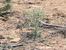
I have collected Frasera albomarginata (#186, 1 May 1996) on the south slopes of Pinto Mountain at the location of one of my experimental plots. The species is found on broken limestones slopes of a lacustrine limestone informally called the Winkler Formation. | ||||
|
Locations: Cedar Canyon. |
Roxanna S.Ferris collected (#9862, 26 Jun 1940) in sagebrush-juniper association in a location east of Cedar Canyon on Cima-Lanfair Valley Road. I believe this collection was made in the vicinity of Pinto Mountain, north of what is now called Cedar Canyon Road. | ||||
|
Other articles:
Locations:
Wild Horse Mesa.
|
| ||||
|
Literature Cited:
Locations: Providence Mountains. |
There is a T. S. Brandegee collection (s.n., 6 Jun 1902) of Frasera albomarginata from the Providence Mountains, as well as a listing of the species in his 1903 article "Flora of the Providence Mountains." | ||||
| I am a little surprised that I have not found a collection of Frasera albomarginata by Mary Beal, or by Willis Linn Jepson, who visited Mary Beal at the Providence Mountains. JEPS has 567 collections made by Mary Beal at the Providence Mountains, and 188 collections made by Willis Linn Jepson there, but none of them are Frasera albomarginata. | |||||
| [Previous Page] [Next Page] | |||||
| If you have a question or a comment you may write to me at: tas4@schweich.com I sometimes post interesting questions in my FAQ, but I never disclose your full name or address. |
Date and time this article was prepared: 4/27/2024 3:29:50 PM |
||||