Eastern Mojave Vegetation
Tom Schweich
|
Eastern Mojave Vegetation
| U. S. Highway 95 |
|
Tom Schweich |

|
(No Preface) | |||||||||||||||||||||||||||||||||||||||||||||||||||||||||||||||||||||||||||||||||||||||||||||||||||||||||||||||||||||||||||||||||||||||||||||||||||||||||||||||||||||||||||||||||||||||||||||||||||||||||||||||||||||||||||||||||||
|
|
U. S. - Canada Border | |||||||||||||||||||||||||||||||||||||||||||||||||||||||||||||||||||||||||||||||||||||||||||||||||||||||||||||||||||||||||||||||||||||||||||||||||||||||||||||||||||||||||||||||||||||||||||||||||||||||||||||||||||||||||||||||||||
|
|
Porthill | |||||||||||||||||||||||||||||||||||||||||||||||||||||||||||||||||||||||||||||||||||||||||||||||||||||||||||||||||||||||||||||||||||||||||||||||||||||||||||||||||||||||||||||||||||||||||||||||||||||||||||||||||||||||||||||||||||
|
|
Sandpoint | |||||||||||||||||||||||||||||||||||||||||||||||||||||||||||||||||||||||||||||||||||||||||||||||||||||||||||||||||||||||||||||||||||||||||||||||||||||||||||||||||||||||||||||||||||||||||||||||||||||||||||||||||||||||||||||||||||
|
|
Coeur d'AleneJunction: U. S. Interstate 90. | |||||||||||||||||||||||||||||||||||||||||||||||||||||||||||||||||||||||||||||||||||||||||||||||||||||||||||||||||||||||||||||||||||||||||||||||||||||||||||||||||||||||||||||||||||||||||||||||||||||||||||||||||||||||||||||||||||
|
|
North LewistonJunction: US Highway 12, west across the river to Lewiston and then into Clarkston.
|
Junction: US Highway 12, east to Orofino, Idaho.
|
|
Locations: Clearwater River.
| Cross Clearwater River.
|
| Spalding
|
Other articles:
Locations: Lapwai.
| Lapwai
|
| Weiser
|
| Payette
|
Idaho
| Oregon below
|
Junction: U. S. Interstate 84.
|
|
| Ontario(?)
|
Other articles:
Junction: US Highway 20, US Highway 26, west into Oregon at Nyssa
|
|
Oregon above
| Idaho below
|
| Parma
|
| Wilder
|
Idaho above
| Oregon below
|
| Jordan Valley
|
| Owyhee River Put InBasic boat ramp, day use tables and clean basic restrooms.
|
Locations: Owyhee River.
| Cross Owyhee River.
|
Locations: Rome.
| RomeRome, also called Rome Station after its sole business, is an unincorporated community in Malheur County, Oregon, United States. Rome was named by William F. Stine for the nearby geologic formations that suggested the ruined temples of Rome, Italy. One gas pump, restroom, and restaurant/café. Pillars of Rome or Rome Cliffs are about 8 minutes away by way of Rome Road, Old Iron Highway, and Kiger Road.
|
Other articles:
| Burns Junction
|
Oregon above
| Nevada below
|
| McDermitt
|
Locations: Santa Rosa Range.
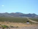
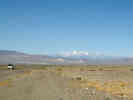
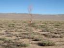
For the next 30 miles to the south, US Highway 95 travels through the Quinn River Valley, bordered by the Santa Rosa Range to the east.
|
|
Other articles:
Junction: Canyon Creek Road (Forest Road 084)
|
|
Other articles:
Locations: Orovada.
| OrovadaJunction: Nevada State Route 293, west to Kings River Valley.
|
Other articles:
Junction: Nevada Highway 140.
|
|
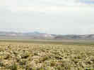
Locations: Santa Rosa Range.
For the next 30 miles to the north, US Highway 95 travels through the Quinn River Valley, bordered by the Santa Rosa Range to the east.
|
|
Paradise Hill. | US Highway 95 is in Quinn River Valley to the north, and Paradise Valley to the south.
|
Other articles:
Junction: Nevada State Route 290
|
|
Literature Cited:
Other articles:
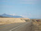
Locations: Winnemucca Dunes.
| Winnemucca Dunes
|
Highway passes under US Interstate 80.
|
|
Other articles:
Locations: Winnemucca.
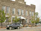
| WinnemuccaIntersection: Winnemucca Blvd and Melarky St.
|
From Exit 83 to Winnemucca, US Hwy 95 follows the route of US I-80. Please see the article on US I-80 for information about the route between Exit 83 and Winnemucca.
|
|
Other articles:
Exit 83: US I-80, north and east to Winnemucca.
|
|
Other articles:
Junction: U. S. Highway 50.
|
|
| Schurz
|
Other articles:
Junction: US Highway Alternate 95, west to Yerington, then north to US I-80 at Fernley.
|
|
Literature Cited:
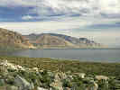
Lower Walker River to the east. | Adams (2007) study of Walker Lake sedimentary environments presented a detailed overview of the different sedimentary environments and stratigraphic sequences observed in outcrops along the margins of paleolake basins and showed how these can be used to reconstruct past lake-level fluctuations, using the Walker Lake basin as an example. This paper presented a new late Holocene lake-level curve based on radiocarbon ages of different sedimentary environments exposed in outcrops along the lower Walker River. Late Holocene sedimentary environments along the lower Walker River include fluvial, deltaic, beach, and offshore settings that migrated laterally over a distance of ~20 km as lake levels fluctuated through a vertical range of ~55 m.
|
Other articles:
Locations:
Walker Lake.
North end of Walker Lake.
|
|
Other articles:
Locations:
Walker Lake.
|
|
Literature Cited:
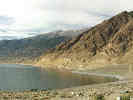
Locations: Walker Lake.
| Walker LakeJunction: Nevada Highway 359, south and west to California Highway 167 and US Highway 395 near Mono Lake.
|
Other articles:
| Hawthorne
|
Other articles:
Junction: Nevada State Route 361, northeast to Gabbs, then north to US Hwy 50.
|
|
Other articles:
|
|
Other articles:
Junction: 1st Street, turn northeast here for Washington Street and New York Canyon.
|
|
Other articles:
|
|
Locations: Luning.
| Luning
|
Other articles:
|
|
| Mina
|
Literature Cited:
Locations: Sodaville.
| SodavilleAlso known as Soda Springs, reached by the Carson & Colorado Railroad on December 1, 1881, was a resting place, a popular resort, and a major freighting point.Astragalus lentiginosus Douglas var. sesquimetralis (Rydb.) Barneby, the Sodaville milk-vetch, was previously listed at Threatened by the US Fish and Wildlife service in 1992. The taxon occurs at (Big) Sand Spring, Inyo County, California, Sodaville, Mineral County, Nevada, and Cold Springs, Nye County, Nevada. Following incorporation of the Sand Spring site into Death Valley National Park and action to protect the population from wild burros, the Fish and Wildlife Service withdrew the proposed rule to list the taxon as Threatened (Fish and Wildlife Service, 1998).
|
Literature Cited:
Silver Star Mining District in the east end of the Excelsior Mountains to the west.
|
|
Literature Cited:
Locations: Rhodes Salt Marsh.
| Rhodes Salt MarshRhodes Salt Marsh, immediately south of Sodaville, was named after A. J. Rhodes. At one time it was known as Virginia Marsh, and it was from this marsh that salt was transported by camels to Virginia City in 1862 (Shamberger, 1978, p. 148).
|
Other articles:
Locations:
Pilot Mountains.
| Tonopah JunctionJunction: NV Highway 360
|
Other articles:
Locations:
Redlich.
| Redlich (Site)
|
Locations: Columbus.
Road to Columbus |
|
Other articles:
Locations:
Columbus Salt Marsh.
Columbus Salt Marsh
|
|
Other articles:
| CoaldaleJunction: U. S. Highway 6, west through Montgomery Pass to Bishop, California.
|
Other articles:
Junction: Nevada Highway 265, south to Silver Peak.
|
|
Other articles:
Locations:
White Mountains.
White Mountains.
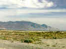
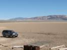
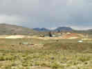
From Tonopah, US Highway 95 goes west. As we rounded a corner we got a good view of the White Mountains in the distance.
|
|
Literature Cited:
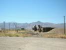
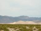
Locations: Crescent Dunes.
Crescent Dunes (Nye County) about 8 miles north of the highway.
|
|
Other articles:
| TonopahJunction: U. S. Highway 6, east to Ely, Nevada, and Salt Lake City, Utah.
|
Other articles:
Junction: Silver Peak Road, west through Alkali to Silver Peak.
|
|
Other articles:
Locations:
Goldfield.
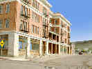
| Goldfield
|
Other articles:
Locations:
Goldfield.
Mine headframes to the east of Goldfield.
|
|
Other articles:
Locations:
Goldfield.
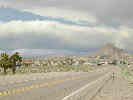
Coming into Goldfield from the south.
|
|
Other articles:
Junction: Nevada Highway 266, west to Lida and into California at Oasis.
|
|
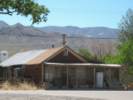
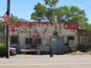
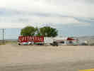 Cottontail Ranch brothel at Lida Junction. Cottontail Ranch brothel at Lida Junction.
|
|
Other articles:
|
|
| Scotty's JunctionJunction: Nevada Highway 267, southwest to the California state line and Scotty's Castle.
|
Locations:
Pahute Mesa.
|
|
Junction: Oleo Road | Access to Nature Consevancy reserve at Torrance Ranch (37.0028, -116.7233), critical habitat for the Amargosa Toad.
|
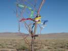
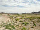 Roadside north of Beatty. Roadside north of Beatty.
|
|
Other articles:
Locations:
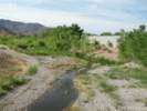
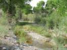
Amargosa River.
|
|
Other articles:
Locations: Beatty.
| BeattyJunction: Nevada Highway 374, southwest past Beatty to Death Valley at Daylight Pass.
|
Other articles:
Locations:
Amargosa River.
|
|
|
|
Amargosa Narrows
|
|
Literature Cited:
Other articles:
Locations: Big Dune.
|
|
Literature Cited:
Other articles:
Locations: Lathrop Wells Volcano.
Lathrop Wells Cinder Cone
|
|
Other articles:
Locations: Amargosa Valley.
| Amargosa ValleyJunction: Nevada Highway 373, south to Ash Meadows, Death Valley, and US I-15 at Baker.
|
Other articles:
Junction:
|
|
| Cactus Springs
|
Locations: Indian Springs.
| Indian Springs
|
Other articles:
Junction: Nevada State Route 172 "Cold Creek Road", to Camp Bonanza and Wheeler Pass Road.
|
|
Other articles:
Junction: Nevada State Route 156, Lee Canyon Road.
|
|
Locations: Sheep Range.
Sheep Range to the northeast.
|
|
Other articles:
Junction: Desert National Wildlife Range Road, to the Corn Creek Field Station, and Alamo Road, which passes up the west side of the Sheep Range.
|
|
Other articles:
Junction: Alamo Road, north, and passing to the east side of the Sheep Range.
|
|
Other articles:
Junction: Nevada State Route 157, Kyle Canyon Road.
|
|
Hite and Lake Powell Overlook
|
|
View upstream toward Hite bridge.
|
|
Other articles:
Locations: Las Vegas.
| Las VegasJunction:
Between the Junction with Interstate 15 in the Center of Las Vegas and south of Henderson, NV, U. S. Highway 95 is coincident with U. S. Interstate 515 and U. S. Highway 93.
|
Other articles:
Junctions:
|
|
Other articles:
Locations: Searchlight.
| Searchlight
|
| Cal Nev Ari
|
Other articles:
| Arrowhead JunctionJunction: Goffs Road, west to Goffs, former route of US Highway 66, the National Old Trails Highway.
|
| Klinefelter
|
Other articles:
Junction: U. S. Interstate 40.
|
|
| Needles
|
Locations: Lobecks Pass.
| Lobecks Pass
|
Other articles:
Junction: Havasu Lake Rd
|
|
Other articles:
| Vidal JunctionJunction: California Highway 62, west to Twentynine Palms and Los Angeles, east to Earp, California, and Parker, Arizona.
|
Other articles:
| BlytheJunction: US Interstate 10, west to Indio and Los Angeles.
|
California above
| Arizona below
|
| Ehrenberg
|
Other articles:
Locations: Quartzite.
| QuartzsiteJunction: US Interstate 10, east to Phoenix, Arizona.
|
Literature Cited:
Locations: Dome Canyon.
Dome Canyon of the Gila River between the Laguna Mountains and the Gila Mountains. | As an application of their criteria-based methodology for determining the mechanism of transverse drainage development, Douglass, et al. (2009) determined superimposition as the mechanism for transverse drainage through Dome Canyon.
|
| Yuma
|
Locations: Quinn River.
Junction: U. S. Interstate 8, west to San Diego, or east to Tucson.
|
|
| San Luis
|
U. S. Mexico Border |
If you have a question or a comment you may write to me at:
tas4@schweich.com
I sometimes post interesting questions in my FAQ, but I never disclose your full name or address.
|
|
Date and time this article was prepared: 5/10/2024 11:11:16 AM |