Eastern Mojave Vegetation
Tom Schweich
|
Eastern Mojave Vegetation
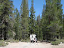
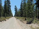
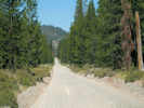
| Forest Road 1S05, "Bald Mountain Road," Mono County, California |
|
Tom Schweich |

|
To the Bald Mountain Lookout from US Highway 395. | ||||
|
Other articles:
Locations:
Bald Mountain.
|
Bald MountainBald Mountain Lookout
| ||||
|
Other articles:
|
Junction: 1S12 | ||||
|
Other articles:
|
Junction: 1S13, north past Little Sand Flat to California Highway 120. | ||||
| Junction: 2S04, down Alpers Canyon to Owens River Roas at Big Springs. | |||||
|
Other articles:
|
Junction: 1S88, north through Little Sand Flat to 1S13. | ||||
| Junction: 2S09 | |||||
|
Other articles:
|
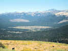
Looking out of the Mono Lake basin. | ||||
| Divide | |||||
|
Other articles:
Locations:
Mono Basin.
|
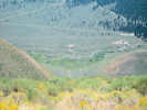
Looking into the Mono Lake basin. | ||||
|
Other articles:
|
Junction:
| ||||
|
Other articles:
|
Junction: Forest Road 2S114, route of a fiber optic cable. | ||||
|
Other articles:
Locations:
Airfield Flat.
|
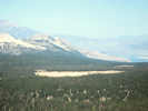
The sand flat to the east has an old airfield. One source suggests it dates from WWI. WWII seems more likely to me. | ||||
|
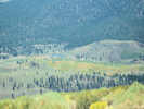
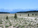
Owens River drainage above
Mono Lake hydrographic basin below | |||||
|
Other articles:
|
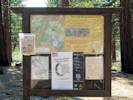
Inyo Forest interpretrive sign. | ||||
|
Other articles:
|
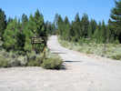
Junction: US Highway 395 | ||||
| If you have a question or a comment you may write to me at: tomas@schweich.com I sometimes post interesting questions in my FAQ, but I never disclose your full name or address. |
Date and time this article was prepared: 5/12/2025 2:43:17 PM |