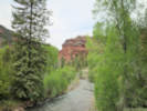
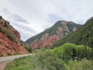
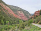
Eastern Mojave Vegetation
Tom Schweich
|
Eastern Mojave Vegetation
| Colorado State Highway 145, Colorado |
|
Tom Schweich |
|
North-south near Telluride, to Cortez. | |||||
|
Other articles:
Locations: Maverick Draw. |
Junction: Colorado State Highway 141 | |||||
|
Other articles:
Locations: San Miguel River. |
Junction: County Road M44 “Bear Trail Road”
| |||||
|
Other articles:
|
Junction: Colorado State Highway 62, to US Highway 550 at Ridgway. | |||||
|
Other articles:
Locations: Placerville. |
PlacervillePlacerville was originally established as a small mining camp, named after the placer gold mines located on the San Miguel River and Leopard Creek. The location became known as Old Placerville after the Rio Grande Southern Railroad constructed a depot and several passing sidings west of the original settlement, calling it Placerville.A. B. Frenzel discovered vanadium-bearing sandstone near Placerville in the late 1890s. The ore was in strataform bodies in the Entrada Sandstone (Jurassic) east of the town. The principal mineral was roscoelite, with minor montroseite and carnotite. By the fall of 1899, development was described as "of the most superficial character," although Frenzel had driven one tunnel 18 feet into the rock.[5] By 1901–1902, Frenzel was excavating several thousand tons intended for shipment to Europe. Most of the Placerville ore was less than 3% vanadium, too low grade to pay for shipment to Europe, so in 1905 the Vanadium Alloys Co. built an ore-processing mill southeast of Placerville to recover the metal as ferro-vanadium, which it sold. At least five mines were active at one time, and by 1919 the two ore mills at Placerville were producing 30% of the world's vanadium. Through 1940, the mines produced about 3.7 million pounds of vanadium. | |||||
|
Other articles:
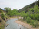
Locations: San Miguel River. |
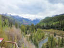
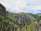
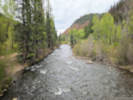
Random pull-out about half way between Placerville and turn-off for Telluride
| |||||
|
Other articles:
Locations: San Miguel River. |
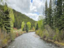
Near Vance Creek and Vance Junction.
| |||||
|
Other articles:
|
Junction: W. Hwy 145 Spur … to Telluride. | |||||
|
Other articles:
|
| |||||
|
Other articles:
Locations: Trout Lake. |
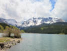
Trout Lake
| |||||
|
Locations: Ophir Loop. |
Ophir LoopThe town of Ophir is about two miles to the east. | |||||
|
Other articles:
Locations: Lizard Head Pass. |
Lizard Head Pass
It is also on the divide between the watersheds of the Dolores River and San Miguel River. The pass lies in the saddle between Lizard Head and Sheep Mountain. The pass is named for a prominent nearby peak, the 12,995 ft (3,961 m) spire of Lizard Head. The pass is currently traversed by State Highway 145, about 12 miles south of the Telluride turnoff. It was also used by the historic Rio Grande Southern Railroad until 1952. Although the grades on both sides of the pass are mild for automobile traffic, this was a significant obstacle for the railroad, and this was a factor leading to the use of the Galloping Goose railcars. | |||||
|
Other articles:
Locations: Lizard Head. |
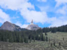
Lizard Head view point. You can't see Lizard Head from Lizard Head Pass.
| |||||
|
Other articles:
Locations: Rico. |
Rico
| |||||
|
Other articles:
Locations: Dolores River. Rio Lado. Section House Draw. |
Rio Lado (historical) and Section House Draw.
Right at the confluence of the river and Section House Draw sat a railroad section house. This was a functional building where a section foreman and a crew of track workers ("gandy dancers") lived. Their grueling daily job was to maintain a specific "section" of the mountainous, flood-prone track. | |||||
|
14th Street | ||||||
|
11th Street, County Road 31 | ||||||
|
9th Street | ||||||
|
8th Street | ||||||
|
Other articles:
Locations: Dolores. |
Dolores(Between 7th and 8th). | |||||
|
7th Street | ||||||
|
6th Street | ||||||
|
5th Street | ||||||
|
Other articles:
|
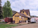
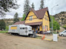
Dolores Railroad Museum / Galloping Goose Historical Society
| |||||
|
Flanders Park | ||||||
|
4th Street | ||||||
|
Other articles:
|
Junction: Colorado State Highway 184, east to Mancos. | |||||
|
Other articles:
|
Junction: Colorado State Highway 184, west to US 491 at Roundup Junction. | |||||
|
Other articles:
|
Junction: US Highway 160, at the eastern edge of Cortez. | |||||
| If you have a question or a comment you may write to me at: tomas@schweich.com I sometimes post interesting questions in my FAQ, but I never disclose your full name or address. |
Date and time this article was prepared: 10/2/2026 12:41:27 PM |