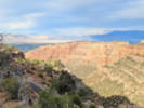
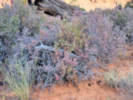
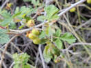
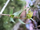
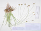
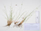
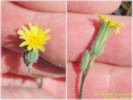
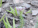
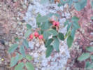
When I first read the field notes of Annie Alexander and Louise Kellogg, I was fascinated by the descriptions they wrote about the places they went and the plants and animals they found there. By publishing my field notes on the Internet I hope to follow a little bit in their tradition.
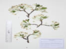
Golden, Jefferson County, Colorado.
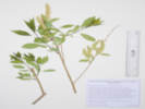
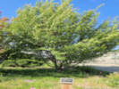
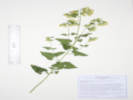
Street tree in the parkway at 410 Cheyenne.
39.76089°N, 105.22981°W.
WGS 1984
Elev. 1769 m.
City of Golden Forestry Department tree inventory no. TRE004185.
Collected by permit: City of Golden, 2026, issued: Mar 15, 2026, to: Tom Schweich.
Tom Schweich
3541.
24-Mar-2026
Bud scales, sericeous, brown;
Stem, gray;
Leaves, adaxial glabrous, abaxial and margin variably lanose;
Pedicel, bractlets, #2-?
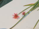
Petals, white, 9 mm. × 8 mm. wide, clawed;
Styles, #3, free at base;
Native and Naturalized Flora of the Golden Area, Jefferson County, Colorado
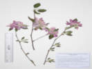
Rosaceae
Malus coronaria (L.) Mill.
Sweet Crabapple.
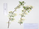
Golden, Jefferson County, Colorado.
Horticultural crabapple at 420 Arapahoe Street.
39.76132°N, 105.22872°W.
WGS 1984
Elev. 1761 m.
Bud scales and sepals abaxially glabrous, petals white, styles 5.
In the private garden of the collector.
Collected by permit: Jefferson County Parks and Open Space, 2026, issued: Mar 17, 2026, to: Tom Schweich.
Native and Naturalized Flora of the Golden Area, Jefferson County, Colorado
Rosaceae
Malus coronaria (L.) Mill.
Sweet Crabapple.
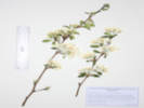
Golden, Jefferson County, Colorado.
Street tree at 900 5th Street.
39.76102°N, 105.22843°W.
WGS 1984
Elev. 1760 m..
Bud scales and sepals abaxially glabrous, petals white, styles 5.
City of Golden parkway tree, Forestry Dept. Tree No. 2319.
Collected by permit: City of Golden, 2026, issued: Mar 15, 2026, to: Tom Schweich.
Tom Schweich
3543.
24-Mar-2026
Coll. No. 3543, 24 March 2026:
Stem, young, brown becoming waxy with age;
Scale buds, abaxial glabrous, ciliate;
Leaves, barely emergent, petiole 6 mm. + 21 mm. × 11 mm. wide, sparsely hairy, serrulate with small glands in sinuses;
Inflorescence, umbel, with (typically) 5 flowers;
Pedicel, bractlets #1;
Sepals, adaxially lanose, abaxially glabrous;
Petals, white, 19 mm. × 9 mm. wide;
Styles, #5.
Native and Naturalized Flora of the Golden Area, Jefferson County, Colorado
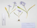
Asparagaceae
Scilla luciliae (Boiss.) Speta.
Glory of the Snow.
Golden, Jefferson County, Colorado.
Landscaping beds at 420 Arapahoe Street.
39.76132°N, 105.22873°W.
WGS 1984
Elev. 1761 m.
Persisting year to year and spreading slowly.
Collected by permit: City of Golden, 2026, issued: Mar 15, 2026, to: Tom Schweich.
Native and Naturalized Flora of the Golden Area, Jefferson County, Colorado
Rosaceae
Malus domestica (Suckow) Borkh.
Common Apple.
Clear Creek, Jefferson County, Colorado.
Old apple tree along an unnamed trail connecting the 6th Avenue Trail to the Chimney Gulch Trail, 60 m. south of Clear Creek, 1.2 km. west of the GNIS location of Golden.
39.75247°N, 105.23455°W.
WGS 1984
Elev. 1759 m.
Large old tree, leaves with a reddish cast, flowers large and pink, probably in an old orchard here.
Collected by permit: City of Golden, 2026, issued: Mar 15, 2026, to: Tom Schweich.
Native and Naturalized Flora of the Golden Area, Jefferson County, Colorado
Salicaceae
Salix irrorata Andersson.
Dewystem Willow.
Heritage Dells & Tripp Ranch Meadow Open Spaces, Jefferson County, Colorado.
In the southernmost gulch of Heritage Dells, middle section between DeFrance Way and Crawford Street, 135 m. downstream of DeFrance Way, 4.2 km. south of the GNIS location of Golden.
39.71838°N, 105.21529°W.
WGS 1984
Elev. 1895 m.
Large willow sprawling across gulch, trunk diameter 18", pruinose on prior year's grown but not on current growth.
Damp soil, with Cirsium arvense, Turritis glabra, Melilotus officinalis, Carex bebbii, C. occidentalis, and Juncus interior.
Collected by permit: City of Golden, 2026, issued: Mar 15, 2026, to: Tom Schweich.
Collected two golf balls this morning.
There was a third, but I did not pick it up.
All golf balls collected on North Golden Hogback have been georeferenced.
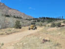
East Slope of the Tarryall Mountains, Camp Site #8 and the point of rocks to the south southeast, Camp Site #9 and North Twn Creek, Molly Gulch and nearby.
Plants of Colorado East Slope of Tarryall Mountains, Jefferson County
Ranunculaceae
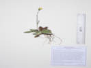
Pulsatilla nuttalliana (DC.) Bercht. & J. Presl.
Pasque Flower.
Dispersed Camp Site #8, Jefferson County, Colorado.
Flat between Dispersed Camp #8 and a point of rocks 700 m. to the south southeast, 9.4 road miles generally southwest of Deckers by way of County Road 126 and Pike-San Isabel Forest Road 211.
39.20659°N, 105.34205°W.
WGS 1984
Elev. 2384 m.
Occasional, only one collected, with Artemisia frigida and unidentifiable grasses.
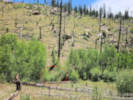
This area burned by Hayman Fire (2002), mapped as high intensity, no tree seedlings seen in immediate vicinity.
Collected by permit: Pike-San Isabel National Forest, 2026, issued: Mar 18, 2026, to: Tom Schweich.
Dispersed Camp Site #8, Jefferson County, Colorado.
Flat between Dispersed Camp #8 and a point of rocks 700 m. to the south southeast, 9.4 road miles generally southwest of Deckers by way of County Road 126 and Pike-San Isabel Forest Road 211.
39.20645°N, 105.342°W.
WGS 1984
Elev. 2384 m.
With Artemisia frigida and Bouteloua gracilis.
This area burned by Hayman Fire (2002), mapped as low intensity here, no tree seedlings seen in immediate vicinity.
Collected by permit: Pike-San Isabel National Forest, 2026, issued: Mar 18, 2026, to: Tom Schweich.
Tom Schweich
3561.
16-Apr-2026
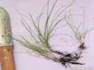
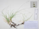
Coll. No. 3561, 16 April 2026,
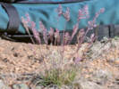
Perennial grass, 18 cm., clumped;
Leaves,
sheath, 65 mm., open,
ligule, membraneous, 0.7 mm.,
auricles, absent,
blade, 1.5 mm. × 2 mm. wide, (almost absent)
tip, prow-shaped;
Inflorescence,
1 per culm,
> leaves,
panicle,
45 mm. × 12 mm. wide,
3+ branches;
Rachis, slightly scabrous;
Spikelets,
many,
7 mm.;
Disarticulation, above the glumes;
Glumes,
lower, 3 mm., veins, 1,
upper, 4 mm., <lowest floret, veins, 3, awns, 0;
Florets, 4 per spikelet, pistillate;
Lemma,
4 mm., >glumes, ovate, membraneous, keeled, wavy hairs on keel and near margin,
tip, truncate-ish, erose-ish, awns, 0;
Palea, 3.2 mm., membraneous, keel ciliate, tip bifid;
Stamens, none seen.
Plants of Colorado East Slope of Tarryall Mountains, Jefferson County
Asteraceae
Erigeron vetensis Rydb.
Early Bluetop Fleabane.
Dispersed Camp Site #8, Jefferson County, Colorado.
Flat between Dispersed Camp #8 and a point of rocks 700 m. to the south southeast, 9.4 road miles generally southwest of Deckers by way of County Road 126 and Pike-San Isabel Forest Road 211.
39.20571°N, 105.34138°W.
WGS 1984
Elev. 2382 m.
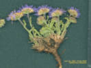
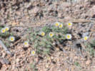
Rays blue, leaves entire.
Soil of coarse decomposed granite, with Artemisia frigida, Packera fendleri, Ceanothus fendleri, and miscellaneous unidentifiable grasses.
This area burned by Hayman Fire (2002), mapped as moderate intensity here, no trees re-established in immediate vicinity.
Collected by permit: Pike-San Isabel National Forest, 2026, issued: Mar 18, 2026, to: Tom Schweich.
Plants of Colorado East Slope of Tarryall Mountains, Jefferson County
Asparagaceae
Leucocrinum montanum Nutt. ex A. Gray.
Star Lily.
Dispersed Camp Site #8, Jefferson County, Colorado.
Flat between Dispersed Camp #8 and a point of rocks 700 m. to the south southeast, 9.4 road miles generally southwest of Deckers by way of County Road 126 and Pike-San Isabel Forest Road 211.
39.20491°N, 105.34024°W.
WGS 1984
Elev. 2380 m.
Soil of coarse decomposed granite, with Achillea millefolium, Artemisia frigida, Packera fendleri, Ceanothus fendleri, and miscellaneous unidentifiable grasses.
This area burned by Hayman Fire (2002), mapped as high intensity here. Only a few Populus tremuloides re-established in immediate vicinity.
Collected by permit: Pike-San Isabel National Forest, 2026, issued: Mar 18, 2026, to: Tom Schweich.
Plants of Colorado East Slope of Tarryall Mountains, Jefferson County
Asteraceae
Erigeron compositus Pursh.
Cutleaf Daisy.
Dispersed Camp Site #8, Jefferson County, Colorado.
Point of rocks about 700 m. south southeast of Dispersed Camp #8, 9.4 road miles generally southwest of Deckers by way of County Road 126 and Pike-San Isabel Forest Road 211.
39.20193°N, 105.33999°W.
WGS 1984
Elev. 2410 m.
In grus at base of an outcrop of Pikes Peak granite, with Pediocactus simpsonii, one small Pinus scopulorum.
This area burned by Hayman Fire (2002), mapped as high intensity here.
Collected by permit: Pike-San Isabel National Forest, 2026, issued: Mar 18, 2026, to: Tom Schweich.
Plants of Colorado East Slope of Tarryall Mountains, Jefferson County
Asteraceae
Packera werneriifolia (A. Gray) W. A. Weber & Á. Löve.
Hoary Groundsel.
Dispersed Camp Site #8, Jefferson County, Colorado.
Near the top of a point of rocks about 700 m. south southeast of Dispersed Camp #8, 9.4 road miles generally southwest of Deckers by way of County Road 126 and Pike-San Isabel Forest Road 211.
39.20343°N, 105.34032°W.
WGS 1984
Elev. 2423 m.
Between a down log from the Hayman fire (2002), an Oxytropis (O. sericea?), and an unidentifiable grass. Nearby: Oreocarya virgata, Arctostaphylos uva-ursi, Pulsatilla nuttalliana, and Populus tremuloides.
This area burned by Hayman Fire (2002), mapped as high intensity here.
Collected by permit: Pike-San Isabel National Forest, 2026, issued: Mar 18, 2026, to: Tom Schweich.
Plants of Colorado East Slope of Tarryall Mountains, Jefferson County
Fabaceae
Oxytropis multiceps Nuttall, Fl. N. Amer. (Torr. & A. Gray) 1(2): 341 (1838).
Southwestern Locoweed.
Molly Gulch, Jefferson County, Colorado.
Bank above FR 211 about 100 m. north of the GNIS location of Molly Gulch, about 10.8 road miles generally southwest of Deckers, CO, by way of County Road 126 and Pike-San Isabel Forest Road 211.
39.19224°N, 105.34408°W.
WGS 1984
Elev. 2317 m.
Flowers, banner is light lavender and wings a dark lavender; all fading to a more uniform purple.
Bare soil on bank above FR 211 with several mature ponderosa pines.
Within the area of the Hayman Fire (2002) but mapped as unburned at this location.
Collected by permit: Pike-San Isabel National Forest, 2026, issued: Mar 18, 2026, to: Tom Schweich.
Plants of Colorado East Slope of Tarryall Mountains, Jefferson County
Asteraceae
Hieracium fendleri Sch.-Bip.
Fendler's Hawkweed.
North Twin Creek, Jefferson County, Colorado.
In a "cove" formed by outcrops of Pikes Peak granite, about 200 m. north/above the crossing of North Twin Creek by Forest Road 211, 6.8 mi. west and south on F. R. 211 from its north end at County Road 126, 11.6 km. southwest of Deckers.
39.20999°N, 105.34577°W.
WGS 1984
Elev. 2445 m.
Thin, probably unburned, ponderosa pine/Douglas fir forest, in thin pine needle duff with Artemisia frigida, Ribes cereum, Geranium cespitosum, and Cercocarpus montanus. Uncommon; two other plants seen within a 1000 m. radius.
Within the perimeter of the Hayman Fire (2002); this location mapped as moderate intensity.
Collected by permit: Pike-San Isabel National Forest, 2026, issued: Mar 18, 2026, to: Tom Schweich.
Plants of Colorado East Slope of Tarryall Mountains, Jefferson County
Violaceae
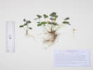
Viola nephrophylla Greene.
Northern Bog Violet.
North Twin Creek, Jefferson County, Colorado.
Northern tributary to North Twin Creek, 1.16 km. upstream of the crossing of North Twin Creek by Forest Road 211, 6.8 mi. west and south on F. R. 211 from its north end at County Road 126, 11.5 km. southwest of Deckers.
39.21735°N, 105.35194°W.
WGS 1984
Elev. 2501 m.
Lvs. simple, gen. glabrous, abaxially purplish-green, fls. blue toward lavender, spur short, some petals bearded.
Collected by permit: Pike-San Isabel National Forest, 2026, issued: Mar 18, 2026, to: Tom Schweich.
Tom Schweich
3578.
15-May-2026
Coll. No. 3578, 16 May 2026, characters observed:
Perennial violet, to 10 cm.,
acaulescent, lacking stolons;
Leaves,
stipules, 8-9 mm., membraneous, not leaf-like,
petioles, to 65 mm.,
blades,
simple,
24 mm. × 26 mm. wide,
base, chordate,
margin, barely serrate,
adaxially, few small hairs,
abaxially, purplish-green;
Flowers,
unicolored,
blue or nearly violet or purplish, with darker veins,
spur, short, 3 mm.±,
some petals bearded.
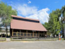
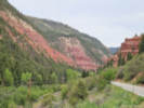
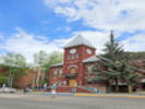
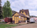
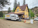
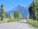
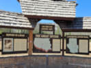
The very kind director of the Visitor Center unlocked the visitor center so we could use the restroom, and spoke withus at length about life in the town.
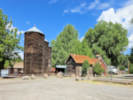
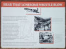
Placerville was originally established as a small mining camp,
named after the placer gold mines located on the San Miguel River and Leopard Creek.
The location became known as Old Placerville after the Rio Grande Southern Railroad constructed a depot
and several passing sidings west of the original settlement, calling it Placerville.
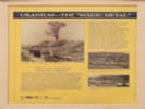
A. B. Frenzel discovered vanadium-bearing sandstone near Placerville in the late 1890s.
The ore was in strataform bodies in the Entrada Sandstone (Jurassic) east of the town.
The principal mineral was roscoelite, with minor montroseite and carnotite.
By the fall of 1899, development was described as "of the most superficial character,"
although Frenzel had driven one tunnel 18 feet into the rock.[5] By 1901–1902,
Frenzel was excavating several thousand tons intended for shipment to Europe.
Most of the Placerville ore was less than 3% vanadium,
too low grade to pay for shipment to Europe,
so in 1905 the Vanadium Alloys Co. built an ore-processing mill southeast of Placerville to recover the metal as ferro-vanadium,
which it sold.
At least five mines were active at one time,
and by 1919 the two ore mills at Placerville were producing 30% of the world's vanadium.
Through 1940, the mines produced about 3.7 million pounds of vanadium.
Other articles: • Colorado State Highway 145:
at pull-out;
Native and Naturalized Flora of the Golden Area, Jefferson County, Colorado
Cyperaceae
Carex occidentalis L. H. Bailey.
Western Sedge.
Heritage Dells, South Gulch, Jefferson County, Colorado.
Middle section between DeFrance Way and Crawford Street, 135 m. downstream of DeFrance Way, 4.2 km. south of the GNIS location of Golden.
39.71846°N, 105.21523°W.
WGS 1984
Elev. 1889 m.
Cespitose, sheath front hyaline, not rugulose, inflorescence elongate 22-24 mm., spikes androgynous, stigmas 2, perigynum 4.2 mm. × 1.4 mm., beak 1.5 mm.
Wet bottom of gulch with Carex bebbii, a Juncus, and a willow.
Collected by permit: City of Golden, 2026, issued: Mar 15, 2026, to: Tom Schweich.
Native and Naturalized Flora of the Golden Area, Jefferson County, Colorado
Cyperaceae
Carex bebbii Olney.
Bebb's Sedge.
Heritage Dells, South Gulch, Jefferson County, Colorado.
Middle section between DeFrance Way and Crawford Street, 135 m. downstream of DeFrance Way, 4.2 km. south of the GNIS location of Golden.
39.71844°N, 105.21524°W.
WGS 1984
Elev. 1889 m.
Wet bottom of gulch with Carex occidentalis, a Juncus, and a willow.
Collected by permit: City of Golden, 2026, issued: Mar 15, 2026, to: Tom Schweich.
Tom Schweich
3588.
1-Jun-2026
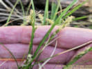
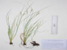
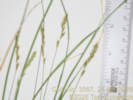
Coll. No. 3588, 1 June 2026, characters observed:
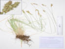
Cespitose sedge, to 44 cm.;
Leaves,
2.9 mm. wide,
sheath, hyaline, not cross-rugulose;
Inflorescence, 18 mm. × 12 mm. wide, spikes crowded,
bract, 10-20 mm., usually < inflorescence;
Spikes, 7 mm. × 4 mm. wide,
gynecandrous;
Pistillate scales, 3 mm. × 1.5 mm. wide,
brown, margin white hyaline;
Perigynum, 3.5 mm. × 2.9 mm. wide,
ovate, plano-convex,
beak, 1.9 mm., not serrulate;
Anthers, bristles at tip;
Stigmas, 2;
Achene, 1.2 mm. × 1.0 mm. wide, bi-convex.
Native and Naturalized Flora of the Golden Area, Jefferson County, Colorado
Juncaceae
Juncus interior Wiegand.
Inland Rush.
Heritage Dells & Tripp Ranch Meadow Open Spaces, Jefferson County, Colorado.
Heritage Dells, south gulch, middle section between DeFrance Way and Crawford Street, 135 m. downstream of DeFrance Way, 4.2 km. south of the GNIS location of Golden.
39.71844°N, 105.21525°W.
WGS 1984
Elev. 1888 m.
Wet bottom of gulch with Carex occidentalis, Carex bebbii, and Salix irrorata.
The three gulches of Heritage Dells were designated a City of Golden Open Space in July, 2025.
Collected by permit: City of Golden, 2026, issued: Mar 15, 2026, to: Tom Schweich.
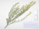
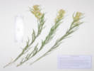
Ericameria parryi (A. Gray) G. L. Nesom & G. I. Baird var. parryi.
Parry's Rabbitbrush.
Salt Creek, Park County, Colorado.
Small canyon, north of Salt Creek, and Pike-San Isabel National Forest Road 435 "Salt Creek Road," 4.4 mi. by road west of US Highway 285, 6.7 km. northwest of Antero Junction.
38.95367°N, 106.03335°W.
WGS 1984
Elev. 2904 m.
Leaves ≥ infl, minutely stipitate-glandular.
Dry slope above barely seeping creek, with Pinus aristata, P. contorta, Pseudotsuga menziesii, Artemisia frigida, A. tridentata ssp. vaseyana, and Hymenoxis richardsonii var. floribunda.
Collected by permit: Pike-San Isabel National Forest, 2026, issued: Mar 18, 2026, to: Tom Schweich.
Ericameria parryi (A. Gray) G. L. Nesom & G. I. Baird var. parryi.
Parry's Rabbitbrush.
Unnamed Gulch on Forest Road 189, Lake County, Colorado.
Along Pike-San Isabel National Forest Road 189, about 1 km. east of County Road 18 “East Tennessee Road,” 7.37 km. north northwest of the GNIS location of Leadville.
39.29873°N, 106.31636°W.
WGS 1984
Elev. 3096 m.
Leaves ≥ infl., minutely stipitate-glandular.
Openings in aspen forest, mixed with patches of mountain big sagebrush and willows.
Collected by permit: Pike-San Isabel National Forest, 2026, issued: Mar 18, 2026, to: Tom Schweich.
Plants of Jefferson County Parks and Open Space Jefferson County, Colorado, USA
Asteraceae
Helianthus pauciflorus Nutt. ssp. subrhomboideus (Rydb.) O. Spring & E. Schilling.
Stiff Sunflower.
Ranson/Edwards Homestead Open Space Park, Jefferson County, Colorado.
1.7 miles west on CO Highway 72 "Coal Creek Canyon Road" from its intersection with CO Highway 93, 0.9 miles generally north on Plainview Road, then 430 m. west northwest across the field; 15.1 km. north northwest of Golden.
39.88661°N, 105.2669°W.
WGS 1984
Elev. 1973 m.
Small colony south side of watercourse, few in flower.
Open grassy field, also collected here: Asclepias viridiflora, Helianthus pumilis, Madia glomerata, Mentha arvensis, Mirabilis linearis, Linaria dalmatica, and Muhlenbergia montana.
Collected by permit: Jefferson County Parks and Open Space, 2026, issued: Mar 17, 2026, to: Tom Schweich.
Plants of Jefferson County Parks and Open Space Jefferson County, Colorado, USA
Asteraceae
Helianthus annuus L.
Common Sunflower.
Ranson/Edwards Homestead Open Space Park, Jefferson County, Colorado.
Beside Plainview Road, 1.7 miles west on CO Highway 72 "Coal Creek Canyon Road" from its intersection with CO Highway 93, then 0.6 miles generally north on Plainview Road; 14.5 km. north northwest of Golden.
39.88162°N, 105.264°W.
WGS 1984
Elev. 1957 m.
Roadside gravel, also collected nearby Liatris punctata, Xanthium strumarium, Chamaesyce serpyllifolia, Amorpha fruticosa, Mirabilis nyctaginea, and Fallopia convolvulus.
Collected by permit: Jefferson County Parks and Open Space, 2026, issued: Mar 17, 2026, to: Tom Schweich.
Ericameria parryi (A. Gray) G. L. Nesom & G. I. Baird var. parryi.
Parry's Rabbitbrush.
Hoosier Creek, Park County, Colorado.
Along Park County Road 58 about 250 m. west of US Highway 285, 1.6 miles north of Kenosha Pass, Park County, Colorado.
39.4332°N, 105.76184°W.
WGS 1984
Elev. 2970 m.
Some leaves > inflorescence; leaves, to 65 mm., minutely stipitate-glandular; flowers intense yellow.
Gentle, south-facing upper montane opening dominated by short grasses and sparse shrubs, about mid-way between the wetlands of Hoosier Creek and lodgepole pine (Pinus contorta) forest canopy.
Collected by permit: Pike-San Isabel National Forest, 2026, issued: Mar 18, 2026, to: Tom Schweich.
Twin Creek, Jefferson County, Colorado.
About 250 meters upstream of Goose Creek where Twin Creek passes through a short, narrow canyon, 7.6 miles west and south on Forest Road 211 "Goose Creek Road" from its intersection with County Road 126 "Deckers Road," 64 km. south of Golden.
39.19613°N, 105.34353°W.
WGS 1984
Elev. 2290 m.
Nestled between small granite outcrops, with Artemisia frigida, Rosa sp., and Rubus idaeus var. strigosus.
Collected by permit: Pike-San Isabel National Forest, 2026, issued: Mar 18, 2026, to: Tom Schweich.
Plants of Colorado East Slope of Tarryall Mountains, Jefferson County
Cannabaceae
Humulus neomexicanus (A. Nelson & Cockerell) Rydb.
New Mexican Hops.
Twin Creek, Jefferson County, Colorado.
About 250 meters upstream of Goose Creek where Twin Creek passes through a short, narrow canyon, 7.6 miles west and south on Forest Road 211 "Goose Creek Road" from its intersection with County Road 126 "Deckers Road," 64 km. south of Golden.
39.19568°N, 105.34301°W.
WGS 1984
Elev. 2282 m.
In boulders just above the creek, climbing over both down and live trees, with Betula occidentalis, Acer glabrum, Verbascum thapsus, Cirsium arvense and a Thalictrum sp. cf. T. sparsiflorum.
Mixed burned and live mature Douglas fir and ponderosa pines suggest the Hayman Fire (2002) may have burned with low to medium intensity here.
Collected by permit: Pike-San Isabel National Forest, 2026, issued: Mar 18, 2026, to: Tom Schweich.
Plants of Colorado East Slope of Tarryall Mountains, Jefferson County
Ranunculaceae
Thalictrum L.
Meadow-Rue.
Twin Creek, Jefferson County, Colorado.
About 250 meters upstream of Goose Creek where Twin Creek passes through a short, narrow canyon, 7.6 miles west and south on Forest Road 211 "Goose Creek Road" from its intersection with County Road 126 "Deckers Road," 64 km. south of Golden.
39.19568°N, 105.34301°W.
WGS 1984
Elev. 2282 m.
Leaning or scrambling on Humulus neomexicanus in boulders just above the creek, with Betula occidentalis, Acer glabrum, Verbascum thapsus, and Cirsium arvense.
Resembles T. sparsiflorum, but insufficient mature fruit/leaf material to distinguish confidently from T. fendleri.
Collected by permit: Pike-San Isabel National Forest, 2026, issued: Mar 18, 2026, to: Tom Schweich.
Plants of Colorado East Slope of Tarryall Mountains, Jefferson County
Lamiaceae
Mentha arvensis L.
Wild Mint.
Twin Creek, Jefferson County, Colorado.
About 250 meters upstream of Goose Creek where Twin Creek passes through a short, narrow canyon, 7.6 miles west and south on Forest Road 211 "Goose Creek Road" from its intersection with County Road 126 "Deckers Road," 64 km. south of Golden.
39.19578°N, 105.34317°W.
WGS 1984
Elev. 2282 m.
Flowers in dense axillary clusters at the nodes.
In creek with Veronica americana.
Collected by permit: Pike-San Isabel National Forest, 2026, issued: Mar 18, 2026, to: Tom Schweich.
Plants of Colorado East Slope of Tarryall Mountains, Jefferson County
Asteraceae
Symphyotrichum laeve (L.) Á. Löve & D. Löve var. geyeri (A. Gray) G.L. Nesom.
Smooth Blue Aster.
Twin Creek, Jefferson County, Colorado.
About 250 meters upstream of Goose Creek where Twin Creek passes through a short, narrow canyon, 7.6 miles west and south on Forest Road 211 "Goose Creek Road" from its intersection with County Road 126 "Deckers Road," 64 km. south of Golden.
39.19585°N, 105.34338°W.
WGS 1984
Elev. 2286 m.
Rooted in bank of creek. with Mentha arvensis and Veronica americana.
Brickellia grandiflora, Betula occidentalis, Humulus neomexicanus, Cornus sericea, Ribes cereum, R. inerme, Prunus virginiana, Rubus idaeus, Acer glabrum, Carex inops ssp. heliopila, and C. occidentalis.
Mixture of burned and live mature Douglas fir and ponderosa pines suggest the Hayman Fire (2002) may have burned with low to medium intensity here.
Collected by permit: Pike-San Isabel National Forest, 2026, issued: Mar 18, 2026, to: Tom Schweich.
New Loveland Mine Park, Jefferson County, Colorado.
Approximate center of park, in mowed verge of natural area adjacent to sidewalk, in a strip about 1 m. wide by 9 m. long, 1.02 km. (geodesic) northwest of the GNIS location of Golden.
39.75849°N, 105.23263°W.
WGS 1984
Elev. 1766 m.
One plant found, summer annual grass, native to Colorado, but the sharp-spined burs limit usability of public park space.
Found first at DeLong Park in 2022, then at this location in New Loveland Mine Park in 2024.
Collected by permit: City of Golden, 2026, issued: Mar 15, 2026, to: Tom Schweich.
If you have a question or a comment you may write to me at:
tomas@schweich.com
I sometimes post interesting questions in my FAQ, but I never disclose your full name or address.
 Eastern Mojave Vegetation