Eastern Mojave Vegetation
Edited by Tom Schweich
|
Eastern Mojave Vegetation
| Colorado State Highway 62 |
|
Edited by Tom Schweich |
|
State Highway 62 (SH 62) is a 23.41-mile-long (37.67 km) state highway in the U.S. state of Colorado. SH 62's western terminus is at SH 145 in Placerville, and the eastern terminus is at U.S. Route 550 (US 550) in Ridgway. | |
|
Other articles:
|
Junction: US Highway 550, north to Montrose, or south to Ouray. | |
|
Racecourse Road | ||
|
Cross Uncompahgre River | ||
|
Liddell Drive | ||
Ridgway Railroad Museum | ||
|
N. Railroad Street | ||
|
Lena Street | ||
|
Cora Street | ||
|
Laura Street | ||
|
Mary Street | ||
|
Charlotte Street | ||
|
Other articles:
Locations: Ridgway. |
Ridgway | |
|
Elizabeth Street. | ||
|
Amelia Street | ||
|
Other articles:
|
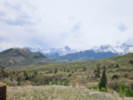
San Juan Mountain Scenic View
| |
|
Locations: Dallas Divide. |
Dallas Divide | |
|
Other articles:
|
Junction: CO State Highway 145, east to Telluride, or west to Norwood. | |
| If you have a question or a comment you may write to me at: tomas@schweich.com I sometimes post interesting questions in my FAQ, but I never disclose your full name or address. |
Date and time this article was prepared: 10/2/2026 12:41:33 PM |